| Pages:
1
2
3 |
larryC
Super Nomad
   
Posts: 1499
Registered: 8-11-2008
Location: BoLA
Member Is Offline
|
|
| Quote: | Originally posted by TacoFeliz
And while we're on the subject, do you know if it is possible to make it to the San Juan mine site from the San Gregorio side?
|
My first trip up to the mine was through Borja, out towards Gregorio, and then we turned to the left where the rock corral and water well are just
before Gregorio. We were on quads, we pecked along occasionally finding the old road to the mine. After about 5 miles or so we could go no farther. We
started hiking up the mountain, again finding the original trail. We hiked for less than 3 hours and made it to the rock building near the mine site.
We could see the tailings from the upper mine shaft just above us, but we were out of time, we lookrd around for 30 miutes or so and then had to head
back to Borja, where we had parked the truck. As far as driving up there, I doubt that it is possible. I made a second trip up there with Carolia from
the museum in LA bay, she arranged for guides and some pack animals. We did a 3 day trip and got to explore the mine pretty well. Truely facinating
how they got all that heavy equipment up there. It must have been torturous. I'd love to go back. Either fly or with animals but never again from the
BoLA side. There is a clearing up there that you can land on, in fact Capt Munoz did it with ES Gardener. On google earth there is a picture that I
took outside the lower mine shaft, just click on the blue dot. I'll try to find some other photos and post them here.
Larry
|
|
|
David K
Honored Nomad
        
Posts: 65442
Registered: 8-30-2002
Location: San Diego County
Member Is Offline
Mood: Have Baja Fever
|
|
| Quote: | Originally posted by larryC
| Quote: | Originally posted by TacoFeliz
And while we're on the subject, do you know if it is possible to make it to the San Juan mine site from the San Gregorio side?
|
My first trip up to the mine was through Borja, out towards Gregorio, and then we turned to the left where the rock corral and water well are just
before Gregorio. We were on quads, we pecked along occasionally finding the old road to the mine. After about 5 miles or so we could go no farther. We
started hiking up the mountain, again finding the original trail. We hiked for less than 3 hours and made it to the rock building near the mine site.
We could see the tailings from the upper mine shaft just above us, but we were out of time, we lookrd around for 30 miutes or so and then had to head
back to Borja, where we had parked the truck. As far as driving up there, I doubt that it is possible. I made a second trip up there with Carolia from
the museum in LA bay, she arranged for guides and some pack animals. We did a 3 day trip and got to explore the mine pretty well. Truely facinating
how they got all that heavy equipment up there. It must have been torturous. I'd love to go back. Either fly or with animals but never again from the
BoLA side. There is a clearing up there that you can land on, in fact Capt Munoz did it with ES Gardener. On google earth there is a picture that I
took outside the lower mine shaft, just click on the blue dot. I'll try to find some other photos and post them here.
Larry |
I would appreciate seeing your San Juan photos, Larry...!!
You have seen the heavy machinery on display at Jose's home (at Mision San Borja)? He told me it was trucked down from San Juan... Perhaps the road
has been worked on. With the price of gold getting so high, I think you may see many old mines re-opened with the better technology for extracting the
gold and silver today.
The San Juan mine was an American venture that was shut down because of the Mexican revolution of 1911, they did not run out of the metal.
|
|
|
bbbait
Nomad
 
Posts: 211
Registered: 9-9-2003
Location: Blythe, Ca
Member Is Offline
|
|
Good info! Thanks Larry
|
|
|
larryC
Super Nomad
   
Posts: 1499
Registered: 8-11-2008
Location: BoLA
Member Is Offline
|
|
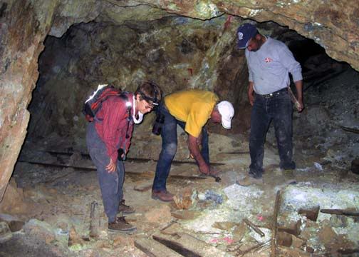
Here is a shot from inside the mine. The shafts are extensive. The lower shaft goes in over 1000' with shafts to the right and left at one place. Then
the shafts goes up hundreds of feet to the upper shaft, and down to who knows where.
|
|
|
larryC
Super Nomad
   
Posts: 1499
Registered: 8-11-2008
Location: BoLA
Member Is Offline
|
|
And another of an intact ore bucket just laying in the desert where the cable finally collapsed.

|
|
|
David K
Honored Nomad
        
Posts: 65442
Registered: 8-30-2002
Location: San Diego County
Member Is Offline
Mood: Have Baja Fever
|
|
Awesome!
|
|
|
larryC
Super Nomad
   
Posts: 1499
Registered: 8-11-2008
Location: BoLA
Member Is Offline
|
|
A few more from the trail to mine from the Borja side.

This is as far as we could go on the quads. All up hill from here. About a 2 1/2 hour hike.
|
|
|
larryC
Super Nomad
   
Posts: 1499
Registered: 8-11-2008
Location: BoLA
Member Is Offline
|
|
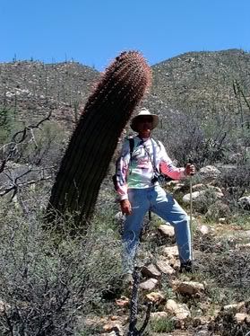
Along the way, the tallest barrell cactus I have ever seen.
|
|
|
larryC
Super Nomad
   
Posts: 1499
Registered: 8-11-2008
Location: BoLA
Member Is Offline
|
|
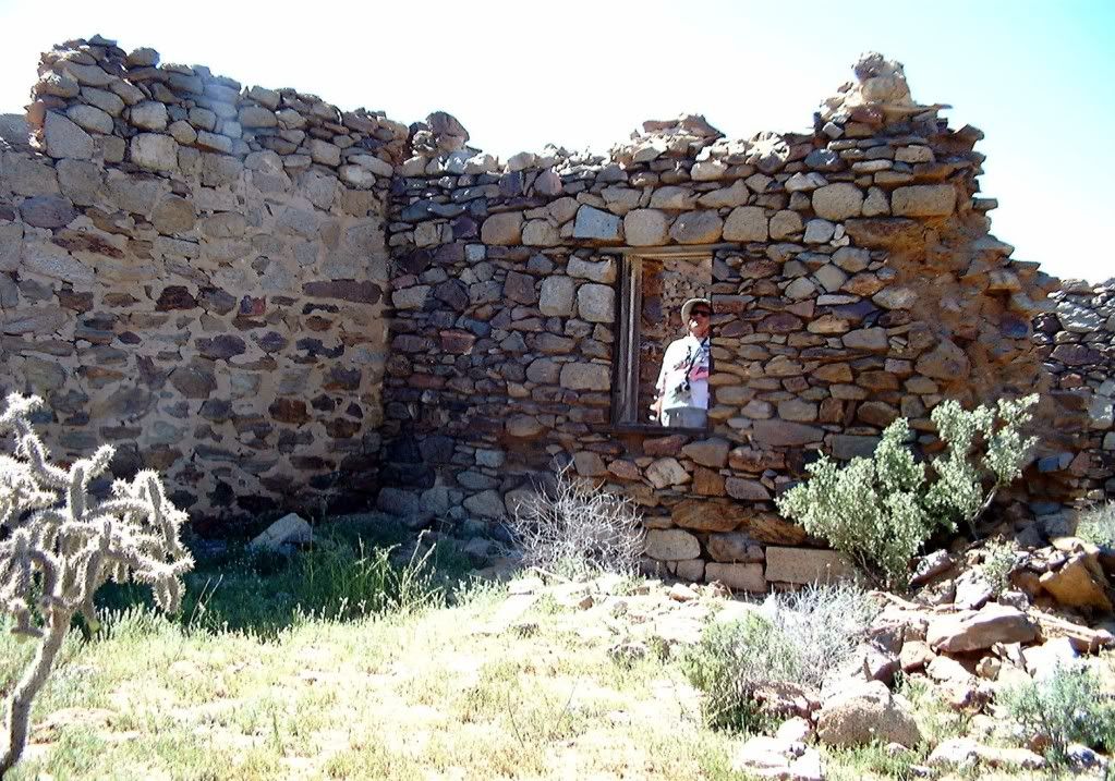
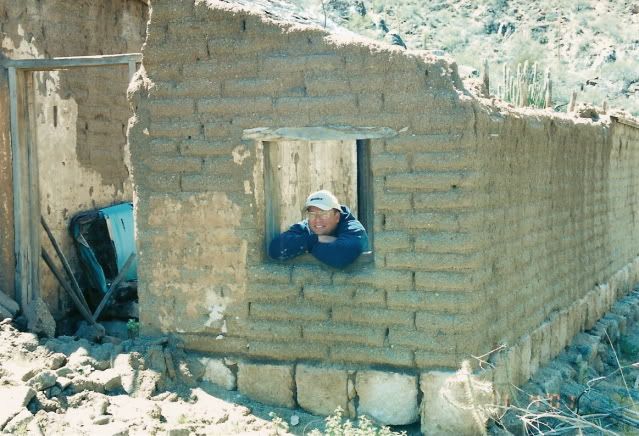
The rock building at the top of the trail. Probably was a storage building or assay building. Carolina calls it the mine "foremans" building.
|
|
|
David K
Honored Nomad
        
Posts: 65442
Registered: 8-30-2002
Location: San Diego County
Member Is Offline
Mood: Have Baja Fever
|
|
| Quote: | Originally posted by larryC
A few more from the trail to mine from the Borja side.

This is as far as we could go on the quads. All up hill from here. About a 2 1/2 hour hike. |
Wow... what year was that Larry?
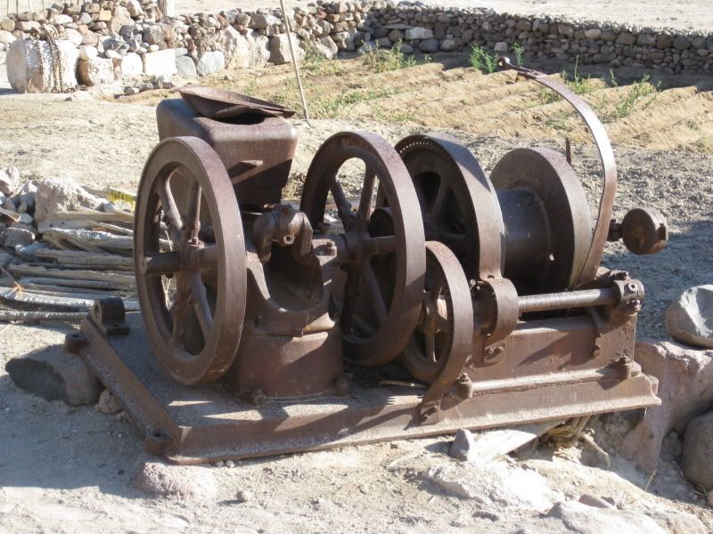
Here is the piece of mine machinery on display at San Borja (Jose's museum)... Jose told me it was brought down from San Juan... I wonder when? I got
the impression from Jose it was possible to drive my Tacoma up there... this was in 2009.
Thanks for showing the photo of the road!
[Edited on 4-15-2011 by David K]
|
|
|
larryC
Super Nomad
   
Posts: 1499
Registered: 8-11-2008
Location: BoLA
Member Is Offline
|
|
We walked up there from the Borja side in '05 probably. I would be very surprised if someone had cut a road into there since then. I went up there in
'07 from the Bahia side and there was no road up there then. Not sure what Jose might have been referring to but it would be a good idea to ask him
again. I am not fluent in spanish. The road we forrlowed in '05 up from the rock corrals, was mostly washed out but in some places you could still see
the road bed. It was at least 8' wide. From what I understand from some of the old timers, they used that road to supply the mine by horse or mule
drawn carts and wagons. Looking at it from google earth earth, I can't see any road up there. But the image date I get is '04 so it wouldn't be there.
Larry
|
|
|
David K
Honored Nomad
        
Posts: 65442
Registered: 8-30-2002
Location: San Diego County
Member Is Offline
Mood: Have Baja Fever
|
|
Neal Johns and his group started to drive up about 10 years ago... one of them with a BFG got a flat... and they had arranged for mules from Jose to
ride up to Aguaje de San Juan... which is on the Golfo Camino Real, east of San Gregorio... So, they didn't drive any closer to San Juan after the
flat was fixed... See http://vivabaja.com/neal for photos...
|
|
|
larryC
Super Nomad
   
Posts: 1499
Registered: 8-11-2008
Location: BoLA
Member Is Offline
|
|
I am just really curious why Jose would say that it would be no problem to drive your Tacoma up to the mine. Maybe he knows a way.
Larry
|
|
|
David K
Honored Nomad
        
Posts: 65442
Registered: 8-30-2002
Location: San Diego County
Member Is Offline
Mood: Have Baja Fever
|
|
Maybe he was being polite? If there isn't any mine company exploring the site to re-open, I am sure the road is tough... You can see it easily on
Google earth... but you can't make out wash-outs and boulder in the way on it!
|
|
|
larryC
Super Nomad
   
Posts: 1499
Registered: 8-11-2008
Location: BoLA
Member Is Offline
|
|
Can you post a shot of the google earth view of the road up there? On my google earth it just shows the foot path that we hiked.
Larry
|
|
|
Paulina
Ultra Nomad
    
Posts: 3812
Registered: 8-31-2002
Location: BCN
Member Is Offline
|
|
Larry,
If you ever get a wild hair and feel like making the trek again, we'd be up for the adventure someday. More than a day run though, so there's plenty
of time to explore.
P>*)))>{
\"Well behaved women rarely make history.\" Laurel Thatcher Ulrich
|
|
|
David K
Honored Nomad
        
Posts: 65442
Registered: 8-30-2002
Location: San Diego County
Member Is Offline
Mood: Have Baja Fever
|
|
| Quote: | Originally posted by larryC
Can you post a shot of the google earth view of the road up there? On my google earth it just shows the foot path that we hiked.
Larry |
I will do that Larry... in the meantime, are you the Larry mentioned in this excellent Discover Baja article with photos of San Juan, by Carolina?:
http://www.discoverbaja.com/pdf/apr09.pdf
|
|
|
David K
Honored Nomad
        
Posts: 65442
Registered: 8-30-2002
Location: San Diego County
Member Is Offline
Mood: Have Baja Fever
|
|
ROAD TO SAN JUAN (passable by 4WD or not?)
First two, north at top:


Facing San Juan, above the road:


Here the trail or road climbs a hill and meets a better looking road (see Jcn.) that drops to the bootom of a gorge and ends (maybe a water source for
the town?).

Top of the grade, Valle de San Juan:

See the foundation of a 2 room building, on the left.
North at top:

A higher view, see the end of the Las Flores Railroad line: yellow pin at the base of the mountain range.

Close up of the main mine entrance.

The small gauge railroad line that goes north from the mine along the east side of the valley. This went to the top of the cable tram bucket line that
took the ore to the bottom of the mountain where the larger railroad took the ore to Las Flores.

Another higher view.
Looking East:

This high view looking east shows the entire distance of the road to San Juan.
Looking North:

High view, north at top.
[Edited on 4-18-2011 by David K]
|
|
|
larryC
Super Nomad
   
Posts: 1499
Registered: 8-11-2008
Location: BoLA
Member Is Offline
|
|
Yes I was on the trip with Carolina, we had a great time. The road you are seeing up to the mine is actually little more than a foot path. Back when
the mine was operational the road was used by mule carts to haul supplies up to and down from the mine. The rock corrals and the well are where the
mules were kept. When I went up that trail the last time there were still places where you could make out the old road bed, but most of it was hunt
and peck with the quads to get through to where the road starts up the mountain. From there it was up hil hiking all the way. The old road is in the
bottom of a wash most of the way so lots of the road is missing due to washouts.
I am now thinking about putting together a trip up to Aguaje in the next week or two. Best to do it now before it gets too hot.
Paulina, you and Dern are welcome to come if you want.
Larry
PS David, Your google earth seems to have much better picture quality than my version, do you subscribe to a pay service or something?
|
|
|
David K
Honored Nomad
        
Posts: 65442
Registered: 8-30-2002
Location: San Diego County
Member Is Offline
Mood: Have Baja Fever
|
|
Hi Larry,
Nope, just the free stuff... what are you drinking today in Bahia?  
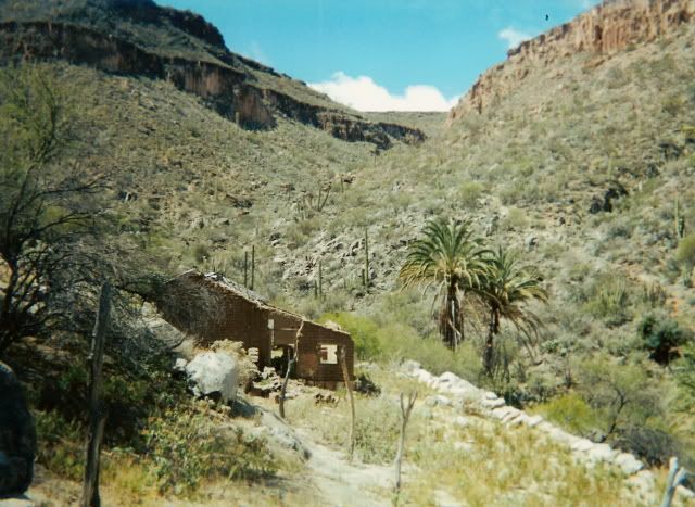
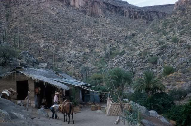
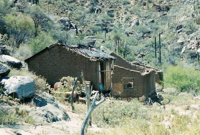
The area over San Gregorio is still not high resolution, so you cannot make out the old ranch house there on Google...
In 2001:
50 years earlier:
2001:
50 years earlier:
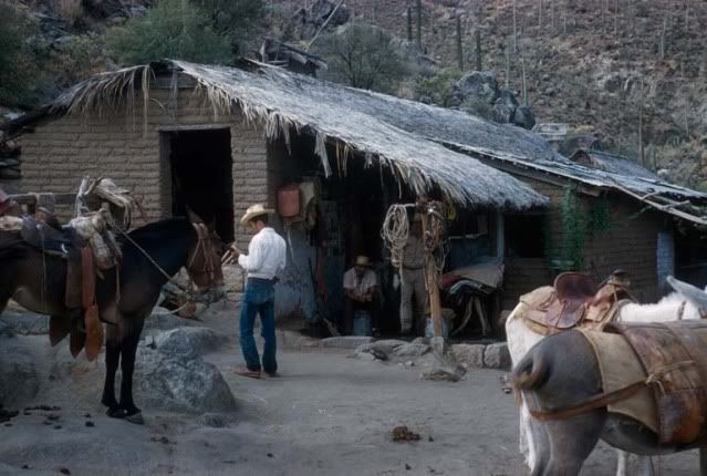
Very special to connect with Baja's past!
|
|
|
| Pages:
1
2
3 |

