| Pages:
1
2 |
Barry A.
Select Nomad
      
Posts: 10007
Registered: 11-30-2003
Location: Redding, Northern CA
Member Is Offline
Mood: optimistic
|
|
Excellent!!!
David, you say referring to the pic of you as a boy,
"This spring is just a half mile off the road, between El Huerfanito and Gonzaga Bay."
Could you be a little more specific?? I don't see that spring on any of the maps above.
barry
|
|
|
David K
Honored Nomad
        
Posts: 65436
Registered: 8-30-2002
Location: San Diego County
Member Is Offline
Mood: Have Baja Fever
|
|
| Quote: | Originally posted by Barry A.
Excellent!!!
David, you say referring to the pic of you as a boy,
"This spring is just a half mile off the road, between El Huerfanito and Gonzaga Bay."
Could you be a little more specific?? I don't see that spring on any of the maps above.
barry |
I read about it first in the Lower California Guidebook, then first saw it on our 1967 trip driving north from L.A. Bay. Lots of quail in there! The
next time was in 1974 (photo of me at 16), and the last time was in 2002.
Here is its location on the Almanac map, with the 12 mile radius drawn in from the lost mission story, above:
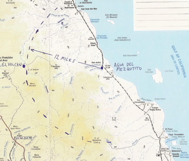
GPS (NAD27 Mexico): Agua del Mezquitito water hole: 29º59.16'/ 114º34.12'
[Edited on 11-3-2011 by David K]
|
|
|
Barry A.
Select Nomad
      
Posts: 10007
Registered: 11-30-2003
Location: Redding, Northern CA
Member Is Offline
Mood: optimistic
|
|
Thanks, David. I have marked my maps and my "Almanac". Barry
|
|
|
David K
Honored Nomad
        
Posts: 65436
Registered: 8-30-2002
Location: San Diego County
Member Is Offline
Mood: Have Baja Fever
|
|
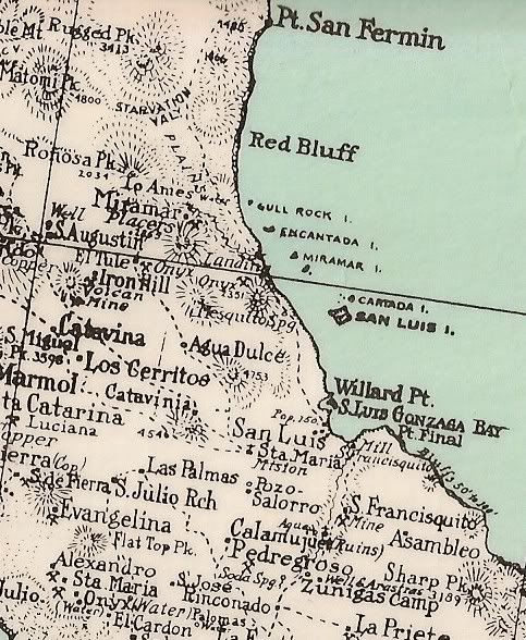
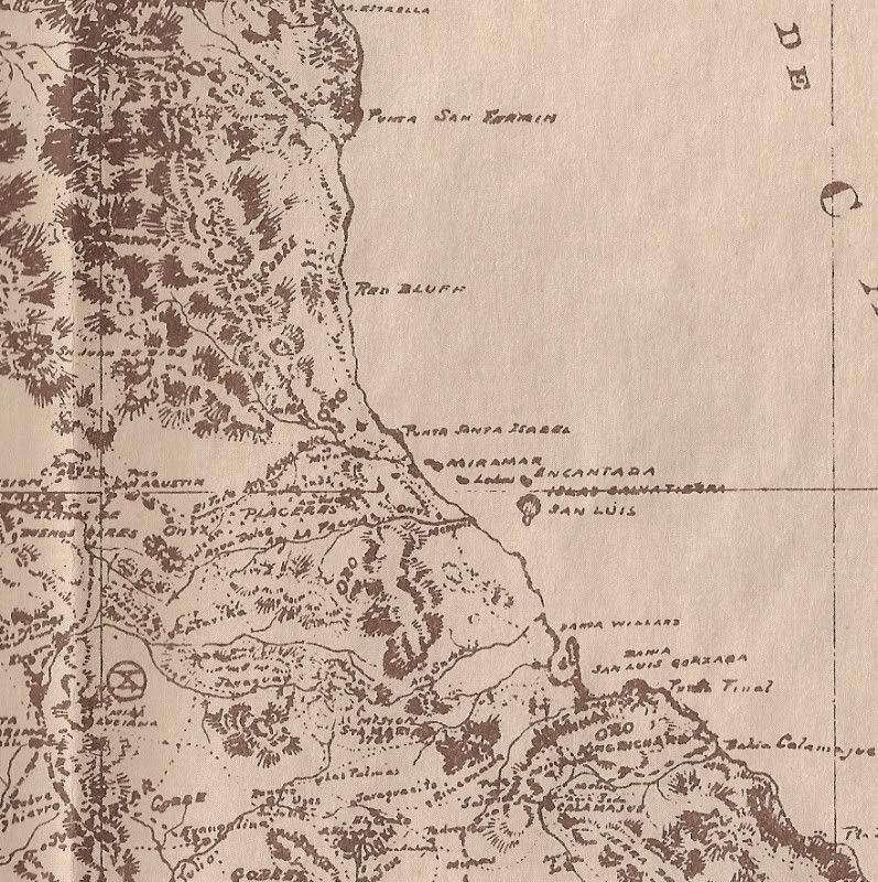
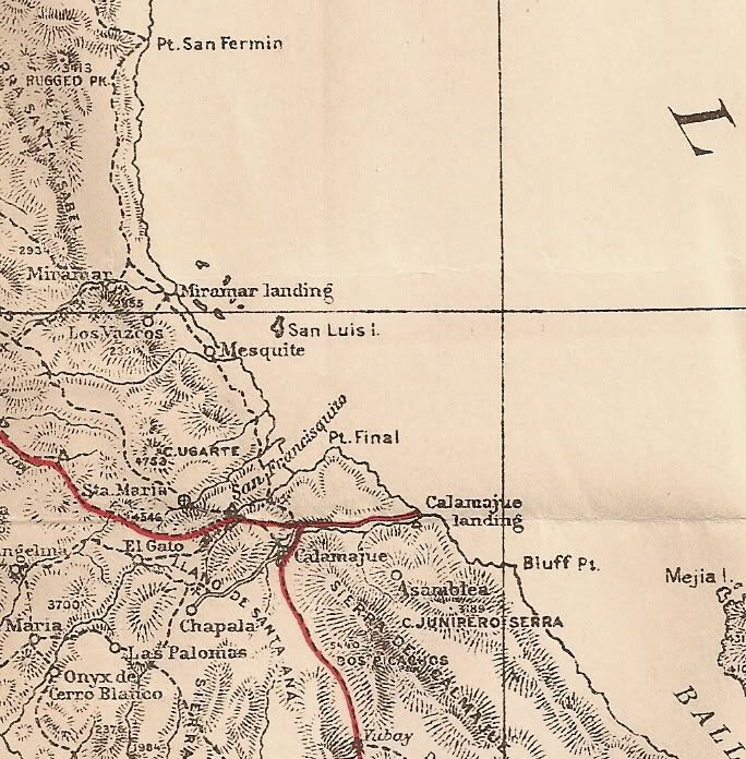
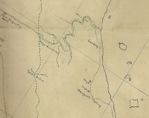
Mezquitito shown on maps:
1930 Map with spring shown:
1919 Map (hard to see, but it's there):
1905 expedition map (pub. 1919):
1905 Mine Map:
|
|
|
TMW
Select Nomad
      
Posts: 10659
Registered: 9-1-2003
Location: Bakersfield, CA
Member Is Offline
|
|
I thought Elbeau was coming out this fall to explore the arroyos from the Sea of Cortez toward El Marmol looking for the Lost Mission. The spring
would be a good starting point.
|
|
|
David K
Honored Nomad
        
Posts: 65436
Registered: 8-30-2002
Location: San Diego County
Member Is Offline
Mood: Have Baja Fever
|
|
| Quote: | Originally posted by TW
I thought Elbeau was coming out this fall to explore the arroyos from the Sea of Cortez toward El Marmol looking for the Lost Mission. The spring
would be a good starting point. |
We already did that... last April/May... wait, you were there! 
I have had a couple of emails with elbeau recently... He is going to come up with new stuff to further his research into looking for ancient sites in
Baja. The Lost Santa Isabel story happened to fit when he saw those weird rocks we hiked to.
|
|
|
David K
Honored Nomad
        
Posts: 65436
Registered: 8-30-2002
Location: San Diego County
Member Is Offline
Mood: Have Baja Fever
|
|
Bump (for fun)
|
|
|
edm1
Senior Nomad
  
Posts: 568
Registered: 8-23-2006
Location: Oak Hills, Ca
Member Is Offline
|
|
"22 year old David Kier . . ."
That's one handsome son of a gun :-)
Anyway, i feel so lucky that i was able to traverse, in my 4x4 motorhome, the "old" grades in 2007 before they're paved.
[Edited on 12-27-2011 by edm1]
[Edited on 12-27-2011 by edm1]
|
|
|
bryanmckenzie
Senior Nomad
  
Posts: 561
Registered: 9-23-2009
Location: 400 Km from Mexico Beach, Florida
Member Is Offline
Mood: Hot & humid --- not hot & dry.
|
|
Thanks, Dave.
|
|
|
bryanmckenzie
Senior Nomad
  
Posts: 561
Registered: 9-23-2009
Location: 400 Km from Mexico Beach, Florida
Member Is Offline
Mood: Hot & humid --- not hot & dry.
|
|
Latest Google Earth Aerial Photos = August 2009
GoogleEarth has posted new aerial/satellite imagery of this section of Baja. It is dated August 2009. Clearly visible is road construction (equipment,
pavement, rough grading) of the new super-duper highway south of Puertecitos through the rough mountainous section.
[Edited on 2011-12-29 by bryanmckenzie]
|
|
|
| Pages:
1
2 |

