| Pages:
1
2
3 |
gonetobaja
Nomad
 
Posts: 286
Registered: 1-4-2004
Member Is Offline
|
|
Sweet report !!!
|
|
|
David K
Honored Nomad
        
Posts: 65445
Registered: 8-30-2002
Location: San Diego County
Member Is Offline
Mood: Have Baja Fever
|
|
| Quote: | Originally posted by Ken Cooke
| Quote: | Originally posted by David K
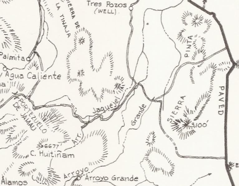
This is Howard Gulick's 1962 map of the area. We went as far as the road junction area just north of the lable 'Grande' for Arroyo grande on the map.
|
For starters, Hwy 5 does not hook the way it does on this map. Plus, where you were driving when you took the photo behind the wheel, is sandy, but
is past the actual arroyo - leading to some massive silt beds.
I would post my photos, but they would throw your screen orientation out of sorts. And, I know you wouldn't like reading your thread with larger
photo images to condend with. |
Hi Ken,
Actually, Howard's maps are more accurate than most if not all others on the roads of the time (1962). He was an engineer and at every bend in the
road he would take out is compass, walk away from his Jeep and take down the new heading. The map portion is a zoomed in area. If I back out and show
the larger area you will see Hwy. 5 is placed true. I will put some notes on a copy to show you where we were in that photo.
Cohabuzo Junction is way off the top left of the map portion I posted and any mountain you see in my photo is not near there. The photo is looking
south IN Arroyo Grande towards Borrego Mountain/ Sierra Pinta. Now the Mexican topo map (Baja Almanac) calls the original Borrego Mountain 'Arrajal'
and names a shorter peak next to it 'Borrego'.
|
|
|
David K
Honored Nomad
        
Posts: 65445
Registered: 8-30-2002
Location: San Diego County
Member Is Offline
Mood: Have Baja Fever
|
|
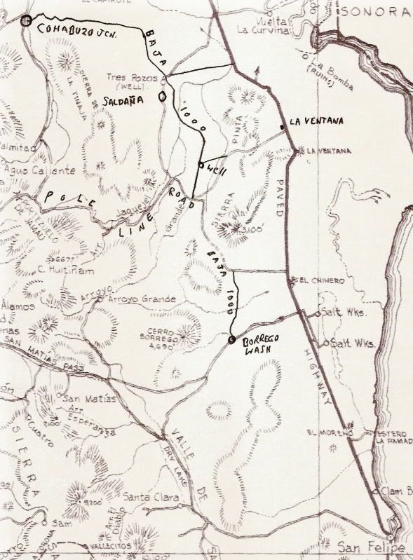
OK Ken, here is the Gulick map, showing more of the area and including San Felipe to Cohabuzo Jcn. I penciled in the Baja 1000 (2011) course and newer
roads from Hwy. 5 (to Ej. Saldaņa and the gold mine water well).
We drove in from La Ventana to the well, then south 5 miles on the Baja 1000 road, passing Race Mile 170 sign and where it meets the Pole Line Road we
drove a short distance east from Arroyo Grande and a bit north on the old road shown on the Gulick map and the Almanac... but it soon vanished. We
returned to Arroyo Grande, headed back to the well and drove back out to La Ventana the same way we came in.
|
|
|
tunaeater
Senior Nomad
  
Posts: 617
Registered: 9-3-2003
Location: Chula Vista, CA
Member Is Offline
|
|
David we had a blast at Rob's (thank you Rob) and it was a treat to watch the Chargers beat up on the Raiders. The clams and all the side dishes were
great!
Glad we got to spend some time with you and Elizabeth. Sorry we didn't make it on Monday. We got lazy, made breakfast and took an easy drive down to
Huerfanito for a few hours. A pit stop at Cowpatty's to quench the thirst on the way North then back to my dads. Looking forward to March SF 250
|
|
|
El Comadante Loco
Nomad
 
Posts: 274
Registered: 6-12-2004
Member Is Offline
|
|
David: Good to see you and Baja Angel again.. Great report.
Sunday's party was huge success and what a way to start the new year with excelent clams, thanks to Rob and all the help he had. There was plenty of
food to be had and enjoyed, clams, pozole, tamales, several bean dishes, pastas, stuffed chiles gueritos, and much more not to mention the spread of
deserts.
BTW the company and drinks were also fantastic.
|
|
|
Ken Cooke
Elite Nomad
     
Posts: 8970
Registered: 2-9-2004
Location: Riverside, CA
Member Is Offline
Mood: Pole Line Road postponed due to injury
|
|
| Quote: | Originally posted by David K
OK Ken, here is the Gulick map, showing more of the area and including San Felipe to Cohabuzo Jcn. I penciled in the Baja 1000 (2011) course and newer
roads from Hwy. 5 (to Ej. Saldaņa and the gold mine water well).
We drove in from La Ventana to the well, then south 5 miles on the Baja 1000 road, passing Race Mile 170 sign and where it meets the Pole Line Road we
drove a short distance east from Arroyo Grande and a bit north on the old road shown on the Gulick map and the Almanac... but it soon vanished. We
returned to Arroyo Grande, headed back to the well and drove back out to La Ventana the same way we came in.
 |
I have a Neal Johns' hand-penciled copy of the Baja Almanac that I refer to. The hill I was referring to is called Cerro Caprote and serves as a
landmark of sorts for the area north of Cohabuzo Junction. The Baja 1000 road travels east of Caprote winding south into the lower reaches of the
Laguna Salada.
|
|
|
Packoderm
Super Nomad
   
Posts: 2116
Registered: 11-7-2002
Member Is Offline
|
|
Is it a against the law for gringos to take petrified clams just like it's illegal to take fresh ones?
|
|
|
David K
Honored Nomad
        
Posts: 65445
Registered: 8-30-2002
Location: San Diego County
Member Is Offline
Mood: Have Baja Fever
|
|
As far as I know, gringos cannot remove fossils... Take only photos, leave only foot and tire tracks! However, just like live clams... if you get them
from a local you can take fossils home. Many of you have seen Kim Williams Map and Fossil store in El Rosario, yes?
|
|
|
David K
Honored Nomad
        
Posts: 65445
Registered: 8-30-2002
Location: San Diego County
Member Is Offline
Mood: Have Baja Fever
|
|
| Quote: | Originally posted by Ken Cooke
| Quote: | Originally posted by David K
OK Ken, here is the Gulick map, showing more of the area and including San Felipe to Cohabuzo Jcn. I penciled in the Baja 1000 (2011) course and newer
roads from Hwy. 5 (to Ej. Saldaņa and the gold mine water well).
We drove in from La Ventana to the well, then south 5 miles on the Baja 1000 road, passing Race Mile 170 sign and where it meets the Pole Line Road we
drove a short distance east from Arroyo Grande and a bit north on the old road shown on the Gulick map and the Almanac... but it soon vanished. We
returned to Arroyo Grande, headed back to the well and drove back out to La Ventana the same way we came in.
 |
I have a Neal Johns' hand-penciled copy of the Baja Almanac that I refer to. The hill I was referring to is called Cerro Caprote and serves as a
landmark of sorts for the area north of Cohabuzo Junction. The Baja 1000 road travels east of Caprote winding south into the lower reaches of the
Laguna Salada. |
Ken... when you are done with the Pole Line run, don't you come out to Hwy. 5 at La Ventana... the same road we took along the water pipe/ power lines
from the Arroyo Grande well?
|
|
|
ArvadaGeorge
Nomad
 
Posts: 358
Registered: 9-2-2003
Member Is Offline
|
|
David
Thanks for the report. I have fond memories of Rob's New Years day party.
Can you send me or post the WPT for the fossil beds. My grandkids would love them.
|
|
|
El Vergel
Nomad
 
Posts: 197
Registered: 8-27-2003
Location: San Felipe - Puertecitos Rd., Km. 35 and Santa Mon
Member Is Offline
|
|
Unchartered Territories
Thank you David for this report!
Killer stuff, especially the region beyond the mine with a loop through La Ventana, via the well. Once you get to the mine, is this a route over the
baja1k trail to encompass an expedition? I sense adventure in 'dem 'dar hills!
I need to get to the clams (petrifried [sp])...was lookin' for those once...thanks to chick for findin' them. Very interesting almejas there!
How long (in hours) to make a loop from La Ventana, through the woods and over the dale to the mine, then to El Chinero? I'm thinkin' Base Camp for
Discovery, 2012 back there somewhere.
BajaRob 's clams looked ....! I've heard of their clams! Awesome!
Shell Beach had it all goin' on!
Thanks for the share! Happy 2012 to all!
[Edited on 1-8-2012 by El Vergel]
|
|
|
David K
Honored Nomad
        
Posts: 65445
Registered: 8-30-2002
Location: San Diego County
Member Is Offline
Mood: Have Baja Fever
|
|
Not sure what mine from La Ventana, but the road to the well is a fast one. From the well south in Arroyo Grande is very slow, being the Baja 1000
course and is all whooped for about 5 miles to where it leaves Arroyo Grande for Borrego.
A cable across the arroyo just past the climb out prevented us from going further up Arroyo Grande as we had wished to.
|
|
|
BAJACAT
Ultra Nomad
    
Posts: 2902
Registered: 11-21-2005
Location: NATIONAL CITY, CA
Member Is Offline
|
|
David, Presidents nomad ride, get ready.We need you to do one of this with us.Remember your past Matomi trips with the gang lead to the new trips..I
will buy you and Baja Angel dinner after the ride on Sunday, what do you say..
BAJA IS WHAT YOU WANTED TO BE, FUN,DANGEROUS,INCREDIBLE, REMOTE, EXOTIC..JUST GO AND HAVE FUN.....
|
|
|
Ken Cooke
Elite Nomad
     
Posts: 8970
Registered: 2-9-2004
Location: Riverside, CA
Member Is Offline
Mood: Pole Line Road postponed due to injury
|
|
| Quote: | Originally posted by David K
A cable across the arroyo just past the climb out prevented us from going further up Arroyo Grande as we had wished to. |
How large of a cable is this? Was it place to prevent access to the well? Is it new?
|
|
|
BajaBlanca
Select Nomad
      
Posts: 13247
Registered: 10-28-2008
Location: La Bocana, BCS
Member Is Offline
|
|
fantastic reading and photos !!! so many petrified clams and starfish !! thanks for sharing and lets get this man some jobs so he can travel more and
post more !!
|
|
|
David K
Honored Nomad
        
Posts: 65445
Registered: 8-30-2002
Location: San Diego County
Member Is Offline
Mood: Have Baja Fever
|
|
| Quote: | Originally posted by Ken Cooke
| Quote: | Originally posted by David K
A cable across the arroyo just past the climb out prevented us from going further up Arroyo Grande as we had wished to. |
How large of a cable is this? Was it place to prevent access to the well? Is it new? |
No Ken, this was ~5 miles SOUTH of the well, just south of where the race course/ Pole Line road climbs out the east side of Arroyo Grande (and where
the Pole Line Road drops in on the west side). The cable looks to block anyone from driving south in Arroyo Grande.
I asked before, how do you go from the Pole Line Road to La Ventana, if not in Arroyo Grande and the the well road?
|
|
|
David K
Honored Nomad
        
Posts: 65445
Registered: 8-30-2002
Location: San Diego County
Member Is Offline
Mood: Have Baja Fever
|
|
| Quote: | Originally posted by BajaBlanca
fantastic reading and photos !!! so many petrified clams and starfish !! thanks for sharing and lets get this man some jobs so he can travel more and
post more !! |
Yes... Baja is just so full of adventures!
|
|
|
Ken Cooke
Elite Nomad
     
Posts: 8970
Registered: 2-9-2004
Location: Riverside, CA
Member Is Offline
Mood: Pole Line Road postponed due to injury
|
|
| Quote: | Originally posted by David K
No Ken, this was ~5 miles SOUTH of the well, just south of where the race course/ Pole Line road climbs out the east side of Arroyo Grande (and where
the Pole Line Road drops in on the west side). The cable looks to block anyone from driving south in Arroyo Grande. |
David - Lower Caņon Jaquegel flows east toward Hwy 5 - not Arroyo Grande from the Pole Line Road. Arroyo Grande lies southeast of the Pole Line Road.
At the terminis of the Pole Line Road, communication lines turn south towards San Felipe and the rocky Arroyo Grande. According to Neal Johns, you
cannot continue through this route to Hwy 3 due to large boulders blocking the route.

Where the well appears on this route, you are inside of the Ejido, away from Hwy 5. Following the two-track, you are actually EAST of the Ejido
traveling NORTH to Hwy 5. I don't have a track drawn up, but in 2 days, I could take you on the complete loop from Ejido Saldaņa to Ejido Saldaņa.
|
|
|
David K
Honored Nomad
        
Posts: 65445
Registered: 8-30-2002
Location: San Diego County
Member Is Offline
Mood: Have Baja Fever
|
|
I was sure I read how you drive to Hwy. 5 at La Ventana after a Pole line run...? S0, you leave the Pole Line and drove way north past Ejido Saldaņa
and came to Hwy. 5 at the sand dunes?
Yes, the original phone line road crosses Arroyo Grande to head to San Felipe... Score uses it (part of it) to cross the Sierra Pinta. You can see it
easy on Google Earth and Neal Johns/ TW waypoints for the Pole Line confirm.
Neal and TW have driven up Arroyo Grande in the past. The Almanac even shows it as a road.
|
|
|
David K
Honored Nomad
        
Posts: 65445
Registered: 8-30-2002
Location: San Diego County
Member Is Offline
Mood: Have Baja Fever
|
|
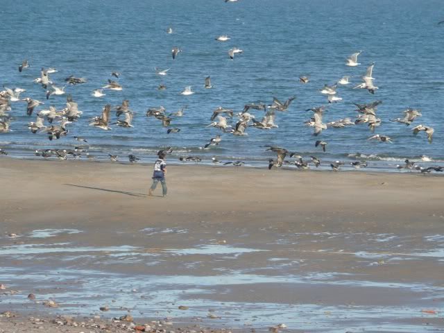
Photos from Tunaeater at the party
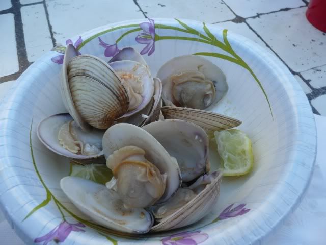
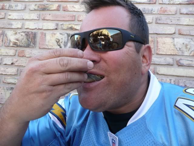
Paul 'Tunaeater'
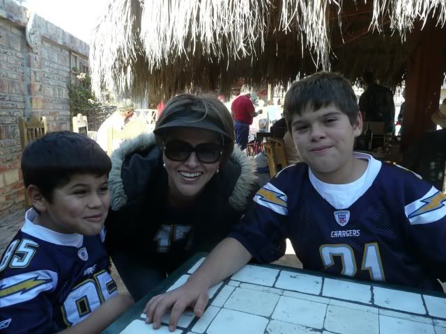
Mrs. Tunaeater and the kids

Tunaeater and his dad El Comandante Loco (Rudy).
|
|
|
| Pages:
1
2
3 |

