| Pages:
1
2
3 |
TMW
Select Nomad
      
Posts: 10659
Registered: 9-1-2003
Location: Bakersfield, CA
Member Is Offline
|
|
DK the cable may have just been a temporary thing either to keep racers and/or chaser out or maybe they were doing some work and did not want anyone
messing with it.
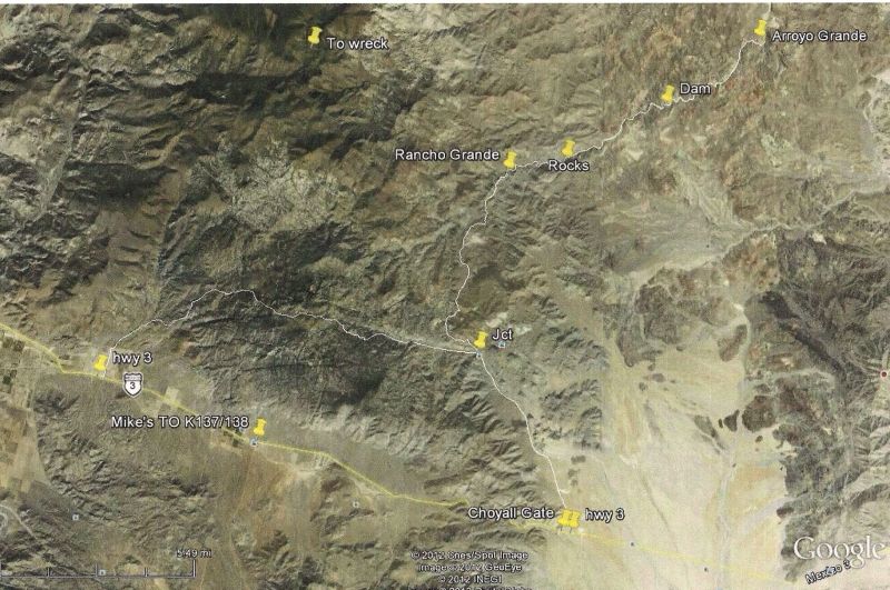
I've been as far as the rocks.
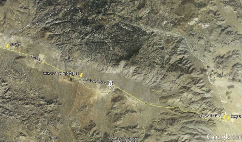
Looking at Google Earth it shows a road going further west from above Choyall and coming out to hwy 3 about half way between Mike's Sky Rancho turn
off and Trinidad.
|
|
|
56MM#
Junior Nomad

Posts: 59
Registered: 2-3-2010
Member Is Offline
|
|
I did the route on October 11th. Also have a picture of the first gate with my truck on the inside. Not sure how to post a 2 MB picture.
|
|
|
David K
Honored Nomad
        
Posts: 65436
Registered: 8-30-2002
Location: San Diego County
Member Is Offline
Mood: Have Baja Fever
|
|
Use photobucket.com and use upload options and select 800 pixels for a reduced size but maximum Nomad size.
|
|
|
56MM#
Junior Nomad

Posts: 59
Registered: 2-3-2010
Member Is Offline
|
|
I uploaded six pictures to photobucket. How do I get them onto this site?
|
|
|
TMW
Select Nomad
      
Posts: 10659
Registered: 9-1-2003
Location: Bakersfield, CA
Member Is Offline
|
|
When you put your curser over the pix there will be a list of items pop open, move your curser to the bottom one and left click on it. When you do it
should say copied. Then go to the Nomad page you are repling on and paste it in the reply box.
|
|
|
TMW
Select Nomad
      
Posts: 10659
Registered: 9-1-2003
Location: Bakersfield, CA
Member Is Offline
|
|
If you don't get the list of option after putting your curser on the pix then double click on the pix and it will open in a larger frame. To the right
will be the list of options put your curser over the bottom one and left click. This is for the old Photobucket I have not used the newer version yet.
|
|
|
David K
Honored Nomad
        
Posts: 65436
Registered: 8-30-2002
Location: San Diego County
Member Is Offline
Mood: Have Baja Fever
|
|
It is the image link called IMG Link
|
|
|
56MM#
Junior Nomad

Posts: 59
Registered: 2-3-2010
Member Is Offline
|
|
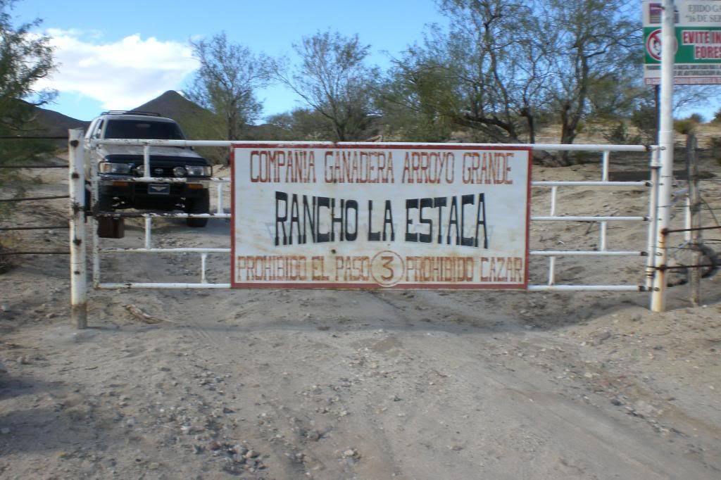
Locked in at the first gate I encountered.
|
|
|
56MM#
Junior Nomad

Posts: 59
Registered: 2-3-2010
Member Is Offline
|
|
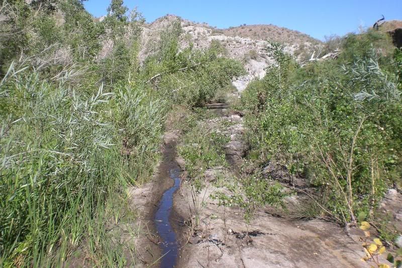
Here's the swamp just before Arroyo Grande:
Rancho Arroyo Grande:
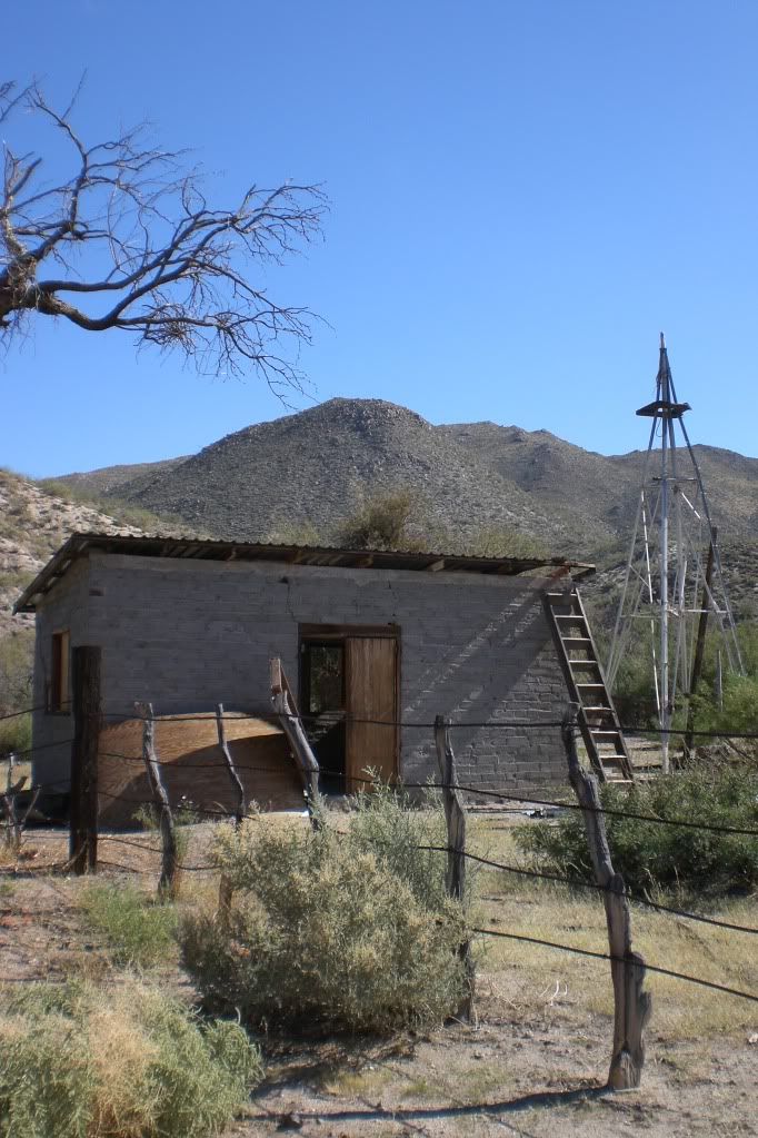
Up on the plain above Arroyo Grande:
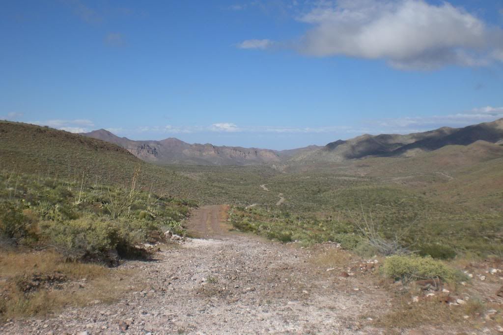
Cerro La Noche looking northwest:
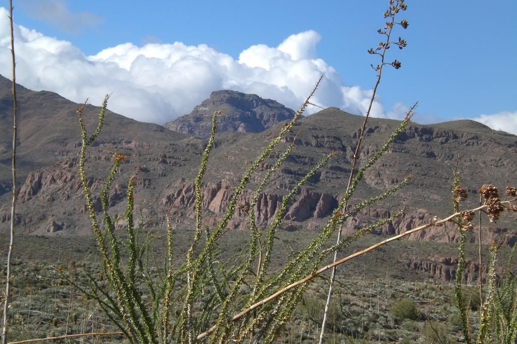
Road winding down to Canada Taraiso:
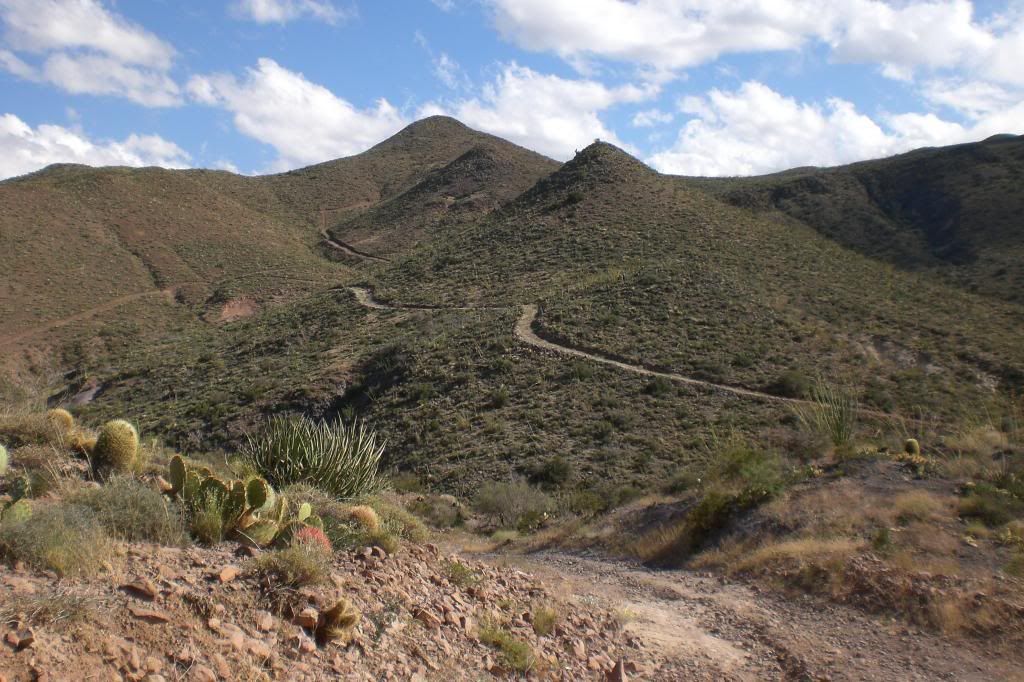
Locked in a few miles up from Choyall:

This is the beefiest ranch gate and fence I have seen in Baja.
|
|
|
Ken Cooke
Elite Nomad
     
Posts: 8970
Registered: 2-9-2004
Location: Riverside, CA
Member Is Offline
Mood: Pole Line Road postponed due to injury
|
|
Is there a way around that gate in Choyall?
|
|
|
56MM#
Junior Nomad

Posts: 59
Registered: 2-3-2010
Member Is Offline
|
|
No. The fence stretches completely across the wash from cliff to cliff.
|
|
|
David K
Honored Nomad
        
Posts: 65436
Registered: 8-30-2002
Location: San Diego County
Member Is Offline
Mood: Have Baja Fever
|
|
Any photos of the north section of Arroyo Grande canyon? Thanks!
|
|
|
TMW
Select Nomad
      
Posts: 10659
Registered: 9-1-2003
Location: Bakersfield, CA
Member Is Offline
|
|
I wonder if there are any locked gates further west toward Trinidad or if the road is passable.
|
|
|
Ken Cooke
Elite Nomad
     
Posts: 8970
Registered: 2-9-2004
Location: Riverside, CA
Member Is Offline
Mood: Pole Line Road postponed due to injury
|
|
Taking an example from tonight's newscast
| Quote: | Originally posted by 56MM#
No. The fence stretches completely across the wash from cliff to cliff. |

|
|
|
TMW
Select Nomad
      
Posts: 10659
Registered: 9-1-2003
Location: Bakersfield, CA
Member Is Offline
|
|
The designer probably failed trigonometry in which case they should have used bigger tires.
|
|
|
56MM#
Junior Nomad

Posts: 59
Registered: 2-3-2010
Member Is Offline
|
|
Heading down to San Felipe for a few days. Will post pictures of Arroyo Grande and some narrative when I get back.
|
|
|
David K
Honored Nomad
        
Posts: 65436
Registered: 8-30-2002
Location: San Diego County
Member Is Offline
Mood: Have Baja Fever
|
|
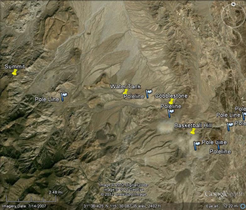
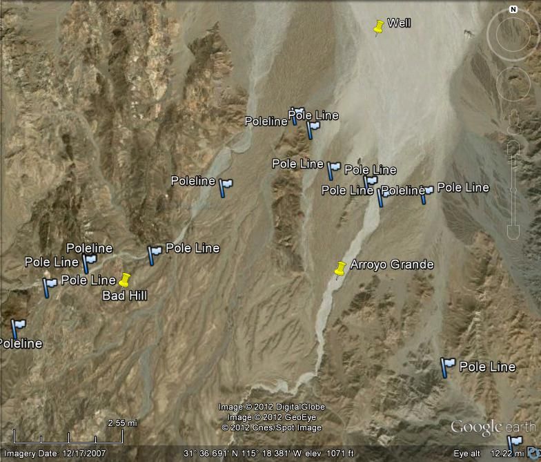
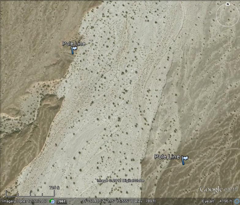
Did some Google Earth flyovers last night and marked the Pole line road on both sides of Arroyo Grande...
|
|
|
David K
Honored Nomad
        
Posts: 65436
Registered: 8-30-2002
Location: San Diego County
Member Is Offline
Mood: Have Baja Fever
|
|
All views have North at top...
HIGH VIEW:
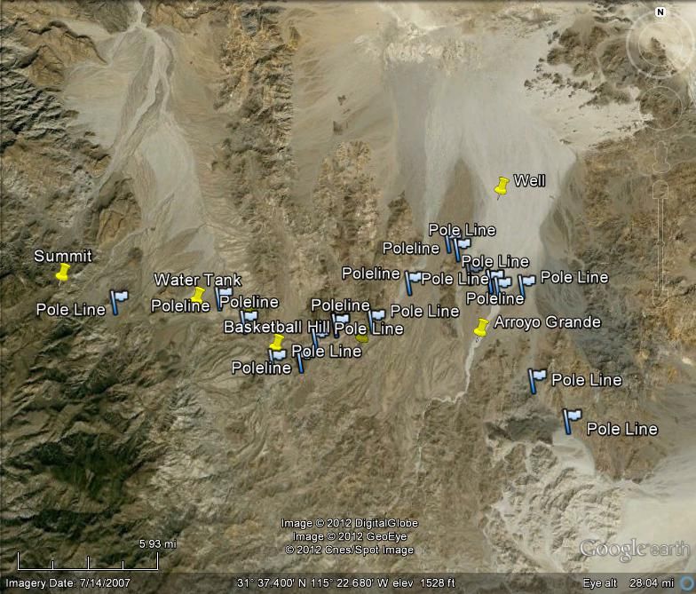
WEST HALF:
EAST HALF:
ARROYO GRANDE CROSSING:
On 1962 Gulick Map:
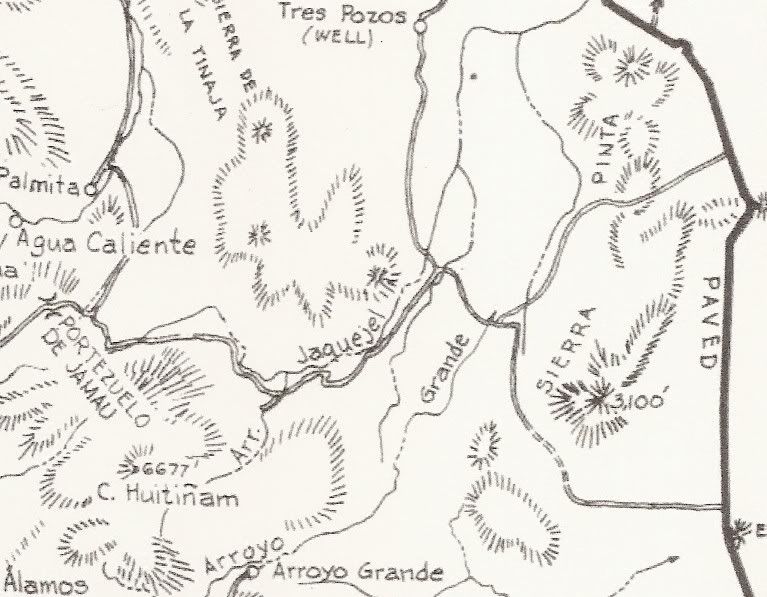
Portezuelo is the summit.
[Edited on 11-4-2012 by David K]
|
|
|
TMW
Select Nomad
      
Posts: 10659
Registered: 9-1-2003
Location: Bakersfield, CA
Member Is Offline
|
|
I thought the pole Line Road went to La Ventana not toward Borrego.
|
|
|
David K
Honored Nomad
        
Posts: 65436
Registered: 8-30-2002
Location: San Diego County
Member Is Offline
Mood: Have Baja Fever
|
|
Nope, the telephone line poles went to San Felipe (for the radar station).. the modern access road to the well and Arroyo Grande comes from La
Ventana...
|
|
|
| Pages:
1
2
3 |

