| Pages:
1
2
3
4
5 |
Ricardo
Nomad
 
Posts: 139
Registered: 12-9-2004
Location: Telkwa
Member Is Offline
|
|
Thanks David I was in Cabo in 72, my camera racheted my film and it wouldn't advance so no pictures, so really enjoy seeing the picture, any of LaPaz?
Rick
|
|
|
David K
Honored Nomad
        
Posts: 65434
Registered: 8-30-2002
Location: San Diego County
Member Is Offline
Mood: Have Baja Fever
|
|
1974
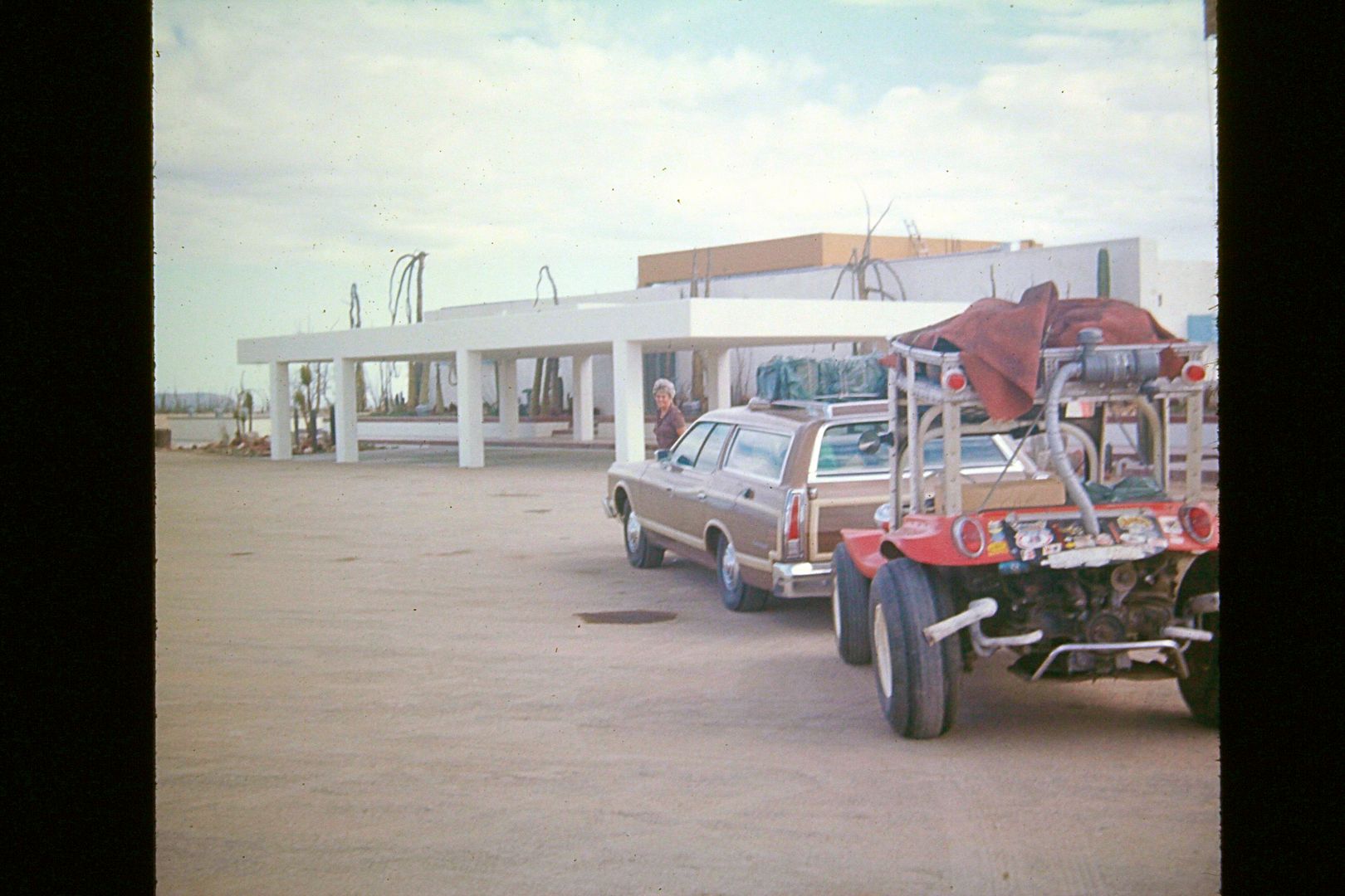
On the Baja Guidebook research trip to Cabo... My dad's station wagon towing my dune buggy (for any off road excursions). I think this is Parador
Punta Prieta (L.A. Bay junction)?
|
|
|
David K
Honored Nomad
        
Posts: 65434
Registered: 8-30-2002
Location: San Diego County
Member Is Offline
Mood: Have Baja Fever
|
|
1972 (November)
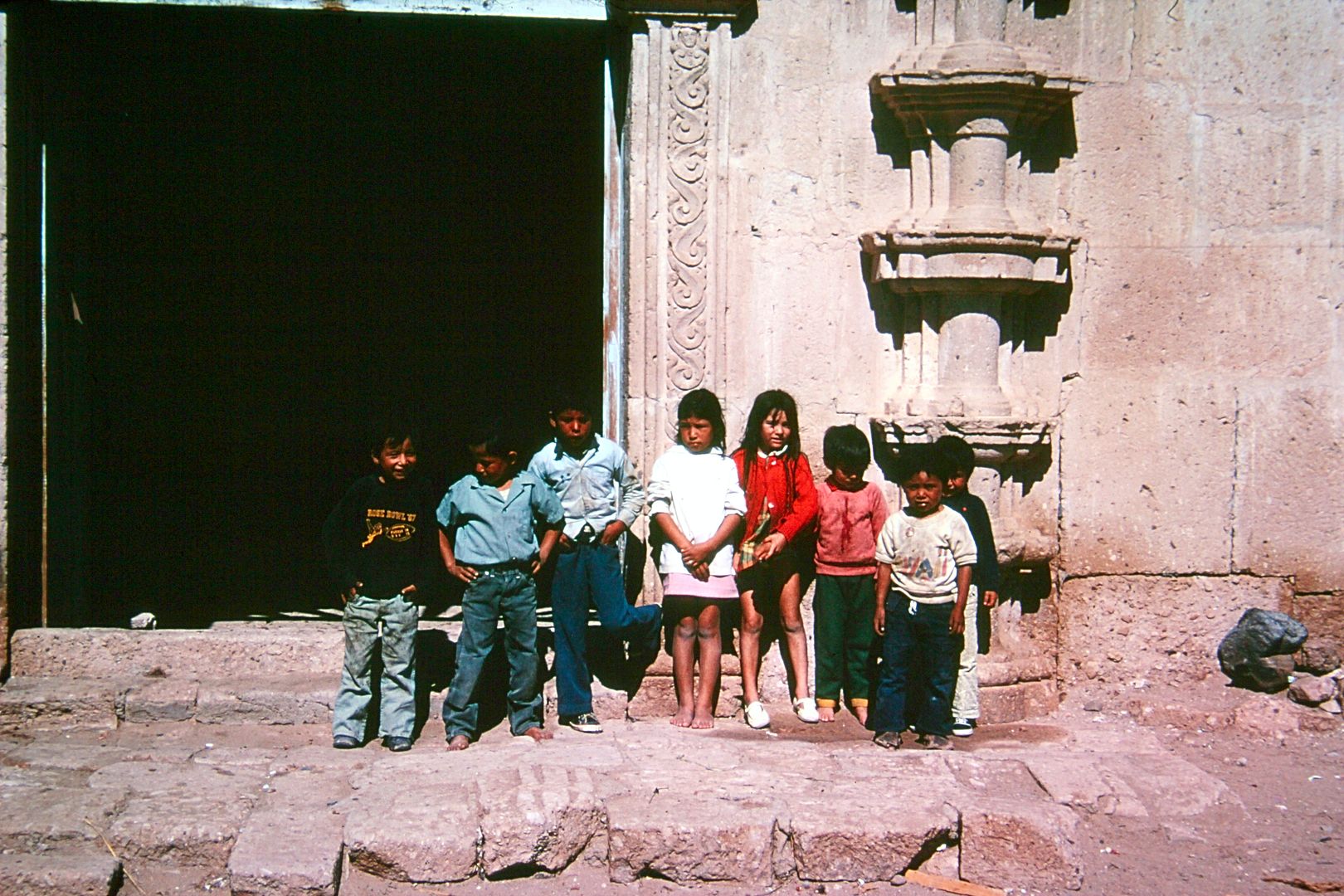
The children of San Borja in front of the mission.
|
|
|
captkw
Ultra Nomad
    
Posts: 3850
Registered: 10-19-2010
Location: el charro b.c.s.
Member Is Offline
Mood: new dog/missing the old 1
|
|
DK,,DK,,David
Mass,,,mass,,mass,, Great Pics and a big Thank's......I miss those early years !!
|
|
|
bajamedic
Nomad
 
Posts: 392
Registered: 12-5-2008
Location: Northern California
Member Is Offline
Mood: Just waitin for baja
|
|
David, our first family trip to San Felipe was in 1965. My Father and Uncle took supplies and were helping to build a small church in San Felipe. I
believe they stopped going with supplies in 1969 or 1970. Do you recall a small church being built anywhere in town? I have not been able to locate
it with all of the changes that have happened over the years. JH
|
|
|
David K
Honored Nomad
        
Posts: 65434
Registered: 8-30-2002
Location: San Diego County
Member Is Offline
Mood: Have Baja Fever
|
|
Quote: Originally posted by bajamedic  | | David, our first family trip to San Felipe was in 1965. My Father and Uncle took supplies and were helping to build a small church in San Felipe. I
believe they stopped going with supplies in 1969 or 1970. Do you recall a small church being built anywhere in town? I have not been able to locate
it with all of the changes that have happened over the years. JH |
Sorry but I do not recall it, we only stopped in San Felipe for gasoline and the bakery (bolillos)... we did visit with Arnold (Arnold's Del Mar
Café) and we stayed overnight a couple times at a motel... end of Hwy. 5, on the right far corner of the main street. There was also a mini sub on
display as you drove into town, before the end of the highway... We discussed that here on Nomad a year or so ago.
[Edited on 1-7-2021 by David K]
|
|
|
David K
Honored Nomad
        
Posts: 65434
Registered: 8-30-2002
Location: San Diego County
Member Is Offline
Mood: Have Baja Fever
|
|
More Photos...
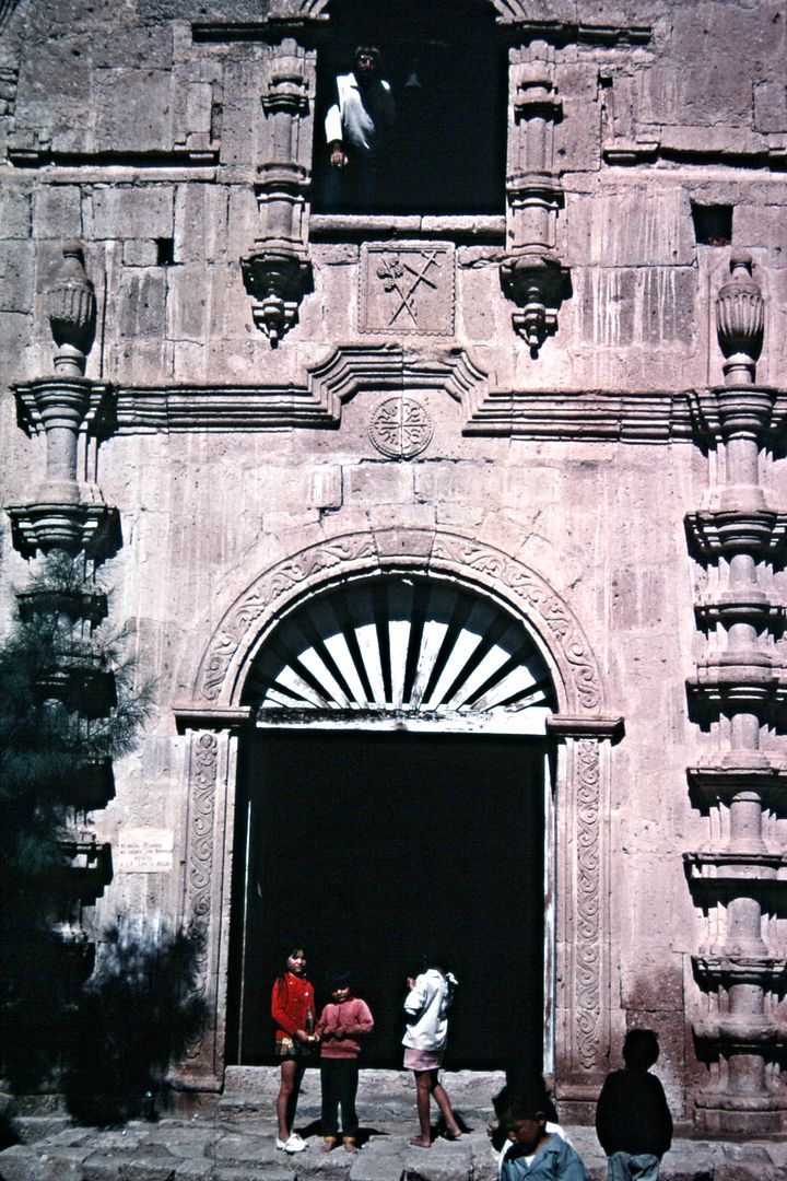
San Borja, November 1972
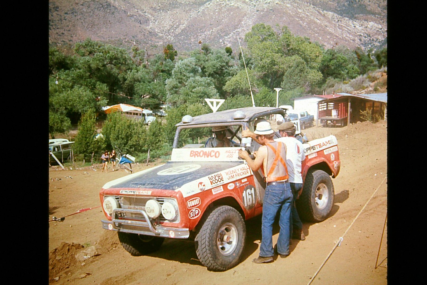
Rod Hall arriving at Checkpoint Mike's Sky Rancho, July 1974 Score Baja Internacional.
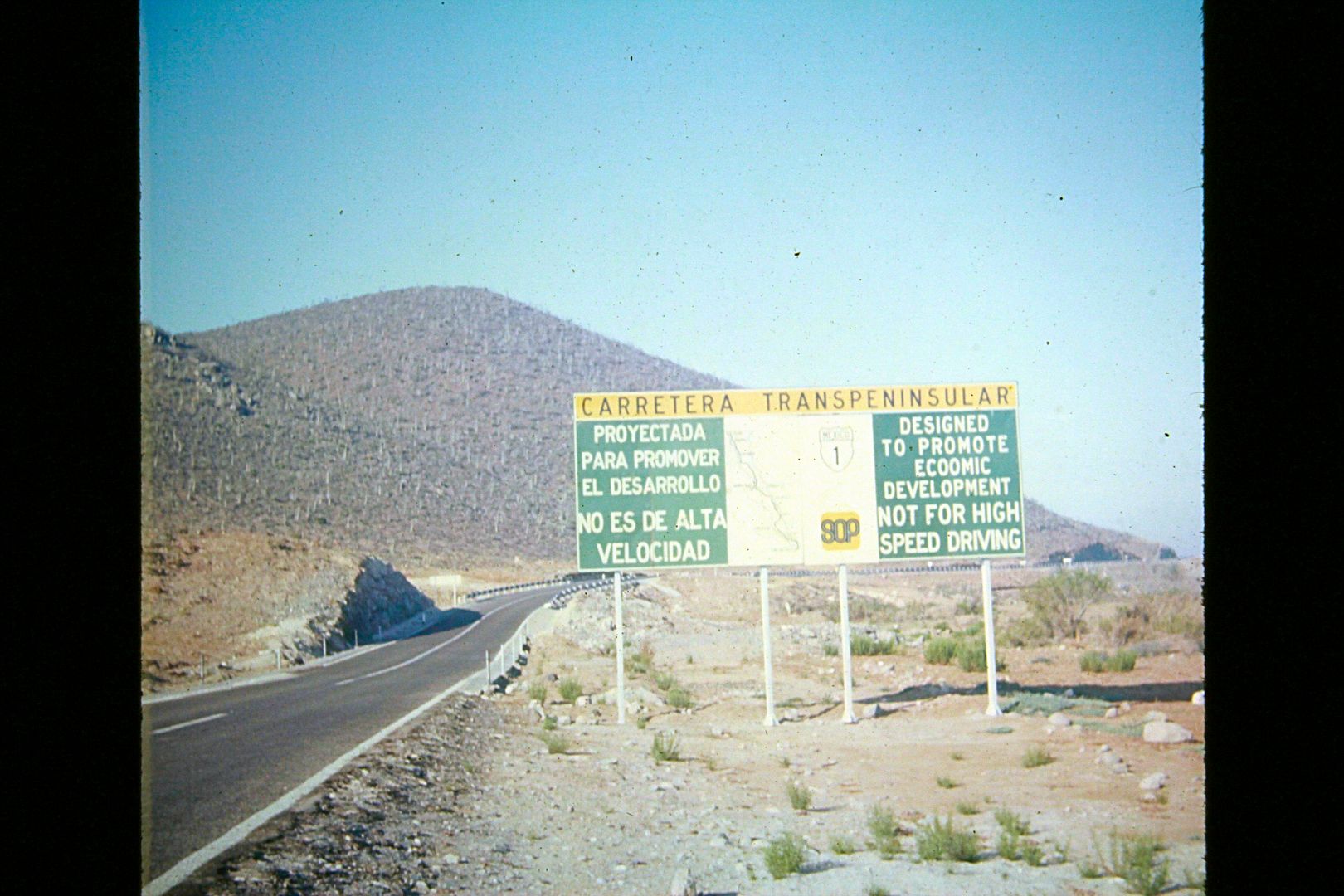
One of the many big signs erected along the new Transpeninsular Highway (notice spelling of economic)
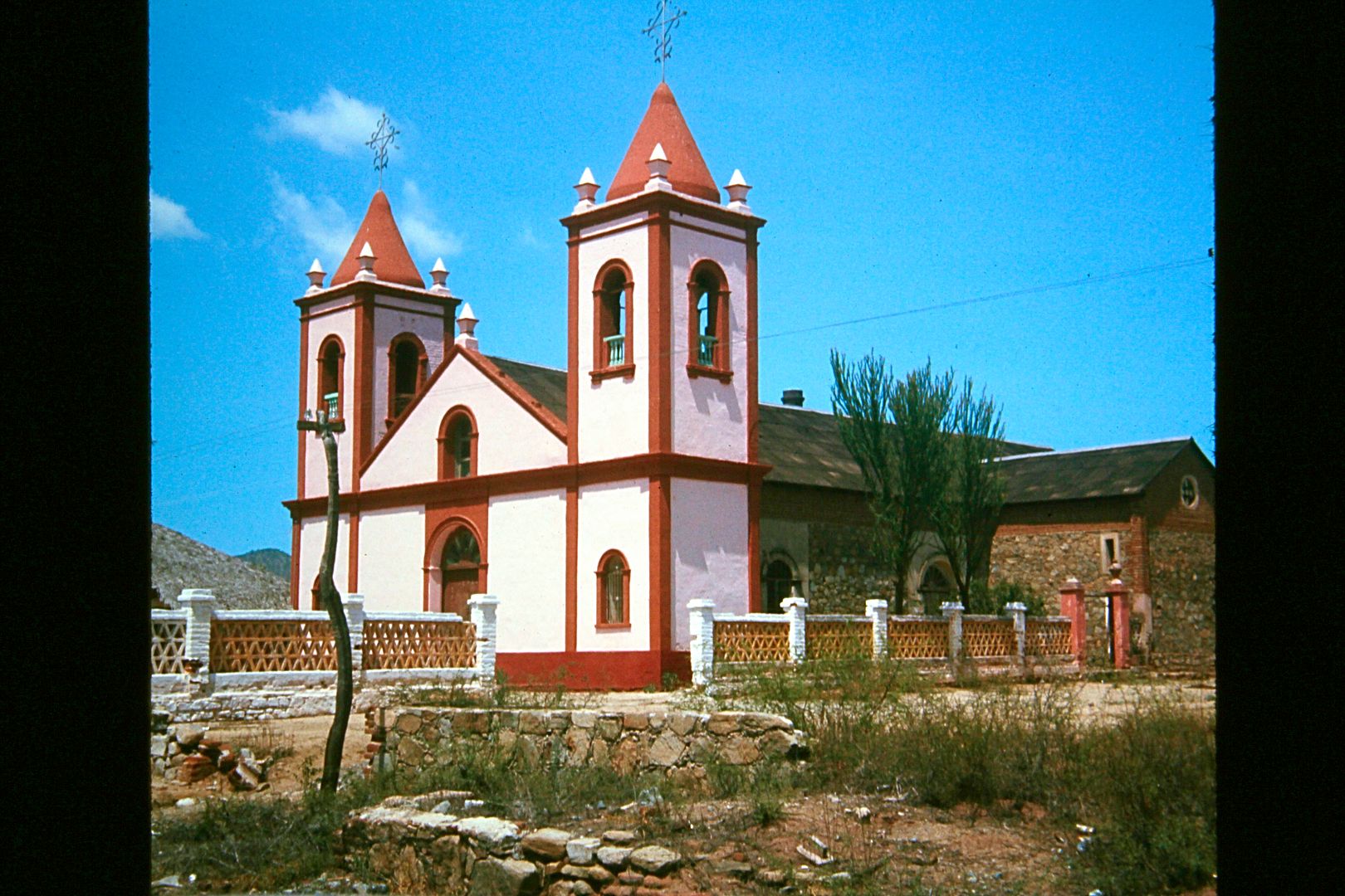
El Triunfo church, July 1974
[Edited on 10-21-2015 by David K]
|
|
|
micah202
Super Nomad
   
Posts: 1615
Registered: 1-19-2011
Location: vancouver,BC
Member Is Offline
|
|
great stuff DK.
I'm trying to figure how far down the time tunnel it was that the journey of San Fellipe to Peurtecitos, Gonzaga Bay and eventually Hwy 1 started with
a sign 'peutecitos highway' with a loooong washboard section,, then some narrow mountainous stretches before or after Peurtecitos....I remember being
rather terrified up there. Then the road completely fizzled down an arroyo,,hadn't seen a car for seeming days,,but then a truck of locals towed us
out,refused any pe$o$!
I think my mind was completely fried by Gonzaga, don't remember it at all,, think it was ~4 days from San Felippe out to hwy 1,,,, can
anyone fit the description with the year? Absolutely zero paving between San Felippe and hwy 1.
funny to think how that highway,my first baja adventure,, is still under construction!
[Edited on 10-16-2015 by micah202]
|
|
|
David K
Honored Nomad
        
Posts: 65434
Registered: 8-30-2002
Location: San Diego County
Member Is Offline
Mood: Have Baja Fever
|
|
Quote: Originally posted by Ricardo  | Thanks David I was in Cabo in 72, my camera racheted my film and it wouldn't advance so no pictures, so really enjoy seeing the picture, any of LaPaz?
Rick |
Hi Rick,
I am not sure, I still have not seen them all. One of the two CDs that the slides were transferred onto was blank, so I called the company and they
promised to send a replacement.
In 1966, we stayed at the Los Arcos in La Paz (I think). Not there long, as my dad was anxious to get to the Rancho Buena Vista and Bahia de las
Palmas resorts for some fishing! Today you guys call that area Los Barriles, but back then it was just the two fly-in resorts on the beach and a tiny
village and store behind. Amazing that the road from there to Cabo San Lucas was just a one-lane dirt road. Four years later, the paved highway would
be finished to Cabo! They were grading the road in '66 and got just past San Bartolo. The pavement (in '66) ended about 10 miles south of La Paz. We
returned to La Paz from Cabo San Lucas through Todos Santos, so we made the full cape loop. We took the ferry from La Paz to Mazatlan for the 'faster'
drive home, on pavement.
|
|
|
David K
Honored Nomad
        
Posts: 65434
Registered: 8-30-2002
Location: San Diego County
Member Is Offline
Mood: Have Baja Fever
|
|
Quote: Originally posted by micah202  | great stuff DK.
I'm trying to figure how far down the time tunnel it was that the journey of San Fellipe to Peurtecitos, Gonzaga Bay and eventually Hwy 1 started with
a sign 'peutecitos highway' with a loooong washboard section,, then some narrow mountainous stretches before or after Peurtecitos....I remember being
rather terrified up there. Then the road completely fizzled down an arroyo,,hadn't seen a car for seeming days,,but then a truck of locals towed us
out,refused any pe$o$!
I think my mind was completely fried by Gonzaga, don't remember it at all,, think it was ~4 days from San Felippe out to hwy 1,,,, can
anyone fit the description with the year? Absolutely zero paving between San Felippe and hwy 1 |
Sure, the 52 some mile road to PUERTECITOS was a graded, 2 lane wide (mostly) roadbed (in the 1960's and over 20 years after, when the newer road
along the coast was built ... 1982-83.) It did get a washboard surface, specially on the sand northern half. From the sulfur mine south was mostly
rocky.
Puertecitos to Gonzaga was a single lane mostly road, bulldozed over the volcanic ridges in the late 1950's, very steep... as the years wore on, the
roadbed got rougher and rockier. Two wheel drive trucks would spin their tires trying to climb the steep grades and in doing so would create ruts.
That makes the next vehicle slow down and then it spins its tires, etc. etc. Wrecked truck in the canyons below the steep grades testified to the
dangers of driving 2WD trucks, with bad brakes! Slow, crawling 4WD low range was the only safe way to Gonzaga Bay (or dune buggies and motorcycles, of
course).
By the late 1970s, no more repairs were made south of Puertecitos because the Highway One offered a smoother way (to and from civilization) for the
fishermen and resort needs of Gonzaga Bay.
The graded 2WD, 2 lane wide road south from Puertecitos was built in 1986. It too got very rough from lack of maintenance after 2005.
|
|
|
micah202
Super Nomad
   
Posts: 1615
Registered: 1-19-2011
Location: vancouver,BC
Member Is Offline
|
|
Quote: Originally posted by David K  | Quote: Originally posted by micah202  | great stuff DK.
I'm trying to figure how far down the time tunnel it was that the journey of San Fellipe to Peurtecitos, Gonzaga Bay and eventually Hwy 1 started with
a sign 'peutecitos highway' with a loooong washboard section,, then some narrow mountainous stretches before or after Peurtecitos....I remember being
rather terrified up there. Then the road completely fizzled down an arroyo,,hadn't seen a car for seeming days,,but then a truck of locals towed us
out,refused any pe$o$!
I think my mind was completely fried by Gonzaga, don't remember it at all,, think it was ~4 days from San Felippe out to hwy 1,,,, can
anyone fit the description with the year? Absolutely zero paving between San Felippe and hwy 1 |
Sure, the 52 some mile road to PUERTECITOS was a graded, 2 lane wide (mostly) roadbed (in the 1960's and over 20 years after, when the newer road
along the coast was built ... 1982-83.) It did get a washboard surface, specially on the sand northern half. From the sulfur mine south was mostly
rocky.
Puertecitos to Gonzaga was a single lane mostly road, bulldozed over the volcanic ridges in the late 1950's, very steep... as the years wore on, the
roadbed got rougher and rockier. Two wheel drive trucks would spin their tires trying to climb the steep grades and in doing so would create ruts.
That makes the next vehicle slow down and then it spins its tires, etc. etc. Wrecked truck in the canyons below the steep grades testified to the
dangers of driving 2WD trucks, with bad brakes! Slow, crawling 4WD low range was the only safe way to Gonzaga Bay (or dune buggies and motorcycles, of
course).
By the late 1970s, no more repairs were made south of Puertecitos because the Highway One offered a smoother way (to and from civilization) for the
fishermen and resort needs of Gonzaga Bay.
The graded 2WD, 2 lane wide road south from Puertecitos was built in 1986. It too got very rough from lack of maintenance after 2005.
|
from your description I'd guess it was the late 80's,,, trying to place amongst girlfriend of the time,,kid's ages ,etc.
Certainly I feel in a strange way honored to see some 'old baja',, even though the 'new highway' had begun!!
|
|
|
David K
Honored Nomad
        
Posts: 65434
Registered: 8-30-2002
Location: San Diego County
Member Is Offline
Mood: Have Baja Fever
|
|
Whatever year any of us first went to Baja, is our point-of-reference for the 'Good 'ol Days of Baja'.
I would have guessed you were down there before 1986 by your description of the road south of Puertecitos.
It was pretty easy driving after '86 for about 20 years unless it was a while since the grader smoothed it over? Before '86 back to about '76, not
many drove it... just too rough and used the Hwy. 1 access road to Laguna Chapala (built about 1983) or via Calamajué Canyon before '83.
[Edited on 1-7-2021 by David K]
|
|
|
David K
Honored Nomad
        
Posts: 65434
Registered: 8-30-2002
Location: San Diego County
Member Is Offline
Mood: Have Baja Fever
|
|
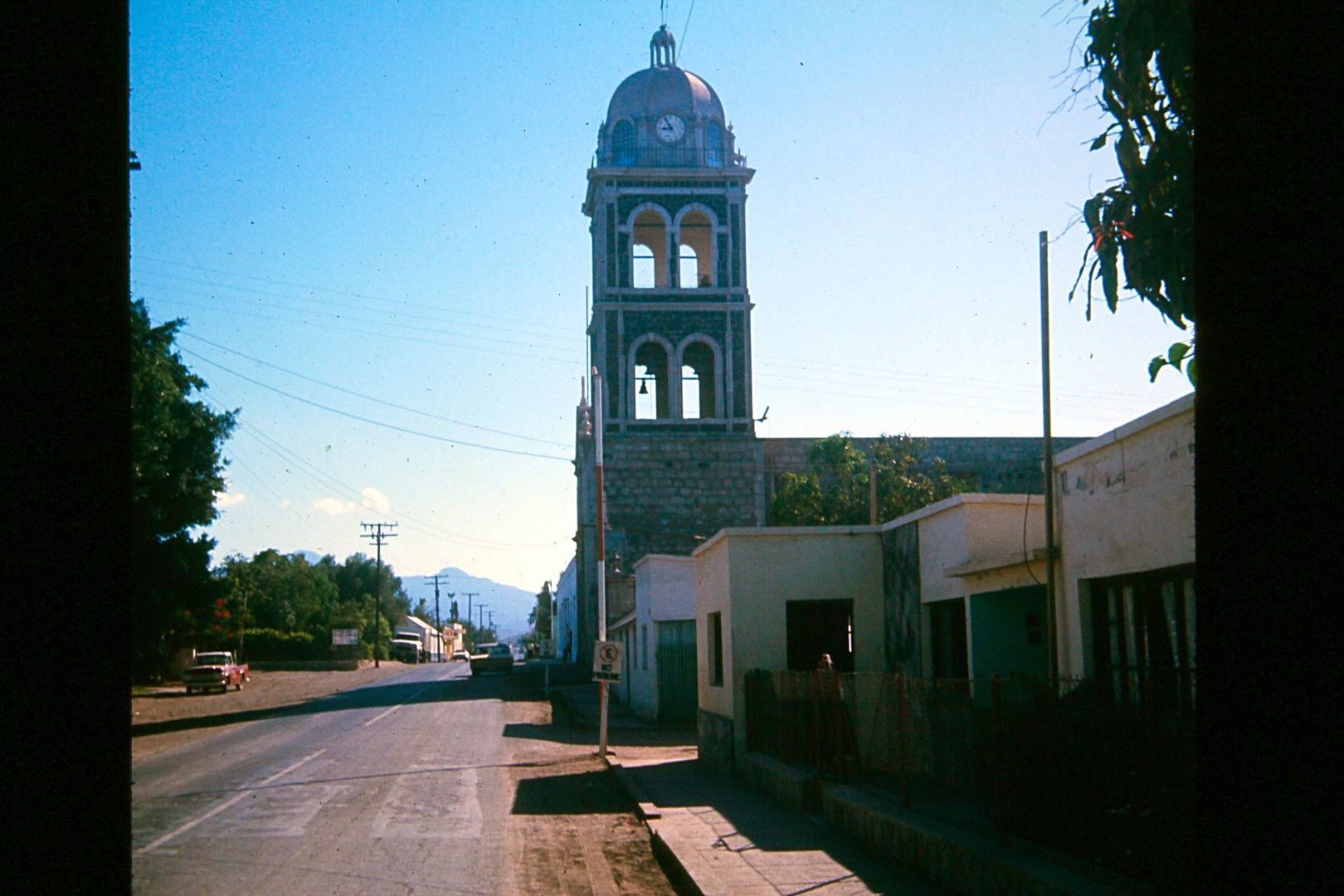
California's First Mission, Loreto. Founded in 1697 and the capital of all California for many years. When this photo was taken, the paved town
entrance road drove right in front of the mission. The other streets were dirt.
The out-of-sync bell and clock tower was added in 1955 following the church priest winning the National Lottery.
1974
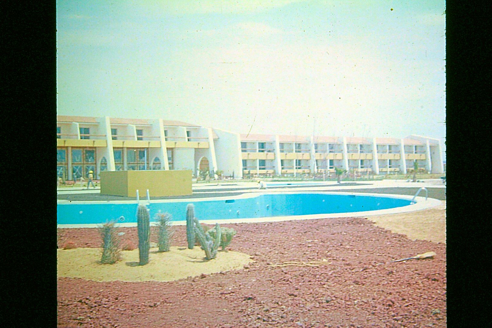
The El Presidente Hotel at San Quintin (on the south outer bay, big beach). A few years after this photo was taken an El Niño condition brought the
ocean over the swimming pool and landscape, filling it all with sand!
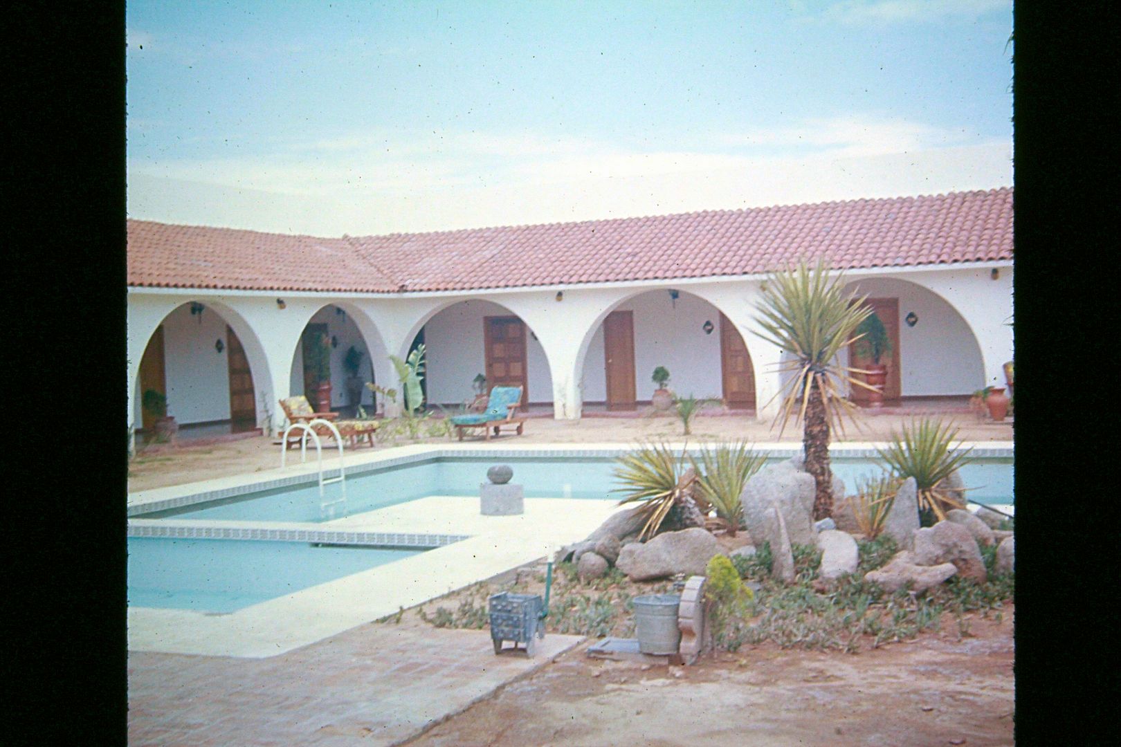
1974: Hotel El Presidente courtyard... Cataviña.
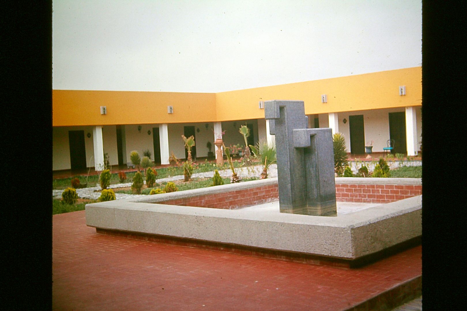
One of the El Presidente hotel's courtyard, 1974. My guess is the Paralelo 28° hotel at the Eagle Monument?
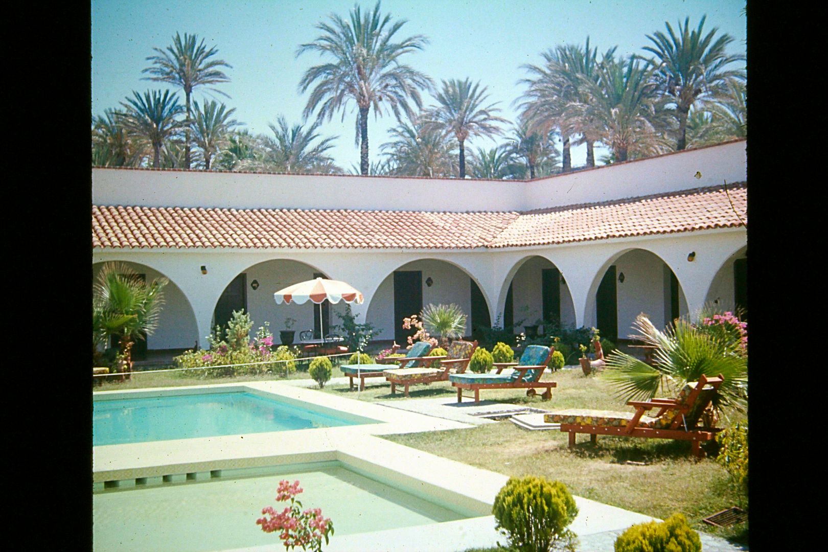
Perhaps the most attractive, thanks to the Jesuit planted palms? The Hotel El Presidente San Ignacio, in 1974.
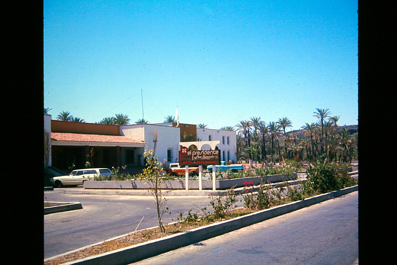
The El Presidente Hotel chain sold out to the La Pinta Hotels who ran the Baja Highway Inns for many years. A few years ago they were renamed Desert
Inn... and a couple years ago, more changes. The San Quintin one became the Hotel Misión Santa María. The Cataviña one became the Hotel Misión
Cataviña. The Paralelo 28° one (near Guerrero Negro) became the Half Way Hotel (or something like that?).
Off to work... more to come!
PS I also have a Super 8 movie I took in 1973 of the Baja 1000 going by (I was about 10 miles east of Ojos Negros). I may need some help on how to put
that on You Tube with some background music, it was converted to a DVD. Thanks!
[Edited on 1-7-2021 by David K]
|
|
|
David K
Honored Nomad
        
Posts: 65434
Registered: 8-30-2002
Location: San Diego County
Member Is Offline
Mood: Have Baja Fever
|
|
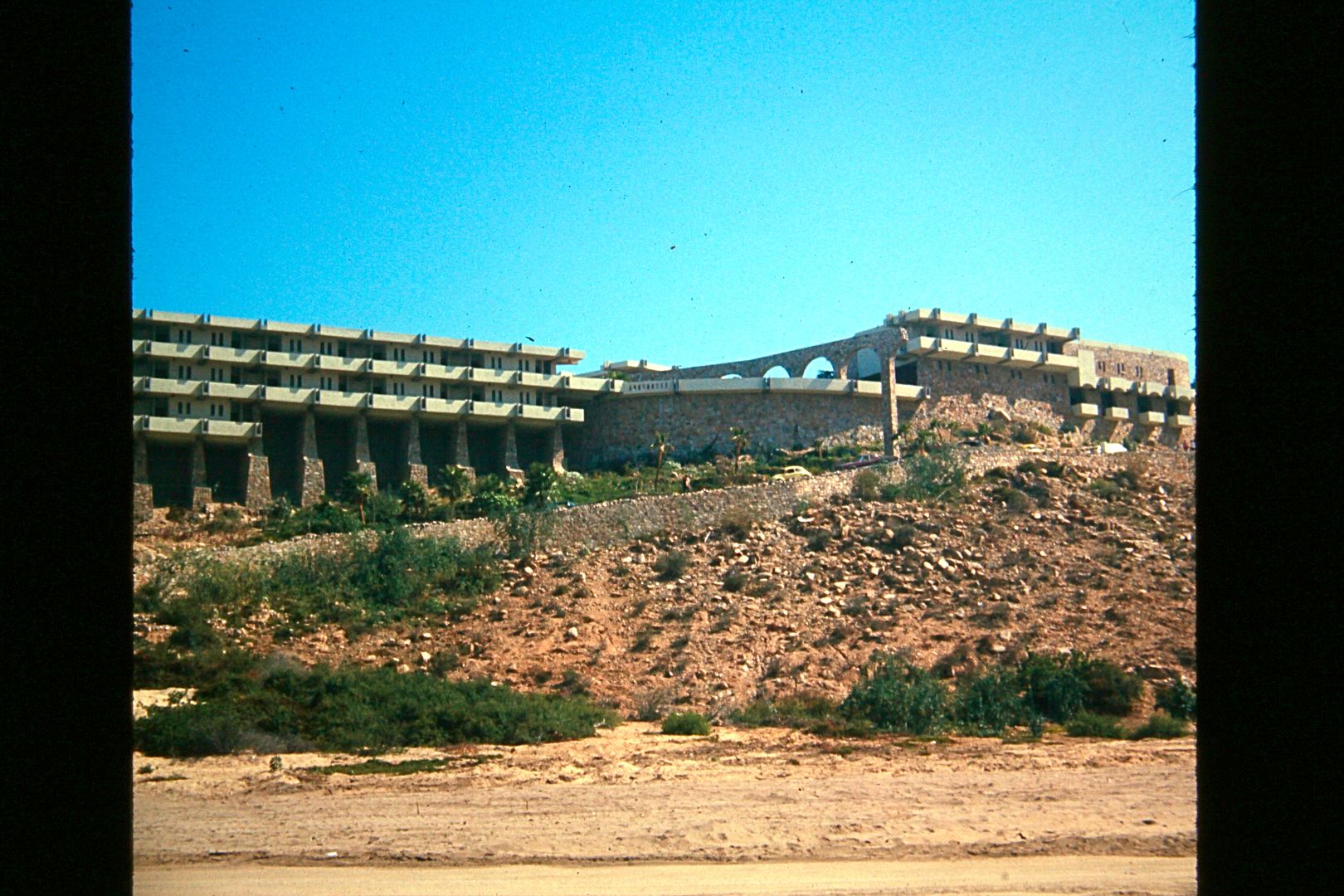
Hotel Finisterra, Cabo San Lucas. November 1972
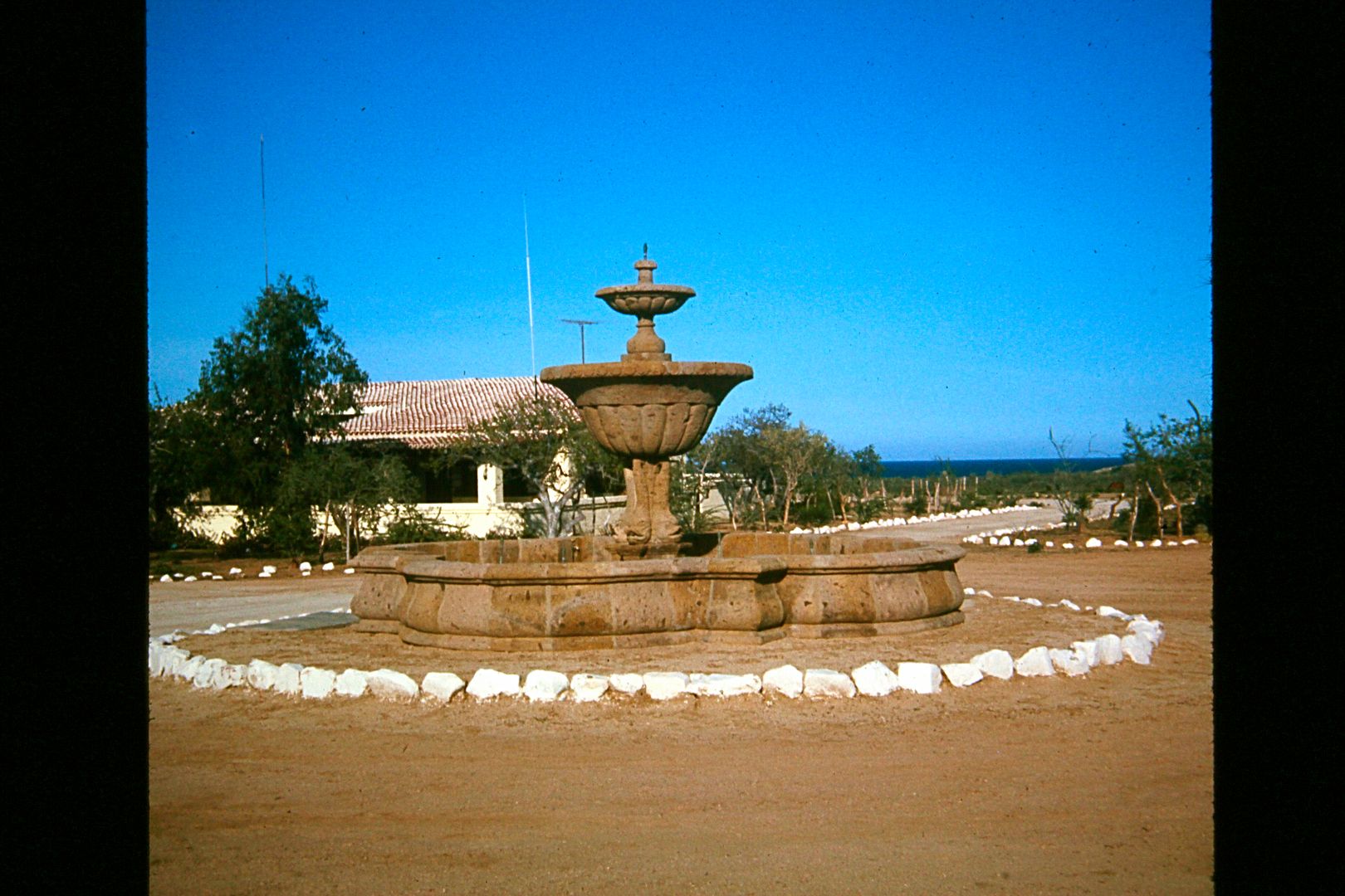
El Rincon, 7 miles north of Cabo Pulmo in July 1974
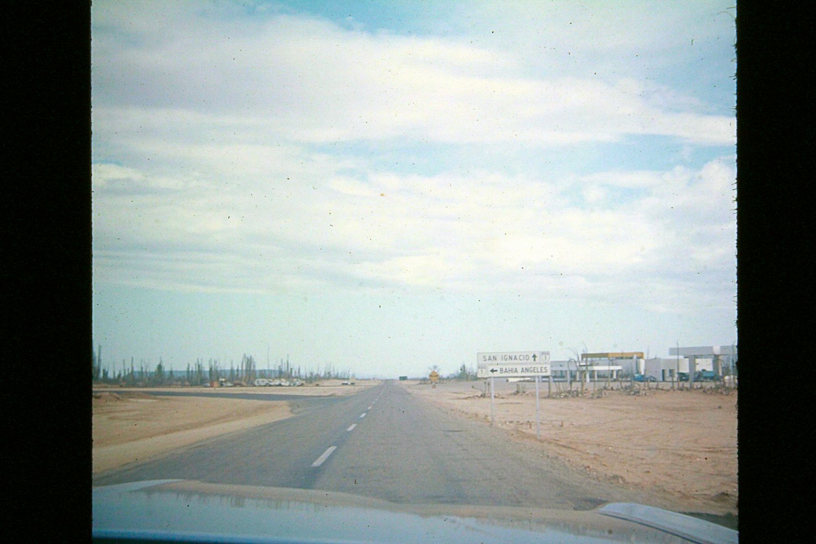
Parador Punta Prieta/ "Bahia Angeles" junction, July 1974
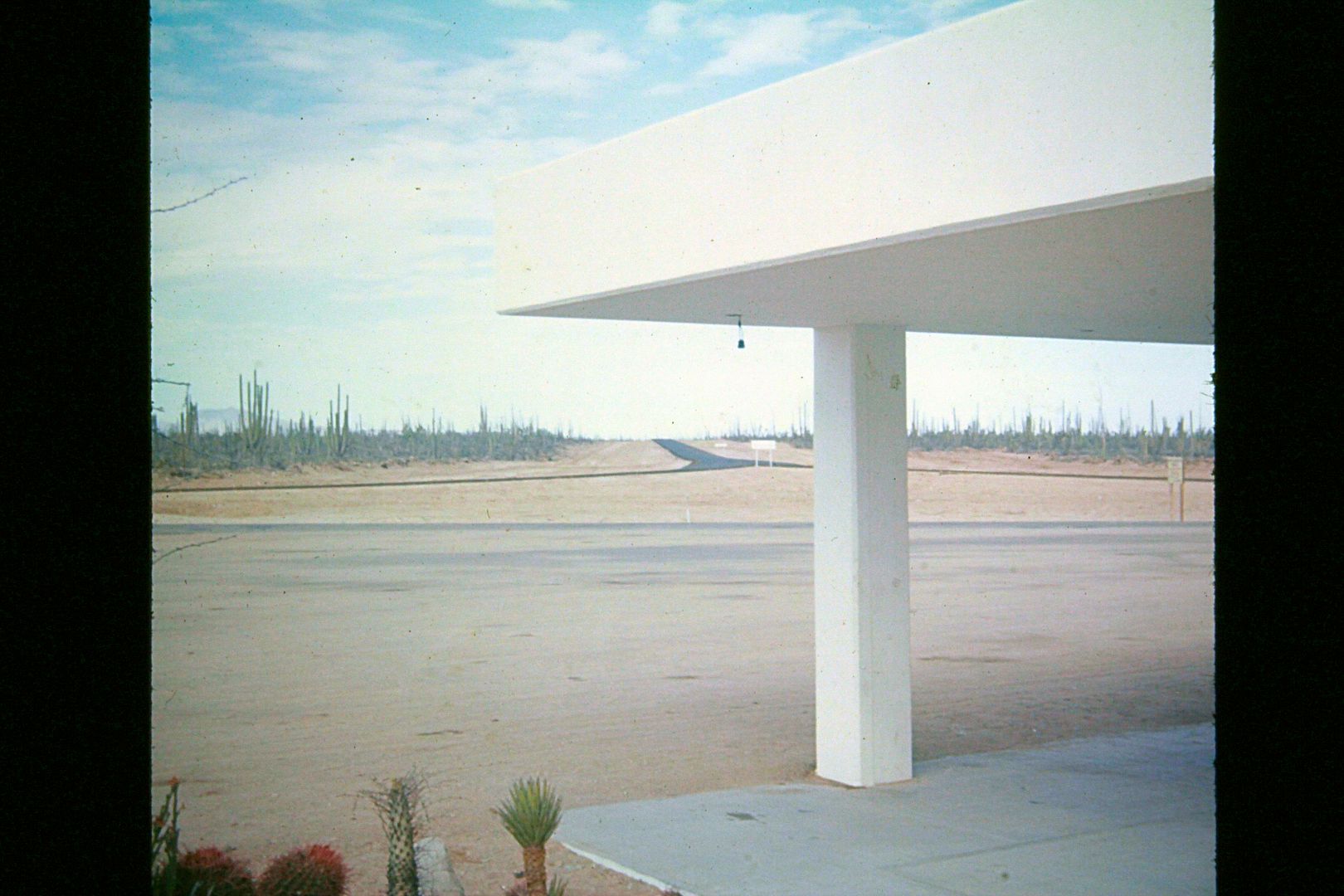
The newly paved road to "Bahia Angeles" as seen from the Parador cafeteria. The blacktop ended less than a mile from Hwy. 1 ... just out-of-sight from
this point. July 1974.
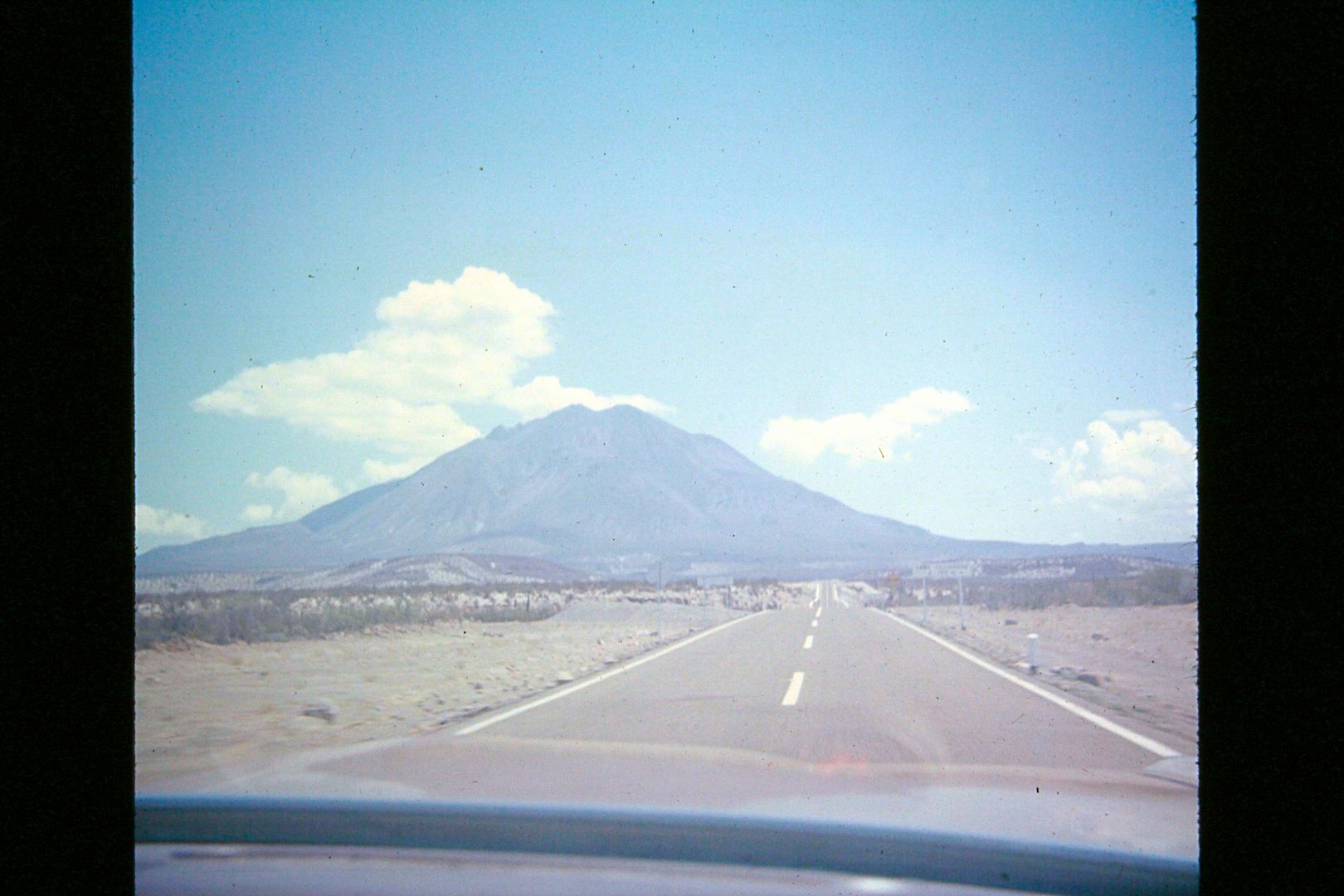
Volcón Trés Vírgenes between San Igncacio and Santa Rosalía, July 1974
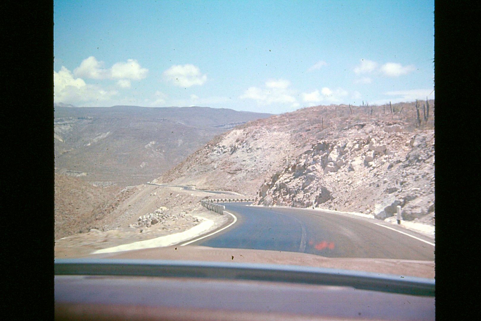
Top of Cuesta del Infierno, July 1974
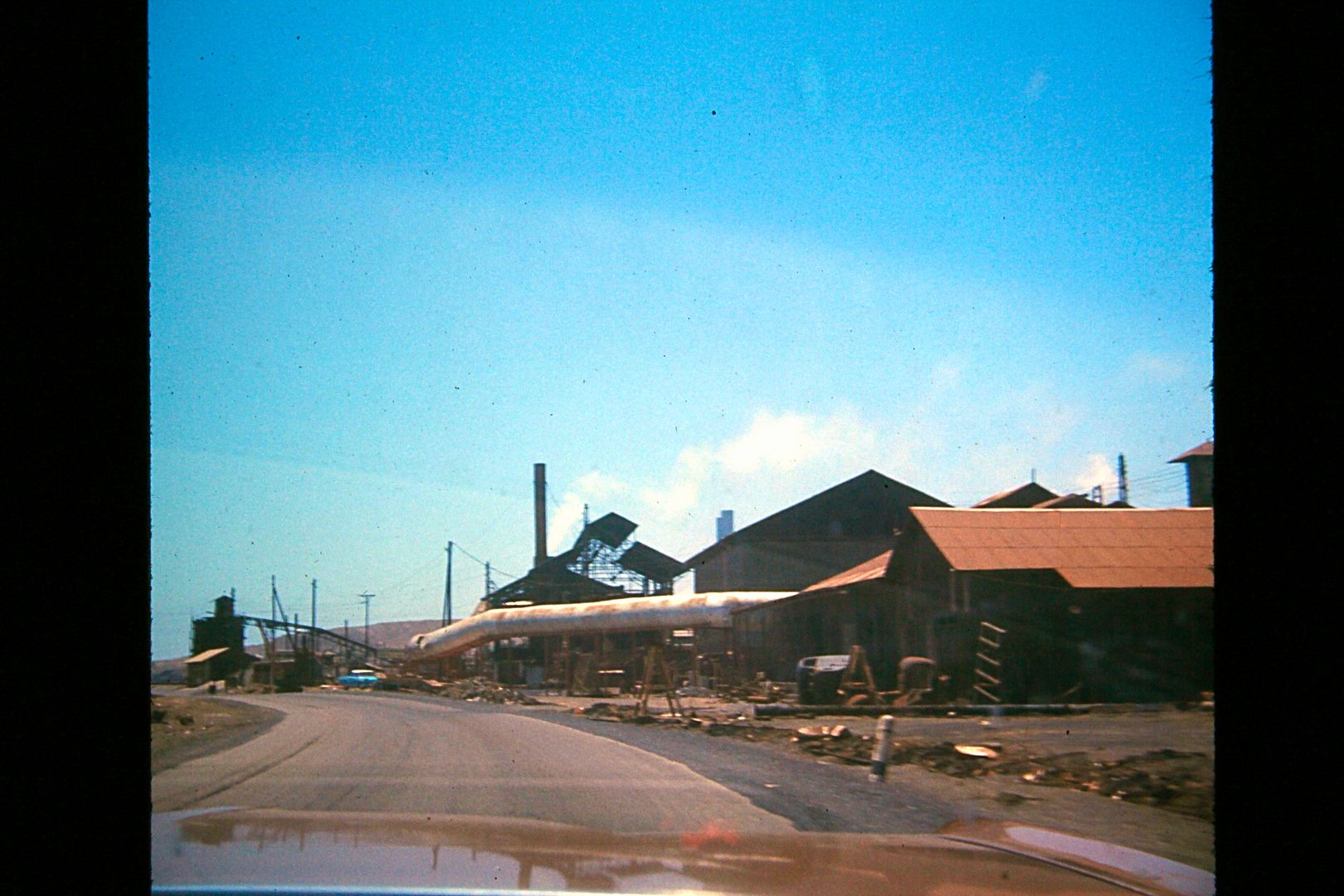
Entering Santa Rosalia, July 1974
Stay tuned for more...
[Edited on 1-7-2021 by David K]
|
|
|
windgrrl
Super Nomad
   
Posts: 1336
Registered: 9-2-2006
Member Is Offline
|
|
Thanks for sharing your adventures!
When the way comes to an end, then change. Having changed, you pass through.
~ I-Ching
|
|
|
Meany
Nomad
 
Posts: 455
Registered: 2-14-2009
Location: santa paula,calif
Member Is Offline
|
|
Thanks for the Great Pictures. 
|
|
|
PaulW
Ultra Nomad
    
Posts: 3113
Registered: 5-21-2013
Member Is Offline
|
|
David, That Rod Hall Bronco is now owned by Todd Zuecher and his good friend Andrew. After they bought it Glen Straightiff & Chris Wilson restored
it and they raced it in in the first NORRA 1000. Todd was happy to see your unpublished picture. The Bronco is still in pristine condition and shows
up at various events.
|
|
|
advrider
Super Nomad
   
Posts: 1920
Registered: 10-2-2015
Member Is Offline
|
|
Some of the coolest photos ever!!! Thanks for sharing with us. Love the dune buggy.
|
|
|
David K
Honored Nomad
        
Posts: 65434
Registered: 8-30-2002
Location: San Diego County
Member Is Offline
Mood: Have Baja Fever
|
|
Great to hear from you guys... I have more! The CD that was blank has been replaced. It has most of the photos from my first dune buggy trip (Spring
Break 1974). The dune buggy my dad bought from a couple in Escondido who built it first to race (old Borrego 100 race, I think). It was a Myers Manx/
VW 1600cc. They used it to do a trip to L.A. Bay in the late 60's or early 70's. The trip was written up in the local newspaper. They lost forward
gears and had to drive backward (I think it was between San Borja and L.A. Bay?)! The buggy had turning breaks (traction control in those days) for
added climbing abilty. It easily went over the 'Gonzaga Grades' (twice) for me in '74 and '75.
Paul, I have a LOT more photos of the '74 Score Baja Internacional at contingency in Ensenada and at Mike's Sky Rancho (where there was a 1 hour
mandatory down-time). Please share the Baja Nomad link with any of your race friends. If they want a direct email of the photo, I am happy to share!
41 years ago was Score's first Baja race, and it was great to be there!
[Edited on 10-17-2015 by David K]
|
|
|
David K
Honored Nomad
        
Posts: 65434
Registered: 8-30-2002
Location: San Diego County
Member Is Offline
Mood: Have Baja Fever
|
|
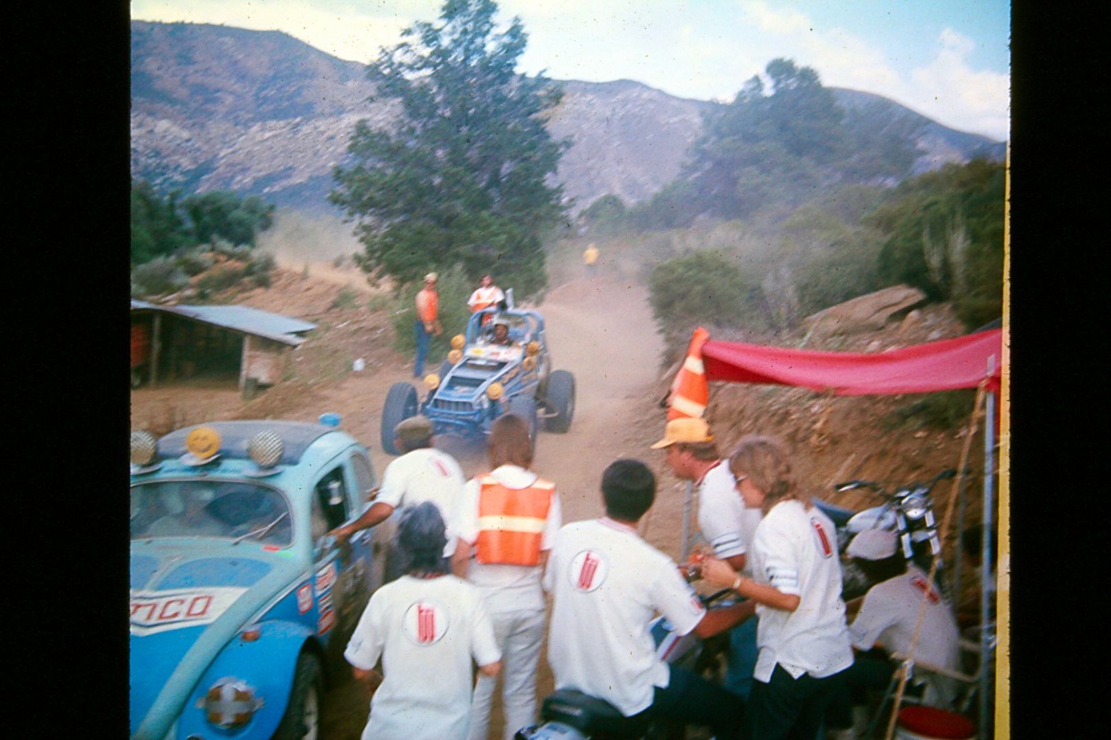
Mike's Sky Rancho 1974 Baja Internacional (it couldn't be called the Baja 500 for several years over a legal challenge by NORRA who owned the name but
was kicked out of Baja by Mexico after the '73 Baja 500). The second racer is one of the Sprint Car type buggies, like Mickey Thompson raced a few
years after this one we see from Chenowth...
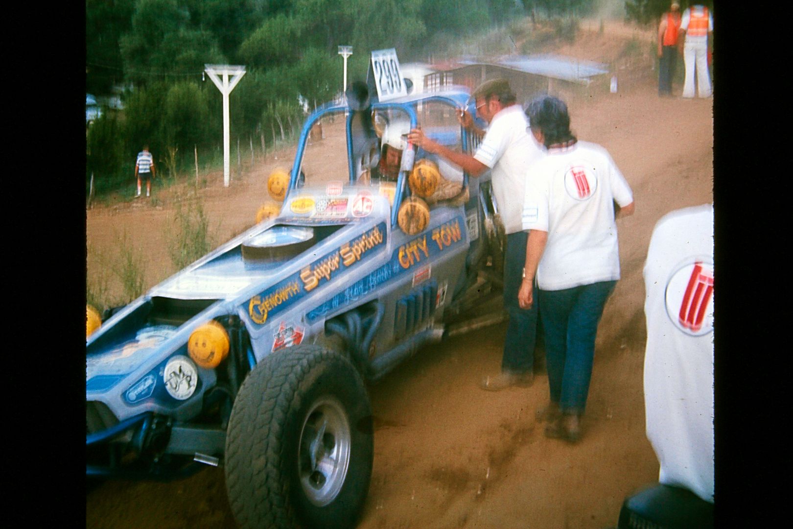
Johnny Johnson (31) went from VW power to V-8 power in this Chenowth Super Sprint. Race car #299 left the starting line at 10:59 am (per my program)
and I have him arriving at Mike's at 5:02 pm. As I recall, Johnny won the '73 Baja 1000 with co-driver and Hollywood stuntman Bobby Ferro in a Class
One buggy. I had some email exchanges with Johnny a couple years ago... he was enjoying life cruising (or sailing) on the Sea of Cortez between La Paz
and Loreto.
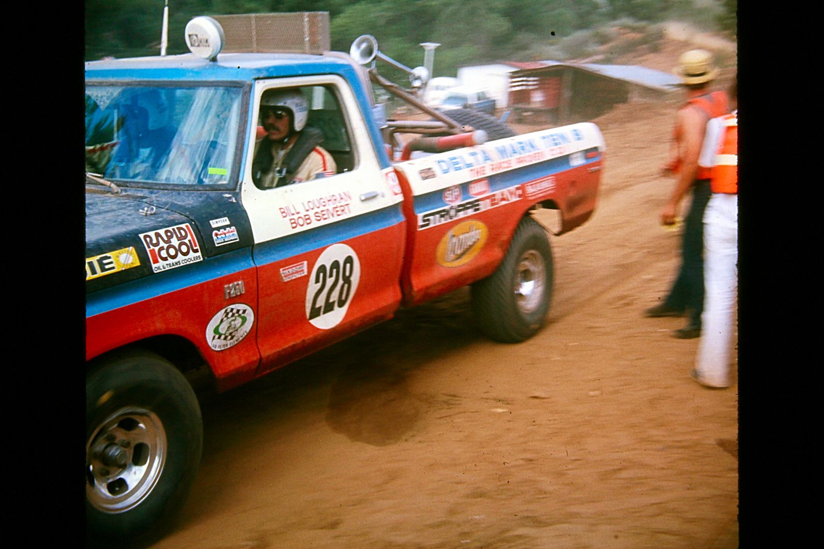
There were many Bill Stroppe prepared Ford trucks and Broncos. These two guys were from Colorado. In at 5:23 pm.
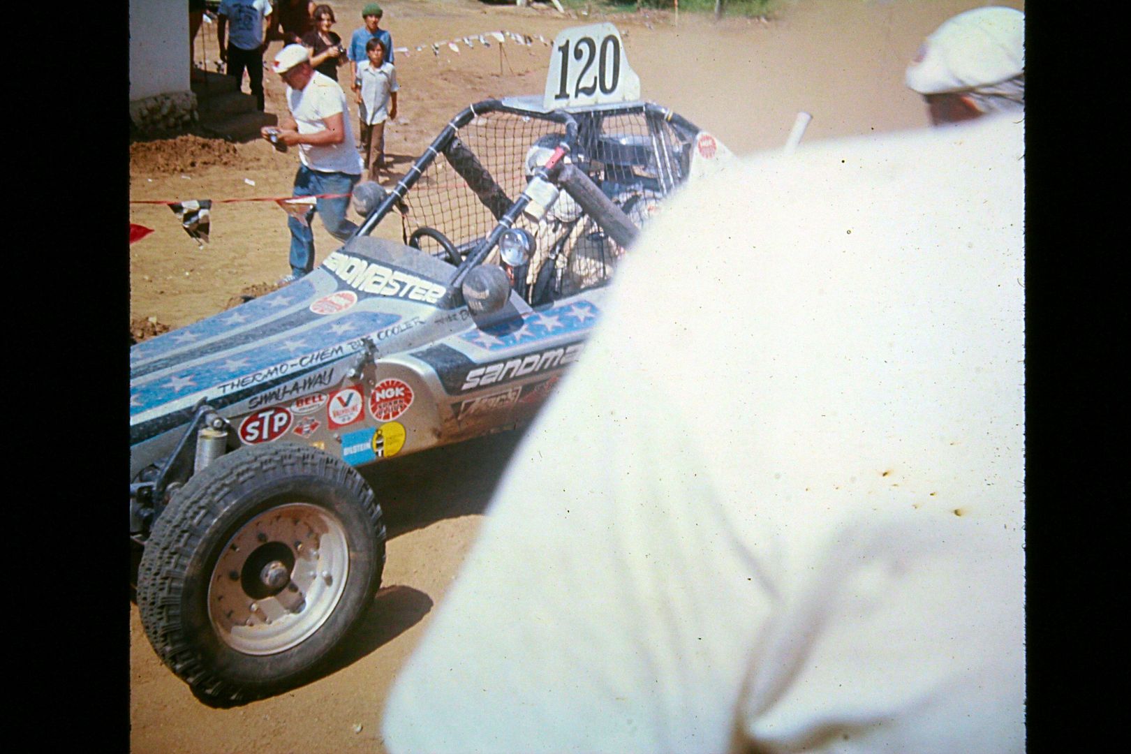
Speaking of Bobby Ferro, here he is, arriving at 3:03 pm. He was one of those "if you're not first, you're last kind of 'all-out' racers! Bummer this
guy stepped in front of me as I was taking the picture!
OKAY... a quick switch of topics... for the boat lovers and fishermen on Nomad....
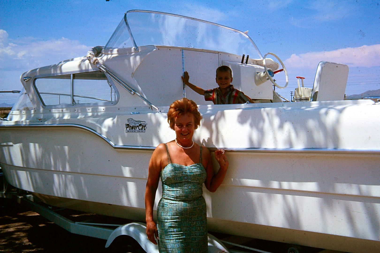
This is the new cabin cruiser my dad had made at a boat factory in Texas (early 1960's). We went there to get it and tow it back to Del Mar,
California. I think I was about 5... so summer of 1963 maybe?
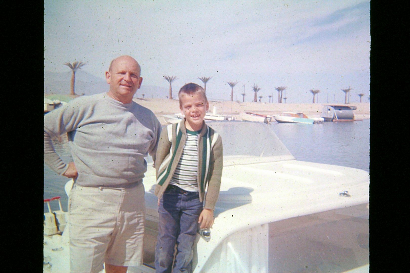
We often took the boat to the Salton Sea. In those years, you could swim, fish, and eat the fish there!
|
|
|
| Pages:
1
2
3
4
5 |
|

