| Pages:
1
2
3 |
BornFisher
Super Nomad
   
Posts: 2128
Registered: 1-11-2005
Location: K-38 Santa Martha/Encinitas
Member Is Offline
|
|
Whoa------ That was BADA$$!!!! You sir know how to report, and pick destinations, and photograph, and pick camp sites and probably cook too!!! Thanks
for the time and work here.
This report and VegasNick report are two treats in a row!!!! Thanks guys!!
"When you catch a fish, you open the door of happiness."
|
|
|
David K
Honored Nomad
        
Posts: 65406
Registered: 8-30-2002
Location: San Diego County
Member Is Offline
Mood: Have Baja Fever
|
|
I am sure many Indians came onto Shell Island for clams, or maybe turtles were there 300 years ago? The Spanish and missionaries did come to San
Felipe (as there was fresh water from a shallow well) but not much... By the time the Dominicans were at San Pedro Martir and Santa Catalina (the
closest missions to San Felipe), they didn't have much to say about San Felipe de Jesus (the full name) and they were busy with hostile natives who
were happy the way it was before the Spanish came to "improve" their lives!
|
|
|
motoged
Elite Nomad
     
Posts: 6481
Registered: 7-31-2006
Location: Kamloops, BC
Member Is Offline
Mood: Gettin' Better
|
|
Geoff,
VERY cool trip report....Gracias....you have provided some great intel/pics re: some places I have on my bucket list.
Looks like you did it the right way...
Don't believe everything you think....
|
|
|
geoffff
Senior Nomad
  
Posts: 710
Registered: 1-15-2009
Member Is Offline
|
|
Quote: Originally posted by David K  | Geoff, how was the road west from Petroglyph Park and on down the mountain for you in the van?
In 2005, it was pretty rough going... only motorcycle tracks on the old road. El Cipres was abandoned.
|
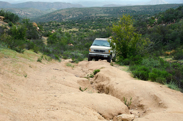
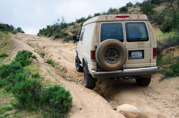
Hi David, The road west of Petroglyph Park was quite eroded and slow going, but still apparently in occasional use, with faint tire tracks. The most
recent ones were motorcycle. OK for high clearance vehicle if you're good at wheel placement. The photos I put below P P in my story above gives an
idea of the erosion. I have dash cam footage of the whole thing.


El Cipres seemed active, with cows munching on nice green grass. No people there at the time.
[Edited on 4-2-2016 by geoffff]
|
|
|
geoffff
Senior Nomad
  
Posts: 710
Registered: 1-15-2009
Member Is Offline
|
|
There was one steep spot that I had to get out and move some rocks around. 4x4 needed if you're going eastbound. [gps:30.369479,-115.649422]

-- Geoff
[Edited on 4-2-2016 by geoffff]
|
|
|
geoffff
Senior Nomad
  
Posts: 710
Registered: 1-15-2009
Member Is Offline
|
|
I think most of the traffic out there to active ranches in the east was taking another east-west road (one between the two used in my loop -- perhaps
the one marked on my map as following the Santa Maria river to "El Morro").
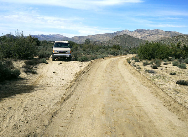
At [gps:30.6282,-115.4292] the road suddenly became nice and graded. I was elated! But then a mile farther south, the graded road turned west away
from my southbound route. [gps:30.615375,-115.429673]

|
|
|
David K
Honored Nomad
        
Posts: 65406
Registered: 8-30-2002
Location: San Diego County
Member Is Offline
Mood: Have Baja Fever
|
|
Wow... thanks for the additional photos and details!!
Some of us Nomads live for those kind of "take me there" reports when we are not there ourselves!
The photo you took of the sign near Rancho (Hacienda) La Presa gave a web address for the place www.misiondolores.com
Their version of that mission's history is a bit different than what was actually recorded by those who were there when the missions were operating.
In a nutshell (for anyone interested):
Dolores was first established on the coast in 1721 (stone buildings soon erected about 2 miles from the beach). The site was called Apaté by the
natives.
San Luis Gonzaga was a visita of Dolores (not the other way around per the website). San Luis Gonzaga was elevated to mission status in 1737 with the
arrival of its own priest.
In 1741, the Dolores-Apaté mission was moved away from the coast and to the final site the natives called both Chillá and Tañuetía. This had been
another Dolores visita, called La Pasión, by the Spanish. That is the site very near La Presa where you took the photos... a couple miles upstream (La
Capilla on the map and not the La Pasion of the 2009 Baja Almanac).
In 1768, both San Luis Gonzaga and Dolores-Chillá missions were closed by the new government representative taking over from the removed Jesuits. The
native Guaycura Indians at both missions were forced to relocate to Todos Santos by governmental dictate to work the better farmlands there. The move
out of their ancestral homelands was devastating to them.
The history details of these many mission sites is fascinating without any embellishment!
|
|
|
MexicoTed
Senior Nomad
  
Posts: 708
Registered: 8-2-2004
Member Is Offline
|
|
Excellent trip report! Loved seeing the photos of Visita San Isidro.
|
|
|
wilderone
Ultra Nomad
    
Posts: 3894
Registered: 2-9-2004
Member Is Offline
|
|
wow - all that in 10 days? Fabulous pics. You should get a Bajanomad award for this trip report.
|
|
|
geoffff
Senior Nomad
  
Posts: 710
Registered: 1-15-2009
Member Is Offline
|
|
Yeah, lots of ground covered! I've come to realize that my attitude towards vacationing in Baja is a bit unusual. I don't fish, or surf, etc. And I
just can't relax in any one spot. Every morning I feel the urge to keep going and check out new spots. So I pretty much spend my whole trip driving.
-- Geoff
[Edited on 4-7-2016 by geoffff]
|
|
|
David K
Honored Nomad
        
Posts: 65406
Registered: 8-30-2002
Location: San Diego County
Member Is Offline
Mood: Have Baja Fever
|
|
Like!
|
|
|
motoged
Elite Nomad
     
Posts: 6481
Registered: 7-31-2006
Location: Kamloops, BC
Member Is Offline
Mood: Gettin' Better
|
|
Quote: Originally posted by geoffff  | Yeah, lots of ground covered! I've come to realize that my attitude towards vacationing in Baja is a bit unusual. I don't fish, or surf, etc. And I
just can't relax in any one spot. Every morning I feel the urge to keep going and check out new spots. So I pretty much spend my whole trip driving.
-- Geoff
[Edited on 4-7-2016 by geoffff] |
Sounds about just right to me ...  
Don't believe everything you think....
|
|
|
cpg
Nomad
 
Posts: 262
Registered: 4-10-2006
Location: Livermore, Ca.
Member Is Offline
|
|
You have the best trip reports and photos.
Thank you!
|
|
|
Fatboy
Senior Nomad
  
Posts: 805
Registered: 6-28-2005
Member Is Offline
|
|
Awesome report, THANKS!!!!
That area north of La Paz, Las Animas/Bahia Coyote is probably one of my favorite area in Baja yet been there the least. Some really cool rockhounding
in that area.
|
|
|
bajalinda
Senior Nomad
  
Posts: 552
Registered: 6-7-2008
Location: Pacific Coast, BCS
Member Is Offline
|
|
geoffff - from your map it looks like you drove right past our front gate at La Aguja - do stop and say hello the next time you're in the
neighborhood.
The newly paved road you saw going from Conquista out to the highway- photo showing the sides of the road eroded - was finished a couple of years ago.
The caved in sides of the road are damage from Odile. There are 2 arroyos between Conquista and Reforma #1 and both of those sections of the road
were washed out in Odile. Now those parts are hard packed dirt or that section where you drive down the middle of the road and avoid the sides.
Don't ask me why the arroyos were paved...........??
Thanks for the great report!
|
|
|
Vince
Nomad
 
Posts: 448
Registered: 10-17-2006
Location: Coronado
Member Is Offline
|
|
Best report I have seen! I'm heading south myself in 2 weeks for the umpteenth time in the past 60 years and will review it again before I leave.
Thanks.
|
|
|
David K
Honored Nomad
        
Posts: 65406
Registered: 8-30-2002
Location: San Diego County
Member Is Offline
Mood: Have Baja Fever
|
|
Great to hear Vince!
|
|
|
TMW
Select Nomad
      
Posts: 10659
Registered: 9-1-2003
Location: Bakersfield, CA
Member Is Offline
|
|
Excellent report and beautiful pictures, thanks.
|
|
|
TedZark
Nomad
 
Posts: 171
Registered: 10-31-2014
Member Is Offline
|
|
Inspirational!
That first loop around San Quintin to the Sea of Cortes and back is my next trip.
Thank you!
|
|
|
monoloco
Elite Nomad
     
Posts: 6667
Registered: 7-13-2009
Location: Pescadero BCS
Member Is Offline
|
|
How was the road up from San Evaristo to El Bosque?
"The future ain't what it used to be"
|
|
|
| Pages:
1
2
3 |

