| Pages:
1
2
3 |
David K
Honored Nomad
        
Posts: 65445
Registered: 8-30-2002
Location: San Diego County
Member Is Offline
Mood: Have Baja Fever
|
|
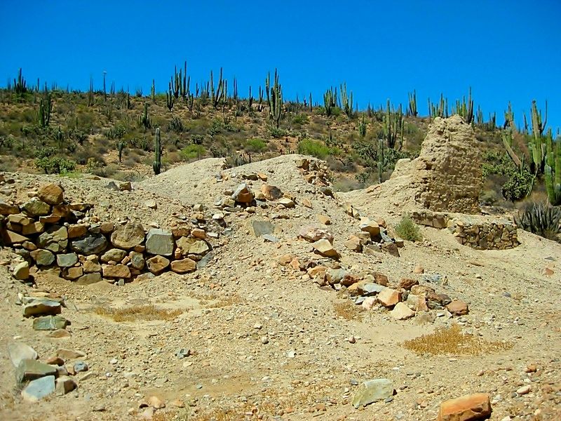
Mission San Fernando (1769) in 2016
The drive north of Highway One was pretty typical. There are some pot holes and rough areas near Laguna Chapala and near Cataviña (about 30 miles
north of the Hwy. 5 junction).
We stopped to have a look at the Hotel Misión Cataviña (formerly Desert Inn, La Pinta, El Presidente) to see what's new... It was impressive
considering the location.
I made a few road notes
San Ignacito café (south of Santa Ynez) was back in business and there looked to be a new monument marker where the highway construction crews from
the north and the south met (1973), across from the restaurant. A plaque was vandalized some time ago here.
Km. 179 Cataviña
Km. 176 Rock Art access (see: http://vivabaja.com/703/page5.html )
Km. 121 Mission San Fernando access/ Rancho El Progreso (café is now abandoned).
It is only 2.3 miles from here to the 1769 mission site...
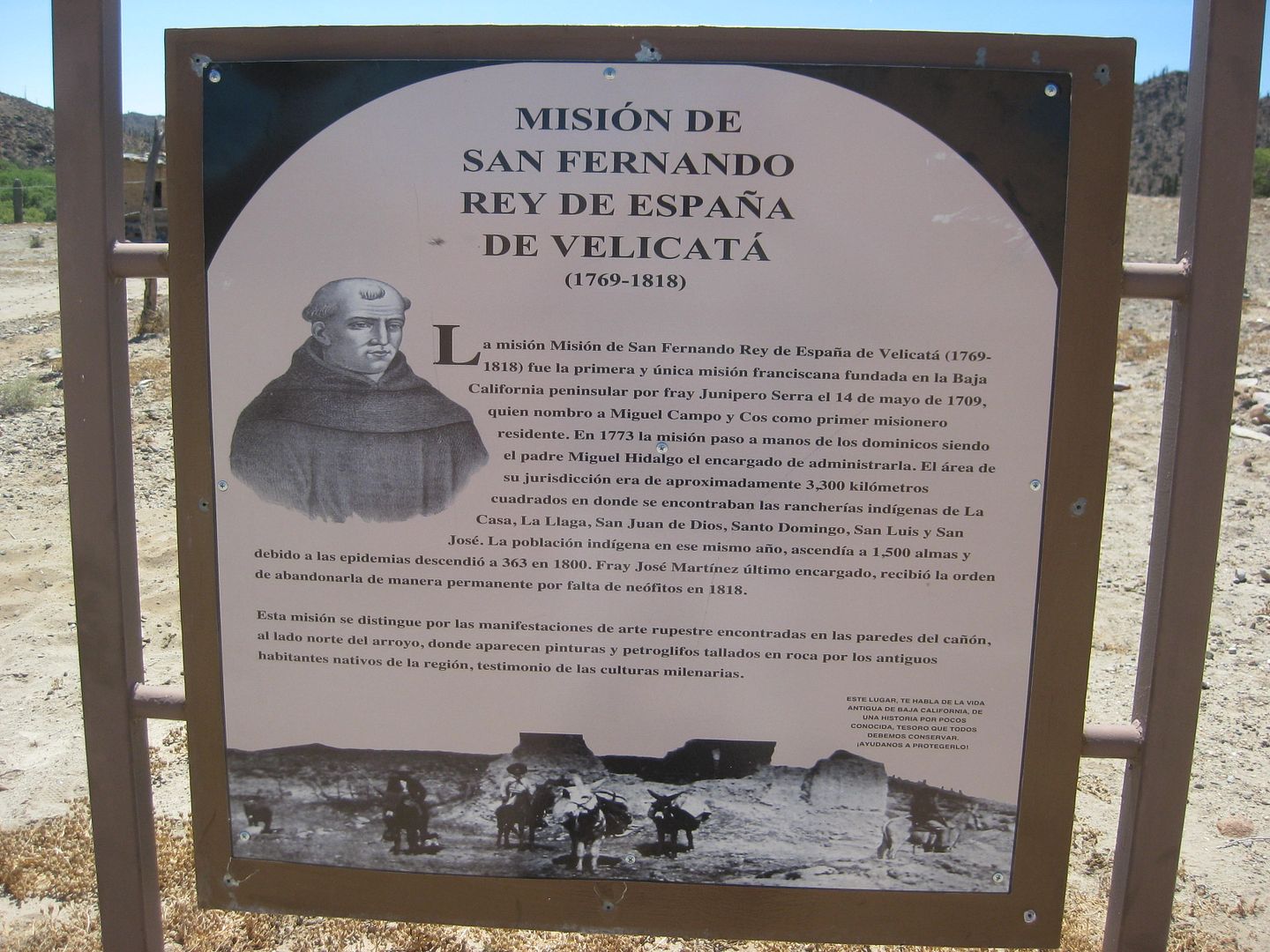
New signs and some archeological digging has exposed the stone side wall of the mission or terrace the mission was built upon. Nobody is there when we
arrived. I was last on site in 2005, but flew over it in a helicopter for photos in 2014 during the Trail of Mission TV show trip I was on.

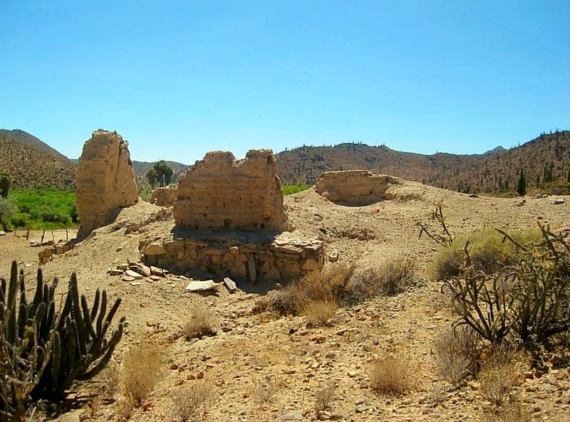
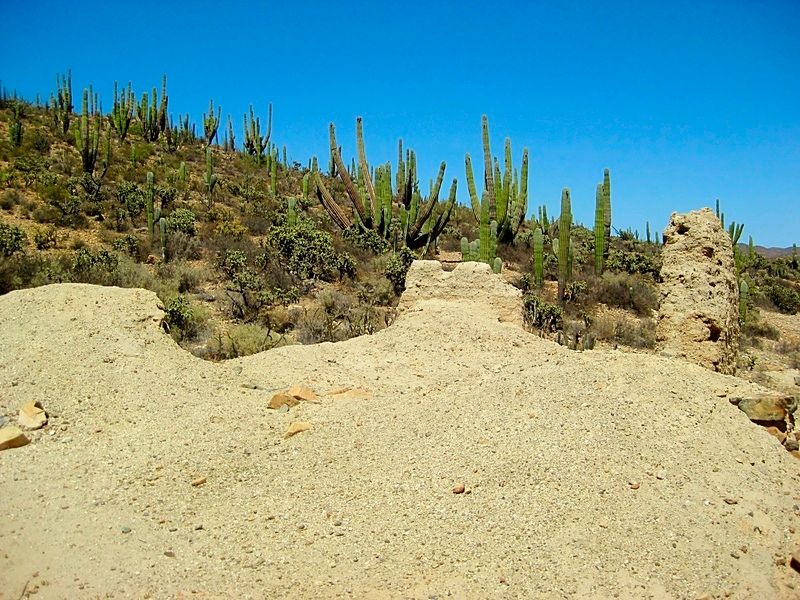

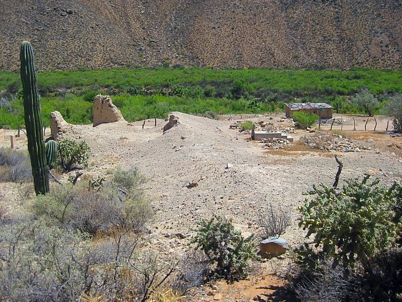
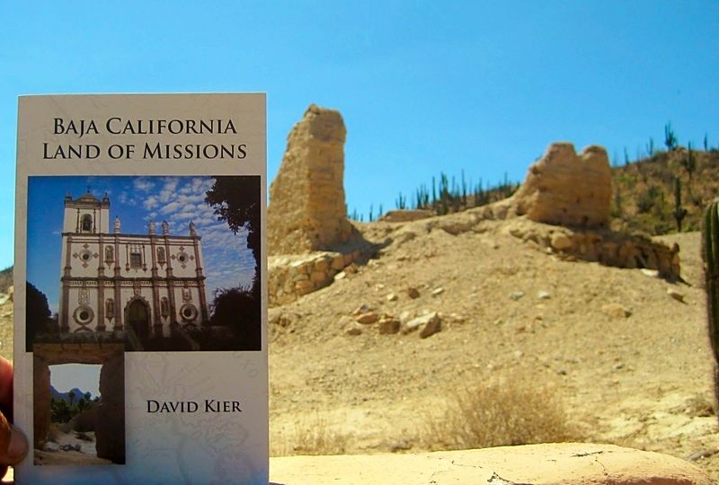
Shameless plug!

Coming up next... EL ROSARIO...
[Edited on 5-23-2020 by David K]
|
|
|
Vince
Nomad
 
Posts: 448
Registered: 10-17-2006
Location: Coronado
Member Is Offline
|
|
Thanks for the fine report, David. Brought back old memories. Very enjoyable. We drove Hiway 5 north 2 months ago, provides a nice alternative to
Hiway 1, will be even better when finished.
|
|
|
sancho
Ultra Nomad
    
Posts: 2524
Registered: 10-6-2004
Location: OC So Cal
Member Is Offline
|
|
Quote: Originally posted by David K  |
The officer speaks perfect English and explains that the FREE FMM must be returned to their office when you leave Mexico (to prove you didn't stay
longer)
[Edited on 7-13-2016 by David K] |
Had the same told to me 2 mo.s back at Mexicali West, return
the 7 day fmm, so I did. Kinda shoots holes in the widely
printed info on the 2 San Diego Mex Ins brokers sites, as well
as others, stating no need to return fmm's.There was at least 1 guy denied a 7 day fmm at
Mexicalli West because computer records showed he had not
returned previous 7 day fmm. I had a 4 mo. old free fmm
from TJ, never returned, they did not mention that. There is
no consistant application in the Imm offices, so I will return
all my fmm's
|
|
|
willardguy
Elite Nomad
     
Posts: 6451
Registered: 9-19-2009
Member Is Offline
|
|
didn't see any pics of the mission warehouse ruins on the bank of bahia willard?
|
|
|
Barry A.
Select Nomad
      
Posts: 10007
Registered: 11-30-2003
Location: Redding, Northern CA
Member Is Offline
Mood: optimistic
|
|
I have several slides of the foundation, taken in the early '60's, and have camped beside the ruins several times in the late '70's and early/mid
'80's. It's an interesting site.
|
|
|
David K
Honored Nomad
        
Posts: 65445
Registered: 8-30-2002
Location: San Diego County
Member Is Offline
Mood: Have Baja Fever
|
|
I didn't go to the shore of Bahía San Luis Gonzaga ("Willard Bay") where the 1768+ warehouse ruin is located, on this last trip.
Here are some, since you brought it up...
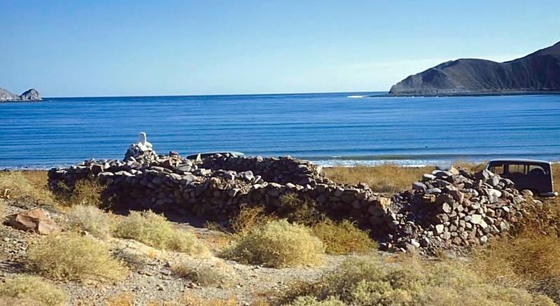
Photo of the warehouse taken by the author of the Lower California Guidebook, in 1958.
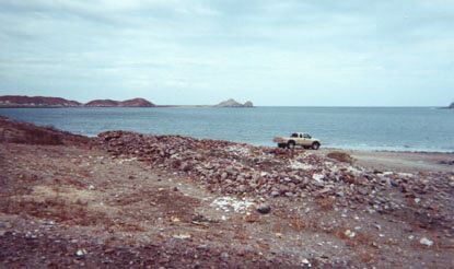
Photo I took of the ruins in 2002. Punta Willard (next to Papa Fernandez' camp) is seen in the background of both photos, above.
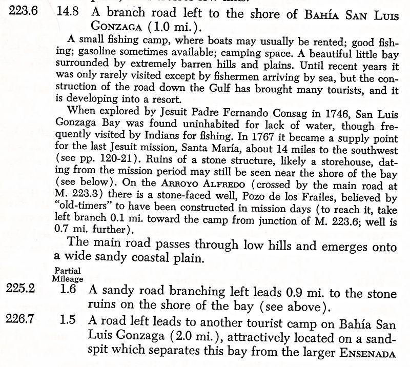
The description of the ruins in the 1962 guidebook.
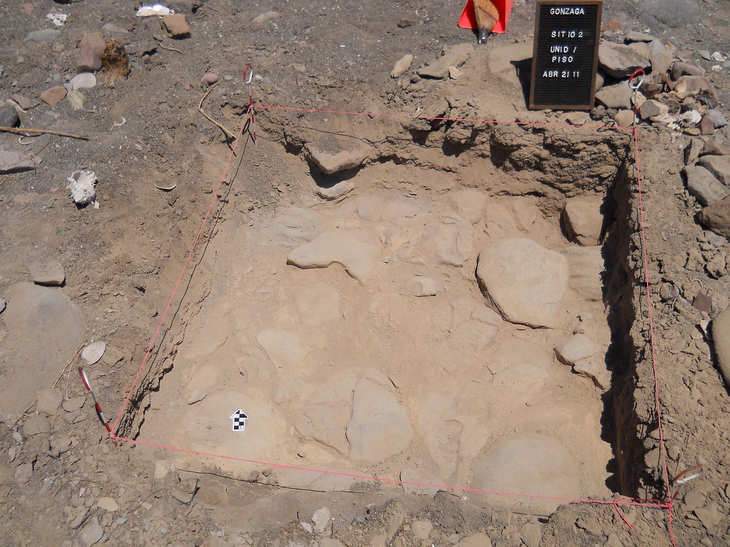
Archeological dig onto the stone tiled floor of the warehouse, a few years ago (2011).
[Edited on 5-23-2020 by David K]
|
|
|
David K
Honored Nomad
        
Posts: 65445
Registered: 8-30-2002
Location: San Diego County
Member Is Offline
Mood: Have Baja Fever
|
|
We leave the mission and return to Hwy. 1 on the original access road just a bit (1.6 mi.) northbound from El Progreso. Part of this road is the
original Baja main road before 1973. In fact, where the highway is reached was where the pavement ended in July 1973, and there was a large worker
camp here.
It is 2.9 miles from the mission to Hwy. 1 using the north access. It is rougher and less used than the southern or El Progreso access (which was 2.3
miles long).
On the pavement, we soon pass Hector's monument (Km. 116.5): See photos of it from 2005: http://vivabaja.com/1005/
El Descanso Café is doing well and we see the café at the Sauzalito/ Los Mártires/ San Juan de Dios junction (near Km. 103) has a new name: El
Sacrificio.
We arrive in El Rosario at 3:45 pm and check into Baja Cactus, our home in El Rosario!
More to come, stay tuned!!
[Edited on 5-23-2020 by David K]
|
|
|
David K
Honored Nomad
        
Posts: 65445
Registered: 8-30-2002
Location: San Diego County
Member Is Offline
Mood: Have Baja Fever
|
|
Antonio soon arrives at the motel to visit with us. He owns the Pemex station, next door, and was there when we arrived. I made friends with Antonio
through Baja Nomad and we met in July 2004 at jrbaja's home near Rosarito (La Barca) for an informal get-together. http://www.vivabaja.com/bajacactus/
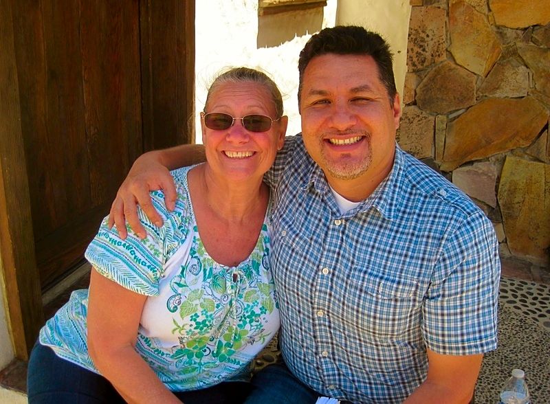
Baja Angel (Elizabeth) and BajaCactus (Antonio). It was Antonio who came up with the handle "Baja Angel" for Elizabeth back in 2005 when she joined
Baja Nomad.
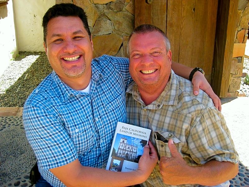
To help Antonio's fire and rescue service, we donate my new book (I had 10 copies) and a couple copies of my previous co-authored book (The Old
Missions of Baja & Alta California) for Antonio to sell at his Baja Cactus Motel in El Rosario, (right next door to the Pemex station). Both are
discounted five dollars to $25 for the new book and $15 for the older book and income from them will go to the Desert Hawks Fire and Rescue service.
We hear of the changes in El Rosario and other happenings. We hadn't spent time there in a few years, using Hwy. 5 to travel south/north on. I saw
Antonio briefly on the Trail of Missions TV special I was part of in 2014 and when he came up to San Diego County for supplies once, last year.
Antonio has a meeting with a government rep that evening and Elizabeth and I go to Ed's Baja's Best B & B restaurant for dinner. We had the shrimp
stuffed chile rellanos.
Monday morning we have breakfast with Antonio and Itzela (who manages the Desert Hawks donations) at Mama Espinoza's. Then, we have to say good bye,
but hope it won't be too long before we return!
Gasoline in El Rosario was 13.40 pesos per liter (Magna) and 14.37 for Premium. The peso per dollar exchange was 17.00: 1. We left at 12:30pm.
Military Checkpoint on the mesa above Rosario was the only one on the drive home, and we were waved through.
At Maneadero we stop for tacos at the place on the east side as you enter town... I will get a Google street view of it added. They were great! Left
there at 3:47 pm.
At Tecate, we needed to turn in the FREE FMM and drove up to the border (entrance into Mexico street) and to the right, one-way street is street
parking. We walk to the border and get instructions on what to do. You go through the turnstiles on the east side of the street, follow arrows north,
then across the street to the INM office. Walk in, find the desk and our passports are stamped and scanned.. all clear to go! It was not too much
trouble.
Back to the Tacoma, we drive east to the U.S. entrance access road and get in line at 6:10 pm. We are in the U.S. at 6:28! No secondary inspection.
I am happy to answer questions and will post more details (maps) to show how we did the Tecate two-step.
Again, the pay FMM does NOT need to be returned, but the free one does.
Thank you... and hope to see some of you at my lecture tonight in San Diego!
http://www.discoverbaja.com/event/david-kier-lecture/
|
|
|
TMW
Select Nomad
      
Posts: 10659
Registered: 9-1-2003
Location: Bakersfield, CA
Member Is Offline
|
|
Thanks DK, great report and pictures.
FYI, at the Tecate INM place if there is no close place to park during the day. Come in on the one way street from the west and park next to the INM
office facility. There will be a man showing you where to park, usually the north side of the street. I give him a couple of dollars when I leave.
If coming into Tecate to get your FMM go to the first light turn right and go around the block back to the INM facility.
I don't know when the man leaves for the day or what his official title or duties are.
|
|
|
JohnK
Junior Nomad

Posts: 69
Registered: 3-11-2012
Member Is Offline
|
|
I really like the way you lay it out, David. Great post. I've got a pop-up camper on the back of my Tacoma. Do you think I would be OK going to Shell
Island with it? Good tires. 4WD.
|
|
|
David K
Honored Nomad
        
Posts: 65445
Registered: 8-30-2002
Location: San Diego County
Member Is Offline
Mood: Have Baja Fever
|
|
Thank you!
Just finished my lecture for Discover Baja on the missions. Was a great turnout.
|
|
|
John M
Super Nomad
   
Posts: 1924
Registered: 9-3-2003
Location: California High Desert
Member Is Offline
|
|
Gonzaga warehouse
David, what was the result of the archaeological dig in 2011?
John M
|
|
|
David K
Honored Nomad
        
Posts: 65445
Registered: 8-30-2002
Location: San Diego County
Member Is Offline
Mood: Have Baja Fever
|
|
Yes, slid out passport books each into it. Also looked at his screen, as if to see when we entered (at Mexicali)? However, the FMM we turned it was
stamped.
I get the impression that they don't want cheapo gringos getting a free FMM and then staying longer than a week (to avoid paying for the 189 day FMM).
Knowing for sure now that the pay one can be tossed in the trash after 180 days and no need to go through any parking and driving challenges to return
it, we will just get that one next time.
|
|
|
David K
Honored Nomad
        
Posts: 65445
Registered: 8-30-2002
Location: San Diego County
Member Is Offline
Mood: Have Baja Fever
|
|
At the time I communicated with the archeologist involved (Dr. Eric W. Ritter), I was under the impression that a paper would be written... I will
send him an email!
|
|
|
Ateo
Elite Nomad
     
Posts: 5947
Registered: 7-18-2011
Member Is Offline
|
|
Thanks for the report and photos David!
|
|
|
David K
Honored Nomad
        
Posts: 65445
Registered: 8-30-2002
Location: San Diego County
Member Is Offline
Mood: Have Baja Fever
|
|
De nada Jon!
If I can get to it soon, I will add a Google Earth view of how to return the FREE FMM at Tecate and then drive to the line to return to the USA.
Oh, I was also going to do a street view of that great Taco place in Maneadero.
|
|
|
BornFisher
Super Nomad
   
Posts: 2132
Registered: 1-11-2005
Location: K-38 Santa Martha/Encinitas
Member Is Offline
|
|
Fine report, thanks
"When you catch a fish, you open the door of happiness."
|
|
|
David K
Honored Nomad
        
Posts: 65445
Registered: 8-30-2002
Location: San Diego County
Member Is Offline
Mood: Have Baja Fever
|
|
Thank you!
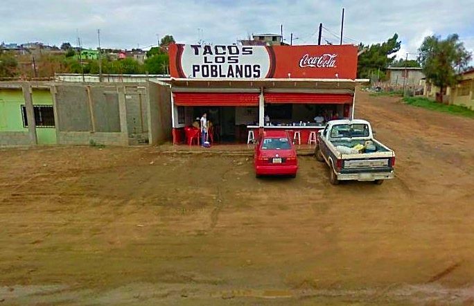
Here is the taco place in Maneadero we go to... east side of the highway, south side of town... We got carne asada with everything on it and the 'al
pastor' tacos... (I am thinking that is what the meat on the verticle spit is called, like how gyros meat is cooked).
Google Earth street view image>>>
|
|
|
David K
Honored Nomad
        
Posts: 65445
Registered: 8-30-2002
Location: San Diego County
Member Is Offline
Mood: Have Baja Fever
|
|
RETURNING THE FREE FMM @ TECATE
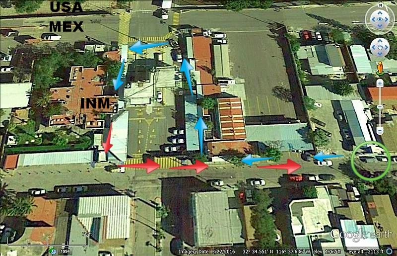
We parked at the circle... one way street to the east (right). Lots of spots on both sides of that street to park (that day).
We walked to the INM office along the blue arrows. You go through a turnstile.
We walked back to the truck along the red arrows. A turnstile is also passed through leaving the INM area.
To go to the USA border line, we drive east on the one-way street a few blocks then to the right (south) a couple blocks to the street that is HWY. 2
(to Mexicali) to the traffic circle and just beyond to the USA entrance road.
|
|
|
David K
Honored Nomad
        
Posts: 65445
Registered: 8-30-2002
Location: San Diego County
Member Is Offline
Mood: Have Baja Fever
|
|
Higher View
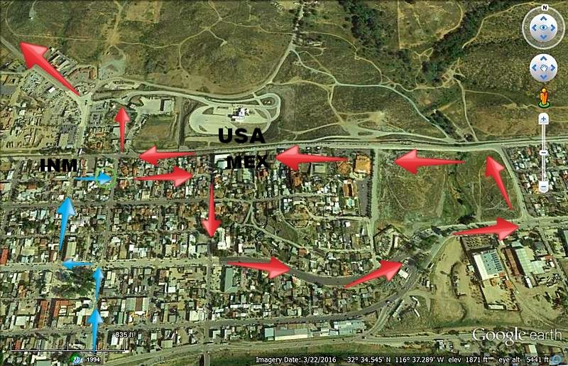
Blue arrows are driving to INM from Ensenada. This is the opposite direction on the same streets as going to Ensenada from the border (except for the
last blue arrow pointing east to where I parked on the one-way street).
Red arrows are driving to the USA from INM.
|
|
|
| Pages:
1
2
3 |

