| Pages:
1
2
3
4
..
9 |
MulegeAL
Nomad
 
Posts: 299
Registered: 8-25-2009
Location: PDX/Mulege
Member Is Offline
|
|
I like it, and try display/print in black and white before you make a decision.
|
|
|
David K
Honored Nomad
        
Posts: 65399
Registered: 8-30-2002
Location: San Diego County
Member Is Offline
Mood: Have Baja Fever
|
|
With Santa Rosalia and Magdalena Bay maps posted, there are now 30 maps to cover the peninsula that I have driven in 2017 researching the Road Guide.
The only missing area I think is the Sierra Juarez and Ensenada to Valle de Trinidad, in detail.
|
|
|
Jack Swords
Super Nomad
   
Posts: 1095
Registered: 8-30-2002
Location: Nipomo, CA/La Paz, BCS
Member Is Offline
|
|
Very nice David. Are you publishing the map collection? Also are some maps able to be connected together? Again, great job!
|
|
|
David K
Honored Nomad
        
Posts: 65399
Registered: 8-30-2002
Location: San Diego County
Member Is Offline
Mood: Have Baja Fever
|
|
Quote: Originally posted by Jack Swords  | | Very nice David. Are you publishing the map collection? Also are some maps able to be connected together? Again, great job! |
Yes, well... published right here and on Facebook, anyway!
The maps are to make my Baja Bound work even more desirable as maps always enhance a road guide. I hope the Road Guide is made available soon. I have
had some great editing help from desert historian author John M and AAA Baja guidebook author Dave Brackney.
By-the-way Jack, my mission book will be going into its 5th printing soon! Sales via our publishing company (M&E BOOKS), Sunbelt, Barnes &
Noble, and Amazon are still trickling in. I updated some travel details and swapped out some photos with new ones I took in 2017. Your photo of Loreto
is still the best and that stays (as well as several others you took)!
|
|
|
bkbend
Senior Nomad
  
Posts: 695
Registered: 11-27-2003
Location: central OR or central baja
Member Is Offline
|
|
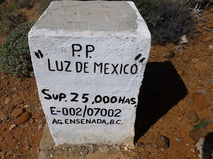
David, sorry I didn't notice this earlier but on Map14 the mine off the Bahia de los Angeles highway is Luz de Mexico and not Lux. Here's one of the
claim markers from the site.

|
|
|
Loretana
Senior Nomad
  
Posts: 825
Registered: 5-19-2006
Location: Oregon/Loreto
Member Is Offline
Mood: alegre
|
|
Thank you for your hard work, David. I just color printed the route I've decided to take to Loreto this weekend. I want to avoid the horrible
potholes, so I've decided to cross at Tecate and take 2D to 5 to Mex 1.
Your excellent map series is stapled together and in my pack. 
Diane
"If you want to find the secrets of the universe, think in terms of energy, frequency and vibration."
-Nikola Tesla
|
|
|
David K
Honored Nomad
        
Posts: 65399
Registered: 8-30-2002
Location: San Diego County
Member Is Offline
Mood: Have Baja Fever
|
|
With so much discussion about gas station locations in another map thread, I have added gas pump icons to two of the maps that had none before because
they were both in areas with numerous gas stations (San Quintín and Los Cabos).
The icon only is to indicate there is a gas station in that area of the icon (not necessarily on that side of the road) or in that town (if the icon
is placed next to the town name).
|
|
|
David K
Honored Nomad
        
Posts: 65399
Registered: 8-30-2002
Location: San Diego County
Member Is Offline
Mood: Have Baja Fever
|
|
Today's edit:
Map 28 (La Paz Area); the Pemex location north of San Pedro had a typo to fix (it is at K194, not 184) and I removed the periods following Km where I
use Km (kilometer markers from 0 to 9). This matches how I did them on the maps before. Just have one at Cabo San Lucas to fix.
If you look long enough, all maps have errors! The key is taking time and having more eyes help you!!
Thank you.
|
|
|
David K
Honored Nomad
        
Posts: 65399
Registered: 8-30-2002
Location: San Diego County
Member Is Offline
Mood: Have Baja Fever
|
|
The maps with mileages added along the roads shown is an idea for the future. The scale is not big enough on most of the maps to insert mileages less
than about 3, however. We shall see, and I am sure you guys will provide input!
I have a couple other projects I will be doing, in the meantime.
Requests are always welcome and I may squeeze in a custom map while taking a break from the other projects.
Thank you for your interst, and Viva Baja, everyone!
|
|
|
oldbroncoguy
Newbie
Posts: 1
Registered: 1-28-2018
Member Is Offline
|
|
I just found this site, and this thread in particular. I'm heading down in May with a group (13) of Vintage Broncos. We are doing on/off road down
to La Paz, trying to hit as many of the missions as possible. These maps are really great as a way to validate some of my route selection. Thanks
much. I can't imagine the work you've put into these!
|
|
|
thebajarunner
Ultra Nomad
    
Posts: 3754
Registered: 9-8-2003
Location: Arizona....."Free at last from crumbling Cali
Member Is Offline
Mood: muy amable
|
|
David, love the maps!! Great service provided for us casual travelers.
My question, is the solid black line indicating paved?
Specifically, we plan to go out to Bahia Tortugas above Asuncion in June. It looks solid most of the way with a bit of different coloration partway
out.
Can we assume that this road is paved, or at least easily traveled?
Some of my guys don't always enjoy following my lead on iffy roads.
And, block out a week and join us.... we can teach each other a lot about the Baja experience.
|
|
|
gueribo
Nomad
 
Posts: 469
Registered: 10-16-2014
Member Is Offline
|
|
Great maps. I love mileage notes along the dirt roads. Very helpful.
|
|
|
LancairDriver
Super Nomad
   
Posts: 1603
Registered: 2-22-2008
Location: On the Road
Member Is Offline
|
|
Great job David. These maps are much appreciated. Many possibilities in later organizing in the book.
|
|
|
gueribo
Nomad
 
Posts: 469
Registered: 10-16-2014
Member Is Offline
|
|
I'd love to see another little guide like "Backroad Baja." The landmarks are out of date now, but those logs are really helpful.
|
|
|
David K
Honored Nomad
        
Posts: 65399
Registered: 8-30-2002
Location: San Diego County
Member Is Offline
Mood: Have Baja Fever
|
|
I am making about 6 mini-guides (3 for Norte and 3 for Sur) in addition to the full guide.
It is a matter of both having maps with the guide as well as offering something specific to your travels.
The full guide was maxed-out with the hundreds of photos it has, to go with the road logs. Maps will have to be a separate file. This may be just an
issue for me as a non-computer tech person?
The mini-guides can have the maps in the same file.
Baja Norte has :
1) Tijuana to San Quintin (+ Hwy. 3 and San Pedro Martir road logs).
2) Mexicali to Laguna Chapala (+ Hwy. 2; Across Baja via Valle de Trinidad; to Valle Chico/Matomí/Sulfur Mine).
3) San Quintin to Guerrero Negro (+ 'Distant Pacific' Coast Road; to L.A. Bay and Punta San Francisquito).
Baja Sur will have (this is in the works and may change):
4) Guerrero Negro to San Ignacio (+ to El Arco and El Barril; Vizcaino to Tortugas area; to Abreojos and on to Asuncion; San Ignacio to San Juanico,
and on to Insurgentes).
5) San Ignacio to Insurgentes (+ Mulege to Mission Guadalupe; Loreto to San Javier/Comondu/La Purisima).
6) Insurgentes to La Paz and both highways to Cabo San Lucas (+ to Lopez Mateos and Puerto San Carlos; to Mission San Luis Gonzaga, La Pasion, Los
Dolores, San Evaristo; to Ensenada de los Muertos/La Ventana; to Tecolote).
Thank you for your interest and support.
|
|
|
gueribo
Nomad
 
Posts: 469
Registered: 10-16-2014
Member Is Offline
|
|
Looking forward to it!
|
|
|
David K
Honored Nomad
        
Posts: 65399
Registered: 8-30-2002
Location: San Diego County
Member Is Offline
Mood: Have Baja Fever
|
|
The six mini-guides (in addition to the full guide) are completed. However, if needed, they (and the maps) can be edited. It just takes a bit of work
with the maps... but Baja is worth it!
The mini-guides are just a little different than I had envisioned earlier.
Baja Norte has :
1) Tijuana to San Quintin (+ Hwy. 3 and San Pedro Martir road logs).
2) Mexicali to Laguna Chapala (+ Hwy. 2; Across Baja via Valle de Trinidad; to Valle Chico/Matomí/Sulfur Mine).
3) San Quintin to Guerrero Negro (+ 'Distant Pacific' Coast Road; to L.A. Bay and Punta San Francisquito).
Baja Sur has:
4) Guerrero Negro to San Ignacio (+ to El Arco and El Barril; Vizcaino to Tortugas area; to Abreojos and on to Asuncion; San Ignacio to San Juanico,
and on to Insurgentes, and Lopez Mateos).
5) San Ignacio to Loreto (+ Mulege to Mission Guadalupe; Loreto to San Javier/Comondu/La Purisima).
6) Loreto to La Paz and both highways to Cabo San Lucas (+ Puerto San Carlos; to Mission San Luis Gonzaga, La Pasion, Los Dolores, San Evaristo; to
Ensenada de los Muertos/La Ventana; to Tecolote).
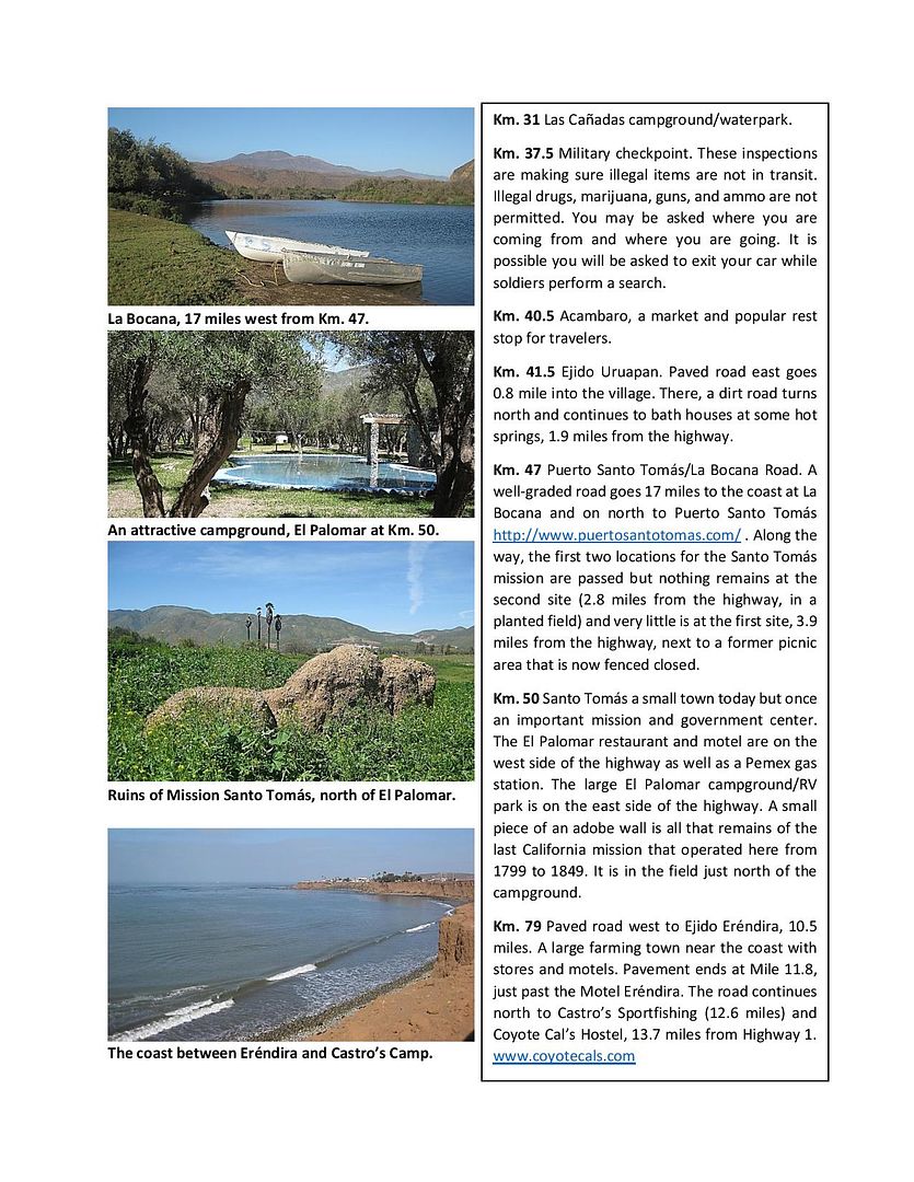
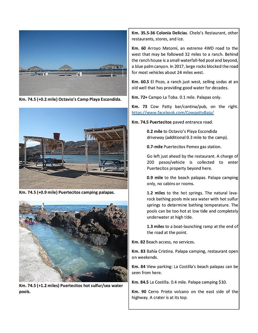
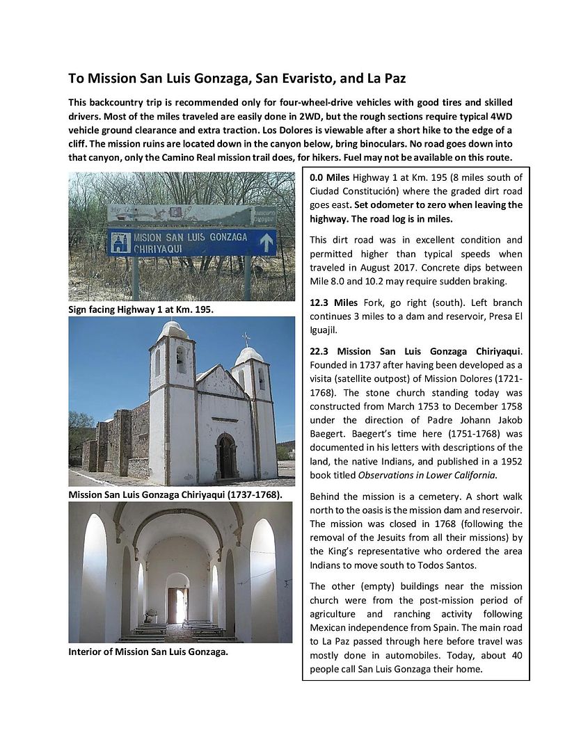
Here are a couple sample pages:
(South of Ensenada)

(South of San Felipe)

(Sideroad, south of Constitución)

|
|
|
fishbuck
Banned
Posts: 5318
Registered: 8-31-2006
Member Is Offline
|
|
Hi Dave! I am back on the boardwalk in Newps.
I will travel to San Diego soon to fly my Baja plane a bit to prep for my Jun 1 BOLA trip.If you can break away from your cartography for a moment
I'll stop by and by you lunch.
Speaking of my BOLA trip. Are there any adventuros BajaNomads out there who want to fly with me to BOLA.
I guarantee you a yellowtail or two and a good sunburn.
The airplane ride will be fast, interesting, and routine.
I flown in there a bunch.
We can split a nice boat. I can carry all rodes and coolers.
4 people max besides the pilot.
The are a few 30 ft pangas that can take 5 anglers easy.
"A ship in harbor is safe, but that is not what ships are built for." J. A. Shedd.
A clever person solves a problem. A wise person avoids it. – Albert Einstein
"Life's a Beach... and then you Fly!" Fishbuck
|
|
|
TMW
Select Nomad
      
Posts: 10659
Registered: 9-1-2003
Location: Bakersfield, CA
Member Is Offline
|
|
DK the guide above looks good. Lots of hard work finally paying off for an end product all can enjoy.
|
|
|
HeyMulegeScott
Senior Nomad
  
Posts: 717
Registered: 8-25-2009
Location: Orygone/Mulege
Member Is Offline
|
|
Looks like some great info. I like the format of the guides.
|
|
|
| Pages:
1
2
3
4
..
9 |

