| Pages:
1
2
3 |
David K
Honored Nomad
        
Posts: 65402
Registered: 8-30-2002
Location: San Diego County
Member Is Offline
Mood: Have Baja Fever
|
|
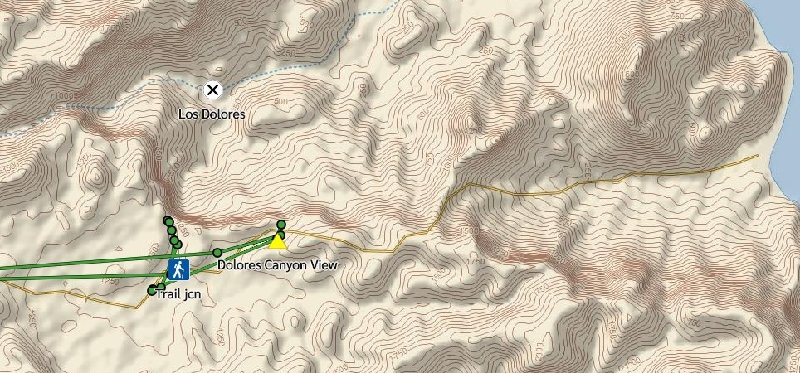
inReach track map (Dolores/ Los Burros area)
My quest was to see Mission Los Dolores (X on white dot) from the canyonside ridge viewpoint. There are two... the first I walked to from the yellow
triangle at and the other is the longer walk from the road with the hiking man symbol at. Los Burros is at the east end of the road shown on the
inReach map... Mission Los Dolores (1721-1741 site) has no road to it unless you bring your vehicle in by boat to the beach!
Here is the region track map, showing the area of three mission sites (San Luis Gonzaga, La Pasión, Los Dolores) southeast from Constitución and the
drive to San Evaristo and on to La Paz:
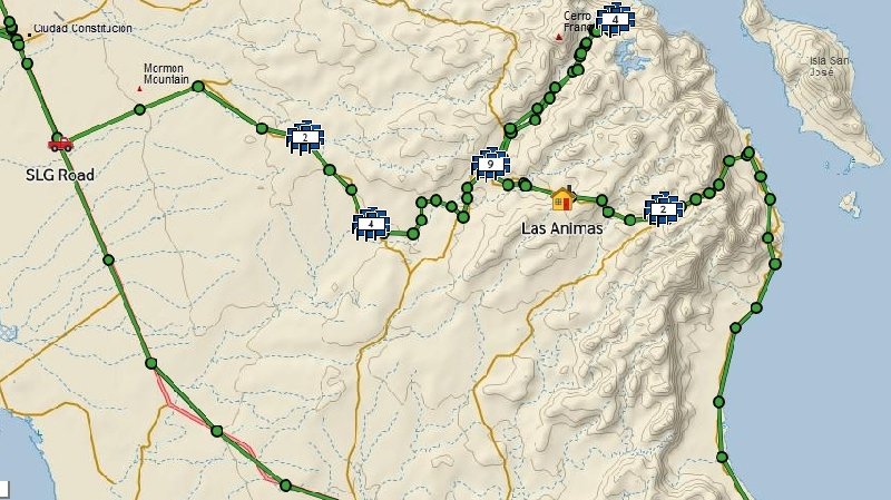
(the cluster at the top right labeled 4 is Los Dolores as seen in the previous map).
[Edited on 2-5-2020 by David K]
|
|
|
defrag4
Senior Nomad
  
Posts: 536
Registered: 2-5-2011
Member Is Offline
|
|
Quote: Originally posted by JZ  | We rode into Timbabichi last year around Easter. It's a fun ride and a very cool bay at Puerto Gato. Have ridden from San Evaristo to La Paz many
times in the last 3 years, great run along the coast. The ride into SE from MX 1 is pretty easy and fun.
When did you do the back door into Agua Verde from Constitucion? We tried going from AV to Constitucion about 2 years ago. Got a couple miles into
it, tons of rock slides. I had the truck in AV, and it wasn't making it, so we turned around.
One of the best rides South of La Paz is along the coast to Los Barriles. The dirt starts at San Juan de Los Planes. Top 5 coastal ride in all of
Baja.
Give us more details of what your looking for.
AV back door trail:
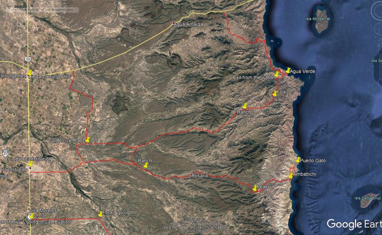
[Edited on 2-5-2020 by JZ] |
hey jz, you got a copy of this backdoor route i can load into gaia? want to check it out next time im down there
[Edited on 2-5-2020 by defrag4]
|
|
|
JZ
Select Nomad
      
Posts: 13583
Registered: 10-3-2003
Member Is Offline
|
|
Here you go.
Attachment: Area Around Agua Verde.kmz (12kB)
This file has been downloaded 302 times
Attachment: Area Around Timbabichi.kmz (17kB)
This file has been downloaded 329 times
|
|
|
defrag4
Senior Nomad
  
Posts: 536
Registered: 2-5-2011
Member Is Offline
|
|
thanks bud!
|
|
|
JZ
Select Nomad
      
Posts: 13583
Registered: 10-3-2003
Member Is Offline
|
|
Note, around Timbabichi, there are two routes going into Puerto Gato. I made both using Google Earth ahead of the trip.
The inland route is bike only. Even then, it's fairly challenging, at least in the dark when running out of gas and your phone battery dying. I
learned this the hard way riding it with my kid - lol.
The coastal route is fine for a truck.
|
|
|
4x4abc
Ultra Nomad
    
Posts: 4454
Registered: 4-24-2009
Location: La Paz, BCS
Member Is Offline
Mood: happy - always
|
|
the drive through Santa Maria to San Jose de la Noria is a lot more scenic than the fast road coming from Insurjentes
how Baja rides used to feel 30 years ago
turn off at km29
Attachment: Santa Maria - San Jose de la Noria.kmz (1kB)
This file has been downloaded 294 times
Harald Pietschmann
|
|
|
JZ
Select Nomad
      
Posts: 13583
Registered: 10-3-2003
Member Is Offline
|
|
Harald, that is really appreciated. You are the best poster on this board.
|
|
|
defrag4
Senior Nomad
  
Posts: 536
Registered: 2-5-2011
Member Is Offline
|
|
Quote: Originally posted by 4x4abc  | the drive through Santa Maria to San Jose de la Noria is a lot more scenic than the fast road coming from Insurjentes
how Baja rides used to feel 30 years ago
turn off at km29
|
thank u sir! will check it out soon and report back
|
|
|
4x4abc
Ultra Nomad
    
Posts: 4454
Registered: 4-24-2009
Location: La Paz, BCS
Member Is Offline
Mood: happy - always
|
|
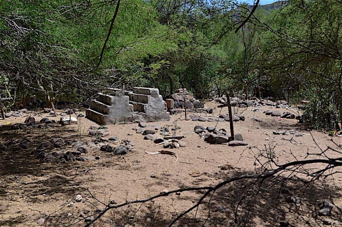
here are some images from that side valley to San Jose de la Noria
I don't like 800pix images - so here is a link:
https://carlosnpainter.smugmug.com/Travel/El-Quepo/
Harald Pietschmann
|
|
|
colloquialoatmeal
Newbie
Posts: 12
Registered: 1-6-2020
Member Is Offline
|
|
This is all very useful info, I really appreciate everyone, especially 4x4abc, giving the advice and tracks. I will be sure to update everything when
I get back.
On another note, does anyone know if there's a backway to Tres Virgenes from San Francisquito? I had heard of a 'no wimps trail' on advrider but am
having a hard time finding recent information on this coastal route.
|
|
|
4x4abc
Ultra Nomad
    
Posts: 4454
Registered: 4-24-2009
Location: La Paz, BCS
Member Is Offline
Mood: happy - always
|
|
very very cool road!
However, the land around San Miguel changed ownership and gates are locked.
You can still have a great driving experience coming from the south - if you don't mind doubling back.
Has been the trend in Baja for some years - we are losing more and more access
Harald Pietschmann
|
|
|
4x4abc
Ultra Nomad
    
Posts: 4454
Registered: 4-24-2009
Location: La Paz, BCS
Member Is Offline
Mood: happy - always
|
|
since we are on this subject - does anyone have the location of the northern locked gate for Rancho San Miguel?
Harald Pietschmann
|
|
|
David K
Honored Nomad
        
Posts: 65402
Registered: 8-30-2002
Location: San Diego County
Member Is Offline
Mood: Have Baja Fever
|
|
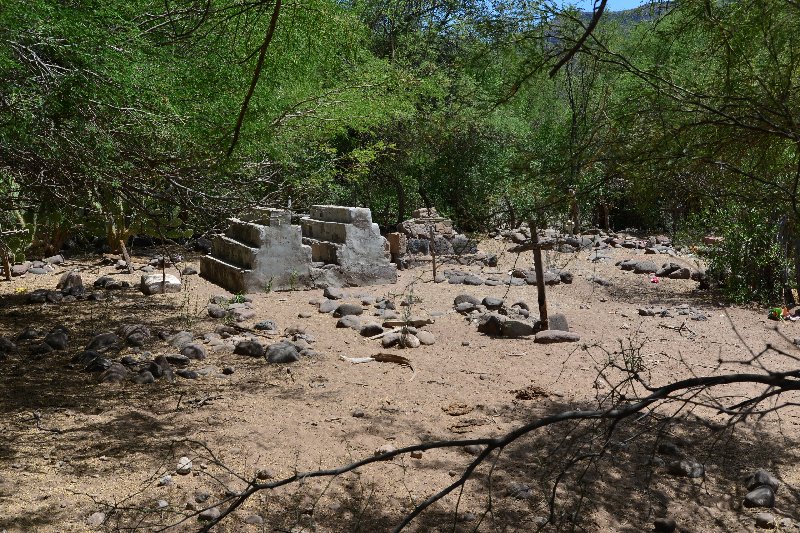
Why not give him a look at the No Wimps route so he knows how to get to it. Your trip reports showing the rocky driving near Rancho La Trinidad was
pretty awesome!
Here's that photo sized to 800 pixels using Postimages.org:
[Edited on 2-6-2020 by David K]
|
|
|
colloquialoatmeal
Newbie
Posts: 12
Registered: 1-6-2020
Member Is Offline
|
|
Does the road go through from El Barril to La Trinidad? I traced a road all the way from La Trinidad to 27°32'39.82"N, 112°34'45.28"W but from
there it looks like there's a steep canyon between that road and another road that runs south to Tres Virgenes.
Just looking for a shortcut from San Francisquito to San Ignacio without taking the normal route past Piedras Blancas.
|
|
|
JZ
Select Nomad
      
Posts: 13583
Registered: 10-3-2003
Member Is Offline
|
|
Quote: Originally posted by colloquialoatmeal  | Does the road go through from El Barril to La Trinidad? I traced a road all the way from La Trinidad to 27°32'39.82"N, 112°34'45.28"W but from
there it looks like there's a steep canyon between that road and another road that runs south to Tres Virgenes.
Just looking for a shortcut from San Francisquito to San Ignacio without taking the normal route past Piedras Blancas. |
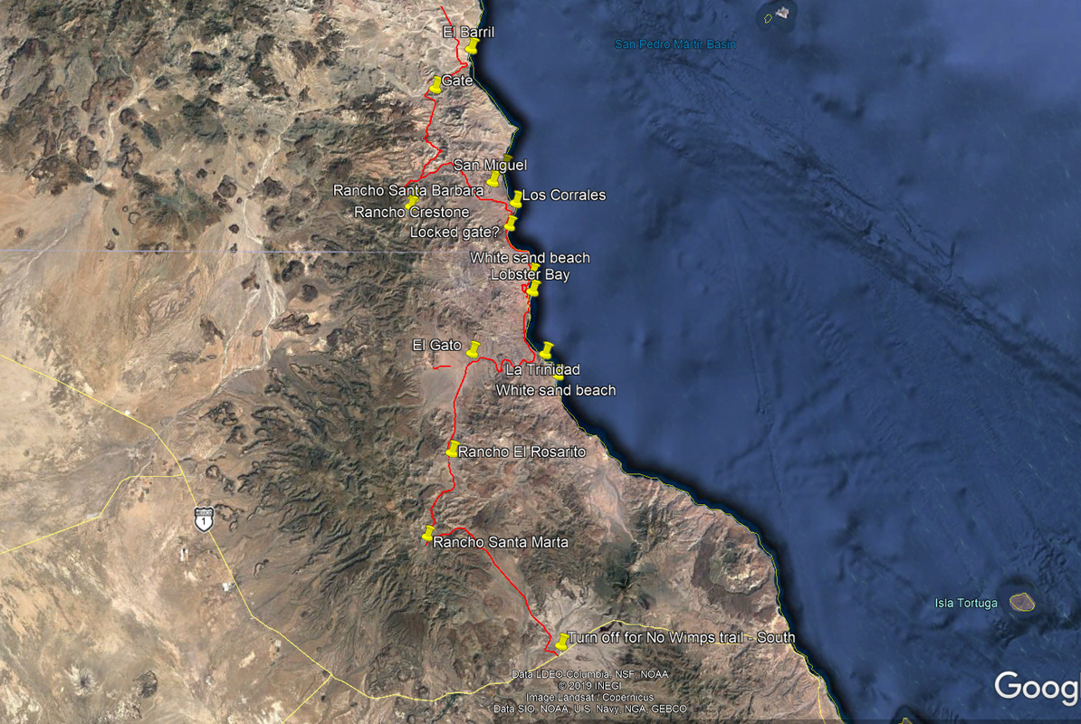
That's the No Wimps area. I have tracks that go from El Barril to San Ignacio. The problem is there are now locked gates at the North part of the
trail.
|
|
|
JZ
Select Nomad
      
Posts: 13583
Registered: 10-3-2003
Member Is Offline
|
|
Here are tracks from the No Wimps trail.
Attachment: Area Around No Wimps.kmz (19kB)
This file has been downloaded 298 times
|
|
|
JZ
Select Nomad
      
Posts: 13583
Registered: 10-3-2003
Member Is Offline
|
|
Quote: Originally posted by 4x4abc  | | since we are on this subject - does anyone have the location of the northern locked gate for Rancho San Miguel? |
I believe it is here: 28.242788° -112.939063°.
|
|
|
David K
Honored Nomad
        
Posts: 65402
Registered: 8-30-2002
Location: San Diego County
Member Is Offline
Mood: Have Baja Fever
|
|
At Trinidad, the route south first goes west to meet El Camino Real. Then turns south to Rancho Rosarito, passes the side road to Santa Marta, and
reach Hwy. 1 at the ejido village between San Ignacio and Santa Rosalía.
|
|
|
JZ
Select Nomad
      
Posts: 13583
Registered: 10-3-2003
Member Is Offline
|
|
[Edited on 2-8-2020 by BajaNomad]
|
|
|
colloquialoatmeal
Newbie
Posts: 12
Registered: 1-6-2020
Member Is Offline
|
|
I searched the forums and people say the gates were locked in 2018 but can't find anything more recent than that. I guess I'll have to go investigate.
Does anyone know if there is gas in El Barril? I have usually gotten gas in San Rafael and once at the place on the north end of the bay at San
Francisquito.
Thanks for the tracks!
|
|
|
| Pages:
1
2
3 |

