| Pages:
1
2
3
4 |
4x4abc
Ultra Nomad
    
Posts: 4453
Registered: 4-24-2009
Location: La Paz, BCS
Member Is Online
Mood: happy - always
|
|
San Lucas (cove) was renamed by Boleo from Rancho San Pedro
San Bruno used to be Rancho Santa Isabel
Harald Pietschmann
|
|
|
David K
Honored Nomad
        
Posts: 65390
Registered: 8-30-2002
Location: San Diego County
Member Is Offline
Mood: Have Baja Fever
|
|
Quote: Originally posted by 4x4abc  | add Santa Ana north of San Borja instead of south and you know it is questionable map
as I said before - Gulick had the first accurate maps of Baja |
As is so often the case, the potential Spanish names is limited, so the same name is used for multiple locations. There is more than one Santa Ana,
and the one on the 1860's map shows up on the 1884 and 1886 maps, between Yubay and Calamajué: Santa Ana in 1884
The 1919 Academy of Sciences map shows a Llano de Santa Ana in that area:
1919 Map
In 1918 (published in 1925), David Goldbaum has a Llanos de Santana near Yubay: David Goldbaum Map
Of course, this all may have been born from an error on the 1860's map??? 
|
|
|
Lance S.
Nomad
 
Posts: 231
Registered: 2-16-2021
Member Is Offline
|
|
Could the Santa Ana on the map be Aguajito de Higueras? It would appear so based on the 1884 map.
Where exactly is Aguajito de Higueras?
[Edited on 1-21-2023 by Lance S.]
|
|
|
David K
Honored Nomad
        
Posts: 65390
Registered: 8-30-2002
Location: San Diego County
Member Is Offline
Mood: Have Baja Fever
|
|
Quote: Originally posted by Lance S.  | Could the Santa Ana on the map be Aguajito de Higueras? It would appear so based on the 1884 map.
Where exactly is Aguajito de Higueras?
[Edited on 1-21-2023 by Lance S.] |
Unless this is a smaller, nearby spring, see Agua de Higuera or Agua de la Higuera, is against the mountain, east from El Crucero, just of El Camino
Real, between Tinaja de Yubay and Calamajué mission site.
See it on the 1954 Howard Gulick ECR map and the 1977 Harry Crosby map, at www.vivabaja.com/maps as well as on CaminoRealBaja.com map, with a special notation. Maybe they mention this little one, too? Really excellent ECR
work by Kevin and his lady.
|
|
|
Lance S.
Nomad
 
Posts: 231
Registered: 2-16-2021
Member Is Offline
|
|
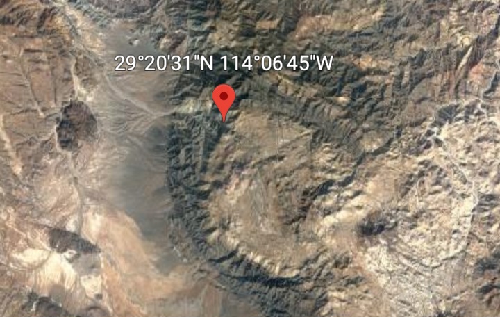
There is a Canyon Aguajito Higueras ,29°16'04"N 114°06'52"W . Don't know if it is the same place.
[Edited on 1-22-2023 by Lance S.]
|
|
|
David K
Honored Nomad
        
Posts: 65390
Registered: 8-30-2002
Location: San Diego County
Member Is Offline
Mood: Have Baja Fever
|
|
I am not on my desktop, so can't tell. Is it straight east of El Crucero? That is where the road from Calamajué meets Hwy. 1, at the big curve,
direction change.
Harald may see this and confirm.
|
|
|
4x4abc
Ultra Nomad
    
Posts: 4453
Registered: 4-24-2009
Location: La Paz, BCS
Member Is Online
Mood: happy - always
|
|
2 competing locations
29°16'38.06"N, 114° 6'33.71"W according to Kevin - Agua de Higuera
28°57'43.53"N, 113°47'31.79"W according to INEGI - Agua de Higueras
Harald Pietschmann
|
|
|
4x4abc
Ultra Nomad
    
Posts: 4453
Registered: 4-24-2009
Location: La Paz, BCS
Member Is Online
Mood: happy - always
|
|
the one Kevin calls Agua de Higuera
is not in Cañada Aguajito de Higuera
so, either INEGI named the wrong canyon or Kevin named the wrong spring Agua de Higuera
the one INEGI calls Agua de Higueras (Agua de Higuera on older maps) is in Arroyo Agua de Higuera and close to Cerros Agua de Higuera
Harald Pietschmann
|
|
|
David K
Honored Nomad
        
Posts: 65390
Registered: 8-30-2002
Location: San Diego County
Member Is Offline
Mood: Have Baja Fever
|
|
When I get home, I will see where your waypoints are.
The spring was named in the 1760s, or soon after. The El Camino Real was created past it in 1766, and as noted earlier by goat, it may have used a
Native path. The Natives of the time were the ones that showed the Jesuits the spring, no doubt.
|
|
|
Lance S.
Nomad
 
Posts: 231
Registered: 2-16-2021
Member Is Offline
|
|
Thank you, thats great. That first one is quite far up the canyon.
[Edited on 1-22-2023 by Lance S.]
|
|
|
Lance S.
Nomad
 
Posts: 231
Registered: 2-16-2021
Member Is Offline
|
|
Quote: Originally posted by David K  | When I get home, I will see where your waypoints are.
The spring was named in the 1760s, or soon after. The El Camino Real was created past it in 1766, and as noted earlier by goat, it may have used a
Native path. The Natives of the time were the ones that showed the Jesuits the spring, no doubt. |
The paths of least resistance between water holes. The Jesuits were following the highways.
[Edited on 1-22-2023 by Lance S.]
|
|
|
David K
Honored Nomad
        
Posts: 65390
Registered: 8-30-2002
Location: San Diego County
Member Is Offline
Mood: Have Baja Fever
|
|
Quote: Originally posted by 4x4abc  | the one Kevin calls Agua de Higuera
is not in Cañada Aguajito de Higuera
so, either INEGI named the wrong canyon or Kevin named the wrong spring Agua de Higuera
the one INEGI calls Agua de Higueras (Agua de Higuera on older maps) is in Arroyo Agua de Higuera and close to Cerros Agua de Higuera
|
Harald, the second waypoint you posted has northing to do with the El Camino Real spring in discussion, it is a ranch on the road to Mission San
Borja, by the stinky sulfur spring. You know that the same name is used for multiple locations, in Mexico.
Examine the 1954 El Camino Real map made by Howard Gulick and you will see both places names Agua de Higuera (nothwest of Yubay and along the San
Borja road):

On Harry Crosby's 1977 El Camino Real map, he has the one spring location that is in discussion (northwest of Yubay):

----------------------------------------------------------------------------------------------------------------------
Now, the best El Camino Real map is from the couple who have been ground-proofing the route from Loreto to El Rosario, for the past 22 years. It is
their waypoints along it, on Google Earth. www.caminorealbaja.com
Here is what they say about Agua de Higuera:
AguadeHigueraH2O
Agua de Higuera was a known water source along the ECR. Visitors will see a small reed filled pool still containing plenty of water. It does make for
a long side trip and if travelers along the trail were not thirsty before, they most likely were by the time they reached this place.
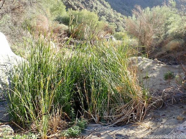
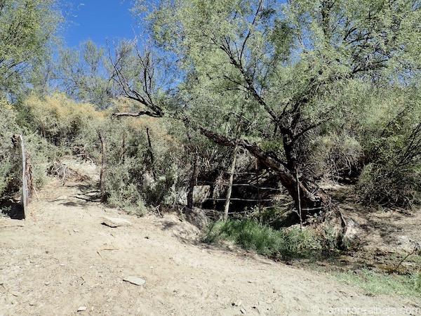
A short distance south is another spring, here is what they said about it:
AguajitoH2O
Aguajito is a recent name given by a local rancher and his family to this waterhole. He does not know of an older name associated with it, and we have
not read about its existence in any historical record that we have come across. The rancher’s belief is that the sidewalls are of an old
construction and the dam across it, built by his family, replaced a much older structure. Certainly, the size and flow indicate to us that this was
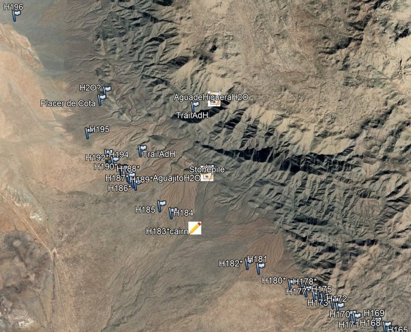
likely an important water source for ECR travelers and that the presence of the cairn at waypoint H183*cairn may support this idea.
Screenshot of CaminoRealBaja map showing Agua de Higuera location in relation to the El Camino Real waypoinst and Hwy. 1 around El Crucero, left lower
area...
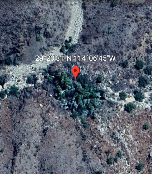
I got the GPS for Agua de Higuera, here: 29° 16.663'N, 114° 6.528'W
You will see two waypoint flags for the side trail to Agua de Higuera from ECR.
|
|
|
Lance S.
Nomad
 
Posts: 231
Registered: 2-16-2021
Member Is Offline
|
|
Fantastic! So maybe Aguajito, the second water source, was Santa Ana. It looks more convenient than Agua Higuera.
|
|
|
David K
Honored Nomad
        
Posts: 65390
Registered: 8-30-2002
Location: San Diego County
Member Is Offline
Mood: Have Baja Fever
|
|
Quote: Originally posted by Lance S.  | | Fantastic! So maybe Aguajito, the second water source, was Santa Ana. It looks more convenient than Agua Higuera. |
Cool idea, about a Santa Ana ranch... Howard Gulick sure combed the area well, in the 50's and 60's, and never reported it. He was guided to these El
Camino Real springs by Arturo Grosso and Dick Daggett, who both had mine claims and knew the old trail.
Surprised Harald hasn't popped back here, yet? He relies a lot on the government maps, even though they so frequently put the wrong names down or
switch names with their neighbor. So, I am cautious about trusting them 100%. They switched the name of Arroyo El Volcán with one nearby (Zamorra),
as well as switching Bahía San Luis Gonzaga with Ensenada de San Francisquito (the bigger bay, south of Alfonsina's), so making errors in this part
of Mexico is a habit with INEGI. They are great for the topgraphic map contour lines, however!
|
|
|
Lance S.
Nomad
 
Posts: 231
Registered: 2-16-2021
Member Is Offline
|
|
Possibly not even a ranch in the 1800's, just the name of the aguaje.
Edit: the legend on the 1884 map does indicate that Santa Ana was a Rancho.
[Edited on 1-24-2023 by Lance S.]
|
|
|
4x4abc
Ultra Nomad
    
Posts: 4453
Registered: 4-24-2009
Location: La Paz, BCS
Member Is Online
Mood: happy - always
|
|
well, to contemplate what is what we would need to know from Kevin who told him that 29.277238°, -114.109364° is Agua de Higuera
so, 2 springs, not very far from each other, are competing for the same name
I am voting for 29.258958°, -114.110674°
because it is closer to ECR and easier to reach
also - the fact that the ranchers are calling it "Aguajito" makes it candidate #1 for the original Jesuit spring. The name is reflected in Cañada
Aguajito de Higuera.
however, David would see it as a disqualifying reason, because the name is found on the INEGI maps
but I have great trust in map making institutions
they are the most accurate part of government
at least there is a difference in names for the 2 Higueras that are far apart, but both on the ECR
Agua de Higuera is here: 28.962092°, -113.792164°
Aguajito de Higuera is either 29.277238°, -114.109364° or here: 29.258958°, -114.110674°
[Edited on 1-24-2023 by 4x4abc]
Harald Pietschmann
|
|
|
David K
Honored Nomad
        
Posts: 65390
Registered: 8-30-2002
Location: San Diego County
Member Is Offline
Mood: Have Baja Fever
|
|
I don't automatically discount INEGI, I just say not to be 100% when they have a history of clear errors in naming places. The majority of their work
seems very good.
The southern Higuera, is the stinky sulfur spring and is not on ECR, which turns to the northwest a litle south of it. Of course the other two are not
on the ECR either, but off on side trails.
|
|
|
Lance S.
Nomad
 
Posts: 231
Registered: 2-16-2021
Member Is Offline
|
|
I think the spot labeled agua soda on golbaum is Las Palmas.

If so then the trail actually runs over the Asamblea plateau rather than around it.
 by by
Harald, you mentioned a trail coming out of Arroyo Las Palmas in another thread. Is there a trail between Las Palmas and Agua de Higuera?
|
|
|
Lance S.
Nomad
 
Posts: 231
Registered: 2-16-2021
Member Is Offline
|
|
Las Palmas is a water source halfway between Agua de Higuera and Calamajue so it makes a lot of sense for the trail to go over the plateau.
|
|
|
4x4abc
Ultra Nomad
    
Posts: 4453
Registered: 4-24-2009
Location: La Paz, BCS
Member Is Online
Mood: happy - always
|
|
Quote: Originally posted by mtgoat666  | Quote: Originally posted by BajaTed  | | As on all of the old maps of that show the border, I have always wondered why the Colorado River has the border transecting the river with a
north/south deviation? |
because CA/Mex border was established when usa acquired CA about 1848 following war.
the AZ/Mex border came out of the Gadsen purchase about 1854. |
I love "acquired"
translated to today - Russia started a war against the Ukraine because they want it (or most of it). So, let's say, Russia overwhelms the Ukraine and
wins the war. Then they have a meeting and Russia pays xyz billion to the Ukraine for the "purchase" of the land they wanted. Meaning for the next 500
years they can teach in school how peaceful they are. And when they needed a few million more acres they "bought" them.
Harald Pietschmann
|
|
|
| Pages:
1
2
3
4 |

