| Pages:
1
2
3 |
David K
Honored Nomad
        
Posts: 65399
Registered: 8-30-2002
Location: San Diego County
Member Is Offline
Mood: Have Baja Fever
|
|
Very cool... so remote, too!
|
|
|
Ken Cooke
Elite Nomad
     
Posts: 8970
Registered: 2-9-2004
Location: Riverside, CA
Member Is Offline
Mood: Pole Line Road postponed due to injury
|
|
There will be a group of Jeeps heading to this rocky destination in a few weeks. I will provide an updated report on the locale and road conditions.
Can't wait!
|
|
|
Ken Cooke
Elite Nomad
     
Posts: 8970
Registered: 2-9-2004
Location: Riverside, CA
Member Is Offline
Mood: Pole Line Road postponed due to injury
|
|
The latest Intel is that the road to Palomar is impassable. A modified Willy's flatfender could not negotiate the boulders in January. These may
have been moved to accommodate 4 wheel vehicles, but I have not heard if this has happened, yet.
|
|
|
David K
Honored Nomad
        
Posts: 65399
Registered: 8-30-2002
Location: San Diego County
Member Is Offline
Mood: Have Baja Fever
|
|
Same with Matomí, more rain, more boulders exposed. Pappy Jon was just in there again and it got even worse than what he and I saw last March.
If our new Nomad amigo has a D9 or some nice dozer, he can move rocks or cover them with sand so we 4x4s can get in and camp.
|
|
|
Mexitron
Ultra Nomad
    
Posts: 3397
Registered: 9-21-2003
Location: Fort Worth, Texas
Member Is Offline
Mood: Happy!
|
|
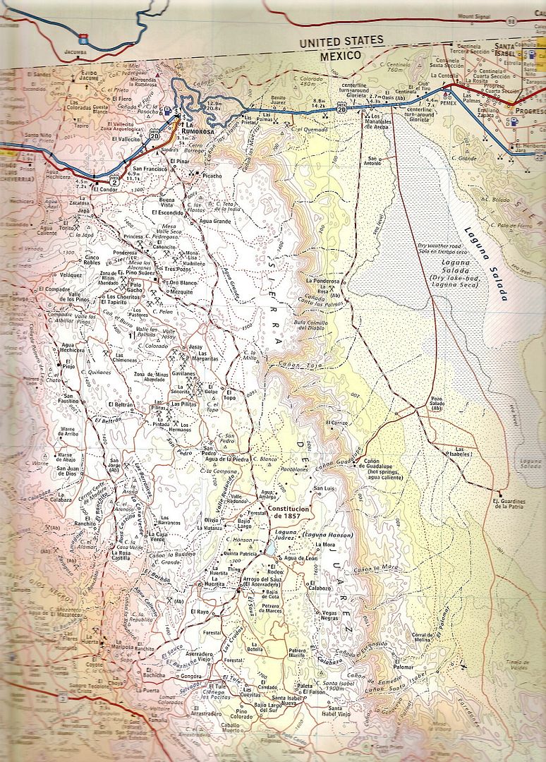
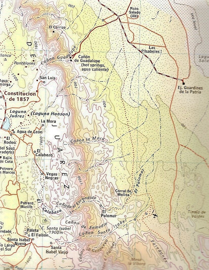
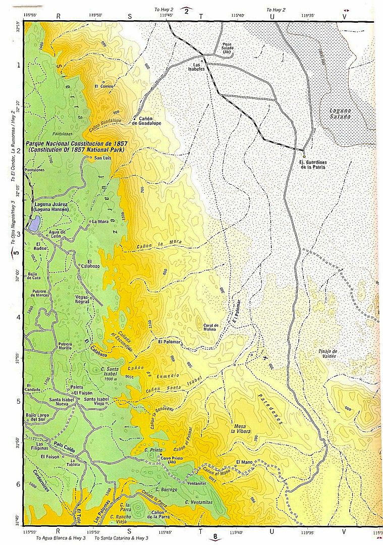
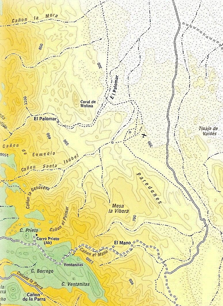
Quote: Originally posted by David K  | Here are 2 maps and 2 'zooms in' on the canyon...
First, the now reported out-of-print, 2009 Baja CA Almanac (if this is a tease tio get you to buy one, great) page, followed by a zoom in on the
canyon area.
Next, the long out-of-print 2003 Baja CA Almanac page, then a zoom in on the Palomar Canyon area. Note that the 2003 and earlier Almanac were of
higher detail/ bigger scale than the 2009... so older is still good to get, if you can!
That runway is by the general's abandoned hunting lodge at the entrance to Santa Isabel Canyon. |
About 20 years we drove a road/trail that went from Hwy 5 west and ended up joining the road into Palomar, was wondering if that still exists or is
fenced off now. Quite an enjoyable drive. It crossed Palomar where the canyon had become an enormous cut through eons of accumulated sandy alluvium
on the edge of the salada area, can just imagine the storms that have gouged all that out. Always amazed to see old palm trunks way out in the salada
from those storms.
|
|
|
David K
Honored Nomad
        
Posts: 65399
Registered: 8-30-2002
Location: San Diego County
Member Is Offline
Mood: Have Baja Fever
|
|
Quote: Originally posted by Mexitron  |
About 20 years we drove a road/trail that went from Hwy 5 west and ended up joining the road into Palomar, was wondering if that still exists or is
fenced off now. Quite an enjoyable drive. It crossed Palomar where the canyon had become an enormous cut through eons of accumulated sandy alluvium
on the edge of the salada area, can just imagine the storms that have gouged all that out. Always amazed to see old palm trunks way out in the salada
from those storms. |
I have not heard of any change to its passability. PaulW is maybe more in tune to it? This is the road that heads west from the sand dune area,
correct (signed for Ejido Saldaña)?
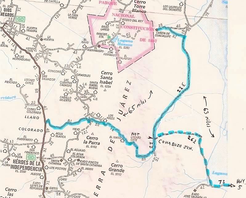
If yes, I traveled it many years ago to get to Guadalupe Canyon from San Felipe and it was pretty bad where it crossed the hills from near Laguna
Salada to Cohabuzo Jcn. (deep silt)... Here is my mileage note map showing it and the way up to Hwy. 3 via Mano Canyon, I did a couple years later:
|
|
|
PaulW
Ultra Nomad
    
Posts: 3113
Registered: 5-21-2013
Member Is Offline
|
|
Find David's road above. You will find lots of changes, but the route follows the general path above. Start at Hwy close to Km 87 (via the barrow pit
from the new road) or 77 (with the sign and a less friendly road). Both go to Saldana #2 Then the road turns northerly. The route these days stays
quite a bit further east due to rancher fencing.
|
|
|
TMW
Select Nomad
      
Posts: 10659
Registered: 9-1-2003
Location: Bakersfield, CA
Member Is Offline
|
|
SCORE uses the route for both the Baja 500 and 1000 races as does CODE. The thing to remember is that the area on David's map above that says Laguna
is often muddy. Be very careful crossing it. Rule of thumb is to stay as far to the west as you can.
|
|
|
| Pages:
1
2
3 |

