| Pages:
1
2
3
4
5
..
15 |
David K
Honored Nomad
        
Posts: 65439
Registered: 8-30-2002
Location: San Diego County
Member Is Online
Mood: Have Baja Fever
|
|
Amy, I am so happy you got in there! Did you "feel it"...?? You know, the spirits...
It is so enchanting in there... It keeps driving us back!
Sounds like you parked at the top of the Widowmaker and both walked the mile and a half to the mission... ? How deep was the water in the bog? How did
you avoid wading in that?
Thanks... Come on back in a few weeks when we go it!
(yes, plenty more hard places in the road than The Widowmaker... That is just the one long, steep grade that is most intimidating to drive back up.)
|
|
|
David K
Honored Nomad
        
Posts: 65439
Registered: 8-30-2002
Location: San Diego County
Member Is Online
Mood: Have Baja Fever
|
|
| Quote: | Originally posted by Pappy Jon
| Quote: | Originally posted by David K
I am trying to make the road sound bad, for a reason... it is. |
My prediction? You won't make it to the mission, at least not in a stock Tacoma. There. I said it. I was there in April and the holes in the first
oasis were very deep. I probably could have done it in my lifted 4Runner, but without a wing man I wasn't going to try. |
What were you driving...? Did you park on top of the Widowmaker and walk in?
I guess we will see, I have done it with my 2001 and 2005 stock Tacomas (both the TRD Off Road 4WD with rear lockers) in 2003 and 2007...
This time in my new 2010 (with A-TRAC, a traction system that gives the effect of front and rear lockers, but allows easy steering while in use) TRD
Off Road 4WD.
If the bog is that deep, we may need to help each other through... Why it is good to not travel alone in there...
Thank you Jon for your report!
|
|
|
bajaamy
Newbie
Posts: 23
Registered: 10-29-2008
Member Is Offline
|
|
| Quote: | Originally posted by David K
How deep was the water in the bog? How did you avoid wading in that? |
Hi, David! We did indeed hike the last mile and 1/2. The water in the bog was about a foot deep (in some places). We jumped from one bank to the
other, finding the easiest way through the brush.
|
|
|
edm1
Senior Nomad
  
Posts: 568
Registered: 8-23-2006
Location: Oak Hills, Ca
Member Is Offline
|
|
Great pics Amy, thanks for sharing.
In that arroyo it looks like there are a lot of big palm trees to wrap a recovery strap and onto the winch, enough anchor for a stuck 10,000 rig, if I
can even get past the WM. Or I'm just too damn upbeat.
|
|
|
David K
Honored Nomad
        
Posts: 65439
Registered: 8-30-2002
Location: San Diego County
Member Is Online
Mood: Have Baja Fever
|
|
Awesome to hear Amy... thanks... a piece of cake for the Toyota!
Art, the road is narrow with off camber sections and steep pitches over granite boulders... like the Rubicon... a 'jeep trail' . I want you to have
fun, but would hate to see that motorhome of yours marooned there for the next 20 years... It may be far too heavy a rig for your winch to pull you up
the Widowmaker or for any of our rigs to anchor at the top?
If you have seen the You Tubes and all photos and still feel comfortable going, then great... Otherwise ride in with one of us in the group and leave
the van at Santa Ynez.
|
|
|
David K
Honored Nomad
        
Posts: 65439
Registered: 8-30-2002
Location: San Diego County
Member Is Online
Mood: Have Baja Fever
|
|
Okay, how about a list of Nomads pretty sure about going?
Again, strongly suggest 9"min. ground clearance, have 4WD low range and a rear locker or traction control, expect some body damage. This is a Rubicon
style Jeep trail over rocks and boulders with steep grades and a muddy bog along the way... less than 15 miles but expect 3 hours to drive in.
I will edit this as people indicate:
1) BAJACAT (DODGE TRUCK)
2) David K & Baja Angel (2010 TACOMA OFF ROAD)
3) TW (GMC TRUCK)
4) Neal Johns (TACOMA OFF ROAD)
5) edm1 (4WD MOTORHOME or hitchhike)
6) KurtG (hitchhike)
7) Bajatripper (4RUNNER)
8) CG (DODGE DAKOTA)
9) * (2009 TACOMA OFF ROAD)
* HB Murphy from Tacoma World Forums
Also, there was some interst if we went later from: BajaRoadrunner, Baja12valve, Steve & Debbie (in the February trip thread that was cancelled).
[Edited on 5-25-2010 by David K]
[Edited on 5-25-2010 by David K]
|
|
|
edm1
Senior Nomad
  
Posts: 568
Registered: 8-23-2006
Location: Oak Hills, Ca
Member Is Offline
|
|
David,
". . . ride in with one of us in the group and leave the van at Santa Ynez."
That's the prudent thing to do, "walk the trail first" and even better if I "ride the trail first" with proven vehicles. I have kind of "walked" the
trail having seen Baja Roadrunner's Utube, believe me, over and over again; however, there's no subsitute for "walking it" IN PERSON, especially that
no known motorhomes have conquered that trail before.
I've taken the motorhome to many "jeep trails" evidenced by the many pinstripes over the paint job (and I'm leaving them on :-), including doing steep
ascent and descents. Off camber when the trail is narrow (i.e. when only one of the rear dually tires is on the ground, the other hanging and
overlooking to a 5000ft cliff) - that's my fear. That's happened to me before and I am not going to repeat it, I had to let my passengers (wife and
daughter) get off the vehicle. It gives me goosebumps everytime I reflect on it.
OK, who's gonna take me in their truck, in the front seat, of course?
Art
[Edited on 5-16-2010 by edm1]
|
|
|
edm1
Senior Nomad
  
Posts: 568
Registered: 8-23-2006
Location: Oak Hills, Ca
Member Is Offline
|
|
Fernando
Got a U2U from fernando saying he won't be able to make it that weekend.
|
|
|
TMW
Select Nomad
      
Posts: 10659
Registered: 9-1-2003
Location: Bakersfield, CA
Member Is Offline
|
|
edm1 ". . . ride in with one of us in the group and leave the van at Santa Ynez."
I think that may be the best thing to do. You would then be able to judge if you could get in on another trip to the mission. Or take you motorhome to
the widowmaker and leave it and ride in with us. Either way you have options and will still have a great weekend.
|
|
|
David K
Honored Nomad
        
Posts: 65439
Registered: 8-30-2002
Location: San Diego County
Member Is Online
Mood: Have Baja Fever
|
|
The big dip 1.8 miles from Santa Ynez is a good filter... climbing up the far side is the first low range event of the run. If you can do that, you
probably can make it to the Widowmaker, 13 miles from Santa Ynez.
The last mile and a half is the worst part of the road... The Widowmaker, the bog, then some short steep parts before the mission.
Also, past the mission is one heck of a steep grade that drops you down to the sandy arroyo if you want to see the oasis (where we camped last time
and saw the bighorns), or the bulldozed grade that ends on the canyon edge... petroglyphs are there... also the El Camino Real switchbacks up the
mountainside from the road, just before it ends at the bulldozed grade.
|
|
|
Neal Johns
Super Nomad
   
Posts: 1687
Registered: 10-31-2002
Location: Lytle Creek, CA
Member Is Offline
Mood: In love!
|
|
Marian gets back from Tibet Monday and does not know she is going to the Mission yet.   
My motto:
Never let a Dragon pass by without pulling its tail!
|
|
|
bajaamy
Newbie
Posts: 23
Registered: 10-29-2008
Member Is Offline
|
|
| Quote: | Originally posted by David K
The big dip 1.8 miles from Santa Ynez is a good filter... climbing up the far side is the first low range event of the run. |
FYI . . . when we left the Santa Ynez ranch, we rode through the arroyo and skipped the rough parts of the beginning of the road. Just wanted you to
know that there's another option at the beginning of the ride if that helps anyone . . .
|
|
|
Pappy Jon
Nomad
 
Posts: 494
Registered: 8-27-2003
Location: Wrong side of the Continental divide.
Member Is Offline
Mood: Temp rising.
|
|
| Quote: | | Originally posted by bajaamyThe water in the bog was about a foot deep (in some places). |
Not when I was there. Plus, the issue was not only the depth of the water, but the depth of the holes and the steep angles in and out.
I wish I could join you all. I felt defeated having my progress stopped at the bog. Like I said, if I had somebody with me I would have tried it, but
certainly not solo. I'm just crazy, not dumb.
"The association of flowers and warm-blooded love is more than a romantic convention; it is based upon one of the great advances in the evolution
of life." Ed Abbey
|
|
|
edm1
Senior Nomad
  
Posts: 568
Registered: 8-23-2006
Location: Oak Hills, Ca
Member Is Offline
|
|
TW.
"...Or take you motorhome to the widowmaker and leave it and ride in with us. "
I appreciate very much the baja nomads' sincere help and concern. First David K's recommendation and now TW's and BajaAmy's. I am anxious to meet you
all.
If I leave my motorhome at the widowmaker, is there a pullout or will I be blocking the way (that wouldn't be proper, of course)?
[Edited on 5-14-2010 by edm1]
|
|
|
roverdude
Junior Nomad

Posts: 74
Registered: 10-1-2005
Location: Garden Grove
Member Is Offline
Mood: No Bad Days, Mornings Maybe...
|
|
Hmmmm, I love that place.
It is not easy. But doable.
Put me on the "I need to get permission for the Mission" list.


|
|
|
edm1
Senior Nomad
  
Posts: 568
Registered: 8-23-2006
Location: Oak Hills, Ca
Member Is Offline
|
|
Another option
Bajaamy,
". . . there's another option at the beginning of the ride"
It's good to know this for most I'm sure, and maybe even for me. I'm in for the rough ride, big challenges and the adventure, but thank you
nevertheless. Like Papy Jon, I'm crazy; aren't we all here at Baja Nomad? So, i'd choose the more challenging one.
[Edited on 5-14-2010 by edm1]
|
|
|
TMW
Select Nomad
      
Posts: 10659
Registered: 9-1-2003
Location: Bakersfield, CA
Member Is Offline
|
|
| Quote: | Originally posted by edm1
TW.
"...Or take you motorhome to the widowmaker and leave it and ride in with us. "
I appreciate very much the baja nomads' sincere help and concern. First David K's recommendation and now TW's and BajaAmy's. I am anxious to meet you
all.
If I leave my motorhome at the widowmaker, is there a pullout or will I be blocking the way (that wouldn't be proper, of course)?
[Edited on 5-14-2010 by edm1] |
There is plenty of room for you to park and not block the trial.
|
|
|
David K
Honored Nomad
        
Posts: 65439
Registered: 8-30-2002
Location: San Diego County
Member Is Online
Mood: Have Baja Fever
|
|
There could be enough for you to park where others have near the top of the Widowmaker... if nobody else is parked there.
Remember, there very well could be OTHER 4WD clubs or people going in.
In 2007, Roy and I were the only ones (vehicles) on Memorial Day Weekend.
In 2003 (Spring Break) a large Jeep club came in after the three of us arrived and took them a long time in the dark to get there.
In 1999 (May 1) a Mexican bicycle group with support vehicle was on the road.
Amy, in 2007 we tried going up the wash only to be blocked by boulders, so we climbed up the hill on the traditional road... Would like to hear more
about your route... but a rough road is part of what we seek.
Maybe I will post some Google Earth images of the route?
[Edited on 5-14-2010 by David K]
|
|
|
David K
Honored Nomad
        
Posts: 65439
Registered: 8-30-2002
Location: San Diego County
Member Is Online
Mood: Have Baja Fever
|
|
15 Google Earth Images of the road.
Starting at Hwy. 1:
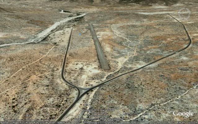
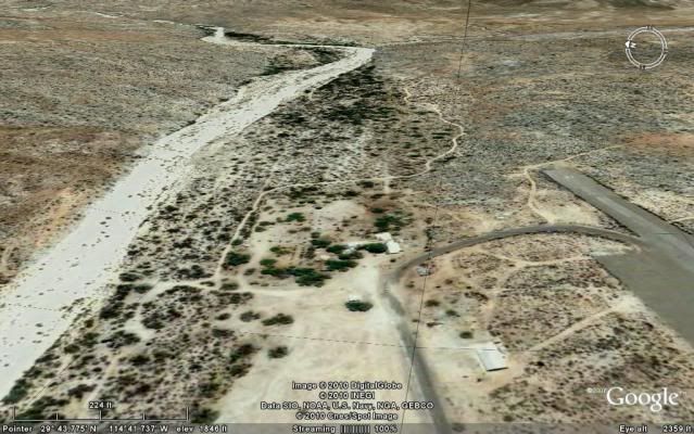
The ranch... paved road continues up to airport, the mission road turns left in front of the ranch/ restaurant parking and goes around the ranch to
the far side and heads for the arroyo crossing.
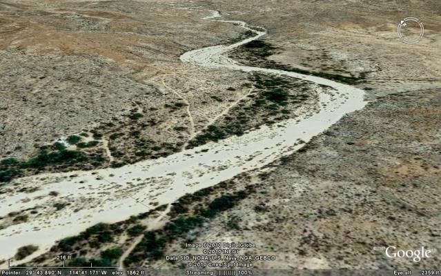
Arroyo crossing then left fork, up the hill...
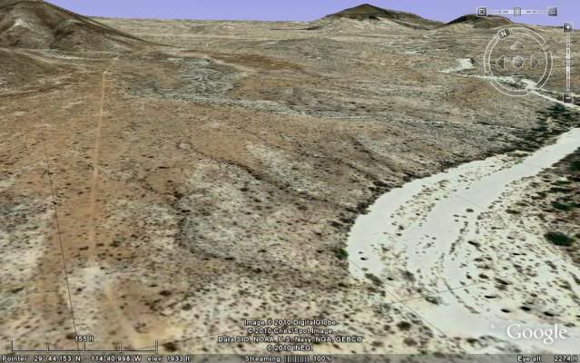
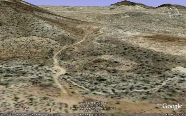
Big gully crossing, 1.8 miles in...first low range 4WD.
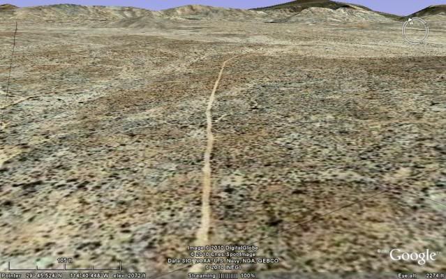
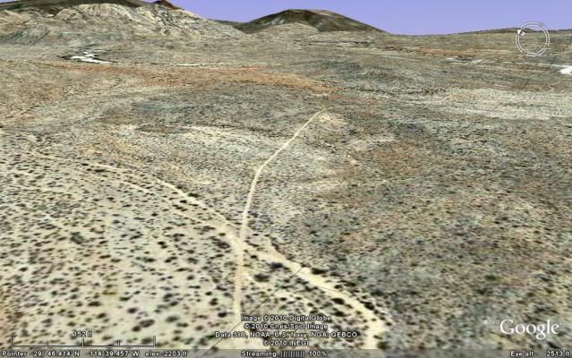
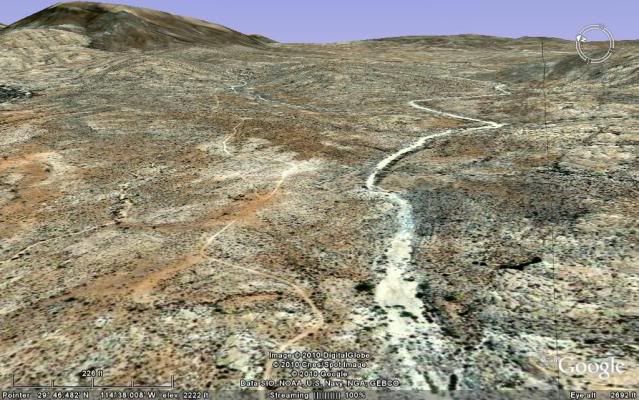
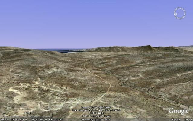
Peninsular Divide 10 miles from Santa Ynez, view of Punta Final.
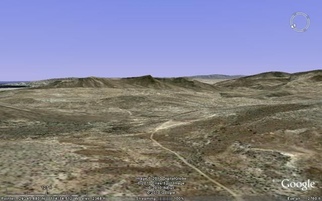
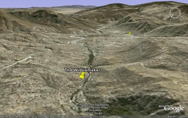
Down, down, down... then the Widowmaker, followed by the bog!
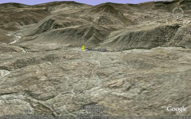
Crossing over some more granite before reaching the mission valley.
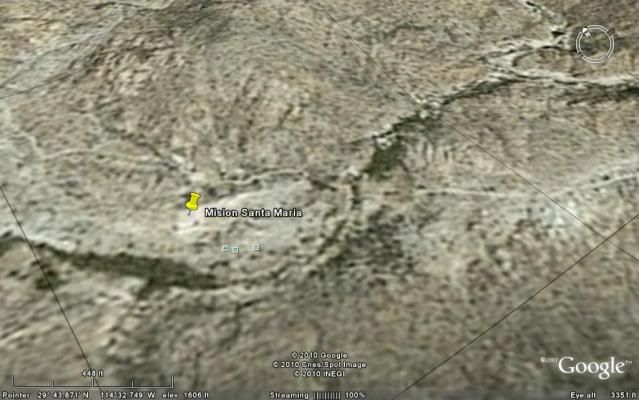
Mision Santa Maria 14.4miles from Santa Ynez
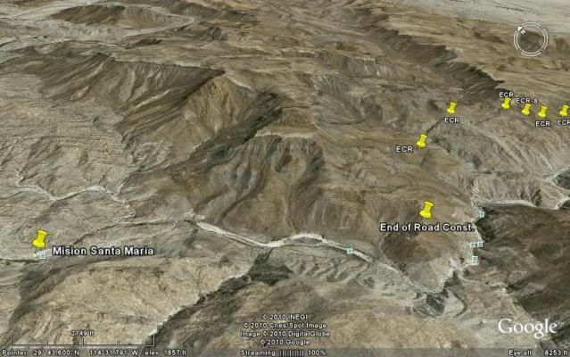
Photo looking northward.
The road goes another mile into the sandy arroyo. 0.3 mile further a left turn out of the arroyo is the road... tracks in the arroyo soon end in a
palm grove. The road was built to the top of the ridge and ended there. An Indian trail continues down into the canyon (this was the older Camino
Real). The newer Camino Real climbs up the ridge to the left before the road ends nnear the bulldozed grade... see pins marking the Camino Real along
the top of the canyon's north rim.
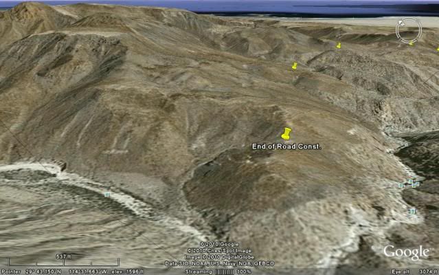
[Edited on 5-14-2010 by David K]
|
|
|
David K
Honored Nomad
        
Posts: 65439
Registered: 8-30-2002
Location: San Diego County
Member Is Online
Mood: Have Baja Fever
|
|
Baja Amy, in the third satellite image you see the fork with the uphill road going left (to the mission) and the right fork going to the sandy arroyo
(road log mile 0.9)... In the 4th image the road is above and to the left of the arroyo... In 2007, we tried going up the arroyo and where you see it
squeeze down, boulders blocked us... but m/c tracks continued up.
Did you guys find the boulders no longer blocking the way, and if so at what point did you rejoin the road... way up where the road crosses the arroyo
by the palms (road log mile 5.6)?
ROAD LOG
0.0 Rancho Santa Ynez, take road through left gate, north of ranch. Go around ranch fence to opposite side then east. Cross wide arroyo and soon come
to fork...
0.8 FORK, go left/ uphill.
1.8 Deep Gully, 4WD climb out (if this scares you, go back!).
2.4 Rock pile, a road to left, go straight/ right fork.
4.6 Cement monument off to left (tracks continue past monument).
5.6 Arroyo crossing with palms.
9.8 Peninsular Divide, view of Punta Final on the gulf.
13.0 Top of the 'Widowmaker' grade.
14.1 MISION SANTA MARIA
Edited to reflect 2010 trip notes
[Edited on 6-2-2010 by David K]
|
|
|
| Pages:
1
2
3
4
5
..
15 |

