| Pages:
1
2
3
4
5 |
Ken Cooke
Elite Nomad
     
Posts: 8970
Registered: 2-9-2004
Location: Riverside, CA
Member Is Offline
Mood: Pole Line Road postponed due to injury
|
|
Grandpa DK!  Congratulations! Congratulations!
|
|
|
David K
Honored Nomad
        
Posts: 65440
Registered: 8-30-2002
Location: San Diego County
Member Is Offline
Mood: Have Baja Fever
|
|
Thanks Tom and Ken...
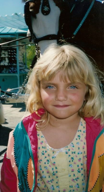
Naturally, she will always be daddy's little girl (to me)!
|
|
|
edm1
Senior Nomad
  
Posts: 568
Registered: 8-23-2006
Location: Oak Hills, Ca
Member Is Offline
|
|
Very nice family pics David! Don't you wish they stay that cute forever? And they do, wait till you get the new arrival, it starts all over again. Are
you gonna babysit him/her? :-) LOL
Congrats, you're lucky you gonna be a grandpa. I'm hoping for the same but my 4 kids are nowhere near that point, even the 30+ eldest (son), we just
don't see any signs of it yet.
|
|
|
wessongroup
Platinum Nomad
       
Posts: 21152
Registered: 8-9-2009
Location: Mission Viejo
Member Is Offline
Mood: Suicide Hot line ... please hold
|
|
Thanks to all, really made me smile... God bless and peace and happiness to you all...
Don't have to say have fun... your smiles tell it all... thanks again
|
|
|
shari
Select Nomad
      
Posts: 13052
Registered: 3-10-2006
Location: bahia asuncion, baja sur
Member Is Offline
Mood: there is no reality except the one contained within us "Herman Hesse"
|
|
oh wow...this grandparent thing is catching!!! muchas felicidades David...wont it be neat to carry photos of the grandkids around in our
wallets...looks like sarah is due pretty soon???
|
|
|
David K
Honored Nomad
        
Posts: 65440
Registered: 8-30-2002
Location: San Diego County
Member Is Offline
Mood: Have Baja Fever
|
|
Thanks Art, wessongroup and Shari... Sept. 3, but maybe sooner?
|
|
|
David K
Honored Nomad
        
Posts: 65440
Registered: 8-30-2002
Location: San Diego County
Member Is Offline
Mood: Have Baja Fever
|
|
Back to Shell Island in 6 days!

[Edited on 6-27-2010 by David K]
|
|
|
edm1
Senior Nomad
  
Posts: 568
Registered: 8-23-2006
Location: Oak Hills, Ca
Member Is Offline
|
|
| Quote: | Originally posted by David K
Back to Shell Island in 6 days!

[Edited on 6-27-2010 by David K] |
Me too, and looking forward to catching some fish to barbecue.
|
|
|
David K
Honored Nomad
        
Posts: 65440
Registered: 8-30-2002
Location: San Diego County
Member Is Offline
Mood: Have Baja Fever
|
|
Bring other food, just in case! For bait: squid, mussels, clams
|
|
|
David K
Honored Nomad
        
Posts: 65440
Registered: 8-30-2002
Location: San Diego County
Member Is Offline
Mood: Have Baja Fever
|
|
Okay amigos, see you there... we started getting ready and will head down Saturday with a return on Tuesday... Looking forward to testing the traction
control goodies again...
When the truck was new, we went to Rob and Connie's (Bahia Santa Maria) over New Year's. The truck glided over the sand without deflating the tires.
Now, it is summer, and the sand acts different than in the winter.
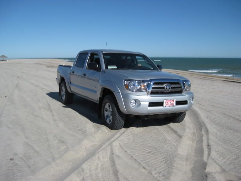
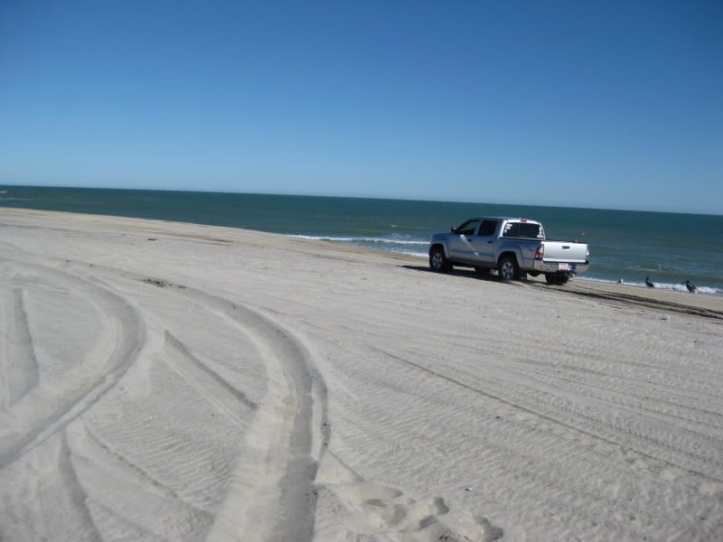
Typically, the coarse sand/ crushed sea shell beach will swallow any vehicle (4WD or 2WD) that doesn't deflate their tires to 10-20 psi. The new
Tacoma now has TRAC (in 4WD High Range), and A-TRAC (in Low Range).
TRAC is a limited slip system that uses the brakes to slow down tires that loose traction and begin to spin freely, and forces torque to the other
tire on that axle that has traction. This prevents the typical one tire in front and one tire in the rear spinning and digging you in, and keeps you
moving.
A-TRAC (Active Traction Control) works almost like having lockers front and rear by nearly matching wheel rotation across the axle for a super strong
limited slip or 'locker action' without the steering problems that lockers have.
You have the ability to turn off the traction devices and have good 'old fashion' 4WD with open differentials... Which I did last New Year's to see if
the TRAC really allowed the sand driving without deflating, or if it was just the condition of the sand...
I turned off the TRAC and withing a 100 feet the truck dug in and got stuck (32 psi, 4WD-Hi). I turned on the A-TRAC, the truck made the typical
A-TRAC noises, shook a bit, and drove itself out of the stuck (without my clearing away sand from the tires or letting any air out).
Once I was out of the stuck, I went back into 4-High (with TRAC on) and continued to drive about freely... it was amazing! I will repeat the test next
weekend and report back!
|
|
|
Ken Cooke
Elite Nomad
     
Posts: 8970
Registered: 2-9-2004
Location: Riverside, CA
Member Is Offline
Mood: Pole Line Road postponed due to injury
|
|
Change of plans
I am planning on leaving for San Felipe on Friday at about noon so that I can show Leidys what San Felipe is like at about dusk. We will get a hotel
room for the night instead of staying at Playas del sol campground. That way, she can be introduced to the Malecon without going to much effort like
if we were camping.
We will meet Art in San Felipe at about noon on Saturday on the Malecon as previously planned.
I do have On-Board Air, and for anyone lowering their tire pressure, I can air back up within about 10 minutes per vehicle.
[Edited on 6-28-2010 by Ken Cooke]
|
|
|
David K
Honored Nomad
        
Posts: 65440
Registered: 8-30-2002
Location: San Diego County
Member Is Offline
Mood: Have Baja Fever
|
|
I also have a quick air pump, if needed.
|
|
|
David K
Honored Nomad
        
Posts: 65440
Registered: 8-30-2002
Location: San Diego County
Member Is Offline
Mood: Have Baja Fever
|
|
July 4 weekend 2009...
| Quote: | Originally posted by Ken Cooke
I am planning on leaving for San Felipe on Friday at about noon so that I can show Leidys what San Felipe is like at about dusk. We will get a hotel
room for the night instead of staying at Playas del sol campground. That way, she can be introduced to the Malecon without going to much effort like
if we were camping.
We will meet Art in San Felipe at about noon on Saturday on the Malecon as previously planned.
I do have On-Board Air, and for anyone lowering their tire pressure, I can air back up within about 10 minutes per vehicle.
[Edited on 6-28-2010 by Ken Cooke] |
Good plan...
We were on Shell Island July 4th last year (2009)... nobody else there (humans that is):


and a view of Baja, from the island!>>>

|
|
|
David K
Honored Nomad
        
Posts: 65440
Registered: 8-30-2002
Location: San Diego County
Member Is Offline
Mood: Have Baja Fever
|
|
Last Year May (Memorial Day 2009) we went to Shell Island with Josh and his girlfriend... to add shade, we tied on a tarp to one side of the sun
canopy and the breeze elevated it...
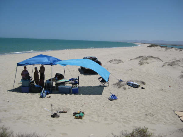
Note tote bags (from Lowe's) bungeed to the tarp and canopy to keep them from blowing away.
[Edited on 6-29-2010 by David K]
|
|
|
David K
Honored Nomad
        
Posts: 65440
Registered: 8-30-2002
Location: San Diego County
Member Is Offline
Mood: Have Baja Fever
|
|
The road across the mud flats going to the island:

This palapa was built in 2006 by ??... it is located about 100 meters south of our camp (seen in distance)... Possible shade structure... just add
tarps (bring tarps Ken)...

Sunrise on Shell Island:

Just No Bad Days... Baja Angel's first time there, July 2005:
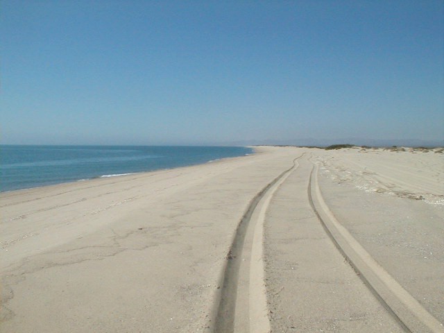

[Edited on 6-29-2010 by David K]
|
|
|
edm1
Senior Nomad
  
Posts: 568
Registered: 8-23-2006
Location: Oak Hills, Ca
Member Is Offline
|
|
David, please tell me whether or not I'm right. That shade structure (fishing palapa?) is SOUTH of your camp shade and North-west of your camp shade
is the unfinished bridge, right? If so, from the main/entrance trail, there is a trail that forks RIGHT to the shade structure; the one that forks
LEFT leads to the unfinished bridge whose south side is the water crossing. The right fork trail is deep sand and that's where I got stuck the first
time I was there 3 years ago, and I can see the palapa clearly from there.
[Edited on 6-29-2010 by edm1]

|
|
|
Ken Cooke
Elite Nomad
     
Posts: 8970
Registered: 2-9-2004
Location: Riverside, CA
Member Is Offline
Mood: Pole Line Road postponed due to injury
|
|
| Quote: | Originally posted by David K
This palapa was built in 2006 by ??... it is located about 100 meters south of our camp (seen in distance)... Possible shade structure... just add
tarps (bring tarps Ken)...
|
Instead of purchasing a new EZ-UP Canopy, I am going to use my existing EZ-UP Dome II (10'x10') frame, and make a visit to one of the military surplus
stores here in town in order to outfit it.
To Art - KM 26 is what David K told me. There are two pylons on the left side of the road about 20 miles south of San Felipe. The dirt road leading
across the mud flats will go south of the broken bridge and the muddy area. Travel directly towards the sand and water, and when the 'Cortez is
visible, follow it north 2 miles. I'm going to eat lunch with the Mrs. between 11:45-12:45 PM on Saturday, on the Malecon, and then we will be ready
to head south.
If you would like to join us for lunch, we will be at the Malecon, packed, and ready to travel after we eat. Otherwise, we will see you on the sand.
|
|
|
David K
Honored Nomad
        
Posts: 65440
Registered: 8-30-2002
Location: San Diego County
Member Is Offline
Mood: Have Baja Fever
|
|
Hi Art,
There is a fisherman's hut ~ 1/4 mile south of the abandoned concrete bridge... occupied during their fishing season. Our camp, and that shade
structure in the photo above, is ~2 miles NORTH of the bridge/ access road. The palapa you saw is not the one in my photo... The beach is all deep
sand and will require deflating or traction control.
The original access road onto the island went southeast across the mud flat and the fisherman's hut is at the end of it. The 'new' (1984) access road
was an elevated causeway going straight east from Km. 26 and across the mud flat to the concrete bridge. It crossed over the older road on the mud
flat. The elevated road has melted back down to the flats almost totally. The concrete bridge at the end, remains a couple feet higher than the
elevated roadbed, and is useless now. During high tides, the deepest water crossing is the detour around the south side of the bridge.
You cannot see our camp 2 miles north of where the access road reaches the beach. At low tide, driving on the firm, wet sand, you cannot see our camp
when driving right by, as the beach is so steep and big. We set up next to the low sand dunes... We can see Rancho (Laguna) Percebu, which is a mile
further north and across the lagoon from the top of the dune behind our camp.
The island is 4 miles long... one mile to the south of the road and 3 miles to the north.
[Edited on 6-29-2010 by David K]
|
|
|
Ken Cooke
Elite Nomad
     
Posts: 8970
Registered: 2-9-2004
Location: Riverside, CA
Member Is Offline
Mood: Pole Line Road postponed due to injury
|
|
| Quote: | Originally posted by David K
The elevated road has melted back down to the flats almost totally. The concrete bridge at the end, remains a couple feet higher than the elevated
roadbed, and is useless now. During high tides, the deepest water crossing is the detour around the south side of the bridge. |
David,
Exactly how necessary was that elevated roadbed during high tides? Does any of that drainage equipment serve any function?
|
|
|
David K
Honored Nomad
        
Posts: 65440
Registered: 8-30-2002
Location: San Diego County
Member Is Offline
Mood: Have Baja Fever
|
|
It provided easy access onto the island during any high tide... Previously (and again now) we had to drive in sea water during high tide if we had to
get on or off the island then... the mud was still bad even if it ws low tide! If you placed your tires in the firmest track (road), which was also
the lowest and deepest with water, you didn't get stuck. I had Subarus with 13" tires and went there many times.
This was only around full and new moon phases. Next weekend is a quarter moon... and since global sea levels have NOT risen in the 32 years I have
been driving onto the island, the mud flats should not be too wet or wet at all.
|
|
|
| Pages:
1
2
3
4
5 |

