| Pages:
1
2
3
4 |
David K
Honored Nomad
        
Posts: 65401
Registered: 8-30-2002
Location: San Diego County
Member Is Offline
Mood: Have Baja Fever
|
|
Quote: Originally posted by rich t  | Paul, i can't get this picture posting thing to work, can you post pic's,
if so will send pics to you of the mini summit, if not will try David K |
Rich, I will always be happy to post photos for those who haven't followed the steps. However, if you want to try again before sending them to me...
HERE ARE THE STEPS:
There are many photo hosting sites, Photobucket.com is one used by many here, it is free for basic membership and very cheap for advanced.
1) Create an album for your trip or subject on Photobucket.
2) Click Upload (top center) to transfer photos from your PC folder to your Photobucket album.
3) Click on the gear symbol on the right corner of the box you see on the screen...

4) Select 800 (full size) or 640 (large size) for Nomad posting...
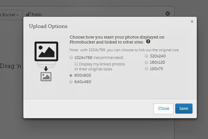
100x75 is the Avatar size, fyi.
5) Click SAVE!
6) Select photos you want to share on Nomad (or other forums) by pressing the Choose Photos & Videos button (or for the entire folder of photos,
click Choose Folder).
Once done with uploading photos, make your post here on Baja Nomad and add photos using the IMG link from the choices of links for each photo in your
album. Copy and paste that link in your Nomad thread, double spacing between links. Add a caption to the photo if desired... Click Preview Post to
check your post... if okay, click Post Reply.
|
|
|
David K
Honored Nomad
        
Posts: 65401
Registered: 8-30-2002
Location: San Diego County
Member Is Offline
Mood: Have Baja Fever
|
|
Rich, This is then final step:
Once done with uploading photos, make your post here on Baja Nomad and add photos using the IMG link from the choices of links for each photo
in your album. Copy and paste that link in your Nomad thread, double spacing between links. Add a caption to the photo if desired... Click Preview
Post to check your post... if okay, click Post Reply.
|
|
|
David K
Honored Nomad
        
Posts: 65401
Registered: 8-30-2002
Location: San Diego County
Member Is Offline
Mood: Have Baja Fever
|
|
Under each photo on your Photobucket album (as well as next to the photo on the individual photo page) are links for different places to post your
photos. For message boards and forums (like Nomad), use the link called "IMG"... Copy the link and paste it on your Nomad post. You can put several
photos in a post. Add captions and double space between the photo links for a clean look.
|
|
|
Ken Cooke
Elite Nomad
     
Posts: 8970
Registered: 2-9-2004
Location: Riverside, CA
Member Is Offline
Mood: Pole Line Road postponed due to injury
|
|
I have been sharing this link with some of my friends to show what hardcore Jeeps can do when in Baja!
|
|
|
Ken Cooke
Elite Nomad
     
Posts: 8970
Registered: 2-9-2004
Location: Riverside, CA
Member Is Offline
Mood: Pole Line Road postponed due to injury
|
|
Okay, haters! Here's your photos!
|
|
|
bajatrailrider
Ultra Nomad
    
Posts: 2504
Registered: 1-24-2015
Location: Mexico
Member Is Offline
Mood: Happy
|
|
Thank you KEN great photos. There is no jeep haters just jeep wanna bees. Your jeep and Eds the real deal.
|
|
|
David K
Honored Nomad
        
Posts: 65401
Registered: 8-30-2002
Location: San Diego County
Member Is Offline
Mood: Have Baja Fever
|
|
Are you talking about your Facebook page, Ken? There are no new photo links in your new (2018) post...
No hate. Afterall, I am a former Jeep owner and always a Jeep history lover... I just would probably never buy one again.
|
|
|
advrider
Super Nomad
   
Posts: 1917
Registered: 10-2-2015
Member Is Offline
|
|
Quote: Originally posted by David K  | Are you talking about your Facebook page, Ken? There are no new photo links in your new (2018) post...
No hate. Afterall, I am a former Jeep owner and always a Jeep history lover... I just would probably never buy one again. |
I was going to point out the same thing,I don't see anything! I thought maybe there was a secret knock or handshake I didn't know about. I'm defiantly
a jeep guy and really need to get my scrambler down to Baja!
|
|
|
David K
Honored Nomad
        
Posts: 65401
Registered: 8-30-2002
Location: San Diego County
Member Is Offline
Mood: Have Baja Fever
|
|
Here is the video going down the La Turquesa Grade from the same guy who showed us how the Camino Real looks going down to Gonzaga from the mission:
https://www.youtube.com/watch?v=c58vTjay26E
This is also known as Kacey's XR Ride (Kacey Smith) and Coco's Shortcut.
|
|
|
Ken Cooke
Elite Nomad
     
Posts: 8970
Registered: 2-9-2004
Location: Riverside, CA
Member Is Offline
Mood: Pole Line Road postponed due to injury
|
|
Quote: Originally posted by David K  | I was sent some pretty cool off roading photos today and told I could share them with you guys...
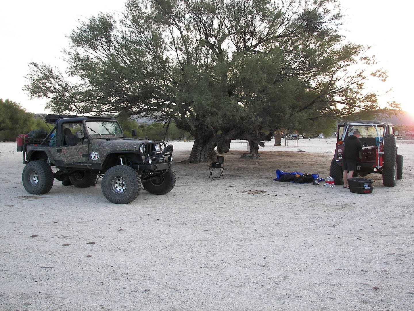
Start of Trail, Rancho Santa Ynez.
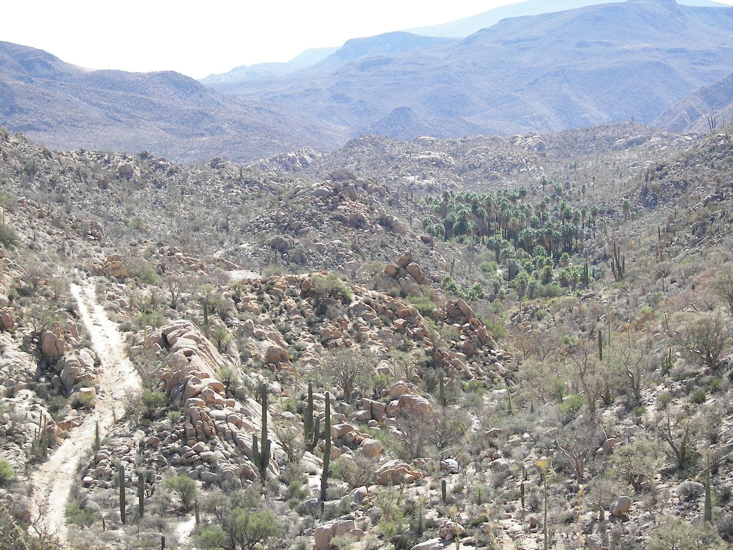
Nearing the Widowmaker, view about 2-3 miles west of the mission.
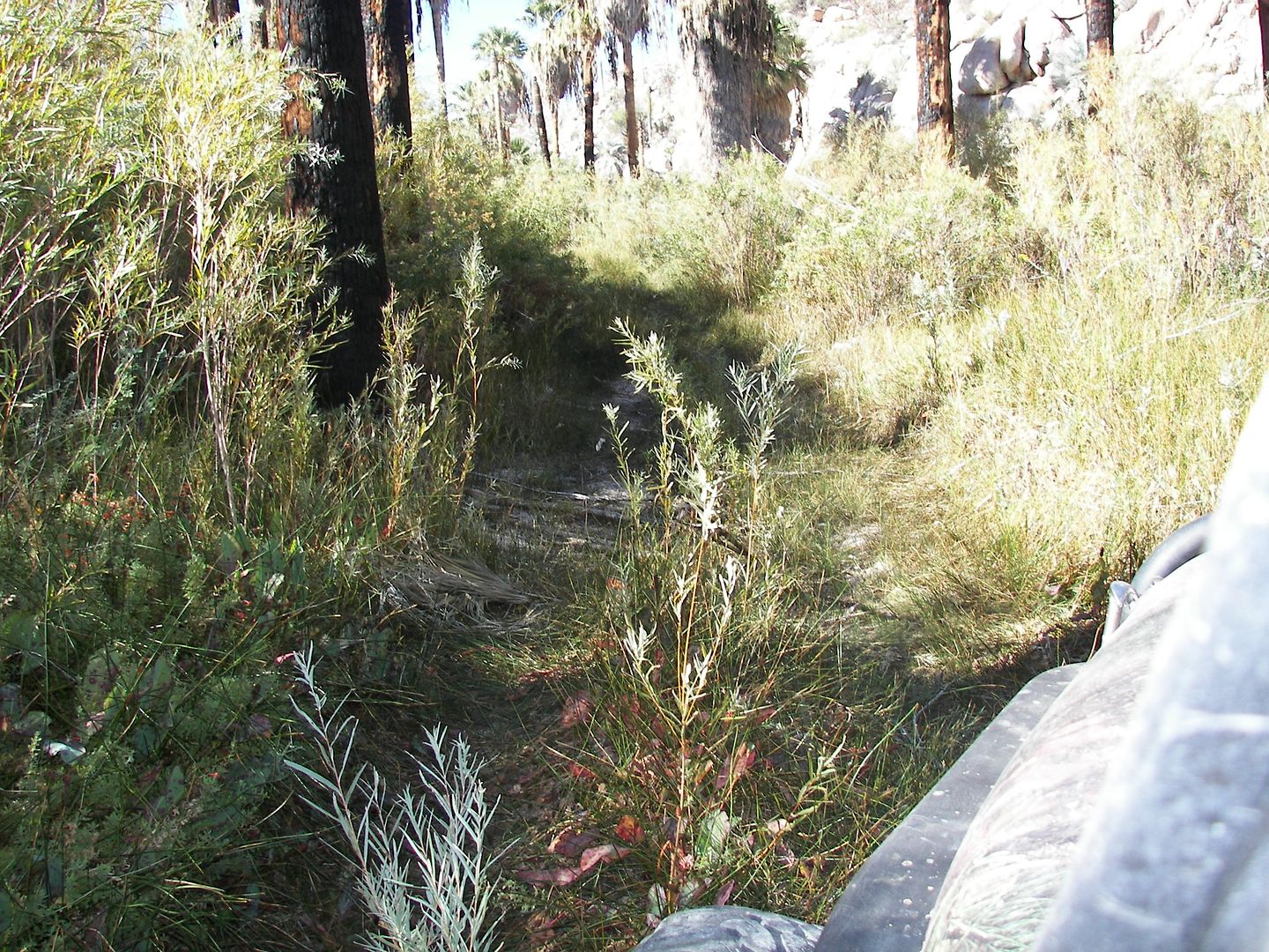
The Bog, but dry... less than a mile from the mission.
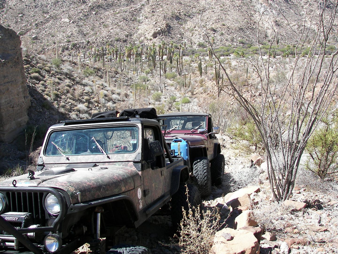
Just over 2 miles east of the mission, on the long-ago bulldozed roadbed that ends on the ridge, above the deep canyon (where road construction to
Punta Final was abandoned by Fred Hampe in the late 1960s).
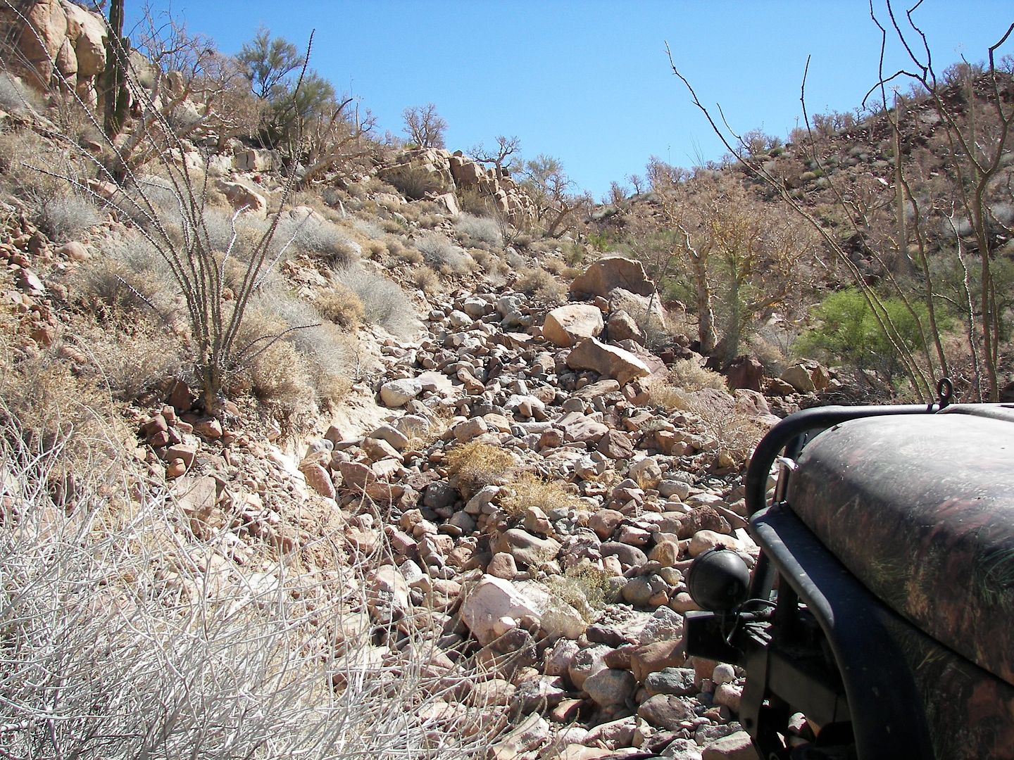
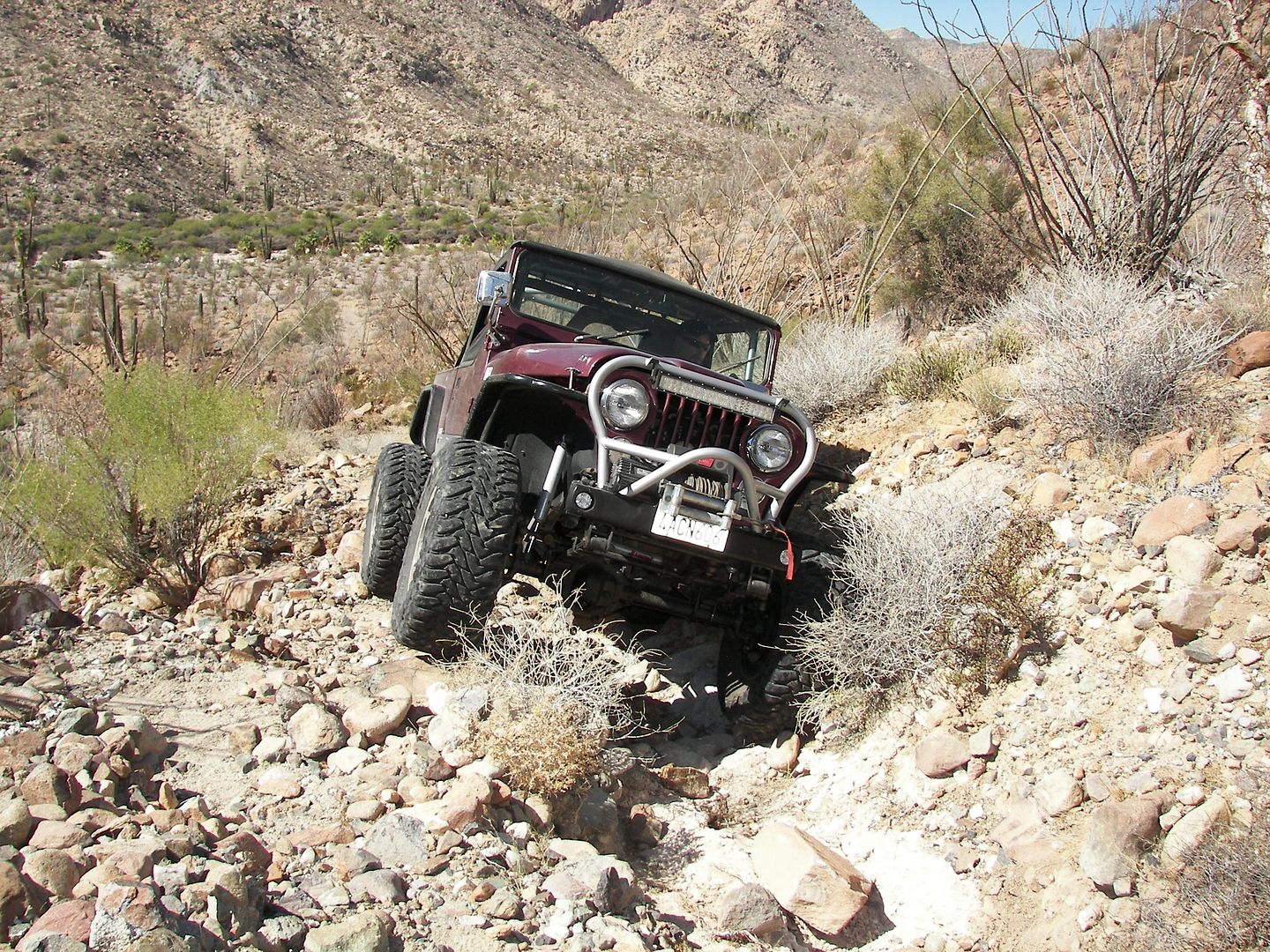
+++++++++++++++++++++++++++++++++++++++++++++++++++++++++
On the old mine road between Molino de Lacy and Coco's Corner:
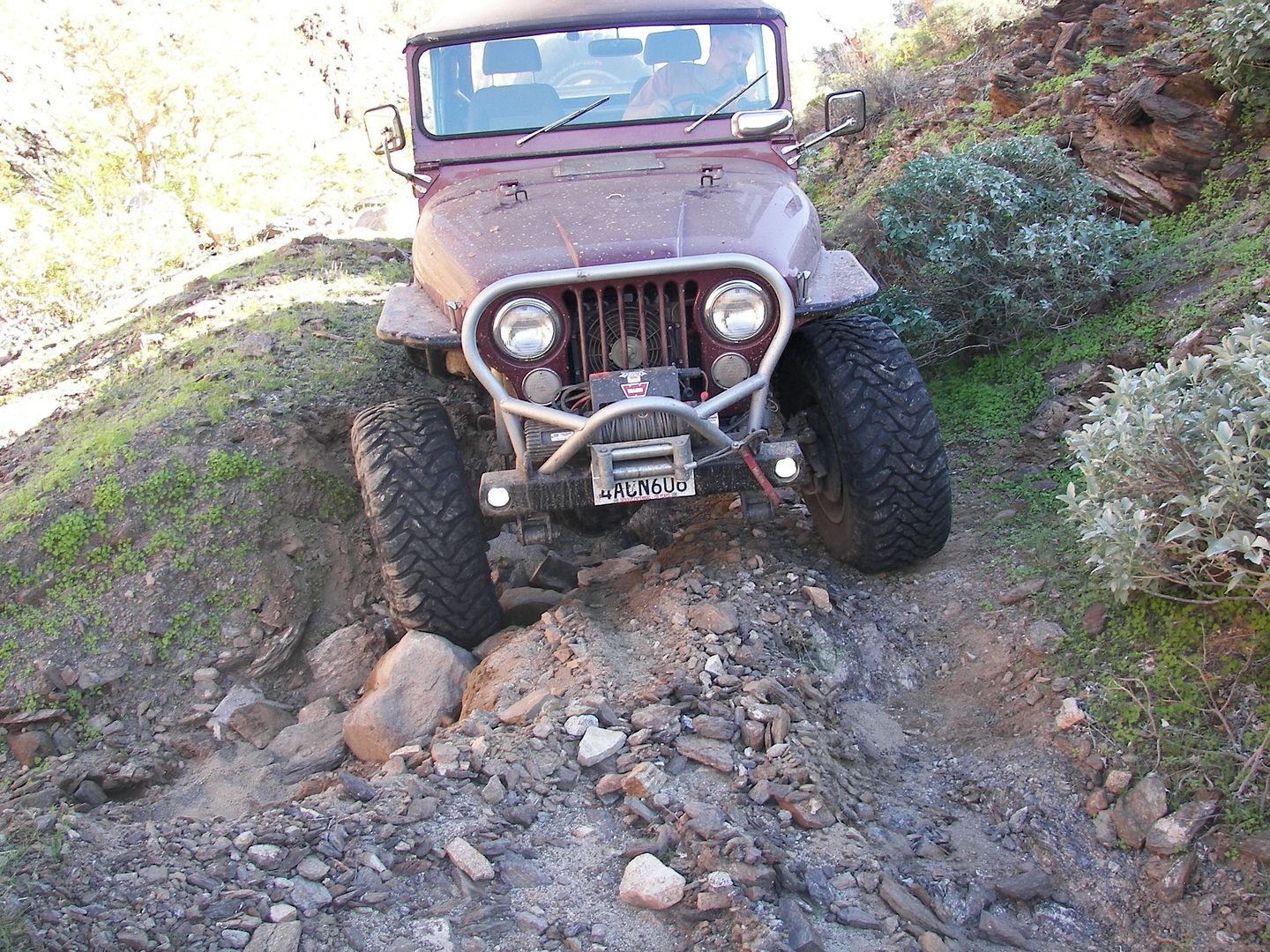
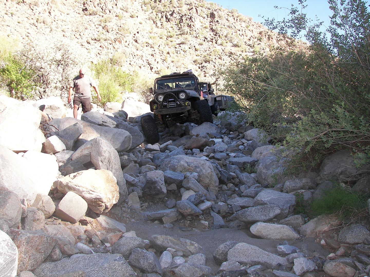
A BIG THANK YOU TO RICH T. !!!   
[Edited on 4-24-2016 by David K] |
|
|
|
bajatrailrider
Ultra Nomad
    
Posts: 2504
Registered: 1-24-2015
Location: Mexico
Member Is Offline
Mood: Happy
|
|
You where close on the name of that trail David. Its called XR trail or Freds
Tractor trail. The guys look like they went down it the easy way. The first time me and Mike did it we went up it. At the bottom there where boulders
all the way to the hill climb. I did it with a gal on the back crashed many times. Our first time up over 22 years ago. I'm hoping to go there again
on bikes this Feb or March.
|
|
|
mcnut
Nomad
 
Posts: 177
Registered: 12-9-2013
Location: Dammeron Valley, UT
Member Is Offline
|
|
Looks to me like the photos are from 2 different routes.
The first batch would seem to document the route from Santa Ines to just east of Mission Santa Maria, perhaps to the end of the dozer cut.
+++++++++++++++++
The second set (separated from the first by plus marks) would seem to document Freds Tractor Trail (La Turquesa Grade).
Bruce
|
|
|
bajatrailrider
Ultra Nomad
    
Posts: 2504
Registered: 1-24-2015
Location: Mexico
Member Is Offline
Mood: Happy
|
|
Has anybody done it recently from Cocos up. Wondering if the bottom is still all round big lose rocks. All the way to start of hill climb the first
20ft of hill climb the hard part. There used to be a 2ft step with big rocks at bottom.
|
|
|
PaulW
Ultra Nomad
    
Posts: 3113
Registered: 5-21-2013
Member Is Offline
|
|
Been years since I drove it, But i did find the star on the new highway
Refer to this:
http://forums.bajanomad.com/viewthread.php?tid=88271#pid1101...
Turk on new road 29° 34.356'N, 114° 22.029'W
|
|
|
David K
Honored Nomad
        
Posts: 65401
Registered: 8-30-2002
Location: San Diego County
Member Is Offline
Mood: Have Baja Fever
|
|
Quote: Originally posted by mcnut  | Looks to me like the photos are from 2 different routes.
The first batch would seem to document the route from Santa Ines to just east of Mission Santa Maria, perhaps to the end of the dozer cut.
+++++++++++++++++
The second set (separated from the first by plus marks) would seem to document Freds Tractor Trail (La Turquesa Grade).
Bruce |
That is exactly correct. Maybe Ken didn't include the captions from the original post. The end story is there is no Jeep driven to Gonzaga from the
mission in or parallel to the Samta María Canyon.
|
|
|
David K
Honored Nomad
        
Posts: 65401
Registered: 8-30-2002
Location: San Diego County
Member Is Offline
Mood: Have Baja Fever
|
|
Quote: Originally posted by bajatrailrider  | | Has anybody done it recently from Cocos up. Wondering if the bottom is still all round big lose rocks. All the way to start of hill climb the first
20ft of hill climb the hard part. There used to be a 2ft step with big rocks at bottom. |
Yes, but not recently... about 10 years ago Roy "The squarecircle" did in his Land Rover LR-3... with help getting across the valley floor by TW and
his brother (I think) clearing the way and scouting a route. This was a vehicle road, but flash floods in the valley bottom erased the road between
the turquoise mine and the bottom of the grade.
I found the access road to the grade off Hwy. 1 on a trip in February 2007: http://vivabaja.com/207/
Ken Cooke and others began to seek a road from the Turquoise mine to the foot of the mountain. Steekers took a nice photo clearly showing the grade,
from the turquoise mine.
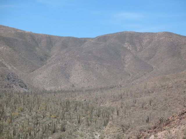
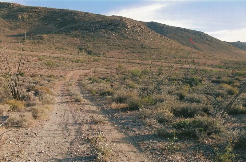
Here again are Roy's photos:
The bottom was the hardest part, as it was very steep, as you can see...
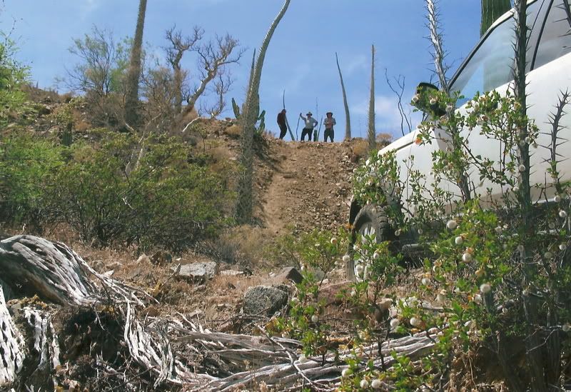
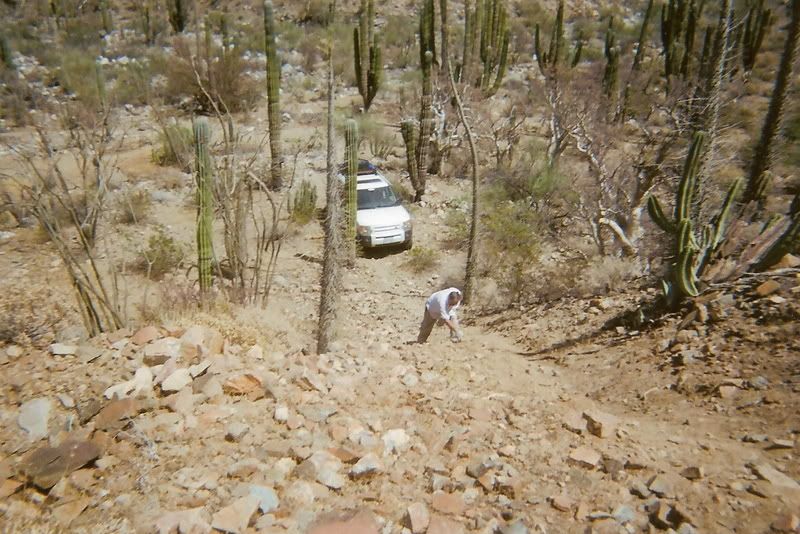
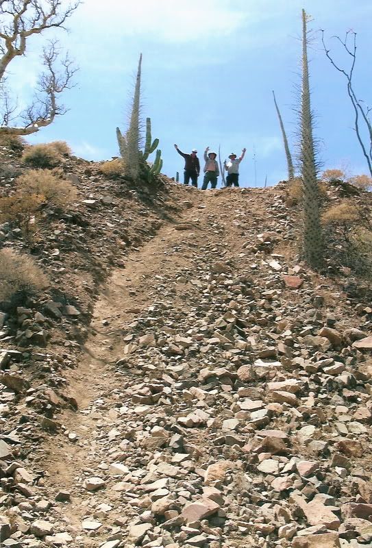
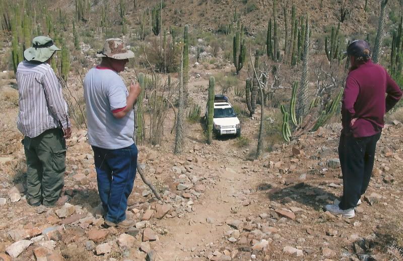
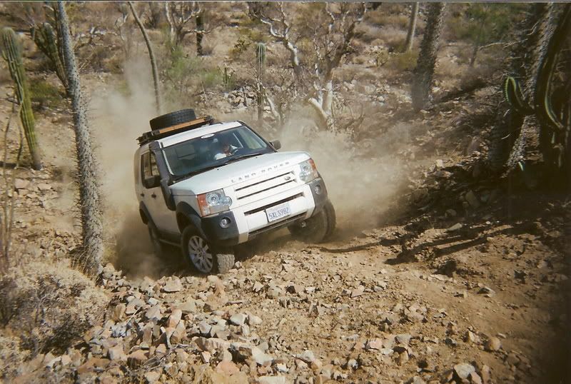
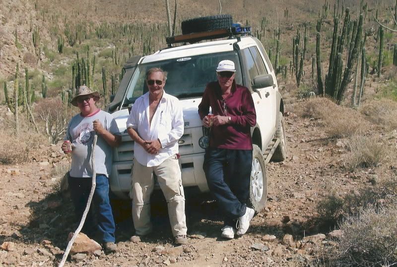
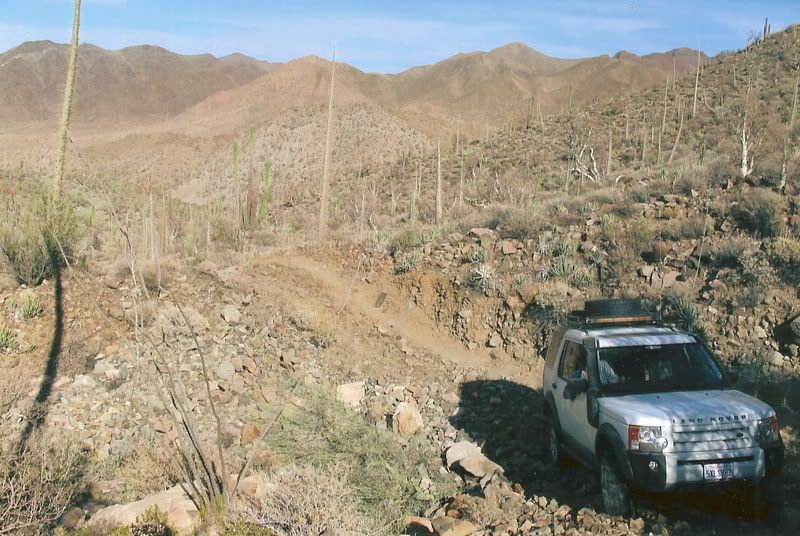
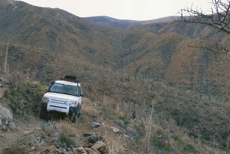
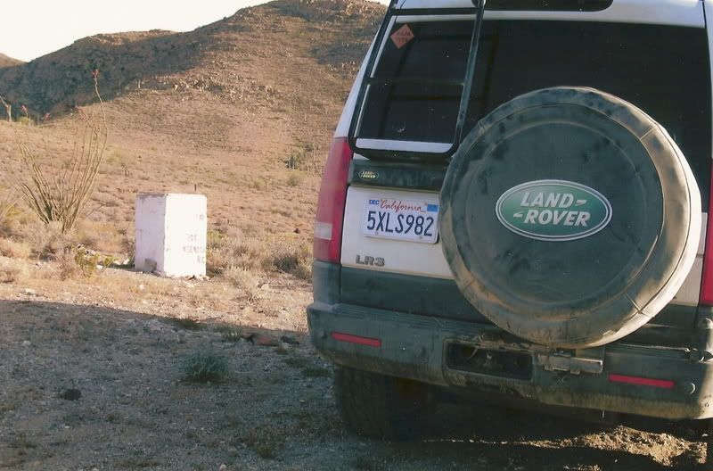
The top
[Edited on 1-31-2018 by David K]
|
|
|
bajatrailrider
Ultra Nomad
    
Posts: 2504
Registered: 1-24-2015
Location: Mexico
Member Is Offline
Mood: Happy
|
|
Thank you David it still looks hard for a 4 wheeler. From when me and Mike went up on motos it looks well worn in.
|
|
|
David K
Honored Nomad
        
Posts: 65401
Registered: 8-30-2002
Location: San Diego County
Member Is Offline
Mood: Have Baja Fever
|
|
Roy has the largest tires that would fit and the LR-3 has a traction control system similar to Toyota's A-TRAC which mimics lockers on the front and
rear. Roy is also an experienced four-wheeler and doesn't scare easily!
|
|
|
rich t
Nomad
 
Posts: 102
Registered: 4-18-2016
Member Is Offline
|
|
XR Trail
Bajatrailrider and Mcnut, We went up the Xr Trail in those photos, it was after the 2014 Hurricane and we actually had to get a half mile off the
regular trail to get thru, it has been graded and the old route re-established since then, the photos you were refering to are from 2 different areas
but on the same trip, the XR trail is doable from either direction, it looks like they ran a grader through the upper part heading south, alot of the
rocks have been removed, we were thru there last month. We did it last year on the Motos, it was an ass kicker.
|
|
|
mcnut
Nomad
 
Posts: 177
Registered: 12-9-2013
Location: Dammeron Valley, UT
Member Is Offline
|
|
Thanks for the update Rich.
Bruce
|
|
|
| Pages:
1
2
3
4 |

