| Pages:
1
2
3
4
5 |
Gscott
Junior Nomad

Posts: 70
Registered: 1-23-2017
Member Is Offline
|
|
What about the ITMB Baja map?
I haven't heard opinions on the ITMB map. So? I can get this map and the Nat'l Geo map pack, I have copies of the AAA map, but I can't get an
Almanac for a reasonable price.
The AAA maps don't have much detail for exploring. Which is better, the NG or the ITMB?
Any chance anyone will print the almanac again? I guess there is no point waiting for the people at baja-almanac.com.
|
|
|
TMW
Select Nomad
      
Posts: 10659
Registered: 9-1-2003
Location: Bakersfield, CA
Member Is Offline
|
|
Refresh my memory, what is a ITMB map?
As to the almanac the copyright owner is dead. I think David K and M&E Books should buy the rights and publish new copies. Maybe BajaBound would
be interested. Either way David K could update the almanac in the areas where there are mistakes.
|
|
|
Franco
Junior Nomad

Posts: 51
Registered: 6-12-2017
Member Is Offline
|
|
Quote: Originally posted by Gscott  | I haven't heard opinions on the ITMB map. So? I can get this map and the Nat'l Geo map pack, I have copies of the AAA map, but I can't get an
Almanac for a reasonable price.
The AAA maps don't have much detail for exploring. Which is better, the NG or the ITMB?
Any chance anyone will print the almanac again? I guess there is no point waiting for the people at baja-almanac.com. |
ITMB provides detail for a few of the dirt roads. Provides information for two wheel off roading. 4X4 off road in the Baja is best using a GPS.
|
|
|
David K
Honored Nomad
        
Posts: 65411
Registered: 8-30-2002
Location: San Diego County
Member Is Offline
Mood: Have Baja Fever
|
|
Quote: Originally posted by TMW  | Refresh my memory, what is a ITMB map?
As to the almanac the copyright owner is dead. I think David K and M&E Books should buy the rights and publish new copies. Maybe BajaBound would
be interested. Either way David K could update the almanac in the areas where there are mistakes. |
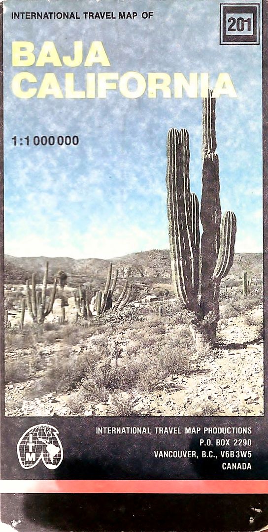
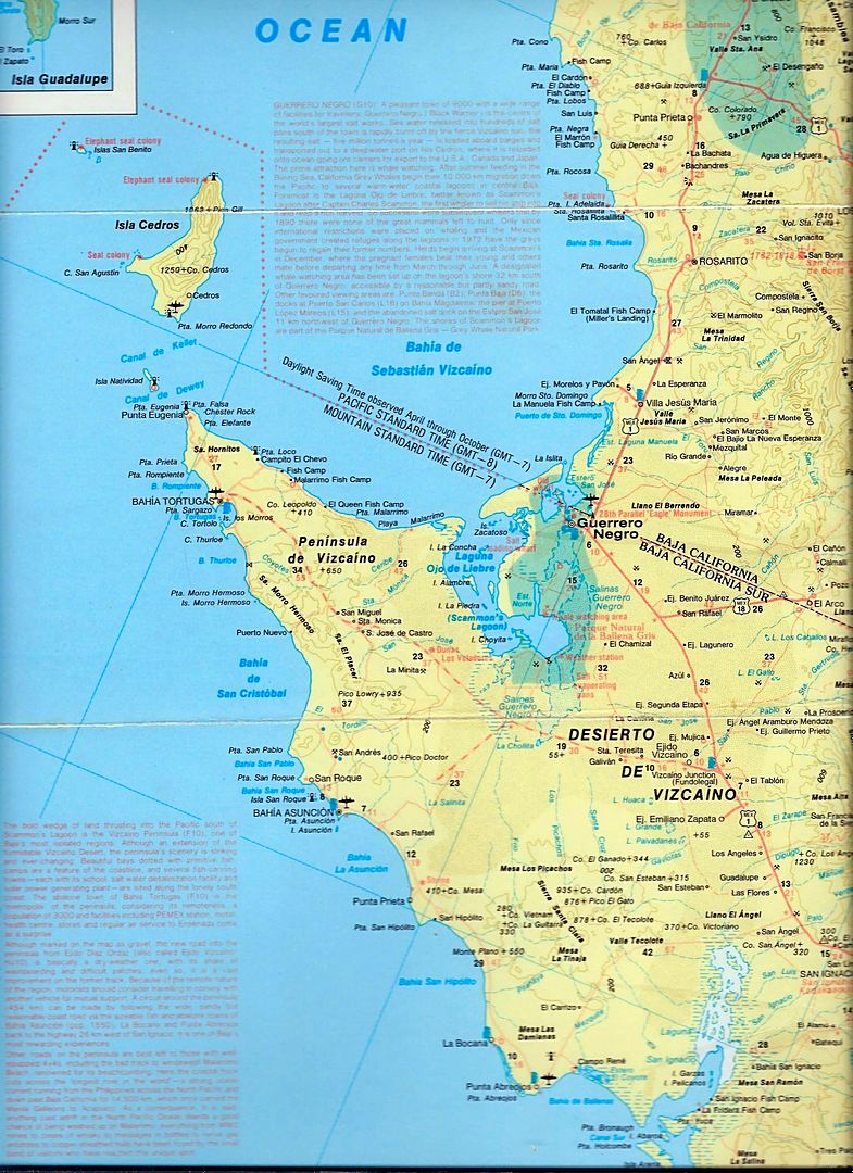
ITMB is (was?) made in Vancouver, Canada. A folding map of the peninsula. The first edition was great (1989); It had topographic contour lines and
mileages on major roads. Many location details were printed on the map around the peninsula (albeit in tiny text). I had mine laminated and made it a
wall map.
Newer editions were terrible (in my opinion). The roads were not correctly shown, names were wrong, etc. Useless. The first Baja Almanac appeared
after that ITMB map and that was it for providing easy to use, topo-road maps. It had replaced the huge (but super detailed) Baja Topo Atlas of the
late 80s and early 90s.
Here is the cover of the folding map first edition... lamination reflects light during scanning, it is darker in reality:

As for the Baja Almanac revision... I am onboard for that and efforts are being made to make that possible. It would be a huge service to the Baja
traveler, so if not me, I hope someone... anyone, can keep it alive!
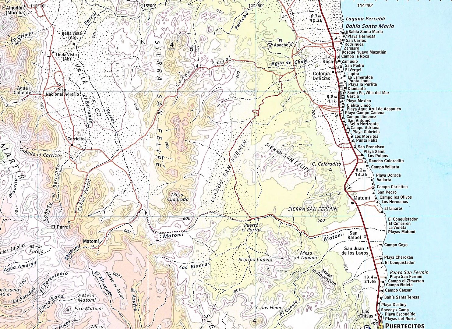
I just scanned part of the ITMB 1989 map:

[Edited on 7-2-2017 by David K]
|
|
|
Marc
Ultra Nomad
    
Posts: 2802
Registered: 5-15-2010
Location: San Francisco & Palm Springs
Member Is Offline
Mood: Waiting
|
|
I have the ITMP second edition. Totally worn out and held together with tape. IMHO the best map of the peninsula.
|
|
|
basautter
Senior Nomad
  
Posts: 862
Registered: 7-1-2013
Member Is Offline
|
|
I like the e32 map mentioned above, or the AAA Baja map. I have the Baja Almanac, and like it the best, but the other two work fine. I would not pay
$100.00 for the BA. $50.00 maybe...
|
|
|
pacificobob
Super Nomad
   
Posts: 2340
Registered: 4-23-2006
Member Is Offline
|
|
I'll be willing bet 90% of maps made in the last 20 years are plagiarized to some degree from various digital sources. I'm no cartographer, just
guessing. i have been in parts of Chihuahua and Durango where i can guarantee the map maker(in this case guia rojo) was never there. villages in the
wrong area ect.
|
|
|
Gscott
Junior Nomad

Posts: 70
Registered: 1-23-2017
Member Is Offline
|
|
Thanks for the reviews. Once again it looks like I'm searching for used and out of print resources..
I'll get the Nat Geo map pack for now. I do hope new editions of the almanac become available again, it's just crazy to think there may not be an
atlas for this area...
|
|
|
TMW
Select Nomad
      
Posts: 10659
Registered: 9-1-2003
Location: Bakersfield, CA
Member Is Offline
|
|
If you are looking at a specific area use Google Earth. If the area on GE is dated before Nov 2014 it may not be correct.
|
|
|
Alm
Ultra Nomad
    
Posts: 2753
Registered: 5-10-2011
Member Is Offline
|
|
Quote: Originally posted by rts551  | | This is why I no longer recommend maps. They are grossly out of date. A good GPS and and associated baja is far better and easier to keep up to
date. |
x2. Especially if you drive same rout year after year 
62 pages, including few index text pages, in mine. Never crossed my mind that people are still buying it, will put mine on Ebay when have time.
|
|
|
David K
Honored Nomad
        
Posts: 65411
Registered: 8-30-2002
Location: San Diego County
Member Is Offline
Mood: Have Baja Fever
|
|
I think the desire for an Almanac-type map is for the backcountry and not so much for those looking for a gas station or Hwy. 1 mileages?
Looking at a real map, on paper seems so much more gratifying than staring at a glowing screen to some of us.
This kind of 'explorable area':

|
|
|
Alm
Ultra Nomad
    
Posts: 2753
Registered: 5-10-2011
Member Is Offline
|
|
It's nice to hold printed map in hands, nice colors, yellow-brown terrain, blue sea. PC screen is less strain on my old eyes, slight touch of the
scroll wheel zooms it up or makes fonts bigger.
Actually I don't have a GPS in my car except for a very old handlheld that I rarely use. Those 7" GPS that I've seen weren't too bad. "Glowing"
back-lighted screen makes it easier to read, better colors and contrast than a printed map.
|
|
|
chrishaynesusa
Junior Nomad

Posts: 65
Registered: 8-19-2017
Member Is Offline
|
|
Just as a progress report and to confirm I do use the search function 
I found a copy of the Baja Almanac(s) Norte & Sur on eBay, where I won the bid at about 50$ each.
Given the amount of note taking room on each page and the level of detail it is my favorite so far.
And I am contemplating making copies of them.
All others found on book search engines are in the 200-1200 dollar range(which is ludicrous)
I also have the AAA baja map Copright 2003/4
and bought within the last month the National Geographic Norte/Sur dual map pack(copyright 2008 on Amazon).
I cant tell you how many dead / deleted / domain gone links I have found in this search.
|
|
|
David K
Honored Nomad
        
Posts: 65411
Registered: 8-30-2002
Location: San Diego County
Member Is Offline
Mood: Have Baja Fever
|
|
Good job.
The Norte/ Sur double book Almanac is from about 1997 or 1998. Landon did not date the edition. I bought them in 1999 or 2000, I think? They are 8.5"
× 11".
In 2003, Landon combined them into one book and enhanced the maps into full color topography.
In 2009, he created a larger map book in page size, but the scale is smaller.
|
|
|
PaulW
Ultra Nomad
    
Posts: 3113
Registered: 5-21-2013
Member Is Offline
|
|
So what to do. I have all the maps discussed. I have a GPS with Murdock maps.
Now I am working on the tablet method. I like the ease of use and large clear viewing screen. Trouble is Baja maps for a tablet (phone) have not been
found. Has anyone got any map suggestions other than the unacceptable Earthmate map?
|
|
|
David K
Honored Nomad
        
Posts: 65411
Registered: 8-30-2002
Location: San Diego County
Member Is Offline
Mood: Have Baja Fever
|
|
What about LB Maps?
http://www.lbmaps.com/lb_baja.htm
[Edited on 9-18-2017 by David K]
|
|
|
PaulW
Ultra Nomad
    
Posts: 3113
Registered: 5-21-2013
Member Is Offline
|
|
For the GPS yes. Not for the tablet/phone.
|
|
|
David K
Honored Nomad
        
Posts: 65411
Registered: 8-30-2002
Location: San Diego County
Member Is Offline
Mood: Have Baja Fever
|
|
Well, keep working on decoding the INEGI site so we can use the color topo maps like Landon did.
|
|
|
Gscott
Junior Nomad

Posts: 70
Registered: 1-23-2017
Member Is Offline
|
|
What tablet? Android? Any Garmin .img should open in Oruxmap on Android.
Of course there is Open Street Map. There are tiles for the whole world, not huge detail in the Baja maps yet. But you can help build the dataset!
http://garmin.openstreetmap.nl/
[Edited on 9-19-2017 by Gscott]
|
|
|
PaulW
Ultra Nomad
    
Posts: 3113
Registered: 5-21-2013
Member Is Offline
|
|
There are many posts on the web for people looking for a Baja background map for the Earthmate tool we use with InReach. Anyway so far nobody has come
up with a map suggestion. People asking about the map are bikers, surfers, whale watchers, and off road drivers like us.
Earthmate works on IPhone & Andriod devices
Yes, there are plenty of maps that work on those platforms, but all suck for Baja and are useless unless they are compatible for Earthmate download.
Life is way to short to become a digital mapping guy.
|
|
|
| Pages:
1
2
3
4
5 |

