| Pages:
1
2
3 |
4x4abc
Ultra Nomad
    
Posts: 4447
Registered: 4-24-2009
Location: La Paz, BCS
Member Is Offline
Mood: happy - always
|
|
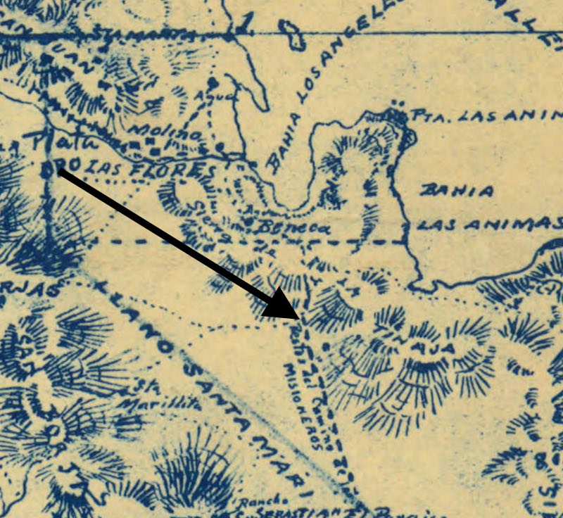
Around Las Flores
location way off
whole mountain ranges are miles off, going in the wrong direction
non existing Valleys (LLanos) are placed where mountains are
Arroyos have wrong names and flow in the wrong direction
who was this Goldbaum guy?
Harald Pietschmann
|
|
|
David K
Honored Nomad
        
Posts: 65382
Registered: 8-30-2002
Location: San Diego County
Member Is Offline
Mood: Have Baja Fever
|
|
No question the map is not all accurate. Many maps over 100 years old cannot be used to navigate today.
The boys in 1921 were not around San Borja or Las Flores.
The map might be a clue to find their route to Punta Prieta and that was my interest in using Goldbaum's map. It does have Agua Leon and Leon Grande,
north of Punta Prieta.
|
|
|
mtgoat666
Platinum Nomad
       
Posts: 20291
Registered: 9-16-2006
Location: San Diego
Member Is Offline
Mood: Hot n spicy
|
|
Quote: Originally posted by 4x4abc  | Around Las Flores
location way off
whole mountain ranges are miles off, going in the wrong direction
non existing Valleys (LLanos) are placed where mountains are
Arroyos have wrong names and flow in the wrong direction
who was this Goldbaum guy?
|
Goldbaum did what he could with what he had. Sketches of wanderings.
The great period of mapping the west took big government topo mapping programs (and science), just like later creation of GPS took big govt (and
science).
Sometimes big govt (and science) are great, eh?
[Edited on 12-13-2021 by mtgoat666]
Woke!
Hands off!
“Por el bien de todos, primero los pobres.”
“...ask not what your country can do for you – ask what you can do for your country.” “My fellow citizens of the world: ask not what America
will do for you, but what together we can do for the freedom of man.”
Pronoun: the royal we
|
|
|
4x4abc
Ultra Nomad
    
Posts: 4447
Registered: 4-24-2009
Location: La Paz, BCS
Member Is Offline
Mood: happy - always
|
|
Goldbaum's map had a major influence
up until 1955 all other map makers copied his mistakes
1956 Gulick is the first accurate map.
the technology for accurate maps has been around for a long time
but since so few traveled the center of Baja, nobody ever cared to used techniques to put locations on their right place on the map
travel on water has been very important for several hundred years
so accurate maps were needed
the tools were available
and they were used by every captain
that is why you have an accurate coastline of Baja on 1700's Jesuit maps
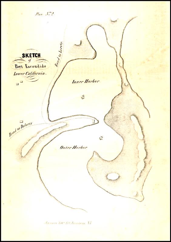
but the interior of Baja was not documented in detail
survey tools allowed the Jesuits to put their missions and other important places on their maps with an accuracy of a few feet
1849 map below
Harald Pietschmann
|
|
|
David K
Honored Nomad
        
Posts: 65382
Registered: 8-30-2002
Location: San Diego County
Member Is Offline
Mood: Have Baja Fever
|
|
Howard Gulick was one of my 'Baja Heroes'...
He inspired me to draw maps and write road logs. I was fortunate to have met him, just prior to our 1966 drive from Tijuana to the tip. He gave my dad
the latest tips on the road, camping places, and short cuts.
Howard Gulick was an engineer for the city of Glendale. Walt Wheelock (La Siesta Press) and Andy Anderson were co-workers there with Howard. Baja was
a big deal to all three of them.
My dad was Andy Anderson's dentist and Andy turned my dad onto his getting a Jeep Wagoneer to get to the great fishing places in Baja. Andy was a
close friend of Howard Gulick and accompanied him on many of Howard's mapping trips in the 50s and 60s.
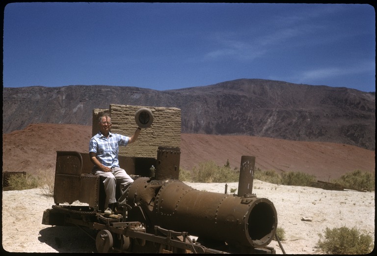
A 1959 photo at Las Flores of Howard Gulick.
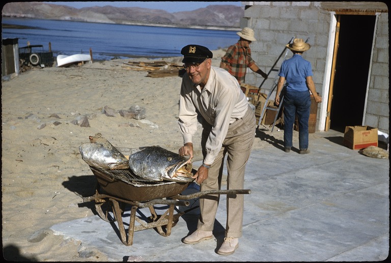
Andy Anderson in 1958 at the future site of Alfonsina's.
I last visited with Andy in 1976. It was at Andy's home that I met Howard Gulick, in 1966. I was almost 9!
See all of Howard's Baja California photos: https://library.ucsd.edu/dc/search?utf8=%E2%9C%93&xf=%7B...
|
|
|
John Harper
Super Nomad
   
Posts: 2289
Registered: 3-9-2017
Location: SoCal
Member Is Offline
|
|
It sure seems like there is evidence of a much wetter climate in Baja in the past. The number of waterworks, desolate ranchos, and other structures
that lie in dried up canyons and valleys today says something for sure.
And, that's just 300 years ago, or less. I've seen a local creek go dry in just the last 10 years, taking a healthy trout population with it. I
guess man has always wanted things to stay the same, but they never do.
John
|
|
|
John Harper
Super Nomad
   
Posts: 2289
Registered: 3-9-2017
Location: SoCal
Member Is Offline
|
|
Check out the creases on those khakis!!! He'd pass inspection for sure.
John
[Edited on 12-15-2021 by John Harper]
|
|
|
John Harper
Super Nomad
   
Posts: 2289
Registered: 3-9-2017
Location: SoCal
Member Is Offline
|
|
Quote: Originally posted by David K  |
So true!
Everything changes... there is no 'normal' weather or climate, only that which we experience. Man (and animals) simply adapt, move, or die.
When I was a kid (1960s), and remember different weather patterns; So, was that normal or is the weather we experience now 'normal'? I think that
there is no normal, there only is what it is!
 
|
We're the same age. I remember Del Mar flooding in college, late 70's, and taking a canoe from Lake Hodges to the bridge at ECR by the polo fields.
That was so rad doing that. We crashed once, going over a weir, but most of it was like Deliverance until we got close to the golf course. Except no
hillbillies to worry about running a river through Rancho Santa Fe!
John
|
|
|
David K
Honored Nomad
        
Posts: 65382
Registered: 8-30-2002
Location: San Diego County
Member Is Offline
Mood: Have Baja Fever
|
|
Quote: Originally posted by Lance S.  | Does the Goldbaum map place Catavina in Catarina's location or does the map actually say Catarina?
Is that a v or an r ?
Is that an accent mark over the n or is it just a line on the map?
The placement of Jaraguay would suggest it says Catavina. I wonder if Goldbaum's mistake came down to misreading an r as a v?
It's evident he got the two places confused because the location is surprisingly accurate for Catarina but the placement of Jaraguay is accurate
(kinda) for Catavina.
[Edited on 12-15-2021 by Lance S.] |
See for yourself: https://collections.lib.uwm.edu/digital/collection/agdm/id/3...
Santa Catarina and Santa Catarina Landing look correct. Cataviña is a tad north.
Jaraguay is only 11 road miles south of Cataviña, see them both, near the top of the Gulick 1962 map:

[Edited on 12-15-2021 by David K]
|
|
|
4x4abc
Ultra Nomad
    
Posts: 4447
Registered: 4-24-2009
Location: La Paz, BCS
Member Is Offline
Mood: happy - always
|
|
as I said before - Gulick has the first correct map
Harald Pietschmann
|
|
|
David K
Honored Nomad
        
Posts: 65382
Registered: 8-30-2002
Location: San Diego County
Member Is Offline
Mood: Have Baja Fever
|
|
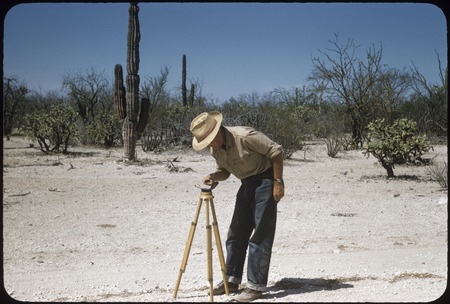
Indeed they were!
Every time the road changed direction, Howard would take out his tripod mounted compass, walk several feet away from his Willys Wagon, and take a new
reading.
I heard this from Andy Anderson.
The full set of his 1962 maps (Lower California Guidebook 1962-1970 editions) have been connected into one, by our very own 'geoffff':
https://octopup.org/img/media/maps/baja/1967--Lower-Californ...
|
|
|
4x4abc
Ultra Nomad
    
Posts: 4447
Registered: 4-24-2009
Location: La Paz, BCS
Member Is Offline
Mood: happy - always
|
|
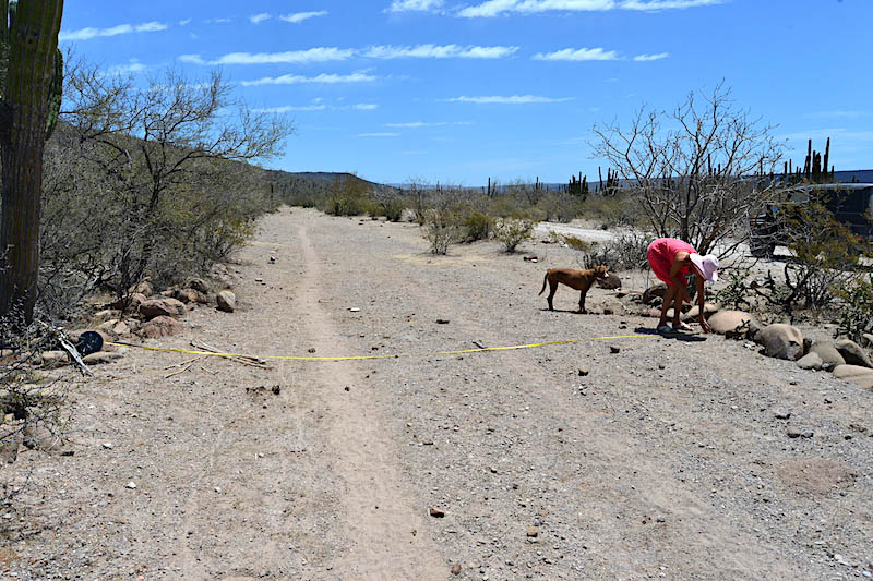
you haven't seen me in action. Whole family is involved
Harald Pietschmann
|
|
|
David K
Honored Nomad
        
Posts: 65382
Registered: 8-30-2002
Location: San Diego County
Member Is Offline
Mood: Have Baja Fever
|
|
Reminds me of the straight roadbed, south from La Prosperidad. I suspect a Boleo road there.
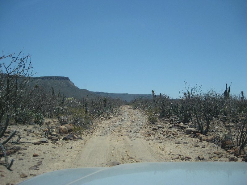
Wait a minute... LOL
|
|
|
4x4abc
Ultra Nomad
    
Posts: 4447
Registered: 4-24-2009
Location: La Paz, BCS
Member Is Offline
Mood: happy - always
|
|
very likely Boleo
Harald Pietschmann
|
|
|
David K
Honored Nomad
        
Posts: 65382
Registered: 8-30-2002
Location: San Diego County
Member Is Offline
Mood: Have Baja Fever
|
|
Ya, but I was just a bit further down the road from where your lady is measuring its width. I thought that was cool.
|
|
|
| Pages:
1
2
3 |

