| Pages:
1
2
3
4 |
4x4abc
Ultra Nomad
    
Posts: 4454
Registered: 4-24-2009
Location: La Paz, BCS
Member Is Offline
Mood: happy - always
|
|
I think the Pila is part of a water line that starts at Boca Magdalena and leads to a Boleo field
a really big one - 37 acres
the entire area around Boca was/is owned by Boleo
but only a small section seems to have been worked on
likely not enough water
the plant growth pattern indicates that there was a second line going to that field
actually, it runs right past that other Pila structure
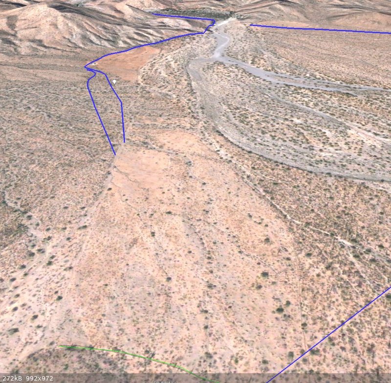
the vertical line in the elevation profile of the water line represents the location of the Pila

Harald Pietschmann
|
|
|
David K
Honored Nomad
        
Posts: 65430
Registered: 8-30-2002
Location: San Diego County
Member Is Offline
Mood: Have Baja Fever
|
|
Yes, that square shape deserves a look!
In 1863, this report describes La Magdalena, Rondin, the aqueduct, and San José (de Magdalena):
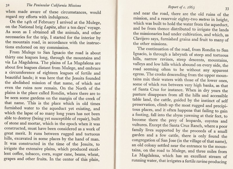
A league is approx. 2.5 miles (ranges from 2-3 miles) or the distance typically traveled in one hour.
|
|
|
David K
Honored Nomad
        
Posts: 65430
Registered: 8-30-2002
Location: San Diego County
Member Is Offline
Mood: Have Baja Fever
|
|
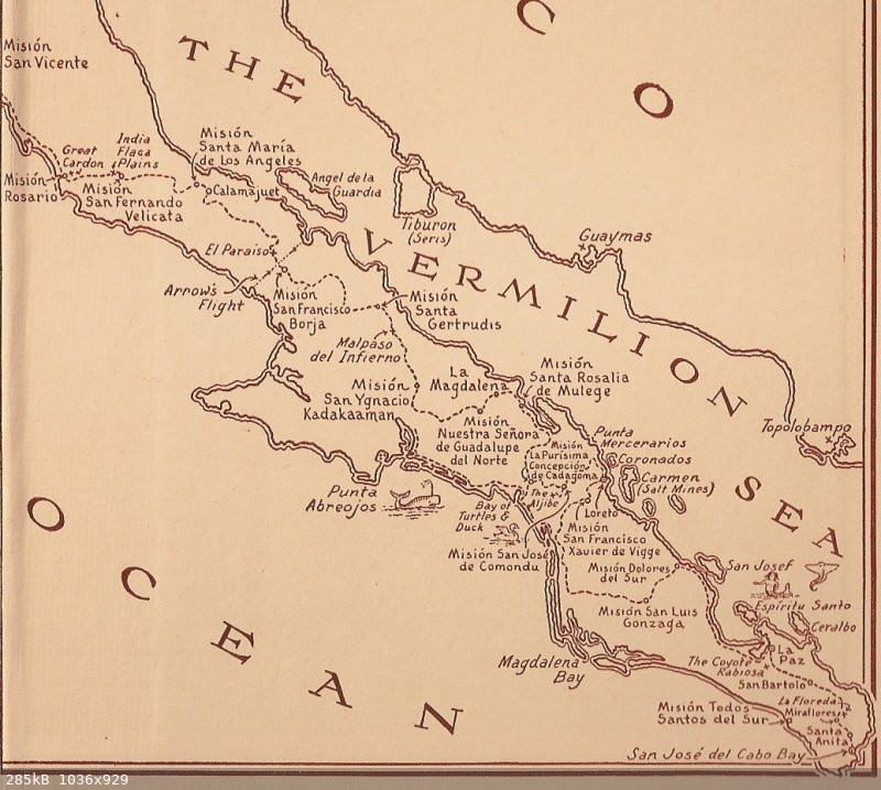
In the 1933 novel, Journey of the Flame, La Magdalena is an imprtant point along El Camino Real:
|
|
|
4x4abc
Ultra Nomad
    
Posts: 4454
Registered: 4-24-2009
Location: La Paz, BCS
Member Is Offline
Mood: happy - always
|
|
well, the routing of Camino Real and the location of place names (Paraiso, San Borja) puts it in the fiction category
Harald Pietschmann
|
|
|
David K
Honored Nomad
        
Posts: 65430
Registered: 8-30-2002
Location: San Diego County
Member Is Offline
Mood: Have Baja Fever
|
|
Quote: Originally posted by 4x4abc  | | well, the routing of Camino Real and the location of place names (Paraiso, San Borja) puts it in the fiction category |
San Borja looks pretty close to actual. Paraiso, of course, is south of San Borja, not north. Mission Guadalupe (near La Magdalena) is not 'del
Norte'. So, yes, it is a fictional novel about travel on ECR in 1810 and some names are not real or correct.
|
|
|
David K
Honored Nomad
        
Posts: 65430
Registered: 8-30-2002
Location: San Diego County
Member Is Offline
Mood: Have Baja Fever
|
|
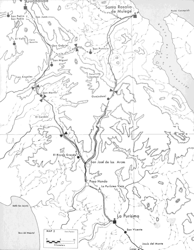
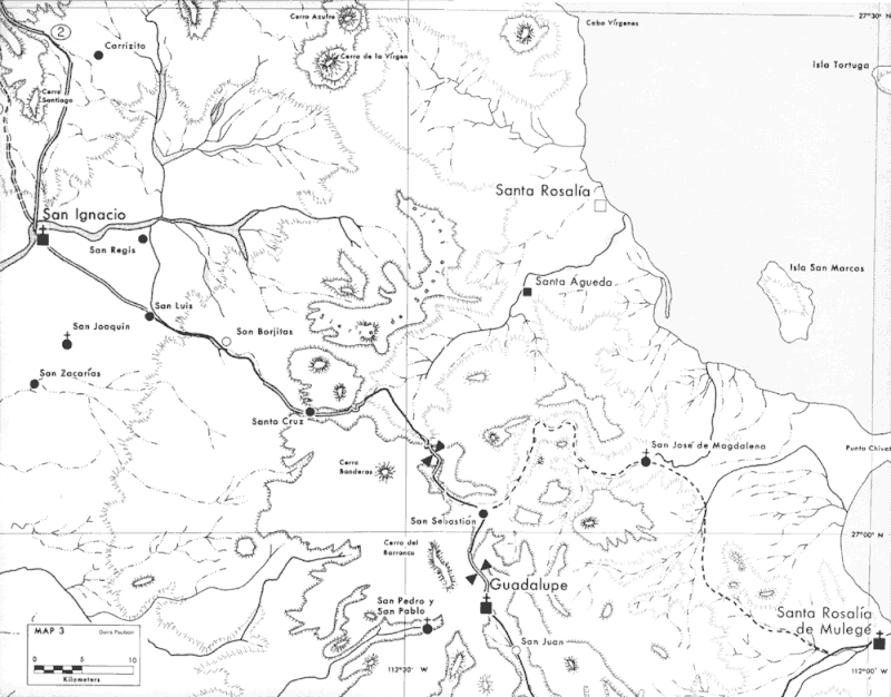
There were parallel ECR routes. The one most often celebrated by Harry Crosby was the route of Junípero Serra to San Diego and goes from Loreto to La
Purísima to Guadalupe to San Ignacio. The alternate ECR goes from La Purísima to Mulegé to La Magdalena to San Ignacio.
See both on these 1977 Crosby maps. The alternate route in question is a single dashed line:
|
|
|
4x4abc
Ultra Nomad
    
Posts: 4454
Registered: 4-24-2009
Location: La Paz, BCS
Member Is Offline
Mood: happy - always
|
|
the Camino Real had some main directional routes and many branches
people at the time had to get to and from Rondin on occasion
but the major need was not to travel to Mulege
it was to find firewood and tend animals
not long ago I identified several of those trails north and south of Rondin
they are all minor
the main routes (like from Loreto to Mulege) are still well defined to this day
and its not the route Crosby published
the 1769 route Serra chose to head north got all the publicity
but it was a route chosen at the end of the Jesuit time to leave the old behind
it only partially reflects the most busy ECR routes.
one of the main routes from Mulege to San Ignacio is kinda close to Magdalena - kinda
it is Mulege - Cuesta Blanca - Rancho Uña de Gato - San Isidro - El Rincon - Santa Cruz - San Ignacio
Harald Pietschmann
|
|
|
David K
Honored Nomad
        
Posts: 65430
Registered: 8-30-2002
Location: San Diego County
Member Is Offline
Mood: Have Baja Fever
|
|
I have no idea... Dave has vanished just a few years after publishing the book in 2003. He was nice enough to mention me in it for some copy editing
of his road logs.
I checked Crosby, Engelhardt, and Dunne (three major history sources on the Jesuits), as well as the 51 volume Dawson Book Series, and found nothing
for activities at Magdalena shortly after Mission Santa Rosalía de Mulegé was founded or otherwise.
|
|
|
| Pages:
1
2
3
4 |

