| Pages:
1
..
4
5
6
7
8
..
13 |
wiltonh
Nomad

Posts: 306
Registered: 2-2-2007
Member Is Offline
|
|
If you look in the top left corner of that last picture, you can see the three micro wave towers where the brick road ends.
|
|
|
David K
Honored Nomad
Posts: 65559
Registered: 8-30-2002
Location: San Diego County
Member Is Offline
Mood: Have Baja Fever
|
|
| Quote: | Originally posted by wiltonh
I know this is a little late but next time you are at El Triunfo, there is a fairly good road to San Antonio that is not highway 1. The road starts
on the South end of town and goes behind the old mill site. It follows a valley along a stream bed and then goes up over the ridge. Near the top you
hit a brick paved road. If you go left, you end up in San Antonio. If you turn right, you end up at the big micro wave tower on the mountain to the
west. That brick road must be about 5 miles or more. Someone built a lot of brick to make that happen.
From the micro wave tower there are some very nice views of the ocean and the big island off shore.
In San Antonio, you can turn off of highway 1 near the gas station and head up into the mountains. About 2 miles up you go by another old mill site
on the left hand side. It is fun to look around also. This road continues a number of miles west where you come to a locked gate with guards. It is
an active mining site.
There are lots and lots of roads in that area to explore. Some were on my GPS map and some were not.
Wilton |
That is great information... Perhaps some of that was the older road before Mex. 1 was graded and paved in the late 1960's through there? Have you
used Google Earth to look at the road you were on?
Thank you for the adding that here!
|
|
|
David K
Honored Nomad
Posts: 65559
Registered: 8-30-2002
Location: San Diego County
Member Is Offline
Mood: Have Baja Fever
|
|
| Quote: | Originally posted by Bob H
| Quote: | Originally posted by David K
That is a great story! I need to read 'The Adventures of Stickeen in Lower California 1874' by John F. Janes. It is #28 of the Dawson Baja Traveler
Series and about El Triunfo. |
David, isnt El Triunfo where JR had his bamboo project going on?
Great photos! |
It was near San Bartolo, actually Bob... a few miles east.
|
|
|
wiltonh
Nomad
Posts: 306
Registered: 2-2-2007
Member Is Offline
|
|
I have GPS tracks of some of this area which was over laid onto Google Earth. My primary reason for doing this was to figure out why there was a
locked gate with guards and guns out in the middle of no where. It is probably 20 or 30 miles west of highway 1.
I would have to check to see if I saved a GPS track on the road in question.
The road to the active mining site has cuts and fills that are probably bigger than you see on Highway 1. It is a very impressive road.
I also have lots of pictures from that area including the ones taken from the micro wave tower. They are currently loaded on another computer.
|
|
|
Bob H
Elite Nomad
Posts: 5867
Registered: 8-19-2003
Location: San Diego
Member Is Offline
|
|
| Quote: | Originally posted by David K
| Quote: | Originally posted by Bob H
| Quote: | Originally posted by David K
That is a great story! I need to read 'The Adventures of Stickeen in Lower California 1874' by John F. Janes. It is #28 of the Dawson Baja Traveler
Series and about El Triunfo. |
David, isnt El Triunfo where JR had his bamboo project going on?
Great photos! |
It was near San Bartolo, actually Bob... a few miles east. |
Ah, that's the place. I stand corrected. I take it that you did not make it over there.
The SAME boiling water that softens the potato hardens the egg. It's about what you are made of NOT the circumstance.
|
|
|
Bajatripper
Ultra Nomad
Posts: 3152
Registered: 3-20-2010
Member Is Offline
|
|
| Quote: | Originally posted by David K
| Quote: | Originally posted by wiltonh
I know this is a little late but next time you are at El Triunfo, there is a fairly good road to San Antonio that is not highway 1. The road starts
on the South end of town and goes behind the old mill site. It follows a valley along a stream bed and then goes up over the ridge. Near the top you
hit a brick paved road. If you go left, you end up in San Antonio. If you turn right, you end up at the big micro wave tower on the mountain to the
west. That brick road must be about 5 miles or more. Someone built a lot of brick to make that happen.
From the micro wave tower there are some very nice views of the ocean and the big island off shore.
In San Antonio, you can turn off of highway 1 near the gas station and head up into the mountains. About 2 miles up you go by another old mill site
on the left hand side. It is fun to look around also. This road continues a number of miles west where you come to a locked gate with guards. It is
an active mining site.
There are lots and lots of roads in that area to explore. Some were on my GPS map and some were not.
Wilton |
That is great information... Perhaps some of that was the older road before Mex. 1 was graded and paved in the late 1960's through there? Have you
used Google Earth to look at the road you were on?
Thank you for the adding that here! |
The old road left El Triunfo down the arroyo, which it pretty much followed all the way to San Antonio. Leaving San Antonio, it went perhaps a mile or
two down the same arroyo before making a right up and over the mountains on its way to San Bartolo.
There most certainly is but one side to every story: the TRUTH. Variations of it are nothing but lies.
|
|
|
Bajatripper
Ultra Nomad
Posts: 3152
Registered: 3-20-2010
Member Is Offline
|
|
| Quote: | Originally posted by wiltonh
I have GPS tracks of some of this area which was over laid onto Google Earth. My primary reason for doing this was to figure out why there was a
locked gate with guards and guns out in the middle of no where. It is probably 20 or 30 miles west of highway 1.
I would have to check to see if I saved a GPS track on the road in question.
The road to the active mining site has cuts and fills that are probably bigger than you see on Highway 1. It is a very impressive road.
I also have lots of pictures from that area including the ones taken from the micro wave tower. They are currently loaded on another computer.
|
One wonders why they would need armed guards for mining activities. Perhaps it's because of the local resistance to such Mexico City-promoted
development, which isn't popular locally no matter what the propaganda says.
Excellent info coming out on this thread, David. Good work to all.
PS Glad to see you got that disc to work.
[Edited on 8-4-2012 by Bajatripper]
There most certainly is but one side to every story: the TRUTH. Variations of it are nothing but lies.
|
|
|
David K
Honored Nomad
Posts: 65559
Registered: 8-30-2002
Location: San Diego County
Member Is Offline
Mood: Have Baja Fever
|
|
| Quote: | Originally posted by Bajatripper
PS Glad to see you got that disc to work.
|
Actually I didn't... not on my machine, but I took it to Costco and after two tries, theirs read it and I made some prints from it that I will scan to
show here. Even the duplicate CD that Costco made of yours won't open in my machine???
You take excellent photos Steve! Now, if your camera could only stop making me look so fat and you so thin next to me, then great!
|
|
|
David K
Honored Nomad
Posts: 65559
Registered: 8-30-2002
Location: San Diego County
Member Is Offline
Mood: Have Baja Fever
|
|
DAY 8a, Todos Santos, San Pedrito
Because we saw so much on this day, I need to break it into a couple of separate posts...
Saturday, July 21st (Day 8)
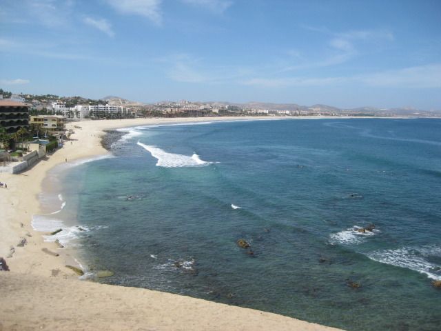
Today we use the Tacoma to drive the Cabo Loop (go south from La Paz to Cabo San Lucas on the Pacific side via Todos Santos, and return north to La
Paz on the gulf side, via Los Barriles). The total miles we drove was this day was 247.
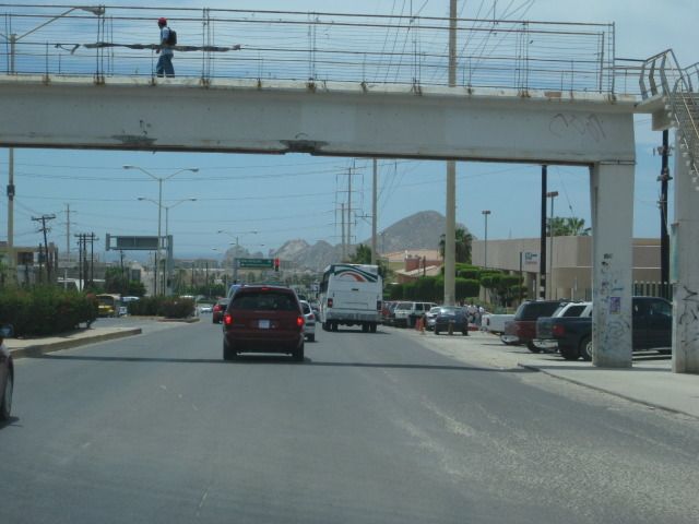
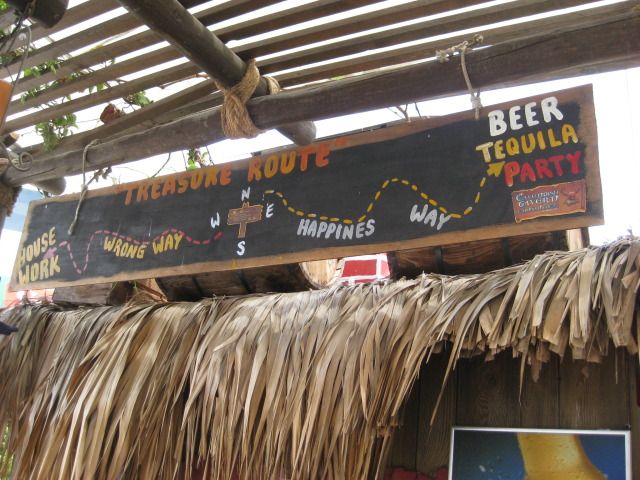
The Todos Santos/ Cabo highway (Mexico #19) has been widened to four lanes except for a few miles around Todos Santos. We do take a side trip in Todos
Santos and photograph a wall where anti-mining graffiti was painted (a Canadian company has been trying to open a new gold mine some miles from Todos
Santos, but not everyone seems to be in favor of it.
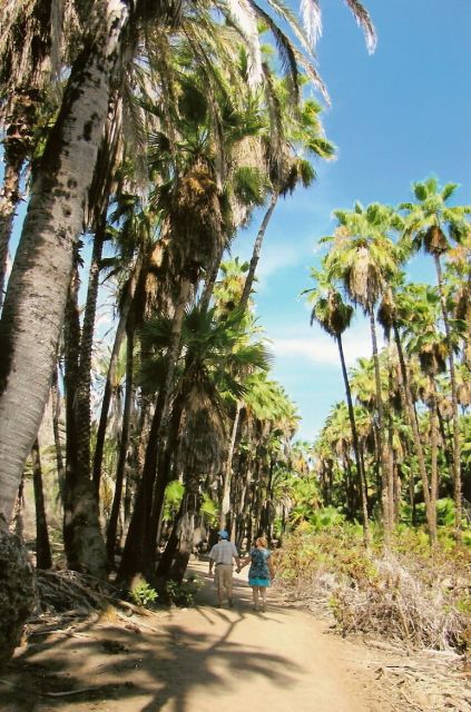
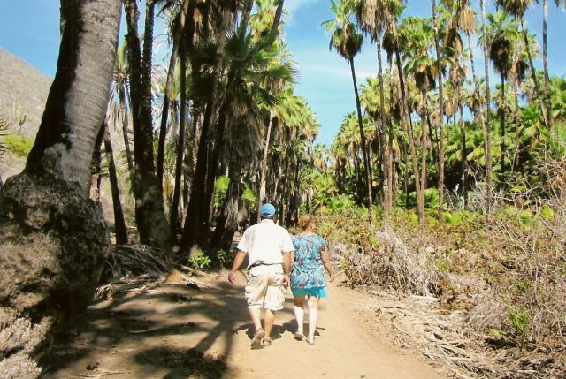
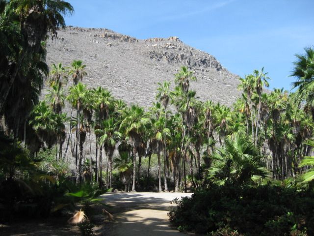
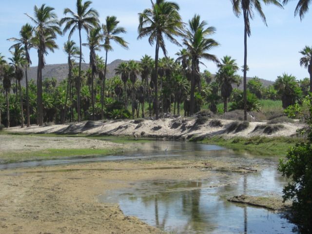
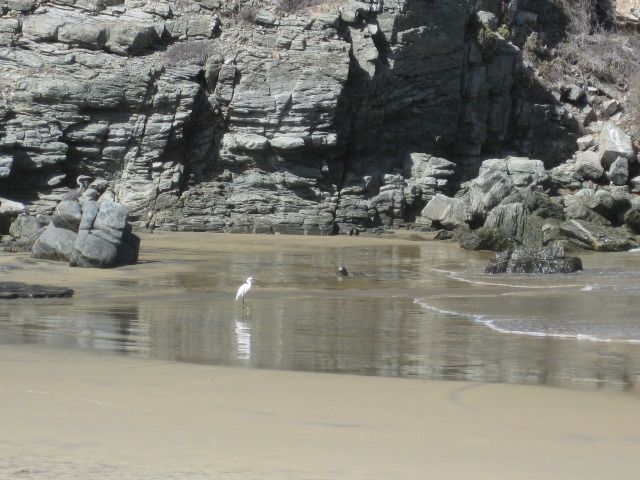
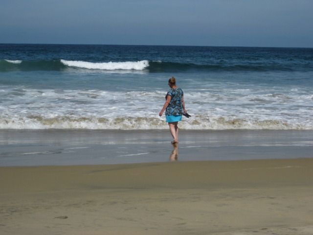
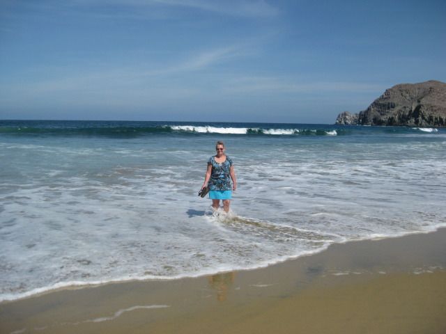
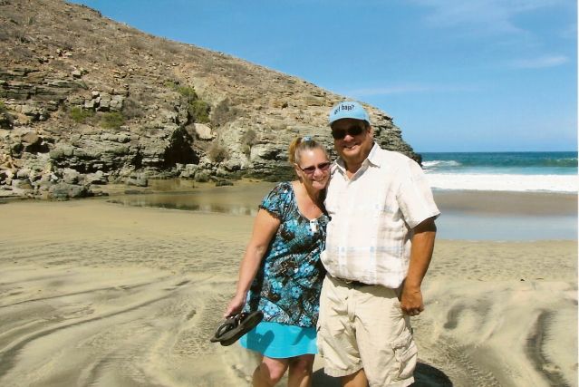
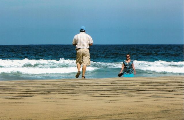
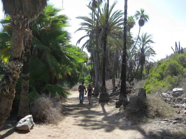
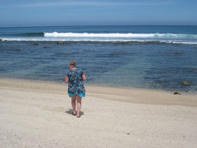
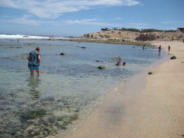
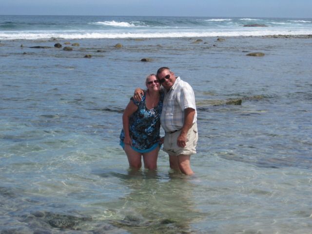
Just a few miles south of Todos Santos we take a dirt road angling to the southwest from the highway and park for the ½ mile walk to the beach of San
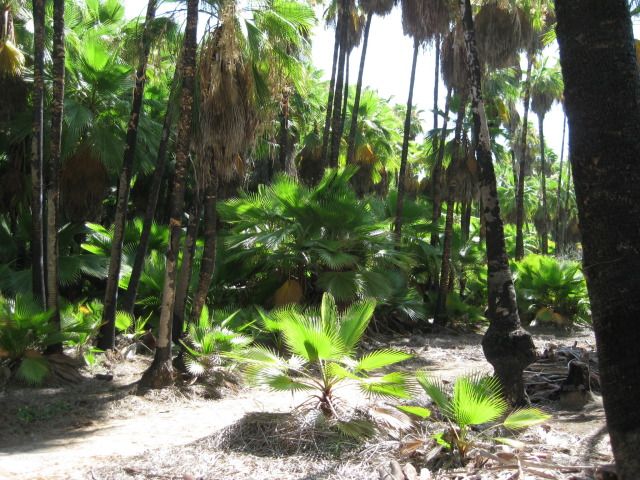
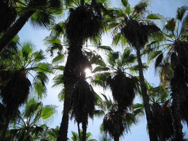
Pedrito. The walk takes you from pure desert to pure tropical paradise, and soon you could be easily dreaming of a scene from the South Pacific
islands. We are after all in the same latitude as Hawaii.
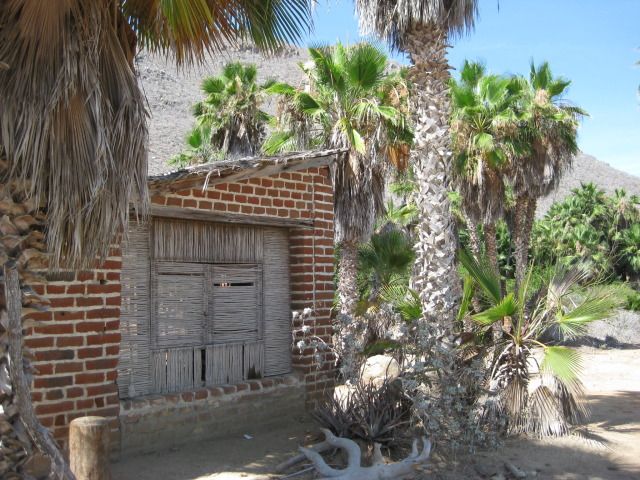
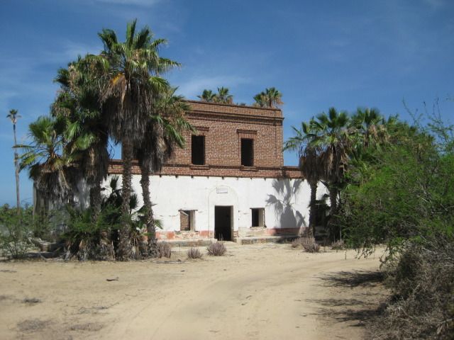
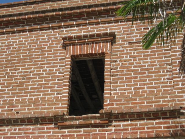
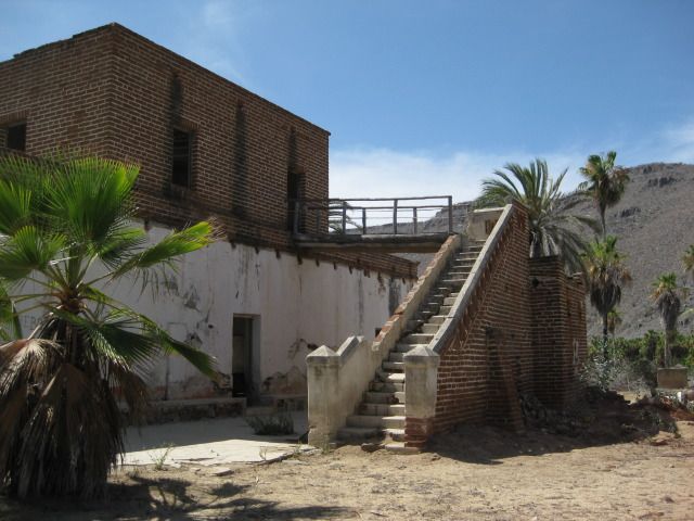
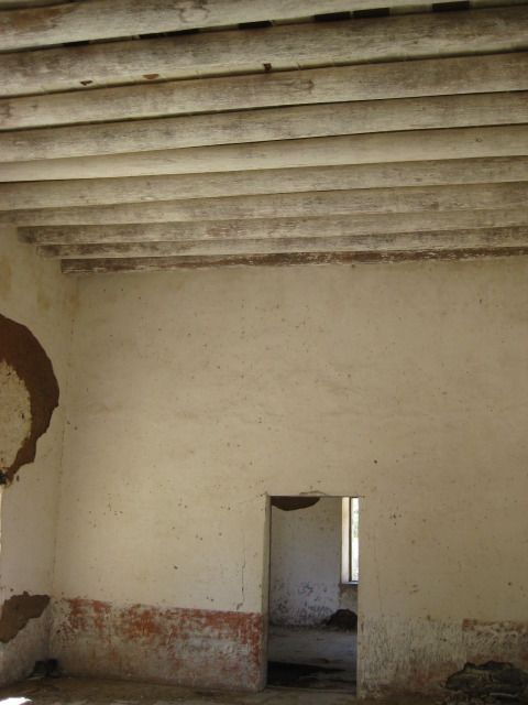
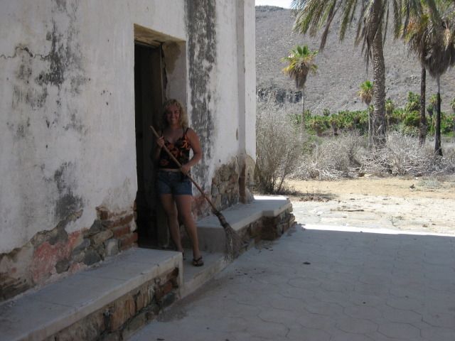
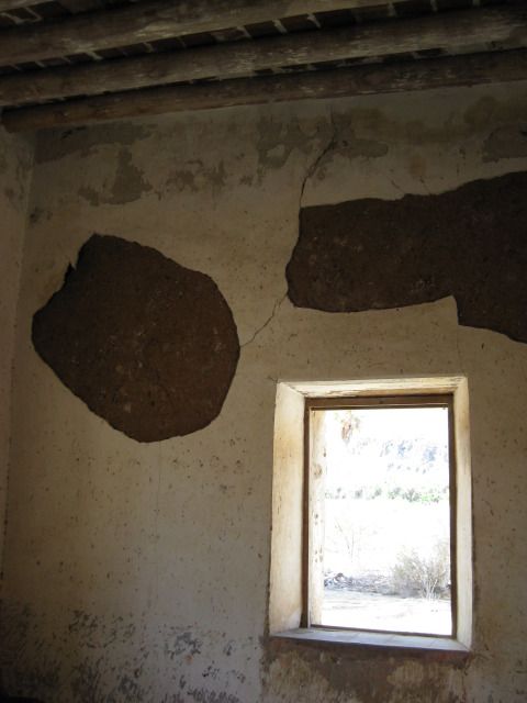
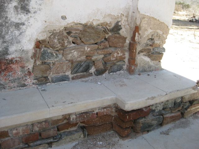
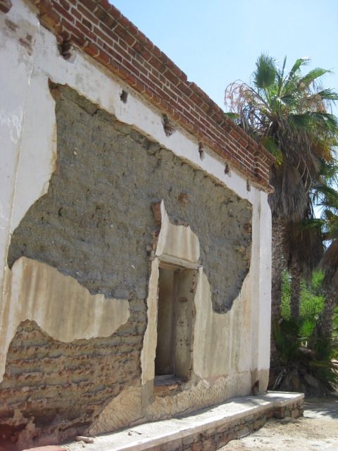
An old ruin near the parking spot was once the villa of a Mexican general and an airstrip was there, too
I will let the photos tell more. Bajatripper
can fill in the additional history as it is quite interesting!
Photos:
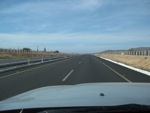
4 lanes south from La Paz to Cabo, except through Todos Santos.
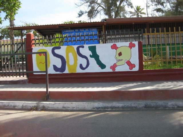
Protesting a Canadian gold mine project in the mountains northwest of Todos Santos.
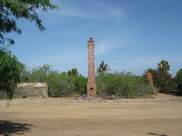
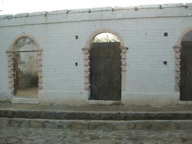
Ruins of a Todos Santos sugar mill.
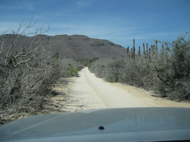
Desert road to a tropical beach, San Pedrito.
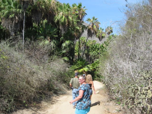
Maybe a half mile walk to the beach.
BT photo
BT photo
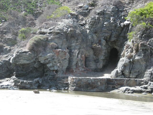
The general who had a villa at San Pedrito also had facilities for his beach guests. Bajatripper showed me an old photo showing some building here, a
refreshment bar and restrooms, I recall?
BT photo
BT photo
Time to head back to the truck
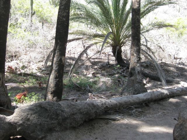
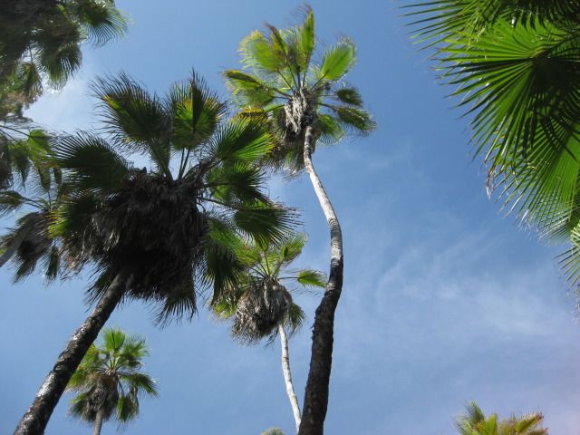
Ever see a creeping palm tree?
BT photo
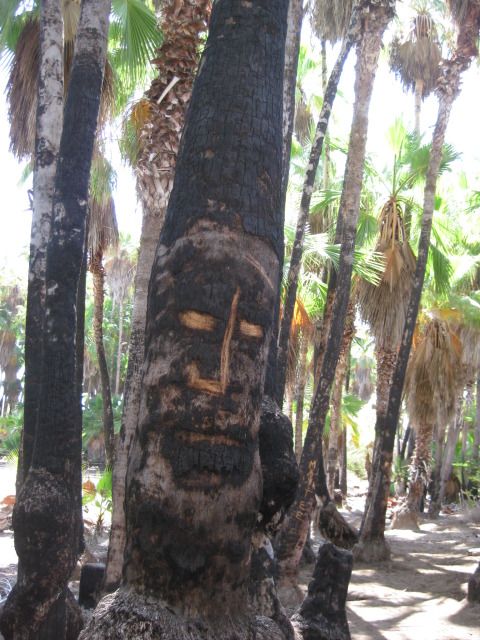
What I was photographing.
Steve says lets go look at the generals villa
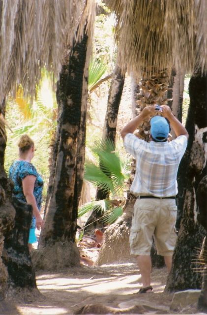
first we pass the watchmans home (it is empty).
Next, we drive south to Lands End, Cabo San Lucas
the tip of Baja!
-------------------------------------------------------------------------------------------------------------
|
|
|
David K
Honored Nomad
Posts: 65559
Registered: 8-30-2002
Location: San Diego County
Member Is Offline
Mood: Have Baja Fever
|
|
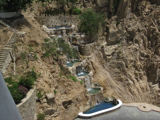
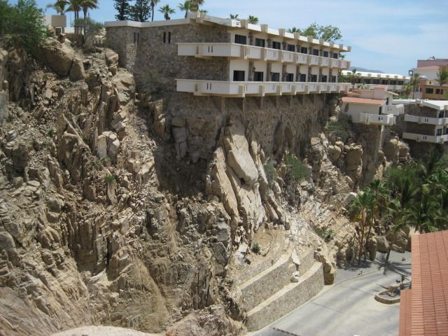
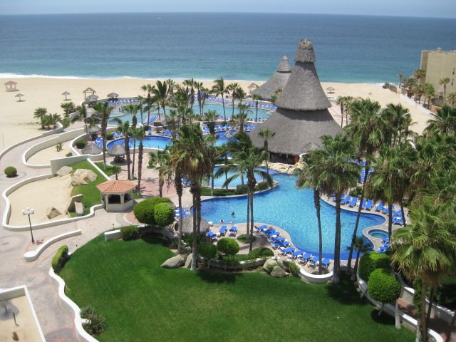
DAY 8b, CABO SAN LUCAS
It is an easy drive on south to the end of the California peninsula at Cabo San Lucas. When I first came here in 1966, it was a small fish cannery
town with a pier and a salt flat that was an airstrip for a lone tourist hotel, the Hacienda. When the Transpeninsular Highway (Mexico #1) was
completed in December, 1973 tourism really had an impact on Baja California, and probably nowhere more than right here at the end of the peninsula.
The old salt flat runway is now a marina, and the sleepy fishing town is a city with hotels, condos and nightclubs.
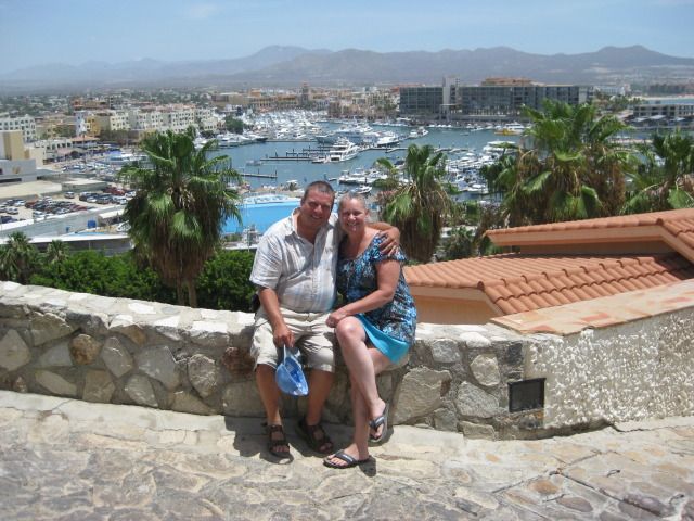
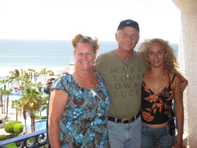
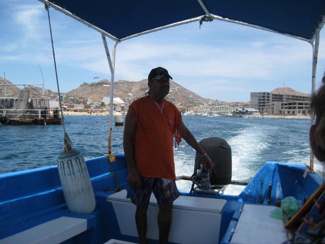
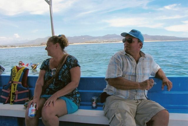
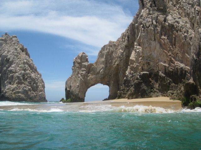
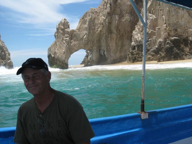
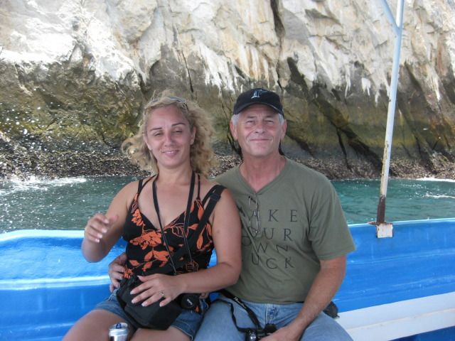
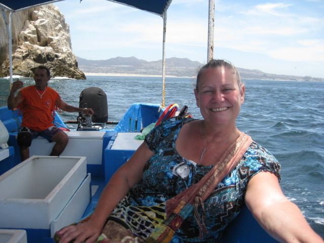
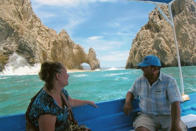
Steve and Zully have a treat for us and it was outstanding
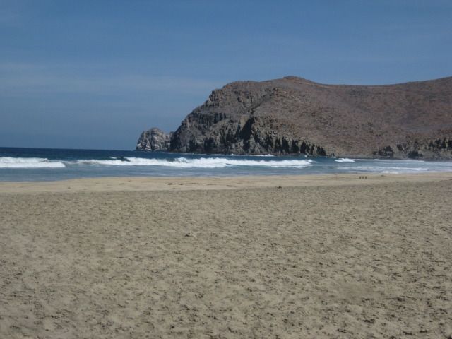
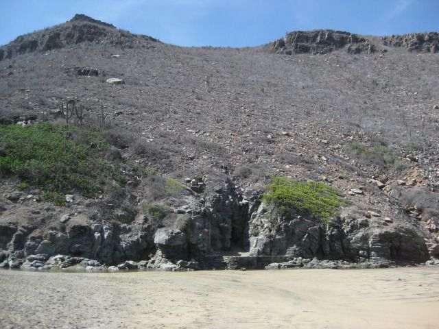
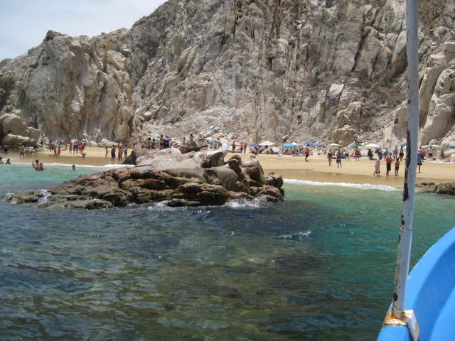
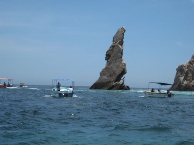
a boat ride out to El Arco (The Arch) at the tip of Baja
Lands End. There is a secure
pay parking area by the docks for the glass bottom boats and water taxis. Soon we were on the water and entertained by our captain who pointed out the
sites along the way.
When you go out past the tip and look back at the arch and the splashing waves, it is quite an experience. Lots of photos and back after 45 minutes
very fun. We have lunch at Cavendishs by the docks
all good food and drink!
Photos:
Entering Cabo on Hwy. 19.
We drive up to the Hotel Finisterra for photos.

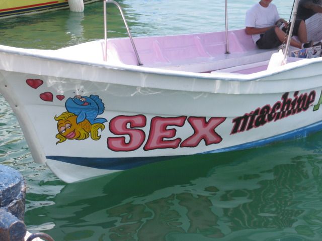
Several interestingly named boats are for hire!
We get a good one!
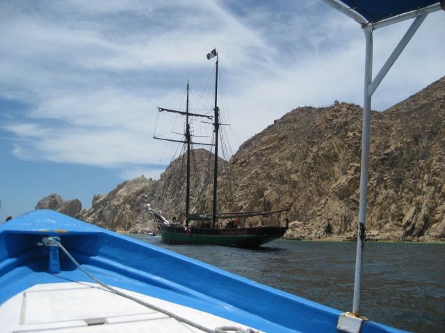
The English pirate Cavendish is waiting for the Spanish ship Santa Ana to poke around the cape!
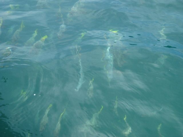
Plenty of colorful fish down there.
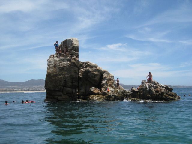
Rock is the Baja peninsula, upside-down.
BT photo
We sure appreciated this ride
what a treat! Thank you Steve and Zully!
BT photo
There it is!
BT photo
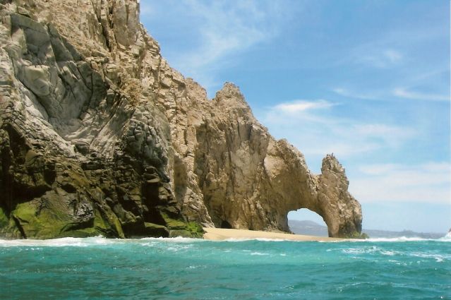
BT photo
Its a dragon taking a drink!
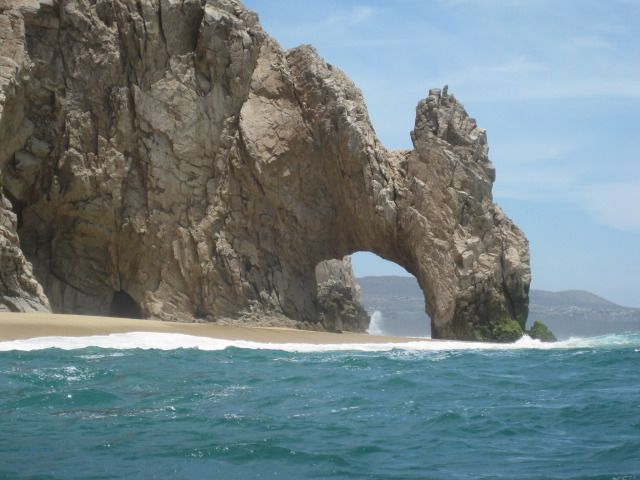
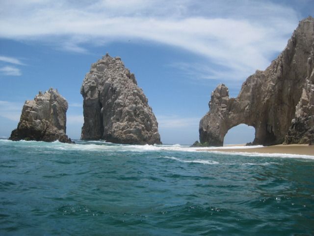
Only fitting that such a fantastic peninsula have such a dramatic ending!
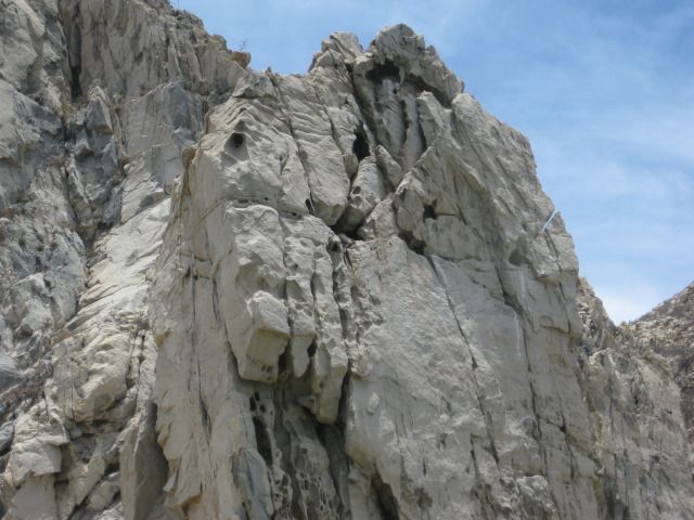
Do you see the horses head?
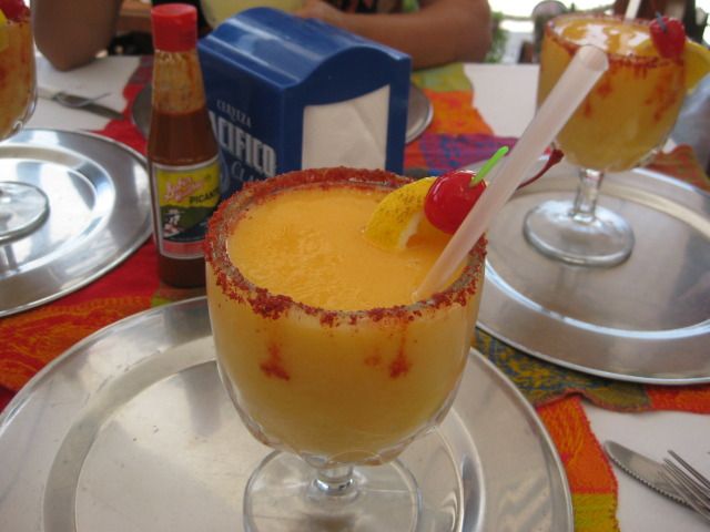
Mango Margaritas seem like a natural choice for our lunch beverage.
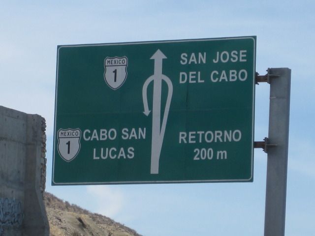
We leave Cabo San Lucas, and can only go north from there, but on Highway #1 back to La Paz. See the rest of todays adventures, coming up next (El
Tule, San Jose del Cabo, Santiago, Las Cuevas)!
|
|
|
wiltonh
Nomad
Posts: 306
Registered: 2-2-2007
Member Is Offline
|
|
In 1974 we drove to Cabo and stayed in a hotel near the beach. At that time we were into scuba diving so we rented a panga to take us out to the end
of the cape. They called the beach near the arch "Lovers Beach".
The captain was running the boat at near full speed. All of a sudden he slowed down to just a crawl. We asked him why. He pointed out at a number
of large rays jumping out of the water. He said something like "him in here, all of us out there".
It seems that a few days before one of the tour boats ended up having a ray jump into the boat and most of the people ended up in the water.
Wilton
|
|
|
bryanmckenzie
Senior Nomad
Posts: 561
Registered: 9-23-2009
Location: 400 Km from Mexico Beach, Florida
Member Is Offline
Mood: Hot & humid --- not hot & dry.
|
|
Cool trip, David. Wish I could have joined you. As always, great pictures & great reporting. Thanks for sharing.
|
|
|
TMW
Select Nomad
Posts: 10659
Registered: 9-1-2003
Location: Bakersfield, CA
Member Is Offline
|
|
Wow I haven't been to Cabo since the Baja 2000 race 12 years ago and after looking at thses pictures I must go back. Thanks DK they are great.
|
|
|
David K
Honored Nomad
Posts: 65559
Registered: 8-30-2002
Location: San Diego County
Member Is Offline
Mood: Have Baja Fever
|
|
You guys are very welcome... it was a great trip... people are crazy to 'afraid' to go to Baja!
Okay, I have the final installment of Day 8 ready to post!
|
|
|
David K
Honored Nomad
Posts: 65559
Registered: 8-30-2002
Location: San Diego County
Member Is Offline
Mood: Have Baja Fever
|
|
DAY 8c: El Tule, San Jose del Cabo, Santiago, Las Cuevas Bat Cave
We leave Cabo on Highway #1 and head northeast past many resorts and condos towards San Jose del Cabo. Along the way, we turn off the four lane
highway to El Tule beach. El Tule is a rare, undeveloped piece of beach here in the Los Cabos region of Baja.
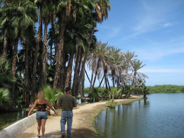
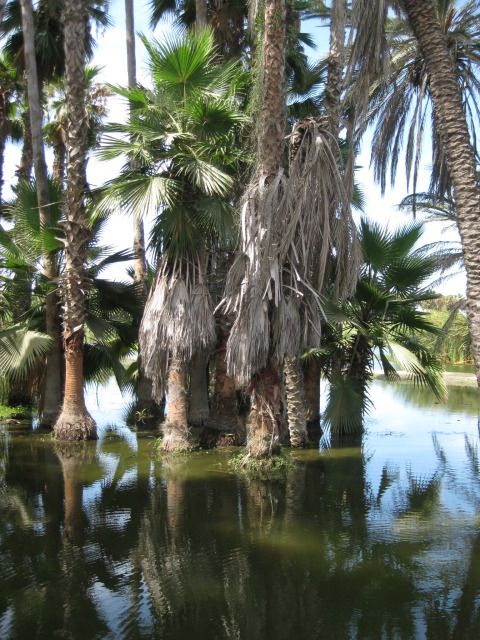
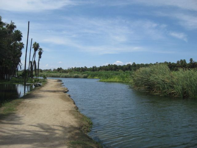
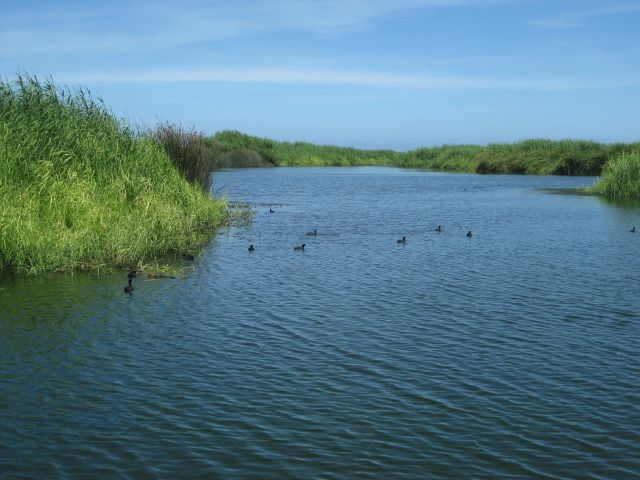
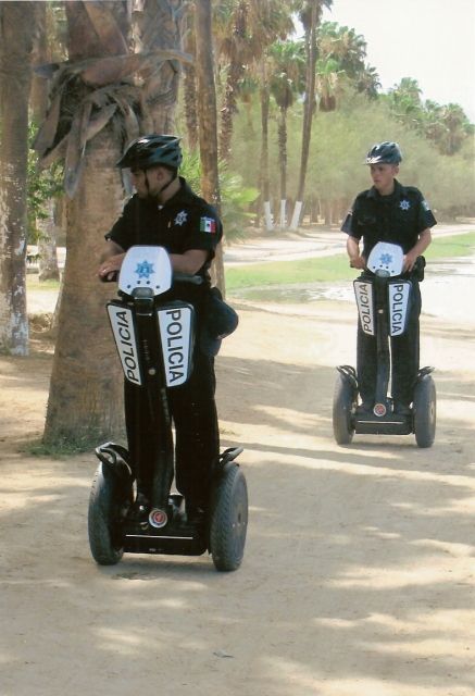
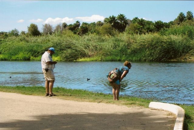
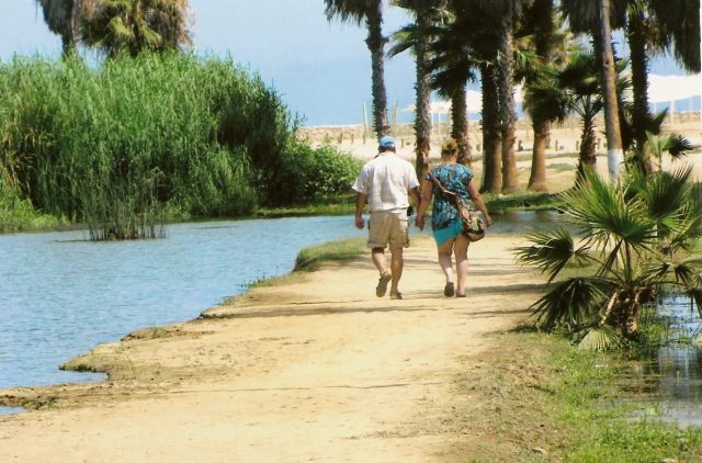
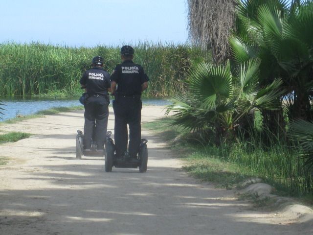
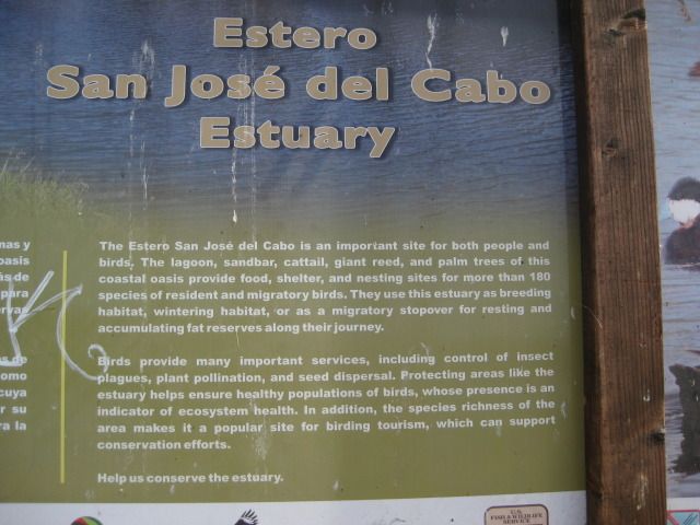
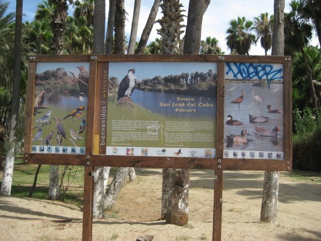
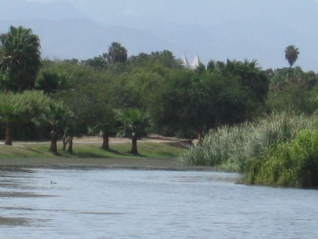
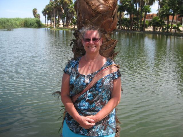
At the entrance to San Jose del Cabo, we take the right fork and go to the estuary for a walk along the water and palms. A totally unexpected place of
serenity surrounded by so much development. The dirt path was patrolled by police, each riding (standing) on a Segway. The southernmost California
Spanish mission was first established here by the estuary in 1730, Mission San Jose del Cabo was perhaps more important to provide water and fresh
fruit to the ships of the Manila Galleon which sailed right off this coast on their way to Acapulco, with treasures from the Orient.
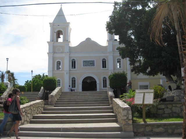
The mission site was moved several times until the final site, which is in the town plaza, where a newer church replaced the ruined mission church
here. Last photographed about 94 years ago, see the photo of it before being demolished.
San Jose del Cabo has old colonial style, narrow streets and are all one way. It takes us some effort to drive in front of the church for photos, and
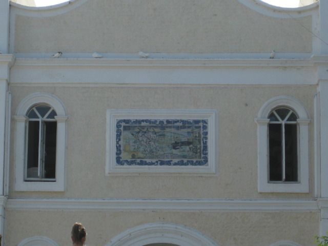
no place there to park. A tiled mosaic above the church entrance illustrates the murder of a Jesuit priest by the natives during the Pericu Indian
uprising of 1734. All four of the southernmost missions were temporarily abandoned during this revolt (La Paz, Todos Santos, Santiago and San Jose del
Cabo).
Highway #1 is four lanes until reaching the Los Cabos International Airport, then it is two lanes past farm towns that include Santa Anita, where the
bus station next to the highway looks like an old home seen in photos of the past. We stop and talk with one person who lived there for over 50 years
and says this building was there at least as long. It had very thick walls, as typical of early construction.
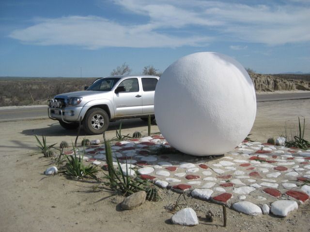
Several miles north, the highway crosses the Tropic of Cancer and a monument consisting of a large white globe, marks the spot. Just beyond is the
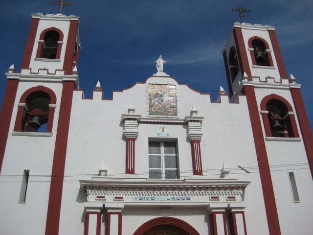
paved side road into Santiago, a tropical village at the final site of Californias tenth Spanish mission dating back to 1724. A modern church is
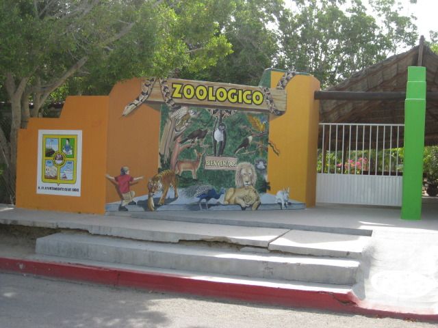
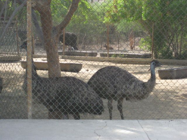
built on the site, right on the paved road through town. The pavement ends at the Santiago Zoo, which despite protests by animal advocates, remains
open and a popular place for family visits.
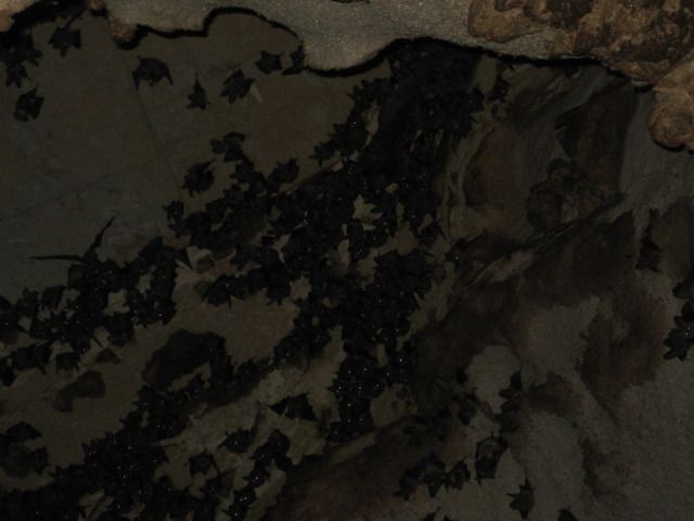
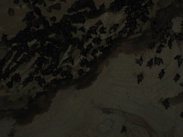
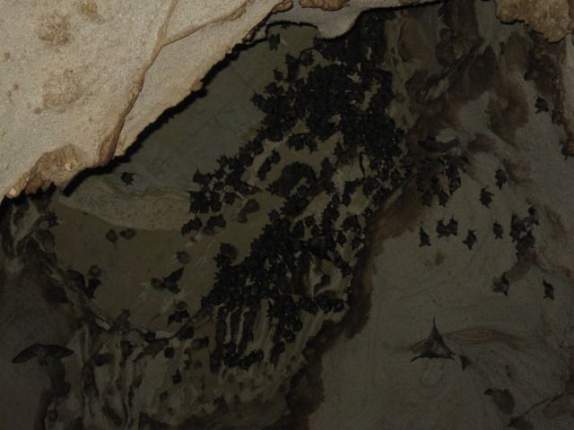
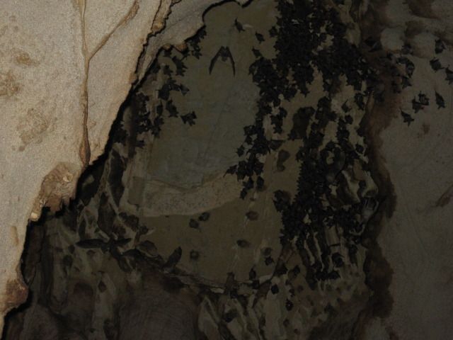
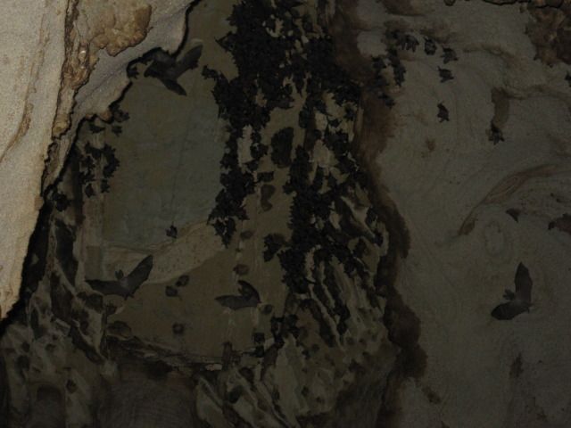
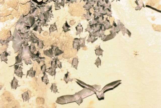
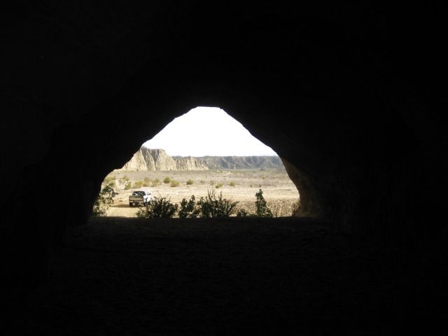
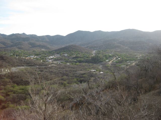
Some five miles north of Santiago is Las Cuevas, The Caves . Access them by driving under the Highway #1 bridge, over the Santiago riverbed and a
mile or so up it. The large cave is on the east side of the arroyo and in the entrance are beehives, way high up. Inside are bats, lots of bats! What
a great tour Bajatripper has given us (again) today!
On our way back to La Paz, we take some photos of the fishing boats off Los Barriles and the town of San Antonio from a view point along the highway.
This has been an incredible day with so much sites and experiences!
The photos:
El Tule (between Cabo San Lucas and San Jose del Cabo)

At El Estero de San Jose del Cabo:
BT photo
BT photo
BT photo
See the top of the mission/church, in town above the estero plants.
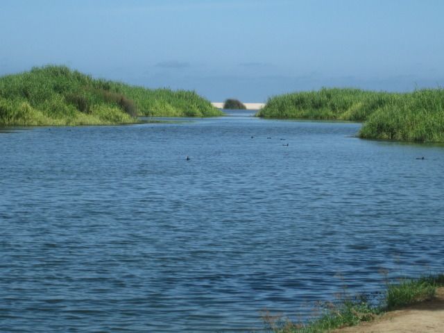
The beach sand, at the other end of the estero.
The modern church on the final mission location.
Tile mosaic of the Pericu Indians murdering Padre Tamaral.]
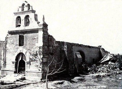
1918-1919 era photo of Mission San Jose del Cabo, the 12th California mission, est. 1730.
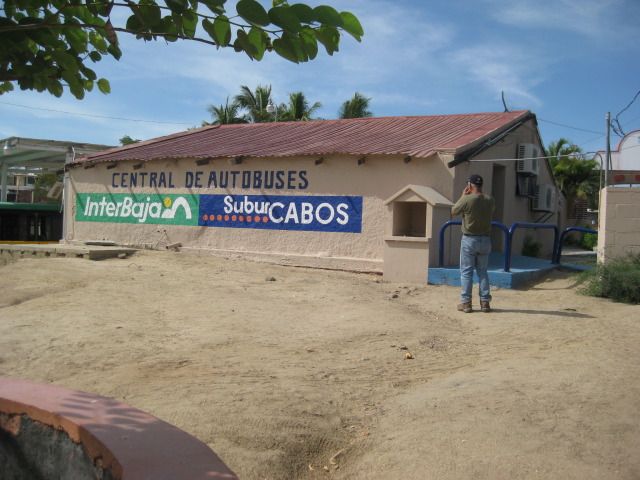
Santa Anita bus depot, but an very old home dating back many years.
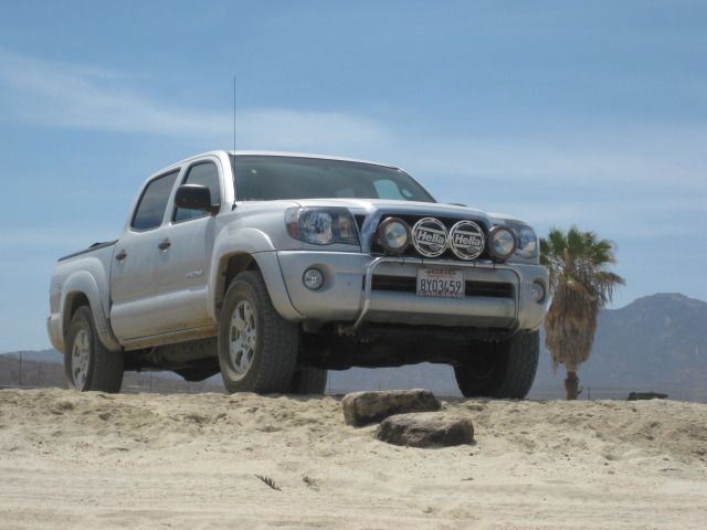
My Toyota Tacoma on the Tropic of Cancer in Baja California Sur, Mexico.
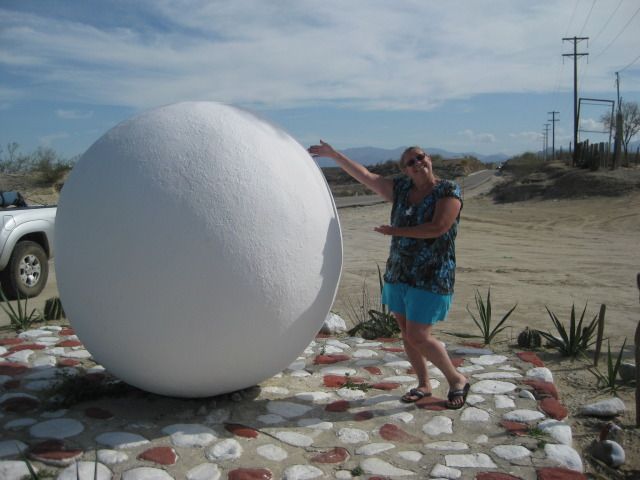
My wife on the Tropic of Cancer, silly girl!
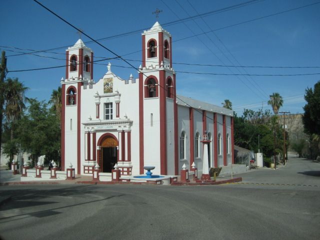
Modern Santiago church on the final site of the 1724 Jesuit founded California mission, it was number 10 of the 48 total California missions.
At the zoo, we turn around and head back to Highway #1, to continue north.
Las Cuevas and the Bat Cave:
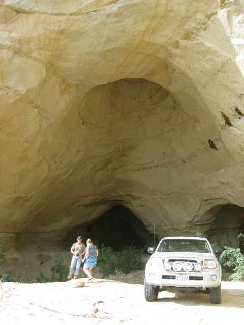
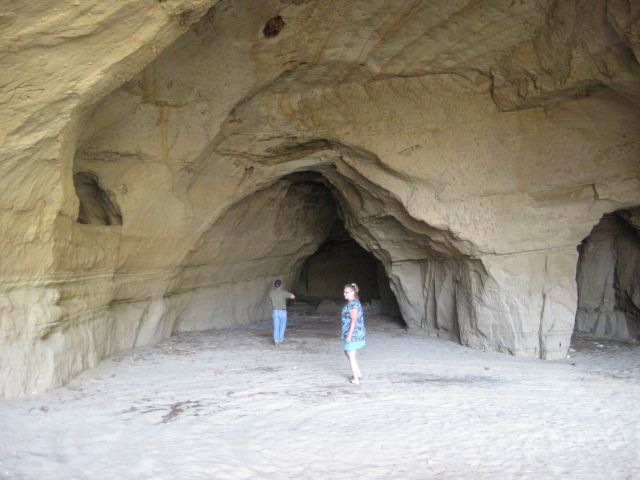
The next six photos are looking up, at the ceiling:
BT photo
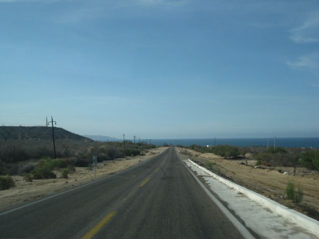
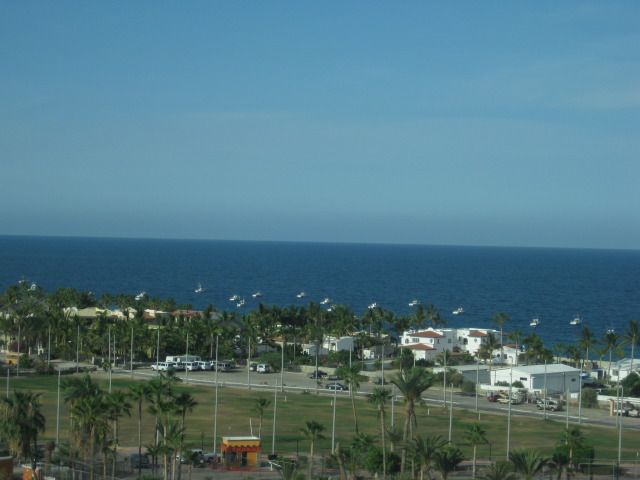
Nearing Los Barriles on the Bahia las Palmas, East Cape of Baja California Sur.
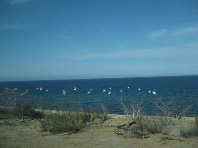
Looking down on San Antonio from a view point.
That wraps up DAY 8 (Saturday, July 21, 2012)
Stay tuned for DAY 9 (diving with sea lions off the islands in the Sea of Cortez)!
|
|
|
BAJACAT
Ultra Nomad
Posts: 2902
Registered: 11-21-2005
Location: NATIONAL CITY, CA
Member Is Offline
|
|
Alike always DK it's a pleassure reading your trips, Congrats on your weeding aniversary..I have to get back to Baja, the close its trip that I have
now is Laguna hanson for Labor day, but we all know that the real Baja starts @ EL ROSARIO...
PS say hi to Elizabeth for me..
|
|
|
David K
Honored Nomad
Posts: 65559
Registered: 8-30-2002
Location: San Diego County
Member Is Offline
Mood: Have Baja Fever
|
|
Thanks José, I hope we can travel together again, soon! :-)
|
|
|
woody with a view
PITA Nomad
Posts: 15940
Registered: 11-8-2004
Location: Looking at the Coronado Islands
Member Is Offline
Mood: Everchangin'
|
|
all those people swimming out around the arch, do the boats drop them off and just wait or is there a sort of taxi service?
|
|
|
David K
Honored Nomad
Posts: 65559
Registered: 8-30-2002
Location: San Diego County
Member Is Offline
Mood: Have Baja Fever
|
|
| Quote: | Originally posted by woody with a view
all those people swimming out around the arch, do the boats drop them off and just wait or is there a sort of taxi service? |
Exactly Woody, there are so many water taxis taking folks (kids) out to the isolated beaches... and they all looked to be having lots of fun. I did
not see any norteamericano tourists there or most anywhere on our trip. The exception was Los Barriles, otherwise it was like Baja was many years
ago... before being 'discovered'.
|
|
|
Bajatripper
Ultra Nomad
Posts: 3152
Registered: 3-20-2010
Member Is Offline
|
|
| Quote: | | What a great tour Bajatripper has given us (again) today! |
Of course, David, you realize that these are my "B" tours that I give to visiting Republicans. I save the really good stuff down here for my liberal
friends
You've done a really nice job of merging contemporary Baja with its history, an approach I also favor. Great photos, David and we all appreciate the
great effort it has taken you to assemble it all here for everyone to enjoy.
There most certainly is but one side to every story: the TRUTH. Variations of it are nothing but lies.
|
|
|
| Pages:
1
..
4
5
6
7
8
..
13 |