| Pages:
1
..
5
6
7
8
9
..
13 |
viabaja
Nomad

Posts: 277
Registered: 10-6-2003
Location: Georgia
Member Is Offline
|
|
Great pix and trip review Dave! Thanks.
|
|
|
David K
Honored Nomad
Posts: 65559
Registered: 8-30-2002
Location: San Diego County
Member Is Offline
Mood: Have Baja Fever
|
|
| Quote: | Originally posted by Bajatripper
| Quote: | | What a great tour Bajatripper has given us (again) today! |
Of course, David, you realize that these are my "B" tours that I give to visiting Republicans. I save the really good stuff down here for my liberal
friends
You've done a really nice job of merging contemporary Baja with its history, an approach I also favor. Great photos, David and we all appreciate the
great effort it has taken you to assemble it all here for everyone to enjoy. |
Well your 'B tour' for us (who believe in less government and more freedom) rates an A+!
I enjoy doing trip reports because it allows me to relive the trip one more time, and I know how much I enjoy others' trip reports here!
Nomads:
The trip is just over HALF WAY through... if you liked what I have posted thus far, the rest should really have you ready to pack your 4x4 and head to
Baja! 
|
|
|
David K
Honored Nomad
Posts: 65559
Registered: 8-30-2002
Location: San Diego County
Member Is Offline
Mood: Have Baja Fever
|
|
| Quote: | Originally posted by viabaja
Great pix and trip review Dave! Thanks. |
My pleasure Chris... fyi, Shell Island was not just the first day's destination but it was also our last night of the trip, too.
|
|
|
windgrrl
Super Nomad
Posts: 1336
Registered: 9-2-2006
Member Is Offline
|
|
Super cool trip report and you both look so happy all through your trip.
Thanks for sharing the journey,
w
When the way comes to an end, then change. Having changed, you pass through.
~ I-Ching
|
|
|
edm1
Senior Nomad
Posts: 568
Registered: 8-23-2006
Location: Oak Hills, Ca
Member Is Offline
|
|
Great trip report. I'm ready for more David!
|
|
|
David K
Honored Nomad
Posts: 65559
Registered: 8-30-2002
Location: San Diego County
Member Is Offline
Mood: Have Baja Fever
|
|
We were super happy w, we haven't had a long vacation since 2009. Baja was an entire awesome place (again)...
Art, thanks...!! I have just finished writing Day 9 and loaded the photos for it... I just need to combine the two part and post it here (and I also
post on Tacoma World, too... as I know you are a member there, as well).
I think I will have Day 9 up tomorrow (Tue.) morning! News flash: I just posted it (11pm Mon.)!
[Edited on 8-7-2012 by David K]
|
|
|
latina
Nomad
Posts: 210
Registered: 3-19-2011
Location: La Paz
Member Is Offline
|
|
Thanks for sharing your trip! We have travelled Baja California Norte and Sur by rv, suv, plane, etc. for 30 years...we are enjoying your photos
and updates tremendously! So many things have changed and so many things remain the same....
|
|
|
David K
Honored Nomad
Posts: 65559
Registered: 8-30-2002
Location: San Diego County
Member Is Offline
Mood: Have Baja Fever
|
|
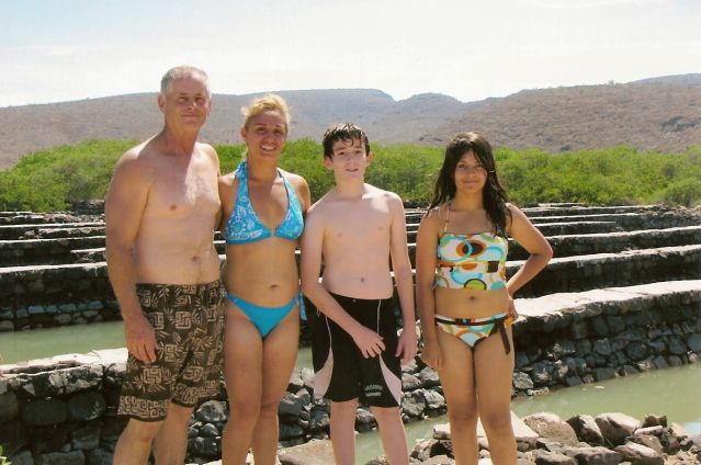
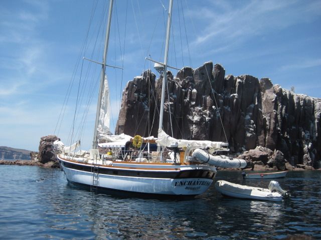
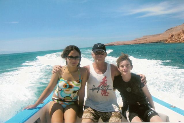
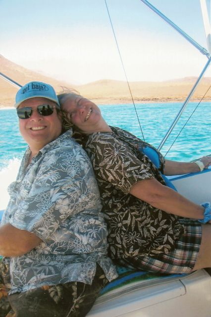
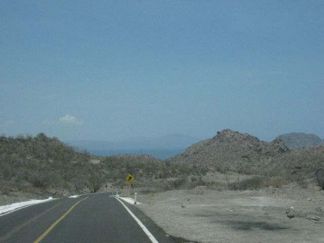
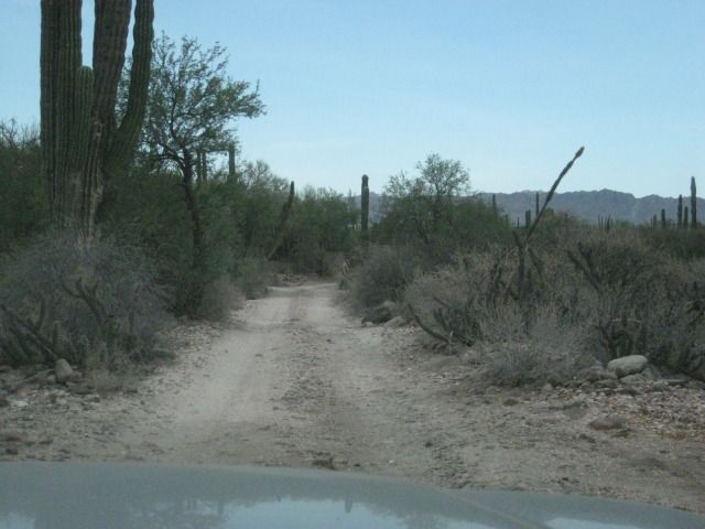
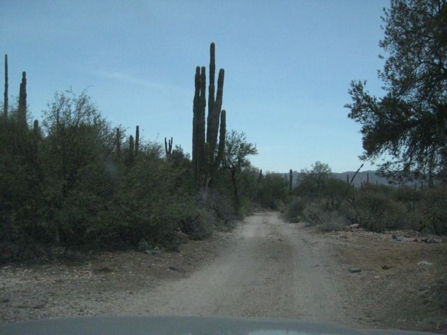
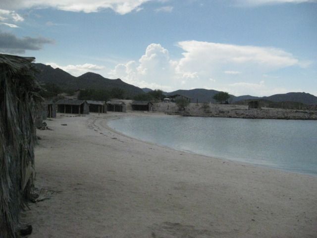
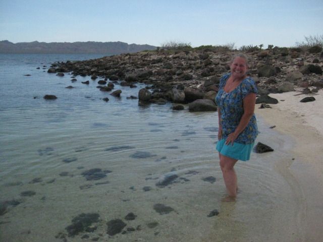
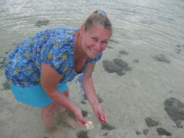
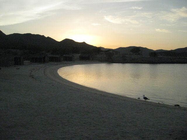
DAY 9 Isla Espiritu Santo and Restaurant Tres Virgenes
Sunday, July 22, 2012 (Day 9)
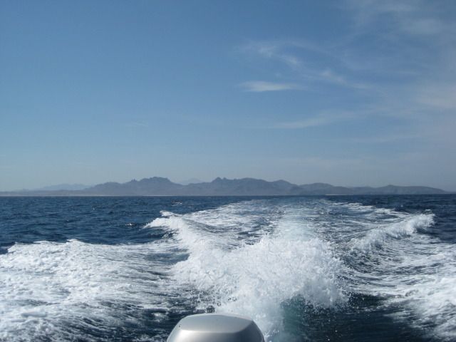
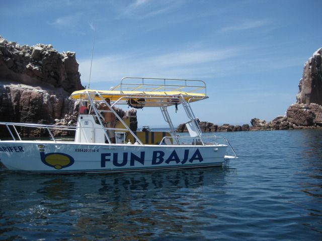
Today is our island day featuring a boat ride from La Paz north to Isla Espiritu Santo and Isla Partida at the north end. We enjoy the scenery of La
Paz from the bay and of El Mogote with its failed hotel and housing development (El Mogote is the sand bar peninsula facing the city of La Paz). Next,
we go past Pichilingue and the now abandoned U.S. Navy coaling station that operated here from 1866 to 1925. A bit past Pichiligue is Bahia Balandra
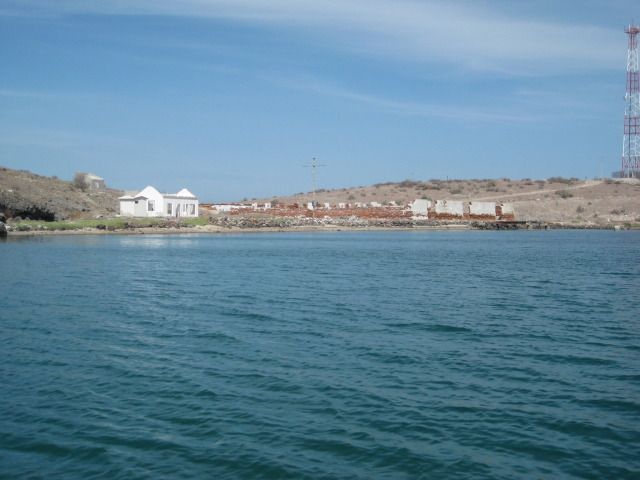
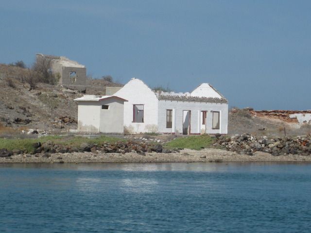
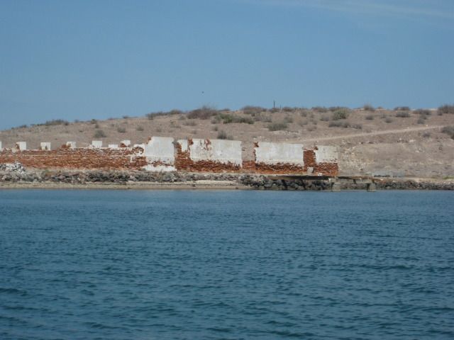
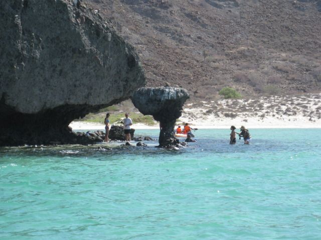
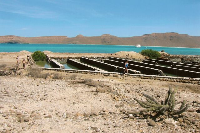
with its popular mushroom rock we visited from land on Friday. Next we zoom across the San Lorenzo Channel to Isla Espiritu Santo. On the southwest
coast of the island is Bahia San Gabriel with its ruins of a pearl oyster farm from the early 1900s. We cannot beach the boat because of the rocks,
so we go over the side and swim to shore to have a closer look at the immense rock works there.
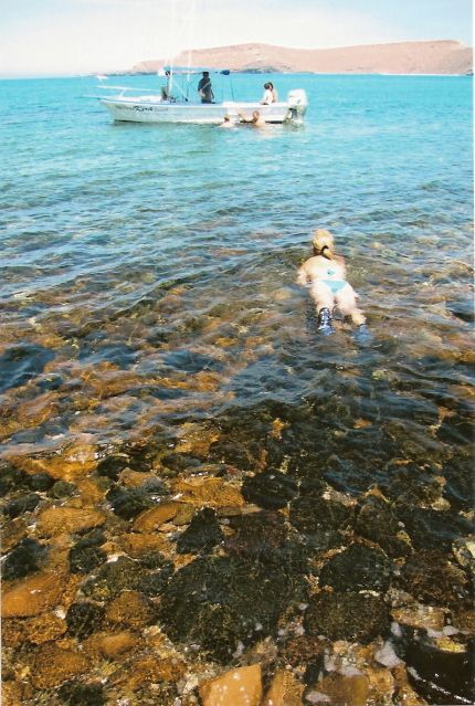
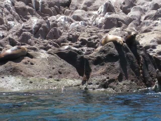
With some effort (mostly on my part), we get back into the boat and continue to the north end of the island and its nearly connected twin, Isla
Partida. Here are many boats bringing people to some clear water shared by sea lions
and we put on masks and fins and go in!
It was the highlight of the day to swim with the tropical fish and the thrill of the day (for me) when a sea lion came within ten feet of me, showing
its teeth! There is a fine line where the sea lions dont want the humans any closer to their spot, and that is fine with me! Following our dive time,
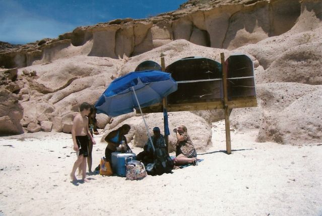
we and other boats went to a nearby beach to have lunch and swim in the sand bottom bay.
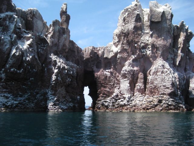
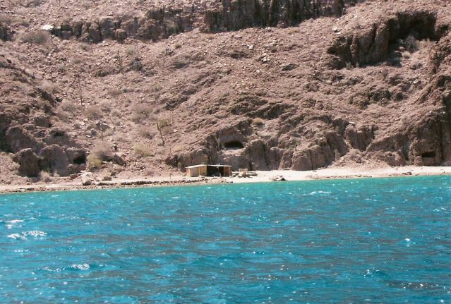
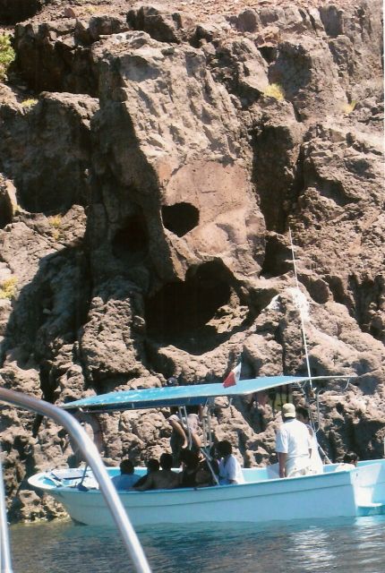
On the way back to La Paz, we stop to have a close look at a set of cliff caves called the mask, and the photos will illustrate why the name. The
first Spanish sailors to come to California should have been warned by it, as most of them died in their attempt to land at La Paz. They were
unwelcome by the Pericu natives, and the leader Fortun Jimenez and 22 of his crew were killed when they landed to take on water. The survivors sailed
back to the mainland and word eventually reached Cortes about the island they discovered, rich with pearls
The following year (1535), Cortes
personally came to La Paz, (he named the bay Santa Cruz) to start a colony and harvest the black pearls. The colony failed and most did not survive
the two years it was reported to have lasted.
This was a wonderful day and it sure was the icing on the cake of our time in La Paz, thanks to Steve and Zully! It was only fitting for us to take
them out to dinner at the famous resturant Las Tres Virgenes (alta cocina peninsular) owned by a friend and fellow Baja Nomad, Jesse. Here is
what I posted on Facebook:
We were in La Paz last month and came to Las Tres Virgenes with our La Paz friends Steve and Zully. The service and the food were OUTSTANDING, AAA#1.
I am telling all my Baja bound friends that when in La Paz, they should treat themselves to a dinner here! My wife had the rib-eye and it was more of
a prime rib and she said was easily the best she has ever eaten. Between the four of us, we could sample several offerings. The lamb taco appetizer
was an awesome start to a great meal. My hat's off to Jesse and his brother Pedro for an outstanding restaurant and I only wish it wasn't 900 miles
away from my home! The address is Madero 1130, Colonia Central C.P. 23000 La Paz BCS, Mexico. This is just a couple blocks up the hill from the
Malecon, and north of the church. Telephone (612)123-2226 and they have a Facebook page, where I just posted the above comments.
Sadly, Jesse wasnt there, but his brother Pedro took good care of us and got Jesse on the phone so I could chat with him. It was a repeat of the last
time I came to his restaurant (in Tijuana, back in 2006) and he was gone that day, but I spoke to him then on the phone.
Well, it was a fantastic time in La Paz and the Cape region the past four full days. Tomorrow we head back north with plans to overnight at Bahia
Concepcion and then head out the Vizcaino Peninsula to meet Blanca and Les at La Bocana then return to Shari and Juans bed and breakfast at Bahia
Asuncion.
Enjoy the photos for Sunday, Day 9:
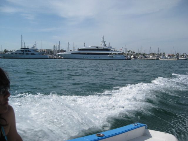
Leaving La Paz, some pretty large yachts are passed.
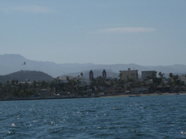
Looking back at La Paz, see the church steeples?
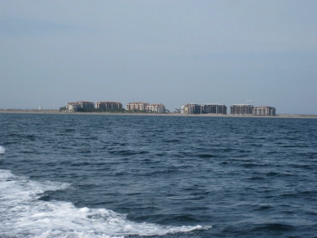
The doomed development on El Mogote.
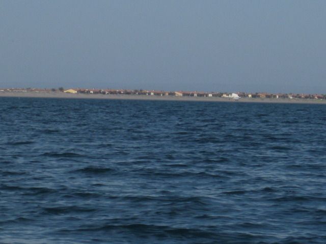
El Mogote housing
expect them to me gone during the next big hurricane.
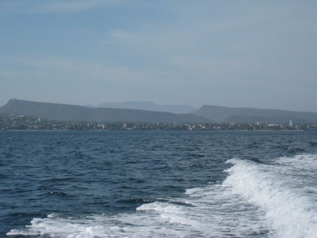
La Paz gets smaller as we cruise north.
American Navy coaling station, closed in 1925.
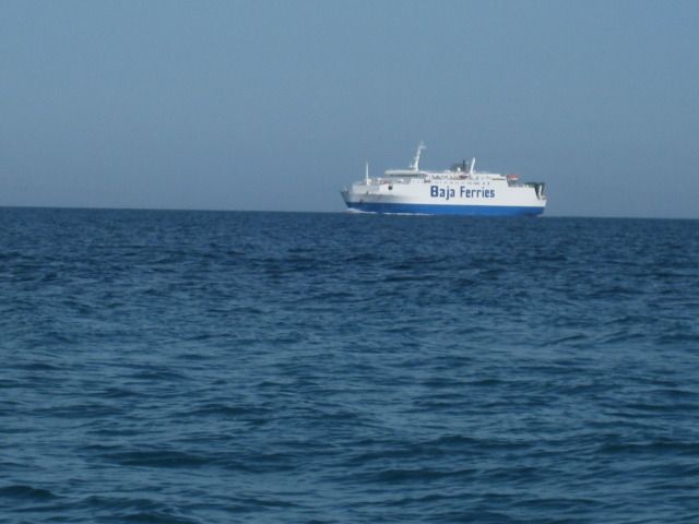
The truck and car ferry returning to La Paz from the mainland.
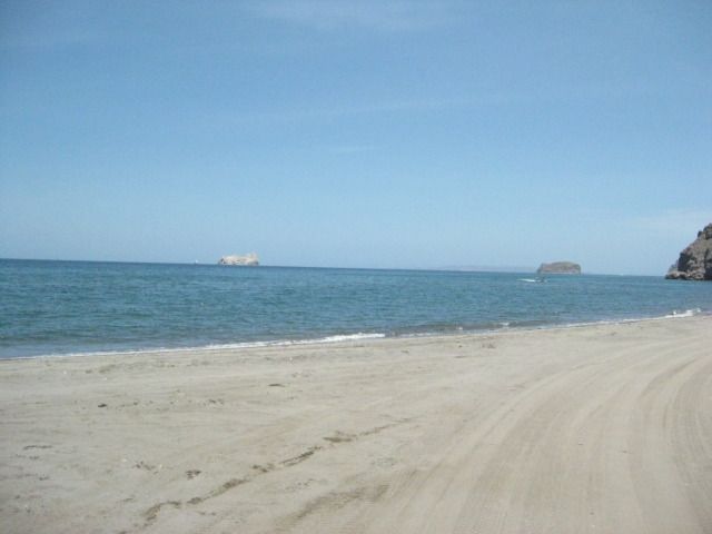
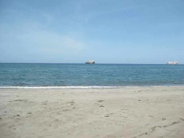
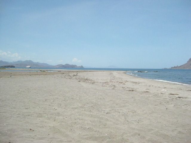
The mushroom rock as seen from the sea.
Crossing the San Lorenzo Channel.
BT photo
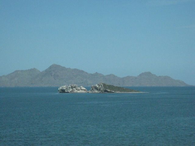
The San Gabriel pearl-oyster ruins of the early 1900s, on Isla Espiritu Santo.
BT photo
Steve, Zully, Jorge, Nikki
BT photo
Returning to our boat.
BT photo
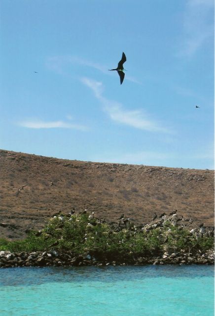
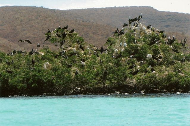
Frigates and their nesting area.
BT photo
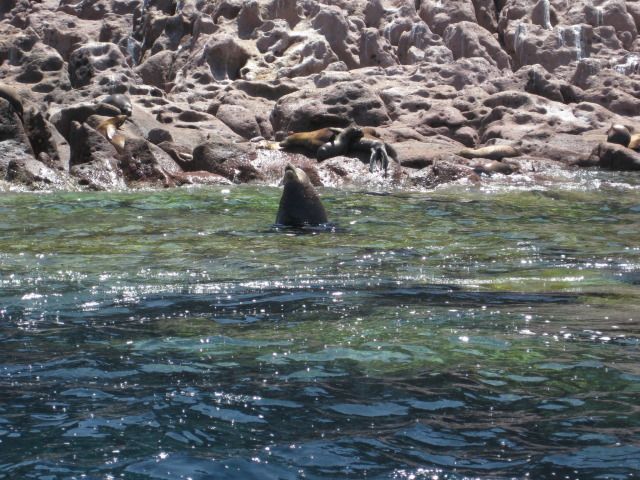
Several sea lions along the islands coast.
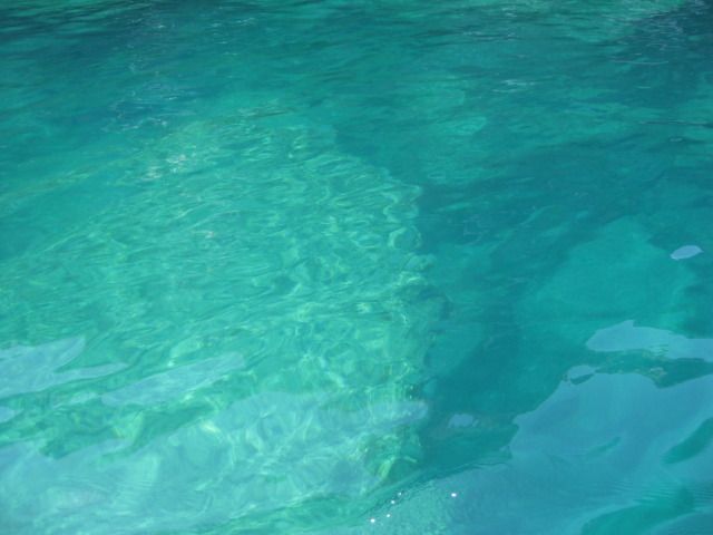
Clear sea water.
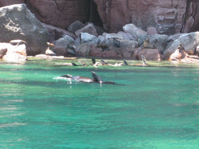
Nearing the snorkeling area we join many other boats.
BT photo
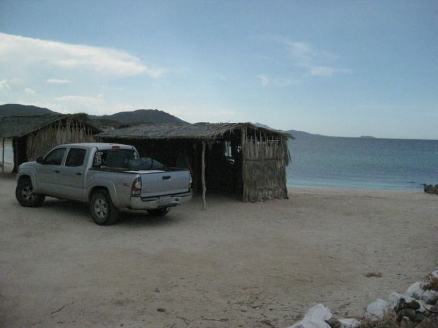
After our snorkeling experience, we cruised over to a sand beach on the island for lunchtime.
BT photo
Fishermens huts on the island.
BT photo
A popular stop is to see the mask.
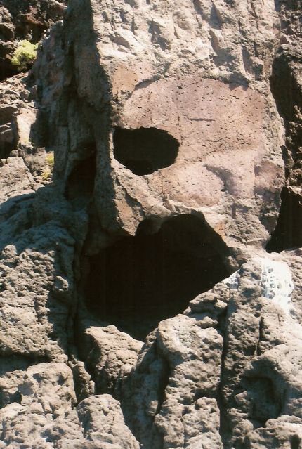
BT photo
BT photo
Heading back to La Paz!
BT photo
Such a great day, thank you Steve Bajatripper and Zully!
Tomorrow we head north for more fun, Baja style!
===========================================
|
|
|
Bajatripper
Ultra Nomad
Posts: 3152
Registered: 3-20-2010
Member Is Offline
|
|
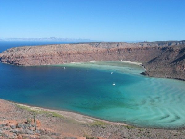
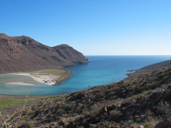
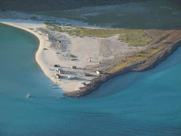
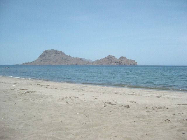
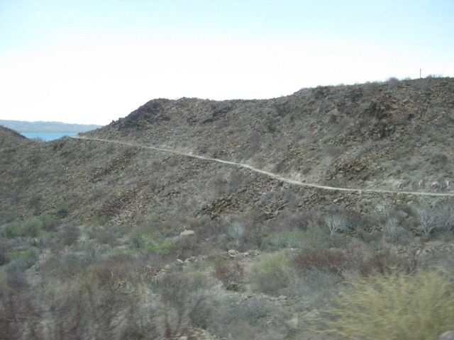
In his post, David mentioned that "Espiritu Santo Island" consists of two islands very close together. Espiritu Santo Island is the larger and
southernmost of the two while Partida Island is to its north. Some years ago I had the chance to climb a hill overlooking the channel separating the
two and took the following photos from Espiritu Santo Island looking over ar Partida Island.
This is the western entrance to Caleta Partida, as the channel is named. It's a popular anchorage for yachters and also has three fisherman camps
This photo is of the narrowest part of the channel. At low tide, one can't get a power boat through without shutting down the engine and
pushing/pulling the boat through the narrow channel
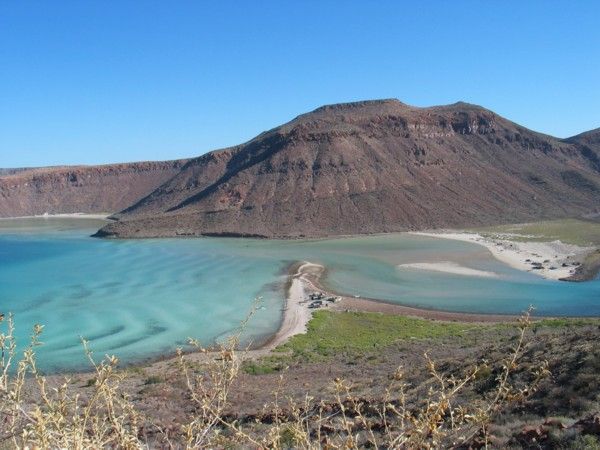
The eastern entrance to Caleta Partida
If you look closely at the waters along the opposite shore, you will see two rings of rock under water that archaeologists say are ancient fishtraps
which allowed fish in at high tide and--if they didn't leave before the tides changed--were trapped within the circles.
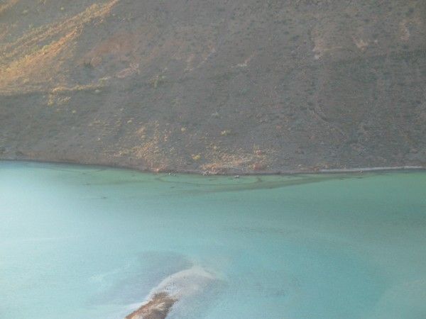
A closeup of one of the fishcamps, where I spent several days interviewing fishermen
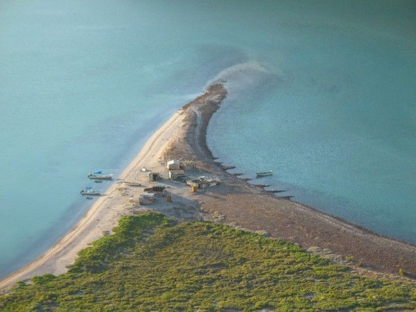
The fishcamp on the opposite side, on Partida Island
[Edited on 8-8-2012 by Bajatripper]
There most certainly is but one side to every story: the TRUTH. Variations of it are nothing but lies.
|
|
|
edm1
Senior Nomad
Posts: 568
Registered: 8-23-2006
Location: Oak Hills, Ca
Member Is Offline
|
|
As I remember Steve, there is not much fish to be caught in the area anymore. No?
|
|
|
El Vergel
Nomad
Posts: 197
Registered: 8-27-2003
Location: San Felipe - Puertecitos Rd., Km. 35 and Santa Mon
Member Is Offline
|
|
as i was about to ask....
days 10 through 15, PULEZE! Thank you all for the share!
[Edited on 8-8-2012 by El Vergel]
|
|
|
Bajatripper
Ultra Nomad
Posts: 3152
Registered: 3-20-2010
Member Is Offline
|
|
| Quote: | Originally posted by edm1
As I remember Steve, there is not much fish to be caught in the area anymore. No? |
While I have rotten luck fishing wherever I'm at (I've pretty much given up on it), there are still many fishermen who continue to earn a living using
the Espiritu Santo Islands as a base camp. But catches are getting smaller and younger, which is true pretty much all over the Bay of La Paz.
There most certainly is but one side to every story: the TRUTH. Variations of it are nothing but lies.
|
|
|
David K
Honored Nomad
Posts: 65559
Registered: 8-30-2002
Location: San Diego County
Member Is Offline
Mood: Have Baja Fever
|
|
Thank you Steve for those photos you climbed a desert mountain to take!
Vern, I have Day 10 done and will post next!
|
|
|
David K
Honored Nomad
Posts: 65559
Registered: 8-30-2002
Location: San Diego County
Member Is Offline
Mood: Have Baja Fever
|
|
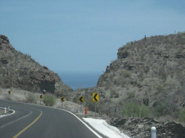
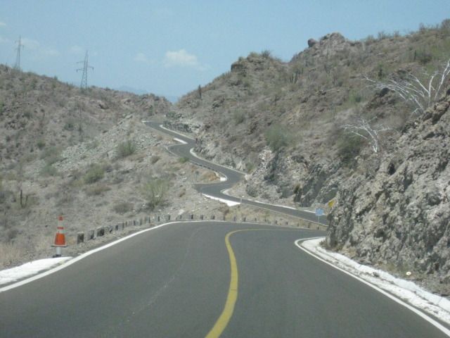
DAY 10, North to Ligui, Loreto, and Bahia Concepcion
Monday, July 23, 2012 (Day 10)
We have a final look at the beautiful back yard of Bajatrippers and say our goodbyes to Steve and Zully. We are on the road at 9:30am and head out of
La Paz. There is no inspection at the checkpoint outside of town, as we are waved on through. About 70 miles from La Paz is a small town of Las
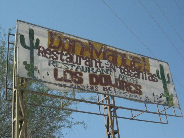
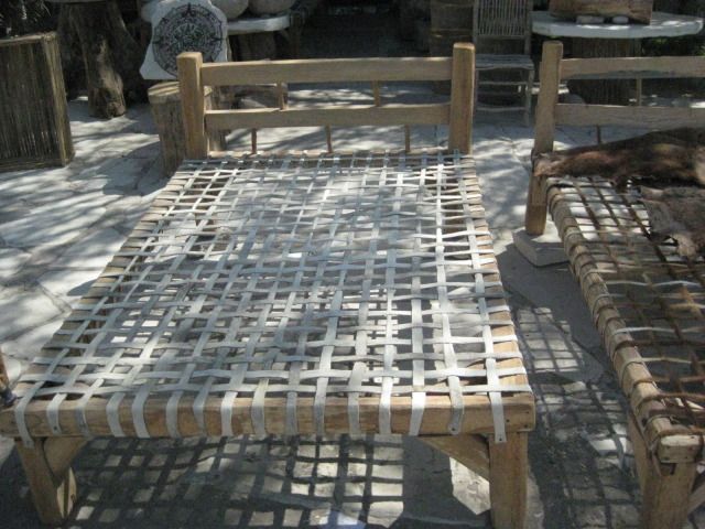
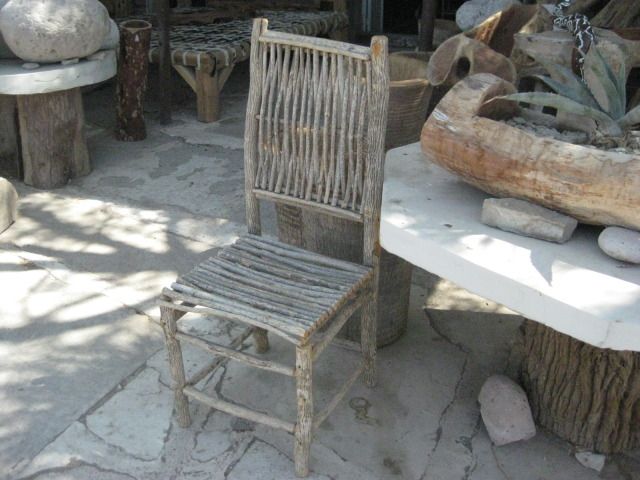
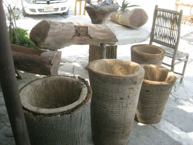
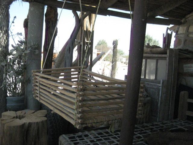
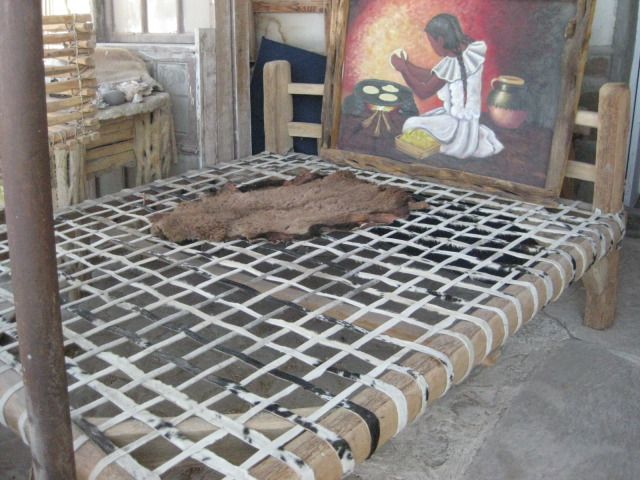
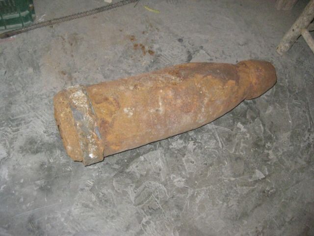
Pocitas and I spot some interesting furniture on display, so we stop. It is the shop of Manuel and he permits me to take photos of his arts and crafts
display. One item of interest is an artillery shell form Bahia Magdalena. Bajatripper had told me about how the U.S. Navy practiced shelling one of
the islands of Magdalena Bay (without Mexicos approval), many years ago.
We are back on the road at 11:15am. I note the the road to Mission San Luis Gonzaga is at Km. 195 ½ and would like to see it in person one day, but I
know we need to keep moving in order to set up camp before dark tonight. The 14th California mission (est. in 1737) will have to wait until the next
trip!
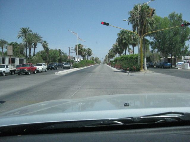
We enter Ciudad Constitucion and the highway becomes a divided multi lane affair at Km. 209. There have been repeated reports of hungry city cops
issuing tickets for the slightest or even no altercations. This was our second time passing through this city on this trip, and no police were even
seen, let alone provided us any harassment either time. The highway to Puerto San Carlos is at Km. 212 and we soon are out of Constitucion. The
highway remains 4 lanes wide for the next 16 miles to Ciudad Insurgentes, where Highway #1 turns to the east to cross over to the gulf coast. It is
12:31 at Insurgentes, as we keep moving back into the desert.
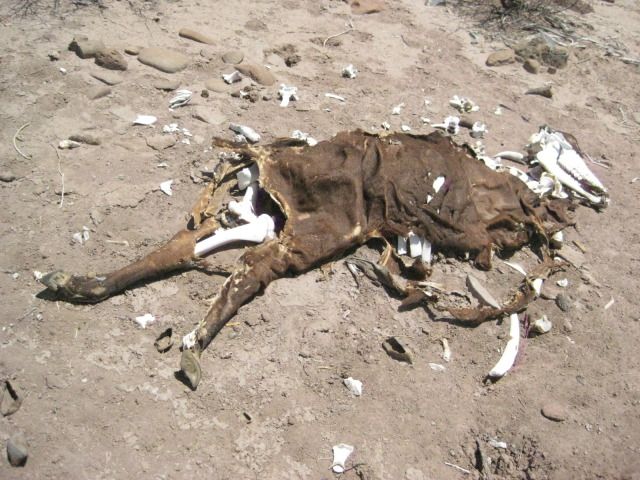
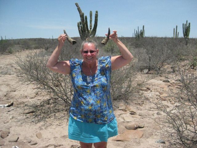
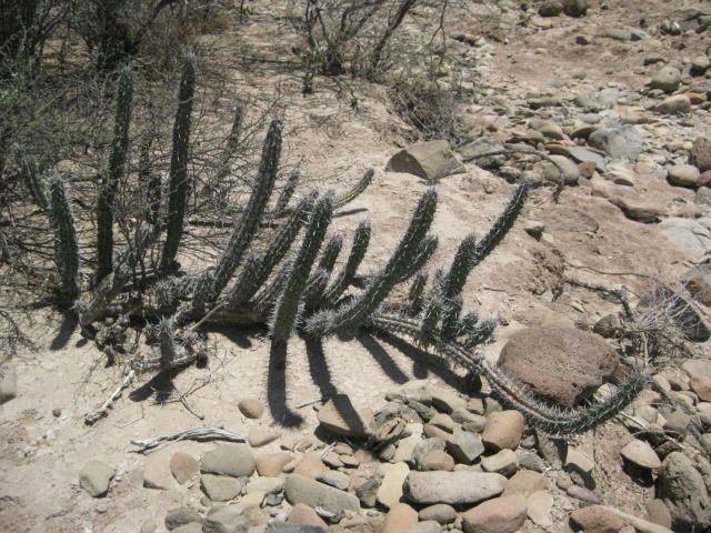
I see lots of pitahaya dulce cactus, but the fruit is not yet mature. We pull off to take photos and see a dead cow, that is mostly bones. Elizabeth
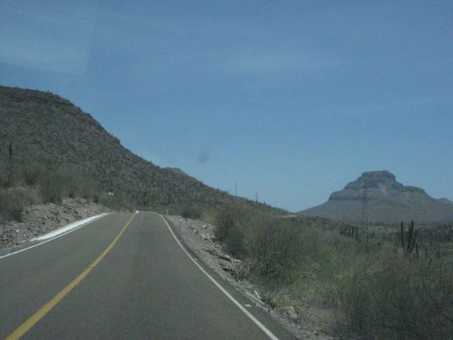
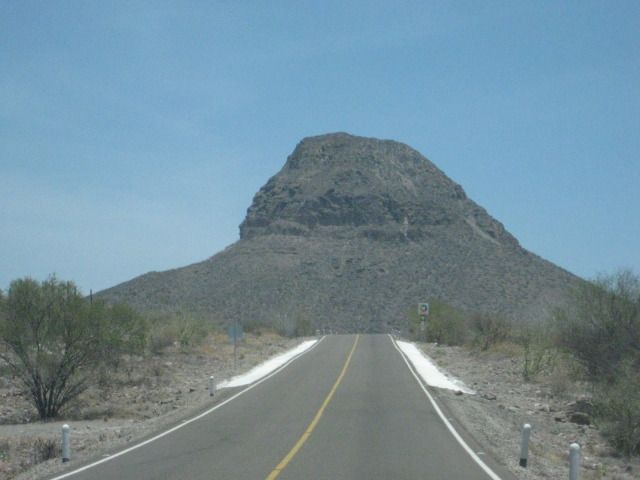
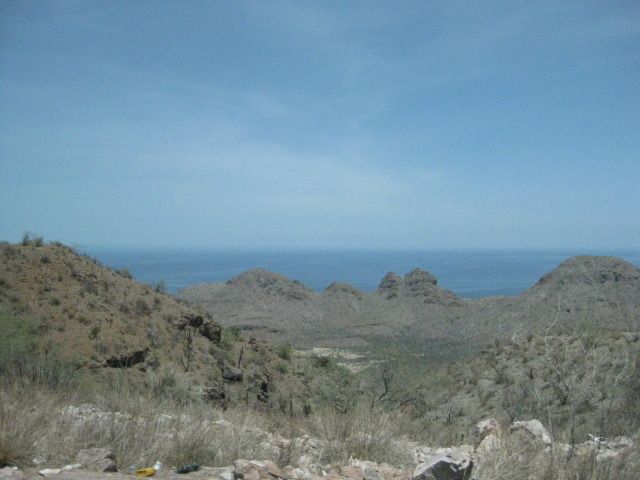
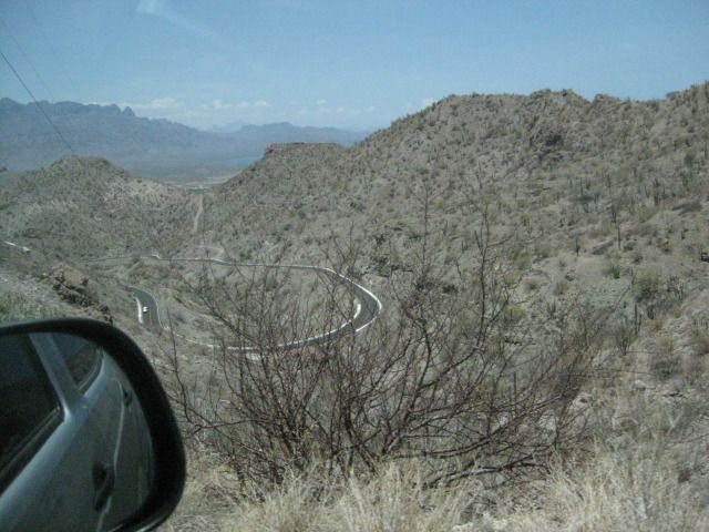
wants to save the horns, she doesnt ask for much. Not too much further we reach the top of the sierra, and the steep drop down to the coast. Ligüí is
not far from the bottom of the grade, so we pull off at Km. 84 ½ (by the school) and drive 0.6 mile to the monument to the 3rd California Spanish
mission, San Juan Bautista de Ligüí/ Malibat (est. in 1705).
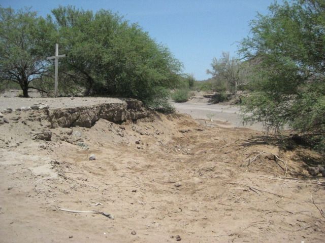
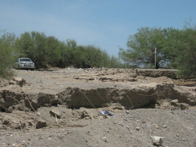
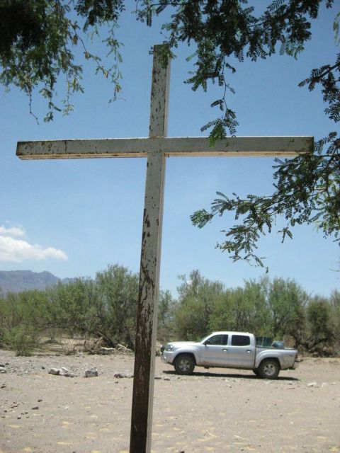
The mission foundation was totally washed away in 2001 by the changing arroyo, I took photos of the rubble back then. By 2009, on my next visit,
people erected a cross and a parking area just beyond were the mission once stood, as a monument. Today we find that the arroyo has widened more and
has started eating away at the new memorial site!
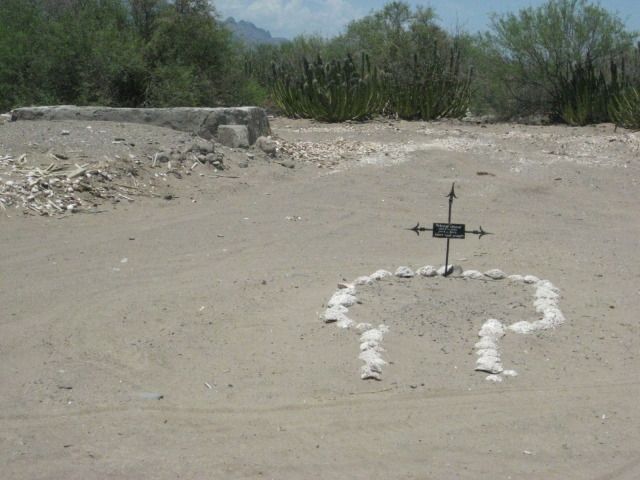
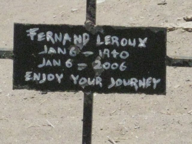
There is a new grave across the road from the memorial park. We continue the half mile more to the beach of Playa Ligüí and see some property owner
has almost made the beach unreachable with his new fence right up to the palapas at this Playa Publica. We continue on from Ligüí at 2 pm and arrive
in Loreto at 2:30. First order is to top off the gas tank, as it has been 228 miles since La Paz. It takes 600 pesos to fill with 59.7 liters. Now
with nearly all of those miles on the highway, my mileage would typically be 17-18 mpg with the load I am carrying. My first clue that the pumps at
this Loreto Pemex (on the highway, by the entrance to town) are not accurate is the mileage with that many liters was only 14.4 mpg. When I filled up
in La Paz after driving south, my mileage was 16.8 mpg. Oh well, nothing to do, the gas is still a great deal at $2.95 a gallon.
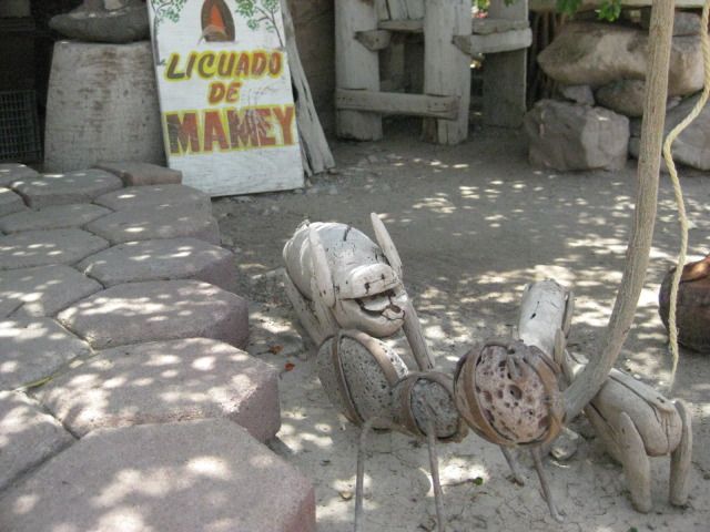
Just a mile north, on the west side of the highway, is the great fruit restaurant El Cañaveral, run by Charlie. We each order the fruit salad
(again) and I also try the Liquado de Mamey which is a smoothie made with the mamey sapote. What is a mamey sapote? Well, it is native to southern
Mexico and Central America, and is the national fruit of Cuba (either for the sweet taste or that it is red inside)! http://fruitmaven.com/2012/04/mamey-sapote/ and http://livefoodexperience.wordpress.com/2009/08/13/mamey-sap...
Are a couple of web sites showing them. I described the mamey liquido like a cross between a chocolate and vanilla milk shake. Yum!! We also had a
serving of coconut horchata to cleanse the palate.
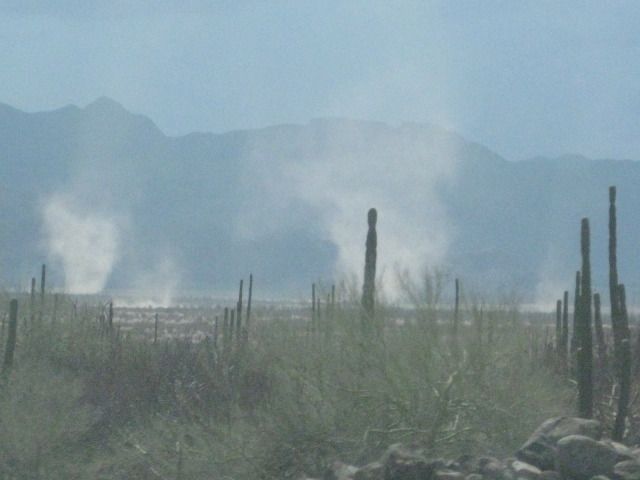
It is 55 miles from Loreto to Playa La Perla on Concepcion Bay. Along the way is a military checkpoint, with the typical questions and search and then
we saw several huge dust devils to the west of the highway.
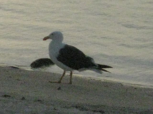
We arrived at La Perla on Bahia Concepcion about sunset. The other family that was there last week were gone, we were all alone
until a seagull made
himself our friend and actually would take food from Elizabeths hand! It took a while, mind you
but it was pretty cool.
Mondays photos:
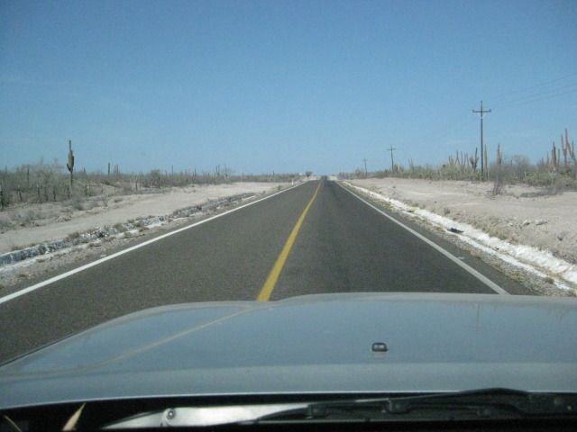
On the road again!
Stopped here in Las Positas.
U.S. Navy shelling a Baja island, maybe 100 years ago?
Entering Ciudad Constitucion
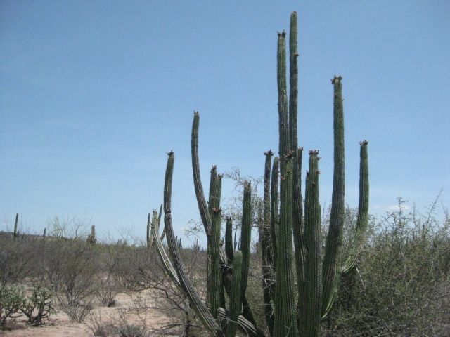
Pitahaya dulce cactus. Sweet pitaya/pitahaya cactus fruit.
Pitahaya agria cactus. Despite the name (Sour pitaya), its fruit is also excellent.
Back to the Cortez side we go!
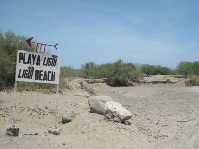
The only fork driving towards the mission and beach of Ligüí. To the right goes to Ensenada Blanca.
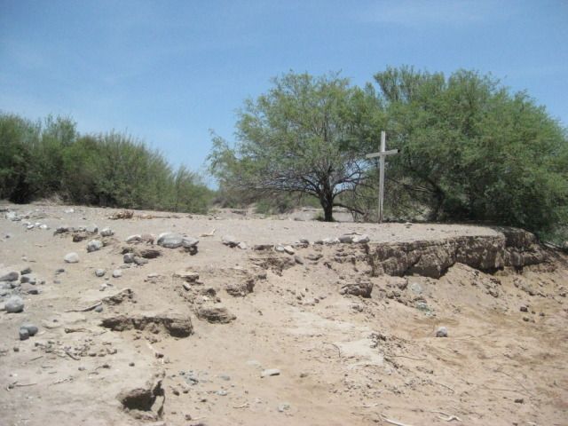
The monument to the washed away mission ruin is also soon to wash away.
Playa Ligüí, A 180º panorama begins here, looking south and swings around to the north
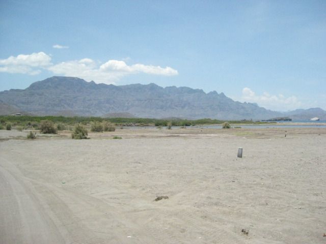
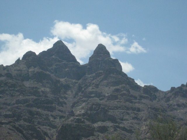
The Sierra de la Giganta.
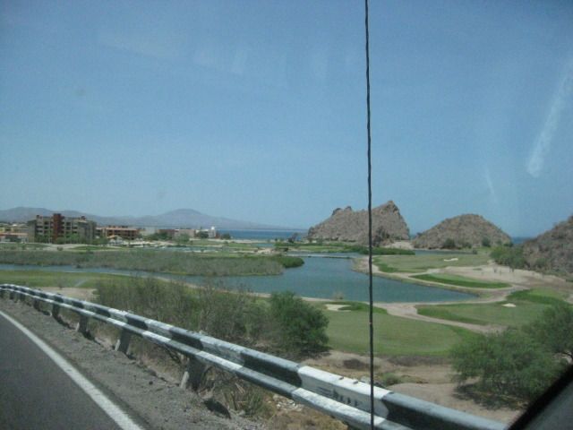
This used to be a lagoon and island called Nopolo, I swam here in 1973. Now, its a golf course.
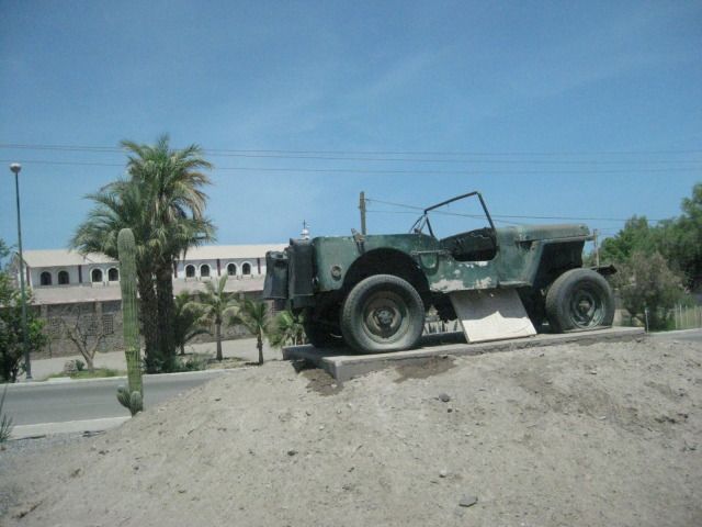
This Jeep at the entrance to Loreto must have a story?
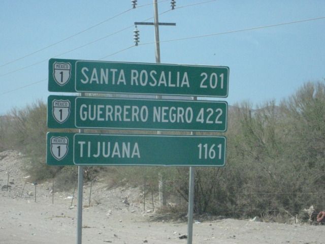
Loreto is just a few kilometers away from these other Baja towns.
Back at the Fruteria El Cañaveral, just north of the Loreto entrance road.
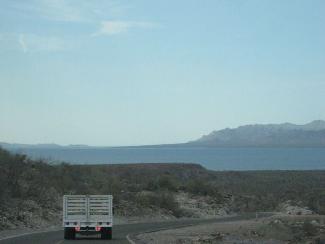
The south end of Bahia Concepcion.
The old Baja main road, carved into the hillside at Bahia Concepcion.
Driving into Playa La Perla, we use some of the old main Baja highway. This was the road to La Paz before 1970 when the new highway roadbed was built
from Loreto north to Santa Rosalia. The entire new highway was completed in late 1973.
Tomorrow, we drive across to the Pacific coast of Baja, and meet new friends at La Bocana and see old friends at Bahia Asuncion!
==============================================================
|
|
|
BajaBlanca
Select Nomad
Posts: 13247
Registered: 10-28-2008
Location: La Bocana, BCS
Member Is Offline
|
|
wow. amazing journey. you all packed so much into your days ! Thanks, again, for taking the time to do this !
|
|
|
Mulegena
Super Nomad
Posts: 2412
Registered: 11-7-2006
Member Is Offline
|
|
A little bit of Baja Delight
Love to see the child-like wonder and glee of Baja Angel as she explores.
So glad you two had a fun and safe trip!
"Raise your words, not your voice. It's rain that grows flowers, not thunder." ~Rumi
"It's the mark of an educated mind to be able to entertain a thought without accepting it." ~ Aristotle
|
|
|
David K
Honored Nomad
Posts: 65559
Registered: 8-30-2002
Location: San Diego County
Member Is Offline
Mood: Have Baja Fever
|
|
Thanks, it was great.. the entire 15 days was a success (well the one tire flat wasn't)... Baja Angel has never been to La Paz or the cape before, and
having Nomads show us around really made it much more awesome!
Wait to you see some really special things we saw the next days of this trip!
|
|
|
David K
Honored Nomad
Posts: 65559
Registered: 8-30-2002
Location: San Diego County
Member Is Offline
Mood: Have Baja Fever
|
|
Hey, there is one thing I forgot to include in my report... our XM sat radio started being interrupted south of Insurgentes (like driving under a
bridge at home). Once south of Santa Rita is was too difficult to listen too. The same was true in the opposite direction. I briefly tried in La Paz,
and got it there, but most of the time we were with Steve and Zully, so we didn't have it on, if it did work. So, that part of the Magdalena Plain and
hills to La Paz is not in a good area to get satellite radio.
|
|
|
Curt63
Super Nomad
Posts: 1171
Registered: 3-28-2009
Location: San Diego, Ca.
Member Is Offline
Mood: Fish tacos and Tecate
|
|
Good stuff!
No worries
|
|
|
Baja4Rnr
Junior Nomad
Posts: 31
Registered: 1-3-2007
Member Is Offline
|
|
Story behind the Jeep.
Years ago I asked some of the locals about the Jeep - at that time I believe the jeep was located at the turnoff to San Javier. The story I got was
that the jeep used to belong to a local doctor who would use it to reach patients who lived in remote places, accessible over rough roads, including
the residents of San Javier. After the doctor passed away, they placed the jeep at the side of the road as a memorial to the doctor and his years of
service to the people, regardless of where they lived.
|
|
|
| Pages:
1
..
5
6
7
8
9
..
13 |
|