| Pages:
1
..
6
7
8
9
10
..
13 |
David K
Honored Nomad

Posts: 65559
Registered: 8-30-2002
Location: San Diego County
Member Is Offline
Mood: Have Baja Fever
|
|
Great story, thank you!
|
|
|
Bajatripper
Ultra Nomad
Posts: 3152
Registered: 3-20-2010
Member Is Offline
|
|
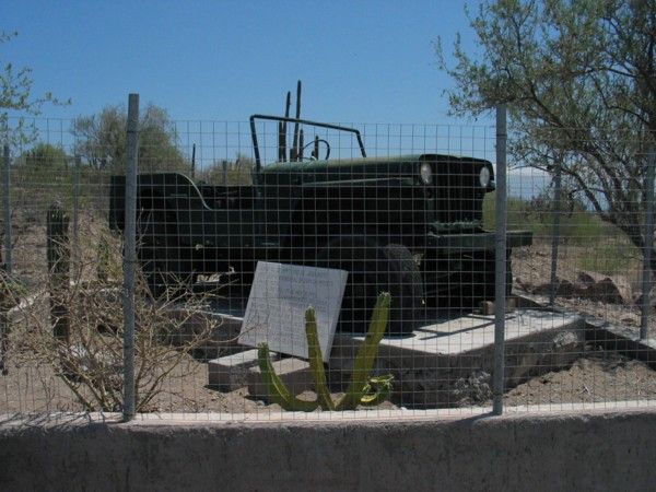
| Quote: | Originally posted by Baja4Rnr
Story behind the Jeep.
Years ago I asked some of the locals about the Jeep - at that time I believe the jeep was located at the turnoff to San Javier. The story I got was
that the jeep used to belong to a local doctor who would use it to reach patients who lived in remote places, accessible over rough roads, including
the residents of San Javier. After the doctor passed away, they placed the jeep at the side of the road as a memorial to the doctor and his years of
service to the people, regardless of where they lived. |
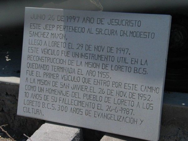
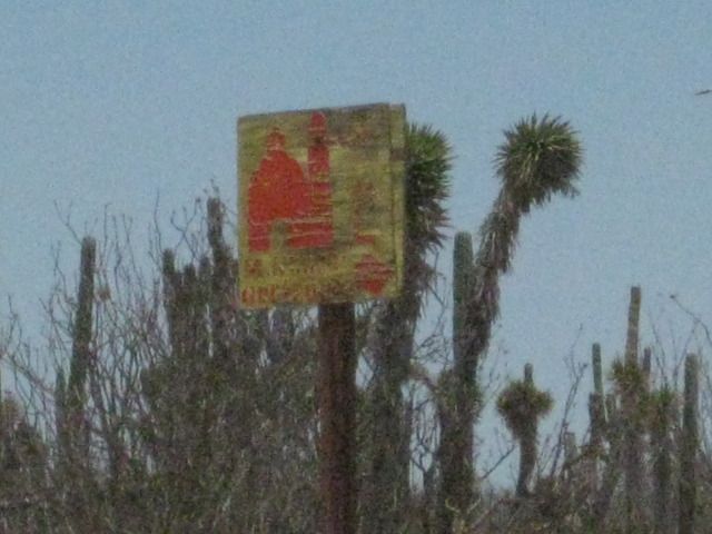
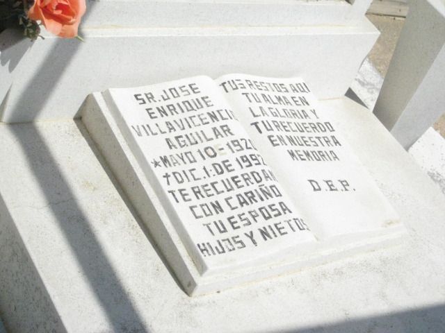
Close, but no cigar. According to a sign that use to be with the jeep at its old location on the turnoff to San Javier, the story of the jeep (loosely
translated) is as follows:
"June 26, 1997 year of our Lord.
This jeep belonged to the priest don Modesto Sanchez Mayon. He arrived in Loreto on Nov. 29, 1947. This vehicle was a useful instrument in the
reconstruction of the Mission of Loreto, BCS, which was completed in 1955. It was the first vehicle to reach San Javier by this road (the old road
between Loreto and San Javier up the Las Parras Arroyo) on Nov. 26, 1952. The town of Loreto (has placed it here?) to commemorate the 10th anniversary
of his (don Modesto's) passing on June 26, 1987.
Loreto, BCS. 300 years of evangelicalism and culture"
The old location of the jeep at the turnoff to San Javier
The sign that use to accompany the jeep, telling its story
[Edited on 8-9-2012 by Bajatripper]
There most certainly is but one side to every story: the TRUTH. Variations of it are nothing but lies.
|
|
|
David K
Honored Nomad
Posts: 65559
Registered: 8-30-2002
Location: San Diego County
Member Is Offline
Mood: Have Baja Fever
|
|
An even better story... thank you Steve!
|
|
|
David K
Honored Nomad
Posts: 65559
Registered: 8-30-2002
Location: San Diego County
Member Is Offline
Mood: Have Baja Fever
|
|
DAY 11: to La Bocana and Bahia Asuncion
Tuesday, July 24, 2012 (Day 11)
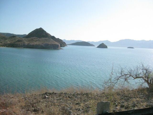
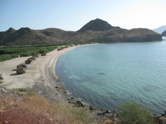
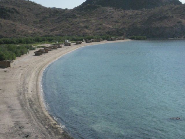
Our camp is pretty easy to pack onto the Tacoma, and this new easy-up tent is great. We leave La Perla at 9am and drive out on the El Requeson road,
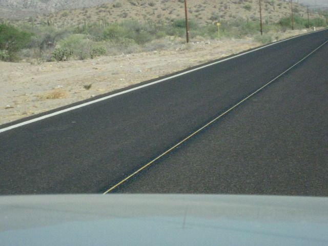
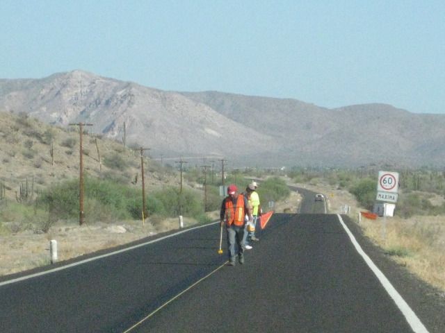
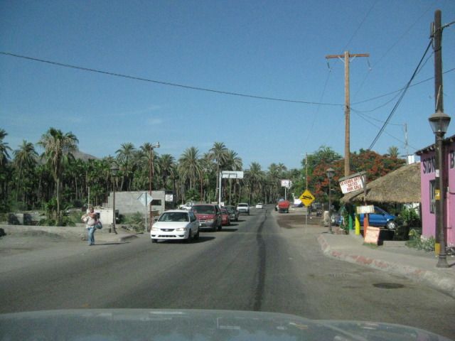
since we are northbound. We take photos of some views of Bahia Concepcion and of a highway crew painting new stripes on fresh pavement. Next we pass
through Mulege, without stopping and the same for Santa Rosalia. We have a long drive to get out to La Bocana and Bahia Asuncion, on the Vizcaino
Peninsula. That is the big point or hook of land that sticks out into the Pacific, halfway down the peninsula of Baja California.
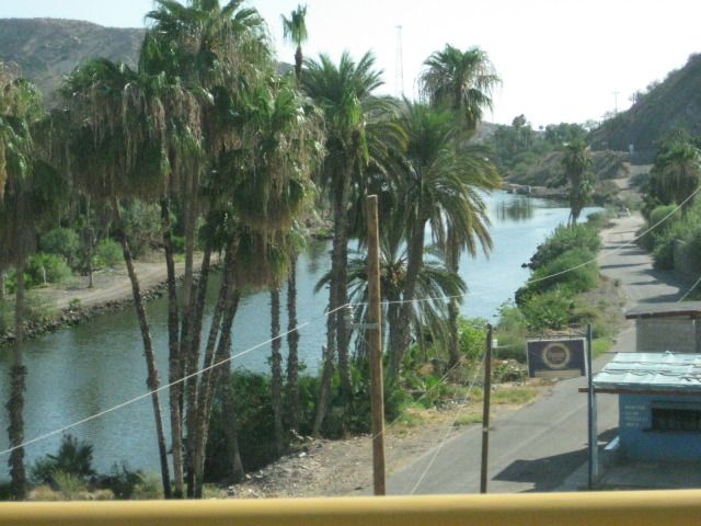
Both La Bocana and Bahia Asuncion have bed and breakfast establishments operated by members of the Baja Nomad forums on the Internet. We have stayed
at Bahia Asuncion once before (in 2007), and were looking forward to seeing the additions made there, since. The town of Bahia Asuncion has become
very popular with Americans and Canadians who heard about it on Baja Nomad, and came for the fantastic fishing or just a quiet get-away, in a small
Mexican town.
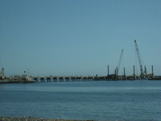
As we pass north of Santa Rosalia, and we get a photo of the new pier being built for the new mines openening up there for copper and manganese. New
discoveries and a rising copper price will pump life into this former French copper mining town, on Mexicos Baja coast.
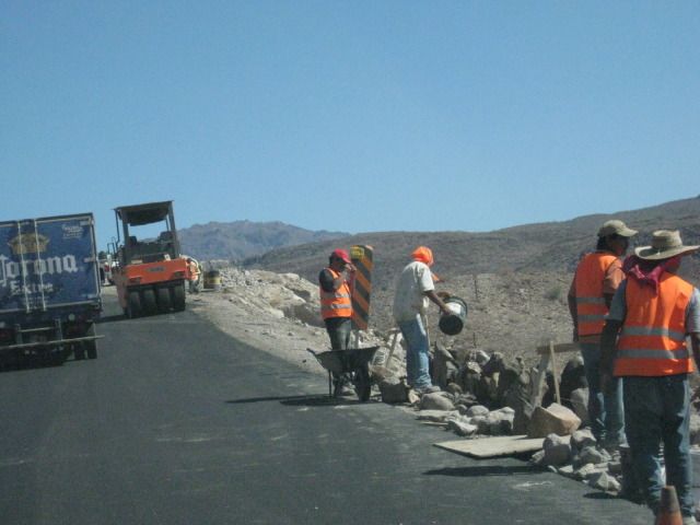
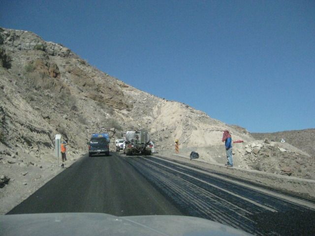
The steep grade Cuesta del Infierno was being widened and repaved and we were one of the first to drive on the new pavement heading up the grade on
this day. The narrow, shoulder-less Baja Highway, finished in 1973, is slowly being modernized to a wider highway with shoulders having enough room
to allow bikes or pedestrians safe space from the trucks, busses, and cars the highway was built for. It also allows for broken down vehicles to not
totally block a lane of traffic.
We arrive in San Ignacio at 11:14 am and fill up the gas tank for the long drive from here. It is 163 miles since I filled up in Loreto, so I need a
half a tank to top it off (40.3 liters/10.6 gallons), cost is 405 pesos ($31.40).
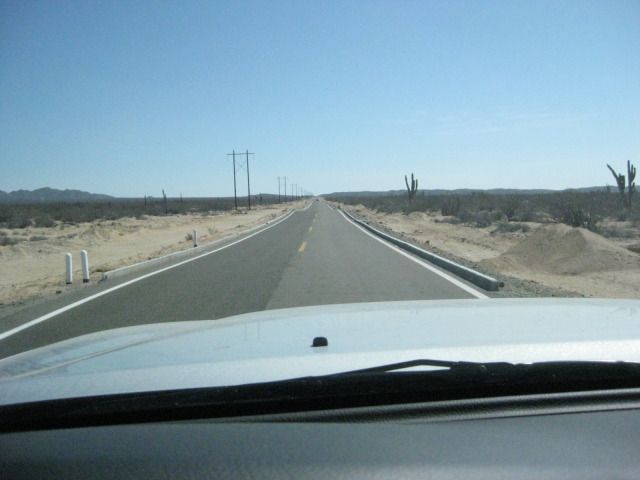
The highway to Punta Abreojos joins Highway #1, 14.5 miles west of San Ignacio at Km. 97 ½ and the road is paved all the way to Abreojos now, 65.5
miles. In 2007, the pavement ended about 10 miles from town.
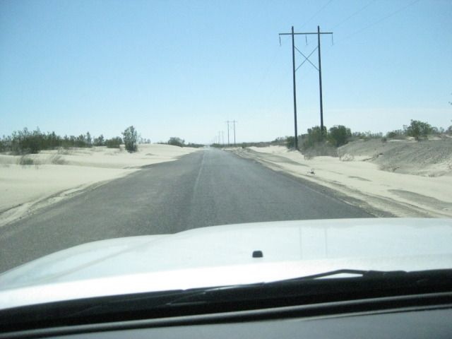
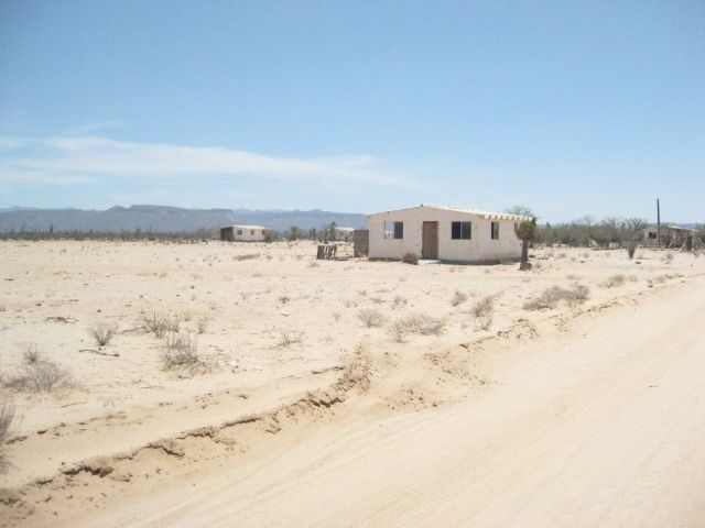
We arrive in Punta Abreojos and miss seeing the road on to La Bocana, so we turn around at the end of town (built on a point) and spot the north road
that drops down onto the salt flat
which is smoother than the graded dirt road, we missed at the entrance to town. Of course, after a real big high
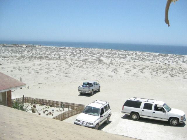
tide, you dont want to use the salt flat! We leave Abreojos at 12:45pm and have an easy drive for 12.6 miles to the La Bocana Bed & Breakfast run
by Blanca and Les www.labocanahotel.com located on the west side of town with a clear view of the Pacific, beyond the expanse of low dunes.
We are invited to see their rooms and then asked if we would like some chicken stroganoff
Why yes, thank you! Their newest and biggest room is quite
the accommodation. I called it the Deluxe room and took several pictures. We had lunch and there was even some chocolate/lemon cake for dessert.
When I offered to pay for the great meal, she declined, but I said, for the children
(Blanca has been helping the village children get and do
things that can make a difference in their fishing village lives).
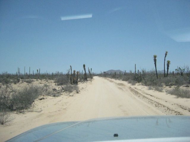
We left La Bocana at 3:12pm and after missing the correct street out of town, found it (maybe the only 4 way stop sign intersection in La Bocana) with
a small sign for Asuncion. The road now is a graded dirt road and had recently been graded, so the drive was pretty fast. A new water pipeline is
being placed in a trench along the road nearly the entire distance to Asuncion.
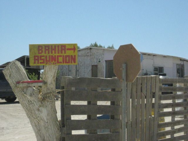
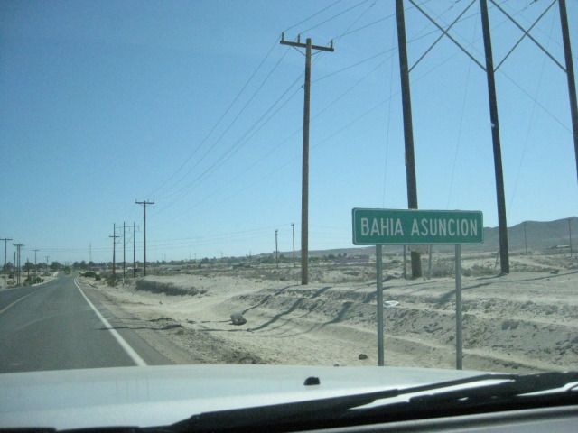
We reach the paved highway to Bahia Asuncion (at Km. 34), just 3 miles from town, and 44.7 miles from La Bocana, at 4:35pm. Juan & Sharis Bed
& Breakfast is on the far side of town, on the point with a clear view of Asuncion Island. Take the left fork at the Fisherman Monument where the
entrance road splits, then work your way over the rise to the other side of the point. To go any further past their B&B, you would be in the
ocean! www.bahiaasuncion.com . Shari was there when we drove up and showed us the new Rock room added since our last visit. It is actually two rooms,
available together or separately, so it is great for a family with children. Another new room was nearly finished on the other side of Sharis house,
the Dolphin room with great views. Upstairs will be another addition, in the near future. For dinner, Shari makes us abalone burgers! Food from the
sea is her specialty and you would be hard pressed to find a more pleasant and accommodating host. Shari came to Baja from Canada to study the whales
and marine life, over 20 years ago. She has made Baja her home, speaks Spanish like a native, and married to a local fisherman from the famous Arce
family that date back to the time of Spanish soldiers who guarded the missions. Sharis daughter (born in Baja) and son-in-law help operate their
campground in Bahia Asuncion, and are raising Sharis grandson, now about 2 years old! During the whale breeding season (Feb.-Apr.), Shari offers
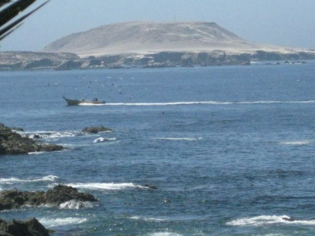
guided tours and whale watching from boats on the lagoon Ojo de Liebre (Scammons Lagoon). The gray whales swim right past her home, as well as they
migrate to and from the Bering Sea, off Alaska.
Here are todays photos:
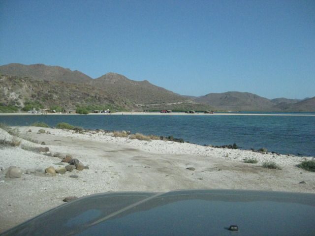
Leaving Playa La Perla and there is the sand isthmus of El Requeson.
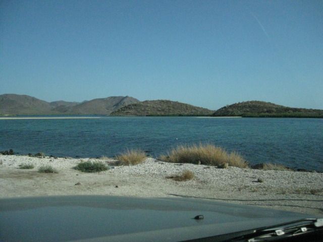
We camped there in 2007 http://vivabaja.com/707
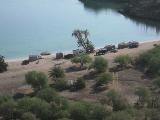
One of the most photographed beaches on Bahia Concepcion is El Coyote.
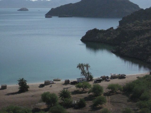
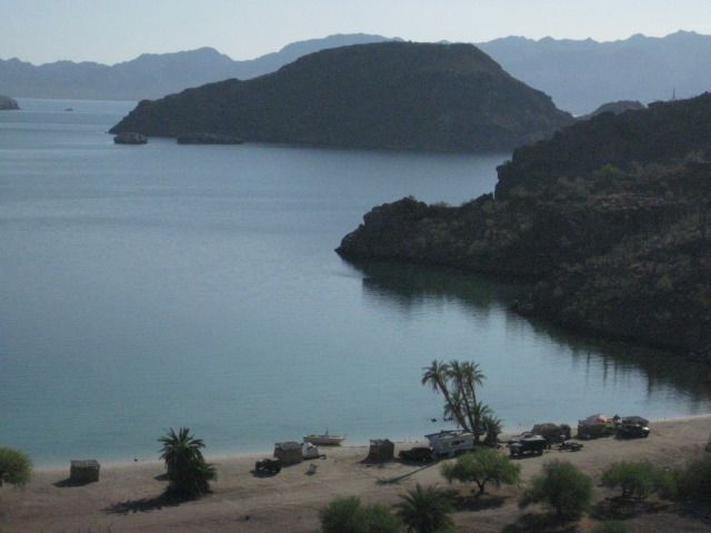
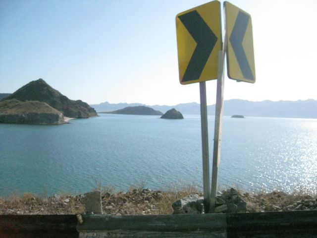
The highway offers many great views of this big bay and the islands it holds.
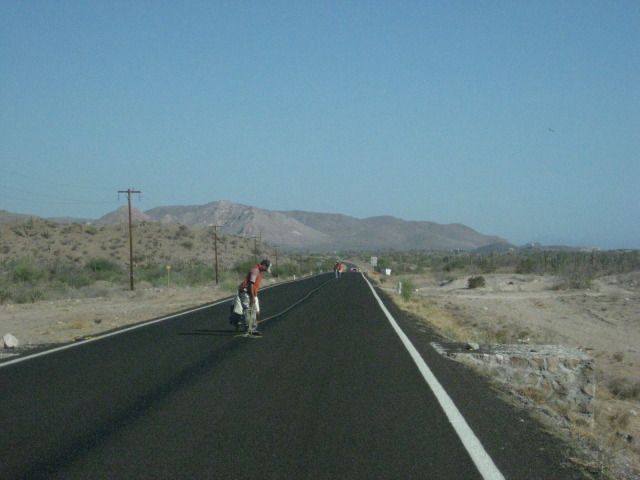
Elizabeth was fascinated with how they painted stripes on the highway.
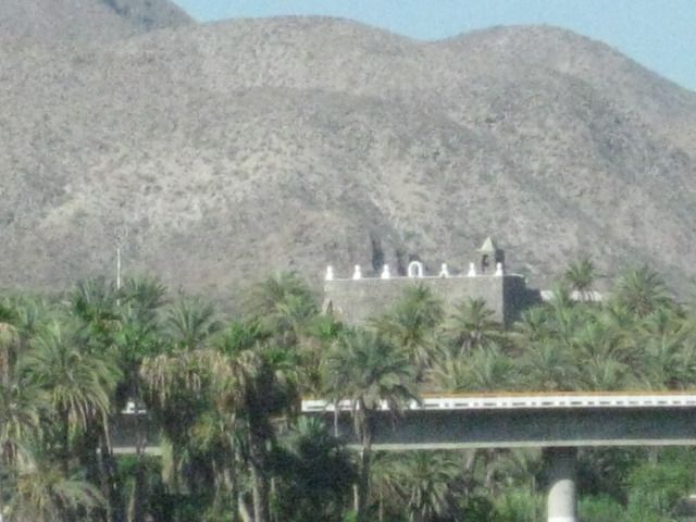
There is the Mulege mission in the distance, past the highway bridge, over the river. The mission was named Santa Rosalia de Mulege and was the 4th
Spanish California mission, founded in 1705. The stone church we see today was constructed beginning in 1766.
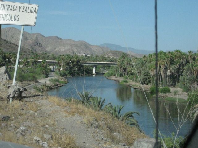
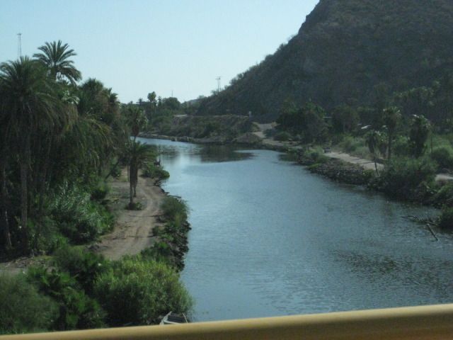
Mulege is often known as the Hawaii of Baja.
New mine pier north of Santa Rosalia.
It was dirt last week, but we get to drive on new pavement going back up the Cuesta del Infierno grade.
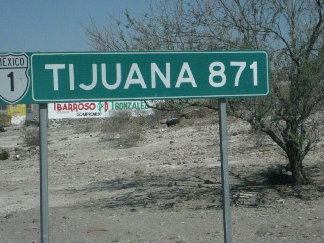
The distance from San Ignacio (540 miles) which is just 10 miles south of the halfway point between Tijuana and Cabo San Lucas (1,059 miles) on
Highway #1.
Just south of Highway #1, on the Punta Abreojos highway, the old main road is crossed
so naturally, I turn onto it for a photo! This was the main
road to La Paz from Tijuana before 1973. I traveled on this road with my parents in our Jeep in 1966... When driving in Baja was a REAL adventure!
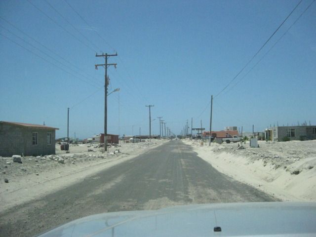
Arriving in Abreojos, a new Pemex gas station is not yet open, up ahead.

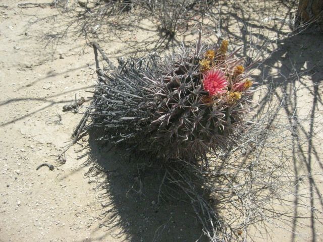
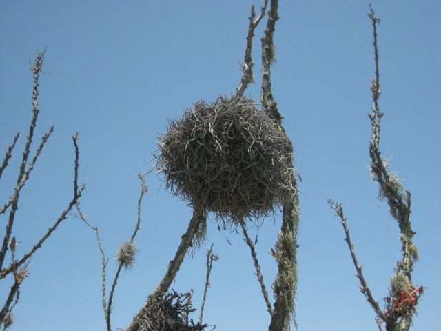
Ospreys make their nests on any high object.
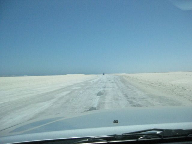
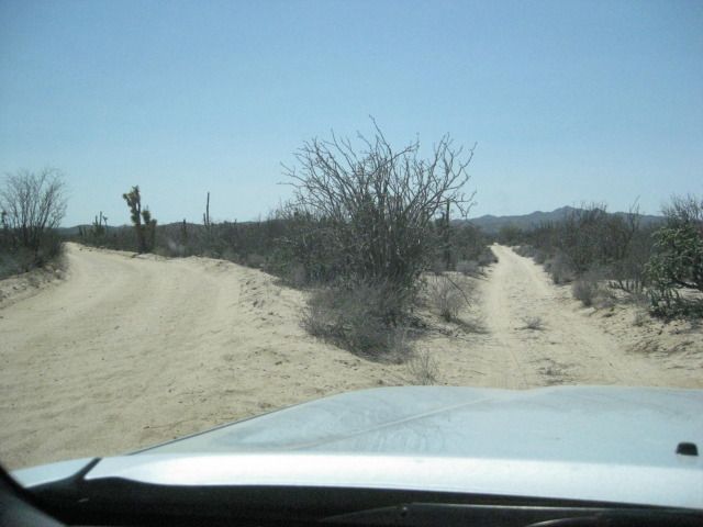
The fast road to La Bocana
If the ice caps begin melting, then this would not be an option!
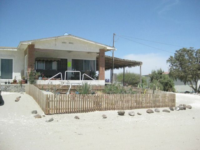
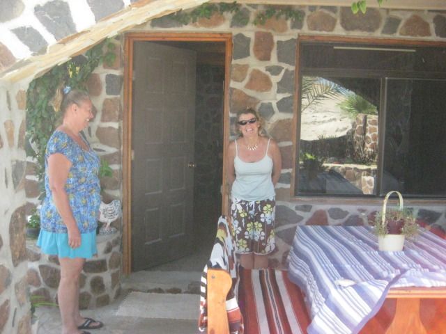
The front of Blanca and Les bed and breakfast in La Bocana.
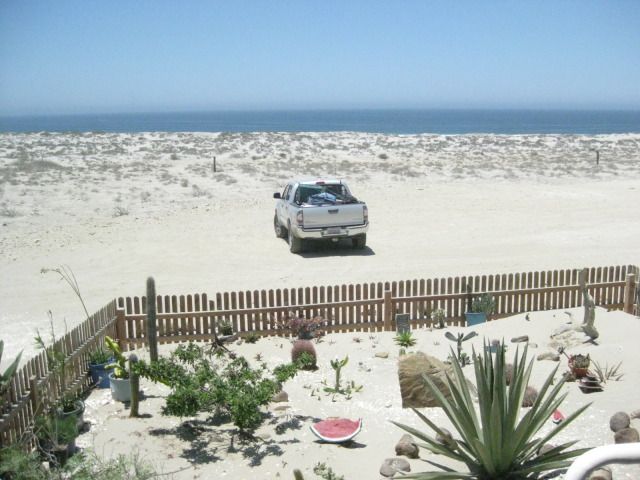
The view from the porch.
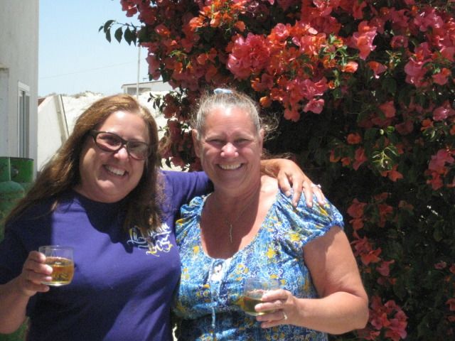
Blanca and Elizabeth.
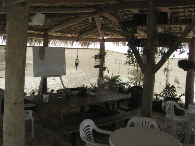
Nice place for a meal or drink, out of the sun and wind.
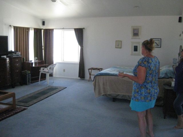
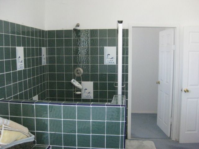
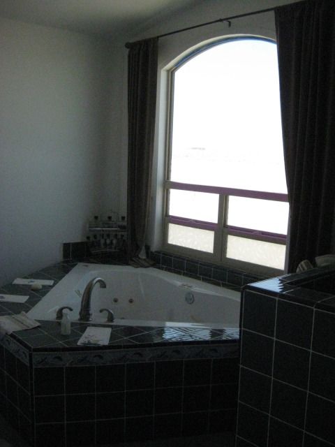
The Deluxe room.
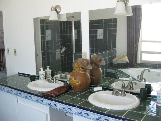
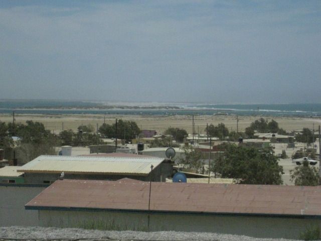
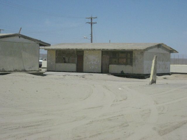
View of La Bocana.
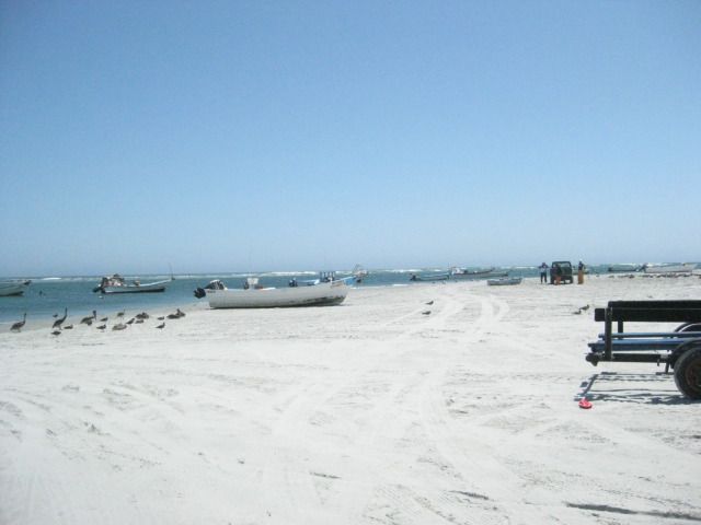
Blanca takes us on a tour of town. Here is where the fishermen launch their boats (pangas).
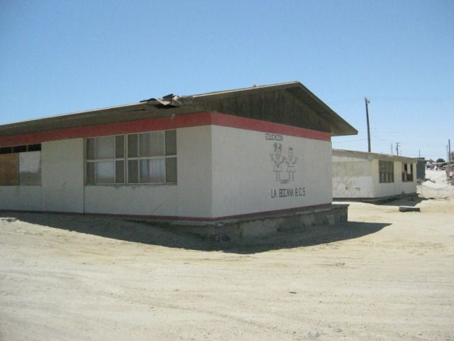
The school
our friend Antonios (Baja Cactus of El Rosario) father was the principle here, many years ago. Probably not the same building.
The road out from La Bocana, northwest to Asuncion.
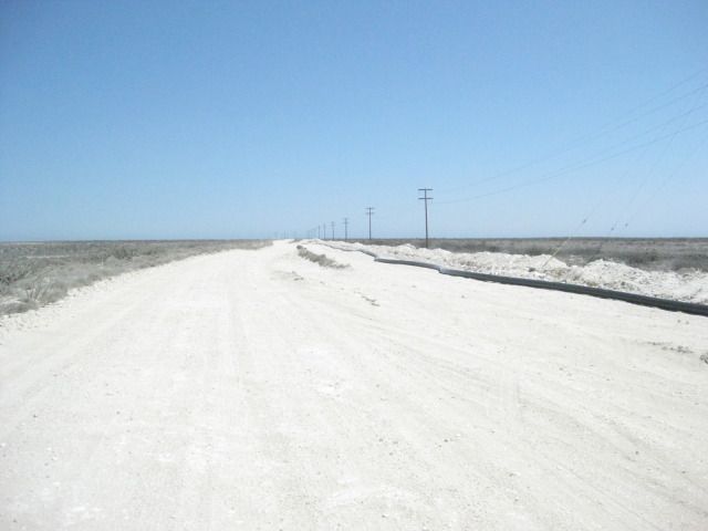
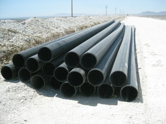
New water pipeline, coming over 100 miles from wells at Vizcaino.
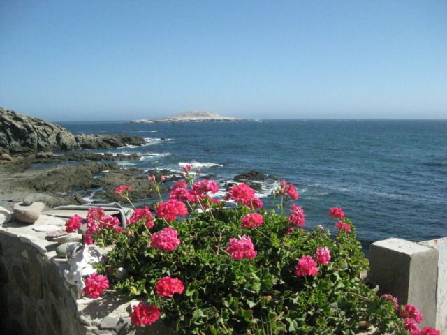
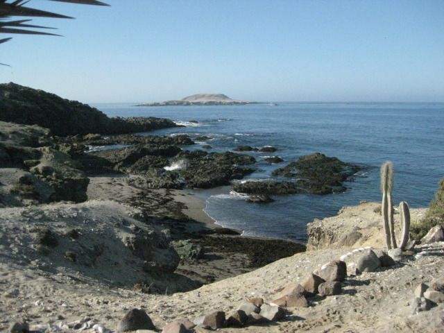
We made it, the Blowhole Bed and Breakfast at Bahia Asuncion.
Shari shows us the new Rockroom, and we get to stay there for two nights!
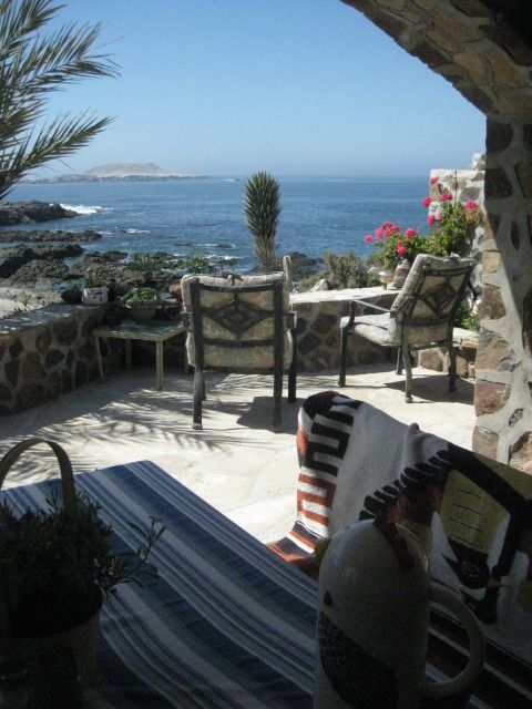
The view from one side of the Rockroom.
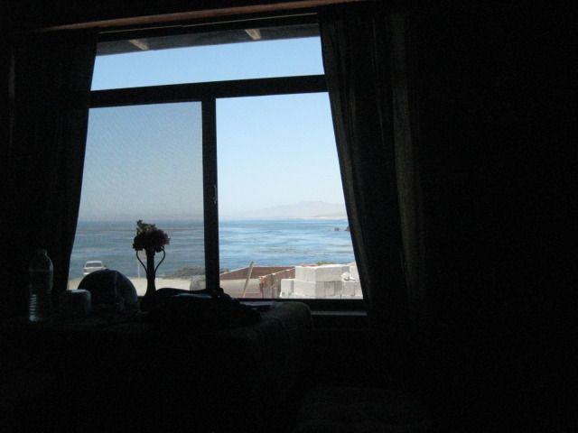
The other side view.
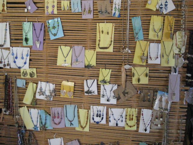
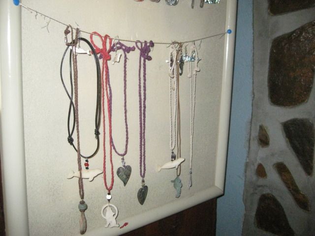
Shari makes jewelry.
The future upstairs room.
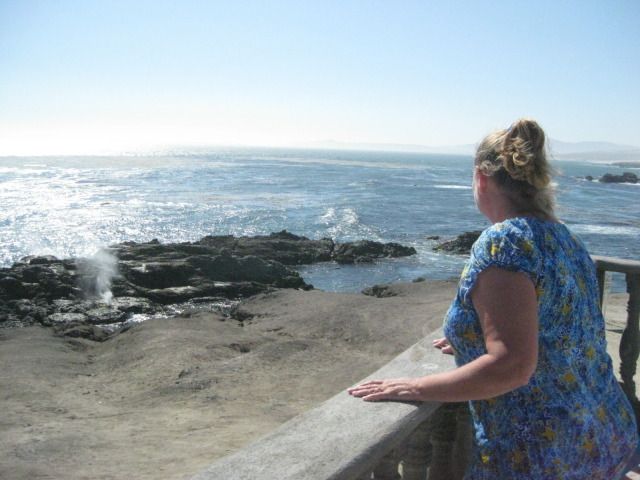
The Blowhole.
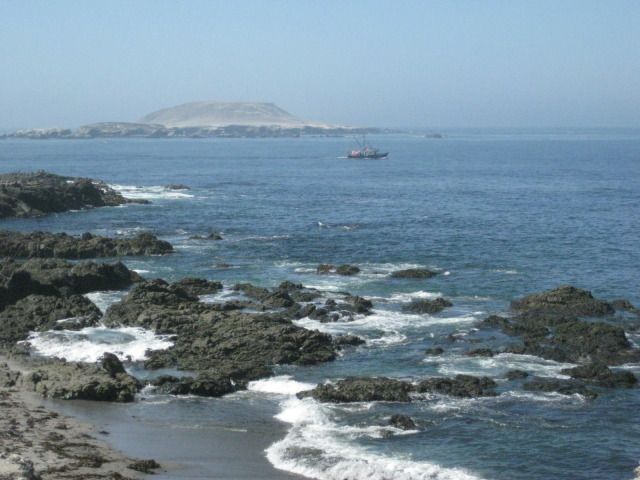
Hard to beat the view here, and listening to the sea lions barking from the island!
Tomorrow, we go hunting for fossils, including sharks teeth from the dinosaur age.
================================================================
|
|
|
edm1
Senior Nomad
Posts: 568
Registered: 8-23-2006
Location: Oak Hills, Ca
Member Is Offline
|
|
Ha "rock room", that's what it's called! We spent a day/night there last year.
Did you guys go to San Roque?
|
|
|
David K
Honored Nomad
Posts: 65559
Registered: 8-30-2002
Location: San Diego County
Member Is Offline
Mood: Have Baja Fever
|
|
| Quote: | Originally posted by edm1
Ha "rock room", that's what it's called! We spent a day/night there last year.
Did you guys go to San Roque? |
That will be told in the next part (DAY 12)... but, for you Art, the answer is no. We went there in 2007 and spent the better part of the day there,
including checking out the haunted church and Juan coming in with a client and their catch of yellowtail. We went almost there on our fossil
hunt, however.
|
|
|
BajaBlanca
Select Nomad
Posts: 13247
Registered: 10-28-2008
Location: La Bocana, BCS
Member Is Offline
|
|
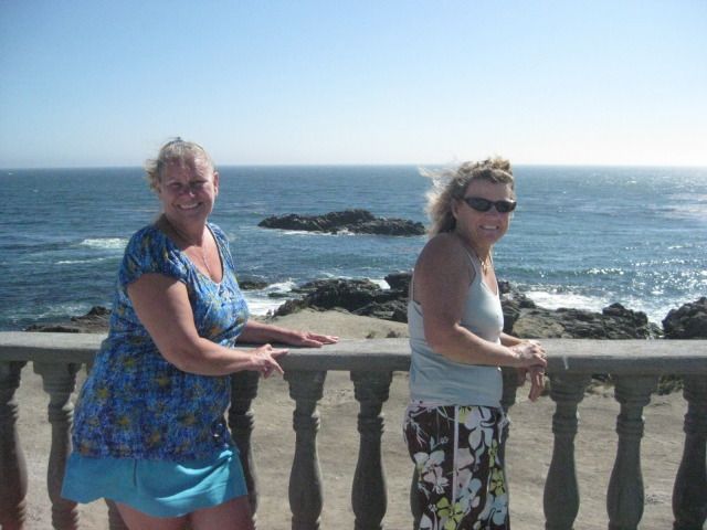
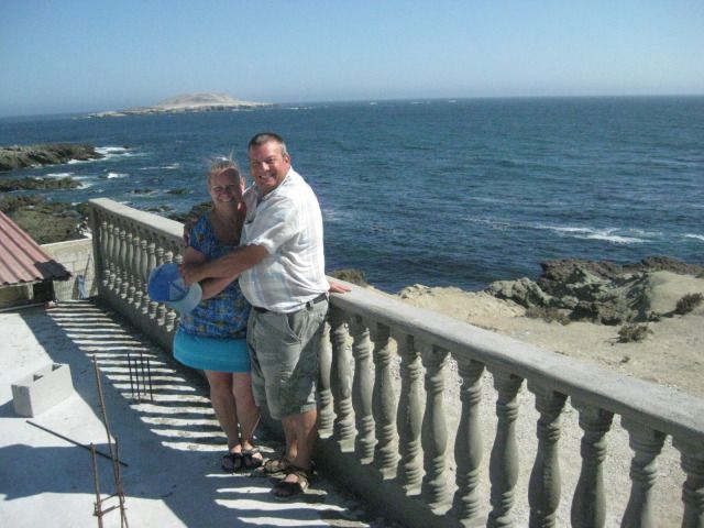
love the pic of you and elizabeth on the top varanda with the ocean in the background.....that rock room totally rocks ! absolutely stunning.
|
|
|
David K
Honored Nomad
Posts: 65559
Registered: 8-30-2002
Location: San Diego County
Member Is Offline
Mood: Have Baja Fever
|
|
DAY 12: Relaxing and Fossil Hunting
Wednesday, July 25, 2012 (Day 12)
We had a fantastic, restful sleep in the Rock room
great mattress and the sound of waves and sea lions were great white noise affects! Shari serves
us lobster omelets for breakfast and it is a super relaxing day with no rushing and no long driving. Ever since our first time at Asuncion, we have
wanted to return to do some fossil hunting. Megalodon teeth http://www.the-shark-side-of-life.com/megalodon-shark.html
have been found in the hills near Bahia Asuncion and we were anxious to have a look in the badlands a few miles away. In fact, it was a request from
Elizabeth to go so we could have a look, so think of this side trip to Asuncion as her anniversary present! Yah, I am willing to do things my wife
likes
like a good husband! Okay honey, if thats what you really want to do, I will go four wheeling for you and look for fossils. LOL
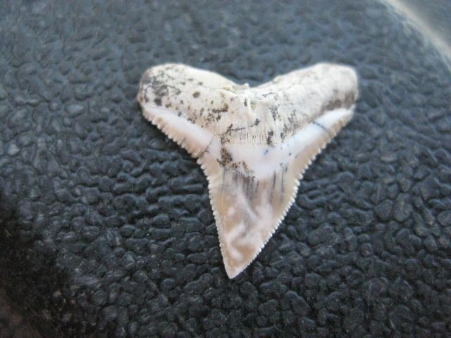
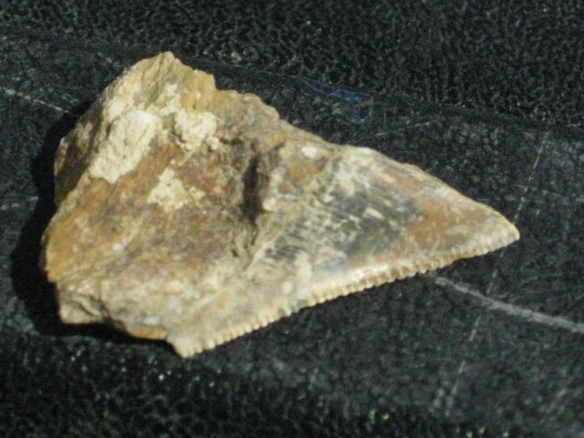
What was a surprise is that not long after picking one place to start looking, Elizabeth found a tooth! Way to go Baja Angel! We just enjoyed looking
at the hills and scanning the ground, and at another location, she found another
and I found one. It wasnt as nice as hers, and was broken, but
still it was fun. There also were lots of tube shaped pieces that looked light rusty ½ inch galvanized pipe. Shari would tell us later that they were
coral fossils.
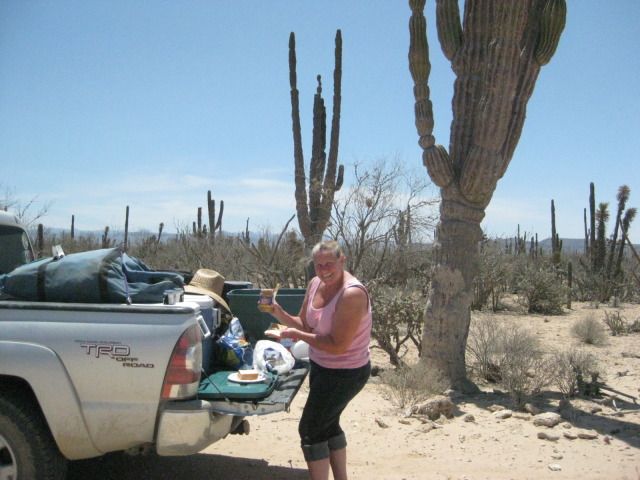
We spent all afternoon out there and it was fun, just Elizabeth and I wondering about and comparing discoveries. I placed them on my tailgate to
photograph before leaving them and the badlands behind as we returned to Sharis home and our Rock room. We met Baja Nomads Nan & D (Nancy and
David) who live at Asuncion full time now. They came over to check out the new dolphin room. Nancy is an artist who has paintings, coffee mugs and
other creative works on display at Juan and Sharis. For dinner we were fed lobster burritos and had a second great sleep.
Todays photos:
Lobster, its not just for dinner anymore!
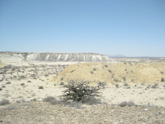
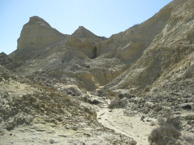
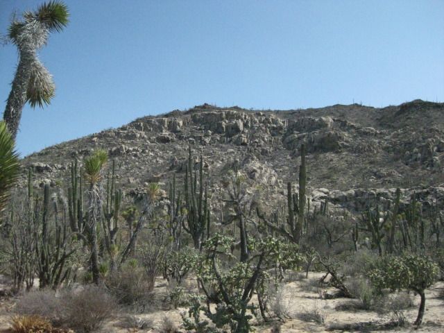
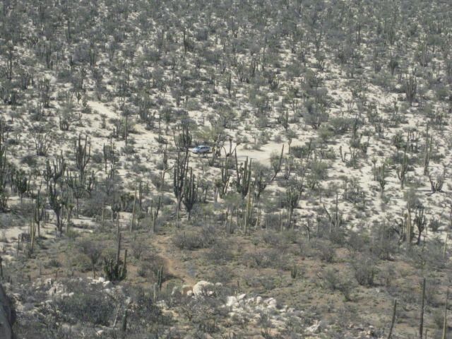
Asuncion Badlands
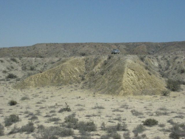
The first tooth was just to the left of my truck and about halfway down the slope. Look for shiny stones that stand out from the rest.
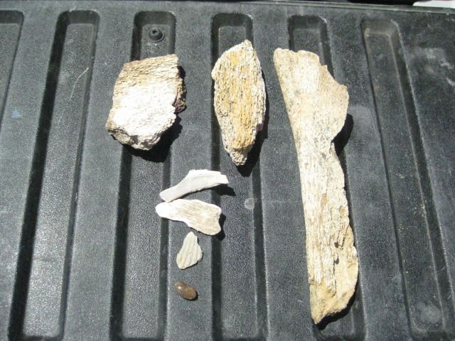
Whale bones are included.
At another location, under a shrub, I found this.
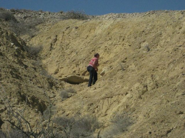
Elizabeth is a far better hunter than I. She tells me, not so fast
look slowly.
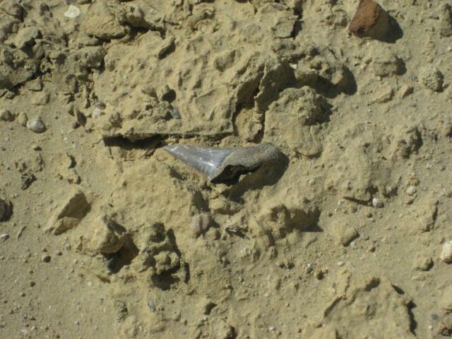
Sitting right on the ledge in front of her, a beauty.
The third area we moved to, and as Elizabeth opens the truck door, a tooth is right on the ground where she steps out.
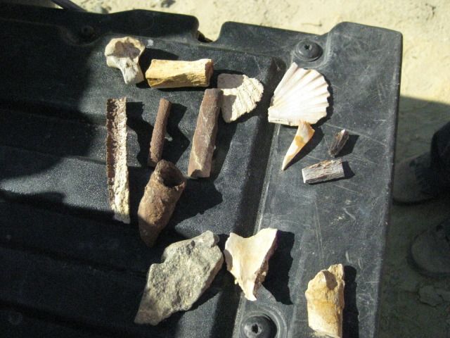
Fossil coral are the tube shaped pieces.
So, dont be in a hurry when hunting for petrified sharks teeth. We were out in the badlands for about 4-5 hours, having a great time
but we only
found about 4-5 teeth and a couple of them were not whole, and none were the big megalodon teeth.
What a relaxing place Juan and Shari have here. So many have also discovered Bahia Asuncion thanks to Shari getting onto Baja Nomad and really
boosting the entire towns economy in doing so.
In our room were some Baja books, and this one had an interesting cave shown.
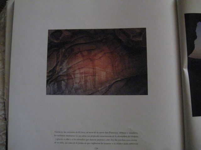
It also gave a location and we would be in the area, tomorrow!
=============================================================================
|
|
|
David K
Honored Nomad
Posts: 65559
Registered: 8-30-2002
Location: San Diego County
Member Is Offline
Mood: Have Baja Fever
|
|
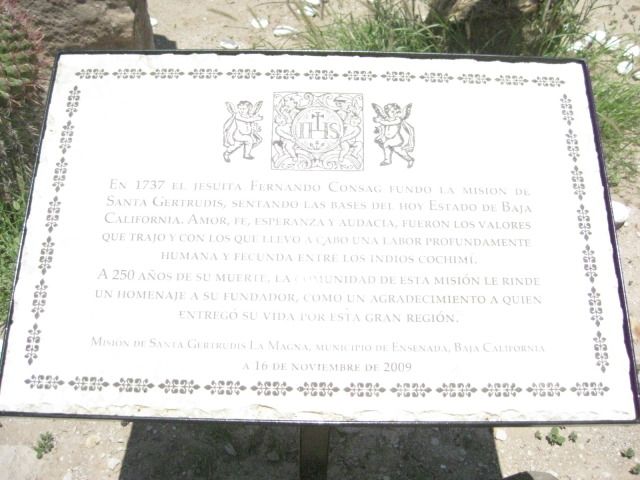
DAY 13: To Mision Santa Gertrudis
Thursday, July 26, 2012 (Day 13-a)
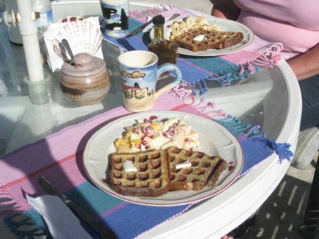
Today we awake after another great sleep, and we even asked for a wake up call so we wouldnt sleep in too long. Not long after we are up and dressed
did Shari deliver waffles with real Canadian maple syrup and fruit. It was great
!
The goal today is to go from the Pacific side of Baja over to the gulf side, and this being the widest part of the peninsula and over half on dirt
roads, we had some ground to cover. However, this is a site seeing vacation and we hope to see the 1752 Spanish mission of Santa Gertrudis, the ghost
town of Pozo Aleman, the giant cave art site as shown in the book we saw yesterday, and to camp at Punta San Francisquito.
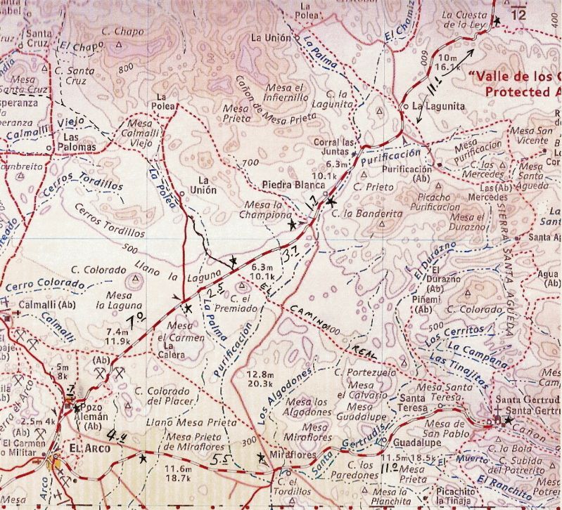
Take a look at the route map, and we are going from the far left side, across to the right side of Baja:
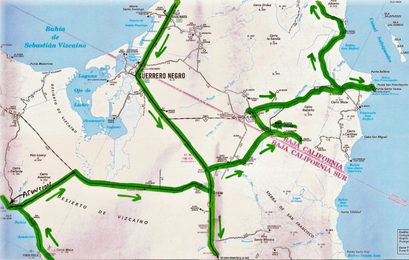
For those not familiar with the central part of Baja California, here is the peninsula map I posted earlier with the places we over-nighted shown:

I made a road log, starting at Shari and Juans Bed & Breakfast on the west side of the point at Bahia Asuncion:
00.0 Juan & Sharis 10:36am
00.9 Fork at fisherman monument, in town.
01.1 Miramar Market, Gas Pump
01.2 Police Station, Curvina Street (road to San Roque)
01.4 Divided street, Campo Sirena access.
01.7 End divided street, town entrance.
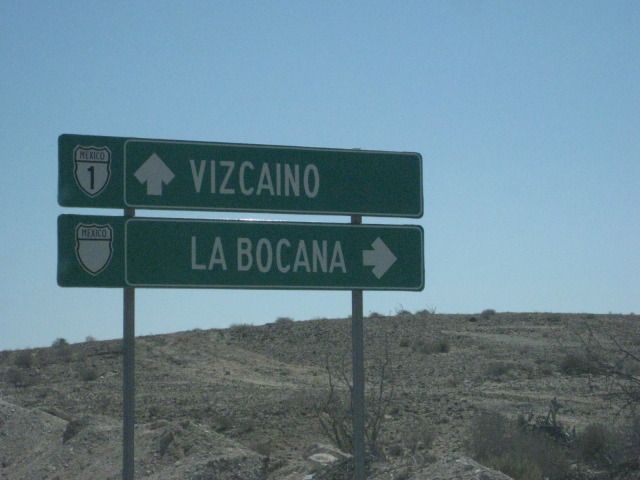
04.7 (Km.34) Road to Punta Prieta, La Bocana, Punta Abreojos
25.2 (Km.0) Junction with Vizcaino-Bahia Tortugas highway 11:05am. Turn east.
70.0 Vizcaino at Highway #1 12:00pm. Gas station is 0.3 mile to the north.
The highway to Vizcaino is 90% good pavement, but the 10% of big pot holes can really ruin the whole road, if you let it. There is also some drift
sand that covers one lane in a few places. Just lower your speed, and all will be fine.
00.0 Vizcaino at Bahia Tortugas Junction. Turn north.
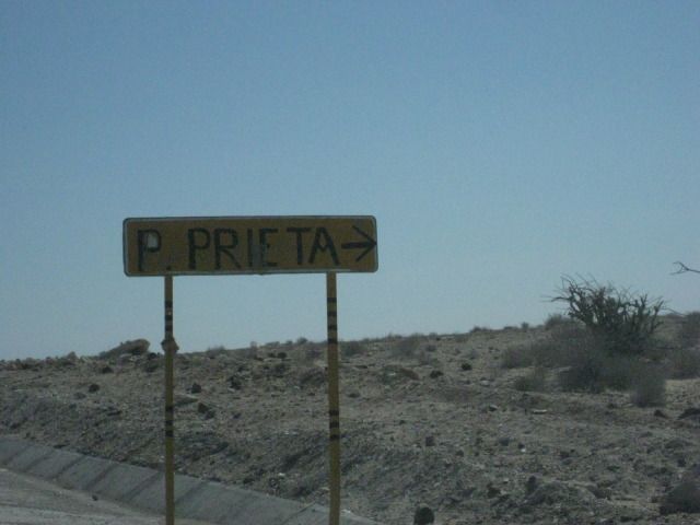
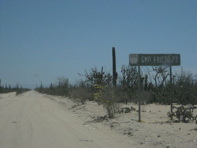
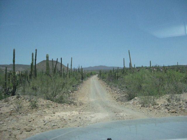
06.5 Turn onto dirt road, signed to Guillermo Prieto 23 km., but I measured it at 20 km. 12:22pm. We stop for a break a ways ahead and make sandwiches
(PB&J).
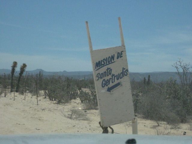
18.4 Mision Santa Gertrudis sign, pointing a left turn.
19.0 Center of Guillermo Prieto (Dark William), seems to be abandoned. Continue straight north.
30.1 The state border between Baja California and Baja California Sur. Also a change from Mountain Time to Pacific Time. A fence is parallel to the
border, about 80 feet north, per my GPS.
32.6 Intersection: Left to El Arco; Ahead to Punta San Francisquito; Right (signed) to Santa Gertrudis. 12:50pm/ Pacific Time. Reset odometer.
00.0 Intersection
00.6 Rancho Miraflores (made famous in Graham Mackintoshs second book, Journey with a Baja Burro, thanks to Grahams burro, Mision)
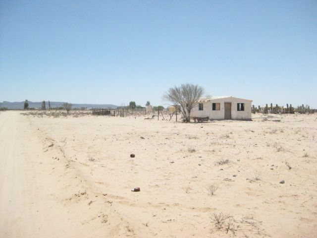
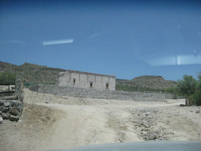
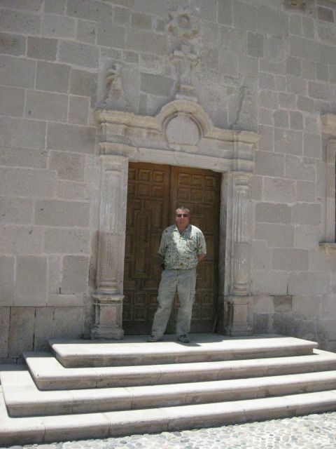
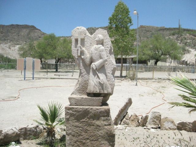
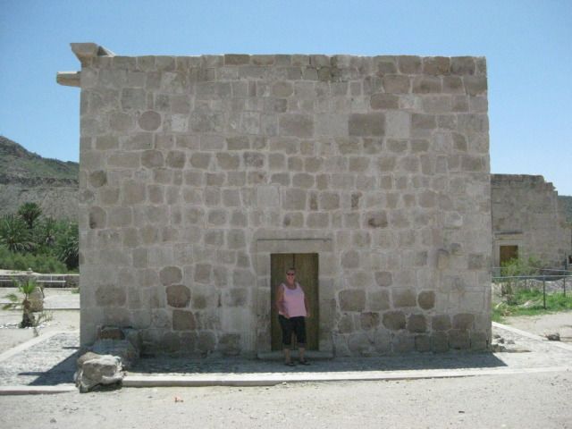
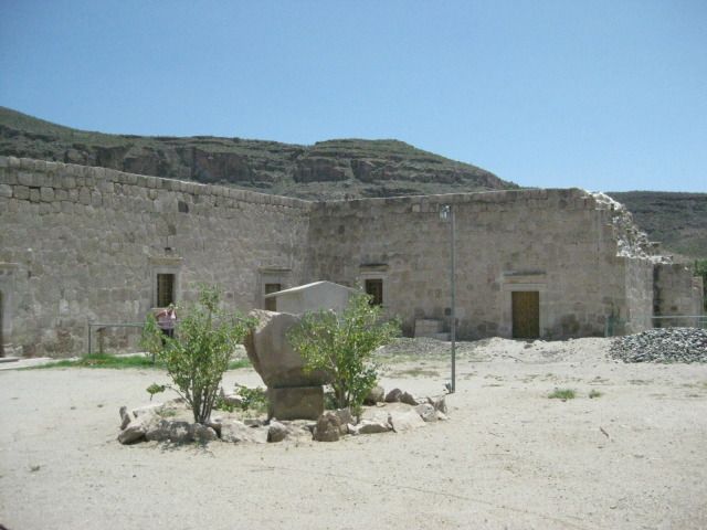
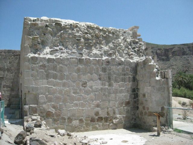
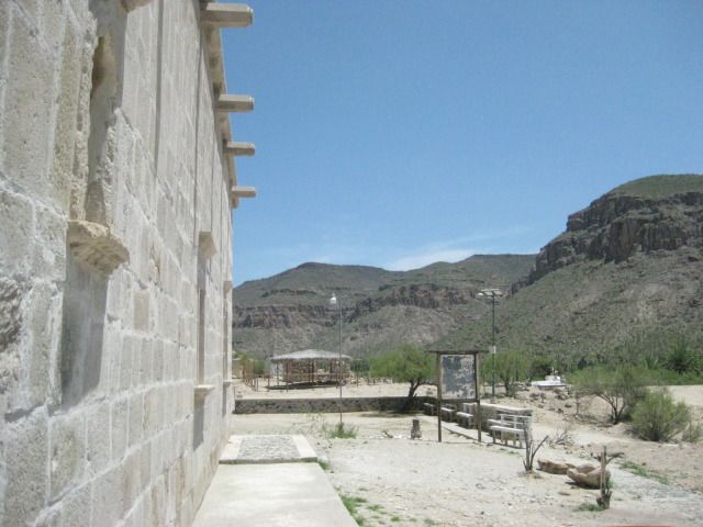
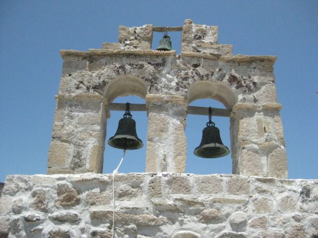
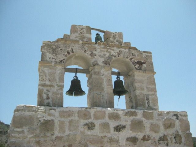
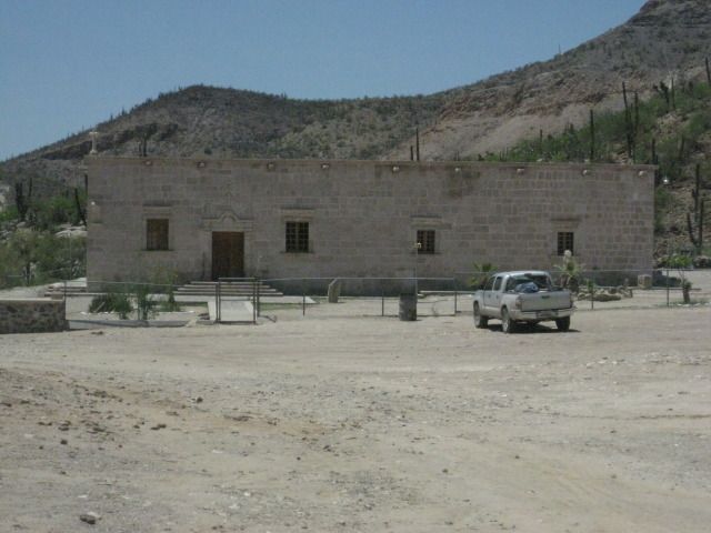
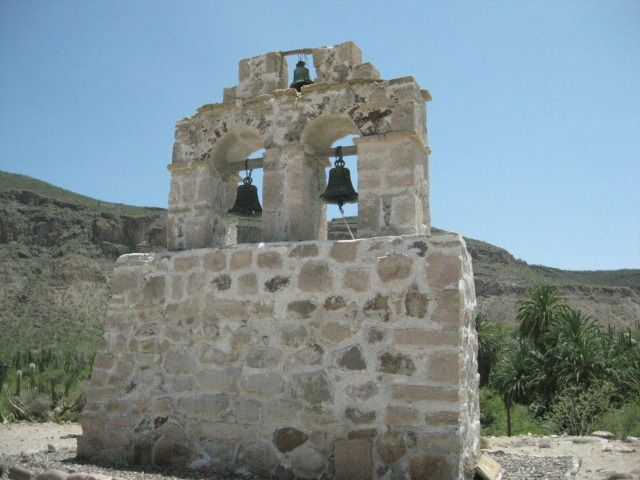
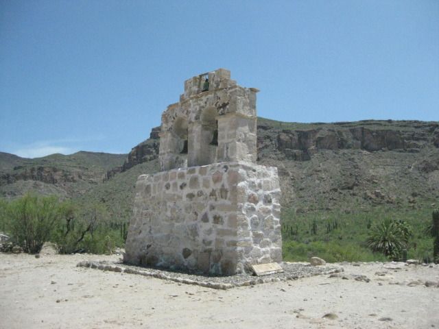
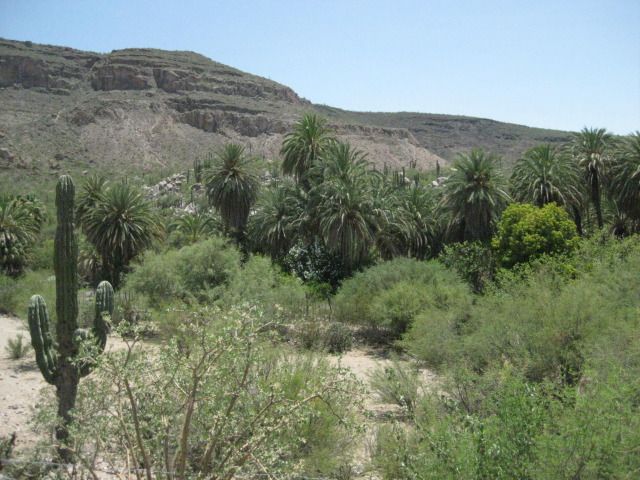
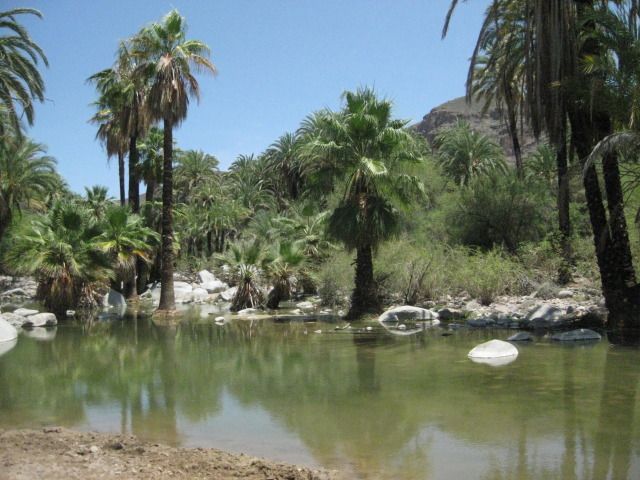
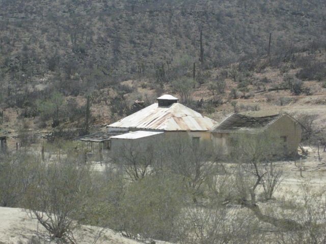
11.0 Mision Santa Gertrudis (1752), on a level bench above a palm filled oasis. 1:14pm.
The mission church was locked and there seemed to be nobody in the village. A Mexican family with their SUV was parked at the oasis having lunch as we
drove by. I guessed them to be visitors, as well. I took lots of photos of the stone church, and its unique separate bell tower. The present church
was completed by the Dominicans in 1796. The Franciscans were here 5 years, before moving on to Alta California in 1773. The mission founding Jesuits
were here until 1768, when the king of Spain ordered them all removed from New Spain. This mission was planned as far back as 1745 to be called
Dolores del Norte, but when funds were available in 1748 with the closing of Mision San Jose del Cabo, the name was changed to honor the benefactors
wife. Construction of the first adobe buildings started in 1751, a year before a priest was available to man the new mission. The mission was
abandoned in 1822, but some families continued to live here.
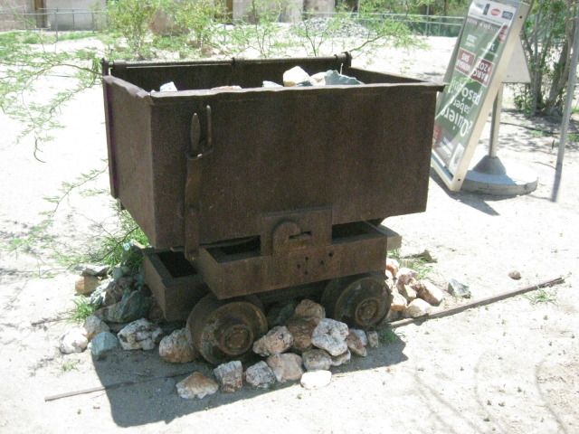
In 1997, the mission was greatly renovated, and some of its historic charm was lost, on the interior changes. Today there are displays and exhibits on
the area history, including a mine cart, perhaps from Pozo Aleman, where we go to next!
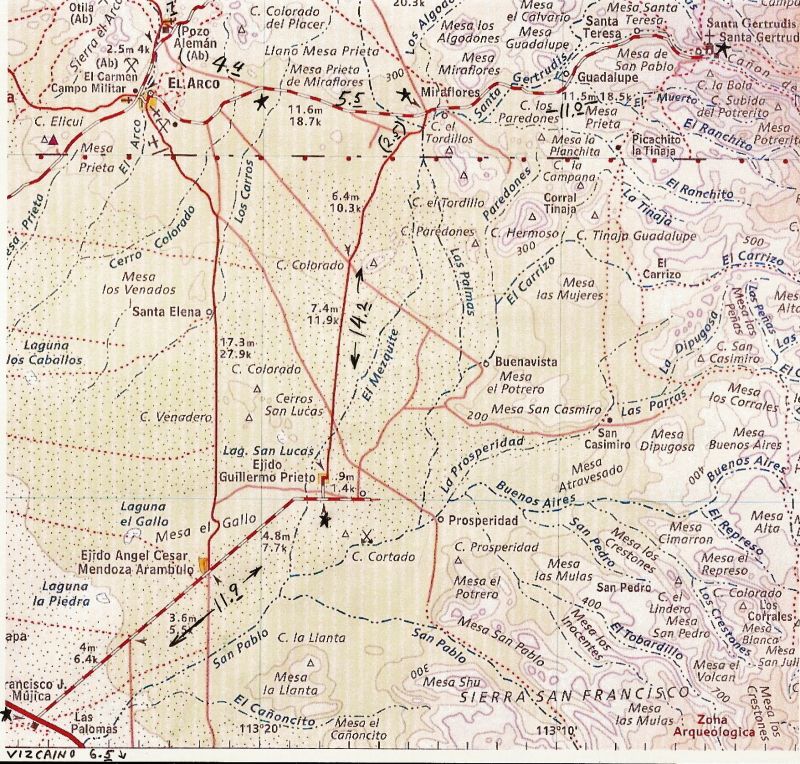
Here is a close up, detailed map of the route from Highway #1, just north of Vizcaino to Guillermo Prieto, the state border, then east 11 miles to
Santa Gertudis:
The photos for Day 13-a:
Is this the Vizcaino Desert American Consulate?
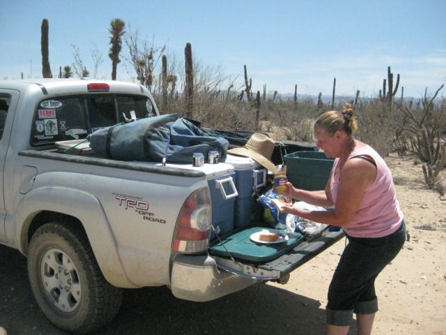
Baja tailgate party! PB&Js with ice cold Tecates.
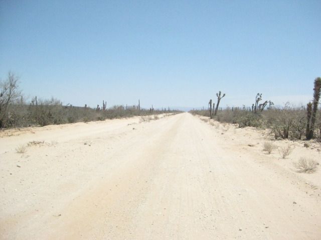
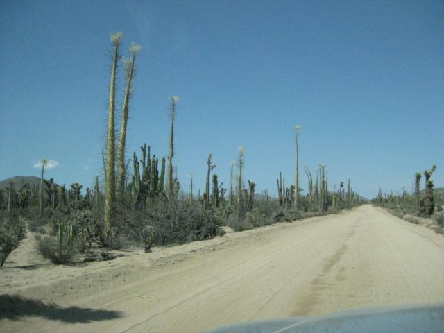
It is a great, fast dirt road to Guillermo Prieto, and on to the border, too.
Guillermo Prieto, 11 years ago it was full of people and kids were playing.
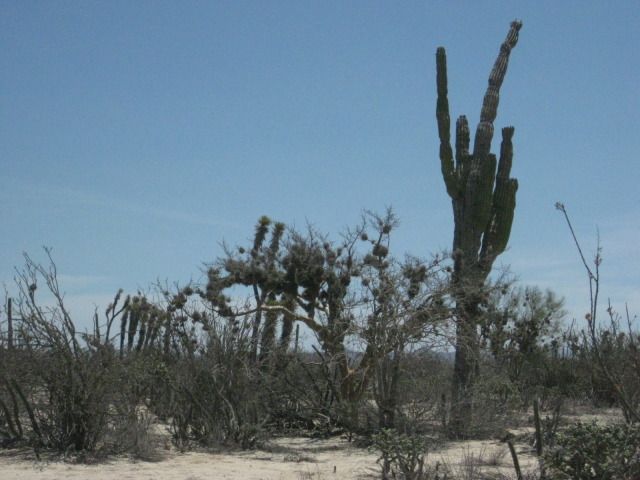
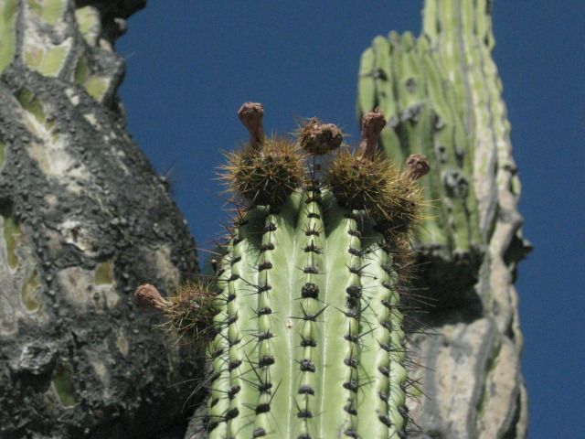
Ball-Moss (Gallito) attaches to many shrubs and cactus in central Baja.
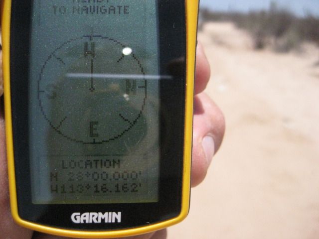
On the 28º parallel of latitude, the state border between Baja California and Baja California Sur, also a time zone change.
My truck at the fence line, just 80 feet inside Baja Norte.
Looking south into Baja Sur.
2.5 miles north of the border is the intersection with signs pointing to the mission.
All the roads I am on today are good and only 2WD is used.
The information is very incorrect
another sign, much faded is closer with a founding date given of 1751. It was 1752, per direct mission texts and
letters.
In the next part, we go to the old gold mine ghost town of Pozo Aleman, where some people lived in man made caves.
===============================================================
|
|
|
vgabndo
Ultra Nomad
Posts: 3461
Registered: 12-8-2003
Location: Mt. Shasta, CA
Member Is Offline
Mood: Checking-off my bucket list.
|
|
Incredible report...insane detail.
Whether or not the rise in sea levels has had any effect, I don't know, but we drove the flats between Abreojos and La Bocana a couple of times during
the highest tides of the year last year, and it was deadly to put a tire off the beaten path. I had my land sailer, and looked everywhere for a solid
place to use all that wind.
Very little more water will reclaim those flats from vehicle use.
And, it isn't IF the poles start to melt. ( I realize you're a "denyer";-)
http://nsidc.org/arcticseaicenews/
I'm glad you had a safe trip.
Undoubtedly, there are people who cannot afford to give the anchor of sanity even the slightest tug. Sam Harris
"The situation is far too dire for pessimism."
Bill Kauth
Carl Sagan said, "We are a way for the cosmos to know itself."
PEACE, LOVE AND FISH TACOS
|
|
|
David K
Honored Nomad
Posts: 65559
Registered: 8-30-2002
Location: San Diego County
Member Is Offline
Mood: Have Baja Fever
|
|
I hope you are enjoying it Perry. One place I think about going to when I am at Bahia Concepcion is your old spot of San Nicolas. Maybe next time?
As for the ice pack, if it is shrinking it hasn't raised sea levels enough to cause problems in Baja. The salt flats used for roads 50 years ago, are
still used for roads today.
Thanks for your comments!
Pozo Aleman is next!
|
|
|
David K
Honored Nomad
Posts: 65559
Registered: 8-30-2002
Location: San Diego County
Member Is Offline
Mood: Have Baja Fever
|
|
DAY 13-b, to Pozo Aleman
Day 13-b: To Pozo Aleman (German Well)
We left Mision Santa Gertrudis and came back out the 11 miles to the 4 way intersection. The left road goes back to Highway #1 (26 miles), and was the
way we came in. The right hand road continues northward for 12.3 miles to the Punta San Francisquito and Bahia de los Angeles road. We go straight
across on the road west to El Arco.
In 5.5 miles, the graded El Arco road bends to the left slightly where the older, Pozo Aleman road continues straight. It is 2:04pm, so we have plenty
of summer daylight still ahead. In a few miles we come to some interesting geology and several other roads going to mine claims, perhaps. I expect
this road to go right to Pozo Aleman, as the map shows, but instead it meets the El Arco-San Francisquito road just to the east of Pozo Aleman. It has
been 4.4 miles from the El Arco/Santa Gertrudis road.
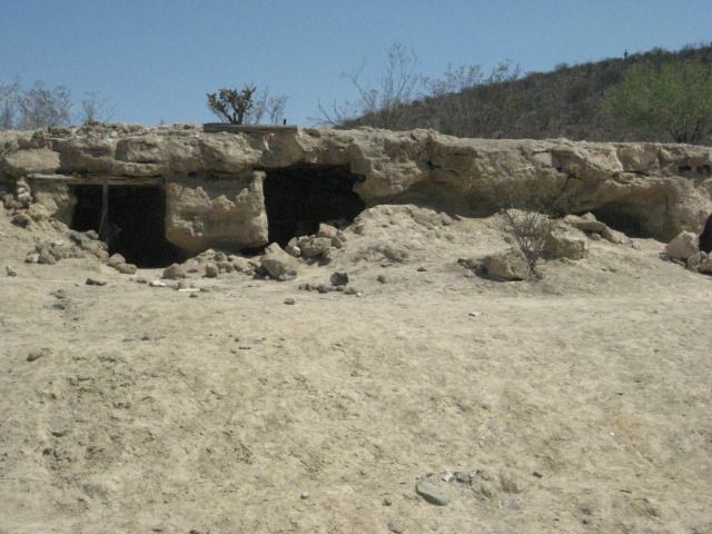
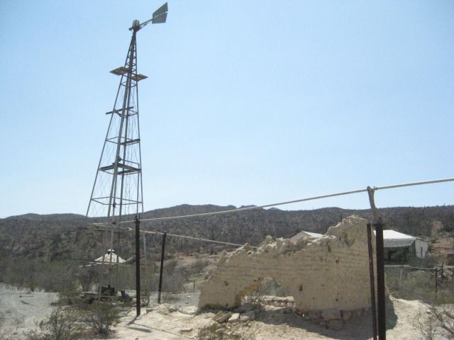
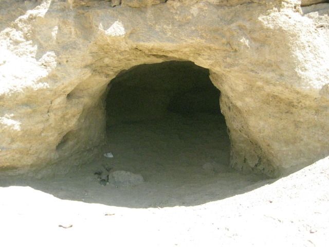
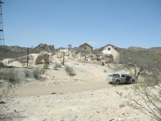
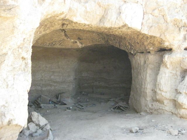
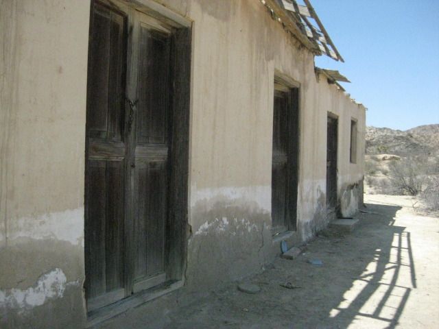
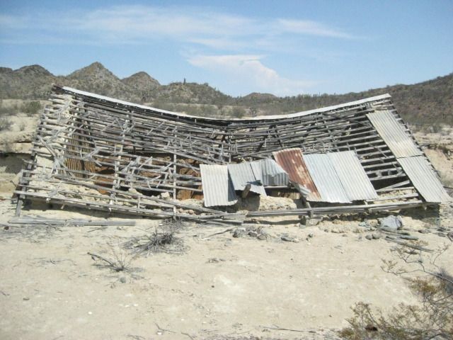
In just 0.4 mile going west, we are at the driveway into Pozo Aleman that passes the cemetery. It is 0.7 mile to Pozo Aleman from the graded road.
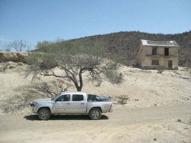
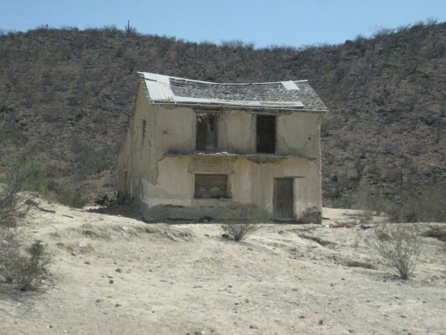
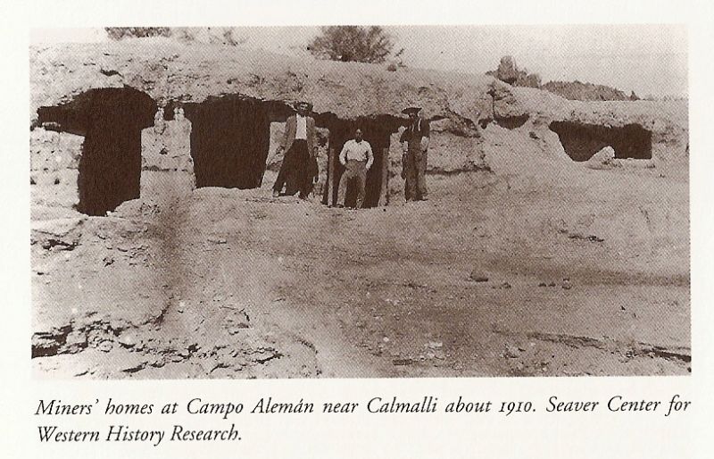
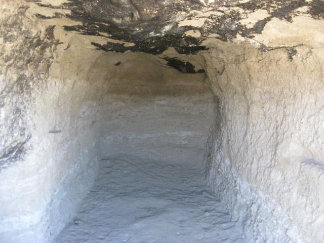
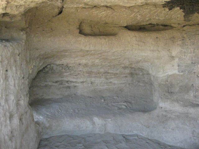
There are several abandoned ruins of adobe and wood homes, as well as the underground homes seen in a 1910 photograph here. There is one rather large
home across the gully from the others, and it looks to be occupied, but we see nobody.
There is plenty to look at here and then at the cemetery before we continue our drive east. We leave Pozo Aleman at 3:05pm and are hopeful we can find
the big painted cave we saw in the book at Sharis (I also have seen photos of it on Baja Nomad from at least two other people). To not cause any
grief, I will not publish the mileages or GPS of the road to the painted cave. See it in the next part of the trip report.
Map of the area, and mileages on the roads we used, between stars. The 4.4 mile road actually ended 0.4 mile east of Pozo Aleman (not shown on map).
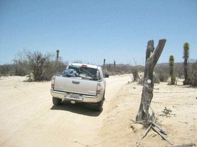
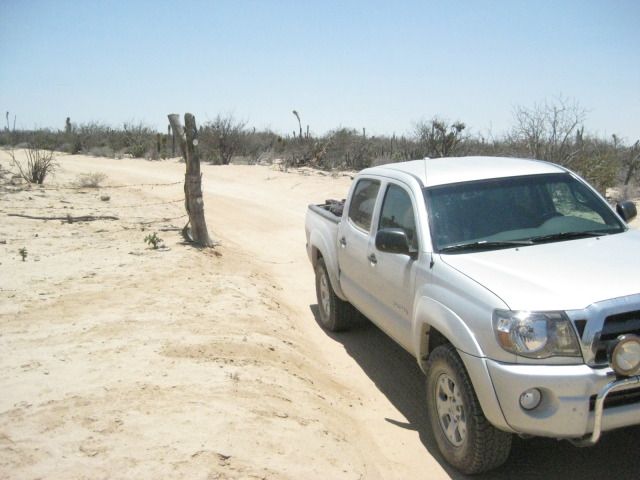
Fork, 16.5 miles from Santa Gertrudis: El Arco left/ Pozo Aleman right.
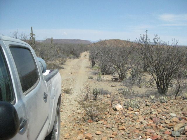
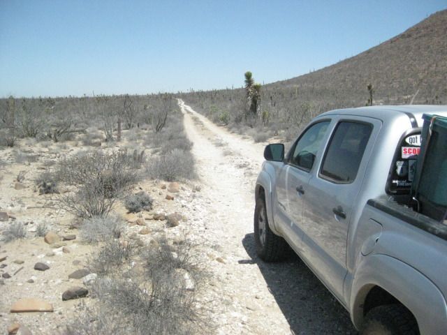
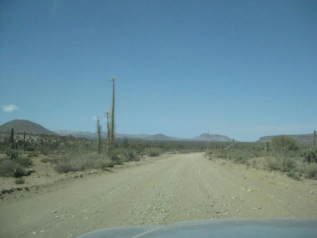
This is the kind of road I like to drive in Baja!
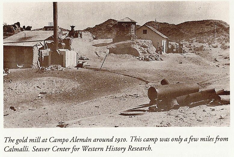
1910 photo.
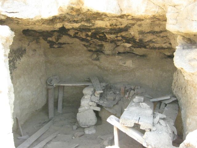
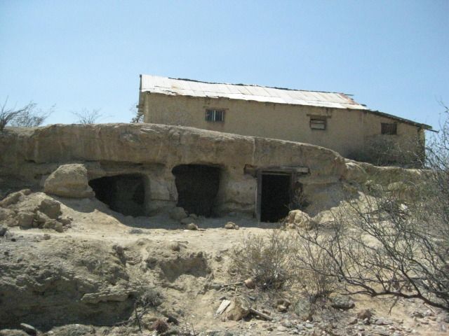
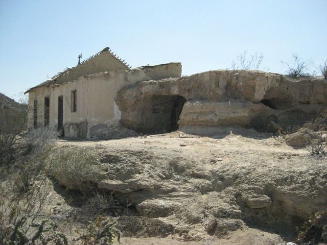
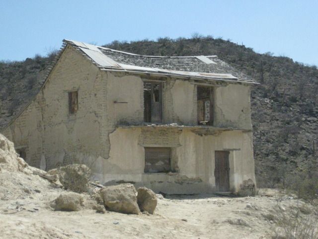
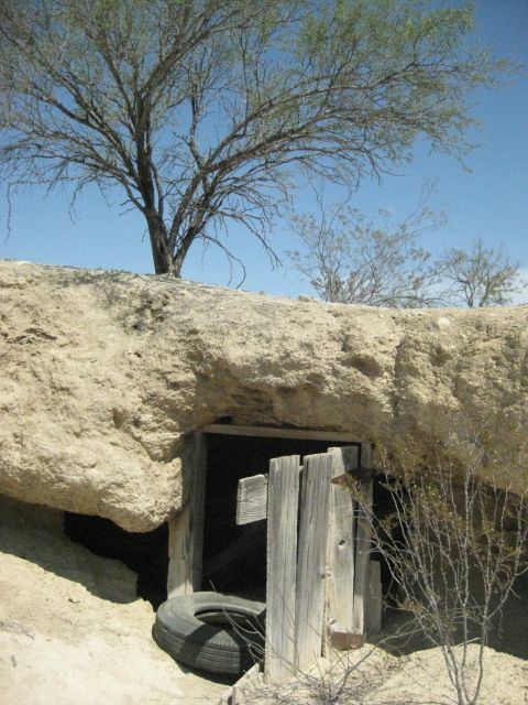
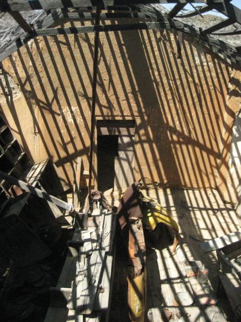
This building is half in the hillside, I walk over to the roof to look down inside.
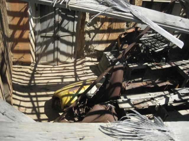
Looks like parts of an old truck in there.
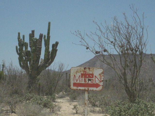
Next we try and find the Cave of El Arco
=================================================================
|
|
|
Paulina
Ultra Nomad
Posts: 3813
Registered: 8-31-2002
Location: BCN
Member Is Offline
|
|
Nice photos, David. I would imagine those sleeping dens would be nice and cool in the evenings.
When we were there last the two story place was full of bees. I'd like to revisit one of these days.
P>*)))>{
\"Well behaved women rarely make history.\" Laurel Thatcher Ulrich
|
|
|
David K
Honored Nomad
Posts: 65559
Registered: 8-30-2002
Location: San Diego County
Member Is Offline
Mood: Have Baja Fever
|
|
Thanks Paulina... It was great to see you and Dern (and Mary Ann) when we passed through Bahia de los Angeles (on Day 14)...
|
|
|
David K
Honored Nomad
Posts: 65559
Registered: 8-30-2002
Location: San Diego County
Member Is Offline
Mood: Have Baja Fever
|
|
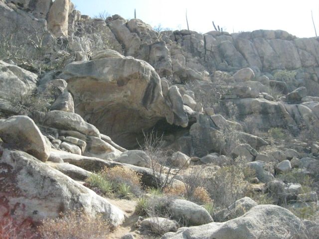
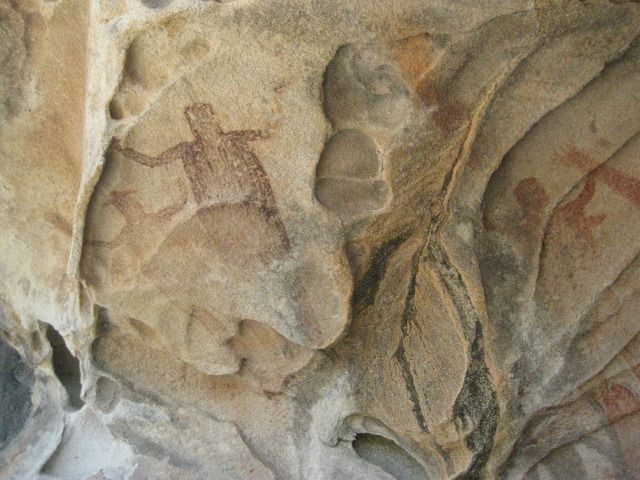
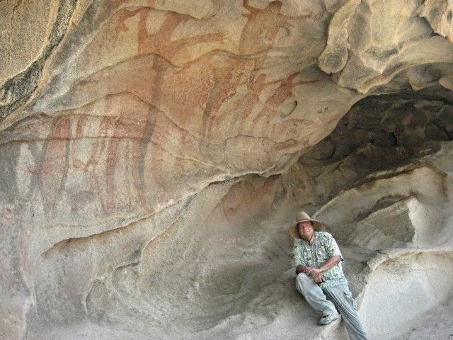
The Big Painted Cave of Fours +2 (El Arco Cave)
Day 13-c
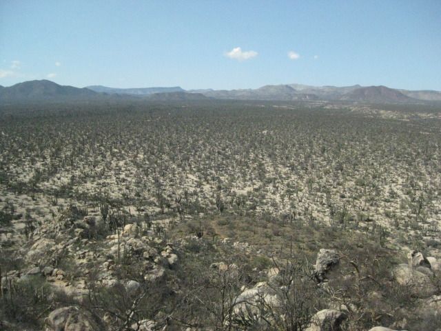
We leave Pozo Aleman at 3:05pm and take the graded road for some miles until I spot a side road with lots of travel. It ends in just ¾ of a mile at a
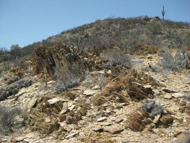
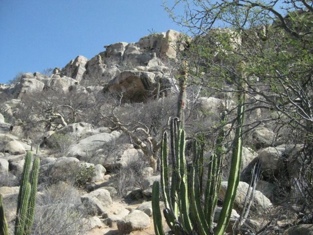
turn around, next to the side of a big hill. A close look up the hill and I see a cave. From the turn around, a well worn foot trail heads up the
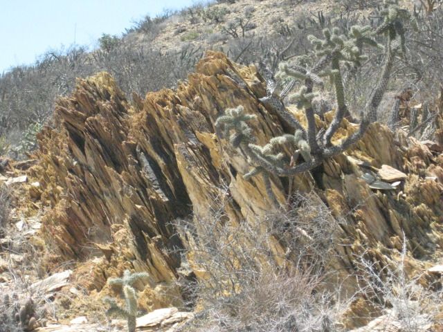
hillside. Obviously many folks have been here, perhaps tours. Along the trail, near the cave is a carved Elephant tree with the name Arce and the
year 1990, perhaps when it was discovered? The site is a major painted cave, yet Harry Crosby did not include it in his books cataloging the
hundreds of central Baja California painted caves. Crosby researched his cave paintings book in the 1970s, so perhaps this one (near El Arco) had
indeed not yet been discovered?
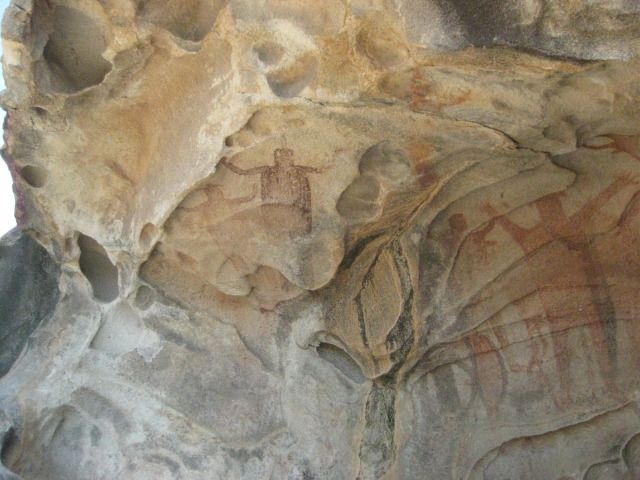
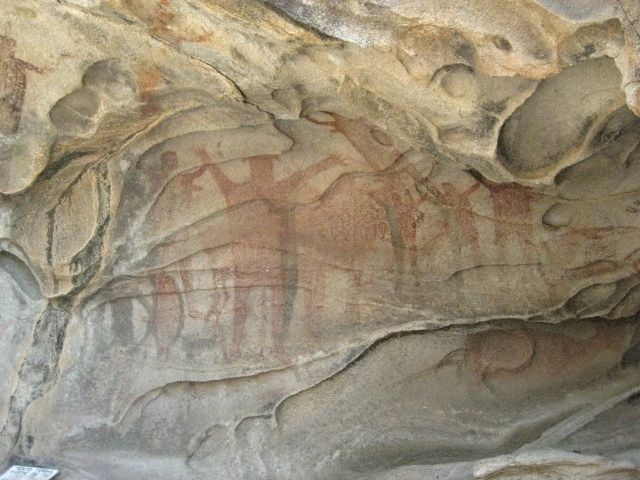
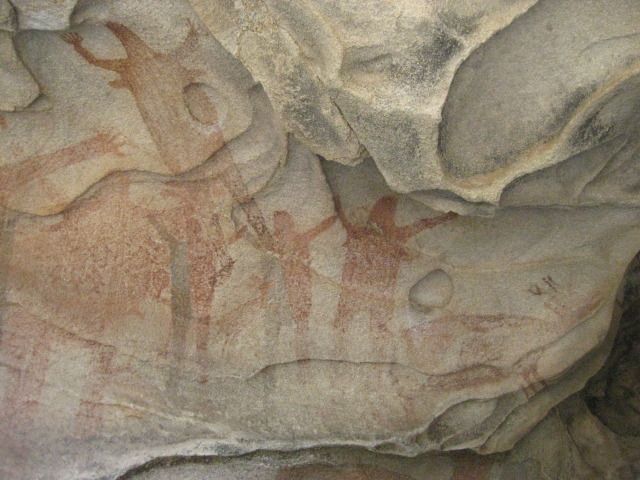
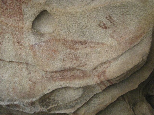
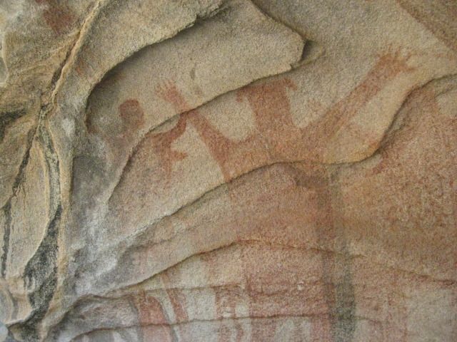
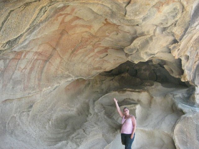
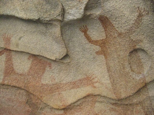
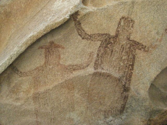
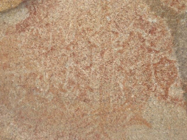
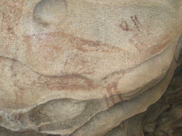
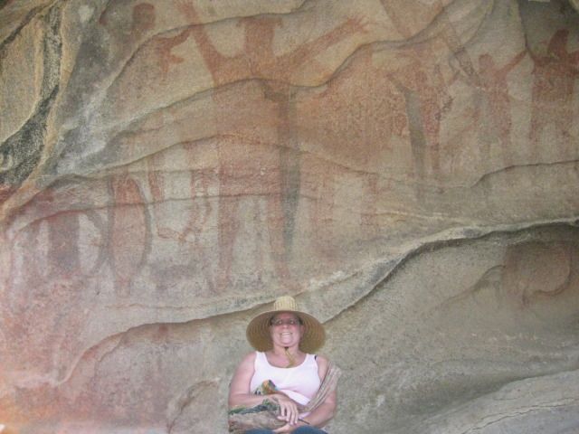
We take many photos at the cave and we note that it contains paintings of 4 men, 4 women, 4 deer, 4 fish and 2 dark figures with one wearing a hat.
So, we call it the cave of fours, plus 2! Some of the images are faint and painted over others
so take your time and study the art here or in my
photos
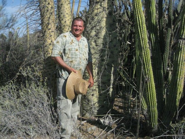
A most exciting site on our great 15 Day Baja vacation. On our way back down the trail we photograph some boojum trees, some pitahaya dulce,
and more ball moss. We are back to the Tacoma and driving again at 5:00pm. It is summer, and the sun is still well up in the sky.
Our goal is Punta San Francisquito where a beautiful beach is located I camped at back in 1983...
Photos:
The El Arco/ Punta San Francisquito road is fast and easy to drive.
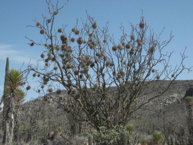
Ball moss.
The painted cave is up there.
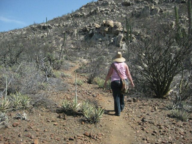
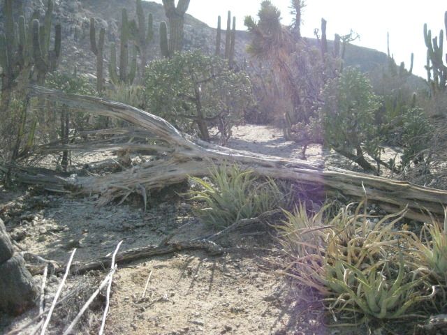
The trail is easy to follow, and only gets steep near the cave.

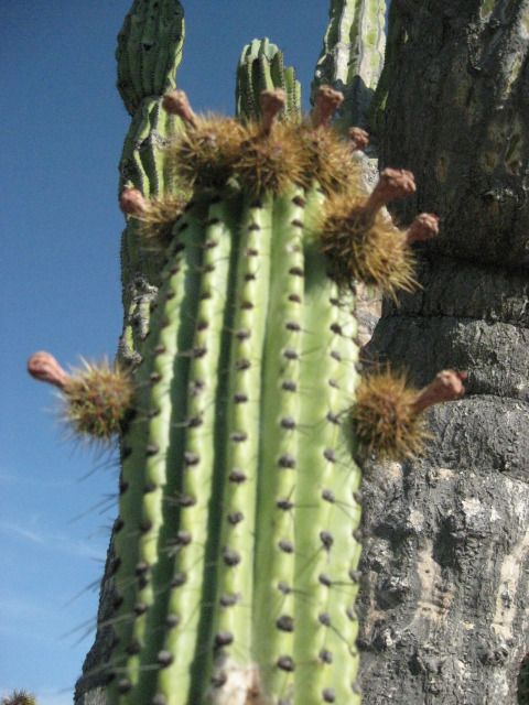
The Pitahaya Dulce or Organ Pipe Cactus was the source of much joy to the Cochimi Indians when its fruit ripened in the fall.
The cave
getting closer!
Looking back down the trail.
We can see the giant paintings.
The only sign at the site


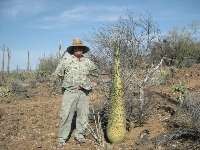
I spot a boojum tree (cirio) about my height
They can grow to 60 feet or more.
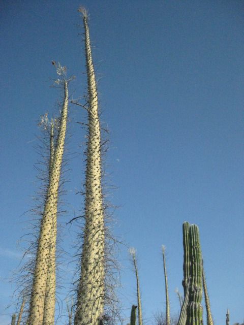
The base of the tall boojums.
Here are some young pitahaya fruit. In a couple more months they will be ripe for eating.
We return to the road to Punta San Francisquito and continue east as the sun slowly drops in the west.
=======================================================================
|
|
|
viabaja
Nomad
Posts: 277
Registered: 10-6-2003
Location: Georgia
Member Is Offline
|
|
"My pleasure Chris... fyi, Shell Island was not just the first day's destination but it was also our last night of the trip, too."
Dave, as it should be!!!
|
|
|
David K
Honored Nomad
Posts: 65559
Registered: 8-30-2002
Location: San Diego County
Member Is Offline
Mood: Have Baja Fever
|
|
The best of Baja... this vacation was great. Fun to see new things but great to return to old favorites, too.
|
|
|
dtbushpilot
Ultra Nomad
Posts: 3297
Registered: 1-11-2007
Location: Buena Vista BCS
Member Is Offline
Mood: Tranquilo
|
|
Interesting that the figures on the cave wall have 6 fingers.....
"Life is tough".....It's even tougher if you're stupid.....
|
|
|
David K
Honored Nomad
Posts: 65559
Registered: 8-30-2002
Location: San Diego County
Member Is Offline
Mood: Have Baja Fever
|
|
| Quote: | Originally posted by dtbushpilot
Interesting that the figures on the cave wall have 6 fingers..... |
Well sure, the aliens need that many to build such great star ships!
|
|
|
desertcpl
Super Nomad
Posts: 2407
Registered: 10-26-2008
Location: yuma,az
Member Is Offline
|
|
| Quote: | Originally posted by dtbushpilot
Interesting that the figures on the cave wall have 6 fingers..... |
you should see my inlaws
|
|
|
| Pages:
1
..
6
7
8
9
10
..
13 |
|