David K
Honored Nomad
        
Posts: 65407
Registered: 8-30-2002
Location: San Diego County
Member Is Offline
Mood: Have Baja Fever
|
|
1888 Baja Maps
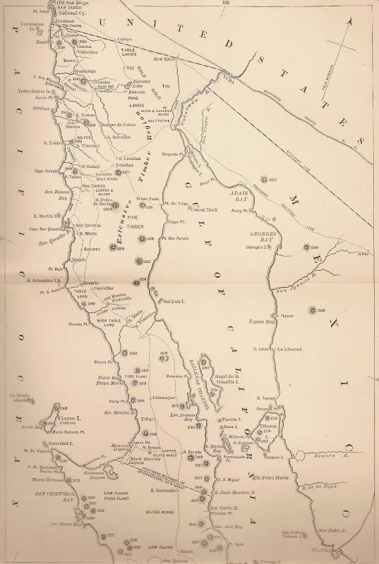
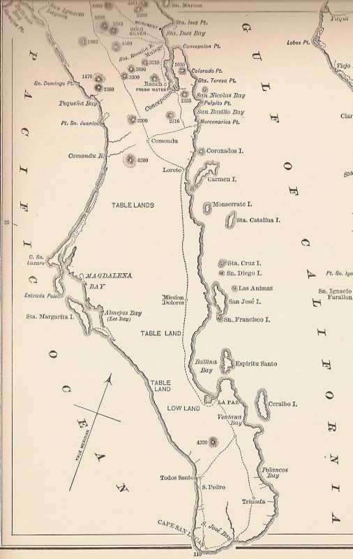
From the 1888 book by Charles Nordhoff: 'Peninsular California'...
|
|
|
David K
Honored Nomad
        
Posts: 65407
Registered: 8-30-2002
Location: San Diego County
Member Is Offline
Mood: Have Baja Fever
|
|
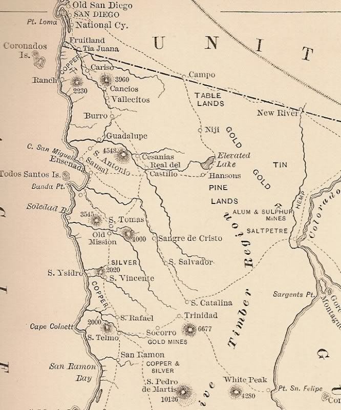
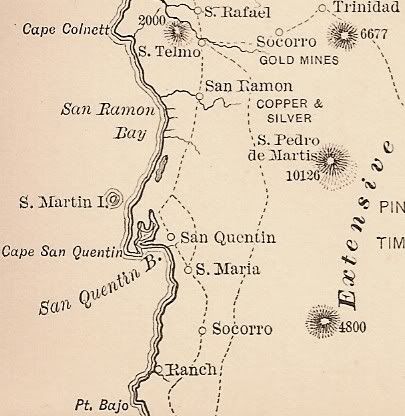
Close up, northern section
Notice 'Tia Juana' on the border? Other places we know today, as well...
Surprised the sulfur mine south of Mexicali (not yet a town) was already in operation... in the 1800's!
[Edited on 5-12-2009 by David K]
|
|
|
David K
Honored Nomad
        
Posts: 65407
Registered: 8-30-2002
Location: San Diego County
Member Is Offline
Mood: Have Baja Fever
|
|
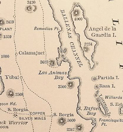
1888 more...
|
|
|
David K
Honored Nomad
        
Posts: 65407
Registered: 8-30-2002
Location: San Diego County
Member Is Offline
Mood: Have Baja Fever
|
|
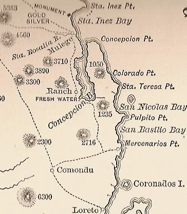
More of 1888 map...
|
|
|
Barry A.
Select Nomad
      
Posts: 10007
Registered: 11-30-2003
Location: Redding, Northern CA
Member Is Offline
Mood: optimistic
|
|
Bump!!!! More good stuff, David. Many thanks. Great to peruse these old maps and compare. Lots of hints for places to visit, or try to find, too.
Well done.
Barry
|
|
|
David K
Honored Nomad
        
Posts: 65407
Registered: 8-30-2002
Location: San Diego County
Member Is Offline
Mood: Have Baja Fever
|
|
If you want to see a close up of any other areas... let me know!
|
|
|
Ken Bondy
Ultra Nomad
    
Posts: 3326
Registered: 12-13-2002
Member Is Offline
Mood: Mellow
|
|
Those are fascinating David. It looks like Bahia de Los Angeles was called Las Animas Bay. If that is correct, when did it change? ++Ken++
carpe diem!
|
|
|
David K
Honored Nomad
        
Posts: 65407
Registered: 8-30-2002
Location: San Diego County
Member Is Offline
Mood: Have Baja Fever
|
|
| Quote: | Originally posted by Ken Bondy
Those are fascinating David. It looks like Bahia de Los Angeles was called Las Animas Bay. If that is correct, when did it change? ++Ken++
|
I think they just didn't put Los Angeles Bay on that map... It was sure a more important harbor than Las Animas Bay... OR WAS IT??? see http://vivabaja.com/109
Las Animas is the next bay south of Los Angeles...
|
|
|
Ken Bondy
Ultra Nomad
    
Posts: 3326
Registered: 12-13-2002
Member Is Offline
Mood: Mellow
|
|
| Quote: | Originally posted by David K
| Quote: | Originally posted by Ken Bondy
Those are fascinating David. It looks like Bahia de Los Angeles was called Las Animas Bay. If that is correct, when did it change? ++Ken++
|
I think they just didn't put Los Angeles Bay on that map... It was sure a more important harbor than Las Animas Bay... OR WAS IT??? see http://vivabaja.com/109
Las Animas is the next bay south of Los Angeles... |
Maybe the whole area, both bays, were called Las Animas then.
carpe diem!
|
|
|
David K
Honored Nomad
        
Posts: 65407
Registered: 8-30-2002
Location: San Diego County
Member Is Offline
Mood: Have Baja Fever
|
|
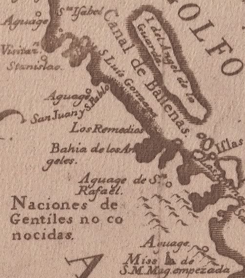
Here is the 1757 Jesuit map with Bahia de los Angeles listed... and the source of the name for San Rafael (Pancho's place) listed just beloe... an
Aguaje was a place for ships to get water, such as a spriwg or tinaja (water hole).
[Edited on 8-18-2011 by David K]
|
|
|

