David K
Honored Nomad
        
Posts: 65364
Registered: 8-30-2002
Location: San Diego County
Member Is Offline
Mood: Have Baja Fever
|
|
Los Dolores (del Sur) Apaté: Mission Ruins
The Spanish mission of Dolores was established in 1721 near the beach, after the closing of the mission 'San Juan Bautista' at Ligui.
Within two years, the mission was moved about 2 miles up the canyon from the beach for a better water supply. The site was known to the Indians as
'Apaté'.
Very extensive ruins can be seen if you can get there... as there is no auto. road. Most arrive by sea to this remote coast between Loreto and La Paz.
Dolores Apaté and San Pedro Martir are the only two missions in Baja not reached by automobile of some type.
The site was so difficult to communicate with that even the Jesuits began moving the mission away from here after 1737 and in 1741 had officially
re-started the mission at the visita of La Pasión, 15 miles to the southwest. This final location was called Chillá by the natives.
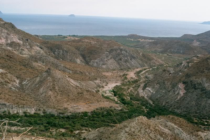
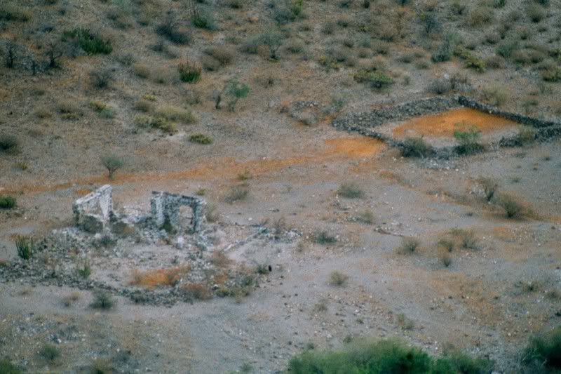
Jack Swords hiked to an overlook, above the canyon, to photograph the site (see the ruins on the clearing):
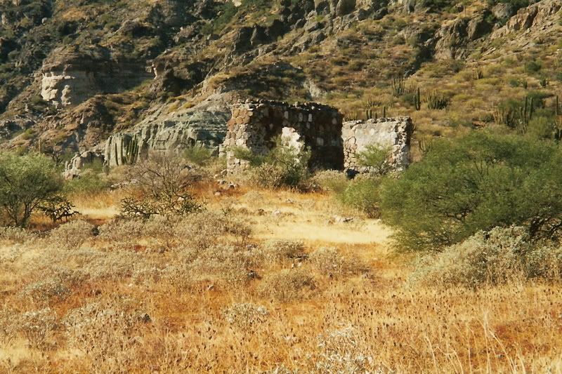
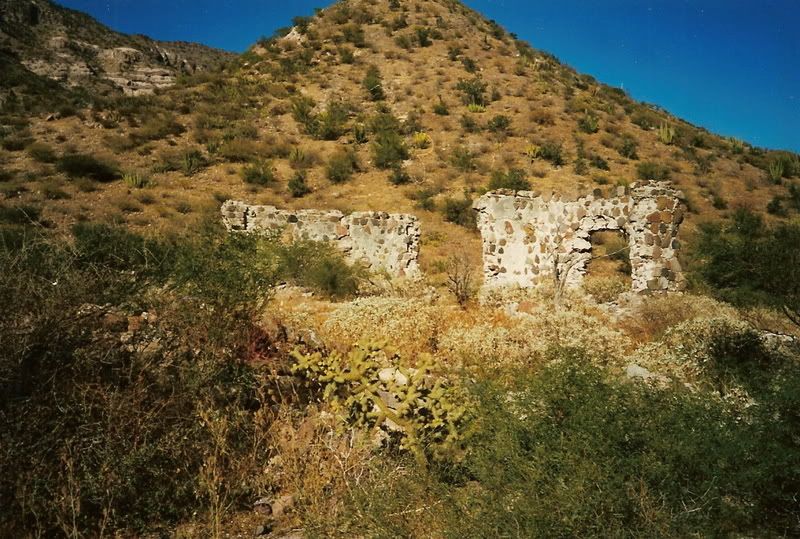
Kevin in Oklahoma reached the mission in 1998 for these close up photos:
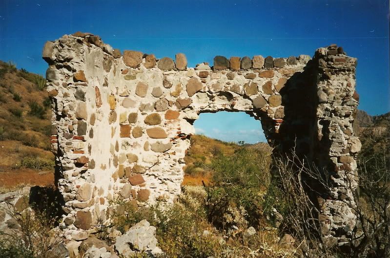
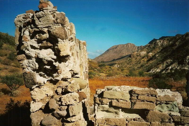
[Edited on 3-1-2009 by David K]
|
|
|
Barry A.
Select Nomad
      
Posts: 10007
Registered: 11-30-2003
Location: Redding, Northern CA
Member Is Offline
Mood: optimistic
|
|
David-------Do you know if there is anything (foundations, walls, ruins) at the original site near the beach?
Barry
|
|
|
Barry A.
Select Nomad
      
Posts: 10007
Registered: 11-30-2003
Location: Redding, Northern CA
Member Is Offline
Mood: optimistic
|
|
David--------the "Almanac" page 44 shows a rudimentary road going past this "mission"-----------do you (or Jack) know anything about this road as to
if it actually exists, or is this a different place entirely?
Also, "La Pasion" according to the Almanac, appears to be a lot further than "15 miles" from the Delores Apate site-----closer to 25 or 30 miles, it
looks to me. Strange.
Barry
[Edited on 3-1-2009 by Barry A.]
|
|
|
Barry A.
Select Nomad
      
Posts: 10007
Registered: 11-30-2003
Location: Redding, Northern CA
Member Is Offline
Mood: optimistic
|
|
Bump-----------(to catch David's attention) 
|
|
|
David K
Honored Nomad
        
Posts: 65364
Registered: 8-30-2002
Location: San Diego County
Member Is Offline
Mood: Have Baja Fever
|
|
| Quote: | Originally posted by Barry A.
David-------Do you know if there is anything (foundations, walls, ruins) at the original site near the beach?
Barry |
Nothing remains, per book authors... it was probably just a palm log building(s) like what was typical of the first mission structures.
|
|
|
David K
Honored Nomad
        
Posts: 65364
Registered: 8-30-2002
Location: San Diego County
Member Is Offline
Mood: Have Baja Fever
|
|
| Quote: | Originally posted by Barry A.
David--------the "Almanac" page 44 shows a rudimentary road going past this "mission"-----------do you (or Jack) know anything about this road as to
if it actually exists, or is this a different place entirely?
Also, "La Pasion" according to the Almanac, appears to be a lot further than "15 miles" from the Delores Apate site-----closer to 25 or 30 miles, it
looks to me. Strange.
Barry
[Edited on 3-1-2009 by Barry A.] |
Again, the Mexican topos are in error... No auto road gets into the Los Dolores canyon... just south of it to Los Burros. That road going to Los
Dolores should have been a foot trail, on the map.
La Pasion is incorrectly located. It is actually at La Capilla, near La Presa on Map 47, X-2. Looks like 15 miles straight, as the crow flys.
|
|
|
Neal Johns
Super Nomad
   
Posts: 1687
Registered: 10-31-2002
Location: Lytle Creek, CA
Member Is Offline
Mood: In love!
|
|
Google Earth shows a road going to the nearby (0.15 miles) ranch just east.
Mission: 25° 3.325'N 110° 53.054'W
[Edited on 3-1-2009 by Neal Johns]
![Delores [800x600].jpg - 23kB Delores [800x600].jpg - 23kB](https://forums.bajanomad.com/files.php?pid=396442&aid=23281)
My motto:
Never let a Dragon pass by without pulling its tail!
|
|
|
Neal Johns
Super Nomad
   
Posts: 1687
Registered: 10-31-2002
Location: Lytle Creek, CA
Member Is Offline
Mood: In love!
|
|
Ranch and road pic:
![Delores2 [800x600].jpg - 32kB Delores2 [800x600].jpg - 32kB](https://forums.bajanomad.com/files.php?pid=396453&aid=23282)
My motto:
Never let a Dragon pass by without pulling its tail!
|
|
|
David K
Honored Nomad
        
Posts: 65364
Registered: 8-30-2002
Location: San Diego County
Member Is Offline
Mood: Have Baja Fever
|
|
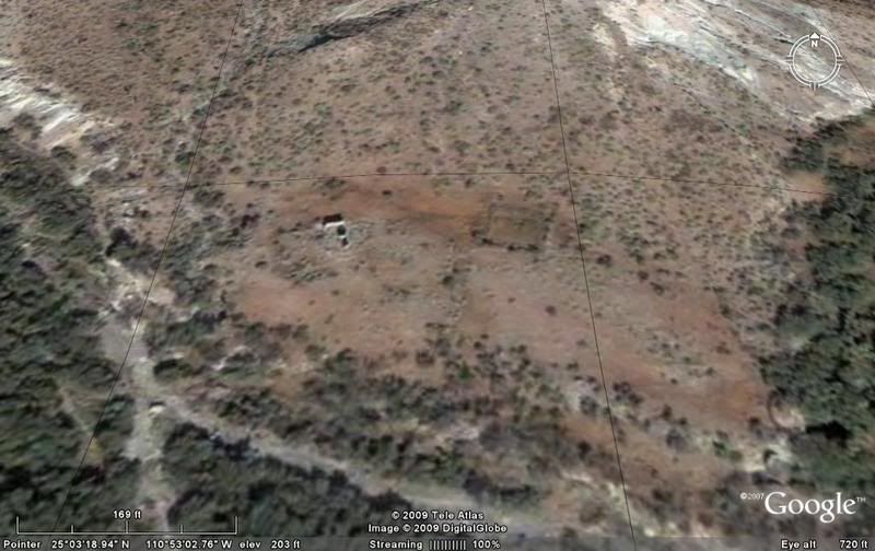
Dolores ruins from 720' up:
Same angle, north at top, from 2,002 feet up:
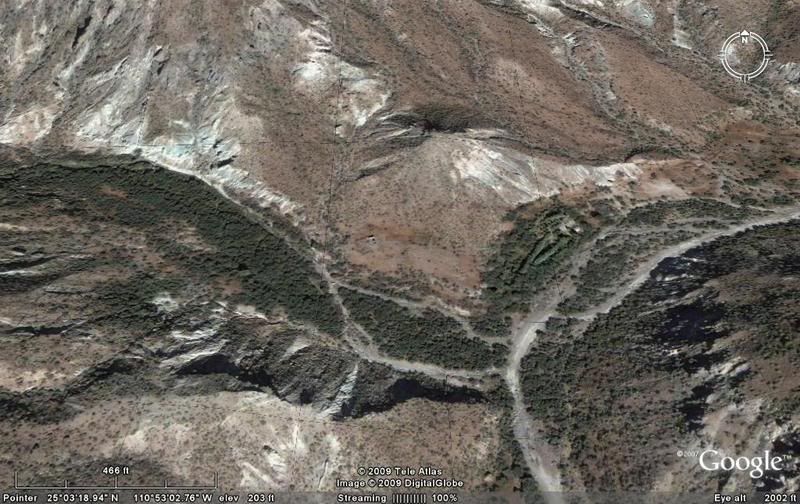
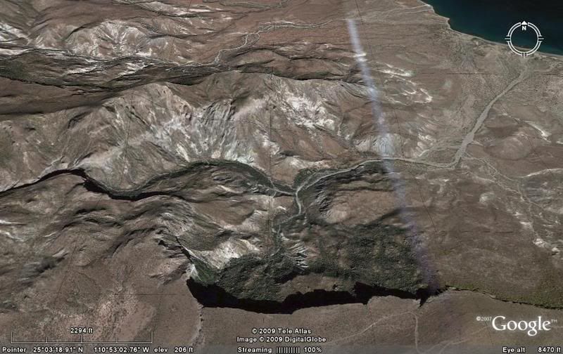
At 8,470 feet up, the Gulf of California comes into view. The auto road to Los Burros is at the bottom of the image along the edge of the dropoff:
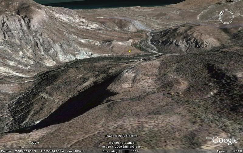
View eastward: Here is the Camino Real (mission road) where it drops off the plateau down into the canyon. Mission site marked in distance:
[Edited on 3-1-2009 by David K]
|
|
|
David K
Honored Nomad
        
Posts: 65364
Registered: 8-30-2002
Location: San Diego County
Member Is Offline
Mood: Have Baja Fever
|
|
Here is the view from the beach (nice palms) where the mission was first established, inland past the ranch towards the canyon containing the ruins.
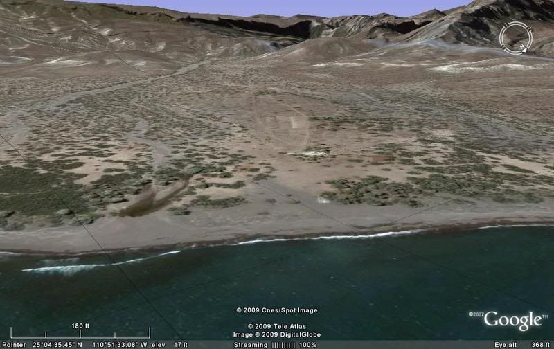
While I do see 'roads' going from the beach to the ranch near the mission as well to the north along the coast a short distance and tio the south a
short distance ... I see none going over the ridge to meet with any road leaving the area.
Either a vehicle was off loaded from a boat, helicopter or cross country got in, or these are well worn animal tracks and mission made roads....
|
|
|
David K
Honored Nomad
        
Posts: 65364
Registered: 8-30-2002
Location: San Diego County
Member Is Offline
Mood: Have Baja Fever
|
|
Coming next, photos at the final site for Los Dolores... at La Pasion.
|
|
|
Barry A.
Select Nomad
      
Posts: 10007
Registered: 11-30-2003
Location: Redding, Northern CA
Member Is Offline
Mood: optimistic
|
|
David-----
Try as I might, I cannot see any "palms" in the beach aerial photo---------just where are the palms you are seeing?
Also, I scruntinized the aerials up canyon, and it does not appear to me that any road goes from the top of that huge escarpment down to the Mission
site, etc., but there are trails (primitive roads???) all over the place. Looks like interesting country, tho. Neal's technical skills I know are
much better than mine, so maybe he was able to see more (???).
Barry
|
|
|
David K
Honored Nomad
        
Posts: 65364
Registered: 8-30-2002
Location: San Diego County
Member Is Offline
Mood: Have Baja Fever
|
|
All the green circles with shadows below them are palms...
As I said above, there are roads in that valley/ canyon but no exit out. Either they off loaded a vehicle by boat or they just look like auto roads
and were only made by animals and people.
|
|
|
David K
Honored Nomad
        
Posts: 65364
Registered: 8-30-2002
Location: San Diego County
Member Is Offline
Mood: Have Baja Fever
|
|
Here are some photos of the beach at Los Dolores... where the palms are visible:


The mission:

I had seen a slide shiow of this expedition given by Bob Vinton, so I knew they landed by boat at Los Dolores, as there is no way to drive there.
Here is the full web page: http://www.sdnhm.org/research/aguaverde/log11-5.html
|
|
|

