| Pages:
1
2 |
ArvadaGeorge
Nomad

Posts: 358
Registered: 9-2-2003
Member Is Offline
|
|
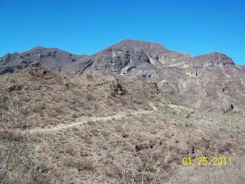
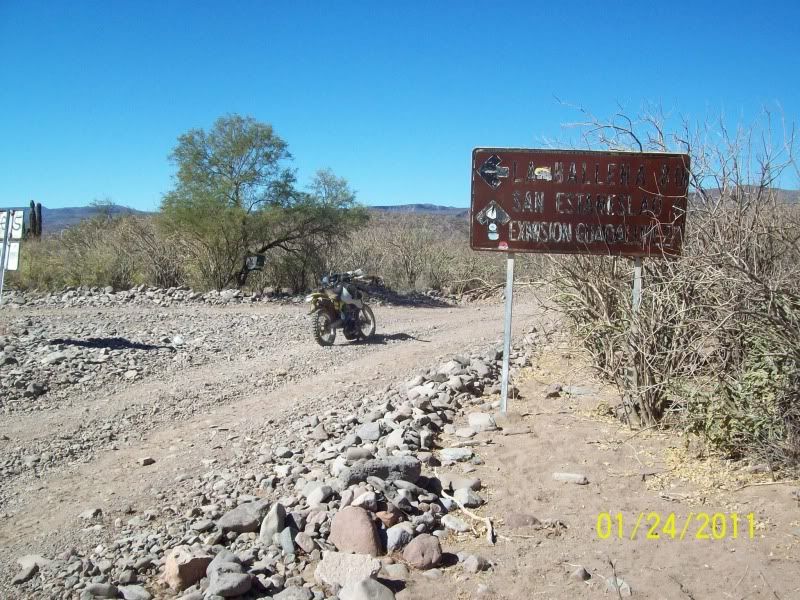
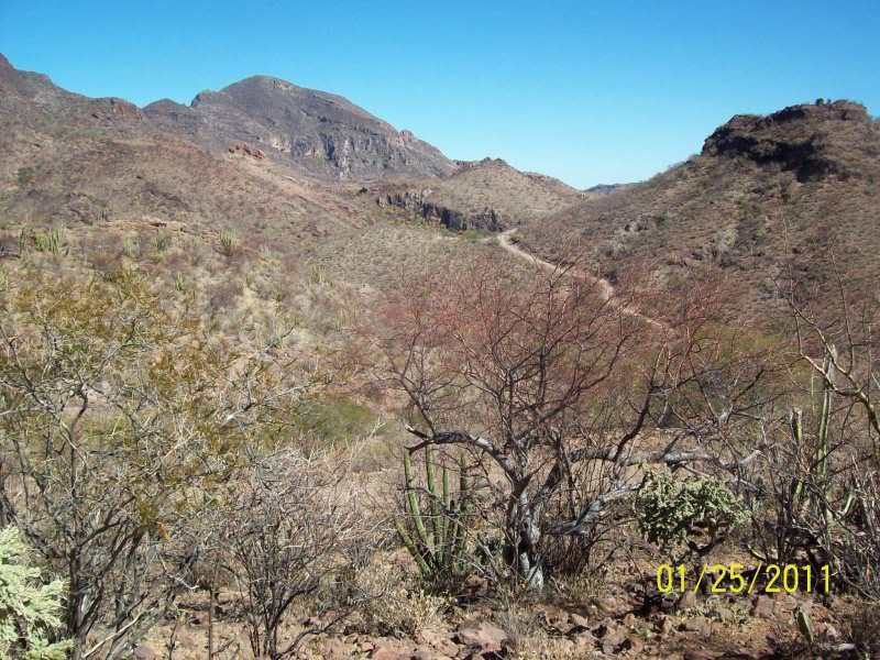
Guadalupe Magdalena Loop
Guadalupe Magdalena Loop
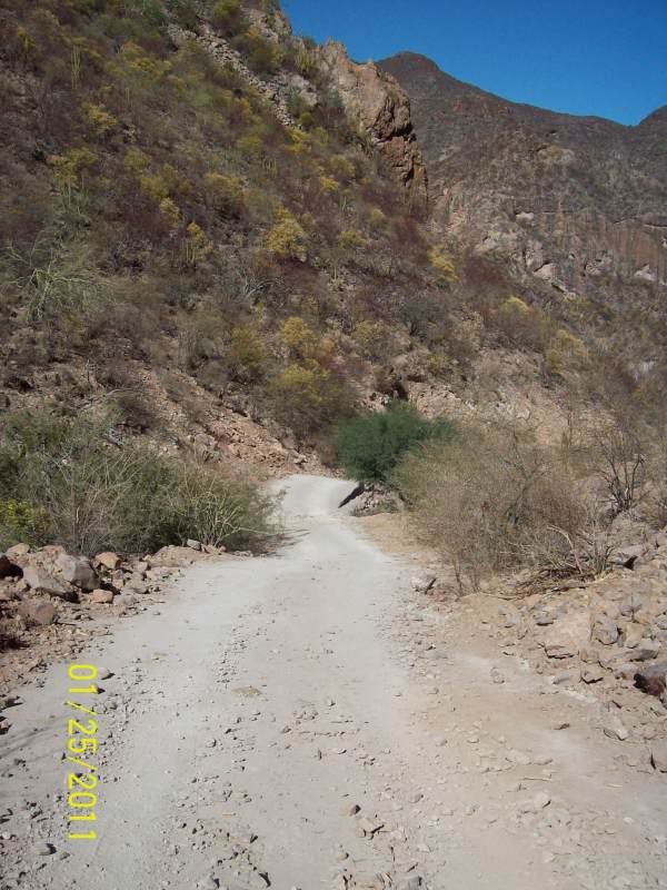
Its just less than 100 miles from Mulege to Mulege just over 5 hrs on a M/C . Mostly a mix of sandy and rocky 2 track with wider graded road close
to Mex 1 . It is signed real well and still pretty much follows Backroad Baja Road log so directions arent a problem. Great ride a lot like beings
on a western Colorado. Mt. road. They are doing a lot of work on the road grading and bridges, also paving a lot of the road in the mountains. The
paved road is barely 8 ft. wide in the really steep and narrow sectionsseems strange to me. Great ride for a Colorado biker on Jan.25th


|
|
|
Cypress
Elite Nomad
Posts: 7641
Registered: 3-12-2006
Location: on the bayou
Member Is Offline
Mood: undecided
|
|
ArvadaGeorge, Thanks for the pictures. An easy day trip.
|
|
|
David K
Honored Nomad
Posts: 65573
Registered: 8-30-2002
Location: San Diego County
Member Is Offline
Mood: Have Baja Fever
|
|
Awesome George!!!
|
|
|
mcfez
Elite Nomad
Posts: 8678
Registered: 12-2-2009
Location: aka BN yankeeirishman
Member Is Offline
|
|
| Quote: | Originally posted by ArvadaGeorge
|
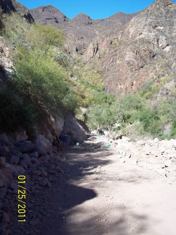
What were these containers in the road for?
Old people are like the old cars, made of some tough stuff. May show a little rust, but good as gold on the inside.
|
|
|
motoged
Elite Nomad
Posts: 6481
Registered: 7-31-2006
Location: Kamloops, BC
Member Is Offline
Mood: Gettin' Better
|
|
McFez,
That canyon road goes down to a rocky riverbed that really must be something to see when the heavy rains hit that road . That roadwork is building cement sections that are either just a cement coat
several inches thick over the dirt/gravel roadbed, or, in some areas is a road surface of flat rock cemented like flagstone. The barrels are likely
to store water as they mix cement by hand on the ground. . That roadwork is building cement sections that are either just a cement coat
several inches thick over the dirt/gravel roadbed, or, in some areas is a road surface of flat rock cemented like flagstone. The barrels are likely
to store water as they mix cement by hand on the ground.
Don't believe everything you think....
|
|
|
motoged
Elite Nomad
Posts: 6481
Registered: 7-31-2006
Location: Kamloops, BC
Member Is Offline
Mood: Gettin' Better
|
|
AG,
Don't you just love that ride?!

Don't believe everything you think....
|
|
|
ArvadaGeorge
Nomad
Posts: 358
Registered: 9-2-2003
Member Is Offline
|
|
| Quote: | Originally posted by mcfez
| Quote: | Originally posted by ArvadaGeorge
|
What were these containers in the road for? |
The blue buckets held the water & gravel was right next to them.. If you look in the center of the photo there is a cement mixer .
|
|
|
elfbrewery
Nomad
Posts: 350
Registered: 12-25-2006
Member Is Offline
|
|
Thanks for the posting and great pix. We'll give it a shot by jeep next week!
|
|
|
ArvadaGeorge
Nomad
Posts: 358
Registered: 9-2-2003
Member Is Offline
|
|
1 more photo
road work
|
|
|
ArvadaGeorge
Nomad
Posts: 358
Registered: 9-2-2003
Member Is Offline
|
|
2nd try

|
|
|
mcfez
Elite Nomad
Posts: 8678
Registered: 12-2-2009
Location: aka BN yankeeirishman
Member Is Offline
|
|
Oh wow!
They were not expecting traffic looks like!
Thanks for that great shot.
Old people are like the old cars, made of some tough stuff. May show a little rust, but good as gold on the inside.
|
|
|
David K
Honored Nomad
Posts: 65573
Registered: 8-30-2002
Location: San Diego County
Member Is Offline
Mood: Have Baja Fever
|
|
MAPS 2007 & 1962
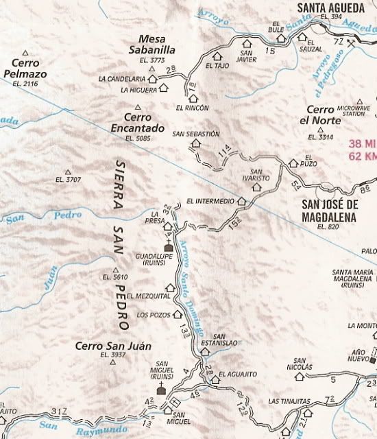
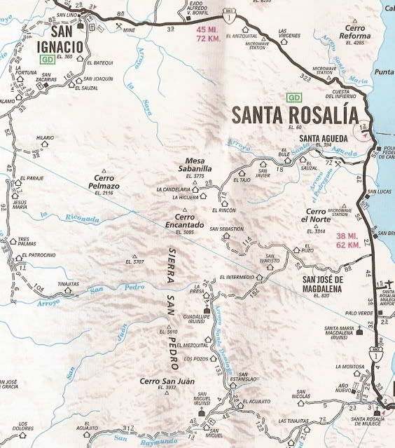
In 1962, you had to hike in to Guadalupe on the El Camino Real... no auto roads...
[Edited on 1-30-2011 by David K]
|
|
|
elfbrewery
Nomad
Posts: 350
Registered: 12-25-2006
Member Is Offline
|
|
Wet Cement
On Tuesday, Feb. 1, 2011, 3 jeeps and a 4wd pickup turned onto the Icehouse Road on the north side of Mulegé at 09:01. Our goal was to drive the loop
that goes west to the turnoff for Rancho Estanislao, then north through Guadaloupe, northeast through the pass, east through San Jose de Magdalena to
Highway 1, returning to Mulegé. A recent report by a motorcycle rider on the Baja Nomad website gave us confidence to make this trip.
First stop, though, was to buy some citrus fruit at the orange grove west of Mulegé. Our vehicle had already aired down a few pounds because we
knew there was heavy washboard just getting that far. Fruit in hand, we carried on. Our vehicle deferred the lead to another, because I always get
lost finding the main road. Turns out Im not alone, because we followed the wide, well-traveled road into the huertas, only to turn around and search
for the turn (to the right) that we missed. By now we have delayed our travel time by 20 minutes, but we have all day.
Soon we pick up speed and whiz into the valley with its lovely scenery with clear, clean air that makes the mountains look so close. The
serpentine road along the cliffs is such a treat. But then, the rock dam we used to take a break by has vanished. Hurricane Jimena has caused the
current road to go around the track we used to take, leaving the small paved bridge we would have driven over to be isolated in a washout. No sense
stopping here. Kilometers 34-37 with the 3 rough climbs were soon behind us and we zigzagged along the canyons skirting ranchos. We turned north onto
the road towards Estanislao at 10:48. Over the hills and down along and through the arroyo we go. We were feeling good that we made it farther than
last year in such good time, when we made an unplanned stop. One of our drivers was experiencing stomach problems. Well, its 11:28 and we might as
well have lunch while deciding what to do. The lead vehicle finally returned after feeling lonely, suspecting a vehicle breakdown, not a human one. We
travel in a group for safety, no question about it. Its just part of life that some things are not meant to happen on some days. And when it comes to
health, those first 2 hours are very important. So, after a bit of lunch, we got ready to retreat. Lo and behold, our poorly driver is cracking jokes
and were ready to push on.
The road is better than last year. We arent even sure that there was a road past Guadaloupe last year. On that trip, a DHL truck had passed us
and returned without a clue as to passage beyond the nearby ranchos he had delivered to. Rain in the mountains made us turn back anyway. But that was
last year and a couple gringos just stopped to tell us they had come through the pass from San Jose de Magdalena, camping up in the mountains last
night.
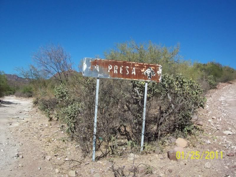
Because we didnt want to take extra time, we skipped hunting for the ruins of the Guadaloupe mission, took the road to the right at La Presa and
headed into the mountains. So nice to be out of the arroyo and so happy to view these picturesque rocky structures. Wow! What a great scene! Whoa! Why
are we stopping? Theres a pickup parked in the road and our lead driver has stopped next to it. Oh, its the road construction we heard about. Lots
of things can hold you up when taking the back roads, but we were in for a new one -- wet cement. A nice long section, about 25 feet in length,
running the full width of what roadway there was, hacked from the cliff on one side, drop-off on the other, had just been laid. The work crew was
taking their lunch break and the lead driver and I walked down to see what our chances were for getting through. After turning down the offer of
gorditas, the foreman answered our plea with, Please. Give me two hours. Well, at least that meant we might get through today, but it was already
after 2pm. Turning back was an option, but no one really wanted to do that; it had taken us a fair chunk of time to get this far (5 hours, but only
2.5 hours full-on driving in reality). Figuring it would be about 1.5 hours from here to Highway 1 via S. J. de Magdalena, we decided to kick back and
enjoy this hiccup in our plans. Out come the chairs, books, cameras,... What, no playing cards?
Unexpectedly, we get a shout at 2:40pm that we can come through. Everything was slung into the vehicles and off we went trying to be careful
driving over the fresh cement. We handed out candy and fruit to the crew, who were very happy to receive it. These guys live up here while working on
the road, so fresh food is very welcome.
A 2wd car was in front of us. The driver swerved around every 3 inch high rock, but floored it when he hit the dusty patches of road. We followed
his slolum for miles as we wound our way out of the canyon. He opened each ranch gate for us, but we were responsible for closing them. Eventually,
the 2wd car stopped at a ranch and we scooted onward. The pretty part of the trip was over as the land flattened out ahead. We were in the mood to get
to Magdelena, Highway 1 and Mulegé. We made a brief stop (less than 10 minutes) in Magdelena and were back to the highway by 4:14. We had accomplished
our mission and have stories to tell.
As for others who may want to try this road, my partner and I rated it a 6 on a scale of 1 to 10 in difficulty. This was because we drove a jeep
and used 4wd for most of it with tires at about 25psi. We would definitely recommend 4wd for both the uphills and steep downhills. According to my
GPS, the maximum slope was approximately 15% up, 21% down; max. elevation was 2653 feet. The distance was about 65 miles (if you dont make any wrong
turns) from highway to highway. Full-on driving time (in a group) was about 4 hours (we took about 7 hours all toll), but you will want to take plenty
of breaks to enjoy this area. As it turns out, we could have stopped at the Guadaloupe ruins. Oh well, next year.
|
|
|
Cypress
Elite Nomad
Posts: 7641
Registered: 3-12-2006
Location: on the bayou
Member Is Offline
Mood: undecided
|
|
elfbrewery, Thanks for the report.
|
|
|
motoged
Elite Nomad
Posts: 6481
Registered: 7-31-2006
Location: Kamloops, BC
Member Is Offline
Mood: Gettin' Better
|
|
Elf,
Glad you folks did that loop and enjoyed it. I have done it several times over past ten years and disagree with one comment you made. I do not think
4-wheel drive is needed for any of the trip unless shortly after hurricane damage. The locals do it in 2-wheel drive vehicles all the time rather
well.
I say this only to not discourage folks who don't have a 4X4 from doing the loop and seeing some spectacular country. 
Don't believe everything you think....
|
|
|
elfbrewery
Nomad
Posts: 350
Registered: 12-25-2006
Member Is Offline
|
|
motoged,
I don't doubt you for a moment, that's why I said "recommend." I didn't want people to think just anyone could do this with their "primary" car
without due caution. Thanks for your thoughts.
|
|
|
motoged
Elite Nomad
Posts: 6481
Registered: 7-31-2006
Location: Kamloops, BC
Member Is Offline
Mood: Gettin' Better
|
|
Elf,
Actually, I would recommend a person do it by dirtbike, on their pegs, in 4th gear ....with one hand free taking pics ....with one hand free taking pics
All joking aside...a full day is what is need as there are so many places to stop and snoop around....horses, cattle, donkeys, and goats along the
road, fig tree roots climbing up canyon walls, flotsam 20 feet up on some trees where the hurricane floods have left debris, a look around the gardens
in Magdalena (that beautiful bougainvillea on the west end of town as you turn a corner), the egrets in the stream running through town, the
cemetery....
Don't believe everything you think....
|
|
|
David K
Honored Nomad
Posts: 65573
Registered: 8-30-2002
Location: San Diego County
Member Is Offline
Mood: Have Baja Fever
|
|
I love detailed trip reports... thank you...
I hope you don't mind that I put in many double spacings to make it easier to read (at least for me)!
| Quote: | Originally posted by elfbrewery
On Tuesday, Feb. 1, 2011, 3 jeeps and a 4wd pickup turned onto the Icehouse Road on the north side of Mulegé at 09:01.
Our goal was to drive the loop that goes west to the turnoff for Rancho Estanislao, then north through Guadaloupe, northeast through the pass, east
through San Jose de Magdalena to Highway 1, returning to Mulegé.
A recent report by a motorcycle rider on the Baja Nomad website gave us confidence to make this trip.
First stop, though, was to buy some citrus fruit at the orange grove west of Mulegé. Our vehicle had already aired down a few pounds because we knew
there was heavy washboard just getting that far. Fruit in hand, we carried on. Our vehicle deferred the lead to another, because I always get lost
finding the main road.
Turns out Im not alone, because we followed the wide, well-traveled road into the huertas, only to turn around and search for the turn (to the right)
that we missed. By now we have delayed our travel time by 20 minutes, but we have all day.
Soon we pick up speed and whiz into the valley with its lovely scenery with clear, clean air that makes the mountains look so close. The serpentine
road along the cliffs is such a treat. But then, the rock dam we used to take a break by has vanished.
Hurricane Jimena has caused the current road to go around the track we used to take, leaving the small paved bridge we would have driven over to be
isolated in a washout.
No sense stopping here. Kilometers 34-37 with the 3 rough climbs were soon behind us and we zigzagged along the canyons skirting ranchos. We turned
north onto the road towards Estanislao at 10:48.
Over the hills and down along and through the arroyo we go. We were feeling good that we made it farther than last year in such good time, when we
made an unplanned stop. One of our drivers was experiencing stomach problems. Well, its 11:28 and we might as well have lunch while deciding what to
do.
The lead vehicle finally returned after feeling lonely, suspecting a vehicle breakdown, not a human one. We travel in a group for safety, no question
about it. Its just part of life that some things are not meant to happen on some days. And when it comes to health, those first 2 hours are very
important. So, after a bit of lunch, we got ready to retreat. Lo and behold, our poorly driver is cracking jokes and were ready to push on.
The road is better than last year. We arent even sure that there was a road past Guadaloupe last year. On that trip, a DHL truck had passed us and
returned without a clue as to passage beyond the nearby ranchos he had delivered to.
Rain in the mountains made us turn back anyway. But that was last year and a couple gringos just stopped to tell us they had come through the pass
from San Jose de Magdalena, camping up in the mountains last night.
Because we didnt want to take extra time, we skipped hunting for the ruins of the Guadaloupe mission, took the road to the right at La Presa and
headed into the mountains. So nice to be out of the arroyo and so happy to view these picturesque rocky structures.
Wow! What a great scene! Whoa! Why are we stopping? Theres a pickup parked in the road and our lead driver has stopped next to it. Oh, its the road
construction we heard about. Lots of things can hold you up when taking the back roads, but we were in for a new one -- wet cement. A nice long
section, about 25 feet in length, running the full width of what roadway there was, hacked from the cliff on one side, drop-off on the other, had just
been laid.
The work crew was taking their lunch break and the lead driver and I walked down to see what our chances were for getting through. After turning down
the offer of gorditas, the foreman answered our plea with, Please. Give me two hours.
Well, at least that meant we might get through today, but it was already after 2pm. Turning back was an option, but no one really wanted to do that;
it had taken us a fair chunk of time to get this far (5 hours, but only 2.5 hours full-on driving in reality).
Figuring it would be about 1.5 hours from here to Highway 1 via S. J. de Magdalena, we decided to kick back and enjoy this hiccup in our plans. Out
come the chairs, books, cameras,... What, no playing cards?
Unexpectedly, we get a shout at 2:40pm that we can come through. Everything was slung into the vehicles and off we went trying to be careful driving
over the fresh cement. We handed out candy and fruit to the crew, who were very happy to receive it. These guys live up here while working on the
road, so fresh food is very welcome.
A 2wd car was in front of us. The driver swerved around every 3 inch high rock, but floored it when he hit the dusty patches of road. We followed his
slolum for miles as we wound our way out of the canyon. He opened each ranch gate for us, but we were responsible for closing them.
Eventually, the 2wd car stopped at a ranch and we scooted onward. The pretty part of the trip was over as the land flattened out ahead. We were in the
mood to get to Magdelena, Highway 1 and Mulegé. We made a brief stop (less than 10 minutes) in Magdelena and were back to the highway by 4:14. We had
accomplished our mission and have stories to tell.
As for others who may want to try this road, my partner and I rated it a 6 on a scale of 1 to 10 in difficulty. This was because we drove a jeep and
used 4wd for most of it with tires at about 25psi. We would definitely recommend 4wd for both the uphills and steep downhills.
According to my GPS, the maximum slope was approximately 15% up, 21% down; max. elevation was 2653 feet. The distance was about 65 miles (if you dont
make any wrong turns) from highway to highway. Full-on driving time (in a group) was about 4 hours (we took about 7 hours all toll), but you will want
to take plenty of breaks to enjoy this area.
As it turns out, we could have stopped at the Guadaloupe ruins. Oh well, next year. |
[Edited on 2-4-2011 by David K]
|
|
|
woody with a view
PITA Nomad
Posts: 15940
Registered: 11-8-2004
Location: Looking at the Coronado Islands
Member Is Offline
Mood: Everchangin'
|
|
| Quote: |
Actually, I would recommend a person do it by dirtbike, on their pegs, in 4th gear
|

|
|
|
TMW
Select Nomad
Posts: 10659
Registered: 9-1-2003
Location: Bakersfield, CA
Member Is Offline
|
|
Excellent pictures George. Great report Elf. I gotta do the loop someday. If you have a chance take the route thru San Juan de la Pila. That's
beautiful country just like above.
|
|
|
| Pages:
1
2 |
|


