John M
Super Nomad
   
Posts: 1924
Registered: 9-3-2003
Location: California High Desert
Member Is Offline
|
|
Baja Adventure part 3 - after the NORRA 1000
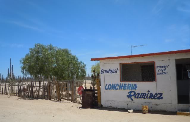
The turn to Bahia de Los Angeles has at least one place for a good meal.
This little loncheria was busy and served us a delightful meal. We were well-entertained by the youthful antics of a little boy, maybe 5 or 6 years
old. He apparently had just learned the art of whistling (in part due to a missing tooth). A too-large cowboy hat partly covering his smiling eyes.
It was difficult to keep the Toyota on the highway as we passed KM 161 for we could clearly see the tire tracks beginning the route up Calamajue Wash
beckoning us once again to come play on this track which is one of our favorites.
September of 1973 saw the completion of the ashphalt ribbon we know as Highway 1. The "golden spike" as it were connecting the route from the south
with the route from the north was commemorated at a little place called San Ignacito about 6.5 miles south of Catavina. A concrete slab with a barren
marker dignify the spot. Actually the plaque which once graced this monument has now been replaced with grafitti.
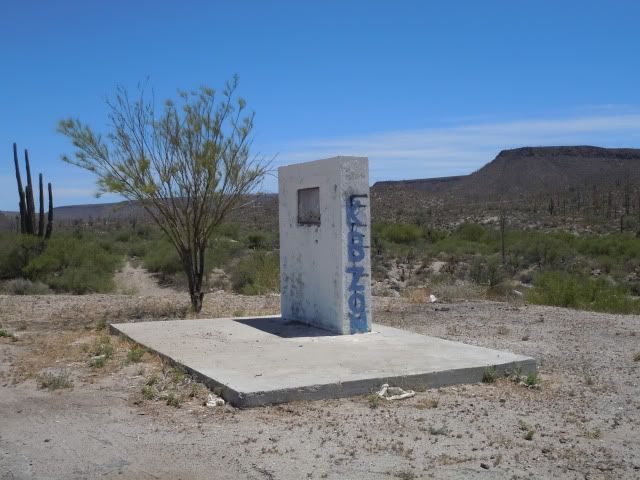
Former marker across from San Ignacito loncheria
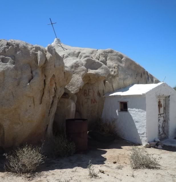
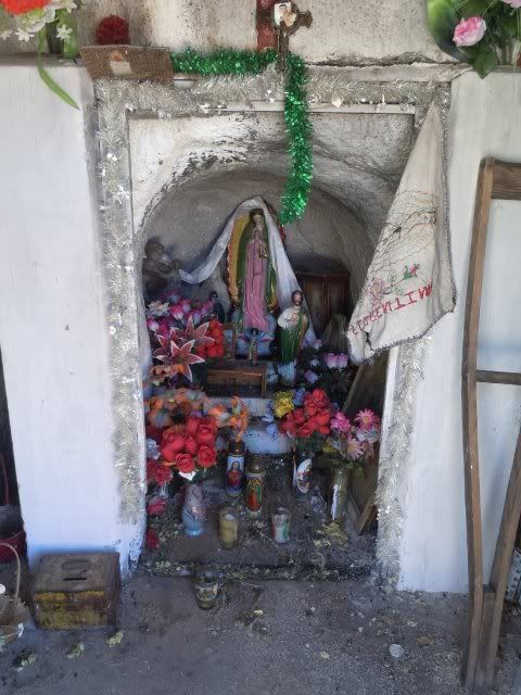
We had seen on the Nomad board that the condition of the little shrine north and east of Catavina had been trashed, donation box broken, and just
generally a mess so we detoured a few miles to check it out. Someone had beat us to it, and the gournds both inside and out were cleaned up we are
pleased to report.
Traffic on the highway was very light so we were able to slow our speed and enjoy the marvelous views the hills and valleys have to offer. Others have
posted many great pictures of the varied plants and rock formations in this region - photographers with way more talent than I, but our enjoyment of
the beauty cannot be diminished just because we cannot adequately capture it on film - film? what film? I guess I mean to say cannot capture it on a
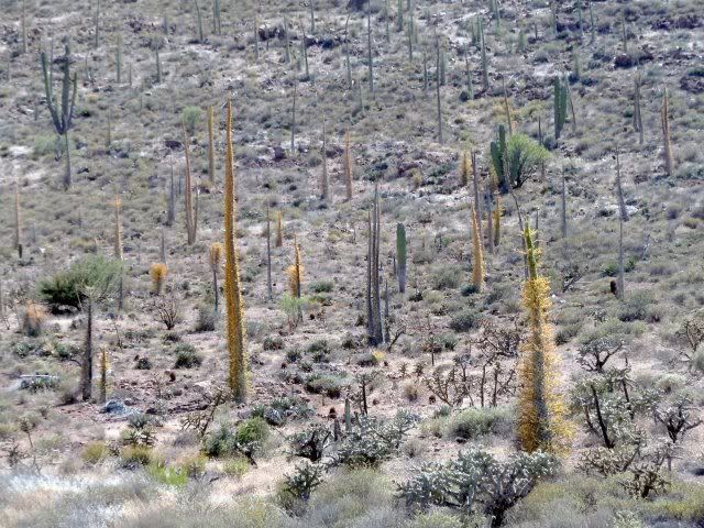
chip? Anyway here is one image of a couple of boojums showing a yellow appearance which signifies a diminished water supply.
Cruising into El Rosario we eagerly anticipated our stay at Baja Cactus. Not disappointed we even pampered ourselves with a wonderful massage! Staying
here the same night, returning from an epic motorcycle event, "The Rip To The Tip" was the support crew with more than 30 motorcycles and 4 or 5 way
cool support vehicles. This event, was tragically marred this year by the death of superstar rider Jeff "OX" Kargola near San Felipe.
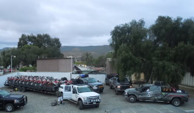
RIP TO THE TIP support crew vehicles.
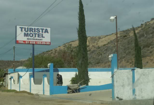
As we entered El Rosario, our attention was diverted to what appeared to be one of the cleanest and neatest motels here in town. The Turista Motel has
spotless rooms as well as a small restaurant that is about to open. This would make a nice place to stay - rates on a par with Baja Cactus.
After two nights in El Rosario we headed home via Tecate.
The road from Ensenada to Tecate will become one of the easiest roads to drive within just a few years. There is a good deal of construction along the
way but caused us no delays. The only delay we encountered happened to be at the L.A. Cetto winery. This highway, probably 10 miles out from Tecate,
has been widened, straightened, and made for a smooth ending of our travels in Baja for this trip.
John and Barbara M
|
|
|
goldhuntress
Senior Nomad
  
Posts: 663
Registered: 1-28-2010
Member Is Offline
|
|
Just finished reading all 3 reports and really enjoyed the trip. Baja is so full of great experiences waiting to be had! Glad to hear Coco is in good
spirits and maybe getting some help. He's such a sweet man and I worry about him. Thanks for sharing.
|
|
|
David K
Honored Nomad
        
Posts: 65412
Registered: 8-30-2002
Location: San Diego County
Member Is Offline
Mood: Have Baja Fever
|
|
Fantastic trip report and photographs John!
The shrine along the old main road, north of Cataviņa, is La Virgen... It has been there since the 1950's! Many historic photos have been posted.
Sad that the monument at San Ignacito has been vandalized... This is where the two construction teams met, as the roadbed was being built south from
San Quintin and north from Santa Rosalia in 1973. Pavement was completed a couple months later just in time for the official opening cermoney at the
Eagle Monument (near Guerrero Negro) on Dec. 1, 1973.
[Edited on 5-13-2011 by David K]
|
|
|
TMW
Select Nomad
      
Posts: 10659
Registered: 9-1-2003
Location: Bakersfield, CA
Member Is Offline
|
|
An excellent report, thanks again.
|
|
|
BornFisher
Super Nomad
   
Posts: 2128
Registered: 1-11-2005
Location: K-38 Santa Martha/Encinitas
Member Is Offline
|
|
Great read and pics. Thanks!!
|
|
|
scouter
Nomad
 
Posts: 100
Registered: 4-11-2011
Member Is Offline
|
|
Very nice I really enjoyed the report......
|
|
|
John M
Super Nomad
   
Posts: 1924
Registered: 9-3-2003
Location: California High Desert
Member Is Offline
|
|
Enjoyment is a dandy word....
to describe the fun we had.
Thanks for the nice comments and Baja is waiting for you. It must seem like a dream - New Jersey to Baja - but many times our fondest goals are
revealed in dreams.
We plan trips sometimes a year distant and wonder if the day will ever come. Now as we get older the wait seems to quicken and we are packing the
truck preparing to leave.
John M
|
|
|
David K
Honored Nomad
        
Posts: 65412
Registered: 8-30-2002
Location: San Diego County
Member Is Offline
Mood: Have Baja Fever
|
|
The missiong plaque from the monument pictured above...
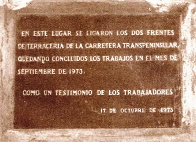
San Ignacito Monument marking the meeting of highway crews from the north and the south... 7.4 miles south of Cataviņa.
|
|
|
David K
Honored Nomad
        
Posts: 65412
Registered: 8-30-2002
Location: San Diego County
Member Is Offline
Mood: Have Baja Fever
|
|
Replaced monument at San Ignacito, in 2017:
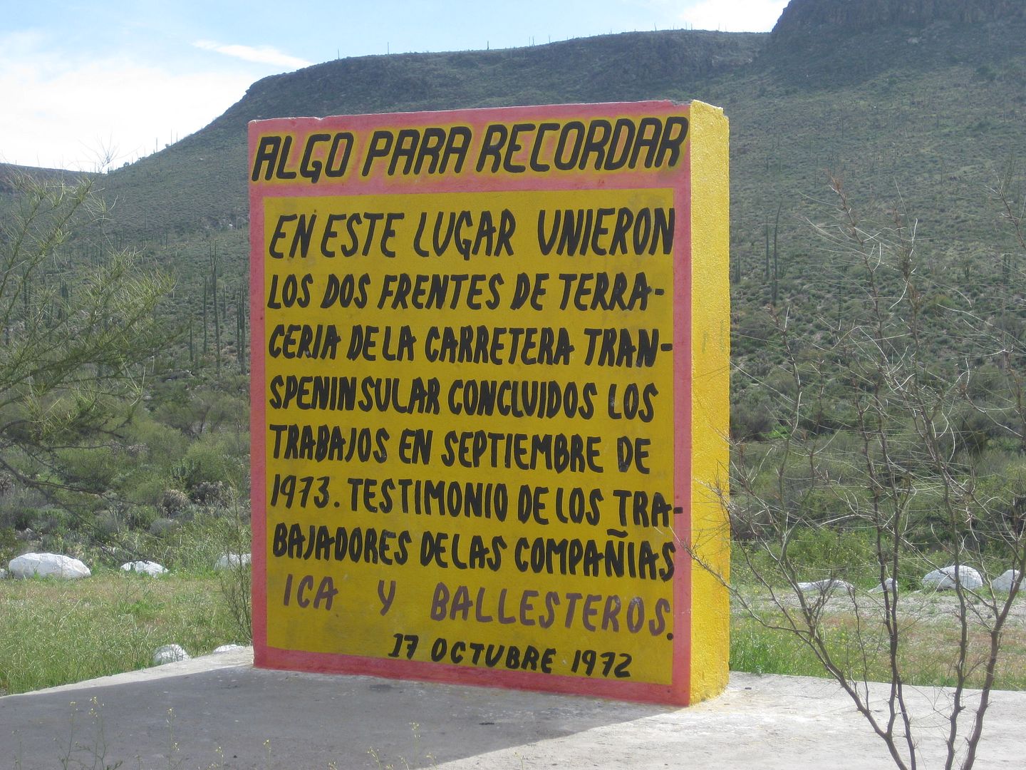
(year should be 1973)
|
|
|

