| Pages:
1
2 |
bajalou
Ultra Nomad
    
Posts: 4459
Registered: 3-11-2004
Location: South of the broder
Member Is Offline
|
|
Lost Mission trip from the start- Day 1, 2, 3 and now the rest of the story
Lost Mission expedition Day one
AT around 10am Thurs. Apr 28, I'm finally out of the house. A couple of short errands and heading for the highway. Nice day - sunny and warm, as I
like it. Filled up the fuel , ice and water yesterday so no stops in town. Just drive on south on Highway 5 - good pavement. Looked for the islands
when I passed Baja Warrier's place but the dunes are higher than the highway so couldn't see anything of interest. Stopped and Bahia Christina to
drop some stuff off at friends camped there who were exploring the canyons from the east.
Pavement ends same place it did last fall but a lot of work going on south of there for 8-10 miles. Culverts, bridges being built. Good detour.
Some roadway almost finished from the looks of it. Road on to Gonzaga not too bad some washboard some rocky but really no problem areas. Lots of
stops to check tiedowns etc. on the trailer
Fill up at Gonzaga Pemex. Regular 9.7 pesos per liter - so much for all Pemex prices the same except border areas.
On to Coco's and get a coke. The guy there said Coco was in Ensenada getting some more operations on his stumps, but doing OK. On to Highway 1 and
the road not too bad (better than the one north of Gonzaga. More tiedown checking.
Highway 1 was good - few potholes so making great time. Looking for turnoff to El Marmol and see a sign "El Marmol 15K" but miss seeing the turn so
figure I've overshot at St. Agustine and return and find the road. Nine miles of dirt road - pretty good dirt road at that - and I'm at the onyx
school house. I don't stop, just glance around and head on out on the road east. Wind down into the wash (about 4 miles I think) and come to the
wash we're looking for.
Tracks to the right (upstream) and tracks to the left (downstream) ? Turn up and get out and walk a ways and see the tracks end so back to the
Bronco. Walking by the trailer and see the right front tire on the quad is flat - and a hole about 2 in wide and 6 inches long.
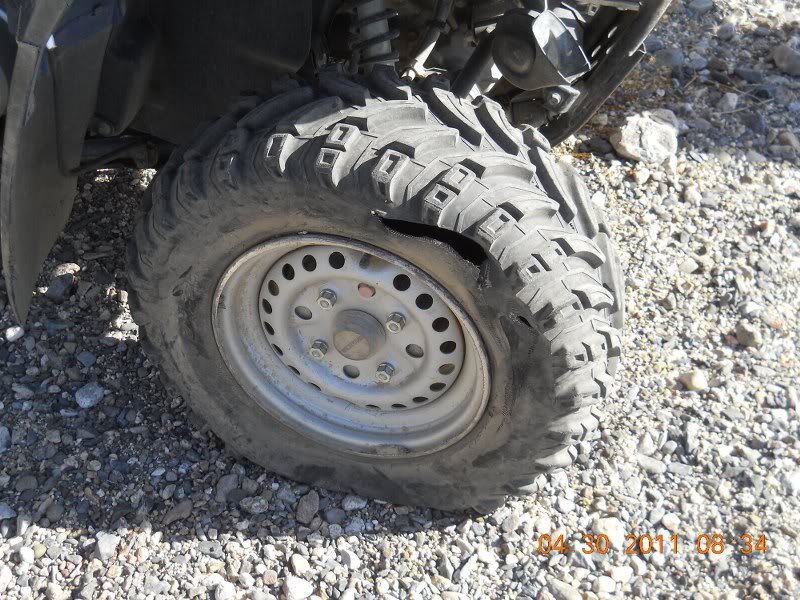
Mmmm don't think I can plug it. Turn around and head back to the road and stop and honk the horn. A coupe minutes and I hear "Hey - you must be a
Nomad". "Yes I a4" I reply and it's Phil, XRPHLANG. We remember meeting before on one of the Nomad President's day trips Baja Cat had set up.
He guided me across the rocks to where he had stopped to camp - looked good to me so I pulled in and shut it down. About 5 minutes later while we're
chatting, we hear another Toyota aproach and it's TW and his brother Bill. They pull in and decide this is the spot so unload and get camp set up. I
unhitch the trailer and unload the Bronco (my bedroom for the weekend). They said they had seen dtbushpilot in El Rosario and he would be in the
next morning. I had breakfast with Ken Cook and wife and Aaron in San Felipe on Monday and they promised to be stopping by around noon on Fri.
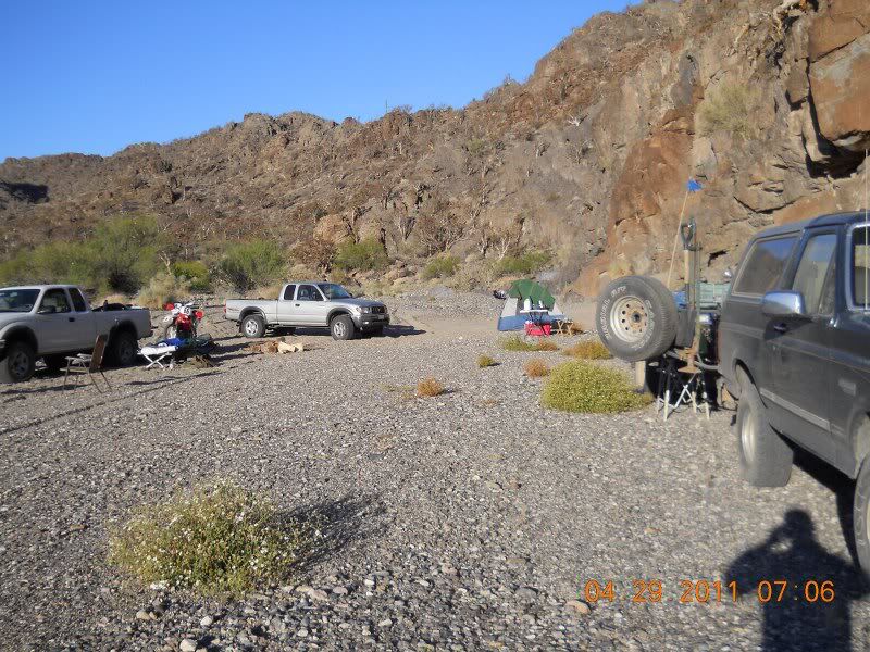
We eat and sit around talking. Save the firewood for later. I got out a computer and we looked at the Google Earth shots of the area - where we were
and where we were going and called it a night. Some wind and kind of cool but not too bad.
Tomorrow - we'll check out the old mine road and see????
[Edited on 5-15-2011 by bajalou]
[Edited on 5-15-2011 by bajalou]
No Bad Days
\"Never argue with an idiot. People watching may not be able to tell the difference\"
\"The trouble with doing nothing is - how do I know when I\'m done?\"
Nomad Baja Interactive map
And in the San Felipe area - check out Valle Chico area |
|
|
bajalou
Ultra Nomad
    
Posts: 4459
Registered: 3-11-2004
Location: South of the broder
Member Is Offline
|
|
To the mine
Check out the mine road-
Up and about and some coffee and a bit of breakfast and we decide to check out and fix? the road to La Olvidada an abandoned mine at the end of the
road. Baja Almanac shows it as a Oro (gold) but other reports call it Barite. If we can get there, we might find the source of the gold that's
hidden at the mission?
TW and Phil take their bikes, I'm on the limping quad and Bill has TW's pickup and off we go. Looking for a big X than elbow asked about and checking
out all the scenery - the place is loaded with white elephant trees. The road shows a lot of recent work - maybe someone fixed it for us.
On up the mountain we go, a couple of side roads but the all end up at the same place we find. Finally pull up to the top of a ridge and there is
where the work has been going on. A large flattened area with a cliff face of very colorful rock.
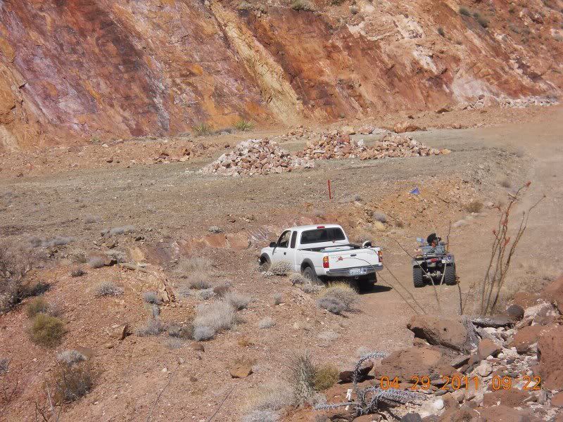
Several piles of rock, looks like they sorted the stuff out 4 ways - but which is the gold? I don't see any nuggets but what do I know? We hiked out
on a point with a $1,000,000 view to the east - Enchanted Islands, beaches, the ridges above other washes to the north - all I could say is "Wow -
look at this"
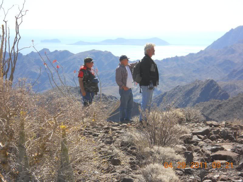
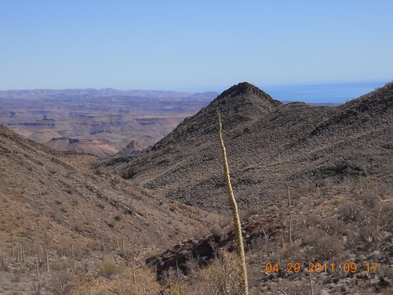
Looked over the hill and about 75 feet lower (and the road was gone) was the origional tunnel of the mine. None of us were curious enough to try to
get down there so it might still be filled with gold bars.
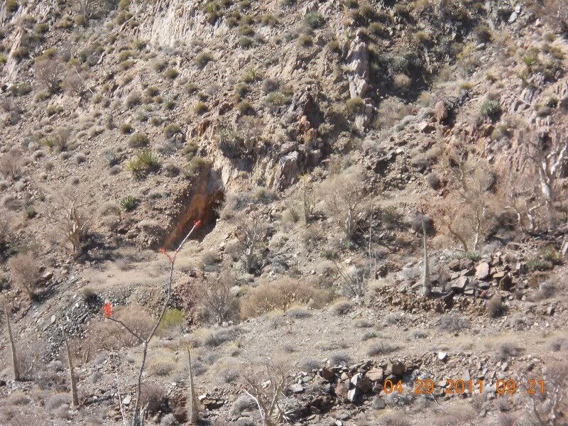
We spend a while looking around and wondering, Phil rides up a road above the cliff and reports just a little digging around to show the same looking
rocks. We head back down taking different roads to the same place. We stop at the GPS coordinates of the X and TW and Bill stay and look around for
it. Phil and I head back to camp. Ken Cooke and group should be showing up pretty soon if they're on schedule. dtbushpilot arrives on his bike and
gets his spot set up.
Tall stories and loafing take up the afternoon as we wait of Ken and group and David and José to arrive. TW and Bill decide they need ice so head out
to Catavena. A hour or two and their back reporting José and David are coming behind them. A couple minutes and a big red Dodge shows up with José
and he picks a spot. After saying hello, his next words are "I hope we don't loose anyone this time!" We had a little excitement on the Pres. Day
trip to Cañon del Diablo. David K's Toyota soon arrives with Vern aka El Vergel.
While David and Vern are setting up, José and I decide to head back to the mine so José can see it for himself. The big Dodge gets us there and in no
time we're walking around the flattened area looking at the piles of rocks, the rock wall, and a short tunnel into the wall.
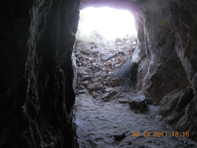
Again I'm amazed by the views.
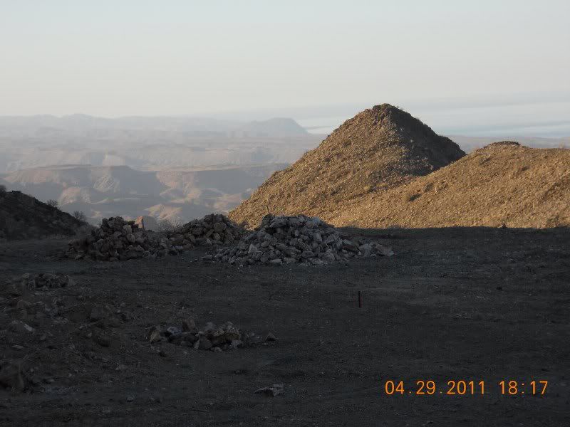
Not knowing what we're seeing, we head back down the mountain stopping at another tunnel about 1/4 mile away and about 100 ft lower in the mountain.
José heads in to check it out.
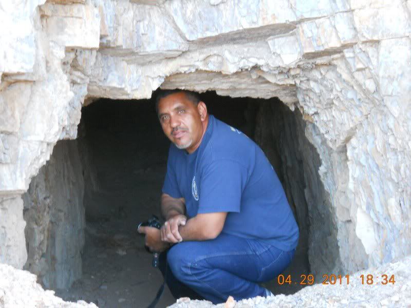
This one is deeper maybe 60ft and ends with some pretty colorful rock
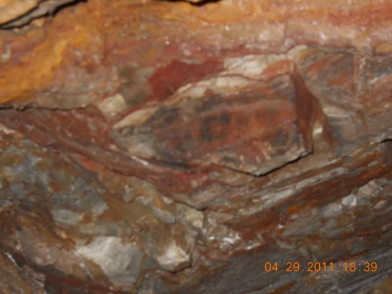
Back to camp cause tomorrow's the big day - we find the lost mission----
[Edited on 5-14-2011 by bajalou]
No Bad Days
\"Never argue with an idiot. People watching may not be able to tell the difference\"
\"The trouble with doing nothing is - how do I know when I\'m done?\"
Nomad Baja Interactive map
And in the San Felipe area - check out Valle Chico area |
|
|
TMW
Select Nomad
      
Posts: 10659
Registered: 9-1-2003
Location: Bakersfield, CA
Member Is Offline
|
|
Great stuff Lou. The pictures are excellent.
|
|
|
wessongroup
Platinum Nomad
       
Posts: 21152
Registered: 8-9-2009
Location: Mission Viejo
Member Is Offline
Mood: Suicide Hot line ... please hold
|
|
Great post.. way cool ... and some kind of luck on the road.. unbelievable... thanks much ...  
|
|
|
bajalou
Ultra Nomad
    
Posts: 4459
Registered: 3-11-2004
Location: South of the broder
Member Is Offline
|
|
They planted a impressive claim marker near the road to the mine.
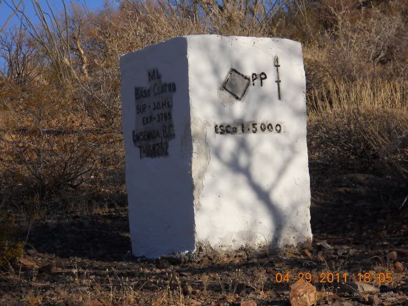
There were two older markers near this pretty new one.
No Bad Days
\"Never argue with an idiot. People watching may not be able to tell the difference\"
\"The trouble with doing nothing is - how do I know when I\'m done?\"
Nomad Baja Interactive map
And in the San Felipe area - check out Valle Chico area |
|
|
John M
Super Nomad
   
Posts: 1924
Registered: 9-3-2003
Location: California High Desert
Member Is Offline
|
|
Ahhhhh - the interest builds!
You are a dandy story teller Lou!
nice photos too.
John M
|
|
|
bajalou
Ultra Nomad
    
Posts: 4459
Registered: 3-11-2004
Location: South of the broder
Member Is Offline
|
|
Day 3 - We search for the mission
Lost Mission day 3 - Searching for the mission
Up bright and early - a little more wind in the night and a bit colder so coffee was a great start for the day. Then tom's famous grits filled me up
to get ready for the search. My plan is to take the quad as far down the canyon as I can. But I didn't take time to plot the route over the rock
field just below camp and with the lame leg on it, I abandoned it and started walking to catch up with the group. Sand and fine gravel most of the
time, then bedrock across the wash, then more sand. Not steep but a steady drop altitude.
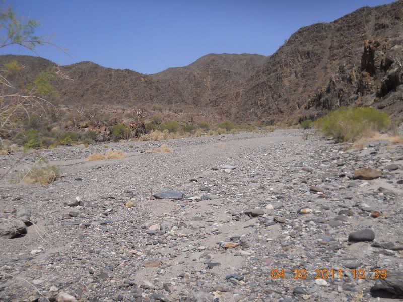
From the size of the trees and brush, it's obvious that this wash gets wiped pretty clean of vegetation from time to time. Bigger trees etc on the
benches to the sides.
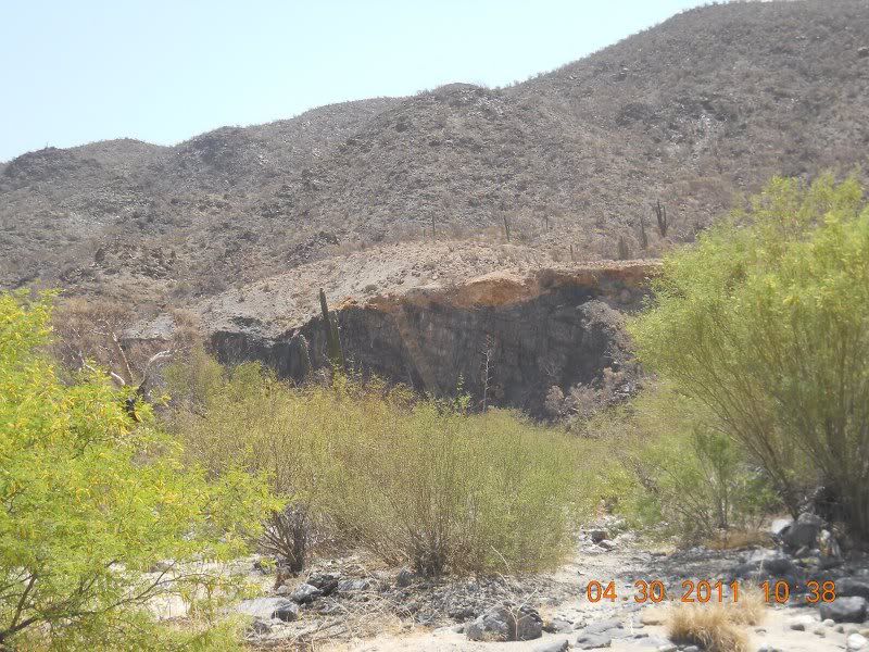
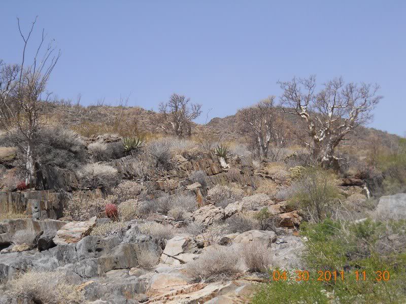
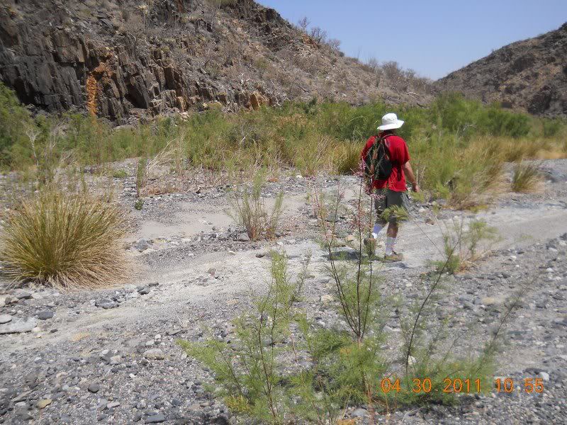
I came around a bend and I saw the cut made when the padres put a water line down the canyon for the mission.
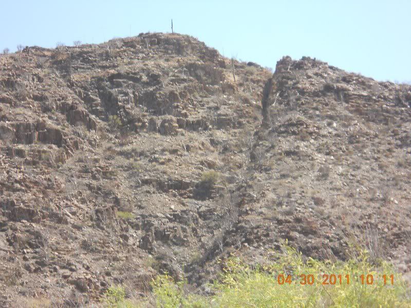
I finally reach a point opposite the "Corral" from elbeau's posting.
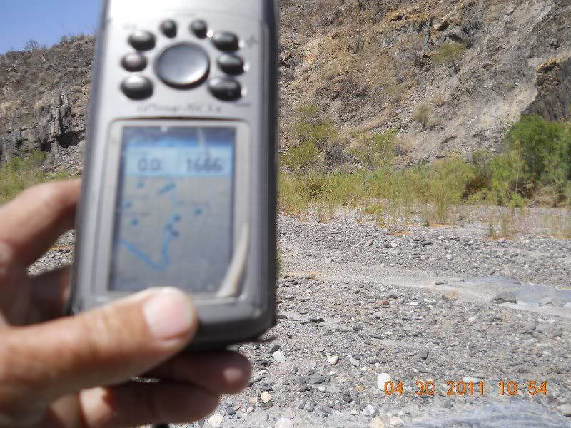
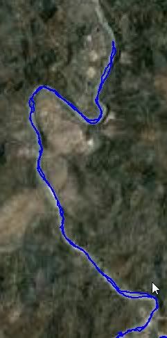
The blue line is my track down the wash. The blue dots are waypoints I entered from elbeau's post marking corral, stairway, etc. None of these
features were visible to me, sorry, just rocks. We could not see the corral as that wall went up about 75 feet very straight up.
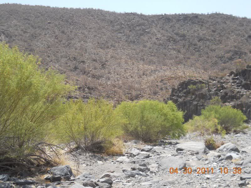
I first thought this was the corral, but it's about 1000 mts before the spot elbeau marked, but looks similar.

It's a rough and unforgiving land. TW, Bill and I stopped here and Tom went up the mountain across the wash from the corral. He finally came back
down and most of the rest of the group came back up and started back toward camp.
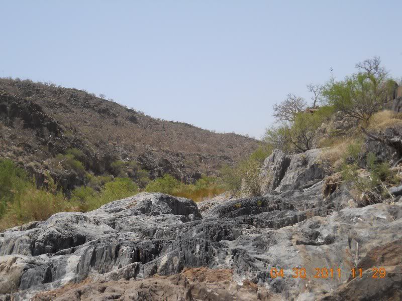
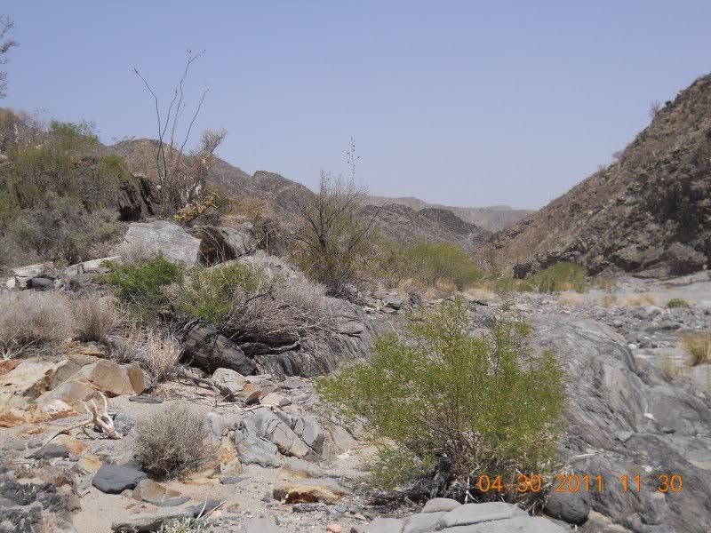
Going back was a lot more work than going down. José held back and walked with the old folks. We would guess how far we came then shatter our dreams
when we would see DavidK's mile markers. Rest a few minutes then on up the wash.

Back to the camp and rest up and some dinner and a evening of stories around a roaring campfire. The wind is blowing pretty good now, but I think
I'll be able to sleep tonight.
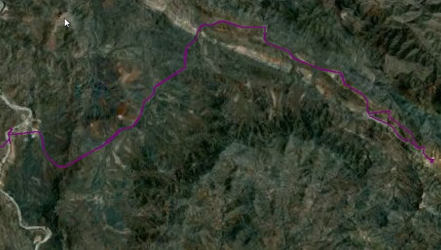
The track down the wash overlayed on Google Earth.
Track to the mine on Google Earth
No Bad Days
\"Never argue with an idiot. People watching may not be able to tell the difference\"
\"The trouble with doing nothing is - how do I know when I\'m done?\"
Nomad Baja Interactive map
And in the San Felipe area - check out Valle Chico area |
|
|
wessongroup
Platinum Nomad
       
Posts: 21152
Registered: 8-9-2009
Location: Mission Viejo
Member Is Offline
Mood: Suicide Hot line ... please hold
|
|
Wow... this is really like getting to go ... and "grits" for breakfast .. not bad..
Thanks for the work.. appreciate it...
|
|
|
bajalou
Ultra Nomad
    
Posts: 4459
Registered: 3-11-2004
Location: South of the broder
Member Is Offline
|
|
The rest (Last) of the story-
Lost Mission - day 4-5 the trip home.
A colder night with more wind - 45 deg. Wind drove José and Phil from their tents into their trucks. Get up and get coffee and breakfast thanks to
José and time to pack up. Phil get's his stuff together and packed and heads out. He has the farthest to go to get home so early start is good. I
think I'm next out and up the hill. Stopped at the schoolhouse in El Marmol for a couple of pictures of the area.
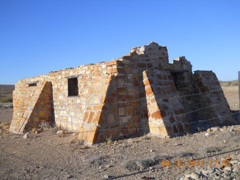
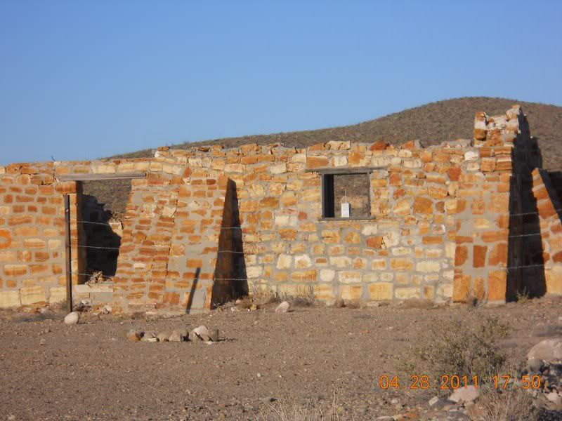
And the cemetery -
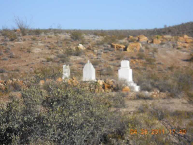
(If you look at the time/date stamp on the pictures, I guess I took them on the way in)
Check the tiedowns and on to the highway. Check them again before getting on Highway 1 and Bill and TW arrive. They're loading the bike as I head
out north on the highway. The plan is to go via Highway 1 and the cutoff to Valle Trinidad to avoid the rough road around Gonzaga.
A few miles up the road and on a steep downgrade with a sharp turn at the bottom and lots of bumpers, I hear a sound like air escaping - the mirror
shows smoke around the trailer - no where to get off here - mmm - gas and propane on the trailer - got my hand on the fire extinguisher. Get to the
top of the hill and pull off and take a look. The left trailer tire is rubbing on the deck (steel) - what happened? Axel loose? A minute later David
(dtbushpilot) pulls over on his bike and we both study the problem. Ah - David points out the torsion housing has broken - not holding anything. A
Toyota pulls over and TW and Bill join us.
We need to block up the torsion housing but with what? TW has a bar, but it's too long. We finally decide on chains I have with a binder. Get the
highlift jack and bumper jack and lift it up and David attaches the chain. Will it hold till I get to el Rosario? We hope so. So it's on the road
again. A little slower but all seems to be holding. DT is right behind me with TW and Bill coming along a little later.
Stop to see Ed at Baja's Best ? for lunch and advise on where to get welding done in town. After some great fish tocos all around, I head to a house
with 2 yellow Caterpillars in the yard - that was Ed's instructions. DT heads on up the road as he's staying in Ensenada. TW and Bill follow me to
the welder's. A few minutes conference and it's decided on the repair plan. I decide that yesterday's walk, and the time it's going to take to weld
this up that I'll stay in El Rosario for the night, to I wish TW and Bill a great trip and they head out.
A couple hours and 700 pesos later, the torsion bar housing is welded and a bar is welded under the housing to the frame. No more bouncing around
like it did before. Off to Baja Cactus's motel for the night. No Baja Nomad ID card so no discount, but at 250 pesos for a room in the old section
I'm happy. I bring in my drinks and a couple snacks and I'm done for the day. Not even out for dinner.
Day 5 - I make it home.
Up about 7 and grateful for the coffee they gave me. A couple of cups and I'm over to the station and fill up for the rest of the trip.
Somewhere up the line I get some birria for breakfast and of course overshoot the turn to Valle Trinidad, so back track about 5 miles and turn east at
the Military inspection point.
Don't remember how many miles it is but the road is very good for a while, up through the vineyards and orchards. Then it gets to be some pretty
rough washboard. Everything on the trailer looks OK except one fender brace has broken loose. Ratchet ties and we got that sucker fastened and on we
go. Into Valle Trinidad and no military there so it's down Highway 3 toward the Sea of Cortez. A great lunch ?? in San Matis and down the hill
toward Highway 5.
Through the military and on down the new highway to San Felipe and up Zoo road to my place. Great trip with great people!
Now, 2500 pesos of gasoline, $75 for quad tire - To whom do I send the bills?
PS - trailer welded the next day and by Fri. morning I'm packed and off to my summer place in New Mexico.
That's my story and I'm sticking to it!
[Edited on 5-15-2011 by bajalou]
No Bad Days
\"Never argue with an idiot. People watching may not be able to tell the difference\"
\"The trouble with doing nothing is - how do I know when I\'m done?\"
Nomad Baja Interactive map
And in the San Felipe area - check out Valle Chico area |
|
|
David K
Honored Nomad
        
Posts: 65412
Registered: 8-30-2002
Location: San Diego County
Member Is Offline
Mood: Have Baja Fever
|
|
Good to hear your story Lou!
When we got to the windmill (and onyx water trough), we met the owner of Rancho Sonora there. BajaCat conversed with him and confirmed the mine was
indeed barite, used in the petroleum drilling business.
As we were a couple hours or so behind you guys (because we went to El Volcan geyser that morning), we didn't see your cars until Ed's place.
Thanks again for the report and satellite images of the tracks.
|
|
|
Larana
Newbie
Posts: 19
Registered: 3-24-2011
Location: Vernon BC /San Felipe BC
Member Is Offline
|
|
Thanks Lou, great report. It was very interesting following everyone.
|
|
|
TMW
Select Nomad
      
Posts: 10659
Registered: 9-1-2003
Location: Bakersfield, CA
Member Is Offline
|
|
Excellent Lou and thanks for the lunch in El Rosario. When Bill and I got to the turn off for Trinidad we pointed to the military we wanted to go
right and they waved us to do so. We stoped and asked if they wanted to look thru the truck and they said no. First time I've been refused an
inspection.
|
|
|
BAJACAT
Ultra Nomad
    
Posts: 2902
Registered: 11-21-2005
Location: NATIONAL CITY, CA
Member Is Offline
|
|
Lou, it was a pleassure like always to go into a baja adventure with you...
I didn't stick with the old folks like you said, because i was worry about you guys, I did it so I can hear more stories from you guys...I knew those
10 miles would not be a problem for you guys... until the next one...
BAJA IS WHAT YOU WANTED TO BE, FUN,DANGEROUS,INCREDIBLE, REMOTE, EXOTIC..JUST GO AND HAVE FUN.....
|
|
|
TMW
Select Nomad
      
Posts: 10659
Registered: 9-1-2003
Location: Bakersfield, CA
Member Is Offline
|
|
Jose speaking for my brother and I, we were glad you were along with us. You are a gentleman and a scholar my friend and hope you are with us on many
more journeys into baja. We don't even hold the fact you drive a dodge against you because we have a tow strap.
|
|
|
dtbushpilot
Ultra Nomad
    
Posts: 3296
Registered: 1-11-2007
Location: Buena Vista BCS
Member Is Offline
Mood: Tranquilo
|
|
I drive a dodge too.....when I'm not riding my motorcycle or when I need to take stuff with me that won't fit in the FJ......
The Dodge('s) have never let me down and we have been lots of places where most folks wouldn't have gone.
X2 about Jose.....dt
[Edited on 5-17-2011 by dtbushpilot]
"Life is tough".....It's even tougher if you're stupid.....
|
|
|
bajalou
Ultra Nomad
    
Posts: 4459
Registered: 3-11-2004
Location: South of the broder
Member Is Offline
|
|
Lost Mission minerals
I picked up a few samples of rock from the mine area and today I took them to New Mexico Tech. they have one of the best School of Mines in the
country and a great museum. I talked to the Curator, Dr. Virgil W. Lueth. He looked at the samples I have and gave his opinion of what they are.
This is the heavy one -
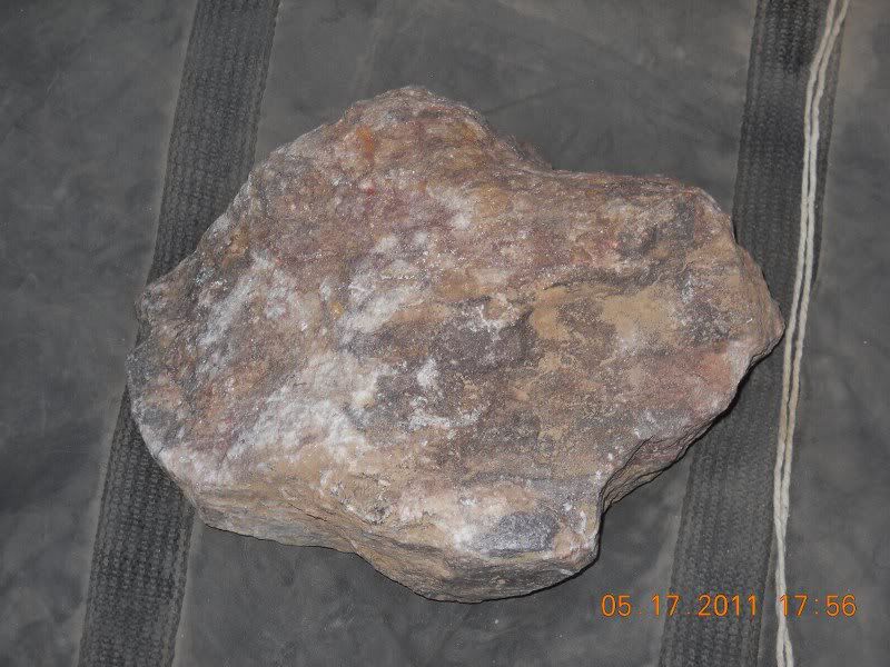
Barite is his opinion.
This is what old maps show the original mine was. After I described the area, tunnels, wall, etc. he thought that they might have determined the vein
was not big enough to start a real operation. Transportation costs are high because of the weight of the mineral.
The others might be pretty colorful etc, but didn't think they had any value. No evidence of Oro (gold) or Plata (silver)
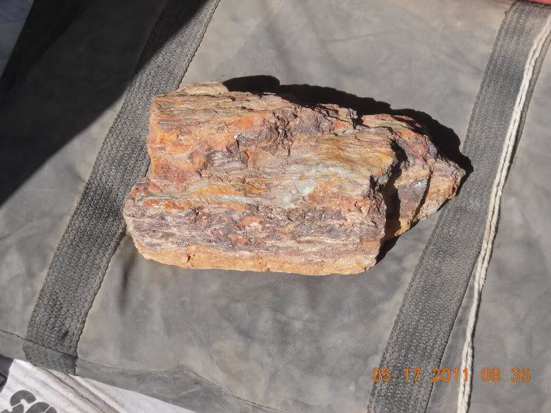
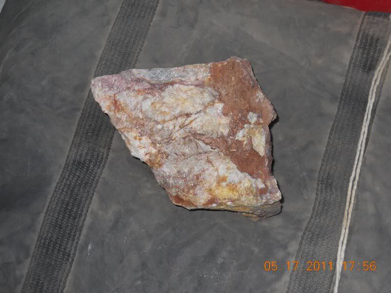
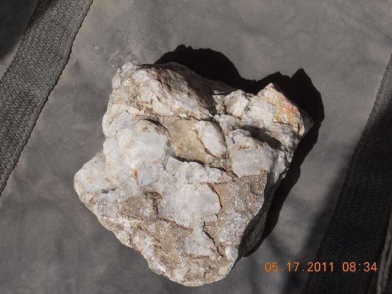

These are generally referred to as DPU samples. (Don't pick up)
[Edited on 5-18-2011 by bajalou]
No Bad Days
\"Never argue with an idiot. People watching may not be able to tell the difference\"
\"The trouble with doing nothing is - how do I know when I\'m done?\"
Nomad Baja Interactive map
And in the San Felipe area - check out Valle Chico area |
|
|
David K
Honored Nomad
        
Posts: 65412
Registered: 8-30-2002
Location: San Diego County
Member Is Offline
Mood: Have Baja Fever
|
|
I learned on this trip that those rocks (not the barite ore, ... the other ones)are known to geologists as leaverite..   
as in "leave 'er right there!"   
|
|
|
bajalou
Ultra Nomad
    
Posts: 4459
Registered: 3-11-2004
Location: South of the broder
Member Is Offline
|
|
That's another name for them all right!
No Bad Days
\"Never argue with an idiot. People watching may not be able to tell the difference\"
\"The trouble with doing nothing is - how do I know when I\'m done?\"
Nomad Baja Interactive map
And in the San Felipe area - check out Valle Chico area |
|
|
David K
Honored Nomad
        
Posts: 65412
Registered: 8-30-2002
Location: San Diego County
Member Is Offline
Mood: Have Baja Fever
|
|
A look back at a nice photo-filled trip report from 5 years ago by the late Baja Lou... we miss you, Lou!
|
|
|
Barry A.
Select Nomad
      
Posts: 10007
Registered: 11-30-2003
Location: Redding, Northern CA
Member Is Offline
Mood: optimistic
|
|
It's posts like this one that keep me coming back to NOMAD'S. I love these trip reports, and all the wonderful photos of great places, and the people
that make them happen.
|
|
|
| Pages:
1
2 |

