| Pages:
1
2 |
Curt63
Super Nomad

Posts: 1171
Registered: 3-28-2009
Location: San Diego, Ca.
Member Is Offline
Mood: Fish tacos and Tecate
|
|
BIG sand - Where in Baja is this sand pile?
I just got back from riding at Glamis and I'm all fired up!
I took this video this morning. Its poor quality, but you get the picture.
http://www.youtube.com/watch?v=XzFaqxvRC6o
Where else can you ride the BIG sand in Baja? Show pics if you got em!
Big Baja sand
No worries
|
|
|
BajaWarrior
Super Nomad
Posts: 2307
Registered: 9-27-2006
Location: Mission Bay, San Diego. Playa Hermosa, San Felipe.
Member Is Offline
Mood: Anxious to get south
|
|
There is a nice pile of sand at San Antonio del Mar (Colonet) that has some steep hills on the south end.
Haven't had a bad trip yet....
|
|
|
bajaandy
Senior Nomad
Posts: 769
Registered: 2-7-2004
Location: North County
Member Is Offline
Mood: Adventurous
|
|
Curt, you've already been there... Seven Sisters. That's all I'm saying. (Wouldn't want to incur the wrath of the Sacred Saints of the Seven Sisters!)
(On Edit: Not sayin that's where your picture was taken... could have been San Antonio Del Mar. Or maybe down at San Quintin. Or maybe even south of
El Socorro. Dunes at all of those places.)
[Edited on 10-3-2011 by bajaandy]
subvert the dominant paradigm
"If you travel with a man, you must either fall out with him or make him your good friend."
JBL Noel
|
|
|
durrelllrobert
Elite Nomad
Posts: 7393
Registered: 11-22-2007
Location: Punta Banda BC
Member Is Offline
Mood: thriving in Baja
|
|
Big dunes south of Rosarito, across MX 1 from Rancho Descanso development and overlooking Pacific (can't get that at Glamis) 
[Edited on 10-3-2011 by durrelllrobert]
Bob Durrell
|
|
|
Curt63
Super Nomad
Posts: 1171
Registered: 3-28-2009
Location: San Diego, Ca.
Member Is Offline
Mood: Fish tacos and Tecate
|
|
Good suggestions. I rode San Antonio Del Mar last Oct and I'll be there again in a few weeks.
The Cantamar dunes are mixed for me. I met my wife camping there and I dislocated my shoulder on an ATC.
Seven Sisters....hmmmmm?......... processing
Hint: the big Baja sand is several miles from the Pacific. I bet Russ knows
No worries
|
|
|
David K
Honored Nomad
Posts: 65591
Registered: 8-30-2002
Location: San Diego County
Member Is Offline
Mood: Have Baja Fever
|
|
Just north of the Guerrero Negro airport are the Sarafan Sand Dunes... beautiful! I went in there in 1985...
Read about it in Jim Hunter's 1977 guidebook 'Offbeat Baja'. Here is the start of his directions: Go 2.4 miles north of the Eagle Monumant and take
the road west...
|
|
|
Bob H
Elite Nomad
Posts: 5867
Registered: 8-19-2003
Location: San Diego
Member Is Offline
|
|
| Quote: | Originally posted by David K
Just north of the Guerrero Negro airport are the Sarafan Sand Dunes... beautiful! I went in there in 1985...
Read about it in Jim Hunter's 1977 guidebook 'Offbeat Baja'. Here is the start of his directions: Go 2.4 miles north of the Eagle Monumant and take
the road west... |
I googled Sarafan and the only thing I could find was this...
http://en.wikipedia.org/wiki/Sarafan
The SAME boiling water that softens the potato hardens the egg. It's about what you are made of NOT the circumstance.
|
|
|
rts551
Elite Nomad
Posts: 6700
Registered: 9-5-2003
Member Is Offline
|
|
| Quote: | Originally posted by David K
Just north of the Guerrero Negro airport are the Sarafan Sand Dunes... beautiful! I went in there in 1985...
Read about it in Jim Hunter's 1977 guidebook 'Offbeat Baja'. Here is the start of his directions: Go 2.4 miles north of the Eagle Monumant and take
the road west... |
Sorry David. Your directions don't get you to this sand.
|
|
|
rts551
Elite Nomad
Posts: 6700
Registered: 9-5-2003
Member Is Offline
|
|
Another shot o this area. way bigger than GN.
[img]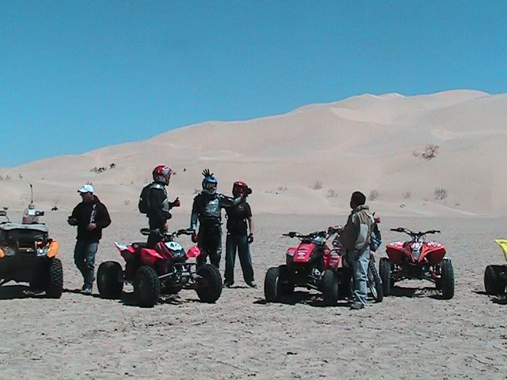 [/img] [/img]
|
|
|
Curt63
Super Nomad
Posts: 1171
Registered: 3-28-2009
Location: San Diego, Ca.
Member Is Offline
Mood: Fish tacos and Tecate
|
|
To get there, you've got to cross this vast salt flat.
You may recognize one active and one former Nomad.
http://25.media.tumblr.com/tumblr_lsi6iiUUhJ1qen5pzo1_500.jp...
No worries
|
|
|
rts551
Elite Nomad
Posts: 6700
Registered: 9-5-2003
Member Is Offline
|
|
Lets take David out there in his Toy!
|
|
|
Curt63
Super Nomad
Posts: 1171
Registered: 3-28-2009
Location: San Diego, Ca.
Member Is Offline
Mood: Fish tacos and Tecate
|
|
The salt flats are tough on a bike if you break through the crust.
This guy is a solid rider
Sorry. I'll fix the link soon
[Edited on 10-4-2011 by Curt63]
No worries
|
|
|
woody with a view
PITA Nomad
Posts: 15940
Registered: 11-8-2004
Location: Looking at the Coronado Islands
Member Is Offline
Mood: Everchangin'
|
|
what's your password?
|
|
|
rts551
Elite Nomad
Posts: 6700
Registered: 9-5-2003
Member Is Offline
|
|
looks like you stumped them Curt, at least for a while~
|
|
|
David K
Honored Nomad
Posts: 65591
Registered: 8-30-2002
Location: San Diego County
Member Is Offline
Mood: Have Baja Fever
|
|
| Quote: | Originally posted by rts551
| Quote: | Originally posted by David K
Just north of the Guerrero Negro airport are the Sarafan Sand Dunes... beautiful! I went in there in 1985...
Read about it in Jim Hunter's 1977 guidebook 'Offbeat Baja'. Here is the start of his directions: Go 2.4 miles north of the Eagle Monumant and take
the road west... |
Sorry David. Your directions don't get you to this sand.
|
Sorry Ralph, but agian you failed reading 101: "Here is the start of his directions: Go 2.4 miles ..." HIS being the key word.
Anyone can see the dunes and road on Google Earth and copy the GPS or figure the miles.
|
|
|
David K
Honored Nomad
Posts: 65591
Registered: 8-30-2002
Location: San Diego County
Member Is Offline
Mood: Have Baja Fever
|
|
| Quote: | Originally posted by Bob H
| Quote: | Originally posted by David K
Just north of the Guerrero Negro airport are the Sarafan Sand Dunes... beautiful! I went in there in 1985...
Read about it in Jim Hunter's 1977 guidebook 'Offbeat Baja'. Here is the start of his directions: Go 2.4 miles north of the Eagle Monumant and take
the road west... |
I googled Sarafan and the only thing I could find was this...
http://en.wikipedia.org/wiki/Sarafan |
I didn't name them... it is what Jim Hunter called them... and what made me go check them out in July, 1985. I found them with Jim Hunter's
directions, even though Ralph says they are wrong... Maybe after nearly 30 years, another road is a shorter way in?
|
|
|
rts551
Elite Nomad
Posts: 6700
Registered: 9-5-2003
Member Is Offline
|
|
What are you talking about? Curt asked where this was? your answer is wrong. You just couldn't figure that part out could you? Reading 101 DK..
This sand refers to the subject of the post!
| Quote: | Originally posted by David K
| Quote: | Originally posted by rts551
| Quote: | Originally posted by David K
Just north of the Guerrero Negro airport are the Sarafan Sand Dunes... beautiful! I went in there in 1985...
Read about it in Jim Hunter's 1977 guidebook 'Offbeat Baja'. Here is the start of his directions: Go 2.4 miles north of the Eagle Monumant and take
the road west... |
Sorry David. Your directions don't get you to this sand.
|
Sorry Ralph, but agian you failed reading 101: "Here is the start of his directions: Go 2.4 miles ..." HIS being the key word.
Anyone can see the dunes and road on Google Earth and copy the GPS or figure the miles. |
[Edited on 10-4-2011 by rts551]
|
|
|
rts551
Elite Nomad
Posts: 6700
Registered: 9-5-2003
Member Is Offline
|
|
David my comment was directed at you having the wrong answer..
| Quote: | Originally posted by David K
| Quote: | Originally posted by Bob H
| Quote: | Originally posted by David K
Just north of the Guerrero Negro airport are the Sarafan Sand Dunes... beautiful! I went in there in 1985...
Read about it in Jim Hunter's 1977 guidebook 'Offbeat Baja'. Here is the start of his directions: Go 2.4 miles north of the Eagle Monumant and take
the road west... |
I googled Sarafan and the only thing I could find was this...
http://en.wikipedia.org/wiki/Sarafan |
I didn't name them... it is what Jim Hunter called them... and what made me go check them out in July, 1985. I found them with Jim Hunter's
directions, even though Ralph says they are wrong... Maybe after nearly 30 years, another road is a shorter way in? |
|
|
|
David K
Honored Nomad
Posts: 65591
Registered: 8-30-2002
Location: San Diego County
Member Is Offline
Mood: Have Baja Fever
|
|
I don't know what you are talking about... I am talking about the sand dune field just north of the Guerrero Negro Airport and a bit south of Villa
Jesus Maria... to the west of Mex. 1.
I then mentioned how I heard about them... in Jim Hunter's 1977 book... and I gave the location of the access road from Jim Hunter's book. Curt is a
big boy, if I could find it with Jim's poor directions, then he can as well...
|
|
|
Ateo
Elite Nomad
Posts: 5965
Registered: 7-18-2011
Member Is Offline
|
|
Just south of Datil is a large swathe of sand.
|
|
|
| Pages:
1
2 |


