| Pages:
1
2 |
David K
Honored Nomad
        
Posts: 65408
Registered: 8-30-2002
Location: San Diego County
Member Is Offline
Mood: Have Baja Fever
|
|
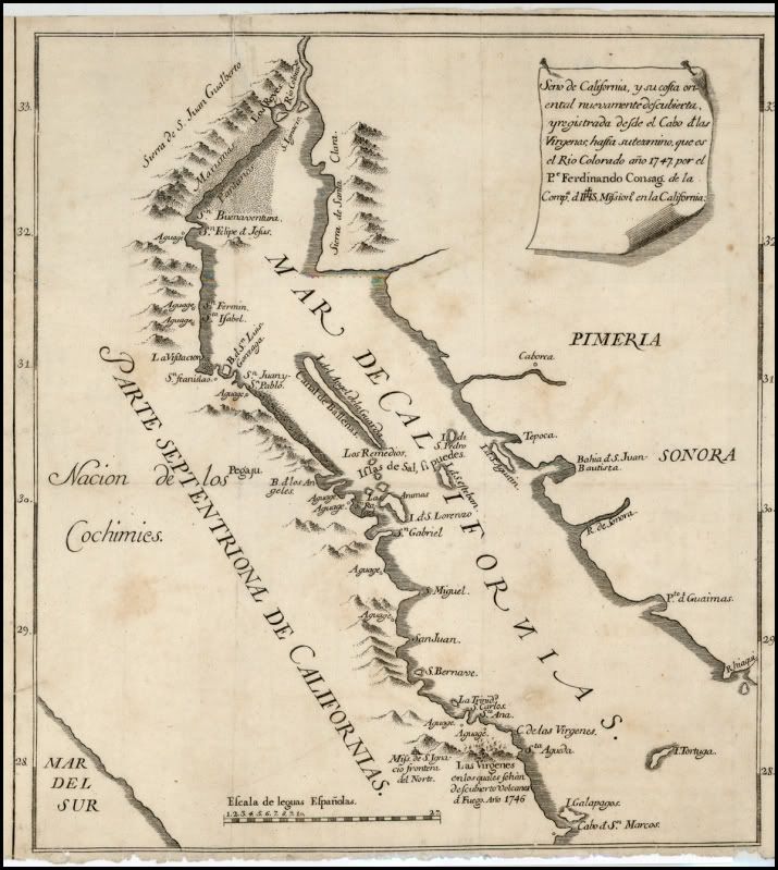
1747 Baja Map by Consag
One of the important maps drawn by the Jesuit explorer following his 1746 expedition. It shows more detail of the upper Gulf of California than
previous maps, and applied many names that are still in use today:
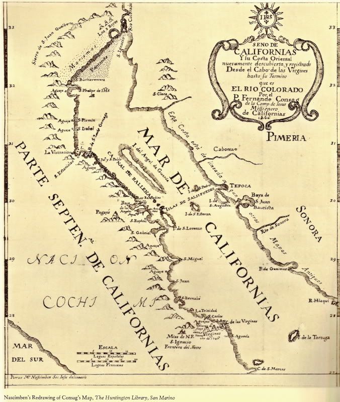
The Consag map was redrawn by the Jesuit Missionary Nascimben... probably about 1748:
Some close ups (south to north):
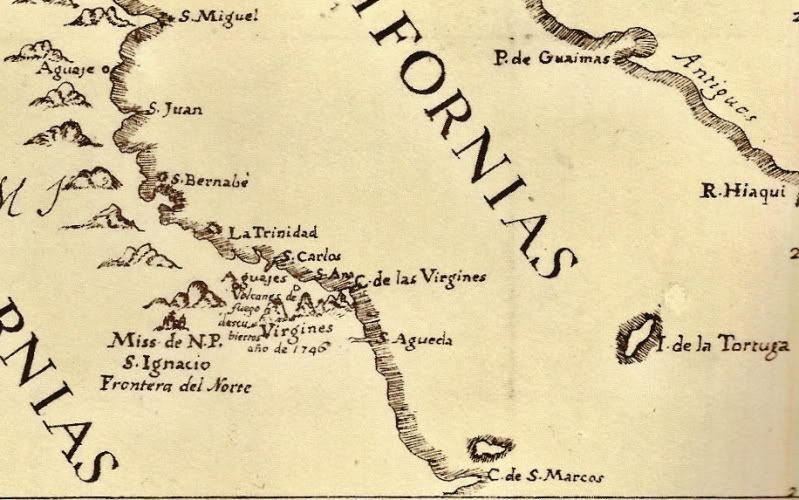
Note the last eruption of Las Tres Virgines (1746) is indicated, as well as San Ignacio Mission being on the 'northern frontier of California. An
'aguaje' was a fresh water source, so important to travelers by sea or land.
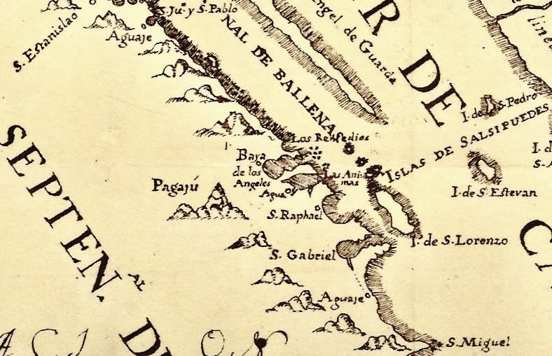
'San Gabriel' looks to be an exaggerated Bahia de San Francisquito; San Raphael is today's San Rafael; Las Animas with an aguaje by the mysterious
wall we photographed in 2009 would indicate why a dam and lone date palm are there?; Baya (Bahia) de los Angeles; Punta Remedios; and near the top an
aguaje at today's Puerto Calamajue are shown.
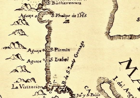
Bahia de San Luis Gonzaga, and aguajes called Santa Isabel (Agua de Mezquitito?), San Fermin, and San Phelipe de Jesus (San Felipe) on the old map.
This Nascimben map is found in the 1966 Dawson Baja Travelers Series book #5 ('Wenceslaus Linck's Diary of his 1766 Expedition to Northern Baja
California'). I hope some of you Baja explorers enjoy it as much as I!
|
|
|
David K
Honored Nomad
        
Posts: 65408
Registered: 8-30-2002
Location: San Diego County
Member Is Offline
Mood: Have Baja Fever
|
|
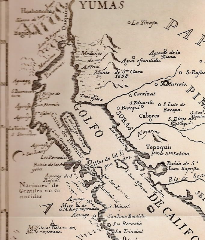
1757 Jesuit Map, northern gulf
Drawn from information obtained about 1747, including Consag's map...
|
|
|
captkw
Ultra Nomad
    
Posts: 3850
Registered: 10-19-2010
Location: el charro b.c.s.
Member Is Offline
Mood: new dog/missing the old 1
|
|
maps !
cool stuff !! thanks
|
|
|
David K
Honored Nomad
        
Posts: 65408
Registered: 8-30-2002
Location: San Diego County
Member Is Offline
Mood: Have Baja Fever
|
|
Glad you like them! It is the above maps that first showed the many place names we use today...
|
|
|
Bob H
Elite Nomad
     
Posts: 5867
Registered: 8-19-2003
Location: San Diego
Member Is Offline
|
|
| Quote: | Originally posted by David K
Glad you like them! It is the above maps that first showed the many place names we use today... |
David, where do you find this stuff... Amazing history!
The SAME boiling water that softens the potato hardens the egg. It's about what you are made of NOT the circumstance.
|
|
|
David K
Honored Nomad
        
Posts: 65408
Registered: 8-30-2002
Location: San Diego County
Member Is Offline
Mood: Have Baja Fever
|
|
| Quote: | Originally posted by Bob H
| Quote: | Originally posted by David K
Glad you like them! It is the above maps that first showed the many place names we use today... |
David, where do you find this stuff... Amazing history! |
In Books!
Below the last map, I said: "This Nascimben map is found in the 1966 Dawson Baja Travelers Series book #5 ('Wenceslaus Linck's Diary of his 1766
Expedition to Northern Baja California'). I hope some of you Baja explorers enjoy it as much as I! "
|
|
|
StuckSucks
Super Nomad
   
Posts: 2369
Registered: 10-17-2013
Location: Pacific Plate
Member Is Offline
|
|
I see Padre Consag's island near San Felipe.
|
|
|
David K
Honored Nomad
        
Posts: 65408
Registered: 8-30-2002
Location: San Diego County
Member Is Offline
Mood: Have Baja Fever
|
|
LOL, yes, the big white sail on the horizon!
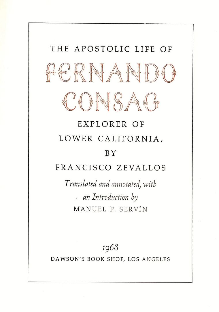
If anyone wants to read more about the great missionary explorer (who finally proved to the authorities that California was not an island), complete
book online: https://archive.org/stream/lifeworksofrever00kons#page/n0/mo...
Otherwise, #15 of the Dawson Baja Book series...
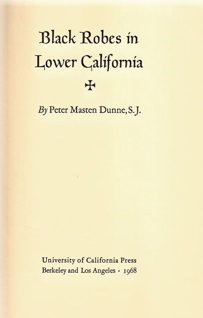
I think more of his explorations are found in Dunne's book...
|
|
|
basautter
Senior Nomad
  
Posts: 862
Registered: 7-1-2013
Member Is Offline
|
|
Cool1 Thanks for sharing 
|
|
|
AKgringo
Elite Nomad
     
Posts: 6281
Registered: 9-20-2014
Location: Anchorage, AK (no mas!)
Member Is Offline
Mood: Retireded
|
|
So the various maps differ on the spelling of Felipe/Phelipe. I wonder who named it first, and which version they used?
I guess it doesn't matter, it is the same fonettickly!
If you are not living on the edge, you are taking up too much space!
"Could do better if he tried!" Report card comments from most of my grade school teachers. Sadly, still true!
|
|
|
David K
Honored Nomad
        
Posts: 65408
Registered: 8-30-2002
Location: San Diego County
Member Is Offline
Mood: Have Baja Fever
|
|
Depended on the language of the cartographer, Phillip in English or Felipe in Spanish, then a combination of the tw0. Obviously he didn't ask on Baja
Nomad before making that map! LOL
The top version is the first map, drawn by Consag, and he spells it Felipe.
Here is a close up (note he also named San Luis Gonzaga bay, and shows the island in the middle but Alfonsina's isn't yet open)!

|
|
|
BajaBlanca
Select Nomad
      
Posts: 13242
Registered: 10-28-2008
Location: La Bocana, BCS
Member Is Offline
|
|
very cool
I see that the sea of cortez right next to BoLA was called CANAL DE LAS BALLENAS....so there were lots of whales there then. Are there still whales
there?
|
|
|
David K
Honored Nomad
        
Posts: 65408
Registered: 8-30-2002
Location: San Diego County
Member Is Offline
Mood: Have Baja Fever
|
|
It is still called that Blanca. 2010 AAA Baja Map >>>
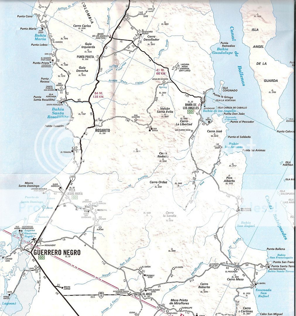
Pretty cool that something named in 1746 by a Jesuit padre/ explorer is still in use.
Yes, whales are still there!
Ken Bondy has a great photo of a blue whale taken there (I think there?):
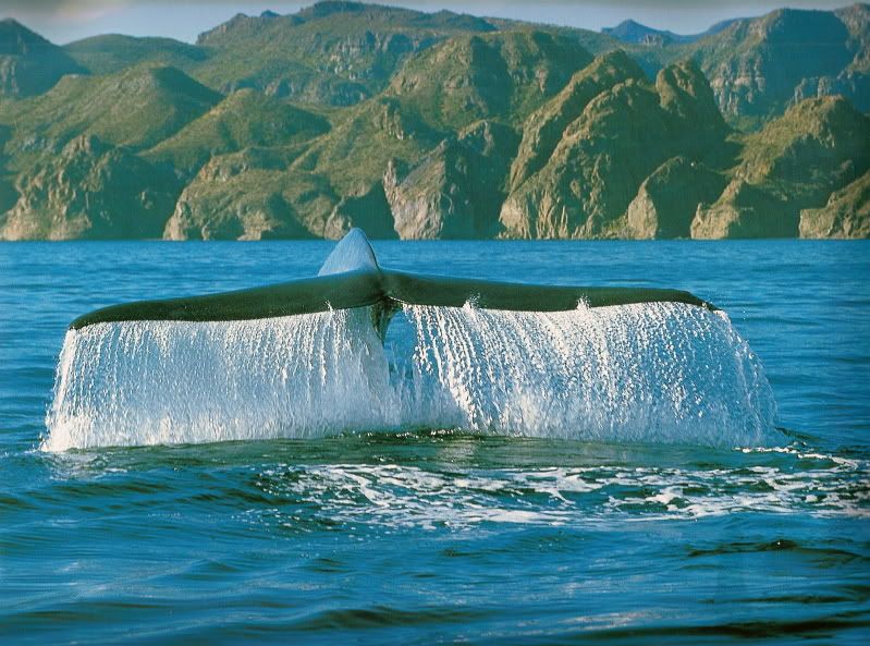
[Edited on 7-11-2025 by David K]
|
|
|
sargentodiaz
Nomad
 
Posts: 259
Registered: 2-20-2013
Location: Las Vegas, NV
Member Is Offline
|
|
Darn it David! You did it to me again.
Read my post on Historium.
|
|
|
Vince
Nomad
 
Posts: 448
Registered: 10-17-2006
Location: Coronado
Member Is Offline
|
|
Fine source of reading and maps there, David. I love flying along that very route and matching the names on the map to where I am. I often use the
AAA map when flying there, the names are more complete. Isla Angel de la Guarda still guards LA Bay and that entire coast. Those pioneers were so
good at exploring and map making.
|
|
|
David K
Honored Nomad
        
Posts: 65408
Registered: 8-30-2002
Location: San Diego County
Member Is Offline
Mood: Have Baja Fever
|
|
Endless wonders exist in Baja. It's what brings many of us back. Dale, I just replied on Historium.
|
|
|
4Cata
Nomad
 
Posts: 115
Registered: 10-28-2008
Location: Yosemite area
Member Is Offline
Mood: Siempre alegre!
|
|
Are these maps ever available in printed, frameable art form? They're gorgeous!
Agaveros, silk in a bottle, a beautiful bottle!
|
|
|
4x4abc
Ultra Nomad
    
Posts: 4454
Registered: 4-24-2009
Location: La Paz, BCS
Member Is Offline
Mood: happy - always
|
|
David, help me out with San Fermin - where do you think that Aguaje is? I have all other locations
Harald Pietschmann
|
|
|
Tioloco
Elite Nomad
     
Posts: 5038
Registered: 7-30-2014
Member Is Offline
|
|
An old spring near the town.....?
|
|
|
David K
Honored Nomad
        
Posts: 65408
Registered: 8-30-2002
Location: San Diego County
Member Is Offline
Mood: Have Baja Fever
|
|
Punta San Fermin is about 10 miles north of Puertecitos, and I am not aware of any natural springs around there, just the old well in Arroyo Matomi
now by Rancho San Rafael.
I would like you opinion of what the Aguaje Santa Isabel was... My opinion is Agua del Mezquitito, about 15 miles north of Papa Fernandez'.
|
|
|
| Pages:
1
2 |

