| Pages:
1
2 |
ssomma
Newbie
Posts: 15
Registered: 6-25-2010
Location: san luis obispo, ca
Member Is Offline
|
|
Scorpion Bay East Road
Hi all!
I'm planning on heading to Scorpion Bay in early October and was wondering about the East Road (taking the turnoff for San Isidro and driving in that
way). I drive a little 4wd Ford Ranger. All stock, nothing fancy. How's the road these days? It's my first time to Scorpion Bay, though I've
driven the truck to El Cardon, and similar areas and been fine. I hear the North road to Scorpion is not great these days with all the rain, so was
thinking the East Road might be a better option without having to go all the way around via the South Road. Anyone have any thoughts on this?
Thanks so much!
-Shea
|
|
|
805gregg
Super Nomad
   
Posts: 1344
Registered: 5-21-2006
Location: Ojai, Ca
Member Is Offline
|
|
Don't do it, I've seen reports by adventure motorcyclist that had a tough time on that bad road. Just take the south road.
|
|
|
David K
Honored Nomad
        
Posts: 65436
Registered: 8-30-2002
Location: San Diego County
Member Is Offline
Mood: Have Baja Fever
|
|
He is talking about the graded, government road from below Bahia Concepcion across... not the mountain road from Mulege via San Miguel, if you were
thinking that?
|
|
|
LaTijereta
Super Nomad
   
Posts: 1192
Registered: 8-27-2003
Location: Loreto
Member Is Offline
|
|
The East road should be open to Baja 1000 pre-run traffic around 1st part of October..Expect some traffic heading eastbound...
There maybe some road reports over on the Offroad Race forms..
Democracy is like two wolves and a lamb voting on what to have for lunch. Liberty is a well-armed lamb contesting the vote.
Ben Franklin (1759)
|
|
|
desertcpl
Super Nomad
   
Posts: 2406
Registered: 10-26-2008
Location: yuma,az
Member Is Offline
|
|
thats a caution, if they are pre running, you would be going against the grain so to speak, not a good idea
|
|
|
Ateo
Elite Nomad
     
Posts: 5947
Registered: 7-18-2011
Member Is Offline
Mood: Just trying to close my Baja Nomad account….
|
|
I did the East Road in 2007 with a non 4 X 4 F150. It was a beautiful road, but I didn't pass one person the whole time till La Purisima. Be
prepared and have supplies.
At that time, the general consensus was that road was a real piece of crap. Many people at S-Bay were surprised I made it in that way. I found the
road to be rough, rocky and beautiful. It wasn't anything different than your average poor Baja road, except for the first incline that had some real
crappy areas, next to a cliff that would drop off 35 feet. I hauled ass up it, stressing I wouldn't make it, but I did. When I got to the top I
realized that if I would've lost traction and slipped to the right, my whole family and I would've been launched off the cliff to serious
injury/death.
Lots of volcanic rock. Desolate landscapes. Great views. Some areas look like your driving on Mars.
My opinion is if your adventurous and have a fit 4X4 you should be fine, unless they're pre-running for the 1000. Although having said that, there'd
be more people to rescue you with pre-running in the area.
Make sure you stop at the mesa before you enter La Purisima and take a few photos. The view is impeccable.
You can always turn around.
Other option is the salt flats instead of the North Road.
Good luck.
|
|
|
ssomma
Newbie
Posts: 15
Registered: 6-25-2010
Location: san luis obispo, ca
Member Is Offline
|
|
So it sounds like the North Road is the better option? I was already thinking of staying a few days in Abreojos at the start of the trip (got great
surf there a few years ago), so heading to the North Road/ Salt flats would be easy from there, correct? About how long is it from Abre to Scorpion
Bay via this route? Anything I should be aware/ wary of along the way?
|
|
|
David K
Honored Nomad
        
Posts: 65436
Registered: 8-30-2002
Location: San Diego County
Member Is Offline
Mood: Have Baja Fever
|
|
Yes... high tide or recent rain!
|
|
|
BFS
Senior Nomad
  
Posts: 520
Registered: 9-28-2006
Location: Todos Santos
Member Is Offline
|
|
Also beginners on Sup's and grumpy longboarders...
|
|
|
vgabndo
Ultra Nomad
    
Posts: 3461
Registered: 12-8-2003
Location: Mt. Shasta, CA
Member Is Offline
Mood: Checking-off my bucket list.
|
|
Abreojos to Scorpion Bay you'll have to backtrack and go to San Ignacio. You'll lose pavement a few miles west of San Ignacio. I recall the conditions
a couple years ago being marginally better, in my rig, between SI and the whale camps than between Asuncion and La Bocana. I recall less 'world class'
washboard. Have fun!
Anyone have any idea what the gradient is on that one little up-hill going SW before the pavement ends? Steep!
Undoubtedly, there are people who cannot afford to give the anchor of sanity even the slightest tug. Sam Harris
"The situation is far too dire for pessimism."
Bill Kauth
Carl Sagan said, "We are a way for the cosmos to know itself."
PEACE, LOVE AND FISH TACOS
|
|
|
David K
Honored Nomad
        
Posts: 65436
Registered: 8-30-2002
Location: San Diego County
Member Is Offline
Mood: Have Baja Fever
|
|
You are talking about the pavement heading to Laguna San Ignacio from downtown San Ignacio? What was the last report, about 20 km. paved?
|
|
|
ssomma
Newbie
Posts: 15
Registered: 6-25-2010
Location: san luis obispo, ca
Member Is Offline
|
|
About how long from Abre to San Juanico via the San Ignacio route?
|
|
|
Mula
Super Nomad
   
Posts: 1664
Registered: 8-16-2011
Location: San Nicolas y Lopez Mateos
Member Is Offline
|
|
The road from Laguna San Ignacio to San Juanico is horrible.
And now with the high water from the Kristy storm and tides, the flats should be mushy.
Dangerous this time of year in my mind.
to correct spelling:
[Edited on 9-16-2012 by Mula]
|
|
|
Ateo
Elite Nomad
     
Posts: 5947
Registered: 7-18-2011
Member Is Offline
Mood: Just trying to close my Baja Nomad account….
|
|
By the looks of the comments in this thread it would seem impossible to get into S-Bay........ 
People travel all roads in and out of S-Bay every day (except for maybe the East Road).
Just go and find your way.
|
|
|
Ateo
Elite Nomad
     
Posts: 5947
Registered: 7-18-2011
Member Is Offline
Mood: Just trying to close my Baja Nomad account….
|
|
Here's some East Road pictures:
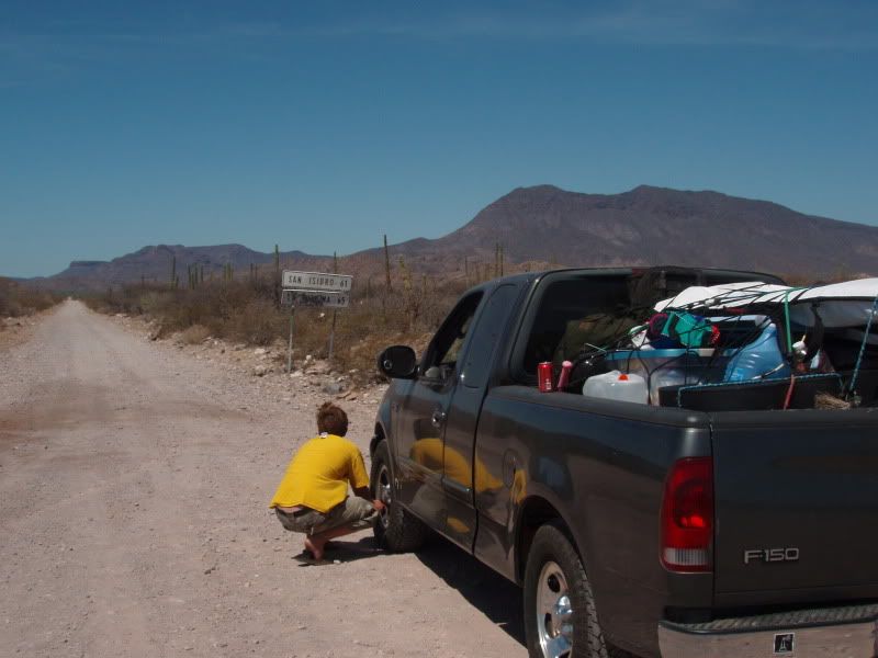
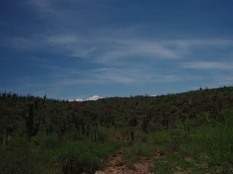
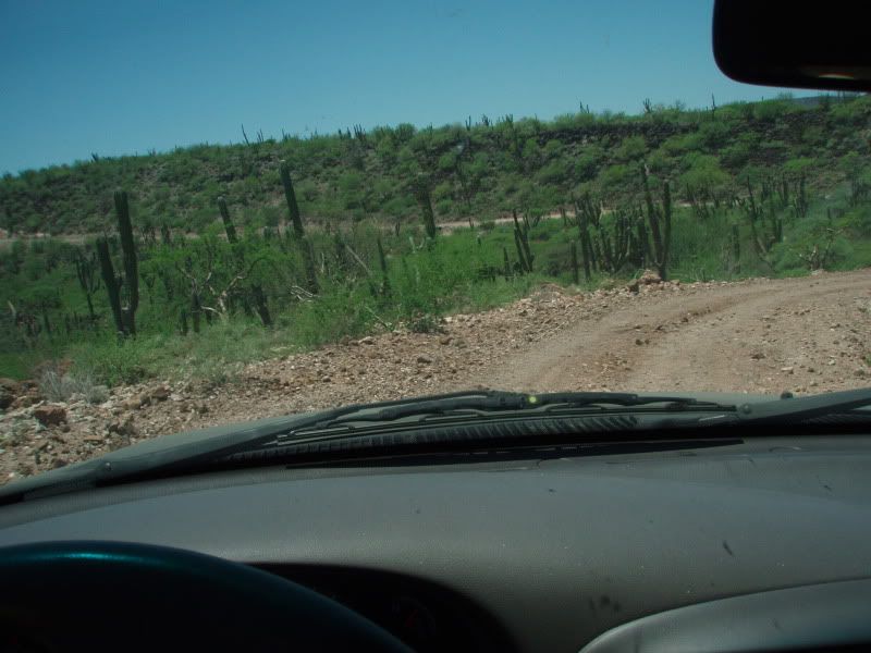
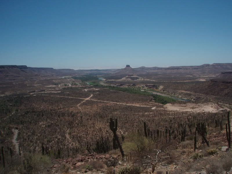
|
|
|
ssomma
Newbie
Posts: 15
Registered: 6-25-2010
Location: san luis obispo, ca
Member Is Offline
|
|
WOW! that looks beautiful! How long from the highway to SB via the east road? Anyone done it this summer?
|
|
|
woody with a view
PITA Nomad
      
Posts: 15940
Registered: 11-8-2004
Location: Looking at the Coronado Islands
Member Is Offline
Mood: Everchangin'
|
|
used to be about 2.5 hours. just do it and report back. if we don't here from you someone may send out a rescue party.....
edit: after the 16+ hours from the border you will arrive, hopefully in one piece, only to find 359 other people, dogs, kids, atv's and all sorts of
flotsam and jetsam eagerly awaiting you setting up camp between them. They really dig if you set up after 11pm with your stereo cranking.
I'd rather get it to myself and smaller than pumping and 250 guys in the water.
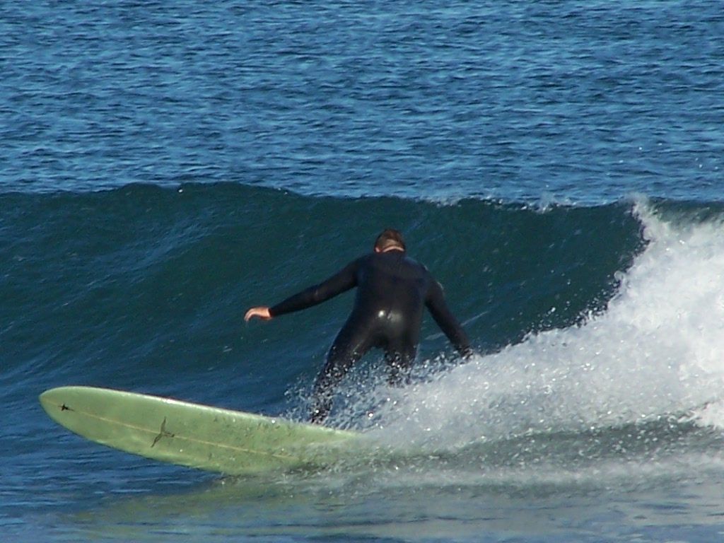
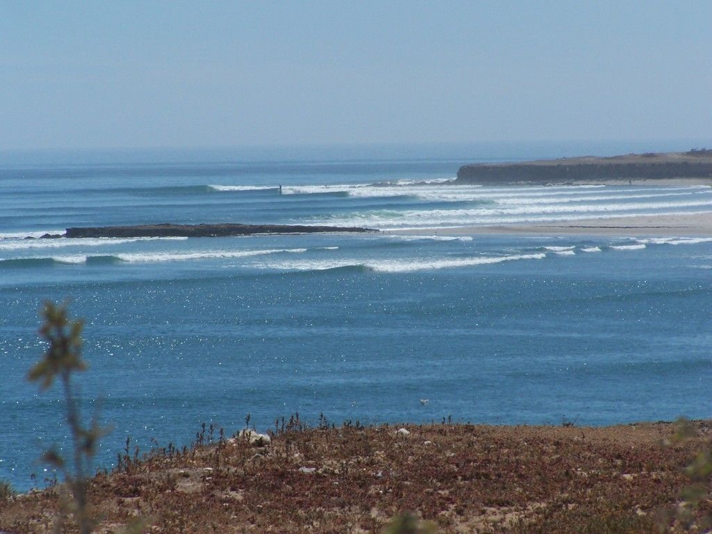
notice the empty campsites?
[Edited on 9-19-2012 by woody with a view]
|
|
|
ssomma
Newbie
Posts: 15
Registered: 6-25-2010
Location: san luis obispo, ca
Member Is Offline
|
|
small and alone is always preferred  how are the crowds early oct? hopefully
less than "peak" season... how are the crowds early oct? hopefully
less than "peak" season...
|
|
|
BigWooo
Senior Nomad
  
Posts: 579
Registered: 1-2-2007
Member Is Offline
|
|
| Quote: | Originally posted by ssomma
small and alone is always preferred  how are the crowds early oct? hopefully
less than "peak" season... how are the crowds early oct? hopefully
less than "peak" season... |
It's always peak season nowadays. Currently at 6:30 pm September 18th, it's barely knee high, the wind is blowing dust at 25 mph, and there are 34
people sitting in a pack at the tip of 2nd.
|
|
|
ssomma
Newbie
Posts: 15
Registered: 6-25-2010
Location: san luis obispo, ca
Member Is Offline
|
|
Hhahah, you all are a really encouraging bunch! Impossible to get to, dangerous, and crowded when I finally get there... seems like I should just
cancel the trip 
|
|
|
| Pages:
1
2 |

