weebray
Super Nomad
   
Posts: 1094
Registered: 7-19-2010
Location: La Paz
Member Is Offline
Mood: lleno
|
|
El Cien/Las Pocitas to Evaristo to San Juan de La Costa
Looking for post recent rains road report for a 4WD but low clearance vehicle. Anyone been there lately?
|
|
|
MMc
Super Nomad
   
Posts: 1679
Registered: 6-29-2011
Member Is Offline
Mood: Current
|
|
I see a map post coming. Will be headed down in 2 weeks. Try asking some of the preruners, on some of the off-road sites.
"Never teach a pig to sing it frustrates you and annoys the pig" - W.C.Fields
|
|
|
David K
Honored Nomad
        
Posts: 65436
Registered: 8-30-2002
Location: San Diego County
Member Is Offline
Mood: Have Baja Fever
|
|
| Quote: | Originally posted by MMc
I see a map post coming. Will be headed down in 2 weeks. Try asking some of the preruners, on some of the off-road sites. |
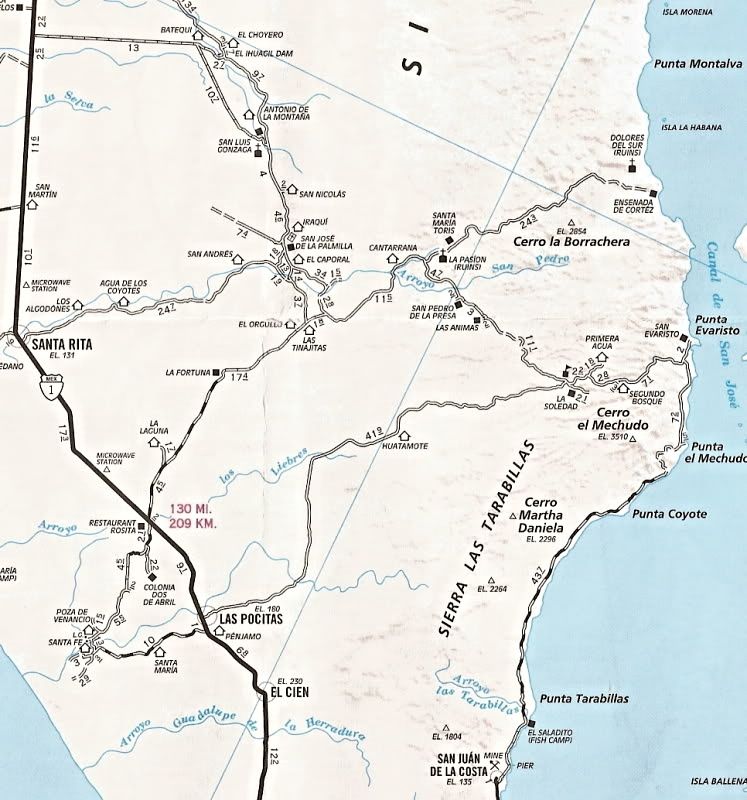
|
|
|
weebray
Super Nomad
   
Posts: 1094
Registered: 7-19-2010
Location: La Paz
Member Is Offline
Mood: lleno
|
|
Off road sites? Like? Thanks, Bobelon
|
|
|
MMc
Super Nomad
   
Posts: 1679
Registered: 6-29-2011
Member Is Offline
Mood: Current
|
|
Best in Desert
Desert Racing.com
Score
Off road.com
Priate4x4
"Never teach a pig to sing it frustrates you and annoys the pig" - W.C.Fields
|
|
|
David K
Honored Nomad
        
Posts: 65436
Registered: 8-30-2002
Location: San Diego County
Member Is Offline
Mood: Have Baja Fever
|
|
How about Baja.net ?
|
|
|
weebray
Super Nomad
   
Posts: 1094
Registered: 7-19-2010
Location: La Paz
Member Is Offline
Mood: lleno
|
|
hmmmm. Just figgered out that the 1000 does not go anywhere near Evaristo. Looking for a report from someone that has been there since the rains.
|
|
|
weebray
Super Nomad
   
Posts: 1094
Registered: 7-19-2010
Location: La Paz
Member Is Offline
Mood: lleno
|
|
My maps: National Geographic, Baja South, Baja California Sur, Mexico and Baja California Almanac Topographic Maps don't agree with the map posted by
David K. ie, lats and longs and backroads are different. WTF, over?????
|
|
|
TMW
Select Nomad
      
Posts: 10659
Registered: 9-1-2003
Location: Bakersfield, CA
Member Is Offline
|
|
You might U2U Bajatripper. He lives in La Paz and may have info for the area up north.
|
|
|
David K
Honored Nomad
        
Posts: 65436
Registered: 8-30-2002
Location: San Diego County
Member Is Offline
Mood: Have Baja Fever
|
|
| Quote: | Originally posted by weebray
My maps: National Geographic, Baja South, Baja California Sur, Mexico and Baja California Almanac Topographic Maps don't agree with the map posted by
David K. ie, lats and longs and backroads are different. WTF, over????? |
The Baja California Almanac latitude figures are WRONG on several pages!
In 2009, we posted the typos of the new Almanac here on Nomad.
The map I posted is the Auto Club map... it is correct, and my Nat Geo map looks to be correct. Please tell us what you see wrong on the Nat Geo
map... Thank you!
|
|
|
David K
Honored Nomad
        
Posts: 65436
Registered: 8-30-2002
Location: San Diego County
Member Is Offline
Mood: Have Baja Fever
|
|
I might add, that while many years ago, the AAA Baja map had errors, the past few years they have used GPS mapping and that places the roads correctly
on the peninsula... Also, when you see a mileage next to a road (all on the AAA map) you know it was traveled and recorded.
The Almanac, while good and shows much much more road and trail detail than the AAA map, uses flawed information from the Mexican topographic maps and
only roads with mileages along them (just a few have mileages) have been personally researched for certain by the Almanac's publisher.
The Nat Geo map, while huge and colorful, has some of the same errors that that come from the Mexican topos/ Almanac... In the case of the area of
interest to this thread map above... there is NO ROAD to Los Dolores mission (and it is not Dolores del Norte, as the Nat Geo map says)...
|
|
|
Jack Swords
Super Nomad
   
Posts: 1095
Registered: 8-30-2002
Location: Nipomo, CA/La Paz, BCS
Member Is Offline
|
|
The road from Las Pocitas is pretty boring. N. road to Mission Gonzaga from above Santa Rita is much more interesting and lots of small ranches and
great people. With no road report I'd just go (assuming 4WD). We've done it many times and had some washouts, but the Mexicans have probably already
gotten through. The road down from Segundo Bosque can be an adventure due to its steepness. As you travel through the area, stop and ask at ranches
how the road is. The maps don't show all of the roads so local advice is often valuable. My favorite area driven each year several times. Hope to
get back in there again this December and enjoy the GREEN.
|
|
|
larryC
Super Nomad
   
Posts: 1499
Registered: 8-11-2008
Location: BoLA
Member Is Offline
|
|
I just got back from there yesterday and the road is fine. We only made it 10 mises north of the pavement because of a trailer problem, but the people
we asked along the way said the road was fine. The part we drove was wide and well graded. You could see some washout damage but it was all repaired
by the time we got there.
Larry
Off grid, 12-190 watt evergreen solar panels on solar trackers, 2-3648 stacked Outback inverters, 610ah LiFePo4 48v battery bank, FM 60 and MX60
Outback charge controllers, X-240 Outback transformer for 240v from inverters, 6500 watt Kubota diesel generator.
|
|
|
David K
Honored Nomad
        
Posts: 65436
Registered: 8-30-2002
Location: San Diego County
Member Is Offline
Mood: Have Baja Fever
|
|
From where Larry?
|
|
|
larryC
Super Nomad
   
Posts: 1499
Registered: 8-11-2008
Location: BoLA
Member Is Offline
|
|
Thanks David for catching that. After rereading my post I see I wasn't very clear. I made it 10 miles nort of the mine on the way to San Evaristo,
north of La Paz. Beautiful country. I had never been up there before, now I can't wait to go back.
Larry
Off grid, 12-190 watt evergreen solar panels on solar trackers, 2-3648 stacked Outback inverters, 610ah LiFePo4 48v battery bank, FM 60 and MX60
Outback charge controllers, X-240 Outback transformer for 240v from inverters, 6500 watt Kubota diesel generator.
|
|
|
weebray
Super Nomad
   
Posts: 1094
Registered: 7-19-2010
Location: La Paz
Member Is Offline
Mood: lleno
|
|
OK, The Nat'L Geo road from Las Pocitas to Evaristo looks to be pretty much like the map posted above. We have been out this road but never as far
as La Solidad. The Nat'l Geo map shows the road from Santa Rita to Evaristo ends at San Ignacio. We would consider taking this road as suggested by
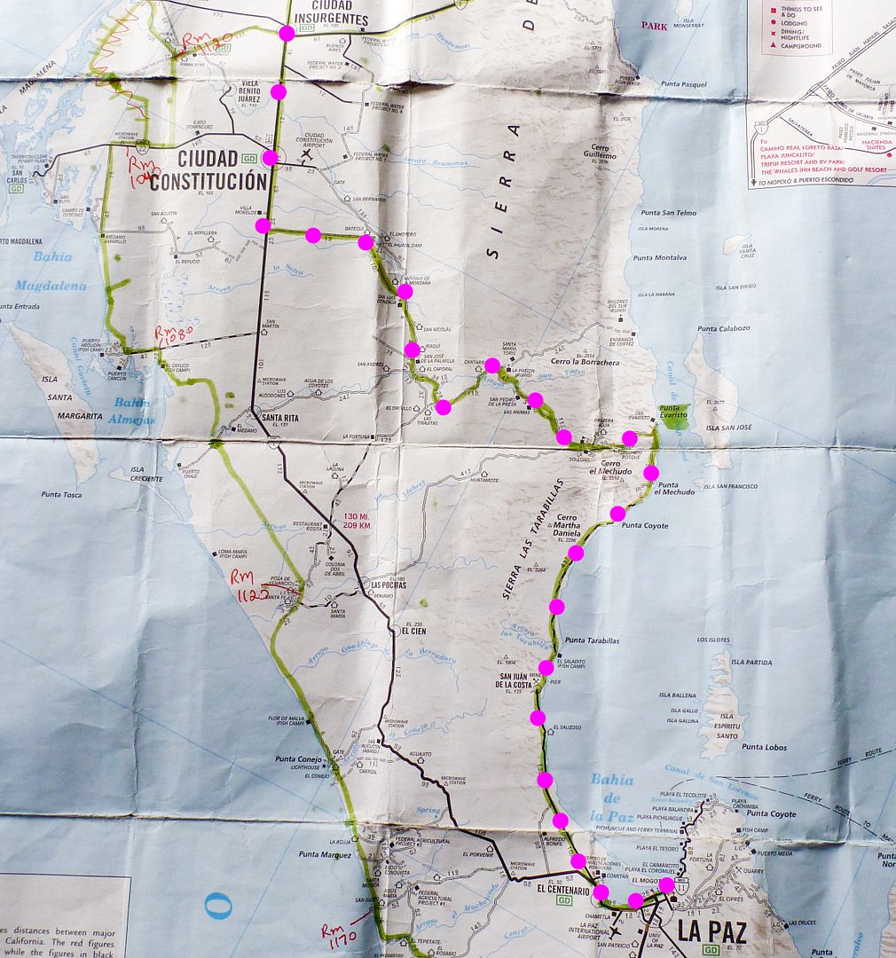
J. Swords. We have a 4WD vehicle but with low clearance. Looking to make a loop - La Paz to Las Pocitas or Santa Rita, over to Evaristo then S.
along the E. Coast thru San Juan de la Costa and back to La Paz. Thanks for all the advice, we always stop and ask everyone we see. What we really
would like is a first hand recent report.
|
|
|
David K
Honored Nomad
        
Posts: 65436
Registered: 8-30-2002
Location: San Diego County
Member Is Offline
Mood: Have Baja Fever
|
|
I am sure you will have a good trip... If your 4WD (or AWD) vehicle with "low" ground clearance (Subaru?) is a concern, just go very slow over rocks
that look taller than your clearance. The coarse to take is to drive over those rocks or avoid putting the middle of the car over the rocks to prevent
damage to oil pan (if there is no skid plate) or transfer case/ differentials, etc. I drove some crazy rough roads in my three Subarus from 1977 to
1991... always got through (but I did arrive at Gonzaga Bay in 1979 without my exhaust and muffler)!
Also to "see" the roads if they indeed go to places the map shows, use Google Earth and do a fly-over. Obviously things change since the photos were
taken, specially the recent hurricane... but at least you can check the map. Do top you gas tank at Las Pocitas or Santa Rita in case you do need to
double back, etc.
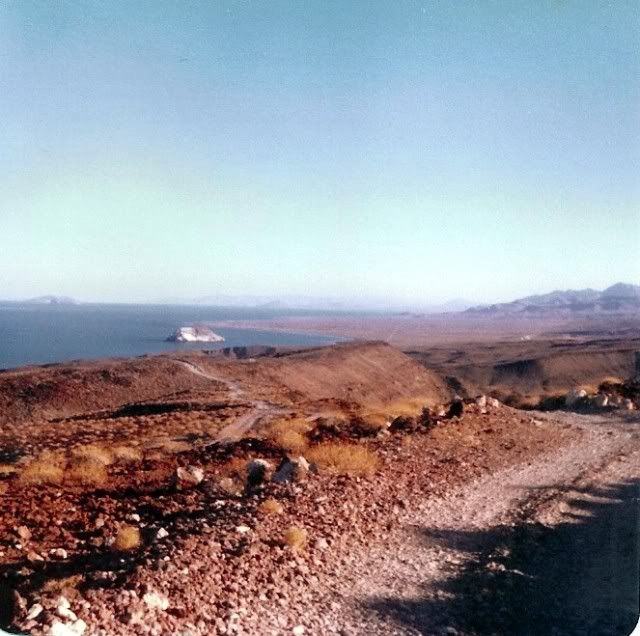
1979 on the original road to Gonzaga:
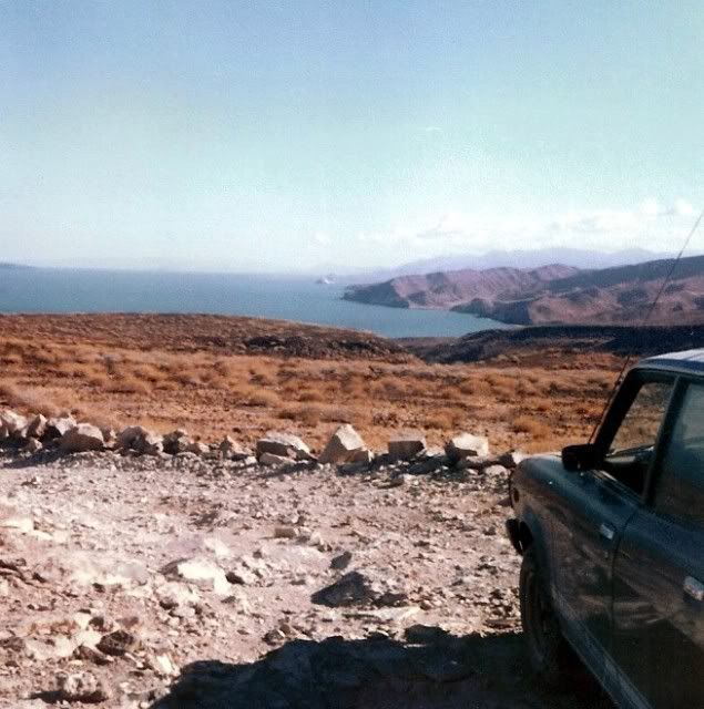
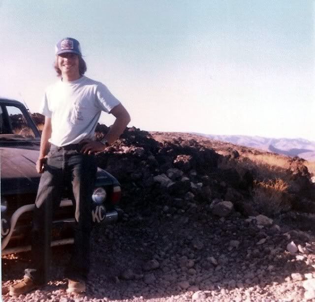
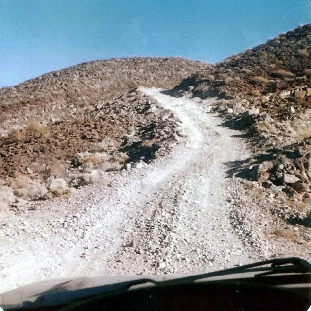
[Edited on 11-5-2012 by David K]
|
|
|
David K
Honored Nomad
        
Posts: 65436
Registered: 8-30-2002
Location: San Diego County
Member Is Offline
Mood: Have Baja Fever
|
|
| Quote: | Originally posted by weebray
OK, The Nat'L Geo road from Las Pocitas to Evaristo looks to be pretty much like the map posted above. We have been out this road but never as far
as La Solidad. The Nat'l Geo map shows the road from Santa Rita to Evaristo ends at San Ignacio. We would consider taking this road as suggested by
J. Swords. We have a 4WD vehicle but with low clearance. Looking to make a loop - La Paz to Las Pocitas or Santa Rita, over to Evaristo then S.
along the E. Coast thru San Juan de la Costa and back to La Paz. Thanks for all the advice, we always stop and ask everyone we see. What we really
would like is a first hand recent report. |
Follow up?
|
|
|
motoged
Elite Nomad
     
Posts: 6481
Registered: 7-31-2006
Location: Kamloops, BC
Member Is Offline
Mood: Gettin' Better
|
|
#1: Recent trip report re: this area...scroll down the page a bit for narrative and pics:
http://www.advrider.com/forums/showthread.php?t=864491&page=11


********************************************
#2: A Second trip report w/ narrative and pics of this area....scroll down and past the pic of map w/ pink dots...
Don't believe everything you think....
|
|
|
David K
Honored Nomad
        
Posts: 65436
Registered: 8-30-2002
Location: San Diego County
Member Is Offline
Mood: Have Baja Fever
|
|
Nice post on that site Ged!
|
|
|

