| Pages:
1
2 |
Wiles
Nomad

Posts: 337
Registered: 10-1-2006
Member Is Offline
|
|
Cruising the Bay of L.A.
Welcome back Nomads. Thanks for watching.
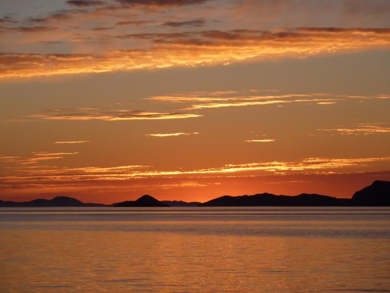
Yawn, Buenas dias. Looks for a great day for a cruise around the Bay. Vamos a Ver, ondele pues.
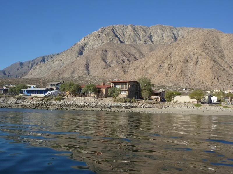
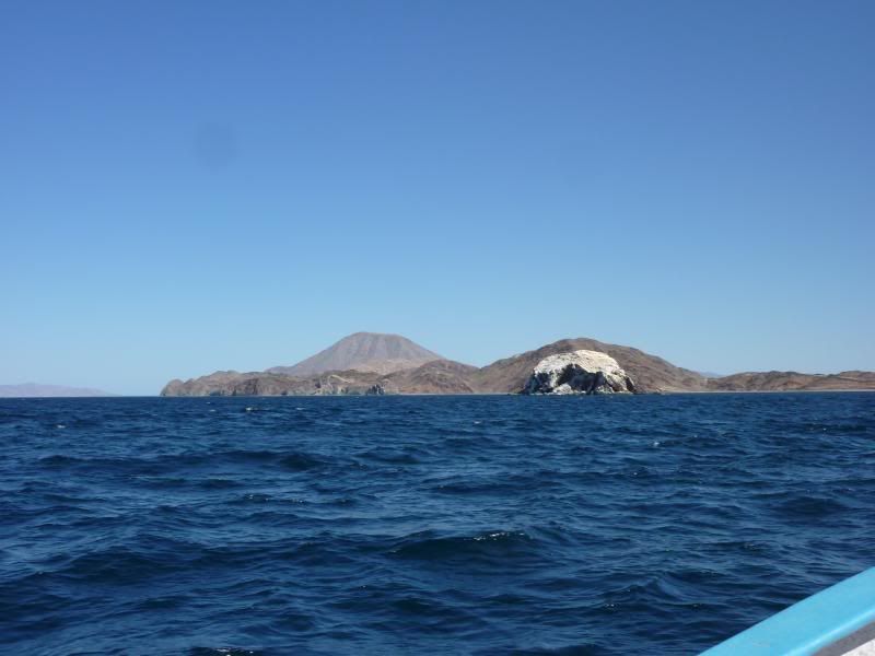
We decided to make a loop around the south of the bay. Here we go. Look to the top of the mountain in the background of this picture. Lots of us
call this Mike's mountain. He is quite the story. He has long since passed. I hiked all 4,000ft of his mtn. w/ him. Many more have followed his
trail since.
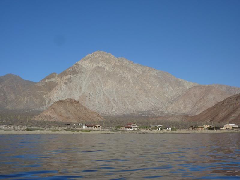
A different view of Mike's mountain.
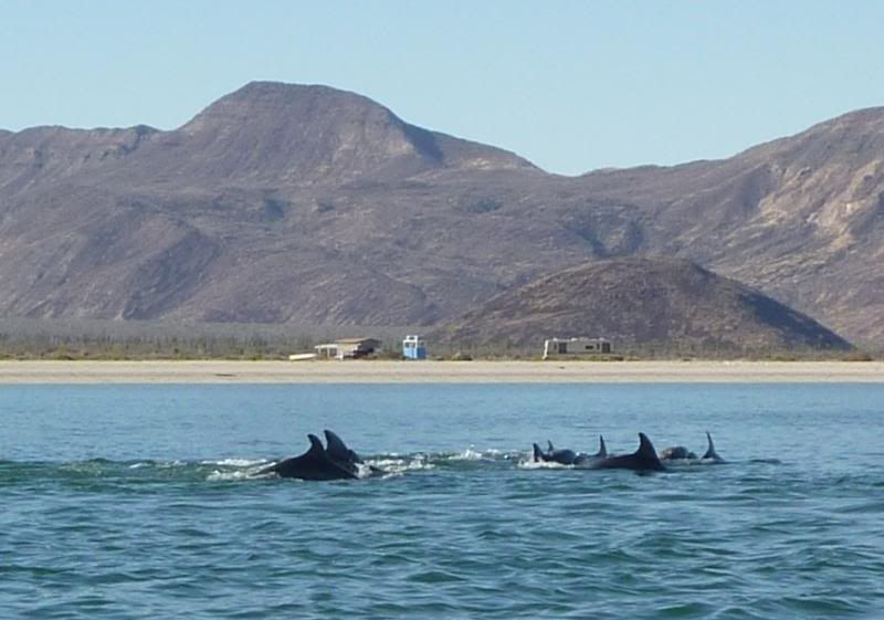
Follow the birds to the action.
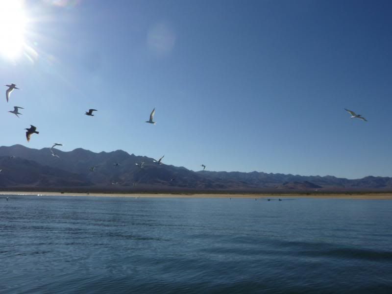
Sea Birds work their magic once again.
We came across a couple pulpo/octopus fisherman. "Hey amigos, toss us one"
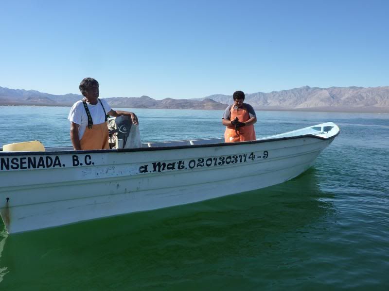
Hey, we were just kidding. 
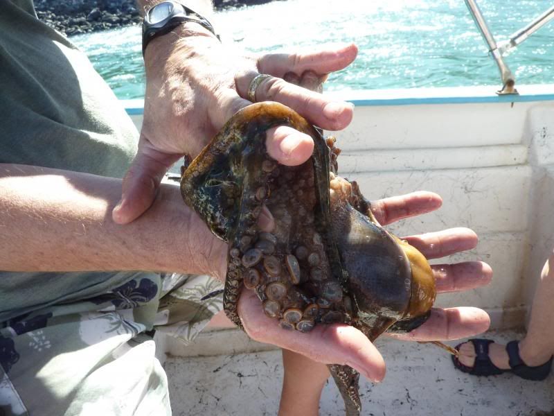
Well, after peeling off this critter and saving him for bait, we continue on.
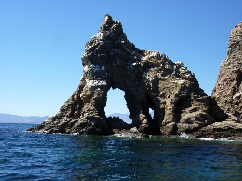
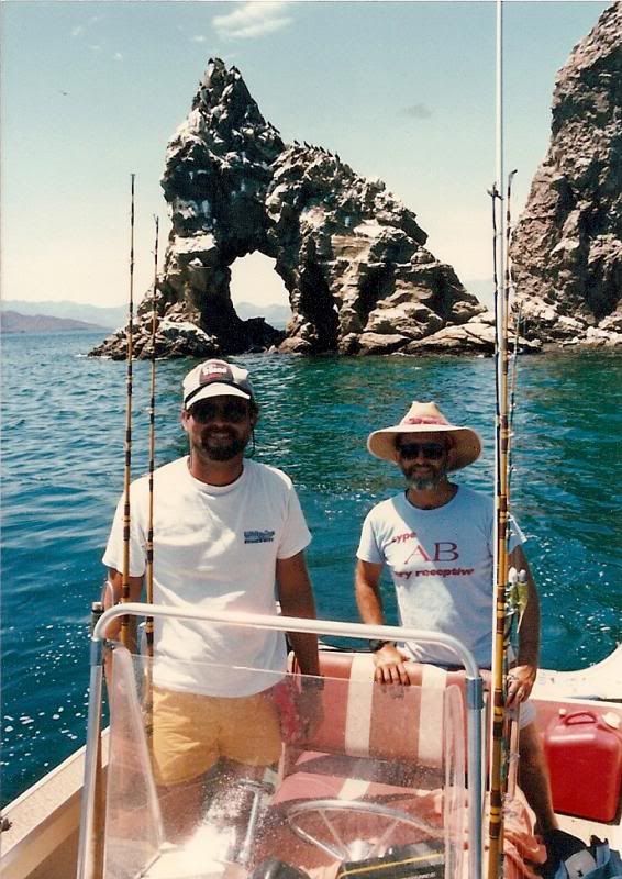
Window rock is always a great picture opportunity on Isla La Ventana. I'm sure if you have visited the 15 offshore islands, you have taken a pic or
two at this location.
Pictured here with my mentor & great friend Dr. Rafe Payne. Yes Memo Smith you have always been a great captain and amigo and deserve a thumbs up.
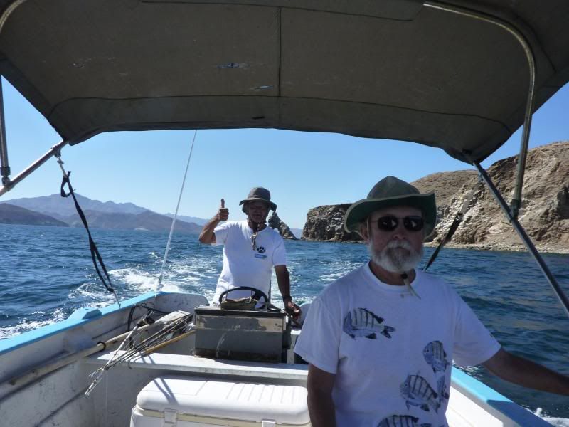
Rafe, how long has it been?
OK, on to Calaveras or Skull Island, home to many birds and sea lions, however oddly enough there were no lobos (sea lions). What's up with That?
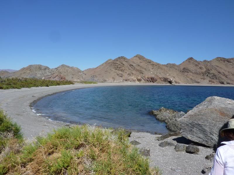
Pulling into a great little cove on Coronado Island for some R & R.
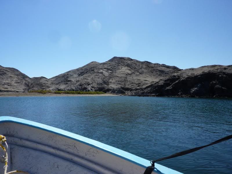
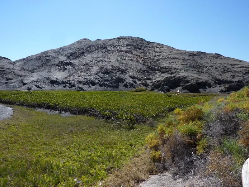
Beyond the beach lies a small estuary with a stand of red mangroves. This is the northern most stand in the Sea of Cortez.
Got beach?
End of a wonderful day on the bay. What should we do tomorrow you ask? How bout a trip 10 miles into the desert and visit the remains of Las Flores?
See you for coffee temprano en la manana.
[Edited on 4-17-2013 by Wiles]
|
|
|
woody with a view
PITA Nomad
Posts: 15940
Registered: 11-8-2004
Location: Looking at the Coronado Islands
Member Is Offline
Mood: Everchangin'
|
|
coronadito? at the north end of smith island? i guess i gotta look closer next time!
|
|
|
24baja
Senior Nomad
Posts: 952
Registered: 2-3-2009
Location: Grants Pass Oregon/Bahia de Los Angeles
Member Is Offline
Mood: Wishing we were in BOLA
|
|
Wiles thankss so much....we miss bahia in between trips.
|
|
|
David K
Honored Nomad
Posts: 65575
Registered: 8-30-2002
Location: San Diego County
Member Is Offline
Mood: Have Baja Fever
|
|
Wow you are doing great with your photo-trip report posts! Thank you for the 'Baja feeling' they bring!!!
|
|
|
Wiles
Nomad
Posts: 337
Registered: 10-1-2006
Member Is Offline
|
|
| Quote: | Originally posted by woody with a view
coronadito? at the north end of smith island? i guess i gotta look closer next time! |
Guess you do. No worries. Coronadito and Coronado are seperated by a very narrow channel (100 yards wide and 100feet deep). Fished it and dove it
many, many times. Loved it when yellowtail would school through there at tidal changes.
Funny (or not) story when we anchored in the channel underneath the frigitbirds for a twilite dive to get some yellowtail. Dropped 65ft. only to see
our anchor floating by. Learned some about tidal currents in that part of the gulf.
Cudos for all your reports from San Clemente & San Nick. Spent lots of years fishing and diving those islands. Never saw any surfers, only Navy
seals & us.
Saludos
|
|
|
Paulina
Ultra Nomad
Posts: 3813
Registered: 8-31-2002
Location: BCN
Member Is Offline
|
|
Wiles,
Do you remember when we were in the inflatable just to the side of Coronado when a whale breached right next to us? It seemed like it was right above
our heads. None of us took a photo, our eyes as big as dish pans. I remember thinking, "did that just happen?"
Just one memory of many, the summer of 81.
P>*)))>{
\"Well behaved women rarely make history.\" Laurel Thatcher Ulrich
|
|
|
woody with a view
PITA Nomad
Posts: 15940
Registered: 11-8-2004
Location: Looking at the Coronado Islands
Member Is Offline
Mood: Everchangin'
|
|
maybe i don't have all the names straight. i've circled coronadito (and pulled YT from that gap) and didn't see any mangroves. there is another island
along the west side of smith that looks a cove unless you go all the way back in at high tide. i only was there once so i am surprised to see
mangroves.
not trying say i know it all-can't wait to return for a better look.
|
|
|
Paulina
Ultra Nomad
Posts: 3813
Registered: 8-31-2002
Location: BCN
Member Is Offline
|
|
| Quote: | Originally posted by woody with a view
maybe i don't have all the names straight. i've circled coronadito (and pulled YT from that gap) and didn't see any mangroves. there is another island
along the west side of smith that looks a cove unless you go all the way back in at high tide. i only was there once so i am surprised to see
mangroves.
not trying say i know it all-can't wait to return for a better look. |
Woodster,
You've got to go find the secret mangrove spot on your own, dude...best kept mangrove secrets are like those surf spots - need to be discovered
without being lacquered all over the internet.
No fair private messaging David K for gps coordinates!
P>*)))>{
\"Well behaved women rarely make history.\" Laurel Thatcher Ulrich
|
|
|
woody with a view
PITA Nomad
Posts: 15940
Registered: 11-8-2004
Location: Looking at the Coronado Islands
Member Is Offline
Mood: Everchangin'
|
|
yeah, you're right. i promise to never pm DK....
|
|
|
Ateo
Elite Nomad
Posts: 5964
Registered: 7-18-2011
Member Is Offline
|
|
Wiles, thanks for taking us along on that trip. I drove by BOLA for years until recently and have now realized the treasure it is.
|
|
|
yellowklr
Senior Nomad
Posts: 507
Registered: 4-14-2006
Member Is Offline
|
|
| Quote: | Originally posted by woody with a view
maybe i don't have all the names straight. i've circled coronadito (and pulled YT from that gap) and didn't see any mangroves. there is another island
along the west side of smith that looks a cove unless you go all the way back in at high tide. i only was there once so i am surprised to see
mangroves.
not trying say i know it all-can't wait to return for a better look. |
Smith aka Coronado
Derek
|
|
|
Alm
Ultra Nomad
Posts: 2756
Registered: 5-10-2011
Member Is Offline
|
|
| Quote: | Originally posted by woody with a view
maybe i don't have all the names straight. i've circled coronadito (and pulled YT from that gap) and didn't see any mangroves.
|
It's the last cove, when you go from North to South, along the West coast of Smith. Narrow entrance, easy to miss, but don't get upset if you do.
Windy. Not sheltered from North. Yes, mangroves, small ones.
|
|
|
Skipjack Joe
Elite Nomad
Posts: 8092
Registered: 7-12-2004
Location: Bahia Asuncion
Member Is Offline
|
|
| Quote: | Originally posted by Paulina
Woodster,
No fair private messaging David K for gps coordinates!
P>*)))>{ |
Somehow I don't think that will happen. 
|
|
|
Udo
Elite Nomad
Posts: 6364
Registered: 4-26-2008
Location: Black Hills, SD/Ensenada/San Felipe
Member Is Offline
Mood: TEQUILA!
|
|
How long did it take you to make around all the islands, Wiles?
Just as a point of reference in case I want to do the same thing in my wind/paddle/pedal Hobie kayak.
Udo
Youth is wasted on the young!
|
|
|
David K
Honored Nomad
Posts: 65575
Registered: 8-30-2002
Location: San Diego County
Member Is Offline
Mood: Have Baja Fever
|
|
No need to ask me, just use Google Earth and look for yourselves... and the GPS (WGS84) waypoint is provided where-ever you point your mouse.  
|
|
|
watizname
Senior Nomad
Posts: 792
Registered: 8-7-2009
Member Is Offline
|
|
Love that place. Looking forward to more, more, more.
I yam what I yam and that\'s all what I yam.
|
|
|
Wiles
Nomad
Posts: 337
Registered: 10-1-2006
Member Is Offline
|
|
| Quote: | Originally posted by Paulina
Wiles,
Do you remember when we were in the inflatable just to the side of Coronado when a whale breached right next to us? It seemed like it was right above
our heads. None of us took a photo, our eyes as big as dish pans. I remember thinking, "did that just happen?"
Just one memory of many, the summer of 81.
P>*)))>{ |
Paulina,
How could I not remember? That was so awesome.
|
|
|
Wiles
Nomad
Posts: 337
Registered: 10-1-2006
Member Is Offline
|
|
| Quote: | Originally posted by Paulina
| Quote: | Originally posted by woody with a view
maybe i don't have all the names straight. i've circled coronadito (and pulled YT from that gap) and didn't see any mangroves. there is another island
along the west side of smith that looks a cove unless you go all the way back in at high tide. i only was there once so i am surprised to see
mangroves.
not trying say i know it all-can't wait to return for a better look. |
Woodster,
You've got to go find the secret mangrove spot on your own, dude...best kept mangrove secrets are like those surf spots - need to be discovered
without being lacquered all over the internet.
No fair private messaging David K for gps coordinates!
P>*)))>{ |
|
|
|
Wiles
Nomad
Posts: 337
Registered: 10-1-2006
Member Is Offline
|
|
| Quote: | Originally posted by Udo
How long did it take you to make around all the islands, Wiles?
Just as a point of reference in case I want to do the same thing in my wind/paddle/pedal Hobie kayak. |
Udo,
We left the ramp at 7:30 a.m. and returned at 2:30 p.m. We saw several kayakers on and around Coronado/Smith Island. I believe they drove up to Punta
La Gringa to launch and paddled the mile or so crossing to Smith. Also see paddlers inside the sand spitz and further south towards La Mona.
Be advised of strong afternoon winds and currents.
Hope this helps.
Wiles
|
|
|
Alm
Ultra Nomad
Posts: 2756
Registered: 5-10-2011
Member Is Offline
|
|
| Quote: | Originally posted by Udo
How long did it take you to make around all the islands, Wiles?
Just as a point of reference in case I want to do the same thing in my wind/paddle/pedal Hobie kayak. |
Circling in a motor boat is one thing, paddling is another. Hobie is not a fast one. Also, depends where you launch. Count on one island per day.
Going to the island, lunch stop, going back. But there are only 2 camp-able islands, others are basically "rocks", though you can get lucky and find a
small strip to land, IF the tide is low, and IF it's not windy, because those won't be sheltered. So, to answer your question - 2 days of a good
weather. It will make you 3 times longer to reach the island if you have to fight the current, and you will get stuck on the island if wind suddenly
(but not unusually for these places) will pick up to a gale force.
|
|
|
| Pages:
1
2 |


