PaulW
Ultra Nomad

Posts: 3113
Registered: 5-21-2013
Member Is Offline
|
|
Highway south of San felipe
The last Kilometer sign going south is K142. And that would be
29 50.075N, 114 25.718W. From my GE view it looks like the end of the pavement is 29 49.604N, 114 25.325W.
The dirt road starts and immediately you will find the turn east to Willard Bay etc.
Caveat. Not been there, but have nice GE view from Murdocknav.com background map..

|
|
|
David K
Honored Nomad
Posts: 65575
Registered: 8-30-2002
Location: San Diego County
Member Is Offline
Mood: Have Baja Fever
|
|
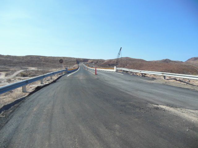
Here is a photo of the end of the pavement on the south side of the new bridge, and just north of Papa Fernandez' driveway to Bahía San Luis Gonzaga
(Willard Bay on some boating charts).
Photo taken Aug. 15, 2013 by bbbait (Wayno):

Here is the view back north, over the bridge:
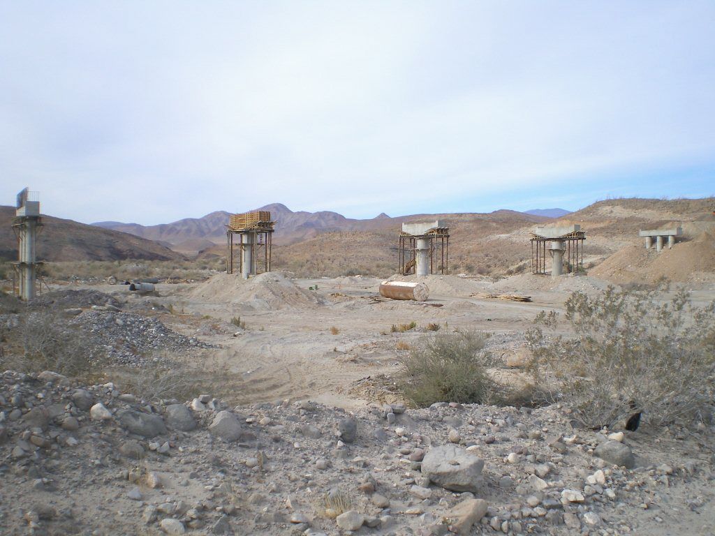
Here's a few months before of the bridge:

Here it is on Jan. 6, 2013:
|
|
|
PaulW
Ultra Nomad
Posts: 3113
Registered: 5-21-2013
Member Is Offline
|
|
thanks for the pics. Good to see a proper transition to the dirt.
Been told there is no road activity south of the pictures bridge. Anyone have an input on that?
|
|
|
David K
Honored Nomad
Posts: 65575
Registered: 8-30-2002
Location: San Diego County
Member Is Offline
Mood: Have Baja Fever
|
|
| Quote: | Originally posted by PaulW
thanks for the pics. Good to see a proper transition to the dirt.
Been told there is no road activity south of the pictures bridge. Anyone have an input on that? |
TW recently posted he detected prep work on the next 10 km. south... no grading yet. Obviously a huge bridge to build over Arroyo Santa María, a few
miles south of Rancho Grande and the Pemex.
|
|
|
tripledigitken
Ultra Nomad
Posts: 4848
Registered: 9-27-2006
Member Is Offline
|
|
We saw survey crews 11 months ago between Gonzaga and Coco's.
|
|
|
TMW
Select Nomad
Posts: 10659
Registered: 9-1-2003
Location: Bakersfield, CA
Member Is Offline
|
|
They are doing several miles of grading from the milkitary checkpoint to past the camping turnoffs and maybe beyond.
|
|
|
willardguy
Elite Nomad
Posts: 6451
Registered: 9-19-2009
Member Is Offline
|
|
theres a new road from the checkpoint to the bridge bypassing the old road from papa's. came thru a couple weeks ago in pitch darkness from the south
and couldnt find our house
|
|
|
David K
Honored Nomad
Posts: 65575
Registered: 8-30-2002
Location: San Diego County
Member Is Offline
Mood: Have Baja Fever
|
|
So, probably pushed the highway route straight ahead instead of that curve towards Papa's road south of the bridge?
It is quite an amazing thing having seen this all being built... having traveled the original dirt road of the 1960's (built following Arturo Grosso's
pilot road of 1956)! I really expected the first graded highway (of 1986) to be paved... This 2007+ paved highway is all new alignment and only
occasionally is on top of the 1986 road... which in turn was a bit different than the ~1960 route.
Heck, the new road from the San Felipe Airport to Puertecitos of 1982+ was a shock, and that took several years to get paved.. and only a couple years
more for that paper-thin asphalt to break apart... and get all repaved less than 10 years ago!
|
|
|


