JZ
Select Nomad

Posts: 14923
Registered: 10-3-2003
Member Is Offline
|
|
Border to BOLA via San Felipe
How long if you drove straight through. Just curious.
What are the logical 2-3 stopping points along the way?
We'll be taking a truck and three dirt bikes. Probably ride the bikes on the unpaved part.
|
|
|
David K
Honored Nomad
Posts: 65589
Registered: 8-30-2002
Location: San Diego County
Member Is Offline
Mood: Have Baja Fever
|
|
Which border? Chapala or Calamajué route?
Tecate or Mexicali is the typical crossing for California Nomads.
Here is approx. times and not trailing or long stops:
Mexicali to San Felipe: 2.5 hours (125 mi.)
San Felipe to Gonzaga Bay Pemex: 2.0 hours (95 mi., all but 3 mi. paved)
Gonzaga Bay (Pemex) to Coco's Corner: 1.0 hour (23 miles/ dirt)
Coco's Corner to Laguna Chapala: close to 1 hour, very rough (13 miles)
See my 2012 trip report for the Calamajué route details.
Laguna Chapala to Bahia de los Angeles: 1.5 hours (70 miles)
Stopping Points:
*San Felipe for fish tacos and gasoline.
*~15 miles south of Puertecitos at wide paved pullout for island view.
*Gonzaga Bay: Pemex top off (if open), Alfonsina's for shrimp or stretch legs and enjoy bay view.
*Coco's Corner to meet a legend and have a beer.
|
|
|
JZ
Select Nomad
Posts: 14923
Registered: 10-3-2003
Member Is Offline
|
|
Good break down.
>>Coco's Corner to Laguna Chapala: close to 1 hour, very rough (13 miles)
What time of rough?
|
|
|
David K
Honored Nomad
Posts: 65589
Registered: 8-30-2002
Location: San Diego County
Member Is Offline
Mood: Have Baja Fever
|
|
What time or what kind of rough?
Time, close to an hour.
Kind, graded 2WD dirt highway through mountain, rocky and washboard/ rutted roadbed. Semi trucks now using so be careful on blind curves and pullover
on a wide spot if you see one coming. Flat tires possible if you are fully inflated. Suggest dropping pressure until you get to Hwy. 1.
|
|
|
David K
Honored Nomad
Posts: 65589
Registered: 8-30-2002
Location: San Diego County
Member Is Offline
Mood: Have Baja Fever
|
|

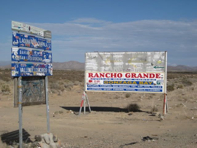
Island viewpoint
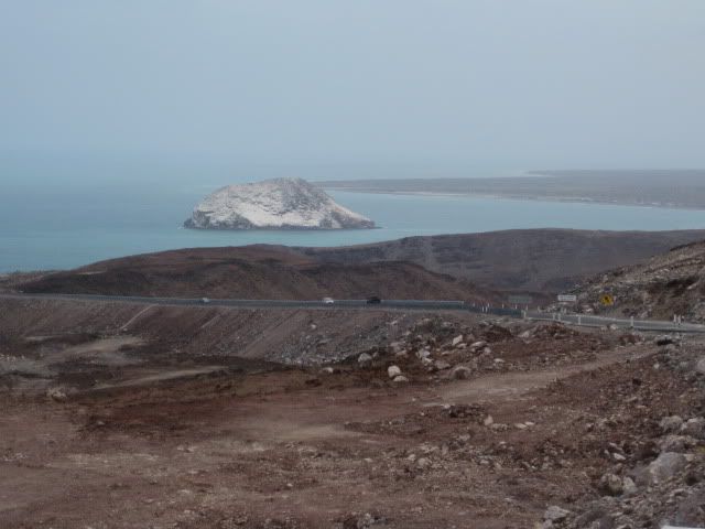
Isla el Huerfanito
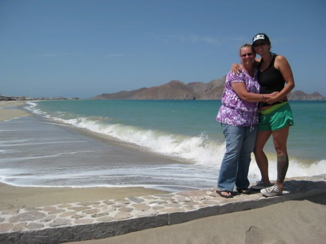
Gonzaga towards Alfonsina's
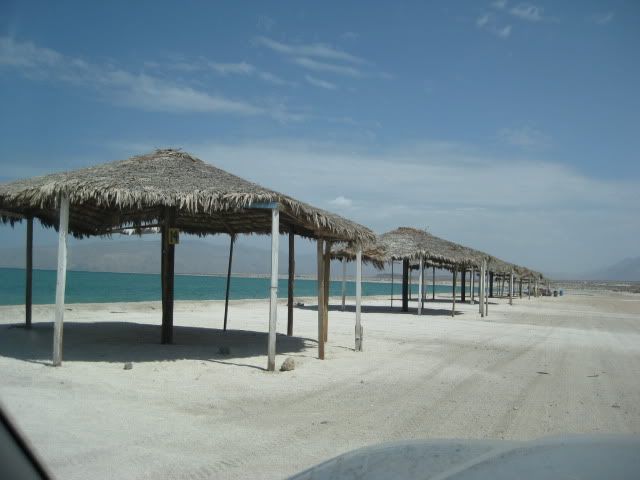
Rancho Grande Palapas 2011
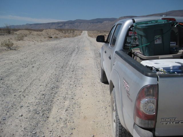
South from Gonzaga 2012
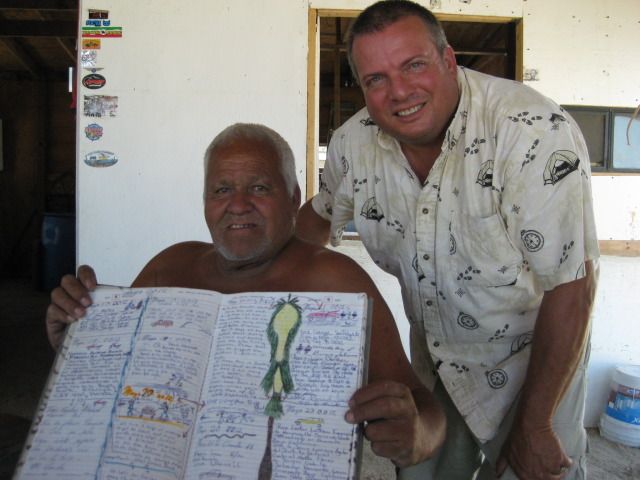
Coco and I 2012
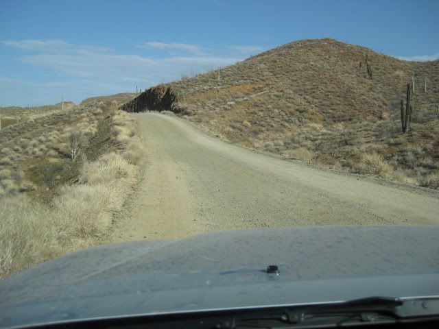
Heading to Chapala from Coco's
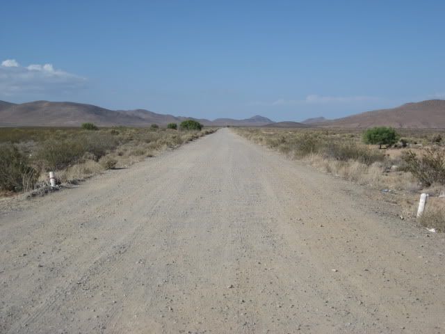
Looking towards Gonzaga from Hwy. 1
|
|
|
Santiago
Ultra Nomad
Posts: 3545
Registered: 8-27-2003
Member Is Offline
|
|
In a full size pick up, about 10-11 hours to Mexicali.
|
|
|
Pacifico
Super Nomad
Posts: 1299
Registered: 5-26-2008
Member Is Offline
|
|
Another option: from Coco's, the bikes can ride through Calamajue Canyon (which is really beautiful) and the vehicle could go out through Chapala.
Then you could meet at El Crucero where the bikes would come out from Calamajue. Just an option...
"Plan your life as if you are going to live forever. Live your life as if you are going to die tomorrow." - Carlos Fiesta
|
|
|
JZ
Select Nomad
Posts: 14923
Registered: 10-3-2003
Member Is Offline
|
|
| Quote: | Originally posted by Pacifico
Another option: from Coco's, the bikes can ride through Calamajue Canyon (which is really beautiful) and the vehicle could go out through Chapala.
Then you could meet at El Crucero where the bikes would come out from Calamajue. Just an option... |
How far is that part.
|
|
|
Pacifico
Super Nomad
Posts: 1299
Registered: 5-26-2008
Member Is Offline
|
|
| Quote: | Originally posted by JZ
| Quote: | Originally posted by Pacifico
Another option: from Coco's, the bikes can ride through Calamajue Canyon (which is really beautiful) and the vehicle could go out through Chapala.
Then you could meet at El Crucero where the bikes would come out from Calamajue. Just an option... |
How far is that part. |
From Coco's, it's about 6 miles down the road toward Calamajue to where you turn off toward the canyon. Then, it's about 20+ miles to where you hit
Hwy. 1 at El Crucero. For whoever is driving the truck down Hwy.1, El Crucero is where a small mountain comes right down to the highway on the west
side (right side). There is a turnout on the east side of the highway just after this. Or, you could ride the highway a bit and meet at the LA Bay
turnoff. Super nice side trip! Check out Baja Almanac page 8.
"Plan your life as if you are going to live forever. Live your life as if you are going to die tomorrow." - Carlos Fiesta
|
|
|
Jaybo
Nomad
Posts: 240
Registered: 12-7-2009
Location: NW Oregon
Member Is Offline
Mood: Praying for Baja!
|
|
At Alfonsina's just make sure you order beer and not a margarita. Hands down the worst one I have ever had in 35 years of drinking them 
Well that was my experience in February this year anyway
|
|
|
Desertbull
Senior Nomad
Posts: 558
Registered: 8-27-2003
Member Is Offline
|
|
Just passing the word that Calamajue Wash Was chewed up pretty good after the Baja Mil race only a month ago, I hate for you to go in their with a
truck and spend your vacation trying to get out...lol, just passing the word don't kill the messenger...
Motos no prob, trucks that know Calamajue no problem if you stay in the normal track, but you gotta know, lots don't know, I towed several out
lately...
DREAM IT! PLAN IT! LIVE IT!
|
|
|
David K
Honored Nomad
Posts: 65589
Registered: 8-30-2002
Location: San Diego County
Member Is Offline
Mood: Have Baja Fever
|
|
Good advice from Desert Bull. The Baja 1000 went through there just a month ago!
|
|
|
JZ
Select Nomad
Posts: 14923
Registered: 10-3-2003
Member Is Offline
|
|
Thinking about doing this around Easter when my kids have spring break. Is that a really bad idea with Semana Santa. On the mainland San Carlos
swells from like 4K to 30K.
|
|
|
David K
Honored Nomad
Posts: 65589
Registered: 8-30-2002
Location: San Diego County
Member Is Offline
Mood: Have Baja Fever
|
|
Semana Santa is when all of Mexico goes to the beach! However, northern Baja beaches south of San Felipe and north of Mulege will be the least
crowded, if you notice any crowd at all. Campo Beluga at Gonzaga Bay makes a good central base camp... take day runs out from there, check out L.A.
Bay camp locations if you leave early from Gonzaga...
|
|
|