| Pages:
1
2 |
TMW
Select Nomad
      
Posts: 10659
Registered: 9-1-2003
Location: Bakersfield, CA
Member Is Offline
|
|
2014 Baja 1000 GPS Files
On the SCORE web site. There are a couple of differences from what is show on the map. At El Rosario and out oF San Ignacio. The GPS ends at hwy 1
after La Purisima.
http://score-international.com/2014-baja-1000-gps-files/
|
|
|
StuckSucks
Super Nomad
   
Posts: 2369
Registered: 10-17-2013
Location: Pacific Plate
Member Is Offline
|
|
Embedded on Google Maps:
http://pizzamanagement.com/portfolio/2014-baja-1000-map/
When they add the portion from CP7 to the finish, I'll add to this map.
|
|
|
Ateo
Elite Nomad
     
Posts: 5938
Registered: 7-18-2011
Member Is Offline
|
|
Thanks to both of you. Getting excited!
|
|
|
TMW
Select Nomad
      
Posts: 10659
Registered: 9-1-2003
Location: Bakersfield, CA
Member Is Offline
|
|
From what I understand the heavy rains did a lot of damage on the section from San Javier out to the coast. Mostly to the arroyo nearest to San
Javier. I'm told there are crews working on clearing it up.
|
|
|
David K
Honored Nomad
        
Posts: 65412
Registered: 8-30-2002
Location: San Diego County
Member Is Offline
Mood: Have Baja Fever
|
|
The race coming to El Rosario is very exciting!
|
|
|
rts551
Elite Nomad
     
Posts: 6700
Registered: 9-5-2003
Member Is Offline
|
|
The map needs a little cleaning up. for example....at RM 200 it goes out to hwy 1 and the backtracks. This will cause some slight changes in RM
markers.
|
|
|
StuckSucks
Super Nomad
   
Posts: 2369
Registered: 10-17-2013
Location: Pacific Plate
Member Is Offline
|
|
I suppose it's a testimonial of things to come, but I'm seeing quite a bit of Speed Zone "racing."
|
|
|
rts551
Elite Nomad
     
Posts: 6700
Registered: 9-5-2003
Member Is Offline
|
|
The route planned is also closer to the hwy than the last few years. This is probably going to result in an increase in Chase vehicle traffic.
|
|
|
TMW
Select Nomad
      
Posts: 10659
Registered: 9-1-2003
Location: Bakersfield, CA
Member Is Offline
|
|
Yes you are right. The speed zone stuff will only increase with more and more hwy paving. It's not too far off that they will have a paved hwy from
San Ignacio to San Juanico, as well as finish the hwy past Cocos to hwy 1.
We could always do a multi-lap loop out of San Felipe. Can you imagine doing 4 laps thru the whoops.
|
|
|
KasloKid
Nomad
 
Posts: 326
Registered: 8-29-2009
Member Is Offline
|
|
| Quote: | Originally posted by TW
We could always do a multi-lap loop out of San Felipe. Can you imagine doing 4 laps thru the whoops. |
No....
|
|
|
David K
Honored Nomad
        
Posts: 65412
Registered: 8-30-2002
Location: San Diego County
Member Is Offline
Mood: Have Baja Fever
|
|
| Quote: | Originally posted by TW
Yes you are right. The speed zone stuff will only increase with more and more hwy paving. It's not too far off that they will have a paved hwy from
San Ignacio to San Juanico, as well as finish the hwy past Cocos to hwy 1.
We could always do a multi-lap loop out of San Felipe. Can you imagine doing 4 laps thru the whoops. |
I see they are using some dirt roads out of San Ignacio before it touches the paved road to the lagoon.
There is also a lots of parallel routes (salt flat/ Cuarenta inland road) along any future extension to San Juanico.
When it is paved to Cocos and Chapala, they may just keep it along the Pacific Seven Sister's road to go south... at least to near Punta Prieta then
shoot back across to L.A. Bay or loop back north (they have done that before, way back to 1975).
|
|
|
TMW
Select Nomad
      
Posts: 10659
Registered: 9-1-2003
Location: Bakersfield, CA
Member Is Offline
|
|
The bright side for SCORE is I don't think they pay to use the hwy like they do the land owner. Who knows sometime in the future a Baja 1000 may have
as many miles on the hwy as in the dirt. The hwy sections fit right in with the NORRA Rally setup.
|
|
|
David K
Honored Nomad
        
Posts: 65412
Registered: 8-30-2002
Location: San Diego County
Member Is Offline
Mood: Have Baja Fever
|
|
| Quote: | Originally posted by TW
The bright side for SCORE is I don't think they pay to use the hwy like they do the land owner. Who knows sometime in the future a Baja 1000 may have
as many miles on the hwy as in the dirt. The hwy sections fit right in with the NORRA Rally setup. |
The original Baja races 1967-1973 were simply endurance & time tests of man and machine to get to La Paz. The first one started in Tijuana so it
would be from the border to La Paz... but they restarted the next day in Ensenada, where the real race part began.
The run was down Hwy. 1... and it was paved for 73 miles (ending just north of Colonet). They would return to pavement again about 100 miles north of
La Paz, with unpaved miles totaling about 700.
In 1972, to get closer to 1000 miles and give another city the start, the race began in Mexicali went down Hwy. 5 for 95 miles then crossed to the
Pacific via Trinidad/San Vicente road or via Mike's Sky Rancho to Hwy. 1.
In 1973, after the June Baja 500, the Mexicans threw out NORRA and ran the first Baja Sports Committee 'Baja 1000' (it was called the Mexican 1000
until then), started it back in Ensenada, but ran it across to San Felipe then south to Calamajue, L.A. Bay, El Arco and then the former route to La
Paz.
The Baja Sports Committee blundered the money, racers didn't get their winnings, and the sport almost ended then. There was no Baja 1000 in 1974, the
only year it hasn't run.
Seeing a huge loss to the people of Baja, state officials approached Mickey Thompson and his new SCORE organization to run all off road races in the
state of Baja California. A test 400 mile race called the Baja Internacional was run in July, 1974, and was a huge success. There wasn't enough time
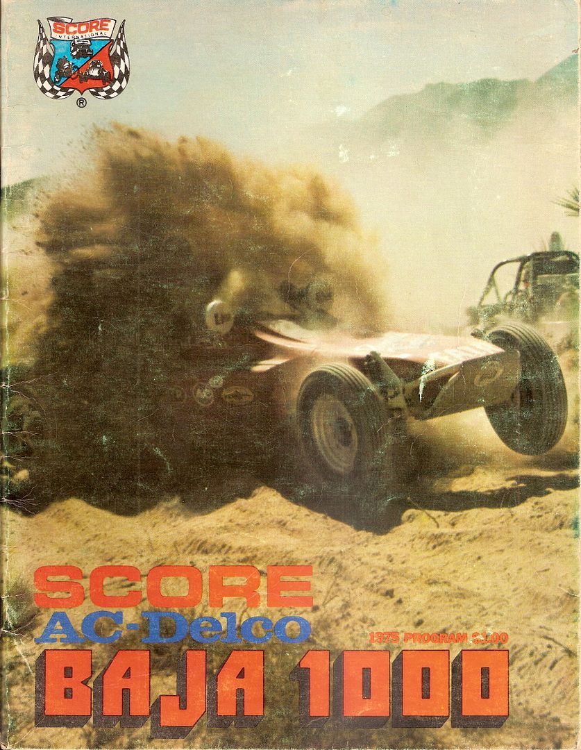
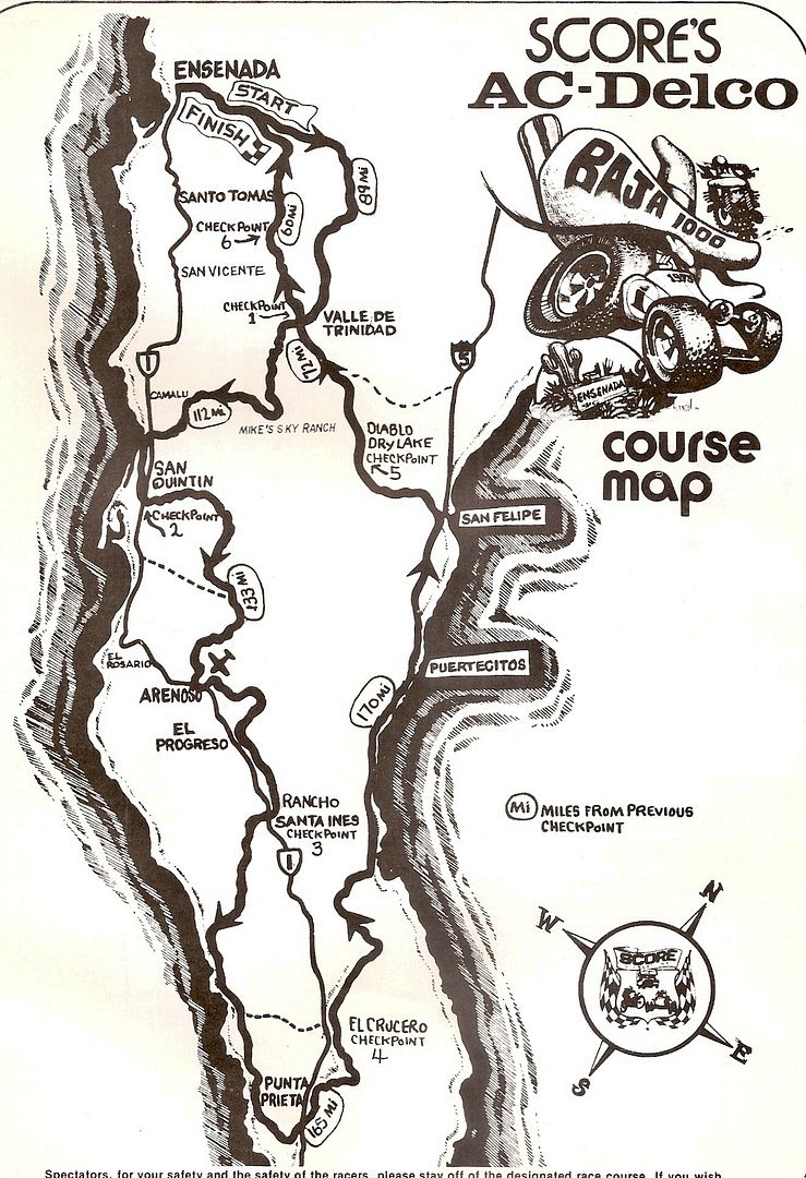
that year to set up the 1000, but in 1975, the first SCORE BAJA 1000 was also the first loop 1000 race, staying only in the northern state.
Negotiations with Baja Sur officials finally saw the return of the 1000 to finish in La Paz, in 1979... SCORE's first race to go to La Paz. It was the
year I was a co-driver.
Here is the first SCORE Baja 1000 program cover and map...


|
|
|
liknbaja127
Nomad
 
Posts: 464
Registered: 1-17-2012
Member Is Offline
|
|
Will be doing the prerun thing next week all the way! Can't wait
|
|
|
KasloKid
Nomad
 
Posts: 326
Registered: 8-29-2009
Member Is Offline
|
|
Any news about the remainder of the course yet?
|
|
|
ehall
Super Nomad
   
Posts: 1906
Registered: 3-29-2014
Location: Buckeye, Az
Member Is Offline
Mood: It's 5 o'clock somewhere
|
|
| Quote: | Originally posted by liknbaja127
Will be doing the prerun thing next week all the way! Can't wait
|
Lucky you! This stupid work thing ruins all my fun. Only 10 more years till retirement. lol
|
|
|
TMW
Select Nomad
      
Posts: 10659
Registered: 9-1-2003
Location: Bakersfield, CA
Member Is Offline
|
|
The GPS file for the complete course is done. There is a hwy section from about KM111 south of Las Positas to KM81 the Punta Conejos turnoff.
If SCORE does not post the files today send me a U2U with your email addy and I'll send them to you. They also say the course from San Javier to hwy
53 should be openned by tomorrow.
|
|
|
StuckSucks
Super Nomad
   
Posts: 2369
Registered: 10-17-2013
Location: Pacific Plate
Member Is Offline
|
|
| Quote: | Originally posted by TW
The GPS file for the complete course is done. |
U2U sent, thanks!
|
|
|
o3dave
Junior Nomad

Posts: 90
Registered: 10-20-2013
Location: Oregon
Member Is Offline
|
|
The files on scores website are zip files and I cant get them to open. Does anyone have a full google embedded map.
|
|
|
StuckSucks
Super Nomad
   
Posts: 2369
Registered: 10-17-2013
Location: Pacific Plate
Member Is Offline
|
|
Thanks Tom for the GPS files! The complete course on Google Maps:
http://pizzamanagement.com/portfolio/2014-baja-1000-map/
|
|
|
| Pages:
1
2 |

