sargentodiaz
Nomad

Posts: 259
Registered: 2-20-2013
Location: Las Vegas, NV
Member Is Offline
|
|
Misión La Purisima Concepción
Okay, give me a hand here.
I've checked every link and every map available to me - including Google Earth - and am somewhat puzzled by this mission.
From everything I can see, the arroyo carries a broad but probably shallow and slow-moving river for more than a few miles. I see grasslands and lots
of palms.
But, I see very few towns/villages or farms. I know the mission closed because the local Indian population died off. But, if there is water, why isn't
there farms, ranches and other signs of human habitation?
Highway 53 goes through the area.
What about wetland wild fowl. Or wildlife in general.
I know DavidK has lots of maps and photos but perhaps others might give me more insight.
Thanks.
|
|
|
TMW
Select Nomad
Posts: 10659
Registered: 9-1-2003
Location: Bakersfield, CA
Member Is Offline
|
|
There are two towns there La Purisima and San Isidro. I don't think the land is very good for farming in any size but a garden because lots of rocks.
They do harvest a lot of dates from the palm trees.
|
|
|
David K
Honored Nomad
Posts: 65588
Registered: 8-30-2002
Location: San Diego County
Member Is Offline
Mood: Have Baja Fever
|
|
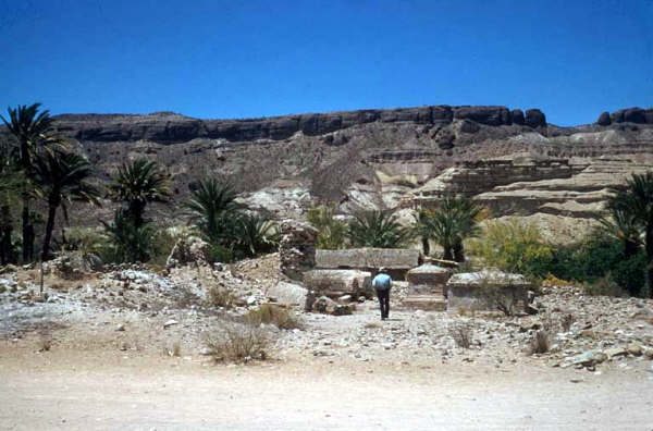
Hi Sargento, I am happy to help. If you don't see your answer here, let me know specifically what you need. I want your novels to be top notch!
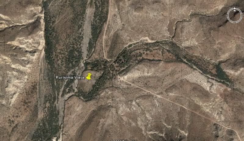
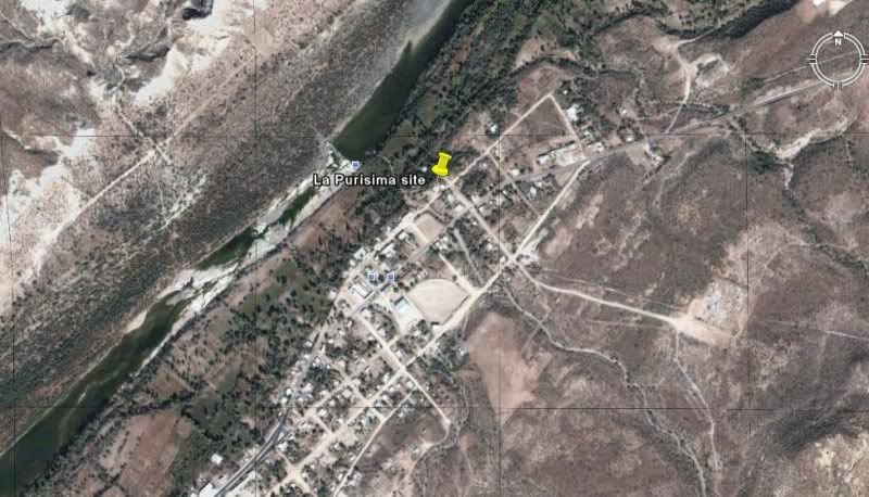
There were two sites for the mission, the second site is where the town today is. The mission is vanished except for some rubble and the few crypts
that were next to the church.
Here is my VivaBaja.com mission page for La Purisima (with photos at both sites):
http://www.vivabaja.com/missions1/page4.html
In 1905:

In 1956, crumbling walls and crypts:
All Baja mission sites and GPS pinned on Google Earth: http://vivabaja.com/missions4/
First site:
Final site:
Here is my recent article on the mission and its history:
The sixth California mission was founded on January 1, 1720 by Jesuit Padre Nicolás Tamaral at a site originally discovered in 1712 by Padre Piccolo
while exploring southwest from Mulegé. The mission prospered for several years and the Cochimí Indian neophyte population grew to 2,000 members by
1730. About the year 1735, the mission was moved 10 miles south to a place the Cochimí called Cadegomó. Following the move, the original site became
known as Purísima Vieja.
A report made in 1744 indicates the mission was productive, owed nothing, and had a population of 156 families. Epidemics began to crush this mission
(as it had the others on the peninsula) and the native population of La Purísima dropped to 54 by the year 1800. That was just 5 years after the
neophytes from the mountain mission of Guadalupe were transferred to La Purísima when Guadalupe was abandoned. La Purísima functioned as a mission for
102 years before it too was abandoned for lack of neophytes to convert to Chritianity. Mexicans from the mainland later arrived to take up farming in
the lush valley. The irrigation canals built by the missionaries and their neophytes are still functioning, after nearly 300 years!
Photography shows the mission church was still being utilized in the early 1900s, but fell into ruins in the years that followed. By 1950 only small
portions of the church walls remained. Today a few crypts and some rubble is all that marks the mission location, in the town of La Purísima. The site
is reached by paved road from the south or a rough, graded road from the east. Only some foundation stones outline the location of the first site, at
Purísima Vieja.
|
|
|
David K
Honored Nomad
Posts: 65588
Registered: 8-30-2002
Location: San Diego County
Member Is Offline
Mood: Have Baja Fever
|
|
| Quote: | Originally posted by sargentodiaz
Okay, give me a hand here....
But, I see very few towns/villages or farms. I know the mission closed because the local Indian population died off. But, if there is water,
why isn't there farms, ranches and other signs of human habitation?...
Thanks. |
Dale, the mission ruins is in the town of La Purisima and nearby is the town of San Isidro... lots of ranches up and down the river valley too.
Unless you are talking about the first site, on a different river? There are ranches and villages up that way too.
|
|
|
David K
Honored Nomad
Posts: 65588
Registered: 8-30-2002
Location: San Diego County
Member Is Offline
Mood: Have Baja Fever
|
|
Posted July 1, 2013
The post: http://forums.bajanomad.com/viewthread.php?tid=68011
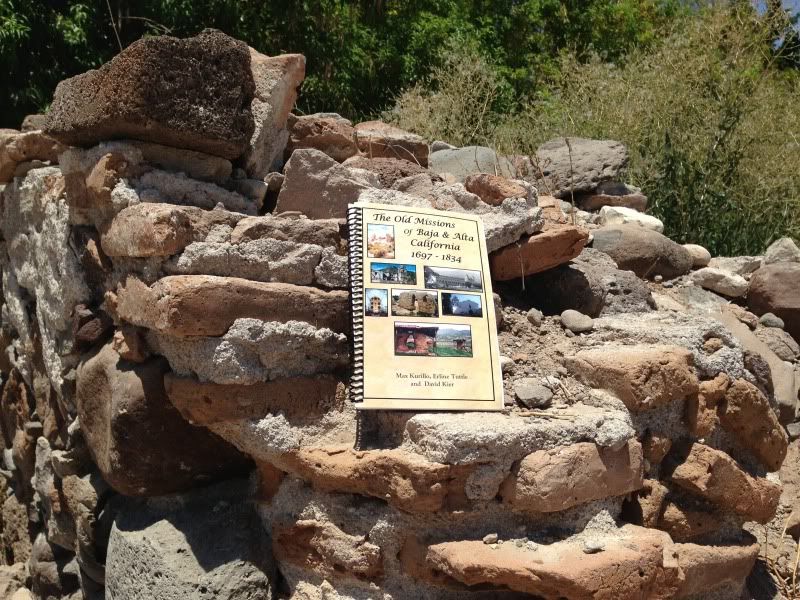
Here's a B & W photo taken by Ateo at a piece of the mission in La Purisima:
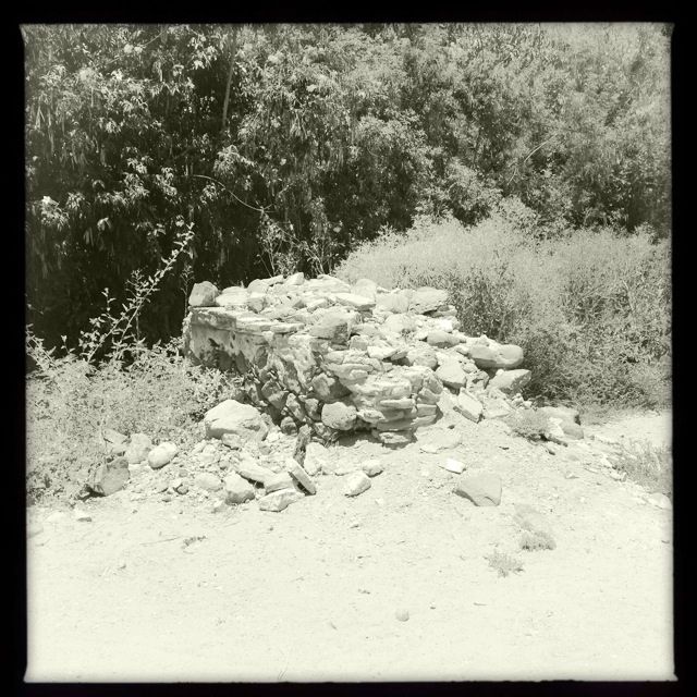
and a color close up with my book included... thanks Ateo!
|
|
|
Ateo
Elite Nomad
Posts: 5965
Registered: 7-18-2011
Member Is Offline
|
|
De nada.
|
|
|
David K
Honored Nomad
Posts: 65588
Registered: 8-30-2002
Location: San Diego County
Member Is Offline
Mood: Have Baja Fever
|
|
Did you take any other pics at the site... can you tell us how it was 'preserved' now (signage, fence, were the crypts still intact...?
|
|
|
David K
Honored Nomad
Posts: 65588
Registered: 8-30-2002
Location: San Diego County
Member Is Offline
Mood: Have Baja Fever
|
|
In 1926
Compared to 1906 photo, the roof is gone now, so the adobe walls would be melting away...
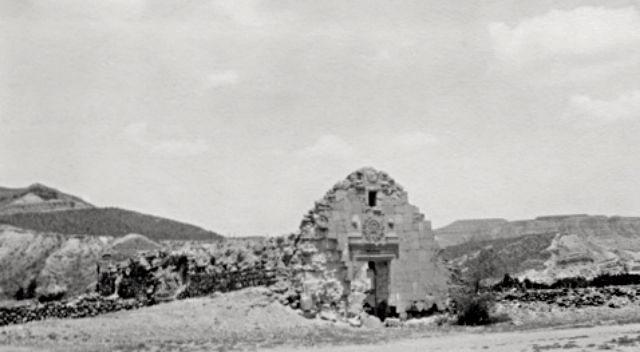
Down the street looking at the mission (behind power or telegraph pole, by pedestrian...
|
|
|
David K
Honored Nomad
Posts: 65588
Registered: 8-30-2002
Location: San Diego County
Member Is Offline
Mood: Have Baja Fever
|
|
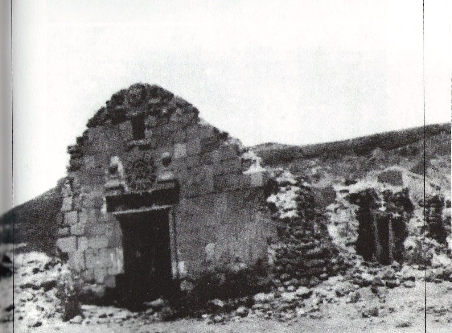
If anyone has or knows of any photos between 1926 and 1956 showing the La Purisima mission church site, please post. Some time in that 30 year span
the walls collapsed. The large Jesuit sun logo above the mission doorway is pretty special... Too bad it wasn't preserved.

|
|
|
David K
Honored Nomad
Posts: 65588
Registered: 8-30-2002
Location: San Diego County
Member Is Offline
Mood: Have Baja Fever
|
|
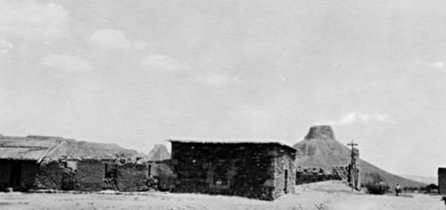
About 1920...
From Max...
|
|
|


