| Pages:
1
2 |
willyAirstream
Super Nomad
   
Posts: 1786
Registered: 1-1-2010
Member Is Offline
|
|
wanted-GPS map
Trying to find a gps map to import into Back Country Navigator app.
Cycle maps is ok, but hoping for something with more detail.
|
|
|
PaulW
Ultra Nomad
    
Posts: 3113
Registered: 5-21-2013
Member Is Offline
|
|
If you had a stand alone GPS you would have lots of map choices. The other platforms are just getting started with the stuff you need/want.
PaulW
|
|
|
Alm
Ultra Nomad
    
Posts: 2753
Registered: 5-10-2011
Member Is Offline
|
|
You are not going to find any good off-line mapping app for Baja, and neither I know why needing a map in place with so few roads.
Online mapping apps - well, they work only where there is a data connection, which is usually in a big town where you don't need a map. In any event,
Googlemaps for Android is good enough for on-line.
|
|
|
willyAirstream
Super Nomad
   
Posts: 1786
Registered: 1-1-2010
Member Is Offline
|
|
Thanks, but I need to clear up a few things
I can use any map for standalones or any gps unit, garmin, lowrance etc.
Gpx, or any xml format, kml, kmz etc. All can be imported to BCN by using poi to convert to xlm, aka gps
BCN does not use a data connection, does not need to be online, just needs to seethe sky for gps satellite reception, same as a stand alone.
I use it to follow a course, a track for off road racing. It works as good as a 1200 dollar Lowrance and a 10 inch screen is easier to see than a
Garmin.
|
|
|
Russ
Elite Nomad
     
Posts: 6742
Registered: 7-4-2004
Location: Punta Chivato
Member Is Offline
|
|
I don't quite get what you're saying. But this is what I have and it's OK
http://www.cartografiagps.com/mape32/updates.htm
Bahia Concepcion where life starts...given a chance!
|
|
|
LaTijereta
Super Nomad
   
Posts: 1192
Registered: 8-27-2003
Location: Loreto
Member Is Offline
|
|
I have been using BCN (free version) with the "Open Cycle" map, and it has many of the offroad trails west of Loreto as you zoom in... I also have
been able to plot trails on Google Earth, then transfer them over to my Samsung tablet for viewing out on the trails.. Just loaded the Gregorio Trail
for a future run..
For the SCORE BajaSur 500 we loaded the course off the GPS files on their website.. then pre-ran the course using the tablet to follow and let us know
how we were from various "RM" locations and access roads in... The GPS on the tablet was right on track, as long as you stayed zoomed in..
I think if you upgrade to their "Pro" ($10) version app, they offer additional mapping choices..
Democracy is like two wolves and a lamb voting on what to have for lunch. Liberty is a well-armed lamb contesting the vote.
Ben Franklin (1759)
|
|
|
willyAirstream
Super Nomad
   
Posts: 1786
Registered: 1-1-2010
Member Is Offline
|
|
Thanks Russ, that is exactly what I am looking for, but is it worth 105 dlls?
Currently I can use google map, cycle topo or even a pdf or aerial photo, if it has co ordinates marked, as a background map for tracking. I can use a
plain white background also. Usually i follow an existing track i have made, but it is nice to have topo and existing conditions shown too,
especially exploring.
To explain what I am doing....I used google earth to trace a race course `track`from a jpg file, then exported a kmz, converted to a gpx and imported
to to BCN.. works great. Now I have a track to follow during pre running, and a bunch of ribbons  to follow. I will make a more accurate track from the pre run to use in the race. My existing background map is pretty
good, showing most of the P Chivato roads and houses. I was curious as to what else was out there. I contacted your link to see if they can send it
in a compatable format. to follow. I will make a more accurate track from the pre run to use in the race. My existing background map is pretty
good, showing most of the P Chivato roads and houses. I was curious as to what else was out there. I contacted your link to see if they can send it
in a compatable format.
Thanks
|
|
|
willyAirstream
Super Nomad
   
Posts: 1786
Registered: 1-1-2010
Member Is Offline
|
|
Thanks LaTij..
We are doing the same thing, great 
I have BCN pro and so far, open cycle is the best out there. I was hoping calTopo had something, but it is mostly usa. How is your tablet holding up?
I have used mine for several trips to the Pacific side, but this will be the first time using it in a race. I built a mount with shocks for it but
need to find away to keep the dust out. So far, blue taping the ports and panels is my only solution.
Btw, i am using Ulysse speedo for speedometer and timing and using My Tracks as a back up tracker, recommend both.
|
|
|
willyAirstream
Super Nomad
   
Posts: 1786
Registered: 1-1-2010
Member Is Offline
|
|
I heard back from cartographis gps, in spanish, and they use an .img file format and can`t say if it is compatable, but I may try a trial if
available.
|
|
|
Russ
Elite Nomad
     
Posts: 6742
Registered: 7-4-2004
Location: Punta Chivato
Member Is Offline
|
|
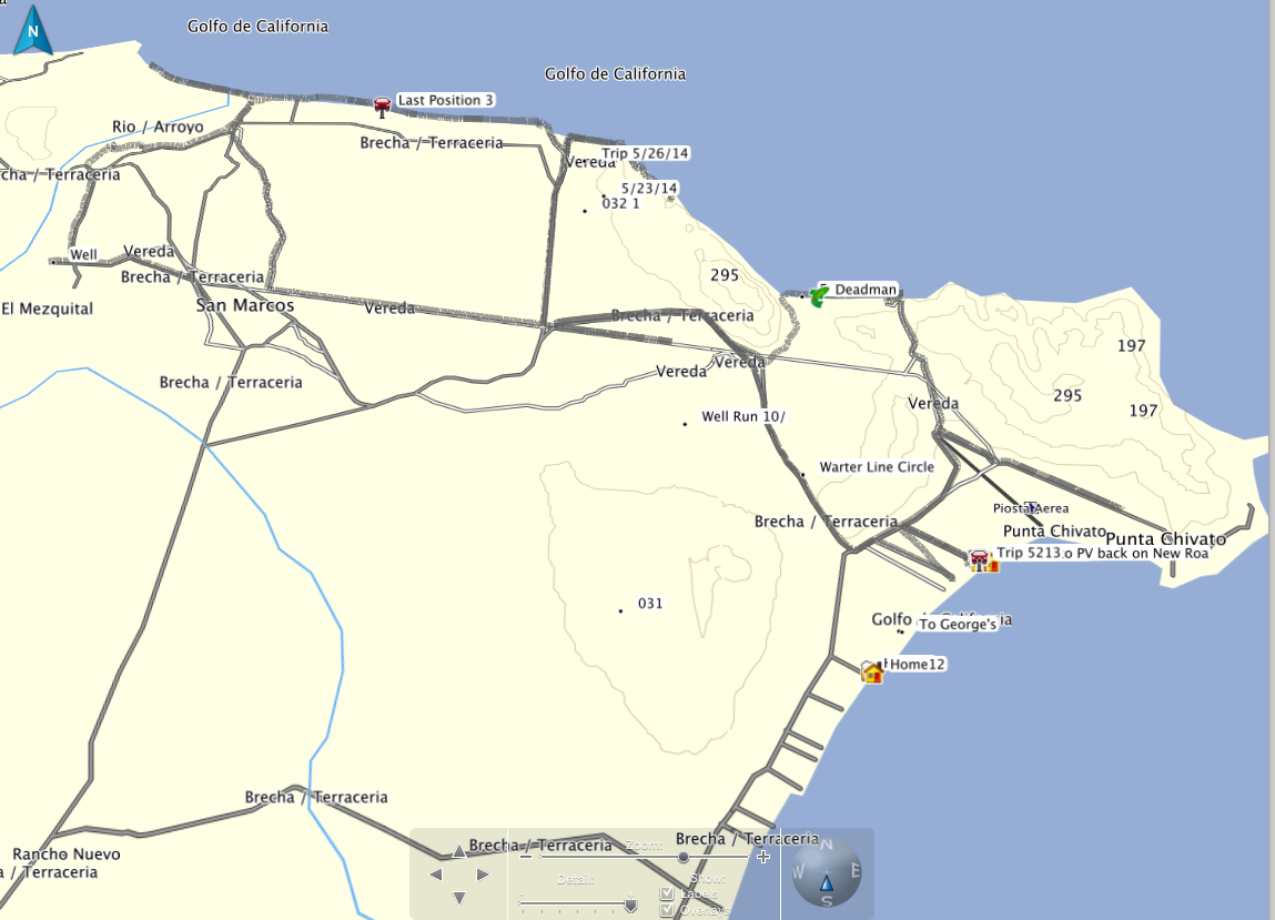
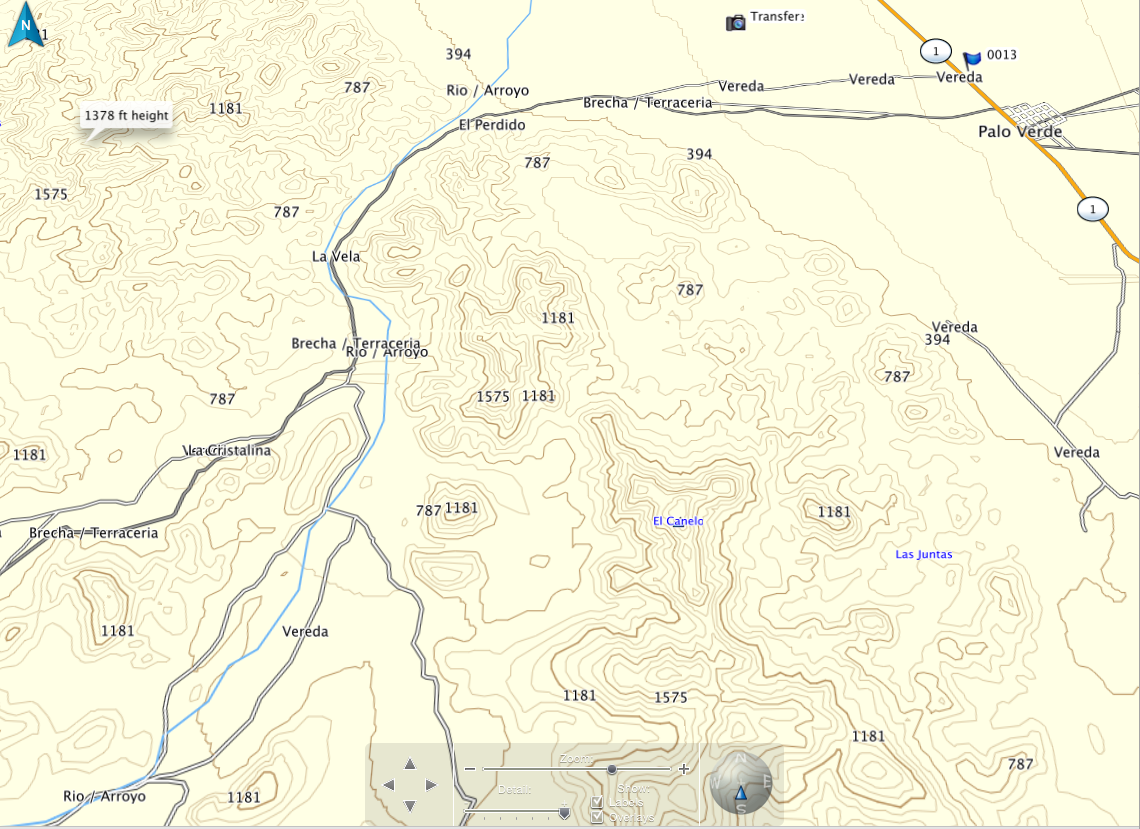
cartographis gps does not show a lot of detail around Pt. Chivato but once you have driven a track and down loaded it to your computer (Garmin Base
Camp in my case) you could print accurate maps. Like any other program you'll have to learn how to work it. I have a Garmin Nuvi mounted on the roof
of my Ranger so it's convenient to look at while on a ride without glare. Once West of Hwy 1 it shows a lot of detail.

Bahia Concepcion where life starts...given a chance!
|
|
|
willyAirstream
Super Nomad
   
Posts: 1786
Registered: 1-1-2010
Member Is Offline
|
|
Thanks Russ
It looks very similar to OpenCycle maps. Saved me from getting a trial version. I will post a pic later of the same areas for comparison.
|
|
|
MulegeAL
Nomad
 
Posts: 299
Registered: 8-25-2009
Location: PDX/Mulege
Member Is Offline
|
|
Richard,
This is what a bunch of the single track riders are using now. But it's not a freebie.
http://advrider.com/forums/showpost.php?p=25805680&postc...
Good luck out there at night! Since it is a night race, maybe that means your screen visibility will be ok. main issue for me running at night was
glare from dusty face shield or goggles and fatigue.
|
|
|
willyAirstream
Super Nomad
   
Posts: 1786
Registered: 1-1-2010
Member Is Offline
|
|
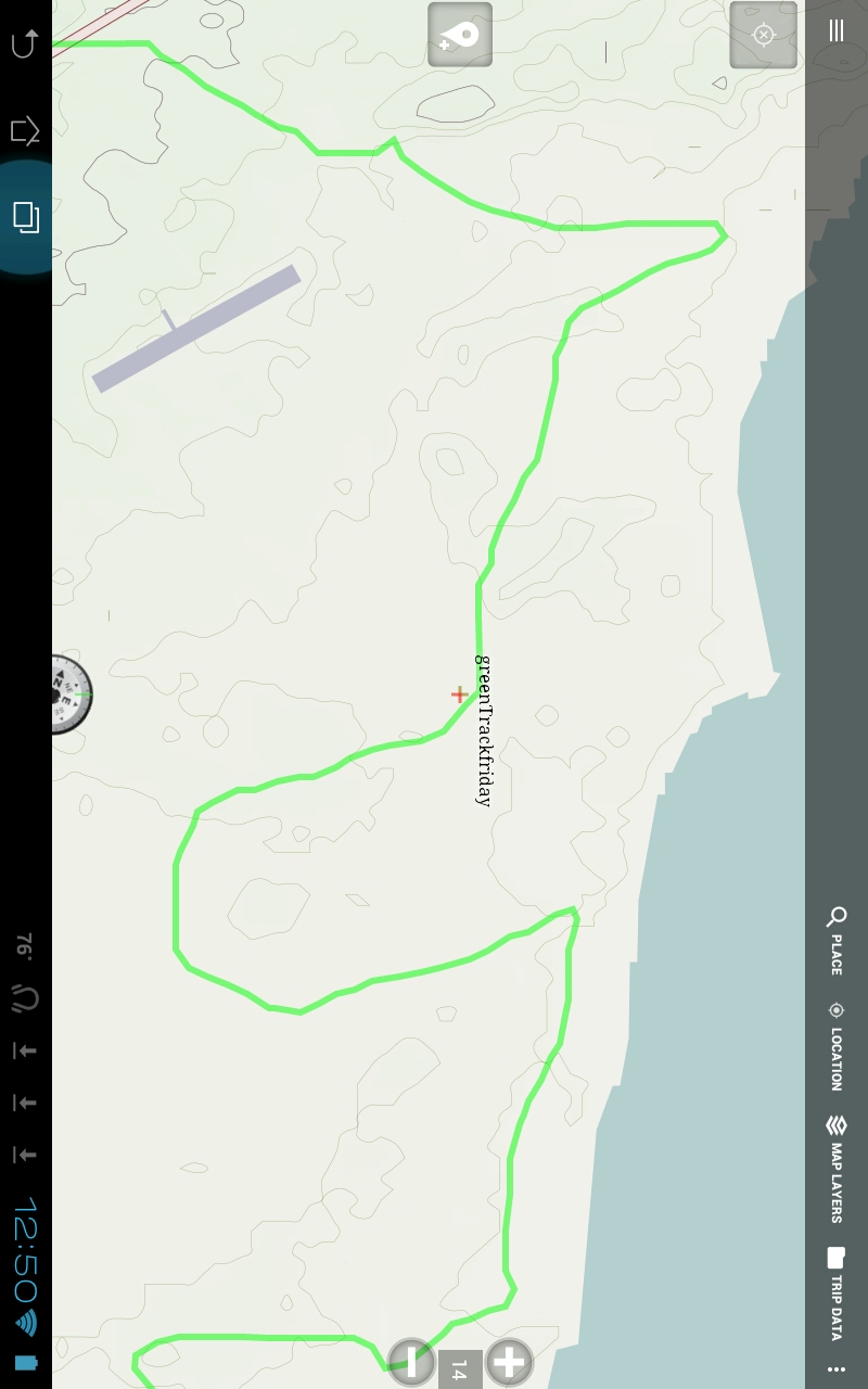
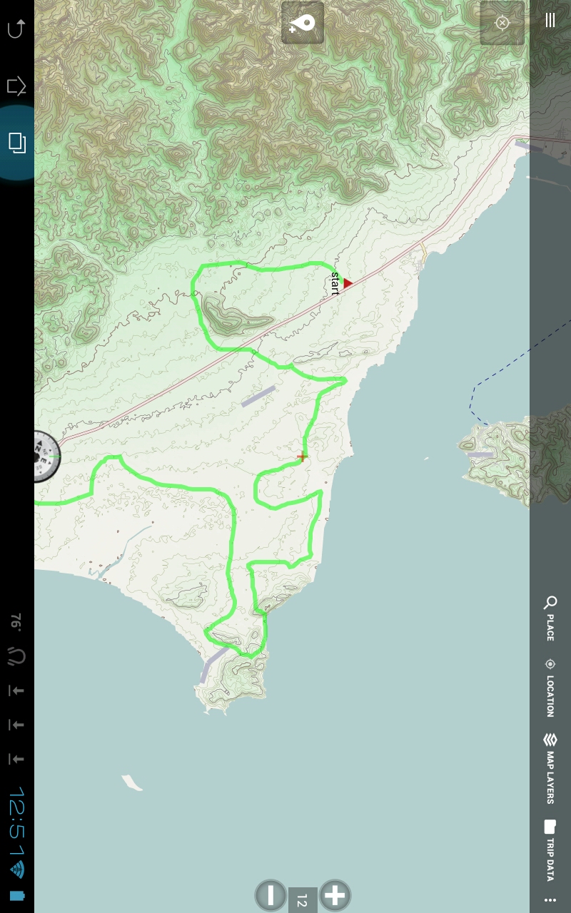
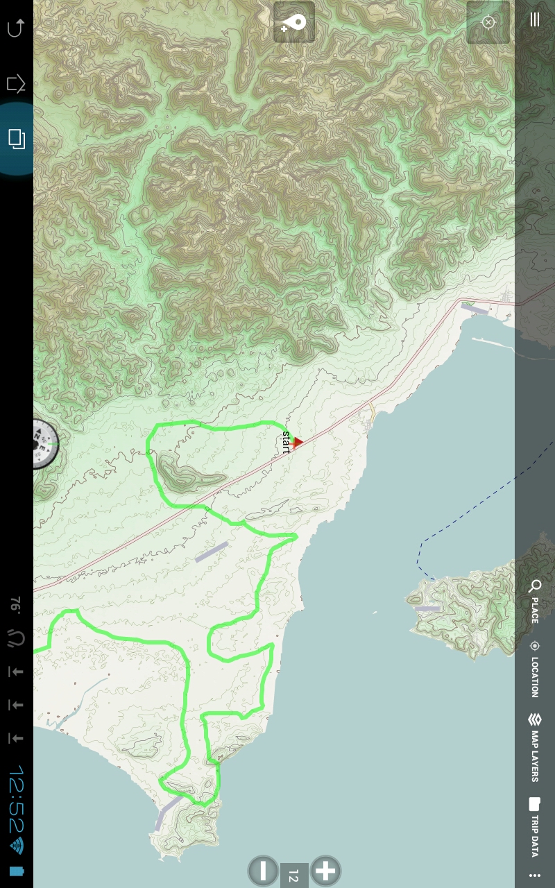
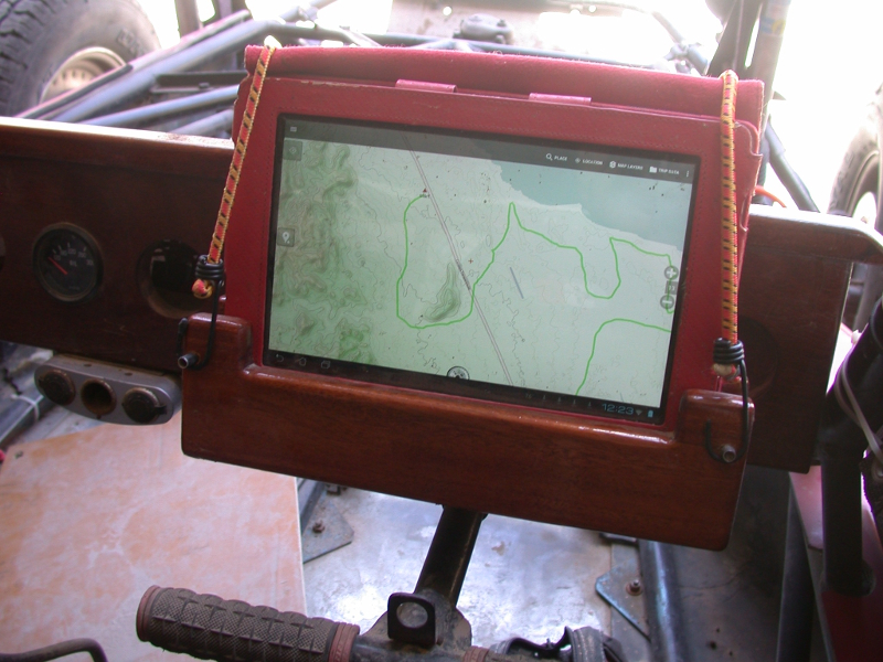
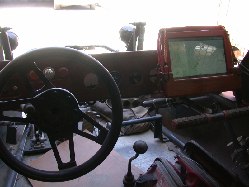
pics below, screenshots rotated to get larger image here
Al, that is the one Russ is using also. The E32
The Garmin and Lowrance are out of my price range. and the Garmin is too small for me to see when driving with my head bouncing around.
Here is what I have learned from 2 days testing. I will give it a full test pre running on Sunday. Not trying to convince anyone to use a tablet, just
sharing info.
A gps tablet solution using Back Country Navigation Pro, BCN, seems to be as good as the E32 as far as I can tell from 2 days testing. the E32 does
show a bit more detail, zoomed to max.
A tablet also has more functions and other uses, for me.
using these apps...............
Back Country Nav Pro
Open Cycle Maps
RealtimeTracker messages powered by greenalp.com
Ulysse Speedo
Pros
large screen, easy to see when driving, if no glare. easy for co driver to see and use
setting a way pt by just touching the screen
send location and text to friends or to pre determned emergency contacts via SMS or email
built in camera and video cam controlled from BCN or normal way,
can take pics and video at waypoints, easy to co ordinate
i have it, nothing to buy and apps are dirt cheap
records times and speeds, highest, average, total etc
exports a google earth video of track, if wanted, pretty cool
easy export from GE to gps tracking on BCN, got kml import to work, no need to convert to gpx
png and photos can be used below the track, not sure on this, read about it, but not tested. This would be cool for a small selected area, not for
racing, just exploring.
import track to GE for detail view, also could track using GE, but it is slow
easy screen shots, store and view on tablet drive
easy cloud storage, ie dropbox, of gpx, km, pics etc of trip to
bounce between tablet and pc
controls and live viewing of pov action cams
gpx and kml from dropbox auto opens in BCN
google earth readily online or from stored images on tablet
entertainment, from stored music and video, plus all the things on the tablet. Everything needed in one unit,
Cons
touch screen hard to use when racing, but really just need to see the track , not menus
glare
hard to dust proof when set up for racing, non racing just stick it a backpack
shock proof mounting not tested. unsure if tablet will with stand racing. Normally, I carry it packed and protected
only 4 hours of battery time, need to carry charger or power pac when used for exploring. Plug into cig lighter recep for long races
using dropbox for uncompressed pics
|
|
|
carlosg
Senior Nomad
  
Posts: 504
Registered: 5-28-2012
Location: chula vista, ca
Member Is Offline
Mood: Just like in Baja: No Bad Days...
|
|
Quote: Originally posted by willyAirstream  | Thanks LaTij..
We are doing the same thing, great 
I have BCN pro and so far, open cycle is the best out there. I was hoping calTopo had something, but it is mostly usa. How is your tablet holding up?
I have used mine for several trips to the Pacific side, but this will be the first time using it in a race. I built a mount with shocks for it but
need to find a way to keep the dust out. So far, blue taping the ports and panels is
my only solution.
Btw, i am using Ulysse speedo for speedometer and timing and using My Tracks as a back up tracker, recommend both. |
You may want to look into these protective cases, I have used the SEIDO for a couple of years to protect my Samsung S4 phone and it really works
great, I use my phone as an underwater camera when camping in Baja:
http://www.seidioonline.com/default.asp
http://www.lifeproof.com/en/?path=TopNav-Logo
It keeps the dust and beach sand out as well, I don't know how good it would perform under the stress of such a bumpy ride as in a Baja race....
|
|
|
willyAirstream
Super Nomad
   
Posts: 1786
Registered: 1-1-2010
Member Is Offline
|
|
Thanks for the links. That is what I need.
I will have to order something.
Being the segunda under the bridge won't have them for the race, fingers crossed that the blue tape works. 
|
|
|
Russ
Elite Nomad
     
Posts: 6742
Registered: 7-4-2004
Location: Punta Chivato
Member Is Offline
|
|
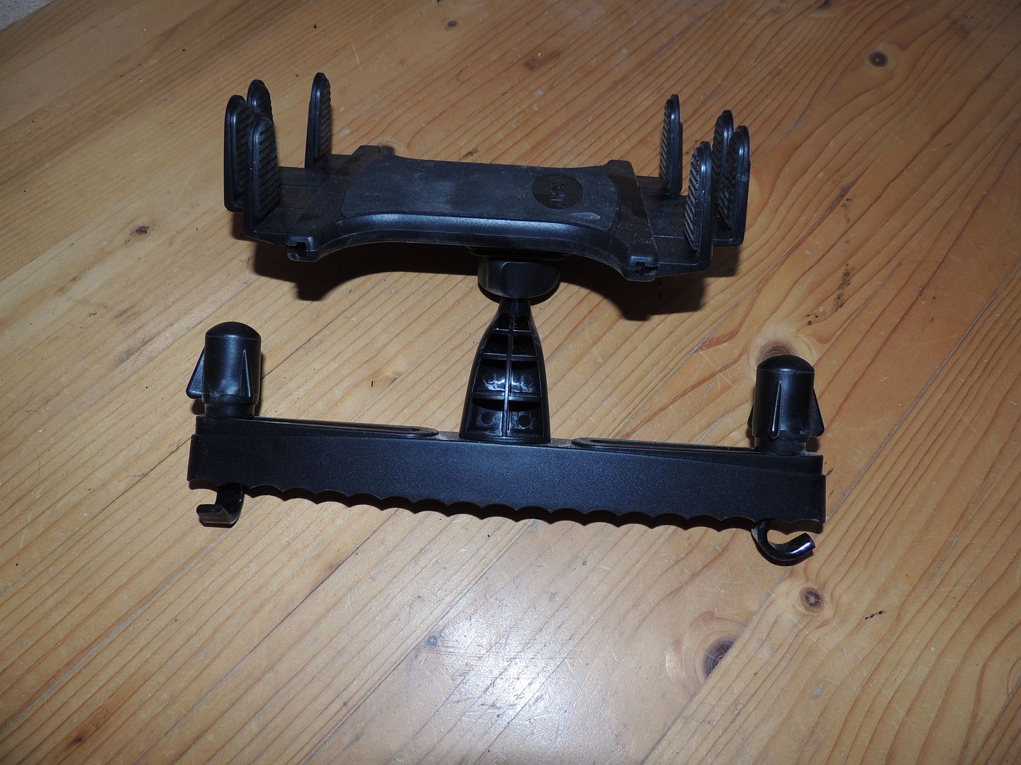
I have this I'll trade for 2 qts of oil. 
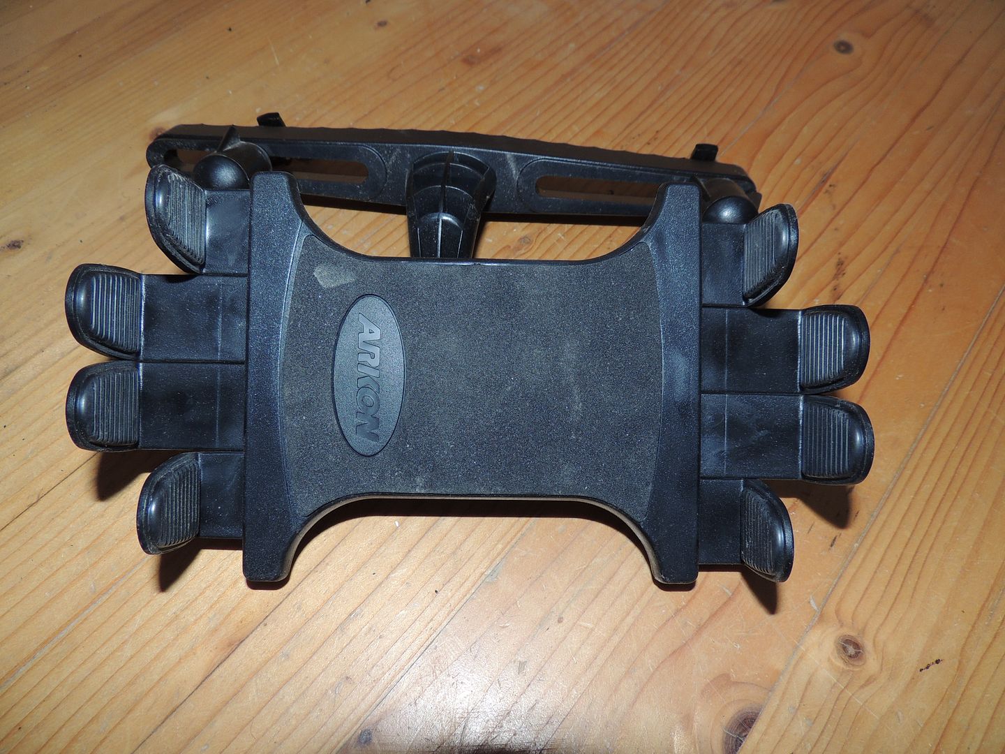
Bahia Concepcion where life starts...given a chance!
|
|
|
willyAirstream
Super Nomad
   
Posts: 1786
Registered: 1-1-2010
Member Is Offline
|
|
Deal!! That means I now owe you 7 quarts plus 4 years interest in Pacificos    :embarrassed: :embarrassed:
Will a 10'' wide x 7.5'' tablet fit in there? I couldn't find that model on the Arkon site.
|
|
|
Russ
Elite Nomad
     
Posts: 6742
Registered: 7-4-2004
Location: Punta Chivato
Member Is Offline
|
|
It spins around so you can lock it in any position so it should work. I think it was made for a seat head rest like this
( http://guide.alibaba.com/shop/car-back-seat-headrest-mount-h... )
but good old Mexican ingenuity should work for a mounting platform.
Forget the oil it's just taking up space here.
Bahia Concepcion where life starts...given a chance!
|
|
|
willyAirstream
Super Nomad
   
Posts: 1786
Registered: 1-1-2010
Member Is Offline
|
|
It is perfect and will mount to the dash easily and I can make it removable..
Pre running on Sunday, mananà, I will try to stop by.
|
|
|
Russ
Elite Nomad
     
Posts: 6742
Registered: 7-4-2004
Location: Punta Chivato
Member Is Offline
|
|
I may be gone from 10 to noon but I'll leave it on the patio. I hope it's strong enough
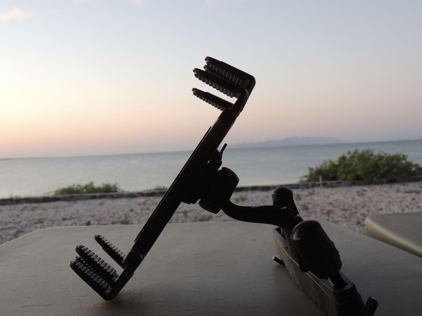
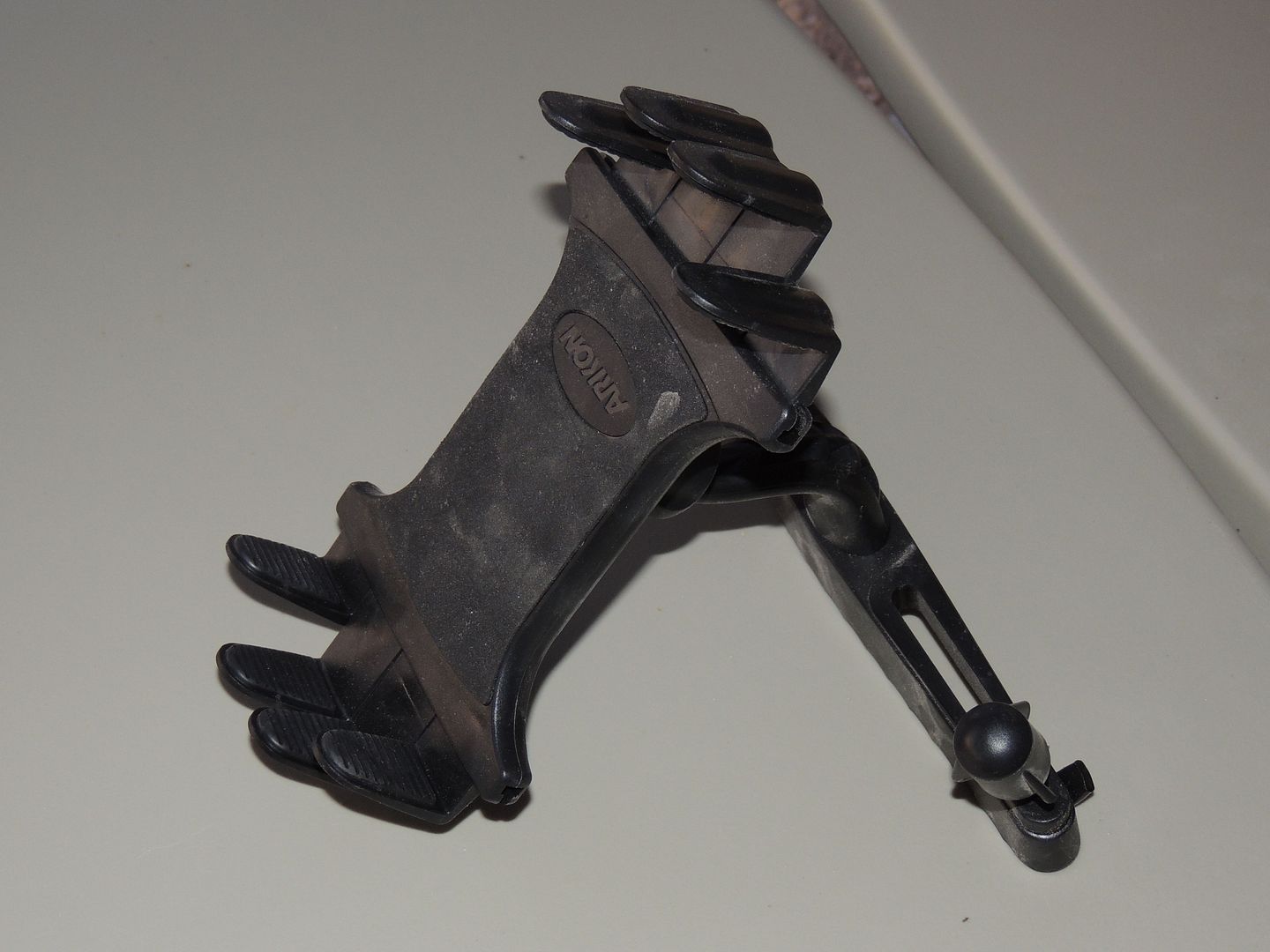
[Edited on 5-9-2015 by Russ]
Bahia Concepcion where life starts...given a chance!
|
|
|
| Pages:
1
2 |

