| Pages:
1
2 |
güéribo
Nomad
 
Posts: 239
Registered: 10-17-2014
Member Is Offline
|
|
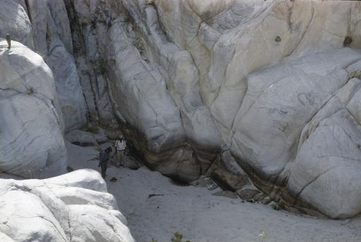
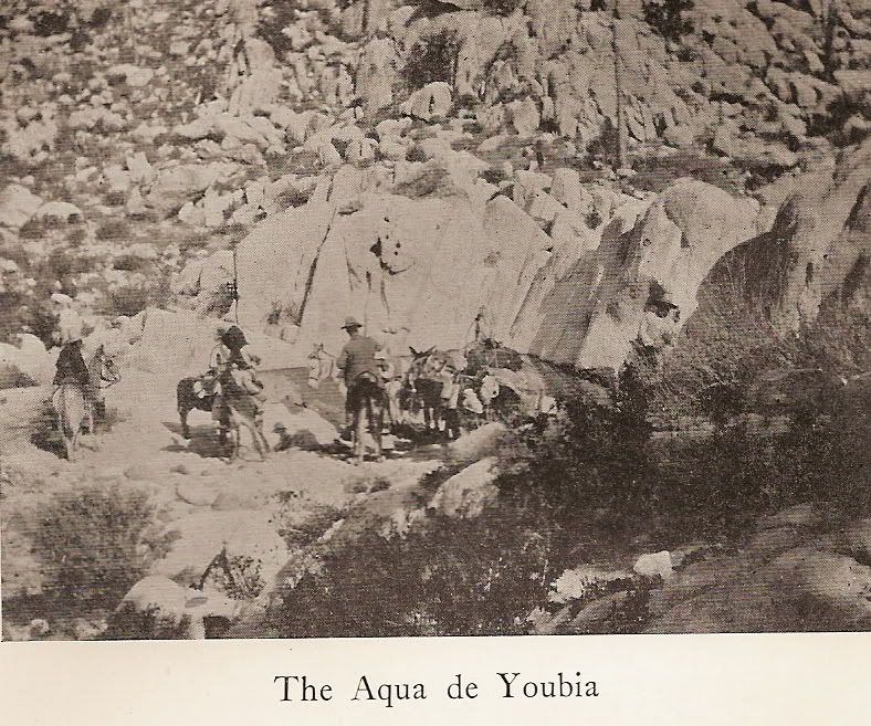
Tinaja de Yubay - Howard Gulick 1961
|
|
|
David K
Honored Nomad
        
Posts: 65408
Registered: 8-30-2002
Location: San Diego County
Member Is Offline
Mood: Have Baja Fever
|
|
A dry year! If you need water, begin digging in the sand... That's how coyotes do it!
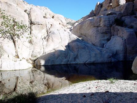
In Feb., 2003.. Neal Johns and Marian found Yubay VERY wet:
In July, 2001... this is how I found Yubay... low, but not dry:
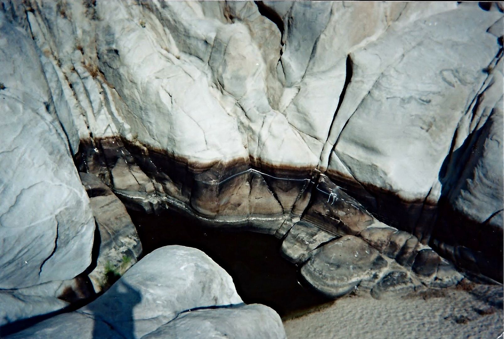
I took photo from about the same place as Howard Gulick did 40 years earlier.
[Edited on 6-25-2015 by David K]
|
|
|
güéribo
Nomad
 
Posts: 239
Registered: 10-17-2014
Member Is Offline
|
|
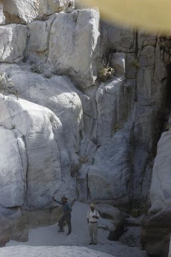
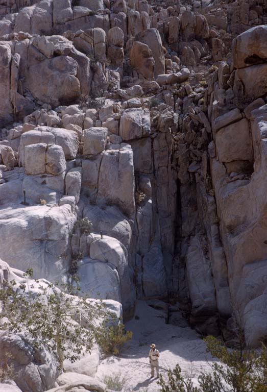
A second Gulick photo:
|
|
|
güéribo
Nomad
 
Posts: 239
Registered: 10-17-2014
Member Is Offline
|
|
Love this place.
|
|
|
David K
Honored Nomad
        
Posts: 65408
Registered: 8-30-2002
Location: San Diego County
Member Is Offline
Mood: Have Baja Fever
|
|
Anywhere in Baja that people (Indians, Spanish soldiers, missionaries, prospectors and travelers) have been to the past hundreds of years has a
magic-like feeling to me. Perhaps why I like visiting the missions and El Camino Real so much?
|
|
|
güéribo
Nomad
 
Posts: 239
Registered: 10-17-2014
Member Is Offline
|
|
This is also where I got a big cholla ball stuck in my heel!
|
|
|
David K
Honored Nomad
        
Posts: 65408
Registered: 8-30-2002
Location: San Diego County
Member Is Offline
Mood: Have Baja Fever
|
|
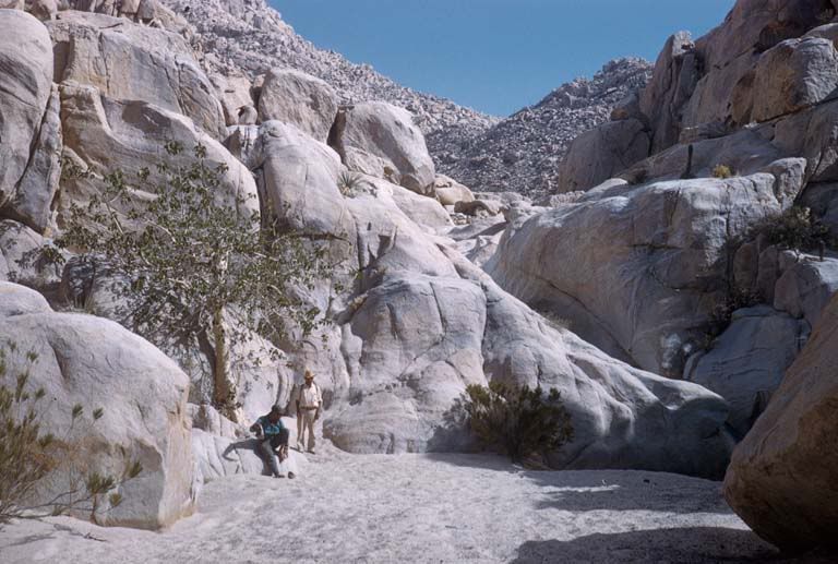
Another Gulick photo at Yubay, showing the fig tree there...
From Harry Crosby, at Yubay... (in the 1974 book 'The King's Highway in Baja California')...
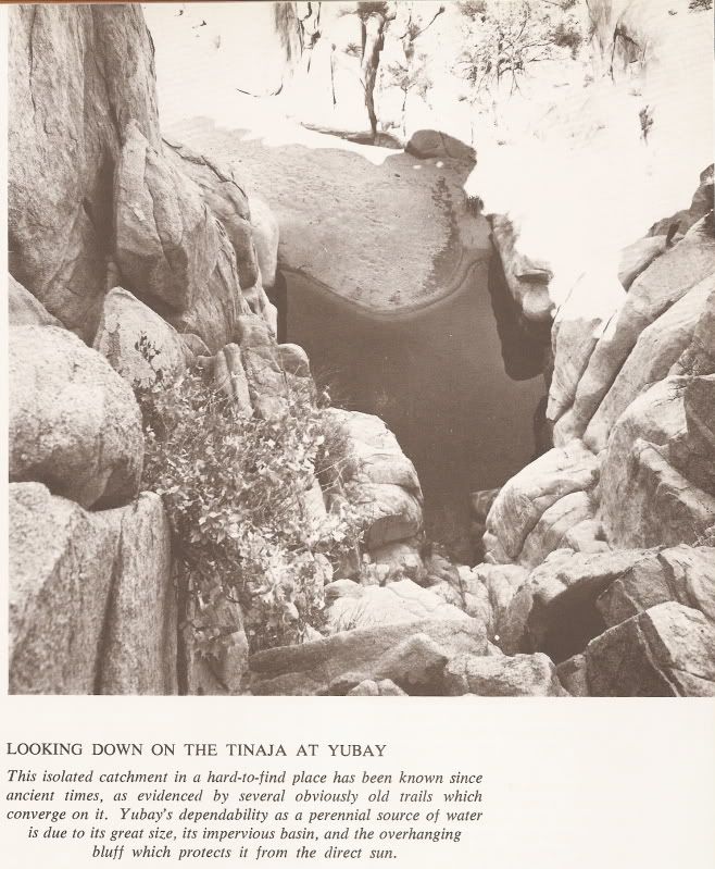
From Arthur North, in 1906...
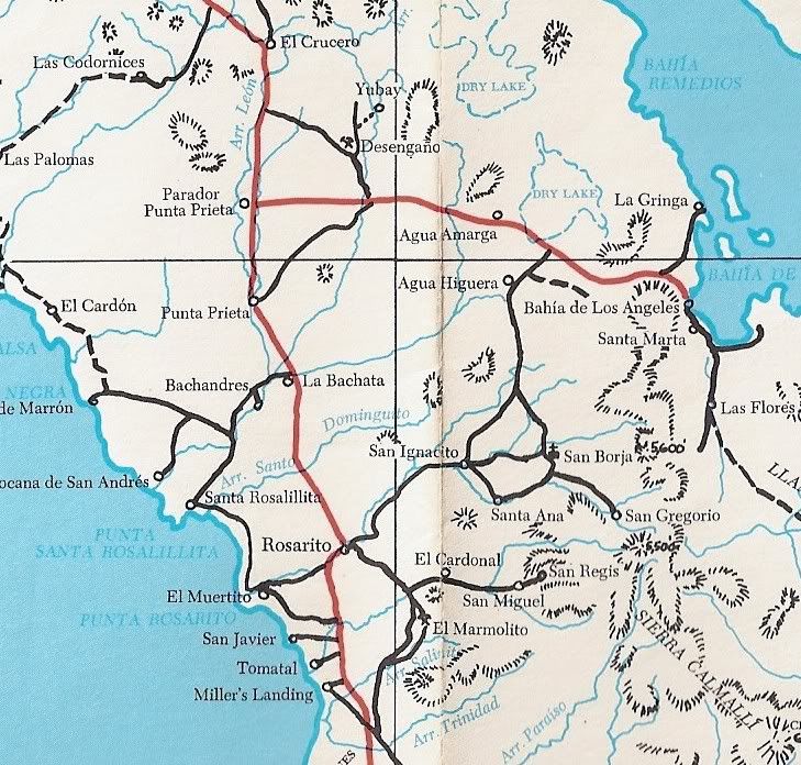
Where it is (north of the L.A. Bay hwy., about 7 miles east of Hwy. 1, then north)...
|
|
|
güéribo
Nomad
 
Posts: 239
Registered: 10-17-2014
Member Is Offline
|
|
Love it.
|
|
|
BooJumMan
Senior Nomad
  
Posts: 929
Registered: 8-11-2007
Location: San Diego
Member Is Offline
|
|
Which map is that DK?
|
|
|
David K
Honored Nomad
        
Posts: 65408
Registered: 8-30-2002
Location: San Diego County
Member Is Offline
Mood: Have Baja Fever
|
|
That is from the 1975 Baja California Guidebook by Walt Wheelock and Howard Gulick. It is the revised (and renamed) guide following the completion of
Hwy. 1 and other changes since the previous edition of the Lower California Guidebook (1967/1970).
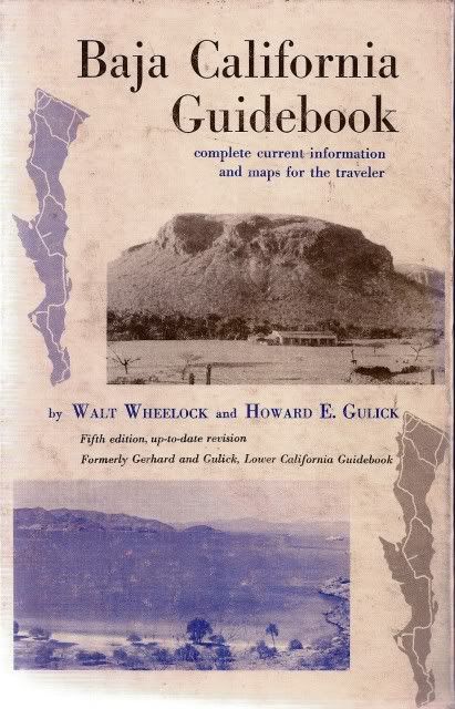
It had a pocket in the back with three folded maps to cover the peninsula.
|
|
|
chuckie
Elite Nomad
     
Posts: 6082
Registered: 2-20-2012
Location: Kansas Prairies
Member Is Offline
Mood: Weary
|
|
I have it...
|
|
|
David K
Honored Nomad
        
Posts: 65408
Registered: 8-30-2002
Location: San Diego County
Member Is Offline
Mood: Have Baja Fever
|
|
Fun historic places to visit in Baja.
|
|
|
4x4abc
Ultra Nomad
    
Posts: 4454
Registered: 4-24-2009
Location: La Paz, BCS
Member Is Offline
Mood: happy - always
|
|
got an accurate lat/long?
Harald Pietschmann
|
|
|
David K
Honored Nomad
        
Posts: 65408
Registered: 8-30-2002
Location: San Diego County
Member Is Offline
Mood: Have Baja Fever
|
|
Yes, you can see it on Google Earth too... N29°10.69', W113°59.26'
|
|
|
David K
Honored Nomad
        
Posts: 65408
Registered: 8-30-2002
Location: San Diego County
Member Is Offline
Mood: Have Baja Fever
|
|
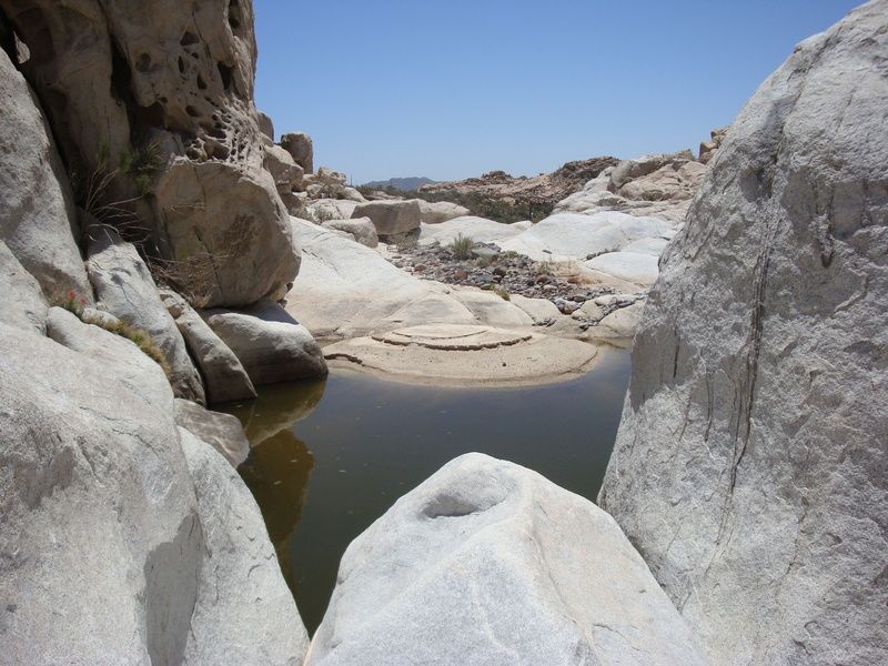
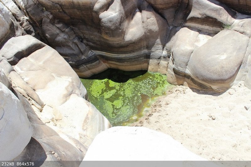
Anybody have recent photos at the historic water hole?
|
|
|
Fatboy
Senior Nomad
  
Posts: 805
Registered: 6-28-2005
Member Is Offline
|
|
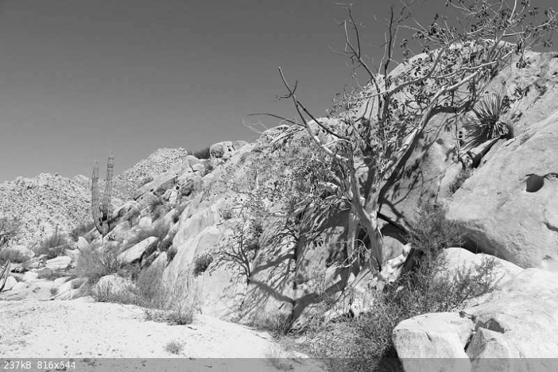
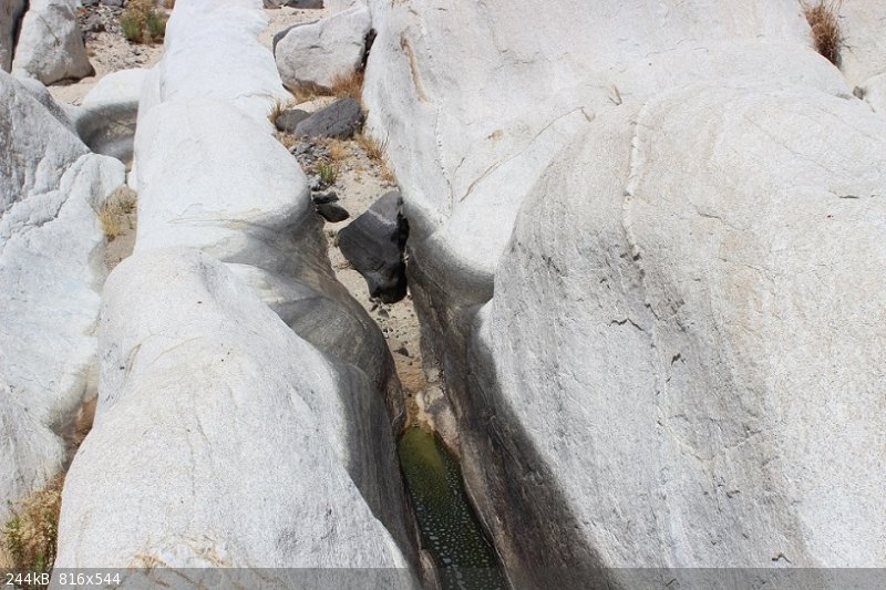
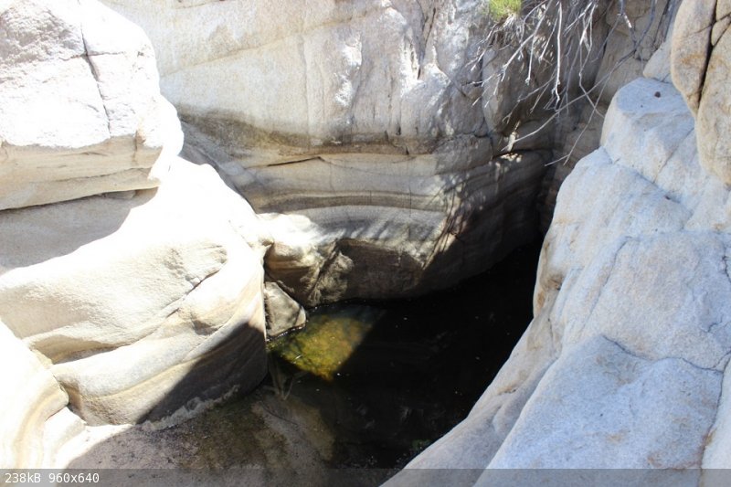
May of 2016....
|
|
|
Fatboy
Senior Nomad
  
Posts: 805
Registered: 6-28-2005
Member Is Offline
|
|
I believe this is the Fig tree?
|
|
|
Fatboy
Senior Nomad
  
Posts: 805
Registered: 6-28-2005
Member Is Offline
|
|
Two water holes further upstream ... all of these were in May of 2016...
|
|
|
David K
Honored Nomad
        
Posts: 65408
Registered: 8-30-2002
Location: San Diego County
Member Is Offline
Mood: Have Baja Fever
|
|
Awesome, thanks!
|
|
|
Fatboy
Senior Nomad
  
Posts: 805
Registered: 6-28-2005
Member Is Offline
|
|
It was really an amazing visit for me .... reading about it here and there over the years, along with the history of the place - it was worth the many
miles of dirt roads to see.
|
|
|
| Pages:
1
2 |

