| Pages:
1
2
3 |
motoged
Elite Nomad

Posts: 6481
Registered: 7-31-2006
Location: Kamloops, BC
Member Is Offline
Mood: Gettin' Better
|
|
Puerto Gato
A friend has resumed her blog about some Baja exploring.....and, again, I am drawn to the coastline south of Agua Verde....
Is this road still somewhat intact?
I am NOT asking for a ton of maps as I know where it is....just looking for access intel if anyone has any....
Blog: https://ridingaround.wordpress.com/2015/11/10/testing-the-camper/
[Edited on 11-10-2015 by motoged]
Don't believe everything you think....
|
|
|
dtbushpilot
Ultra Nomad
Posts: 3297
Registered: 1-11-2007
Location: Buena Vista BCS
Member Is Offline
Mood: Tranquilo
|
|
We drove in to Timbabichi several years ago, I assume that would be the access road, hard to tell with my Baja Almanac, maybe a different map might
show more detail  . I know that the road south out of Agua Verde is impassable. . I know that the road south out of Agua Verde is impassable.
"Life is tough".....It's even tougher if you're stupid.....
|
|
|
motoged
Elite Nomad
Posts: 6481
Registered: 7-31-2006
Location: Kamloops, BC
Member Is Offline
Mood: Gettin' Better
|
|
David,
I was thinking....would be a good spot to ride into for several days of "stranded on a beach" do nothing time....
Don't believe everything you think....
|
|
|
TMW
Select Nomad
Posts: 10659
Registered: 9-1-2003
Location: Bakersfield, CA
Member Is Offline
|
|
Google Earth shows a road from Timbabichi to Puerto Gato.
When we were there in 2012 I followed Karl north and we stopped at a couple of beach areas the last one may have been P. Gato or maybe not.
|
|
|
motoged
Elite Nomad
Posts: 6481
Registered: 7-31-2006
Location: Kamloops, BC
Member Is Offline
Mood: Gettin' Better
|
|
Thanks, guys....I have Google-earthed it (my first step in any travel planning) but , despite a local friend's saying "If you can see it on Google
Earth, you can ride it !" I do NOT rely on GE being current road conditions.....but it is a very good base upon which to get more accurate info.....
In 2011 some guys from Kamloops rode motos from Santa Rosalia to San Ignacio on a route determined solely on GE....and they made it, much to the
utter dismay of the local rancheros they encountered once out of the maze on the western end of the trip....the "way out" at the crux point of the
ride was to follow the burro poop and tracks....
The next year another group of local A riders followed the track and were convinced it was impossible when in the midst of the track....yet they
persisted and also completed the route..... Ricardo at Rice and Beans was dumbfounded as he had stated for years it was impossible.
But I still like to check in with the Nomads for their collective wisdom, opinions, wit, and kind words for one another. 
Don't believe everything you think....
|
|
|
dtbushpilot
Ultra Nomad
Posts: 3297
Registered: 1-11-2007
Location: Buena Vista BCS
Member Is Offline
Mood: Tranquilo
|
|
Quote: Originally posted by TMW  | Google Earth shows a road from Timbabichi to Puerto Gato.
When we were there in 2012 I followed Karl north and we stopped at a couple of beach areas the last one may have been P. Gato or maybe not.
|
Was that the same year that I went with you? I've slept since then and forgot. I rode in to Agua Verde last year from Constitution, people said the
part that goes down the mountain just before AV was impassable but we were on motos so we went anyway. We made it down but it was really bad, one of
the riders in our group tried to go back up it a week later just to see if he could....he couldn't. He is a young solid rider. Don't think they have
repaired that section yet.
"Life is tough".....It's even tougher if you're stupid.....
|
|
|
motoged
Elite Nomad
Posts: 6481
Registered: 7-31-2006
Location: Kamloops, BC
Member Is Offline
Mood: Gettin' Better
|
|
David,
I didn't know you went down that road to AV....Harald , I thought, tried and said it was impenetrable...(not sure about that)....I have been under the
impression past few years the road was washed out near the bottom just above the arroyo that comes out to the level road between Cosmo (sp?) ranch and
AV....and I saw a sign there two years ago put up by Cosmo Rancho saying "Private- keep out"
My sense is that the Timbabichi road to Puerto Gato might be what I am asking about....cool looking coastline and sandy beach....
Don't believe everything you think....
|
|
|
4x4abc
Ultra Nomad
Posts: 4455
Registered: 4-24-2009
Location: La Paz, BCS
Member Is Offline
Mood: happy - always
|
|
the last time I was able to drive the "back door" road of Agua Verde was in February 2012
https://carlosnpainter.smugmug.com/Travel/Off-Road-Spass/i-r...
in November of the same year, the road was completely gone at the top
https://carlosnpainter.smugmug.com/Travel/Baja-California-No...
both images show the same location on the road
the damage below that first big landslide was not too bad - but the first one was beyond pick and shovel repair (and we have done a lot of that)
Harald Pietschmann
|
|
|
dtbushpilot
Ultra Nomad
Posts: 3297
Registered: 1-11-2007
Location: Buena Vista BCS
Member Is Offline
Mood: Tranquilo
|
|
Unless it has been repaired since last year you won't be driving a 4 wheel vehicle through there. The only reason we were able to go down it was that
we had gravity on our side. A pro level GNCC rider on a 300 KTM could ride back up but that ain't me.
"Life is tough".....It's even tougher if you're stupid.....
|
|
|
motoged
Elite Nomad
Posts: 6481
Registered: 7-31-2006
Location: Kamloops, BC
Member Is Offline
Mood: Gettin' Better
|
|
Damn...I gotta get out there...you guys are having way too much fun....Harald....your Smugmug pics are great....I can't get down until December
2016....but will be down for several months...and may be begging for company down to that area.... getting the "DT's", David 
Don't believe everything you think....
|
|
|
motoged
Elite Nomad
Posts: 6481
Registered: 7-31-2006
Location: Kamloops, BC
Member Is Offline
Mood: Gettin' Better
|
|
David,
I know you are jonesing for a map and really appreciate that you trust nomads to find this location on their own if they really want to.
I think leaving some threads unmapped allows some folks the challenge and pleasure of exploring through their own research 
Don't believe everything you think....
|
|
|
dtbushpilot
Ultra Nomad
Posts: 3297
Registered: 1-11-2007
Location: Buena Vista BCS
Member Is Offline
Mood: Tranquilo
|
|
I will admit that I've been zooming around on Google Earth tonight following trails in the area we are talking about. If I had 14 maps from Padre
times through today of the area in question I might not have bothered.....or maybe I would have. Sorry DK but sometimes maps aren't necessary, offer
to help but let us figure it out on our own if that's what we want to do. 
"Life is tough".....It's even tougher if you're stupid.....
|
|
|
MulegeAL
Nomad
Posts: 299
Registered: 8-25-2009
Location: PDX/Mulege
Member Is Offline
|
|
We rode into Agua Verde last season from the north (after Odile), no problem. Local there told us the road out to the SW was no-go in the canyon
climb, that jives with what I'm reading here. We didn't go look, we ran out of day.
Will put the Timbabichi route on the list for this winter, see how that goes!
Dust, rocks, no water or gas, dead ends; what am I waiting for!
|
|
|
TMW
Select Nomad
Posts: 10659
Registered: 9-1-2003
Location: Bakersfield, CA
Member Is Offline
|
|
Yes dt it was the same trip. On the morning we were leaving Karl wanted to check out a couple of beaches north so my brother and I tagged along then
we met up with everyone back at the hacienda.
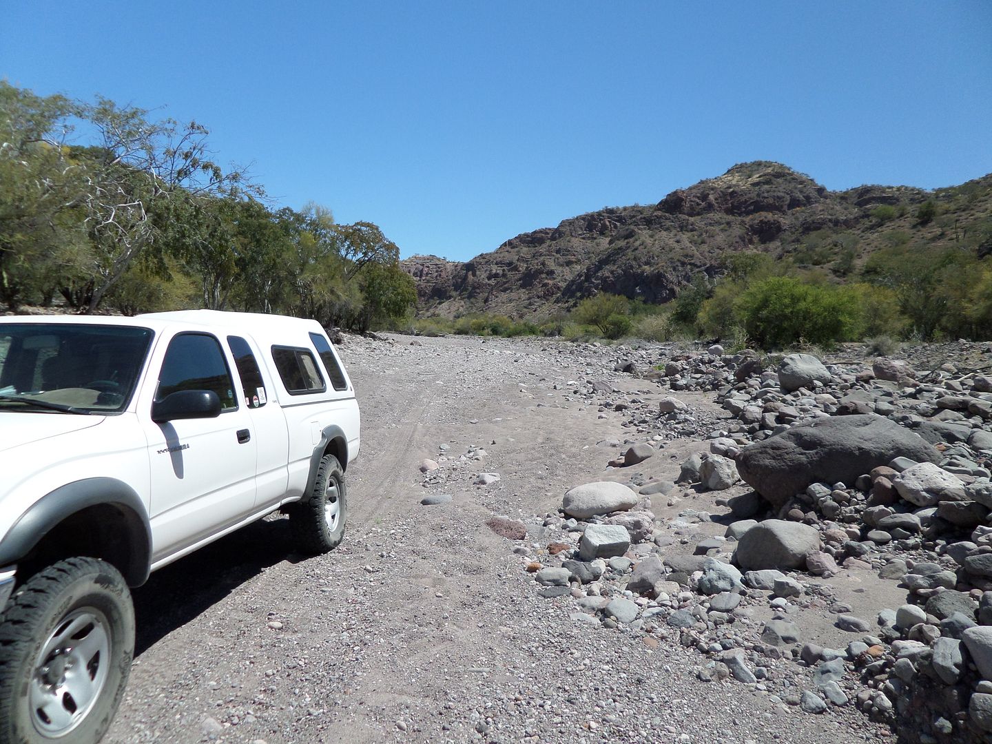
Last April my friend BJ and I went to Agua Verde and down the wash for the trail up the mountain. We didn't make it to where it started uphill. Too
many rocks.


[Edited on 11-11-2015 by TMW]
|
|
|
4x4abc
Ultra Nomad
Posts: 4455
Registered: 4-24-2009
Location: La Paz, BCS
Member Is Offline
Mood: happy - always
|
|
what's the attraction of Puerto Gato?
The name indicates that the padres used it
anything else?
white beach?
great restaurant?
Harald Pietschmann
|
|
|
Jack Swords
Super Nomad
Posts: 1097
Registered: 8-30-2002
Location: Nipomo, CA/La Paz, BCS
Member Is Offline
|
|
Beautiful double coves lined with very large reddish rocks. Don't know if you can drive into Gato, but we have spent time anchored in the north cove.
No restaurants, etc.
|
|
|
motoged
Elite Nomad
Posts: 6481
Registered: 7-31-2006
Location: Kamloops, BC
Member Is Offline
Mood: Gettin' Better
|
|
| Quote: Originally posted by 4x4abc | what's the attraction of Puerto Gato?
The name indicates that the padres used it
anything else?
white beach?
great restaurant? |
Harald,
Just looks like a cool place to hang for a few sleeps.....not much to do except explore the area by foot/moto, sit by a fire at night, enjoy the
ubicacion....
I just have a thing about remote places that have desert and ocean stuff going on.....
You live there and get out into it more than I can, so any trips south include some special trips among the daily mundane activities....judging by
your photos, you get it.
Don't believe everything you think....
|
|
|
Jack Swords
Super Nomad
Posts: 1097
Registered: 8-30-2002
Location: Nipomo, CA/La Paz, BCS
Member Is Offline
|
|
or...simply Google Puerto Gato Baja or Puerto Los Gatos Baja for some fine photos taken at the site.
[Edited on 12-11-2015 by Jack Swords]
|
|
|
motoged
Elite Nomad
Posts: 6481
Registered: 7-31-2006
Location: Kamloops, BC
Member Is Offline
Mood: Gettin' Better
|
|
Thank you , Jack.
David....if someone has time to send you an e-mail, they can Google it themselves and get a map and way more info than your map will offer.
And don't do that "Area 51... I am just helping" thing here, please.
Don't believe everything you think....
|
|
|
ligui
Senior Nomad
Posts: 895
Registered: 2-9-2008
Location: Fraser co.
Member Is Offline
Mood: love Baja !
|
|
I've got the time ... Guess i'll do both .  Thanks for the idea motoged i
would have never been able to think that up for myself . Thanks for the idea motoged i
would have never been able to think that up for myself .
By the way ... thanks for info david
|
|
|
| Pages:
1
2
3 |


