VegasNick
Junior Nomad

Posts: 75
Registered: 4-14-2015
Member Is Offline
|
|
Help me get to the lighthouse! (please)
So I had a "bucket list" item to get to the light house and mine at Bahia Concepcion. I made it to this point on the trail I had been researching and
found a fence: 26.679313, -111.769898
It was late, and trying to be a good trail citizen, I didn't open the gate and drive through. can you guys help me be sure I can be on the right trail
next time?
Thank you!
|
|
|
woody with a view
PITA Nomad
      
Posts: 15940
Registered: 11-8-2004
Location: Looking at the Coronado Islands
Member Is Offline
Mood: Everchangin'
|
|
if a gate is closed but not locked you are expected to leave it in the same condition after you pass thru.
|
|
|
StuckSucks
Super Nomad
   
Posts: 2369
Registered: 10-17-2013
Location: Pacific Plate
Member Is Offline
|
|
Curious to see how this pans out - that's also on my bucket list.
I see a little rancho north of your fence line:
https://goo.gl/maps/BPh9yzGEK2o
|
|
|
TMW
Select Nomad
      
Posts: 10659
Registered: 9-1-2003
Location: Bakersfield, CA
Member Is Offline
|
|
If the gate is not posted with keep out or private property signs and not locked you can go thru but make sure you close it if it was closed when you
got to it.
It would also be good to stop by the ranch and ask them if it's OK to go to the light house. Maybe offer a beer or soda.
On Google Earth the road goes north then west to the coast and follows the coast line to the light house. We went close to the light house about 15
years ago to a really nice sandy beach. There were four sail boats at anchor and a man and wife came over to the beach in a rubber boat to where we
were and chatted for a while. They were from Moro Bay and they quit their jobs and decide to go sailing for a year. Young couple late 20s or early
30s.
|
|
|
David K
Honored Nomad
        
Posts: 65422
Registered: 8-30-2002
Location: San Diego County
Member Is Offline
Mood: Have Baja Fever
|
|
Posted a couple years ago...
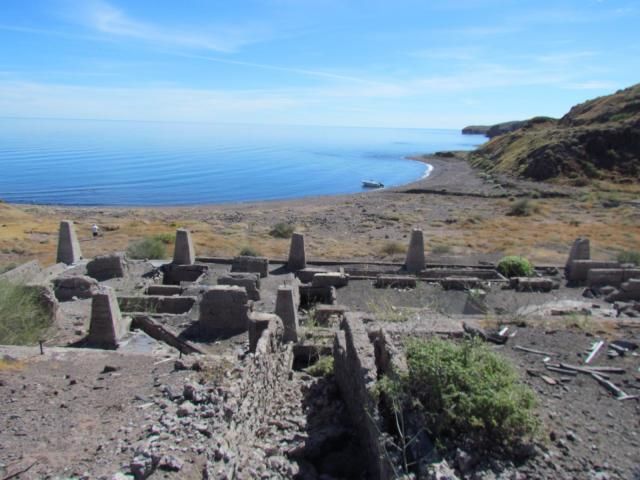
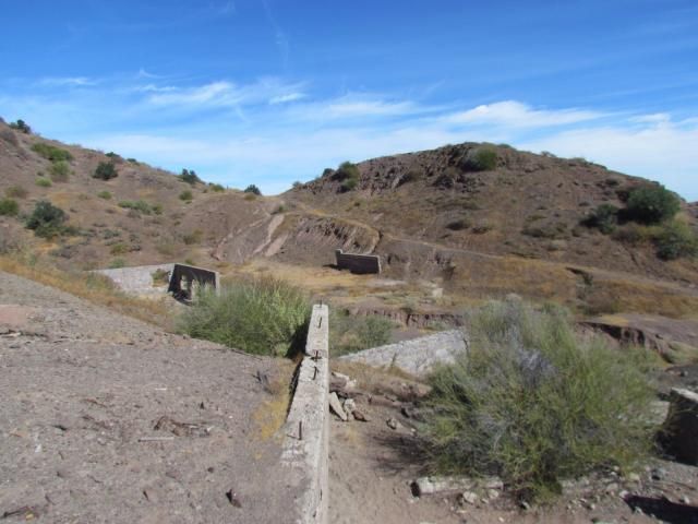
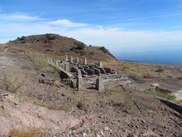
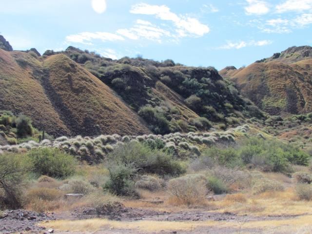
Quote: Originally posted by CarlosAK  | Being a newbie I wanted to learn how to properly post pics to the site. Using David K's instructions and working off my Ipad here are a few pics I
took out at the old Conception Mine last winter. Thank you David K
 |
From Pompano, with map pointing it out and photos from the sea: http://forums.bajanomad.com/viewthread.php?tid=71228
More...
| Quote: | Originally posted by rockman
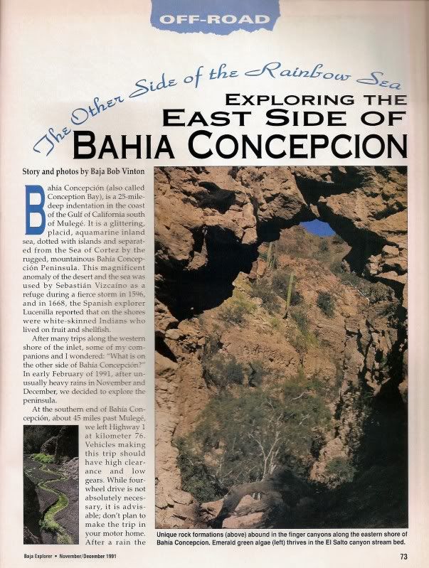
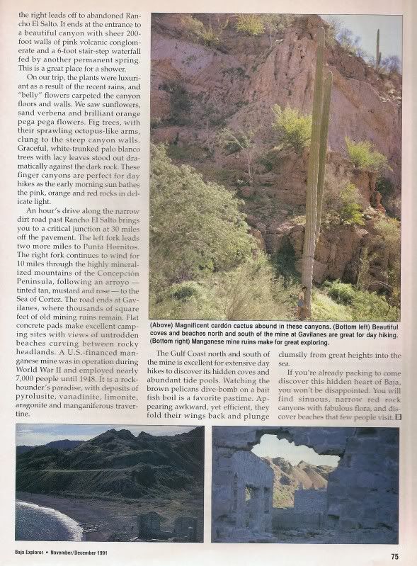
There are several references to the Gavilan mine which produced manganese (not magnesium) for the US war effort during WWII. At that time, more than
6,000 people worked at the mine. It was operated by a Mexican subsidiary of the Homestake Mining Co. Lessened post-war demand diminished the
output, and the mine closed when a hurricane devistated much of the infrastucture in 1946. Although many of the foundations and concrete floors still
survive, all of the equipment was salvaged and moved to other operations. The ore consisted of veins of pyrolusite, traces of which can still be
picked up. There are great campsites, but the drive from the west side of the peninsula to the east can be quite challenging. High clearance is
mandatory.
Best References:
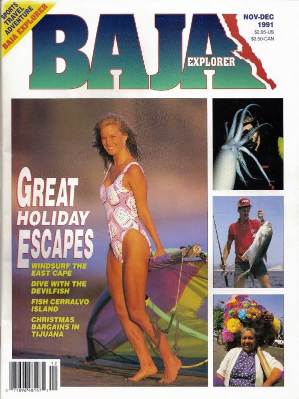
Baja Explorer magazine (Later called Baja Life), Nov-Dec, 1991. Article by Bob Vinton.
Manganese on Punta Concepcion, by James Noble, Calif Inst of Tech, in Economic Geology, v45#8, Dec, 1950. |
Here is the magazine cover, followed by the 4 pages of the article by Baja Bob (Bicycle Bob) Vinton!


[Edited on 4-4-2016 by David K]
|
|
|
David K
Honored Nomad
        
Posts: 65422
Registered: 8-30-2002
Location: San Diego County
Member Is Offline
Mood: Have Baja Fever
|
|
Want to see more of this mine?
Search "manganese" here on Nomad.
|
|
|
VegasNick
Junior Nomad

Posts: 75
Registered: 4-14-2015
Member Is Offline
|
|
WOW! Thanks guys!! LOTS of help!
|
|
|
fourninerpapa
Junior Nomad

Posts: 40
Registered: 11-2-2008
Member Is Offline
|
|
We made the trip to the mine last month. The road beyond Rancho El Salto is very overgrown with brush. If you are traveling in anything other than a
quad or motorcycle you can expect lots of "baja pin stripes" We did not find the road to the lighthouse. I suspect you would have to travel along the
beach at low tide.
Three rigs made the trip. We had a Jeep, Geo Tracker and a full size Chevrolet van. The van had a 4x4 conversion and it got the worst of the
scratches.
|
|
|
Bob and Susan
Elite Nomad
     
Posts: 8813
Registered: 8-20-2003
Location: Mulege BCS on the BAY
Member Is Offline
Mood: Full Time Residents
|
|
what did bajapattys house look like?
did you take any pictures
|
|
|
KurtG
Super Nomad
   
Posts: 1211
Registered: 1-27-2004
Location: California Central Coast
Member Is Offline
Mood: Press On Regardless!!
|
|
Last time I was there several years ago there was nothing left of the house but the slab.
|
|
|

