David K
Honored Nomad
        
Posts: 65392
Registered: 8-30-2002
Location: San Diego County
Member Is Offline
Mood: Have Baja Fever
|
|
Ensenada Street Maps
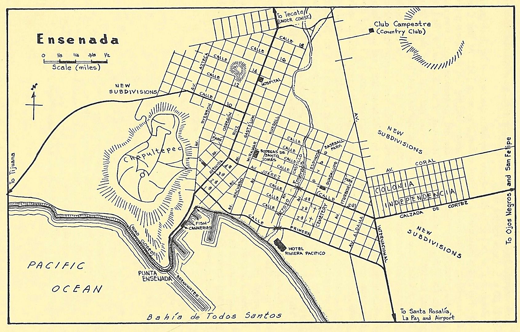
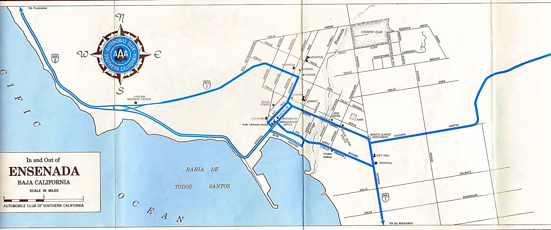
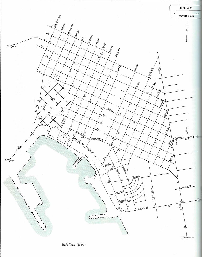
I received a request for old Ensenada street maps.
1956 Lower California Guidebook:

1974 Auto Club:

1987 Baja Adventure Book:

|
|
|
Udo
Elite Nomad
     
Posts: 6364
Registered: 4-26-2008
Location: Black Hills, SD/Ensenada/San Felipe
Member Is Offline
Mood: TEQUILA!
|
|
That last one does the trick, DK.
But any GPS that handles Mexico roads will give you all the streets for many blocks as you drive the area. I have a Garmin in every vehicle now. Yes,
my vehicles came with GPS installed in them but once past the border, Mexico disappears. The factory upgrades to include the Mexico streets are
$300-$500 USD, and it was cheaper to buy a Garmin for about $75.00 USD.
BTW...the Garmins also show the dirt roads.
Udo
Youth is wasted on the young!
|
|
|
David K
Honored Nomad
        
Posts: 65392
Registered: 8-30-2002
Location: San Diego County
Member Is Offline
Mood: Have Baja Fever
|
|
Quote: Originally posted by Udo  | That last one does the trick, DK.
But any GPS that handles Mexico roads will give you all the streets for many blocks as you drive the area. I have a Garmin in every vehicle now. Yes,
my vehicles came with GPS installed in them but once past the border, Mexico disappears. The factory upgrades to include the Mexico streets are
$300-$500 USD, and it was cheaper to buy a Garmin for about $75.00 USD.
BTW...the Garmins also show the dirt roads.
|
Hi Udo, this thread was a request by a new Nomad that sent me a u2u and who was interested in seeing old Ensenada city maps and maybe the growth to
today? I think Google Maps and other programs show the city as it is now if one needs a map for driving assistance?
|
|
|
BajaTed
Senior Nomad
  
Posts: 859
Registered: 5-2-2010
Location: Bajamar
Member Is Offline
|
|
I liked the note for the coast road to the docks (road closed), the boulders from that hillside were as big as two story house.
Always terrified of those rocks as a kid
Es Todo Bueno
|
|
|
David K
Honored Nomad
        
Posts: 65392
Registered: 8-30-2002
Location: San Diego County
Member Is Offline
Mood: Have Baja Fever
|
|
You also can see the Hotel Riviera Pacifico was on the waterfront back then. I think the Bahía Hotel was also on the beach before the harbor project,
landfills, etc.
|
|
|
AlanDavid90
Junior Nomad

Posts: 28
Registered: 11-12-2017
Member Is Offline
|
|
Thank you David K for posting the Ensenada's Street Maps, How my city has changed seen through the maps
|
|
|

