bajamary1952
Nomad
 
Posts: 204
Registered: 9-29-2016
Location: Ensenada
Member Is Offline
|
|
Arroyo Amargo Campground
Anyone have experience or know anything about this campground which is on Google near La Lobera north of El Rosario? Couldn't find anything on web in
English or Spanish. Thanks!
|
|
|
David K
Honored Nomad
        
Posts: 65422
Registered: 8-30-2002
Location: San Diego County
Member Is Offline
Mood: Have Baja Fever
|
|
Where are you looking?
I just went on Google Earth and Google Maps and I see La Lobera but no Arroyo Amargo or campground listed nearby?
There was camping at La Lobera before the project closed up in 2015. There is also open camping at La Bocana, west of El Rosario.
|
|
|
KurtG
Super Nomad
   
Posts: 1211
Registered: 1-27-2004
Location: California Central Coast
Member Is Offline
Mood: Press On Regardless!!
|
|
Quote: Originally posted by David K  | Where are you looking?
I just went on Google Earth and Google Maps and I see La Lobera but no Arroyo Amargo or campground listed nearby?
There was camping at La Lobera before the project closed up in 2015. There is also open camping at La Bocana, west of El Rosario.
|
Here it is, looks like a new camp. South of Arroyo Hondo. https://www.google.com/maps/@30.1982508,-115.7938178,637m/da...
|
|
|
carlosg
Senior Nomad
  
Posts: 504
Registered: 5-28-2012
Location: chula vista, ca
Member Is Offline
Mood: Just like in Baja: No Bad Days...
|
|
https://www.google.com/maps/place/arroyo+amargo,+Ensenada,+B...
|
|
|
David K
Honored Nomad
        
Posts: 65422
Registered: 8-30-2002
Location: San Diego County
Member Is Offline
Mood: Have Baja Fever
|
|
Thanks... not so close to La Lobera after all... On street view, this is near Km 39. La Lobera road is at Km 47.5.
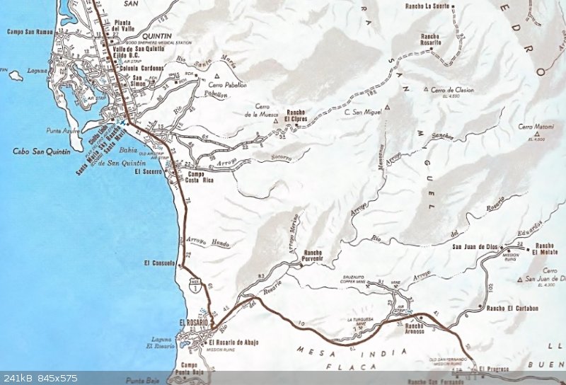
In the old days before Hwy. 1 and not long after was a place called El Consuelo. It was about where the road to El Rosario swings away from the coast
to head up the mesa. Today it is the road you take to get to the giant sand dune that Cameron likes to take his Trail or Missions tour group to, and
you see it on his TV shows.
See El Consuelo, north of El Rosario, on this 1973 auto club map? Hwy. 1 pavement ended near the Mission San Fernando/El Progreso road (KM 118/121) in
mid-1973.

|
|
|
mcnut
Nomad
 
Posts: 177
Registered: 12-9-2013
Location: Dammeron Valley, UT
Member Is Offline
|
|
Looking at Google Earth (2010 img) and Bing (img date? but better of the two) show nothing so perhaps fairly new. I did see a POI in Google for the
place, it will be great to hear a report of what exactly is there.
Bruce
|
|
|
David K
Honored Nomad
        
Posts: 65422
Registered: 8-30-2002
Location: San Diego County
Member Is Offline
Mood: Have Baja Fever
|
|
Calling BajaMary1952 
Did you see a campground or just a Google maps listing?
|
|
|

