| Pages:
1
2
3 |
brumsky
Junior Nomad

Posts: 32
Registered: 1-18-2019
Member Is Offline
|
|
Single track near Catavina
Heading down to explore area around Catavina in April. Does anyone have any single track routes they recommend? I have done the rock trail, but not
much else around there.
Also any advice on places to stay in the area. Wanted to check out the Punta San Carlos area as well.
I have a bunch of single track routes of some other areas in baja I would be happy to offer up to anyone who likes. Bay of LA, Gonzaga, 22-day trail,
tractor trail, Rock trail, RSV, and some really nice stuff near El Coyote.
|
|
|
motoged
Elite Nomad
     
Posts: 6481
Registered: 7-31-2006
Location: Kamloops, BC
Member Is Offline
Mood: Gettin' Better
|
|
Try the trail to Santa Maria mission that heads east out of Santa Inez....a nice day trip in and out.
lotsa stuff to explore westerly from Catavina hotel....
Don't believe everything you think....
|
|
|
fishbuck
Banned
Posts: 5318
Registered: 8-31-2006
Member Is Offline
|
|
You guys are geniuses!
I'm going single track riding in Catavina.
I better get to my storage and start wrenching on the Honda.
"A ship in harbor is safe, but that is not what ships are built for." J. A. Shedd.
A clever person solves a problem. A wise person avoids it. – Albert Einstein
"Life's a Beach... and then you Fly!" Fishbuck
|
|
|
Jinete Viejo
Junior Nomad

Posts: 88
Registered: 1-23-2017
Member Is Offline
|
|
Check your U2U Brumsky.
|
|
|
JZ
Select Nomad
      
Posts: 13942
Registered: 10-3-2003
Member Is Online
|
|
Post them here. You can upload kmz and gpx files right into the message.
[Edited on 1-19-2019 by JZ]
|
|
|
advrider
Super Nomad
   
Posts: 1920
Registered: 10-2-2015
Member Is Offline
|
|
The ride out to the old mission is good but rocky, not suere I would go solo! There are some big climbs coming back out. I have some tracks but you
might have most of them already? Cactus, 22 day trail, window rock and one that runs out to Solo sports at punta San Carlos. Might have a few others?
|
|
|
JZ
Select Nomad
      
Posts: 13942
Registered: 10-3-2003
Member Is Online
|
|
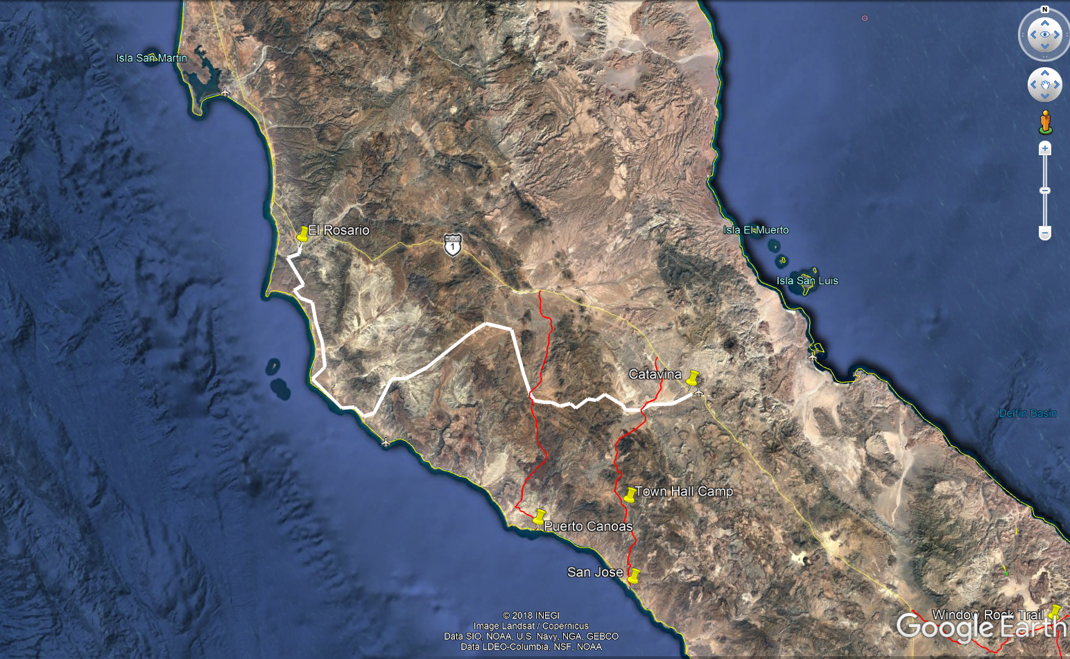
How much of the 22 day trail is single track?
|
|
|
basautter
Senior Nomad
  
Posts: 862
Registered: 7-1-2013
Member Is Offline
|
|
The Bill Nichols trail goes from Catavina to EL Rosario, and is my Baja favorite. Kasey Smith (Lizard Lady) published the track (and more) in one of
her books. THe books are pricey, but worth it if you don't already know Baja single track.
http://www.bajagpsguide.com/index.php?option=com_frontpage&a...
|
|
|
advrider
Super Nomad
   
Posts: 1920
Registered: 10-2-2015
Member Is Offline
|
|
JZ, the first half of that is two track, the second is the single track and is awesome. The single track starts at some really cool mud hills, but be
aware that one section has a locked gate you have to back track if you don't have the work around (you have it).We rode it last year and ended up in
the dark the last two hours into Catavina! Hope to do all of it in the day light this year.
|
|
|
motoged
Elite Nomad
     
Posts: 6481
Registered: 7-31-2006
Location: Kamloops, BC
Member Is Offline
Mood: Gettin' Better
|
|
This track is the Bill Nichols trail....:
Don't believe everything you think....
|
|
|
brumsky
Junior Nomad

Posts: 32
Registered: 1-18-2019
Member Is Offline
|
|
Thanks a ton for all the replies! You guys are awesome. Looks like there is a ton of good trails to explore down there. If I can send anyone the
tracks I have please let me know. I also have a lot of tracks for southern California if anyone is interested. Just PM me or email me mjg989@gmail.com
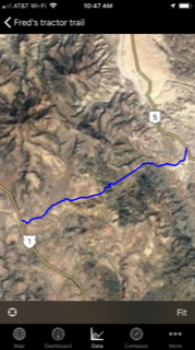
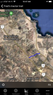
Noticed JZ's map didn't have Fred's Tractor trail on it. Thought I would share it. Sorry if the images are blurry. JZ, how did you get such a nice
image uploaded? its only letting me do 250 kB
|
|
|
TMW
Select Nomad
      
Posts: 10659
Registered: 9-1-2003
Location: Bakersfield, CA
Member Is Offline
|
|
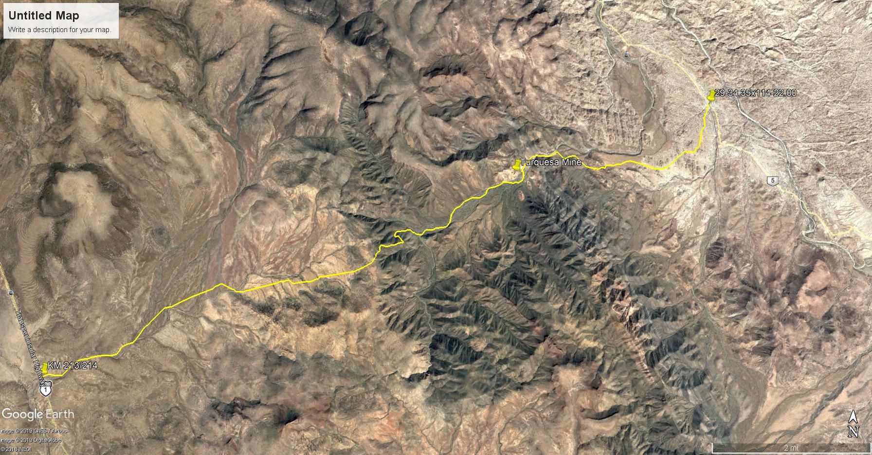
The bottom image looks like the Turquesa Trail, never heard it called Fred's Tractor Trail.
|
|
|
TMW
Select Nomad
      
Posts: 10659
Registered: 9-1-2003
Location: Bakersfield, CA
Member Is Offline
|
|
Larger image of the Turquesa Mine Trail.
[Edited on 1-19-2019 by TMW]
[Edited on 10-29-2022 by BajaNomad]
|
|
|
brumsky
Junior Nomad

Posts: 32
Registered: 1-18-2019
Member Is Offline
|
|
Good to know! I should have known my buddy Fred was full of chit.
|
|
|
TMW
Select Nomad
      
Posts: 10659
Registered: 9-1-2003
Location: Bakersfield, CA
Member Is Offline
|
|
Kacey Smith in her GPS Guidebook calls it "The XR Ride" and says it is the toughest ride in the book going uphill. She also says a 4 wheeler can't get
thru the wash but I know of two Nomads who have done it in 4 wheel SUVs. The Squarecircle and 4x4abc. I was with the Squarecircle when he did it in
his Range Rover back in 2006.
|
|
|
David K
Honored Nomad
        
Posts: 65436
Registered: 8-30-2002
Location: San Diego County
Member Is Offline
Mood: Have Baja Fever
|
|
Well, now, hang on... Fred Hampe of Rancho Santa Ynez, who built the road to Mission Santa Maria and 2 miles beyond, is credited for building the La
Turquesa road as we learned... I think it was Larry (bajatrailrider) who also verified this?
Perhaps the La Turquesa Canyon was the next best attempt location at a short cut between Santa Ynez and Punta Final? The Mission Santa Maria route was
built in the late 50s and early 60s. The route was abandoned at the edge of the deep Santa Maria Canyon, 2 miles past the mission.
Perhaps that is when Fred moved to the next pass south, La Turquesa Canyon? Otherwise, the poor road from Laguna Chapala or a better, but longer drive
route through Calamahjué Canyon was how Santa Ynez could communicate with its other property at Punta Final.
Here are the first photos of Fred's road where it drops down into La Turquesa Canyon I took in Feb. 2007... The Squarecircle with help from TW and
others would later get through from the east side.


|
|
|
David K
Honored Nomad
        
Posts: 65436
Registered: 8-30-2002
Location: San Diego County
Member Is Offline
Mood: Have Baja Fever
|
|
Tom, it was May, 2007 you guys cleared the way and Roy made it to Hwy. 1 from Hwy. 5:
=============================================================
In May, 2007... Roy went in from the Hwy. 5 side, to the turquoise mine and tried to scout a route beyond to the bottom of the grade:
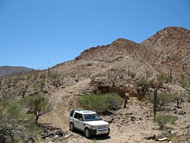
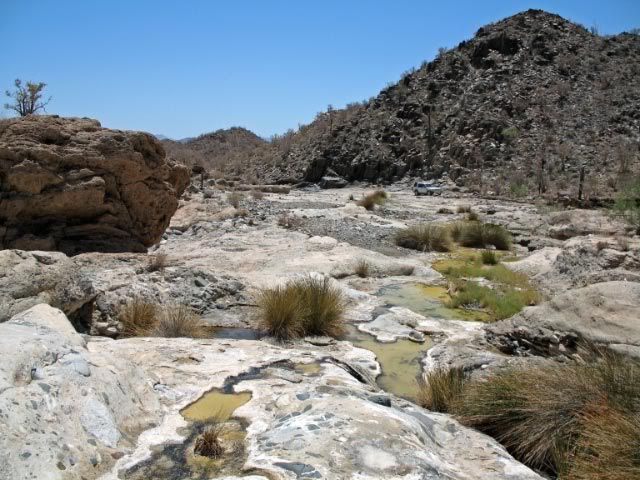
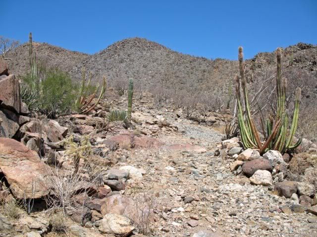
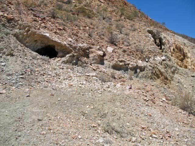
Roy needed more help and time to find the lost road across the valley floor. Nomads Steekers and Ken Cooke made trips in to see if they could get
across.
Steekers took this photo from the turquoise mine area showing the grade coming down the mountain...
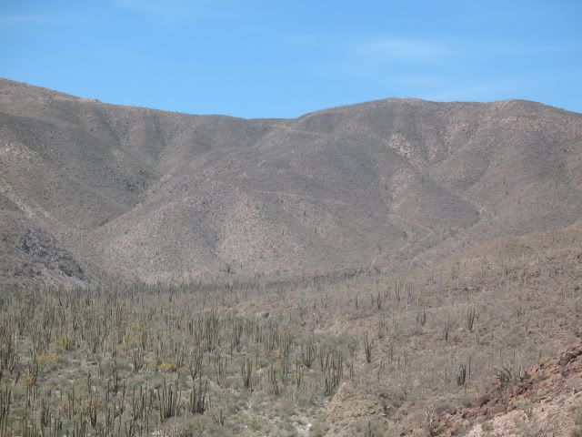
Roy, TW and others helping forged a road across the valley from the turquoise mine to the foot of the mountain:
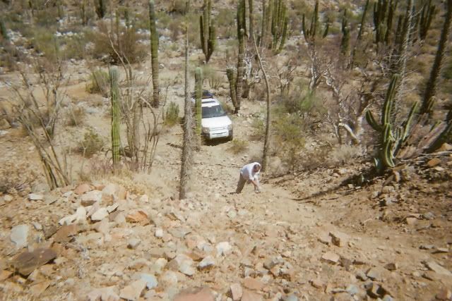
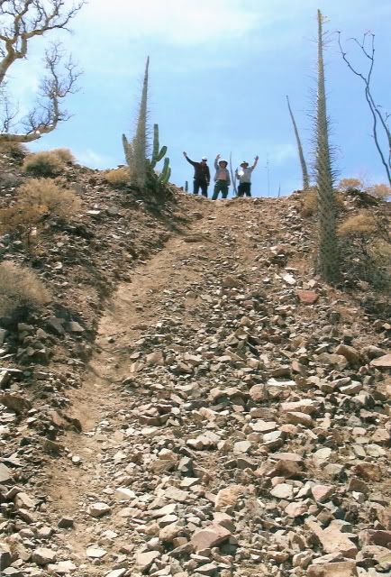
Only motorcycle tracks could be seen on this former mine service road... It was very steep, but the Rover with Roy at the wheel, made it up!
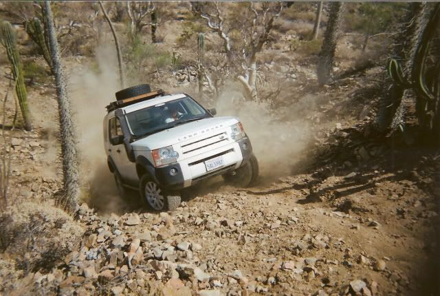
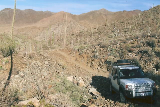
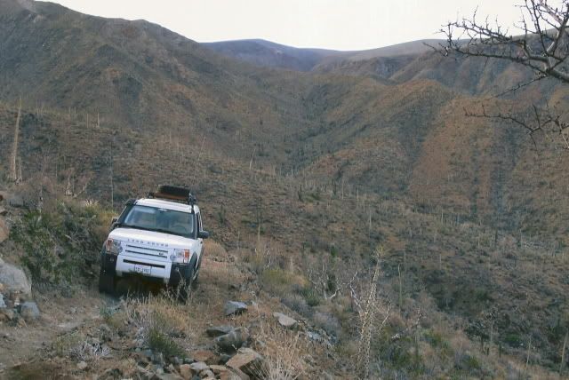
The top of the grade... where I was the previous year...
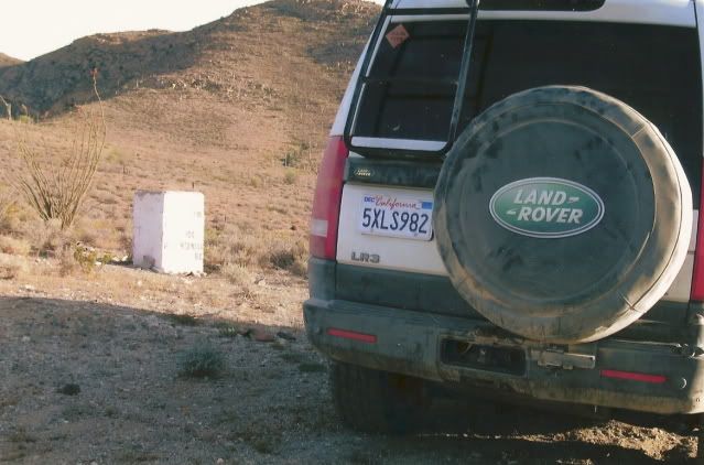
The road on to Hwy. 1:
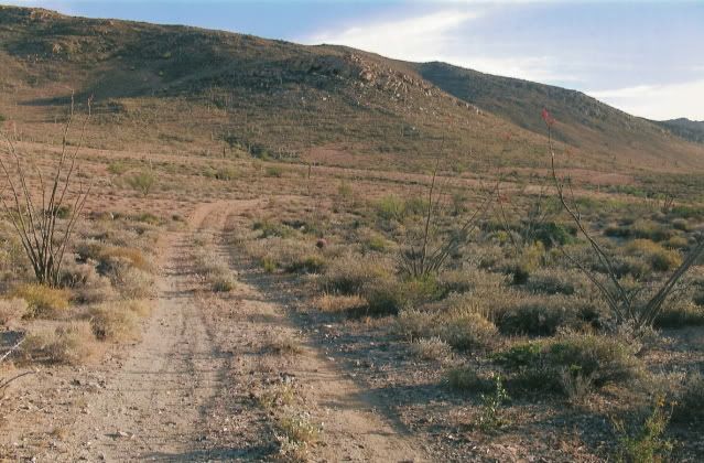
For more on finding this La Turquesa Canyon shortcut: http://vivabaja.com/207
|
|
|
JZ
Select Nomad
      
Posts: 13942
Registered: 10-3-2003
Member Is Online
|
|
Quote: Originally posted by advrider  | | JZ, the first half of that is two track, the second is the single track and is awesome. The single track starts at some really cool mud hills, but be
aware that one section has a locked gate you have to back track if you don't have the work around (you have it).We rode it last year and ended up in
the dark the last two hours into Catavina! Hope to do all of it in the day light this year. |
Where does the single track start? I'm guessing at the place it intersects with the route down to Canoas? Between there and Catavina?
|
|
|
advrider
Super Nomad
   
Posts: 1920
Registered: 10-2-2015
Member Is Offline
|
|
Don't have my map in front of me, but that sounds correct. Where the track cuts back inland from the coast on the main dirt road. If you are looking
to the right you will see the mud hills and that's where the single track starts.
|
|
|
brumsky
Junior Nomad

Posts: 32
Registered: 1-18-2019
Member Is Offline
|
|
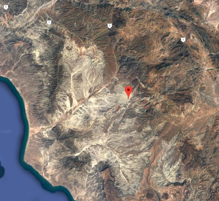
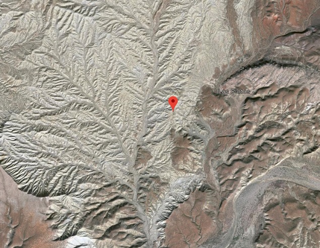
Anyone ever been to this area? Around 29.896388, -115.418035?
Im seeing a ton of tracks around there on Google Earth.
|
|
|
| Pages:
1
2
3 |

