Isignay
Newbie
Posts: 22
Registered: 9-20-2016
Member Is Offline
|
|
Sierra de la Laguna 4x4 trails?
My wife and I are in San Jose Del Cabo for the month and are looking to take a break from the heat. We tried heading to Sierra De La Laguna to
explore but ran into numerous private ranches with dead end roads.
Are there any roads that lead towards the higher elevation portions of the mountains with good camping? We don't have a crazy monster 4x4 but our
Tundra is capable and has high clearance.
Thank you.
|
|
|
David K
Honored Nomad
        
Posts: 65418
Registered: 8-30-2002
Location: San Diego County
Member Is Offline
Mood: Have Baja Fever
|
|
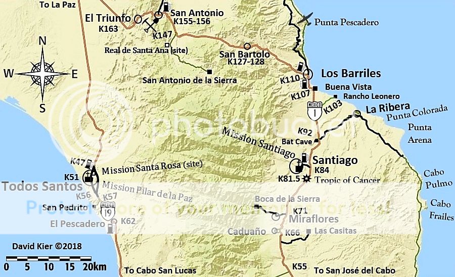
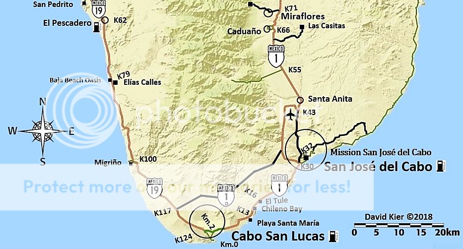
1) The Los Naranjos road crosses the sierra from just north of San José del Cabo over to the Pacific side, Km. 54.5. The north side of San José del
Cabo is Km. 32. It is often washed out during storms.
2) Ramal a San Antonio de la Sierra, is a graded road at Km. 147 (about 12 miles past San Bartolo) that goes way back into the hills above Los
Barriles.
Do see the other sites during your time there: The missions, Boca de la Sierra past Miraflores, the bat cave of Santiago, the spring-fed swimming pool
and mangoes at San Bartolo, the waterfall and hot springs near Santiago, the oldest mine in all the Californias (Real de Santa Ana)... Just so much
Baja to explore!
|
|
|
tiotomasbcs
Super Nomad
   
Posts: 1837
Registered: 7-30-2007
Location: El Pescadero
Member Is Offline
|
|
Very few roads, thankfully. The weather here on Pacific Coast is still nice...hot but cool breezes. North of TS you could camp but always be alert.
Cerritos Beach is too crowded for me nowadays . Check rentals/B&Bs...offseason pricing. Beautiful Old Pueblo. Good luck.
|
|
|
4x4abc
Ultra Nomad
    
Posts: 4454
Registered: 4-24-2009
Location: La Paz, BCS
Member Is Offline
Mood: happy - always
|
|
Quote: Originally posted by David K  | 1) The Los Naranjos road crosses the sierra from just north of San José del Cabo over to the Pacific side, Km. 54.5. The north side of San José del
Cabo is Km. 32. It is often washed out during storms.
2) Ramal a San Antonio de la Sierra, is a graded road at Km. 147 (about 12 miles past San Bartolo) that goes way back into the hills above Los
Barriles.
|
none offer high elevation or camping
Pacific coast is your best bet during the summer
Harald Pietschmann
|
|
|
David K
Honored Nomad
        
Posts: 65418
Registered: 8-30-2002
Location: San Diego County
Member Is Offline
Mood: Have Baja Fever
|
|
There is also a lot to explore between El Triunfo and Todos Santos. Old silver mines and villages. El Oro comes to mind. See photos from Jack Swords:
http://www.vivabaja.com/swords/page6.html
Harald, thanks... I saw many photos of the Naranjas road that sure looked like they were taken high up? I added what I did as nobody else had since
yesterday to give them something to do in their Tundra other than the city stuff. July on the Tropic of Cancer will not find them in any cool places,
that's for sure.
|
|
|
defrag4
Senior Nomad
  
Posts: 536
Registered: 2-5-2011
Member Is Offline
|
|
Quote: Originally posted by 4x4abc  | Quote: Originally posted by David K  | 1) The Los Naranjos road crosses the sierra from just north of San José del Cabo over to the Pacific side, Km. 54.5. The north side of San José del
Cabo is Km. 32. It is often washed out during storms.
2) Ramal a San Antonio de la Sierra, is a graded road at Km. 147 (about 12 miles past San Bartolo) that goes way back into the hills above Los
Barriles.
|
none offer high elevation or camping
Pacific coast is your best bet during the summer |
damn, like the TS i was eyeballing that area for a high elevation escape from the heat, guess its too remote or privately owned to have any accessible
high elevation roads?
|
|
|
wilderone
Ultra Nomad
    
Posts: 3894
Registered: 2-9-2004
Member Is Offline
|
|
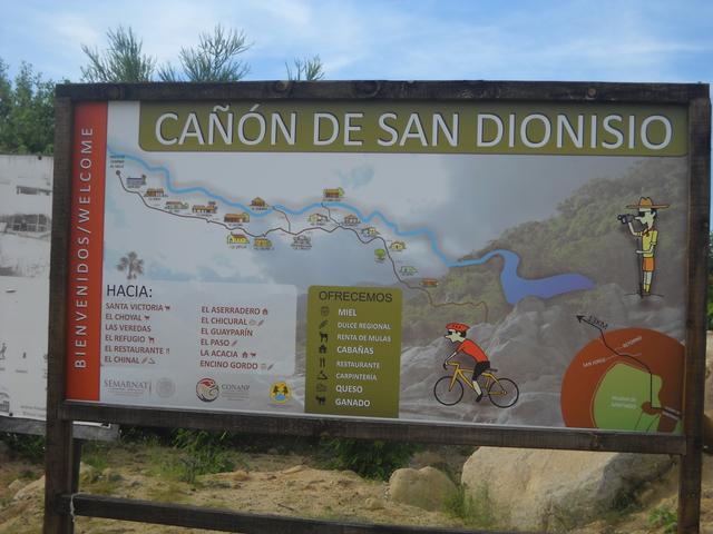
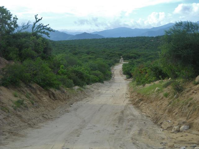
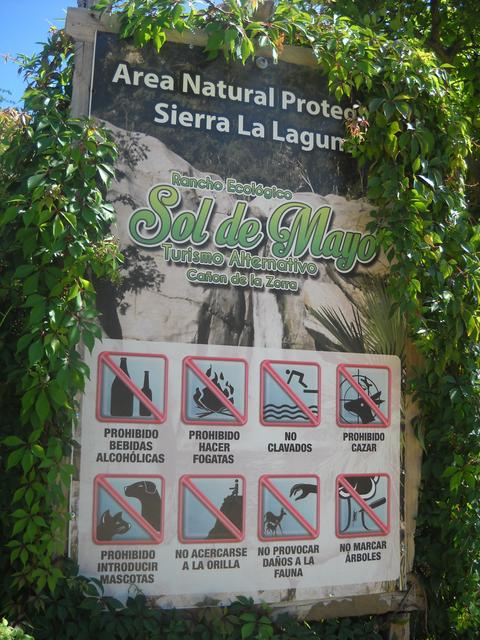
Go to Sol de Mayo - a bit west of Santiago (go to Santiago - go through town to the corner with all the signs - it's on most maps, and there are signs
along the road. Casitas, hiking trails, waterfall. Road that goes there also passes junction to 16 mi. dirt road that passes a bunch of stuff, and
ends up at Sierra de la Laguna trailheads.

|
|
|
David K
Honored Nomad
        
Posts: 65418
Registered: 8-30-2002
Location: San Diego County
Member Is Offline
Mood: Have Baja Fever
|
|
Sweet!   
|
|
|
JZ
Select Nomad
      
Posts: 13707
Registered: 10-3-2003
Member Is Offline
|
|
We had several days in the 80s on the SoC this week. 90 and 100s inland. Water was perfect to swim.
Check out this thread for a fantastic coastal route North of Los Barriles.
http://forums.bajanomad.com/viewthread.php?tid=92987
[Edited on 7-7-2019 by JZ]
|
|
|
Nikno
Junior Nomad

Posts: 90
Registered: 7-12-2019
Member Is Offline
|
|
Type "San Pedro de la Soledad" into Google Maps and search directions from Cabo and Jan Jose del Cabo and you'll get a nice loop that crosses the
peninsula. This might be the same road that David is referring to as Los Naranjos. There is a buddhist retreat about halfway along this route that
offers cabanas and I believe they have camping spots.
https://tsegyalgarwest.org/
An easy but beautiful drive is just heading up the dirt road on the East Cape to Cabo Pulmo and then looping back around through Santiago and checking
out Canon de la Zorra waterfalls. There is camping there.
Lastly, a bit further afield, but if you are there for a month, drive up to Los Barriles (1.5 hours from Cabo) and take the dirt road up the coast to
Bahia de los Muertos and then up the canyon to San Juan de los Planes. Someone recently posted a trip report from this route with some fantastic pics.
|
|
|
David K
Honored Nomad
        
Posts: 65418
Registered: 8-30-2002
Location: San Diego County
Member Is Offline
Mood: Have Baja Fever
|
|
Welcome to Nomad!

|
|
|
Isignay
Newbie
Posts: 22
Registered: 9-20-2016
Member Is Offline
|
|
Thank you for the replies everyone.
|
|
|

