PaulW
Ultra Nomad
    
Posts: 3113
Registered: 5-21-2013
Member Is Offline
|
|
Green Door trail
New Green Door Track
This time we started from the south and we had great success.
Issues were found. We had to drive around huge Cardon’s across the road in two places but were able to get back on the road with some trials. The
road for the most part is heavily overgrown, and we had to bash thru some pretty big tree limbs. Tons of scratches and after the first rig we had sap
dripping on our rigs. (The sap came off with alcohol when we got home).
Our previous track was done with a Garmin and used a 10-minute track point interval, so we used that track just as a gross guide. Tha t track is
omitted on the attached KMZ. The road was easy enough to find. Yes, we found their TW and Johns track from November and they missed the road at one
point by less than 20 ‘. It was on their left.
It is obvious from examining our track the south end was difficult as the bushes had concealed the road. Thus, we wandered a bit.
The Murdock map has a road that was accurate as it starts from the south and is not complete. We followed it until it ended at a side wash. From
there the road was easy to find. When traveling S the area where Murdock ends is a very easy place to lose the road. The new track solves that issue
for sure.
Major edit:
The KMZ does not show the important WPs:
Jct North is 28 40.7633, -113 25.491
Jct South is 28 27.763, -1213 12.697
Stone wall is 28 39.421, -113 26.161
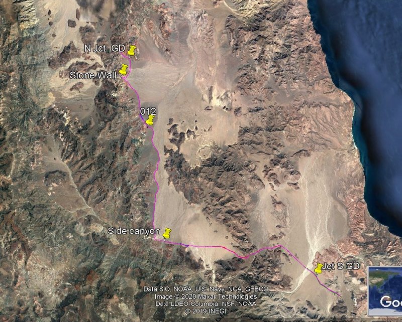
Attachment: Trail001GD.kmz (77kB)
This file has been downloaded 352 times
[Edited on 2-3-2020 by PaulW]
|
|
|
David K
Honored Nomad
        
Posts: 65350
Registered: 8-30-2002
Location: San Diego County
Member Is Offline
Mood: Have Baja Fever
|
|
GOOD JOB PAUL!!!
I last drove the entire route from north to south in 2002, other times either the north half or the south half (2001-2003)
This road's modern history is told in Erle Stanley Gardner's 1967 book, 'Off the Beaten Track in Baja'... The Gardner expedition blazed this route in
February of 1966. It was not on any map then and only old sages like Dick Daggett of L.A. Bay seemed to know of it. The Gardner team reopened and
reconstructed where necessary theis route so they could get to Rancho El Barril directly from Bahía de los Angeles.
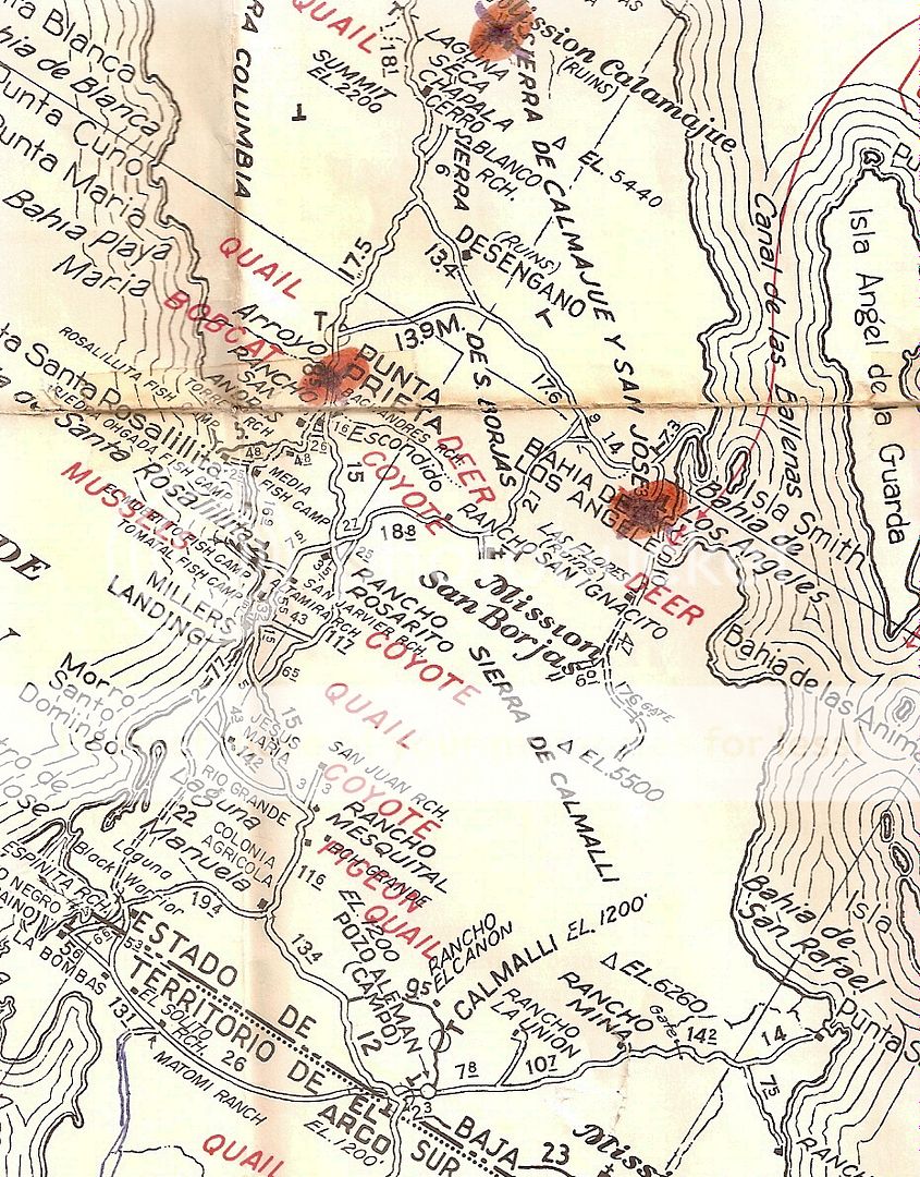
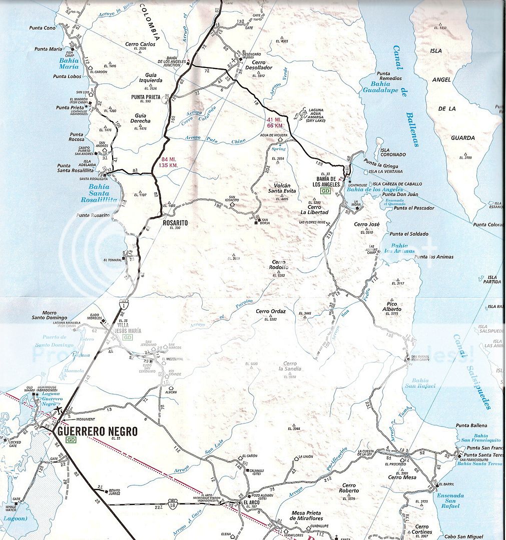
The 1965 AAA map only shows some of it:
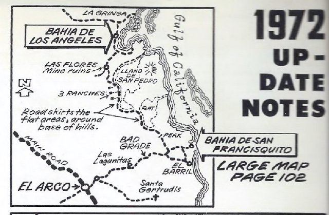
The first book to make a road log and draw a map of it was the 1972 updated edition of Cliff Cross' Baja Guide.
The Auto Club began to map all of it, too... here's their 1973 map:
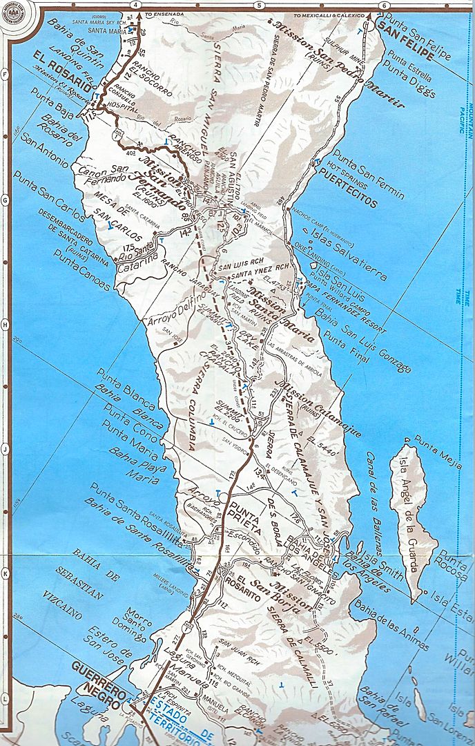
The better detailed 1975 & 1978 maps:
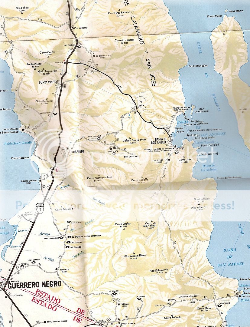
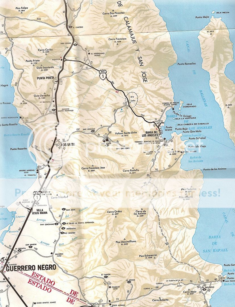
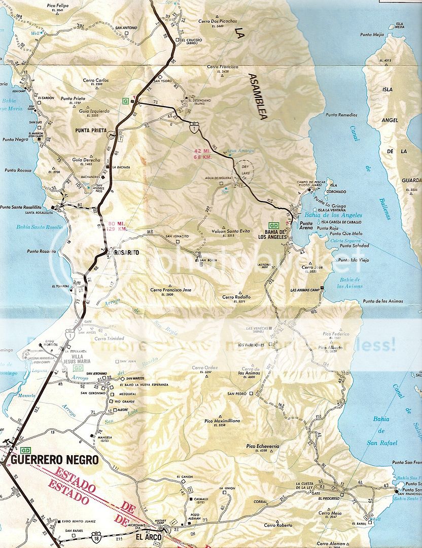
1987 the new graded road via San Rafael was added and the road more accurately placed:
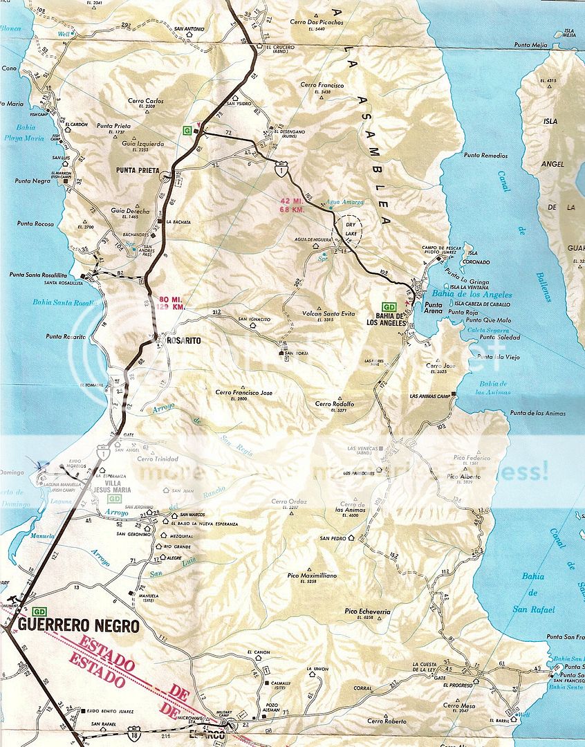
1989 was the last year they included the old road:
The final AAA maps (to 2010) included the northern part of the road:
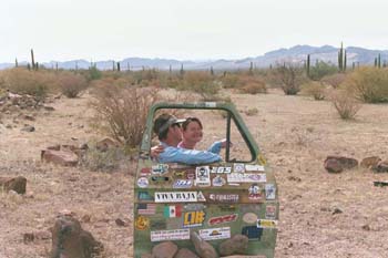
How the Green Door Road got its name...
Paulina and Dern pose at it, a few years ago, before it vanished.
|
|
|
4x4abc
Ultra Nomad
    
Posts: 4443
Registered: 4-24-2009
Location: La Paz, BCS
Member Is Offline
Mood: happy - always
|
|
there is only one short line in that file - something must have gone wrong
Harald Pietschmann
|
|
|
PaulW
Ultra Nomad
    
Posts: 3113
Registered: 5-21-2013
Member Is Offline
|
|
Thanks Harald, I fixed the KMZ and documented the important WPs.
|
|
|
PaulW
Ultra Nomad
    
Posts: 3113
Registered: 5-21-2013
Member Is Offline
|
|
Thanks David for all those details.
|
|
|
mtgoat666
Platinum Nomad
       
Posts: 20161
Registered: 9-16-2006
Location: San Diego
Member Is Offline
Mood: Hot n spicy
|
|
Quote: Originally posted by PaulW  | New Green Door Track
This time we started from the south and we had great success.
Issues were found. We had to drive around huge Cardon’s across the road in two places but were able to get back on the road with some trials. The
road for the most part is heavily overgrown, and we had to bash thru some pretty big tree limbs. Tons of scratches and after the first rig we had sap
dripping on our rigs. (The sap came off with alcohol when we got home).
Our previous track was done with a Garmin and used a 10-minute track point interval, so we used that track just as a gross guide. Tha t track is
omitted on the attached KMZ. The road was easy enough to find. Yes, we found their TW and Johns track from November and they missed the road at one
point by less than 20 ‘. It was on their left.
It is obvious from examining our track the south end was difficult as the bushes had concealed the road. Thus, we wandered a bit.
The Murdock map has a road that was accurate as it starts from the south and is not complete. We followed it until it ended at a side wash. From
there the road was easy to find. When traveling S the area where Murdock ends is a very easy place to lose the road. The new track solves that issue
for sure.
Major edit:
The KMZ does not show the important WPs:
Jct North is 28 40.7633, -113 25.491
Jct South is 28 27.763, -1213 12.697
Stone wall is 28 39.421, -113 26.161

[Edited on 2-3-2020 by PaulW] |
You ever wonder why property owners fence their land? Because offroaders open abandoned roads, cut or otherwise remove vegetation to open roads, etc
If a road has returned to nature or is otherwise unused in many years, you should seek landowner approval to undertake travel or work to open a road
Woke!
Hands off!
“Por el bien de todos, primero los pobres.”
“...ask not what your country can do for you – ask what you can do for your country.” “My fellow citizens of the world: ask not what America
will do for you, but what together we can do for the freedom of man.”
Pronoun: the royal we
|
|
|
David K
Honored Nomad
        
Posts: 65350
Registered: 8-30-2002
Location: San Diego County
Member Is Offline
Mood: Have Baja Fever
|
|
The land belongs to everyone!
Don't listen to this conservative, capitalist mtgoat666
|
|
|
mtgoat666
Platinum Nomad
       
Posts: 20161
Registered: 9-16-2006
Location: San Diego
Member Is Offline
Mood: Hot n spicy
|
|
There is very little public land in baja. Most land is owned by ejidos, individuals or corporations. In the subject area, there is no public land.
Woke!
Hands off!
“Por el bien de todos, primero los pobres.”
“...ask not what your country can do for you – ask what you can do for your country.” “My fellow citizens of the world: ask not what America
will do for you, but what together we can do for the freedom of man.”
Pronoun: the royal we
|
|
|
4x4abc
Ultra Nomad
    
Posts: 4443
Registered: 4-24-2009
Location: La Paz, BCS
Member Is Offline
Mood: happy - always
|
|
the kmz file has now disappeared
Harald Pietschmann
|
|
|
KasloKid
Nomad
 
Posts: 326
Registered: 8-29-2009
Member Is Offline
|
|
The trail/road from the north to the arroyo where the track goes from N-S to W-E was still being used by a family that operated a small ranch a few
hundred yards West of the 90 degree turn, about 8 or 9 years ago. Is it still being used?
|
|
|
David K
Honored Nomad
        
Posts: 65350
Registered: 8-30-2002
Location: San Diego County
Member Is Offline
Mood: Have Baja Fever
|
|
That is Rancho La Bocana, even though most maps call it San Pedro.
|
|
|
ehall
Super Nomad
   
Posts: 1906
Registered: 3-29-2014
Location: Buckeye, Az
Member Is Offline
Mood: It's 5 o'clock somewhere
|
|
Thanks Paul. Wish I could of went with you. This job thing really kills my free time.
|
|
|
PaulW
Ultra Nomad
    
Posts: 3113
Registered: 5-21-2013
Member Is Offline
|
|
Go to the first post and click on the KMZ. Just did it and it is complete less WPs.
|
|
|

