David K
Honored Nomad
        
Posts: 65383
Registered: 8-30-2002
Location: San Diego County
Member Is Offline
Mood: Have Baja Fever
|
|
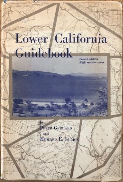
Lower California Guidebook, 1967 4th edition
This was the 'Baja Bible' to travelers in the 1950s-1970s. There were 4 editions (1956, 1958, 1962, 1967) using this name plus two additional
printings (1964, 1970). In 1975, La Siesta Press's Walt Wheelock with input from Howard Gulick revised the guide to include the Transpeninsular
Highway and other changes under the new name 'Baja California Guidebook'. This (like-new) book image was emailed to me from 'Slow Baja' after he found
it on the Internet. My copies are quite a bit more worn!
|
|
|
David K
Honored Nomad
        
Posts: 65383
Registered: 8-30-2002
Location: San Diego County
Member Is Offline
Mood: Have Baja Fever
|
|
1956 First Edition:
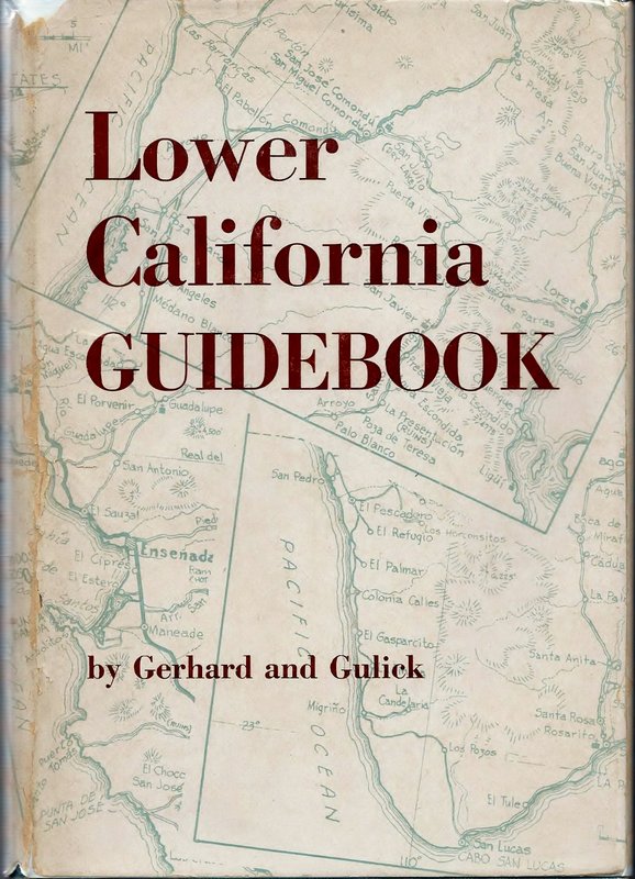
1958 Second Edition:
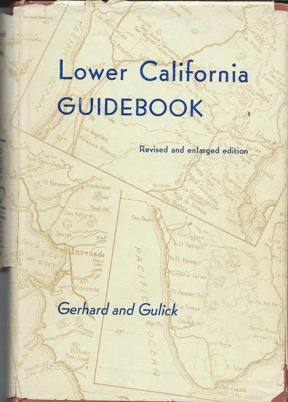
The 1962 Third Edition and 1967 Fourth Edition have the same cover.
[Edited on 6-16-2020 by David K]
|
|
|
David K
Honored Nomad
        
Posts: 65383
Registered: 8-30-2002
Location: San Diego County
Member Is Offline
Mood: Have Baja Fever
|
|
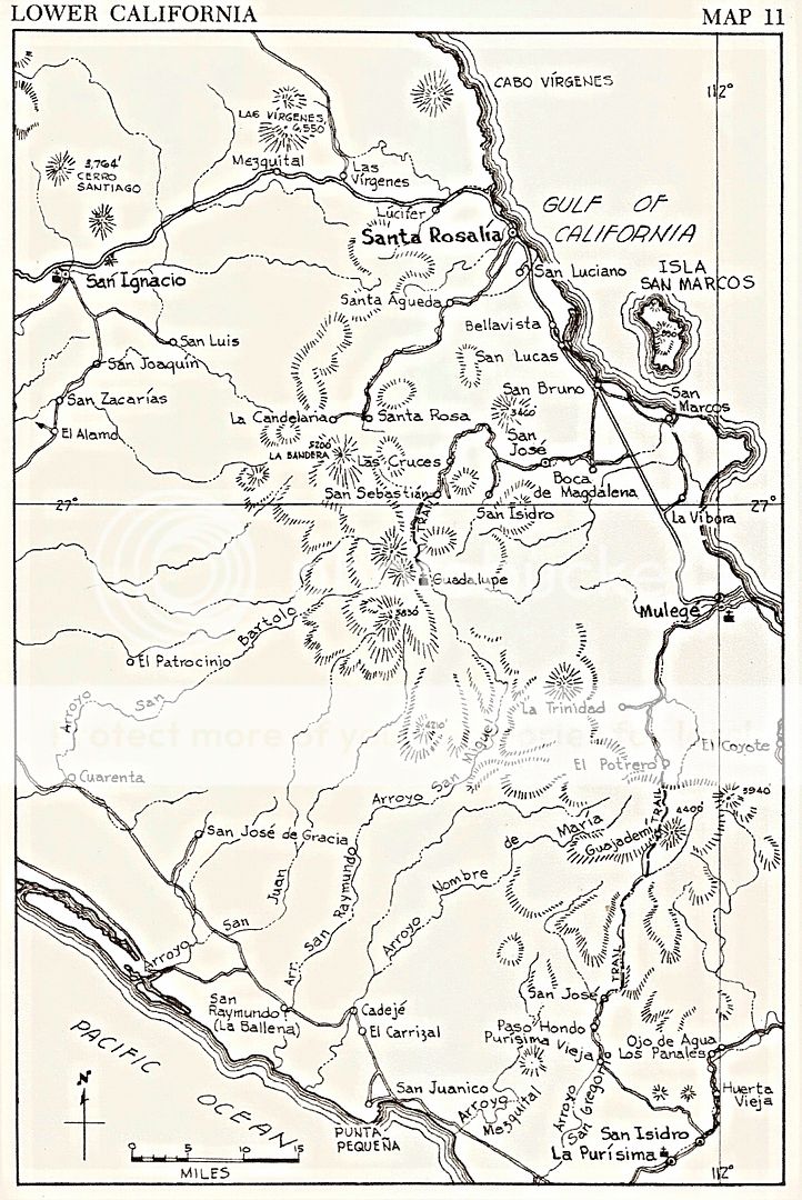
Maps...
Howard Gulick, an engineer with the City of Glendale, was the cartographer, photographer, and roadlog author.
Peter Gerhard was the historian, and he is credited with some southern Baja guide work, too.
All of the maps from the 1962 3rd edition (they are the same in the fourth edition) are online... Just click on the peninsula map where you want to
see the detail map from Howard: http://biology.fullerton.edu/biol517dje/maps/baja_1962.html
|
|
|
David K
Honored Nomad
        
Posts: 65383
Registered: 8-30-2002
Location: San Diego County
Member Is Offline
Mood: Have Baja Fever
|
|
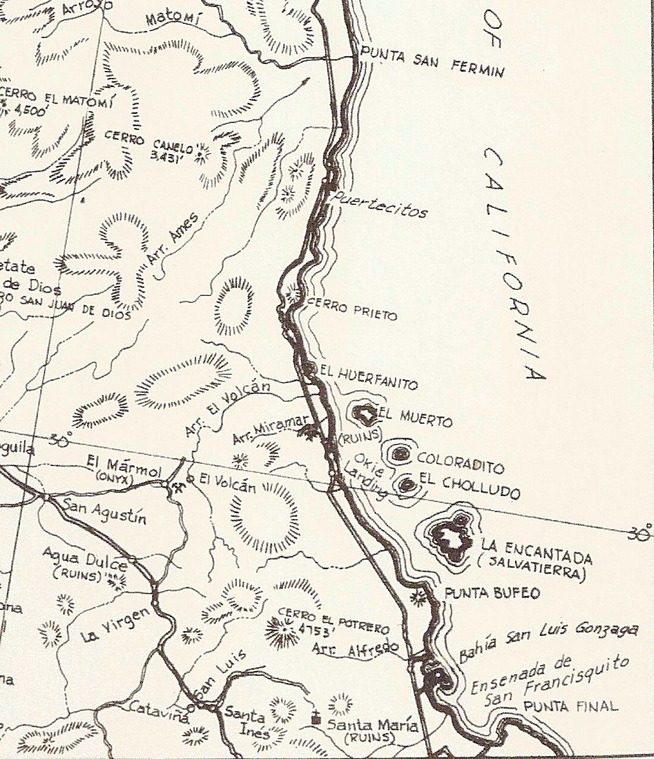
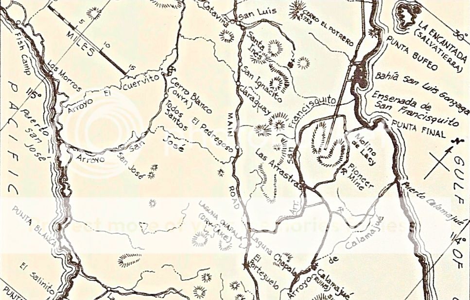
Loved Howard's maps... They were the first accurate road maps of the peninsula. A sample of one...
|
|
|
PaulW
Ultra Nomad
    
Posts: 3113
Registered: 5-21-2013
Member Is Offline
|
|
Agree. Do you have any incite on what Gulick used for the source to his maps. Seems like there is way to much accurate detail for one person to
create.
|
|
|
David K
Honored Nomad
        
Posts: 65383
Registered: 8-30-2002
Location: San Diego County
Member Is Offline
Mood: Have Baja Fever
|
|
He used existing charts for his base map (coastline, mountain topography, arroyos) but all the roads were his doing.
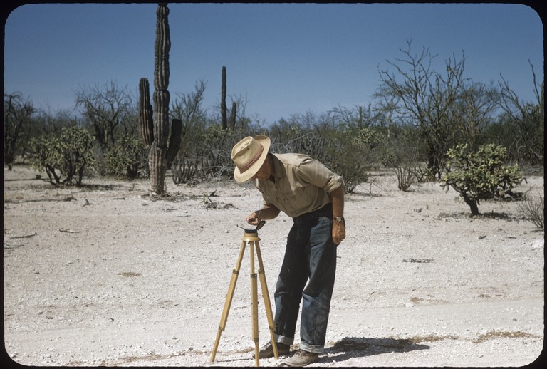
One of his traveling companions (Andy Anderson) told us how Howard would stop at every direction change in the road and take out his compass, walk
several feet away from the Willys wagon, and make a reading.
There is a photo of Howard and his tripod mounted compass in the Gulick photo collection.
|
|
|
David K
Honored Nomad
        
Posts: 65383
Registered: 8-30-2002
Location: San Diego County
Member Is Offline
Mood: Have Baja Fever
|
|
April 1957 Road to Gonzaga Bay
Here is Howard Gulick taking a compass reading as he maps Baja California's roads...
[Edited on 6-17-2020 by David K]
|
|
|
David K
Honored Nomad
        
Posts: 65383
Registered: 8-30-2002
Location: San Diego County
Member Is Offline
Mood: Have Baja Fever
|
|
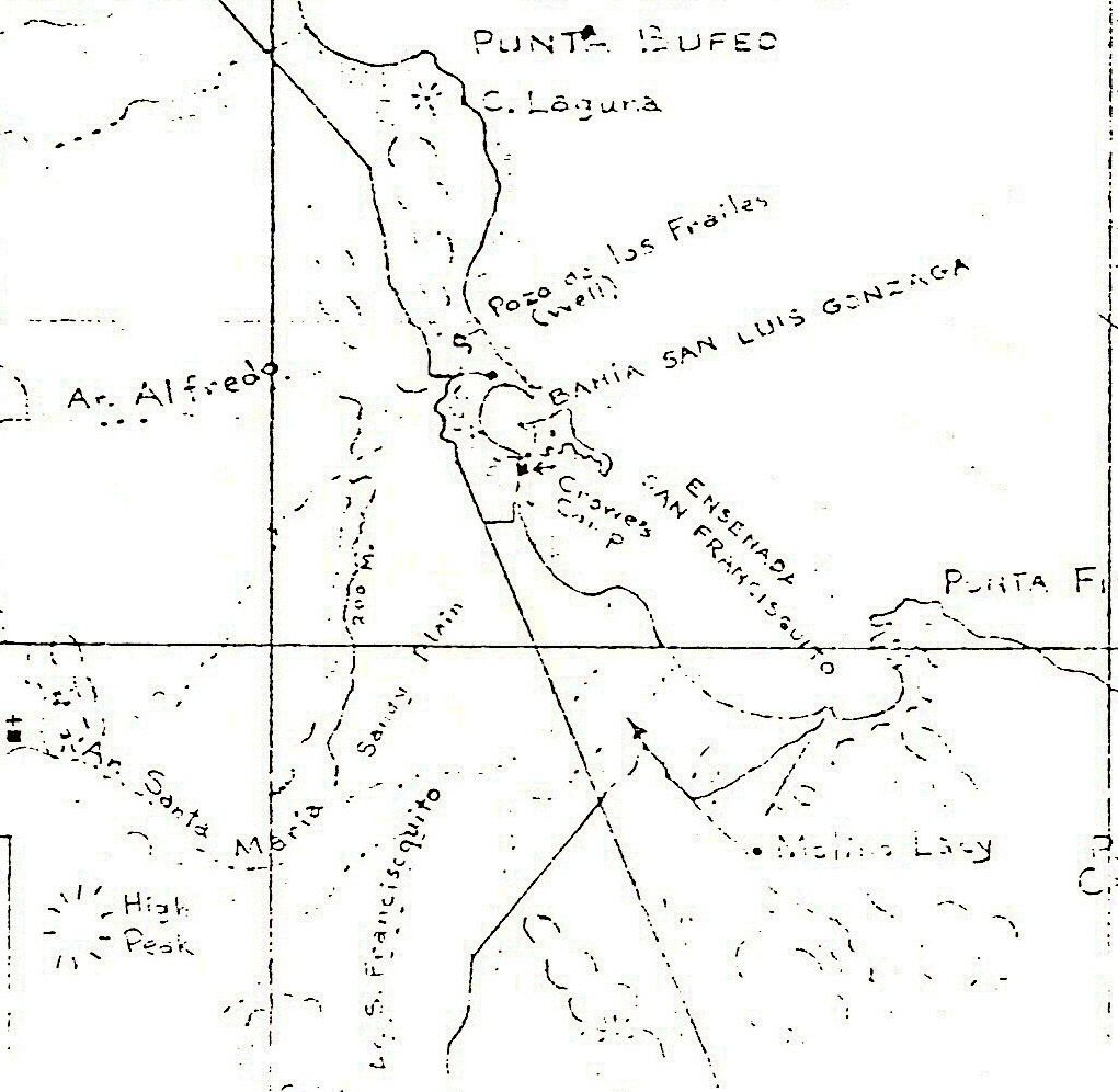
Here is an unpublished, 1960 map by Howard Gulick of the Gonzaga Bay area:
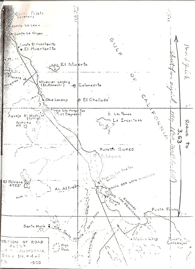
zoom in...
|
|
|
4x4abc
Ultra Nomad
    
Posts: 4452
Registered: 4-24-2009
Location: La Paz, BCS
Member Is Offline
Mood: happy - always
|
|
Mexico is a little behind, but they probably had excellent government maps in the 1950's. It is not that American visitors charted Baja for the first
time. There are more books written and maps plotted by Mexicans than by Gringos. Go to a Mexican library - its all there.
Harald Pietschmann
|
|
|
David K
Honored Nomad
        
Posts: 65383
Registered: 8-30-2002
Location: San Diego County
Member Is Offline
Mood: Have Baja Fever
|
|
Quote: Originally posted by 4x4abc  | Mexico is a little behind, but they probably had excellent government maps in the 1950's. It is not that American visitors charted Baja for the first
time. There are more books written and maps plotted by Mexicans than by Gringos. Go to a Mexican library - its all there.
|
Let's see them, please!
==========================================================================
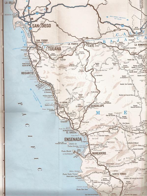
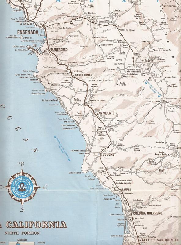
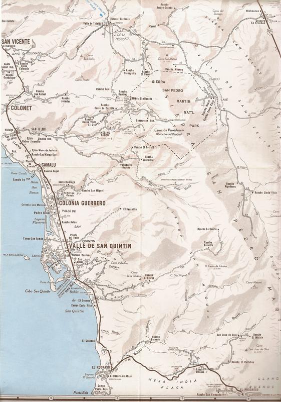
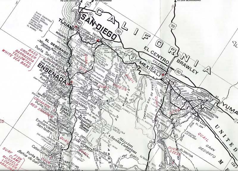
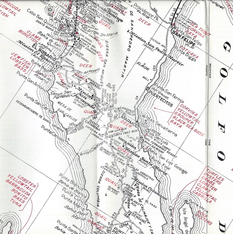
I have been a fan of Baja maps all my life and road maps made before Howard's first appeared (1956) fell quite short in accuracy. Even the Auto Club
map before the 1970s was very poor with details or accuracy. I heard that Howard offered the club his assistance and that is when they created very
good maps, but only of northernmost Baja:
This is part of the 1974 edition:
=====================================================================
The earlier, 1962 edition:
====================================================================
Shell Oil even produced a pretty fair map in 1958:
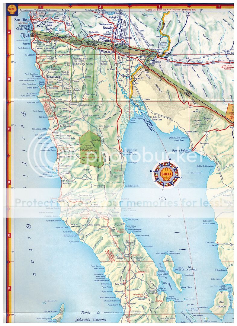
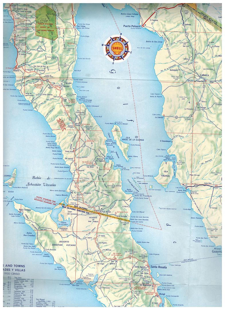
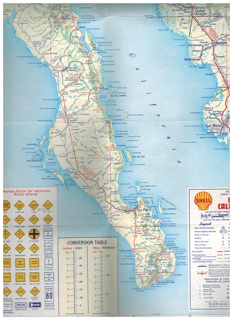
Zoom in:
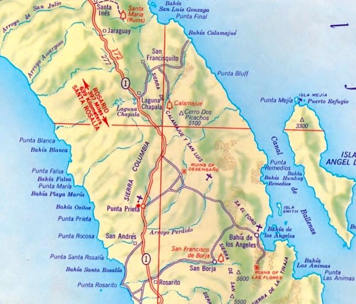
Not bad for 1958!
I have a 1955 AAA map as well but before that, a 1941 road-guide map was the next one I know of...
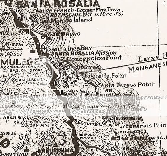
Part of the 1941 map. The heavy dark line is not pavement, it is simply the main trans-peninsular road.
I have shared these on Nomad before... but they are way down on the Historic Interests forum, so let me know what year maps you would like to see more
of.
Harald, please try and find any 1950s Mexican made maps of Baja California to share!
|
|
|
KurtG
Super Nomad
   
Posts: 1211
Registered: 1-27-2004
Location: California Central Coast
Member Is Offline
Mood: Press On Regardless!!
|
|
I have a very well used '56 edition as well as '58 and '62 both in very good condition. After seeing what these books are selling for I think the
latter two may end up on ebay. Monies would go into my Baja Travel Fund and then I just have to live long enough to get back down to all my favorite
places. I have marveled for years at the effort it took to complete that book. The level of detail and the quality of the maps is outstanding.
|
|
|
David K
Honored Nomad
        
Posts: 65383
Registered: 8-30-2002
Location: San Diego County
Member Is Offline
Mood: Have Baja Fever
|
|
Quote: Originally posted by KurtG  | | I have a very well used '56 edition as well as '58 and '62 both in very good condition. After seeing what these books are selling for I think the
latter two may end up on ebay. Monies would go into my Baja Travel Fund and then I just have to live long enough to get back down to all my favorite
places. I have marveled for years at the effort it took to complete that book. The level of detail and the quality of the maps is outstanding.
|
It changed my life... made me want to be just like Howard Gulick making maps and road logs (I met Howard when I was 8, just before our big trip from
Tijuana to Cabo in 1966)!
Howard was an engineer with the city of Glendale, CA. Walt Wheelock was too (La Siesta Press books plus the revised in 1975 Baja California Guidebook,
with Howard Gulick).
|
|
|
geoffff
Senior Nomad
  
Posts: 710
Registered: 1-15-2009
Member Is Offline
|
|
The 15 black & white map series in the back of the 1970 edition Gerhard & Gulick's Lower California Guidebook, stitched into a single image.
(Click to enlarge.)

1967--Lower-California-Guidebook-Map.jpg
1967--Lower-California-Guidebook-Map--rotated.jpg
[Edited on 6-5-2021 by geoffff]
|
|
|
David K
Honored Nomad
        
Posts: 65383
Registered: 8-30-2002
Location: San Diego County
Member Is Offline
Mood: Have Baja Fever
|
|
Very cool, geoffff.
It was the 1962 and 1967 edition maps, fyi.
|
|
|
geoffff
Senior Nomad
  
Posts: 710
Registered: 1-15-2009
Member Is Offline
|
|
Thanks! Year corrected.
|
|
|
David K
Honored Nomad
        
Posts: 65383
Registered: 8-30-2002
Location: San Diego County
Member Is Offline
Mood: Have Baja Fever
|
|
You are a good soul!
|
|
|
BajaBlanca
Select Nomad
      
Posts: 13241
Registered: 10-28-2008
Location: La Bocana, BCS
Member Is Offline
|
|
My gosh, those first maps are amazing! What detail. Years ago, my friend Tuly and I climbed El Portrero with a guide (which I could not attempt
nowadays) and when you look at it on the map, it looks so innocent LOL. It was so difficult! Getting to El Potrero area was a 45 mile trip that took
us 7 hours out of San Ignacio.
|
|
|
David K
Honored Nomad
        
Posts: 65383
Registered: 8-30-2002
Location: San Diego County
Member Is Offline
Mood: Have Baja Fever
|
|
Quote: Originally posted by BajaBlanca  | | My gosh, those first maps are amazing! What detail. Years ago, my friend Tuly and I climbed El Portrero with a guide (which I could not attempt
nowadays) and when you look at it on the map, it looks so innocent LOL. It was so difficult! Getting to El Potrero area was a 45 mile trip that took
us 7 hours out of San Ignacio. |
Where is this El Potrero you climbed?
The only one I see on the Gulick map is a ranch south of Mulegé.
|
|
|
PaulW
Ultra Nomad
    
Posts: 3113
Registered: 5-21-2013
Member Is Offline
|
|
I am also curious
Here is what I found. I wonder if I am correct?
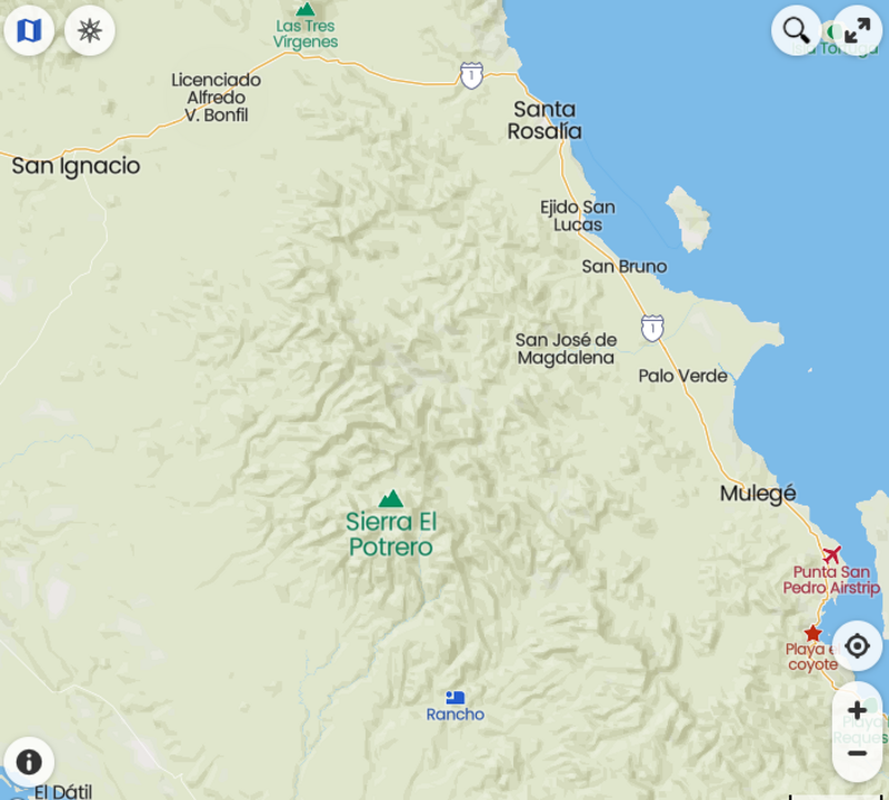
|
|
|

