4x4abc
Ultra Nomad
    
Posts: 4452
Registered: 4-24-2009
Location: La Paz, BCS
Member Is Offline
Mood: happy - always
|
|
Puerto Magdalena
I think I solved the mystery around an image that was supposedly taken between Loreto and La Paz. Only it did not match anything on the ground today.
Did not match anything on Google Earth either.
I think it is depicting Puerto Magdalena. The historic US Naval coaling station.
It had to be a location with very calm protected waters, like on the Cotes side or on the east side of a Pacific island.
I think, this is it.
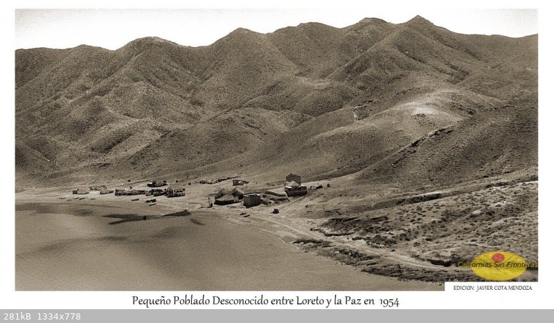
There are 2 distinct houses up on a Mesa. Easily recognized in other images taken around the turn of the century.
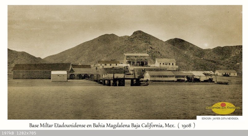
There is a quarry of white rock close to theses 2 houses that can still be seen on Google Earth. 24°38'11.22"N, 112° 8'27.49"W. Well visible in
this 1900 picture
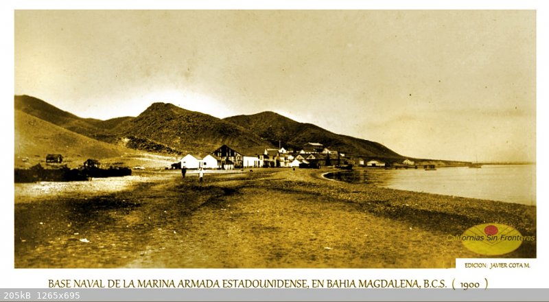
What I found in the process is that the US Naval Station must have moved from Puerto Magdalena to Punta Arena farther south at one point in time. Does
anyone know when? I had always thought that Punta Arena (Punta Belcher) had always been the location for the Naval Station.
Harald Pietschmann
|
|
|
mtgoat666
Platinum Nomad
       
Posts: 20295
Registered: 9-16-2006
Location: San Diego
Member Is Offline
Mood: Hot n spicy
|
|
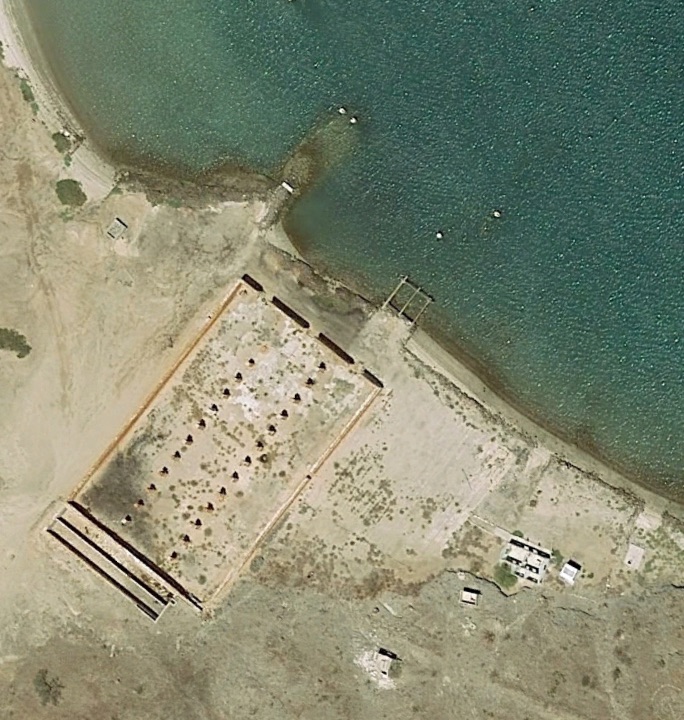
The us navy station at la paz was at pichilingue.
Us navy at mag bay was in harbor to south side of main/wide bay entrance, maybe puerto Alcatraz is where the navy had shore station?
Woke!
Hands off!
“Por el bien de todos, primero los pobres.”
“...ask not what your country can do for you – ask what you can do for your country.” “My fellow citizens of the world: ask not what America
will do for you, but what together we can do for the freedom of man.”
Pronoun: the royal we
|
|
|
4x4abc
Ultra Nomad
    
Posts: 4452
Registered: 4-24-2009
Location: La Paz, BCS
Member Is Offline
Mood: happy - always
|
|
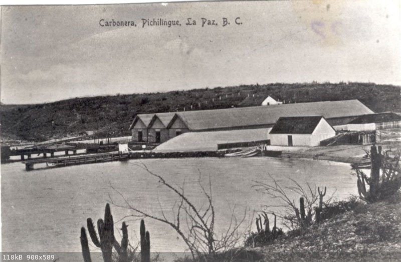
Pichilingue coaling station still visible
Harald Pietschmann
|
|
|
4x4abc
Ultra Nomad
    
Posts: 4452
Registered: 4-24-2009
Location: La Paz, BCS
Member Is Offline
Mood: happy - always
|
|
Carbonera Pichilingue
Harald Pietschmann
|
|
|
David K
Honored Nomad
        
Posts: 65383
Registered: 8-30-2002
Location: San Diego County
Member Is Offline
Mood: Have Baja Fever
|
|
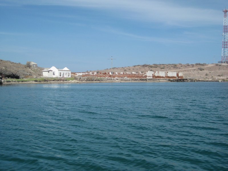
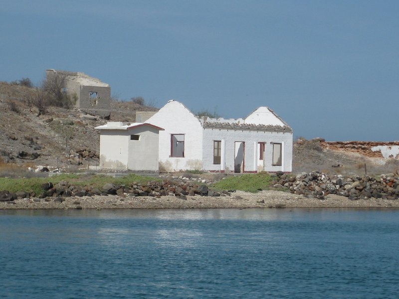
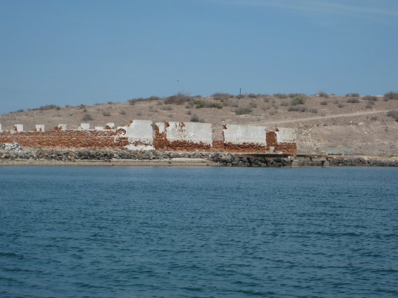
In 2012, we boated past the U.S. coaling station north of La Paz:
|
|
|
4x4abc
Ultra Nomad
    
Posts: 4452
Registered: 4-24-2009
Location: La Paz, BCS
Member Is Offline
Mood: happy - always
|
|
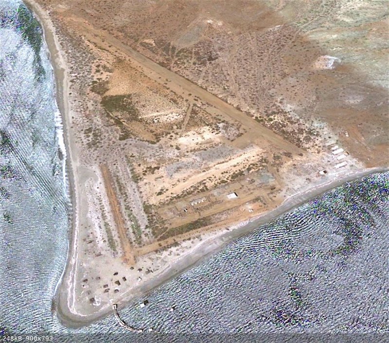
So, Puerto Magdalena was the only US base on Isla Magdalena as the paper below describes.
Then who used the newer base with the airstrip (no airstrips around 1900) farther south? Mexicans? US in WWII?
Abandoned now.
file:///Volumes/New%20Box%20Pro%20Snow%20Leopard%20/Users/laspuertas/Documents/Baja%20and%20CR%20images/military%20interest%20in%20Magdalena%20Bay.pdf
Harald Pietschmann
|
|
|
4x4abc
Ultra Nomad
    
Posts: 4452
Registered: 4-24-2009
Location: La Paz, BCS
Member Is Offline
Mood: happy - always
|
|
sorry for the bad link:
https://online.ucpress.edu/scq/article-split/83/3/261/87015/...
Harald Pietschmann
|
|
|
AKgringo
Elite Nomad
     
Posts: 6276
Registered: 9-20-2014
Location: Anchorage, AK (no mas!)
Member Is Online
Mood: Retireded
|
|
Harald, I did a google earth search of Isla Magdalena, and found nothing on it! It is actually north of where the screen shot you posted is located
on Bahia Magdalena.
Even then I had trouble locating it because the shot you posted has been rotated almost 180 degrees from having north at the top of the image.
If you are not living on the edge, you are taking up too much space!
"Could do better if he tried!" Report card comments from most of my grade school teachers. Sadly, still true!
|
|
|
4x4abc
Ultra Nomad
    
Posts: 4452
Registered: 4-24-2009
Location: La Paz, BCS
Member Is Offline
Mood: happy - always
|
|
Puerto Magdalena 24°38'9.95"N, 112° 8'21.43"W
Punta Arenas (Punta Belcher) 24°35'1.73"N, 112° 4'31.70"W
Google does not offer much - you need to look at G12C66
Harald Pietschmann
|
|
|

