| Pages:
1
2 |
steve5555
Nomad
 
Posts: 204
Registered: 7-9-2008
Location: Jamul, CA
Member Is Offline
|
|
How to get to El Cardon surf spot?
Do you take the paved road to Santa Rosalito and then just before town head north on dirt road? I have a 4WD sprinter and a 4x4 super duty.
Steve
|
|
|
TMW
Select Nomad
      
Posts: 10659
Registered: 9-1-2003
Location: Bakersfield, CA
Member Is Offline
|
|
Never heard it called El Cardon surf spot. Most people refer to it as the 7 sisters. But yes you can take the paved road to Santa Rosalillita Hwy 1 at
KM38 and turn north on the graded road. After San Jose de las Palomas (see almanac) it's a dirt road with some silt beds. Even with a 4x4 becareful.
You can also come in from Hwy 1 at KM 168 north of Catavina and reach the ocean at the San Jose area. Farro San Jose on David's map. David K put
together some maps that show the area pretty good.
North of Faro San Jose the beaches are mostly rocky and south of there they are mostly sandy
I'm not a surfer but a good book that shows the surf places along there is called The Surfers Guide to Baja by Mike Parise.
[Edited on 9-28-2020 by TMW]
|
|
|
mtgoat666
Platinum Nomad
       
Posts: 20555
Registered: 9-16-2006
Location: San Diego
Member Is Online
Mood: Hot n spicy
|
|
The internet is killing secret surf spots.
Please do not reply to questions like this.
Woke!
Hands off!
“Por el bien de todos, primero los pobres.”
“...ask not what your country can do for you – ask what you can do for your country.” “My fellow citizens of the world: ask not what America
will do for you, but what together we can do for the freedom of man.”
Pronoun: the royal we
|
|
|
bajafreaks
Nomad
 
Posts: 422
Registered: 3-27-2007
Location: Gardnerville, NV./ Los Barriles BCS
Member Is Offline
Mood: No Bad Days !!!
|
|
The internet is killing Baja if you ask me...
|
|
|
ehall
Super Nomad
   
Posts: 1906
Registered: 3-29-2014
Location: Buckeye, Az
Member Is Offline
Mood: It's 5 o'clock somewhere
|
|
Google Earth has eliminated all secrets
|
|
|
John Harper
Super Nomad
   
Posts: 2289
Registered: 3-9-2017
Location: SoCal
Member Is Offline
|
|
The internet is killing our country as well.
Can't wait for Bill O'Reilly's next book, Killing the United States.
John
|
|
|
SFandH
Elite Nomad
     
Posts: 7455
Registered: 8-5-2011
Member Is Offline
|
|
It's not breaking today at any of thr Seven Sisters breaks. I just checked the SS surf cams, a real-time coastal drone video on Surfline, and the NOAA
ocean swell bouy data super-imposed upon Google maps. A 1.63 meter swell from 312 degrees will arrive tomorrow at 0522 and break for 4.37 hours.
Shhh, it's a secret.
[Edited on 9-28-2020 by SFandH]
|
|
|
David K
Honored Nomad
        
Posts: 65436
Registered: 8-30-2002
Location: San Diego County
Member Is Offline
Mood: Have Baja Fever
|
|
Quote: Originally posted by steve5555  | Do you take the paved road to Santa Rosalito and then just before town head north on dirt road? I have a 4WD sprinter and a 4x4 super duty.
Steve |
Yes, El Cardón is on the graded dirt highway running north from Santa Rosalillita. It is 23 miles north of the pavement to El Cardón ranch and 1
more mile to the beach camp road... This is by Punta Diablo:
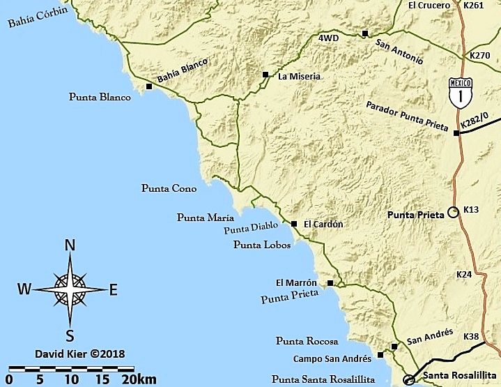
The paved road to Santa Rosalillita is at Km. 38.5. Go west 7.8 miles to the dirt highway running north. The good graded road ends at the Punta Cono
junction. 4WD is best to continue north.
|
|
|
WestyWanderer
Nomad
 
Posts: 284
Registered: 10-24-2014
Location: San Clemente, CA
Member Is Offline
|
|
Cardon might as well be San Miguel, the only thing keeping it less crowded is it’s remote location, everybody knows where it is.
Steve, you don’t even need 4x4 to get there unless it’s rained recently. Having said that, the best camping spots at Cardon are much easier to get
into with 4x4. DK’s description is spot on.
|
|
|
steve5555
Nomad
 
Posts: 204
Registered: 7-9-2008
Location: Jamul, CA
Member Is Offline
|
|
Thanks everyone. I had seen a dirt road off of Hwy 1 (north of the junction to Santa Rosalita) and it looked quicker. Im guessing though that it is
impassable. Im a premium member of Surfline and their google directions sent me the route via Santa Rosalita. Just wanted to check. thanks.
As always we will try hard to be respectful of the countryside and coast.
Steve
|
|
|
David K
Honored Nomad
        
Posts: 65436
Registered: 8-30-2002
Location: San Diego County
Member Is Offline
Mood: Have Baja Fever
|
|
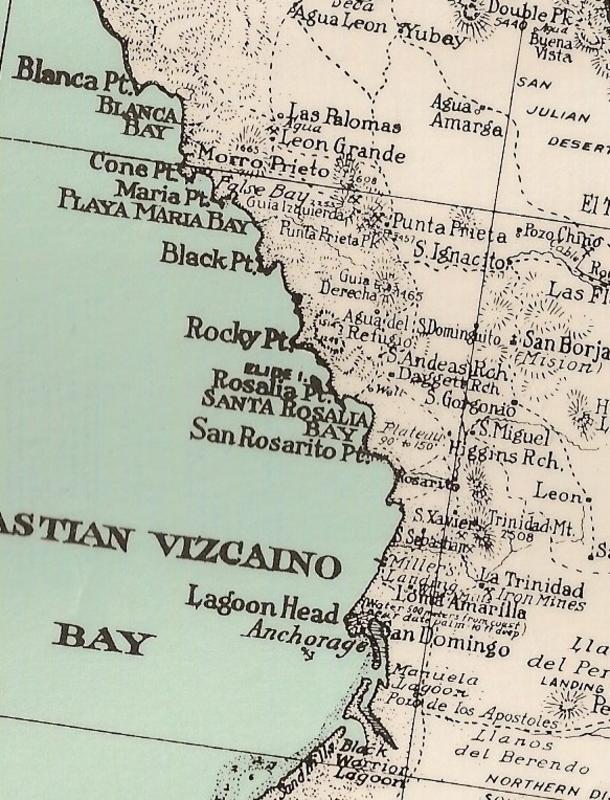
It is spelled "Rosalillita" but incorrectly sometimes as "Rosaliita". Yes, it means "Little Santa Rosalía"... the original name for the point. See
this map from 1930:
1941 map:
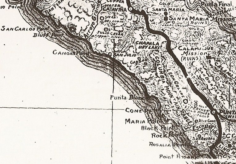
The name was altered to 'Santa Rosalillita' after the French Mine Town of the same name became famous in books, perhaps soon after WWII, to prevent
confusion!
|
|
|
David Nuevo
Junior Nomad

Posts: 64
Registered: 1-24-2018
Member Is Offline
|
|
The name was officially changed many years ago to "El Crowd-On".
|
|
|
David K
Honored Nomad
        
Posts: 65436
Registered: 8-30-2002
Location: San Diego County
Member Is Offline
Mood: Have Baja Fever
|
|
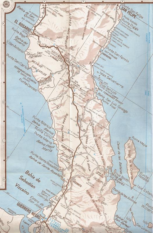
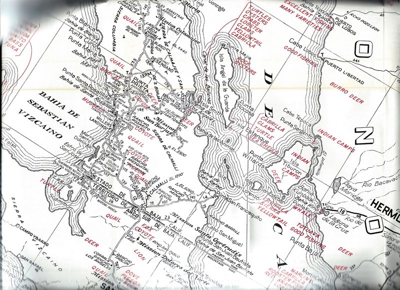
"Little Rosalia" is Rosalillita... traditional spelling at all places with the same name. A double i (ii) has never been seen by me in place names or
Spanish words... have you see it?
INEGI makes so many map errors, I just don't trust them to get this right, lol!
I have never seen the Auto Club spell a Baja place wrong:
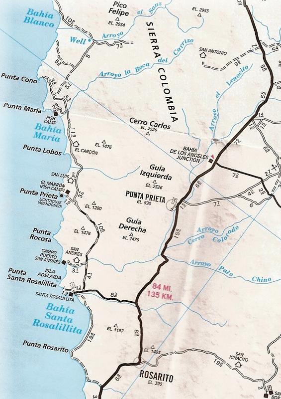
2010
1974
1962
Also, The Lower California Guidebook (1956-1970):

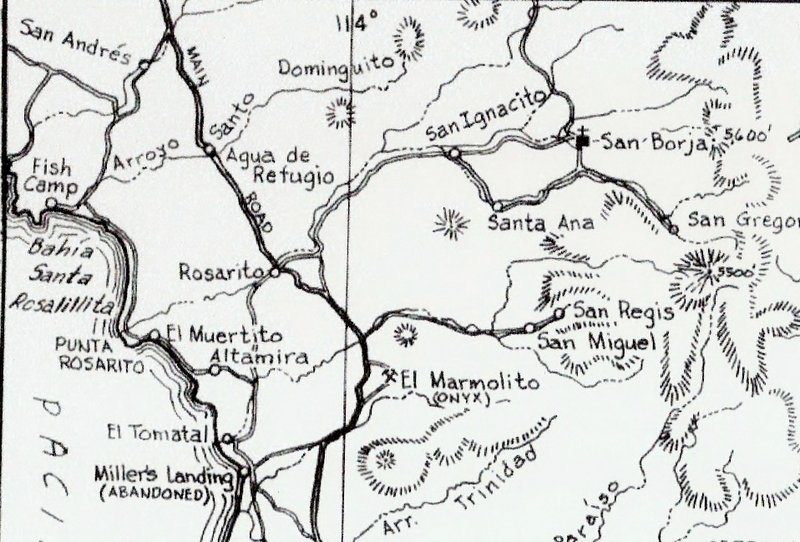
1962
|
|
|
JZ
Select Nomad
      
Posts: 13939
Registered: 10-3-2003
Member Is Offline
|
|
Santa Rosaliíta per Google Maps.
|
|
|
SFandH
Elite Nomad
     
Posts: 7455
Registered: 8-5-2011
Member Is Offline
|
|
Normally, to form the diminutive of a word ending in "a", you drop the a and add "ita"
casa -> casita
perra -> perrita
caja -> cajita
so.....Rosalia -> Rosaliita
pronounced rosa-lee-eeta with the accent on the second ee.
How Rosalillita came about is a mystery.
[Edited on 9-28-2020 by SFandH]
|
|
|
David K
Honored Nomad
        
Posts: 65436
Registered: 8-30-2002
Location: San Diego County
Member Is Offline
Mood: Have Baja Fever
|
|
Maybe it is a new word? I don't know and I have no input on the original Rosalillita spelling vs this new, millennial Rosaliita.
Can you give examples of the double i in other place names in Baja... or even in Mexico?
|
|
|
David Nuevo
Junior Nomad

Posts: 64
Registered: 1-24-2018
Member Is Offline
|
|
Remember, the language was being spoken before all the spelling and grammar rules came along to try to make sense of it all. Easy to see how the two
different spellings could be applied to the same pre-existing pronunciation.
|
|
|
JZ
Select Nomad
      
Posts: 13939
Registered: 10-3-2003
Member Is Offline
|
|
There are road signs for it off MX 1. What do they say?
|
|
|
vandy
Senior Nomad
  
Posts: 538
Registered: 10-10-2003
Member Is Offline
|
|
And as far as native spelling skills, I wish I had taken pictures of the series of official signs I saw on a bridge on hwy 1 between Santiago and
Miraflores.
The first said "Puente Las Vivoras".
A month or so later it was "Bivoras"
The last and current one reads correctly "Viboras"
They are all pronounced the same.
|
|
|
David K
Honored Nomad
        
Posts: 65436
Registered: 8-30-2002
Location: San Diego County
Member Is Offline
Mood: Have Baja Fever
|
|
2009 Baja Almanac (made from Mexican INEGI maps)
Now, it is true that Landon added names, mileages, etc. I don't know if he changed any spellings?
Here is the 2009 Almanac with the traditional spelling of the town, point, and bay:
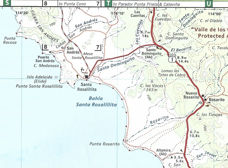
|
|
|
| Pages:
1
2 |

