PaulW
Ultra Nomad
    
Posts: 3113
Registered: 5-21-2013
Member Is Offline
|
|
Offroadig GPS
Offering for Garmin fans
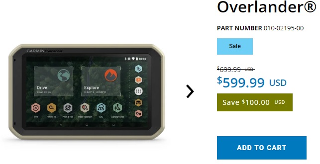
Garmin overlander. A 7” screen. It is not a NUVI as you can tell by the price.
https://www.garmin.com/en-US/blog/automotive/explore-more-wi...
Anybody have one?

|
|
|
advrider
Super Nomad
   
Posts: 1920
Registered: 10-2-2015
Member Is Offline
|
|
Nice looking unit but I have found Garmin very hard to use. I have spent countless hours trying to load stuff on my Garmin with little success. Could
just be me but I find most phone GPS app's much easier to use and no you don't need cell service for them to work.
|
|
|
PaulW
Ultra Nomad
    
Posts: 3113
Registered: 5-21-2013
Member Is Offline
|
|
My experience with Garmin is about the same as Lowrance. Huge learning curve then easy after that.
With the phone or tablet if you want to use all the capabilities then there is a learning period.
Trouble with all the non GPS units I have tried the image is very poor.
Phone is way to small and tablet is usually big enough, but hard to read.
Lots of pluses and minuses, but except for the learning curve on a GPS they will always be my favorite.
|
|
|
TMW
Select Nomad
      
Posts: 10659
Registered: 9-1-2003
Location: Bakersfield, CA
Member Is Offline
|
|
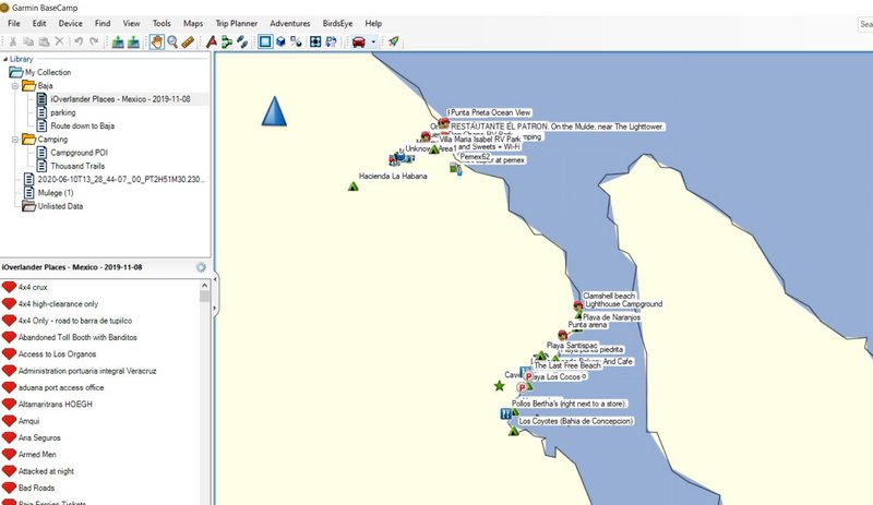
Loading stuff in a Garmin is usually thru BaseCamp. Once you learn how it's easy.
|
|
|
Mr. Bills
Nomad
 
Posts: 189
Registered: 9-10-2019
Location: Area Code 530
Member Is Offline
|
|
I looked at the Garmin Overlander, but in the end decided my money was better spent on a Garmin inReach Explorer+ and an inexpensive Garmin Drive 51
navigation unit.
Even the cheapest model of the Garmin Drive navigation units is capable of using a multitude of third party maps and Open Street Map files.
I haven't had much opportunity to experiment with the Garmin navigation unit in 2020, but last year used the Garmin Drive 51 with the Cartografia 32
topo map of Baja. Worked great.
|
|
|
larryC
Super Nomad
   
Posts: 1499
Registered: 8-11-2008
Location: BoLA
Member Is Offline
|
|
Along the same lines, I'm trying to use Google maps off line but can't figure out how to download the maps. It seems to have better resolution than
Gaia. Anyone had luck with google maps offline?
Off grid, 12-190 watt evergreen solar panels on solar trackers, 2-3648 stacked Outback inverters, 610ah LiFePo4 48v battery bank, FM 60 and MX60
Outback charge controllers, X-240 Outback transformer for 240v from inverters, 6500 watt Kubota diesel generator.
|
|
|
StuckSucks
Super Nomad
   
Posts: 2369
Registered: 10-17-2013
Location: Pacific Plate
Member Is Offline
|
|
Quote: Originally posted by larryC  | | Along the same lines, I'm trying to use Google maps off line but can't figure out how to download the maps. It seems to have better resolution than
Gaia. Anyone had luck with google maps offline? |
Google's downloadable maps are the map version only, not satellite, so if you get away from any infrastructure, there is nothing to see on the map. In
a Baja, off-line world, I find them useless.
With Gaia, you can download all your map layers including satellite (granted, not as good as Google's sat view).
|
|
|
StuckSucks
Super Nomad
   
Posts: 2369
Registered: 10-17-2013
Location: Pacific Plate
Member Is Offline
|
|
Quote: Originally posted by larryC  | | Along the same lines, I'm trying to use Google maps off line but can't figure out how to download the maps. |
Download a Google map to use offline
1. On your iPhone or iPad, open the Google Maps app.
2. Make sure you're connected to the Internet and are not in Incognito mode.
3. Search for a place, like San Francisco .
4. At the bottom, tap the name or address of the place.
5. On the resulting page, in the upper right, click the 3 dots menu.
6. Select Download offline map. Download.
|
|
|
PaulW
Ultra Nomad
    
Posts: 3113
Registered: 5-21-2013
Member Is Offline
|
|
And repeat for any place you want offline maps.
Like choose San felipe Bc or Mexicali BC, etc.
And for redundancy do a similar drilfor maps.me. The you will have two choices of offline maps.
|
|
|
advrider
Super Nomad
   
Posts: 1920
Registered: 10-2-2015
Member Is Offline
|
|
Good info stuck..
|
|
|
msteve1014
Senior Nomad
  
Posts: 947
Registered: 12-2-2006
Member Is Offline
|
|
As was said before, those maps are great for finding a place in Mexicali or Ensenada, but a map of the Viscaino area will show almost nothing.
|
|
|
JZ
Select Nomad
      
Posts: 13649
Registered: 10-3-2003
Member Is Online
|
|
Hard pass on a standalone GPS. Not user friendly.
Back Country Navigator or Gaia are the best GPS apps for your phone.
Google Maps for paved roads in Baja.
[Edited on 12-7-2020 by JZ]
|
|
|
PaulW
Ultra Nomad
    
Posts: 3113
Registered: 5-21-2013
Member Is Offline
|
|
Back Country Navigator or Gaia backcountry tracks
Correct, but no POIs for a new traveler
All have a purpose
|
|
|
4x4abc
Ultra Nomad
    
Posts: 4454
Registered: 4-24-2009
Location: La Paz, BCS
Member Is Offline
Mood: happy - always
|
|
sure you can use Google Earth imagery offline.
They are held in cache.
cache is limited in size, but you can create as many diffenret cache files as your computer/tablet can hold
will work on tablet as well as on laptop - not on phone
there is a number of help applications out there - here is an example:
https://qpdownload.com/cache-for-google-earth/
Mac users have to create their own cache files - easy, but time consuming
and yes, Garmin sucks. InReach sucked before it was acquired by Garmin - and it it did not improve a bit. One of the most useful tools. But one of the
most cumbersome.
Garmin will go away like Blockbuster.
The smart kids are just getting ready.
Harald Pietschmann
|
|
|
bajaric
Senior Nomad
  
Posts: 668
Registered: 2-2-2015
Member Is Offline
|
|
I tried the Google Maps thing on a tablet, where you select "offline maps" and the draw a rectangle for the area that you want to save to the tablet's
memory cache. This actually saves not only the street maps, but a satellite view, however the satellite view was such low resolution that when zoomed
in it was blurry. Only JZ know the secret of saving hi res satellite views to a tablet.
|
|
|
HeyMulegeScott
Senior Nomad
  
Posts: 717
Registered: 8-25-2009
Location: Orygone/Mulege
Member Is Offline
|
|
One of the benefits of this unit is that it has preloaded data from ioverlander.com but you can download that data for free from ioverlander and use
in Basecamp to update any Garmin GPS unit, even mine from the stoneage.

|
|
|
JZ
Select Nomad
      
Posts: 13649
Registered: 10-3-2003
Member Is Online
|
|
Quote: Originally posted by 4x4abc  | sure you can use Google Earth imagery offline.
They are held in cache.
cache is limited in size, but you can create as many diffenret cache files as your computer/tablet can hold
will work on tablet as well as on laptop - not on phone
there is a number of help applications out there - here is an example:
https://qpdownload.com/cache-for-google-earth/
Mac users have to create their own cache files - easy, but time consuming
and yes, Garmin sucks. InReach sucked before it was acquired by Garmin - and it it did not improve a bit. One of the most useful tools. But one of the
most cumbersome.
Garmin will go away like Blockbuster.
The smart kids are just getting ready.
|
I have the equivalent of Google Earth satellite imagery for offline use. Works on phone and tablet. All of Baja.
It's like seeing yourself drive / ride on GE.
|
|
|
JZ
Select Nomad
      
Posts: 13649
Registered: 10-3-2003
Member Is Online
|
|
The other thing to remember is the phone apps are also supported on the dash screens of newer trucks.
The new Bronco has a huge 12 inch LED screen that runs Gaia.
|
|
|

