| Pages:
1
2
3
4 |
steekers
Nomad
 
Posts: 255
Registered: 12-4-2007
Member Is Offline
|
|
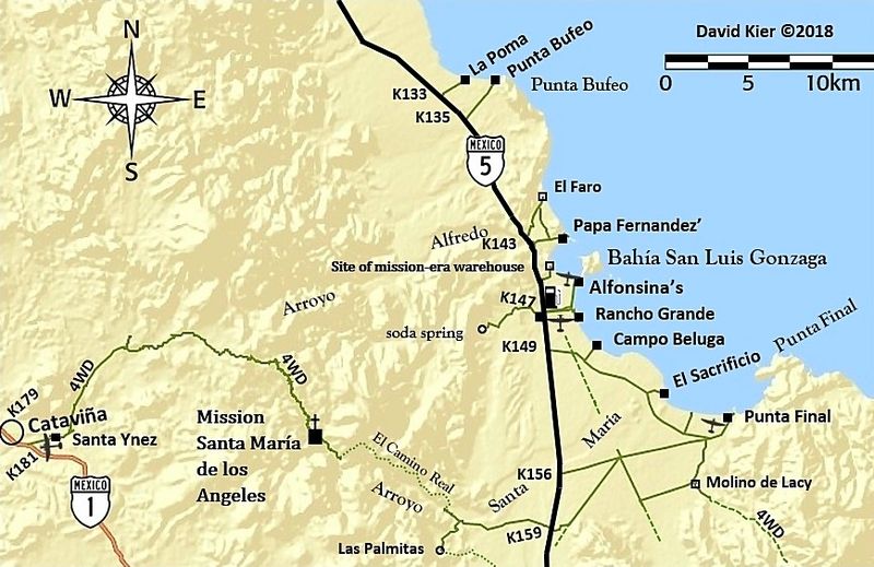
Hike to Oasis Santa Maria from Gonzaga side
Looking for some brave souls to accompany me on a photo mission hike up the Santa Maria wash from the Gonzaga side. Likely a 2-3 day mission. Planning
for a weekend in March. I was at the base 3-4 miles in from the new road this last week doing some prelim aerial and ground photo work. Obviously you
need to be in shape for boulder jumping. This should be a fun hike. Love to hear from you.
|
|
|
David K
Honored Nomad
        
Posts: 64852
Registered: 8-30-2002
Location: San Diego County
Member Is Offline
Mood: Have Baja Fever
|
|
OH BOY!!!   
[Edited on 1-29-2021 by David K]
|
|
|
David K
Honored Nomad
        
Posts: 64852
Registered: 8-30-2002
Location: San Diego County
Member Is Offline
Mood: Have Baja Fever
|
|
I last hiked up the canyon in 1999, with the late Baja Mur. We hiked about a mile to where water pools were deep enough to take a dip, but not the
pretty oasis seen on Internet photos (La Poza de Escuadra):

|
|
|
TMW
Select Nomad
      
Posts: 10659
Registered: 9-1-2003
Location: Bakersfield, CA
Member Is Offline
|
|
If you need someone to see you off at the start and meet you at the Mission i'll volunteer. Take as long as you want.
|
|
|
David K
Honored Nomad
        
Posts: 64852
Registered: 8-30-2002
Location: San Diego County
Member Is Offline
Mood: Have Baja Fever
|
|
You are always good for the ground support, Tom!
In this case, no mission, just a hike to the oasis in the canyon.
On the new TV show, The Last Mission, they go to the canyon edge (from the mission) and fly a drone to see the oasis below.
Your great support to help Roy, The Squarecircle, get across La Turquesa Canyon so he could climb that grade to Hwy. 1, was commendable! Steekers was
also scouting out the root before Roy attempted it.
|
|
|
TMW
Select Nomad
      
Posts: 10659
Registered: 9-1-2003
Location: Bakersfield, CA
Member Is Offline
|
|
How far is the mission from the the oasis. Real men would go all the way.
|
|
|
David K
Honored Nomad
        
Posts: 64852
Registered: 8-30-2002
Location: San Diego County
Member Is Offline
Mood: Have Baja Fever
|
|
The trail down to the canyon bottom is about 2 miles east of the mission from the end of the bulldozed roadbed at the rim. It is the first El Camino
Real route used before Serra ordered a better route made that stays out of the canyon.
From the rim, it is down down down to the canyon floor.
Google Earth path measuring tool can give you the exact distance.
|
|
|
advrider
Super Nomad
   
Posts: 1863
Registered: 10-2-2015
Member Is Offline
|
|
Wish I could get down there, I would love to do that hike... It's on the list of must see/do things in Baja.... Take lots of pictures. What would you
guess will be the total mileage in and out?
[Edited on 1-30-2021 by advrider]
|
|
|
David K
Honored Nomad
        
Posts: 64852
Registered: 8-30-2002
Location: San Diego County
Member Is Offline
Mood: Have Baja Fever
|
|
From where you can drive a 4x4, about 3-4 miles each way.
|
|
|
advrider
Super Nomad
   
Posts: 1863
Registered: 10-2-2015
Member Is Offline
|
|
Not a bad hike at all, I'm sure there is plenty of elevation gain and rock hopping to add in. It would be neat to camp near the oasis...
|
|
|
David K
Honored Nomad
        
Posts: 64852
Registered: 8-30-2002
Location: San Diego County
Member Is Offline
Mood: Have Baja Fever
|
|
Quote: Originally posted by advrider  | | Not a bad hike at all, I'm sure there is plenty of elevation gain and rock hopping to add in. It would be neat to camp near the oasis...
|
It is a sandy-bottom arroyo at first... but boulders and brush prevent quads and motorcycles from going much further than a 4x4. It is hard to imaging
that the first missionaries went this way on horses or mules. It is no wonder that Junípero Serra ordered a better road be made that stayed out of
the canyon, after he arrived at Santa María in May 1769, on his journey to San Diego!
|
|
|
David K
Honored Nomad
        
Posts: 64852
Registered: 8-30-2002
Location: San Diego County
Member Is Offline
Mood: Have Baja Fever
|
|
From 1999... up and over Arroyo Santa María:

Not far from where the road ended in the sandy arroyo, we enter the canyon on foot... I am pointing the way!
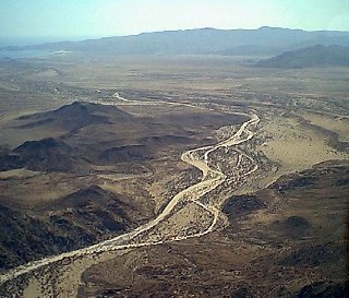
The next day, we asked Douglas to fly us over the canyon and the mission.
This photo is over the canyon entrance looking east to Punta Final. I am about at the bottom left corner of the photo in my pointing photo.

About a mile up the Santa María canyon we find pools of water.
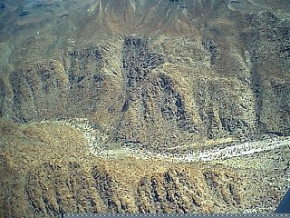
Location of the pools, looking north.

This image is looking east. The bulldozed road is seen going to the canyon edge and the trail (first El Camino Real) continues down to the canyon
bottom. The big osais (La Poza de Escuadra) is at the bottom of the trail or near it.
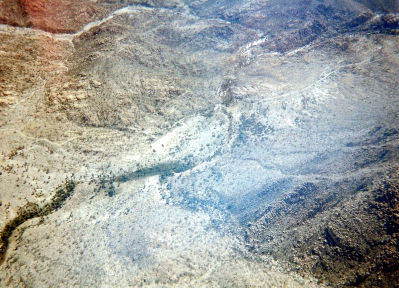
The mission from Doug's plane. View north.
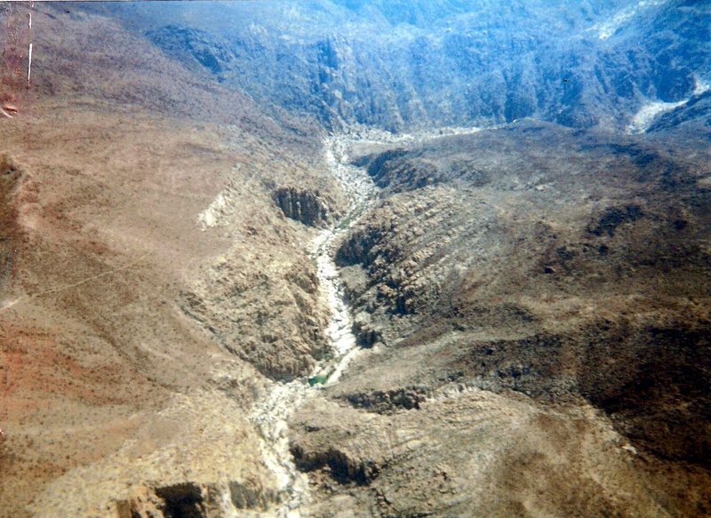
Flying back to Alfonsina's, this photo is looking into the canyon where the big oasis is. Note the early El Camino Real on the left going down.
Well, even though we didn't hike the 3-4 miles to the big oasis, I found one just my size!

|
|
|
steekers
Nomad
 
Posts: 255
Registered: 12-4-2007
Member Is Offline
|
|
My goal is to get lots of close up photos. Use of my drone is key to getting an aerial perspective. I suppose I could fly over it in a real plane and
get photos, but NOT the same quality. Getting 4K quality video and hi-res stills are a photographer"s goal.
The hike of 3-4 miles from base should not be that strenuous. Slight altitude gain. Just fields of boulders.
At base camp, a few will camp out and just hang around. Those who take the full hike might stay 1 night close to the pools. Goal: the pools, not the
mission.
Planning the weekend of the 27th of March. That Sunday is the full moon.
[Edited on 1-31-2021 by steekers]
|
|
|
David K
Honored Nomad
        
Posts: 64852
Registered: 8-30-2002
Location: San Diego County
Member Is Offline
Mood: Have Baja Fever
|
|
I would like to go... it has been 22 years since I last hiked in the canyon. I would like to see what has changed (besides me)!
This canyon is the original El Camino Real route of May 26, 1767 when Padre Victoriano Arnés moved his mission from Calamajué to Cabujakaamang, the
Cochimí name for the new site of Mission Santa María de los Angeles.
On May 5, 1769, Junípero Serra (Franciscan president, and now Saint), came this way on his journey to San Diego from Loreto.
He began the day after overnighting at the waterhole of San Francisco (renamed San Francisquito, near Las Arrastras along the new Hwy. 5)
On the 5th I rose good and early, and by a most grievous road, which
they call [that of] the Caxon {Cajon},* arrived at about half-past eight of the morning at the Mission of Santa Maria de los Angeles. Here I
encountered the Senior Governor with the Father Fray Miguel de la Campa; and part of the Retinue had already gone on ahead to Vila Catha [Velicatá],
for the recuperation of the beasts, which there had grass that they lacked here. We were mutually glad to see ourselves already joined to begin anew
our peregrination through a desert land populated only with Infidelity, with innumerable Gentiles.
* Cajon, a great box; a " box-canyon.
Serra later ordered a better route be made that stayed out of the canyon and kept to the hills on the north side of it.
It is the post-Serra El Camino Real that we hike on and have mapped:
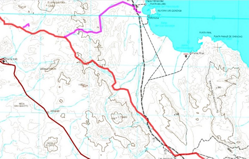
The blue trail is Serra's cargo or Antelope Spring trail.
|
|
|
Don Jorge
Senior Nomad
  
Posts: 648
Registered: 8-29-2003
Member Is Online
|
|
Quote: Originally posted by steekers  | My goal is to get lots of close up photos. Use of my drone is key to getting an aerial perspective. I suppose I could fly over it in a real plane and
get photos, but NOT the same quality. Getting 4K quality video and hi-res stills are a photographer"s goal.
The hike of 3-4 miles from base should not be that strenuous. Slight altitude gain. Just fields of boulders.
At base camp, a few will camp out and just hang around. Those who take the full hike might stay 1 night close to the pools. Goal: the pools, not the
mission.
Planning the weekend of the 27th of March. That Sunday is the full moon.
[Edited on 1-31-2021 by steekers] |
It is an easy day hike up the wash with time to lounge and lunch with some rock hopping to keep it fun. Before drones we would climb up the canyons to
get the "aerial" perspective.
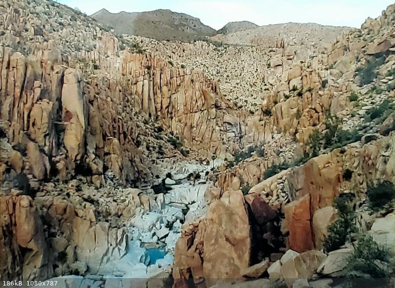
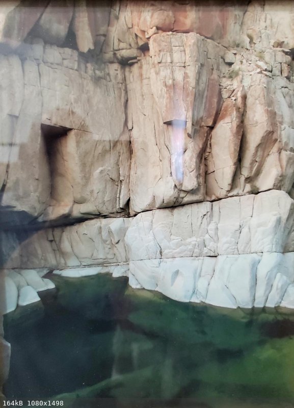
The main pool is deep enough for diving.
If one is doing the loop hike, choosing to go up and around on the north side and return down the arroyo from the mission, the easiest way to get
around that series of pools is to jump in and carry on.
Attached are pictures of pictures we had blown up and framed, thus the poor quality. Sorry about that chief.
�And it never failed that during the dry years the people forgot about the rich years, and during the wet years they lost all memory of the dry
years. It was always that way.�― John Steinbeck
"All models are wrong, but some are useful." George E.P. Box
"Nature bats last." Doug "Hayduke" Peac-ck
|
|
|
steekers
Nomad
 
Posts: 255
Registered: 12-4-2007
Member Is Offline
|
|
Very nice shots Don Jorge. This place seems magical. I love all the different rock formations. Nice to have David come along. Looking forward to this
trip. 
[Edited on 2-3-2021 by steekers]
|
|
|
aburruss
Nomad
 
Posts: 218
Registered: 2-6-2018
Member Is Offline
|
|
I think the wife and I are a definite MAYBE. This is on her bucket list, and it would be a great trip.. AND the timing actually works out for us.
Would a couple adventurous 9 and 10 year olds be able to do this? Would you be interested in a couple of awesome kids on this trip? 
|
|
|
David K
Honored Nomad
        
Posts: 64852
Registered: 8-30-2002
Location: San Diego County
Member Is Offline
Mood: Have Baja Fever
|
|
I want to go... and I am happy to provide as much logistical support as possible to steekers and others.
Until the Covid restrictions change, I won't go and risk bringing it back to my wife, who is high-risk.
|
|
|
TMW
Select Nomad
      
Posts: 10659
Registered: 9-1-2003
Location: Bakersfield, CA
Member Is Offline
|
|
I got my first shot yesterday almost by accident.
|
|
|
steekers
Nomad
 
Posts: 255
Registered: 12-4-2007
Member Is Offline
|
|
Quote: Originally posted by aburruss  | I think the wife and I are a definite MAYBE. This is on her bucket list, and it would be a great trip.. AND the timing actually works out for us.
Would a couple adventurous 9 and 10 year olds be able to do this? Would you be interested in a couple of awesome kids on this trip?  |
Why not. I don't mind at all. Better to have a small group. Thanks for the interest.
Maybe tunaeater or someone in his clan might go.
|
|
|
| Pages:
1
2
3
4 |

