volcano3
Junior Nomad

Posts: 37
Registered: 12-9-2021
Member Is Offline
|
|
Sierra de la Laguna
has anyone been into the Sierra de la Laguna either via the relatively new signed entrance near San Antonio, or via Santa Cruz and Las Cuevas, Info?
vehicle type, trails? looking at that area specifically.
|
|
|
David K
Honored Nomad
        
Posts: 65434
Registered: 8-30-2002
Location: San Diego County
Member Is Offline
Mood: Have Baja Fever
|
|
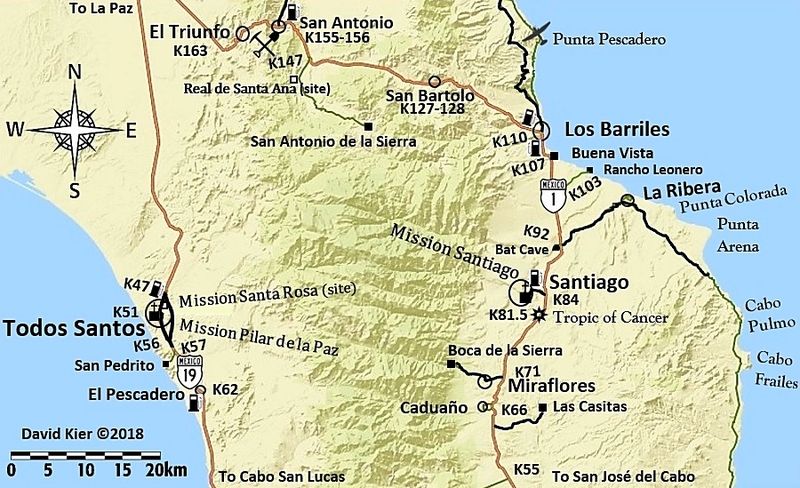
The road signed San Antonio de la Sierra was a nice drive... we went with Jimmy Smith way back in December of 2001. A good, graded road. Jimmy wanted
to show us some güéribo trees after we saw the mill and oven of the Real de Santa Ana (California's oldest mine), also off that road. Km. 147:

[Edited on 1-26-2022 by David K]
|
|
|
wilderone
Ultra Nomad
    
Posts: 3895
Registered: 2-9-2004
Member Is Offline
|
|
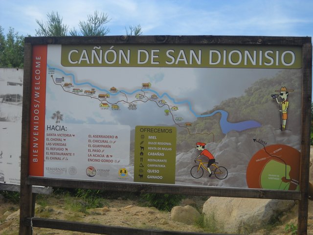
From Santiago, you can go north once in town - you'll see many signs at the junction - left, right, straight. There is a sign for San Dionisio
(straight), which is the last point for further excursion into Sierra de la Laguna (maybe 12 mi. from the junction). You could also go left - to Sol
de Mayo - and start hiking from there. Looks like Santa Amalia is another 3 miles past Sol de Mayo - end of the road. I went to Sol de Mayo in a
standard sedan. I have notes from a truck transverse of Sierra de la Laguna - started off Mex. 1 at a sign "Presa La Palma" which is north of San
Bartolo. It's 33 mi. on that route to Mex. 19 on the other side (reported took about 3 hrs). I have more info on this route if you want it.


|
|
|
volcano3
Junior Nomad

Posts: 37
Registered: 12-9-2021
Member Is Offline
|
|
going to do Las Naranjas in a month or so....interested in the more northern access...and Parque.....thanks for your responses
|
|
|
4x4abc
Ultra Nomad
    
Posts: 4454
Registered: 4-24-2009
Location: La Paz, BCS
Member Is Offline
Mood: happy - always
|
|
there are hundreds of trails crossing Sierra La Laguna
only 2 are drivable -
Los Naranjos
Los Potrerillos/Valle Perdido
pretty much all organized hiking concentrates on reaching La Laguna, a 5,700 ft mountain meadow
the 2 classic east routes are from Santiago/San Dionisio and San Antonio de la Sierra/La Victoria
the farthest you can get into Sierra La Laguna with a car is the San Antonio de la Sierra route to Rancho San Venancio - 38 km
that same road takes you to the Rancho La Victoria hiking starting point
I just visited the ranch people at Rancho San Venancio
it is a 6 hour pavement to pavement trip (km 147)
some very steep grades on lose ground
the Los Potrerillos/Valle Perdido crossing also starts at km 147
very scenic route
about 4 hours from km 147 on MEX1 to km 17 on MEX 19
allow time for exploring the mine ruins at Valle Perdido

Teresa at San Venancio

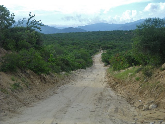
some of the canyons have jungle like vegetation
Harald Pietschmann
|
|
|
4x4abc
Ultra Nomad
    
Posts: 4454
Registered: 4-24-2009
Location: La Paz, BCS
Member Is Offline
Mood: happy - always
|
|
here is more:
https://backend.aprende.sep.gob.mx/media/uploads/proedit/res...
Harald Pietschmann
|
|
|
volcano3
Junior Nomad

Posts: 37
Registered: 12-9-2021
Member Is Offline
|
|
thank you for the excellent details 4x4
|
|
|
4x4abc
Ultra Nomad
    
Posts: 4454
Registered: 4-24-2009
Location: La Paz, BCS
Member Is Offline
Mood: happy - always
|
|
Quote: Originally posted by wilderone  | I have notes from a truck transverse of Sierra de la Laguna - started off Mex. 1 at a sign "Presa La Palma" which is north of San Bartolo. It's 33
mi. on that route to Mex. 19 on the other side (reported took about 3 hrs). I have more info on this route if you want it.
|
Presa la Palma is just north of the Los Cabos airport
it is at the eastern end of the Los Naranjos route
Harald Pietschmann
|
|
|

