| Pages:
1
2
3
4
5
6 |
David K
Honored Nomad

Posts: 65245
Registered: 8-30-2002
Location: San Diego County
Member Is Offline
Mood: Have Baja Fever
|
|
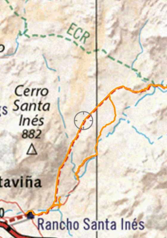
OK, figured out how to share the track:
Three zoom levels to show the original and new arroyo routes:
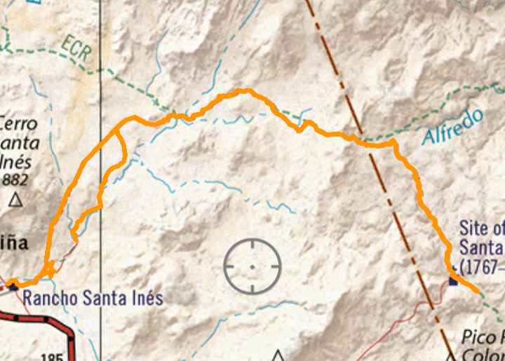
A short section in the arroyo, the tracker was off, on accident.
|
|
|
wilderone
Ultra Nomad
Posts: 3871
Registered: 2-9-2004
Member Is Offline
|
|
Those are some great photos of the mission - creative angles, lighting, etc.
|
|
|
David K
Honored Nomad
Posts: 65245
Registered: 8-30-2002
Location: San Diego County
Member Is Offline
Mood: Have Baja Fever
|
|
Gee thanks, Cindi! A couple look really good when we first could see it, before the sun went behind the mountain. It was after 6 pm when we got
there... six hours drive and repair time since leaving Santa Ynez!
Wait to you see the photos I took at sunrise, on Day 3... Coming up...
|
|
|
bajatrailrider
Super Nomad
Posts: 2475
Registered: 1-24-2015
Location: Mexico
Member Is Offline
Mood: Happy
|
|
that must have been a hard trip David as many broken parts. So you would say this is the hardest run ever? to the mission
|
|
|
David K
Honored Nomad
Posts: 65245
Registered: 8-30-2002
Location: San Diego County
Member Is Offline
Mood: Have Baja Fever
|
|
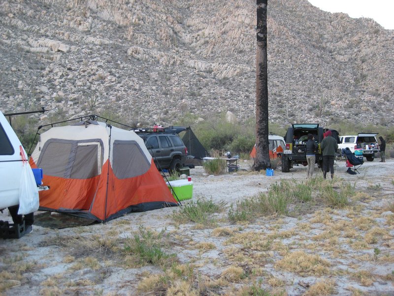
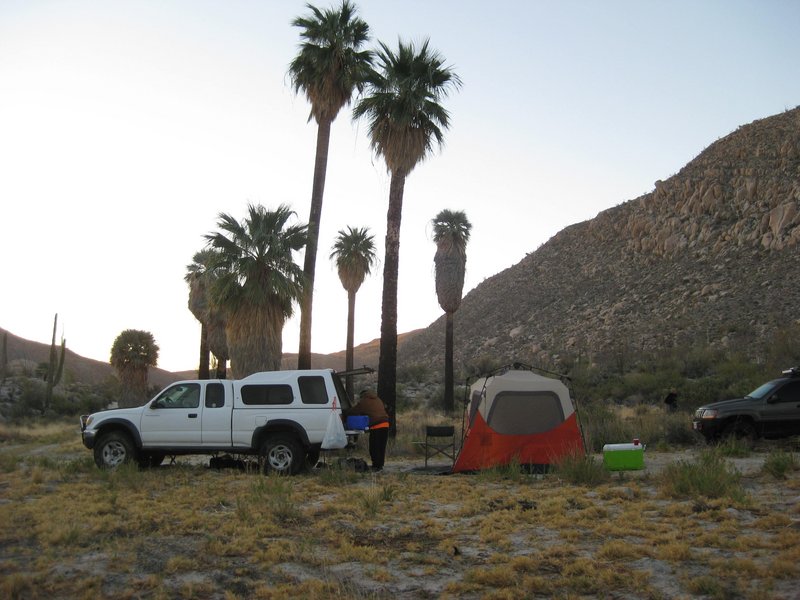
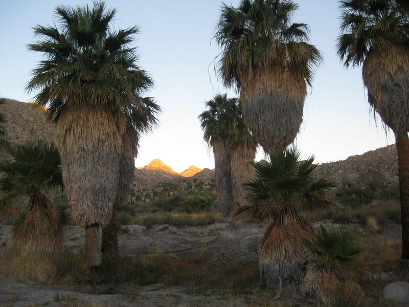
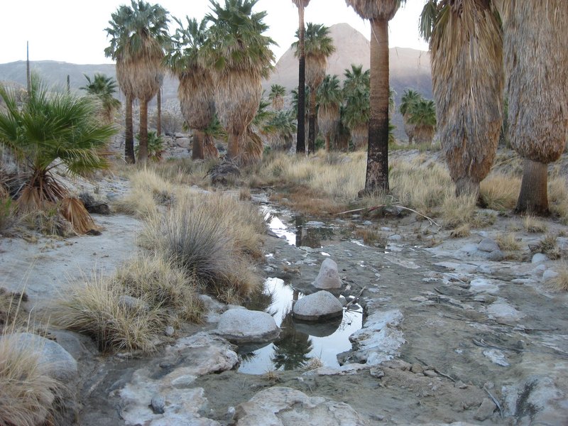
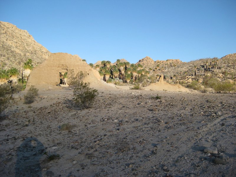
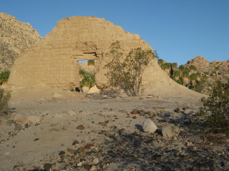
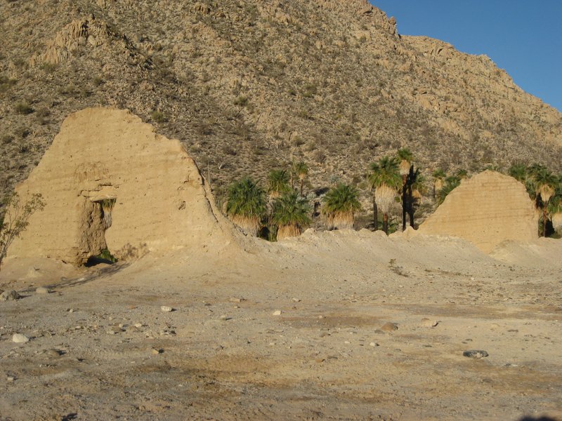
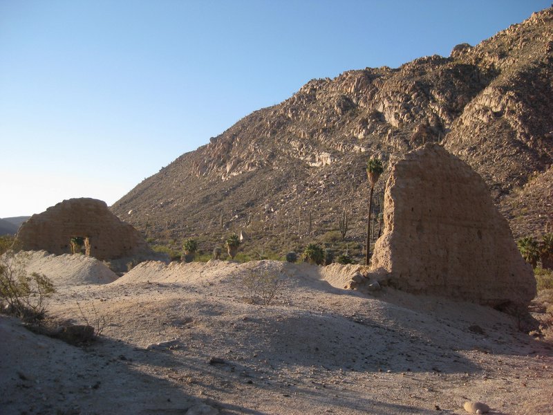
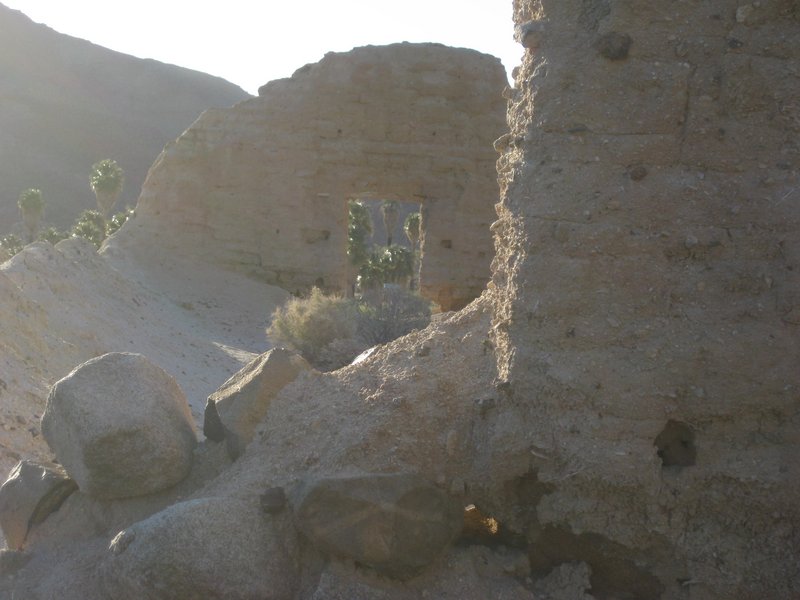
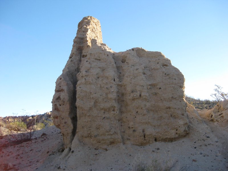
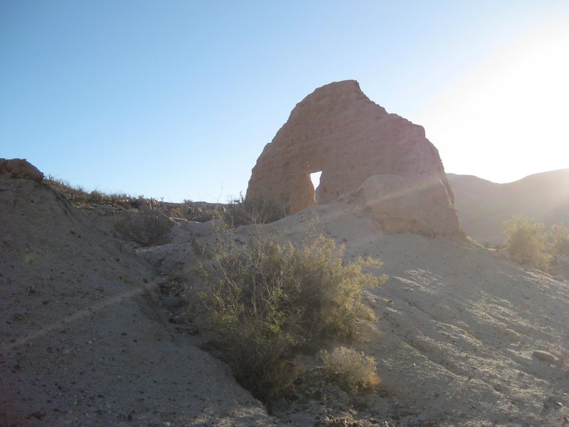
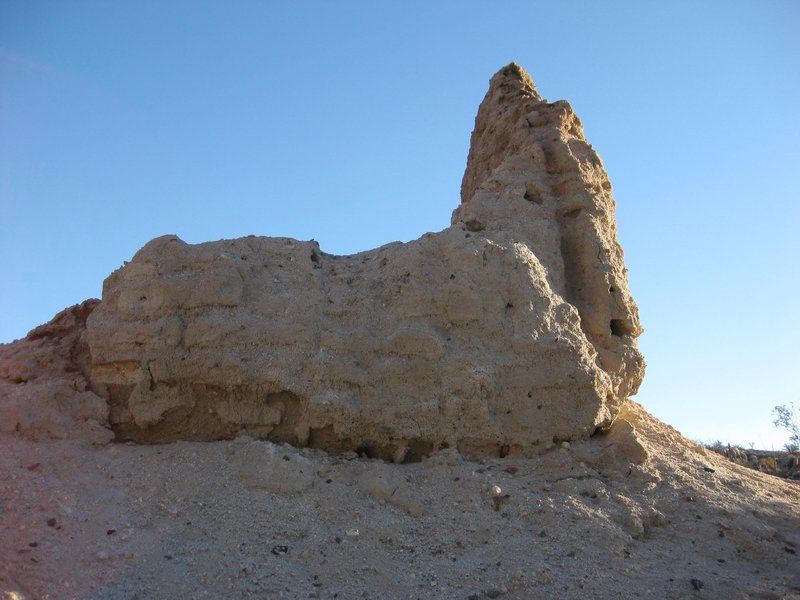
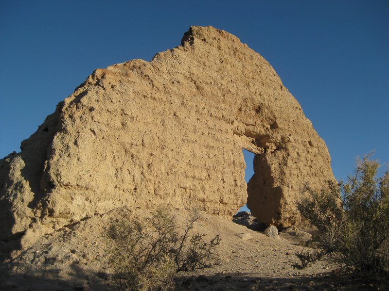
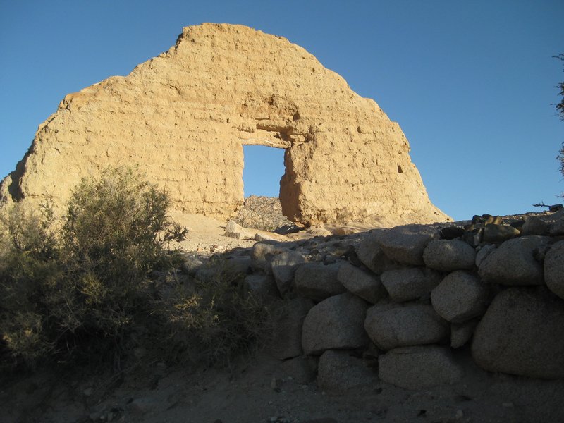
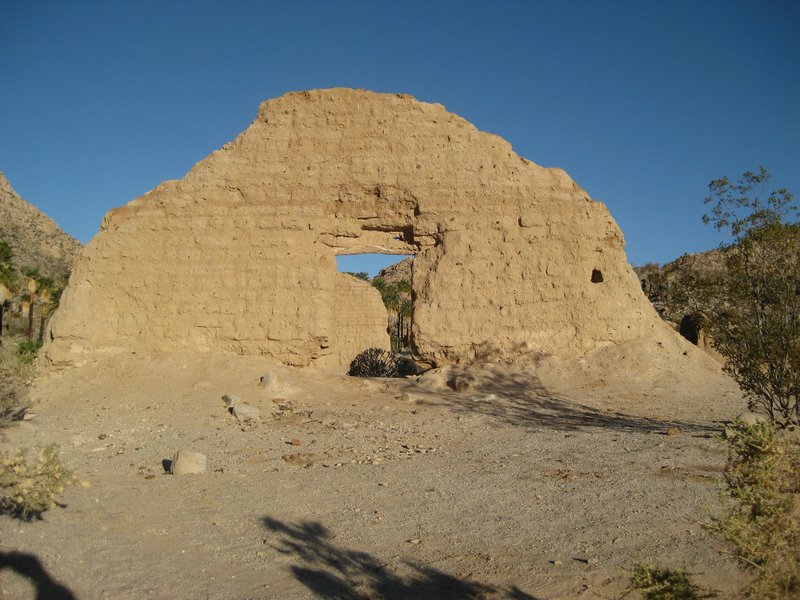
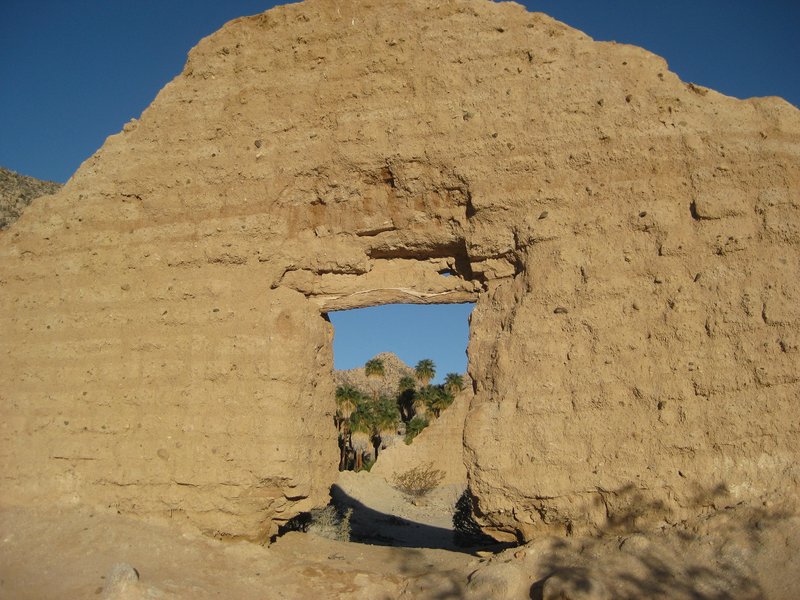
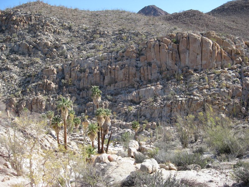
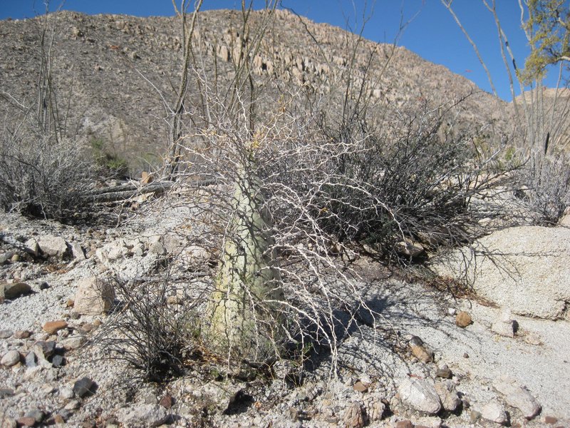
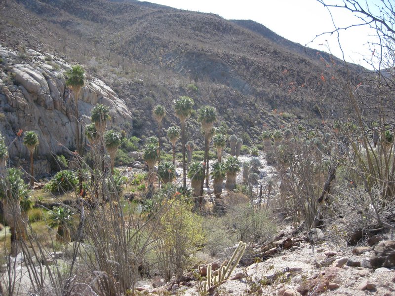
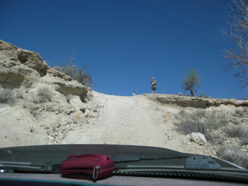
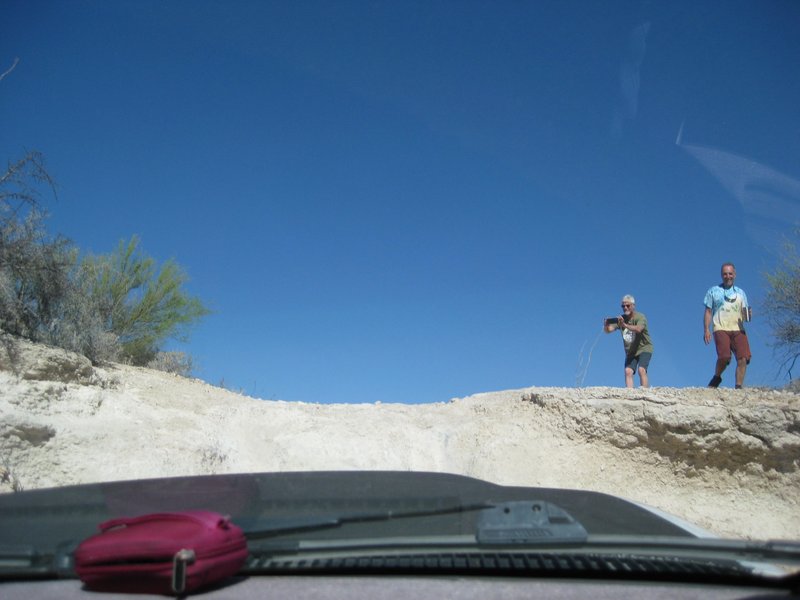
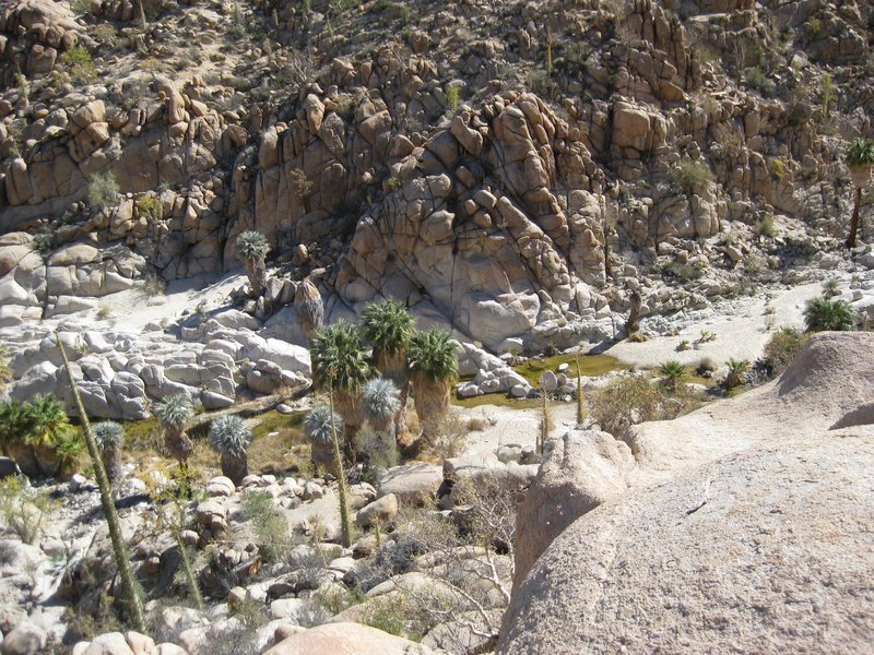
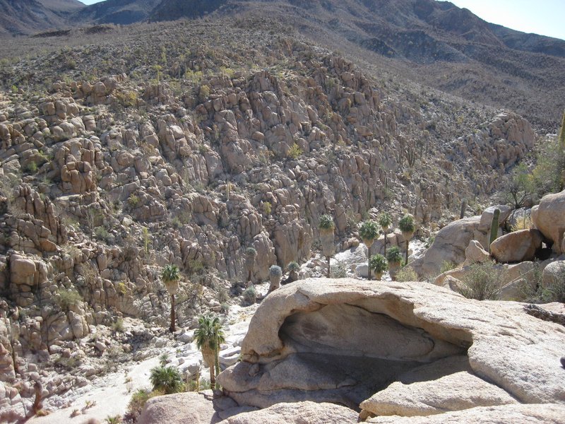
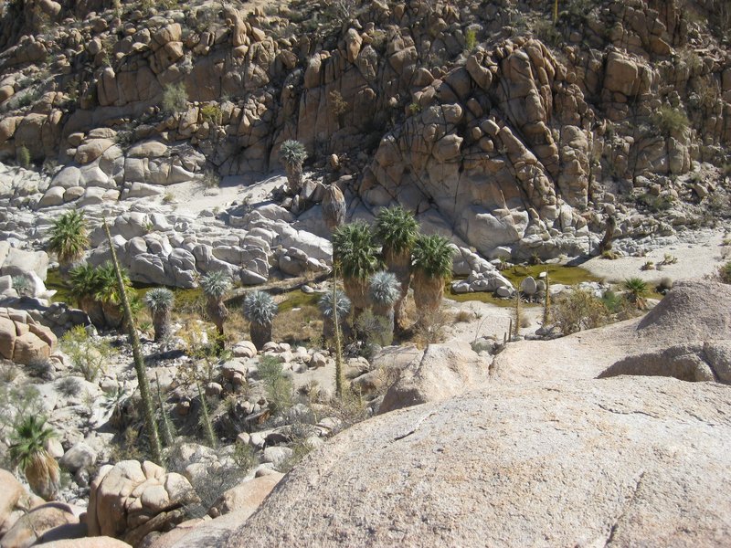
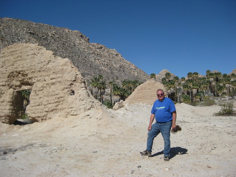
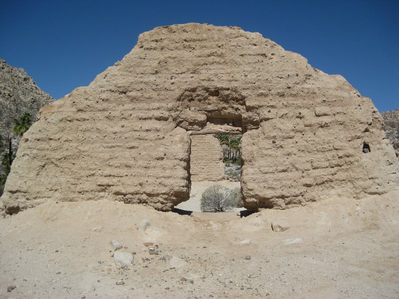
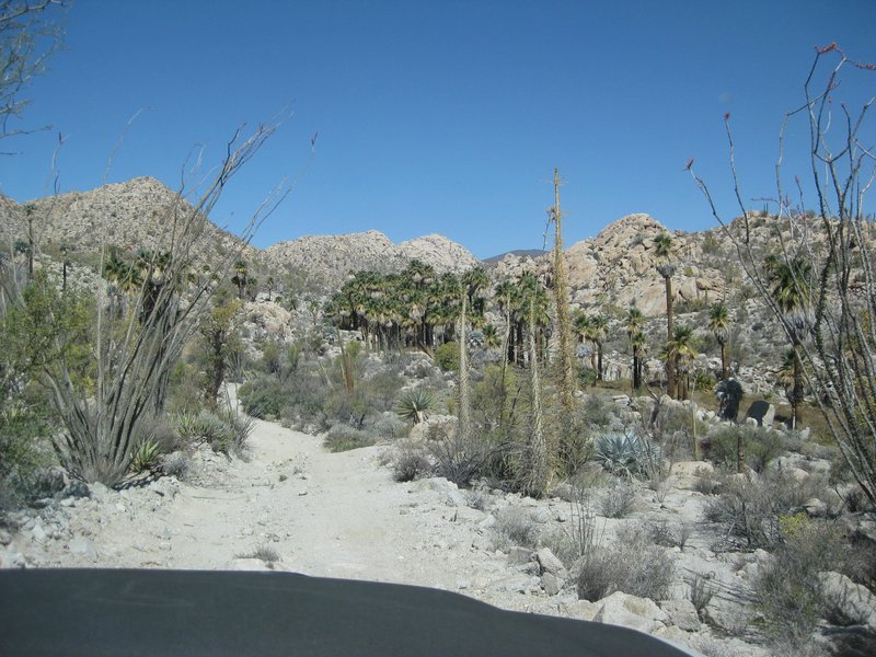
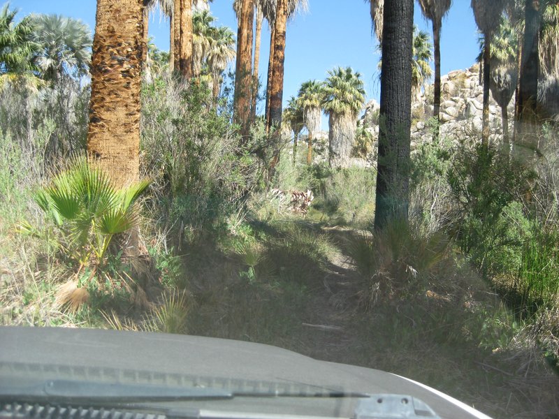
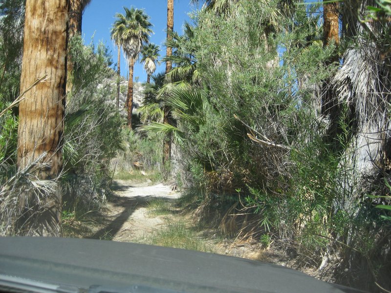
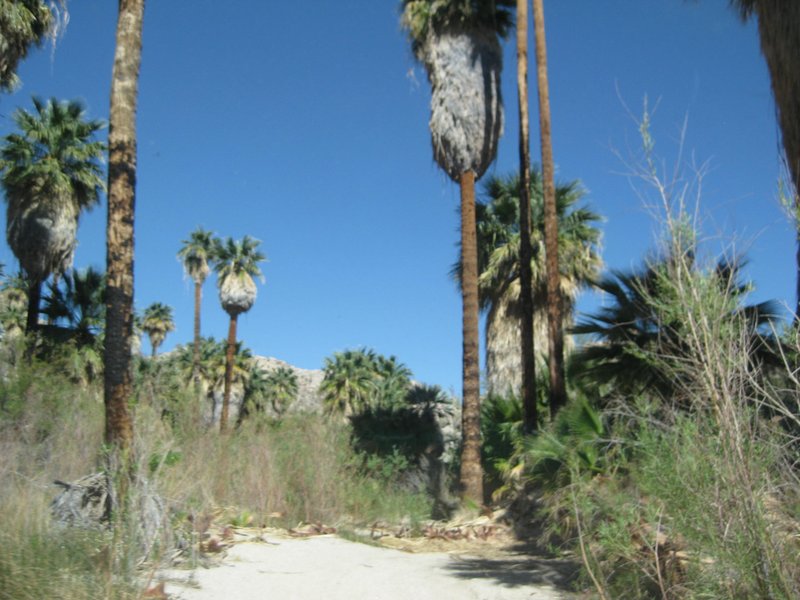
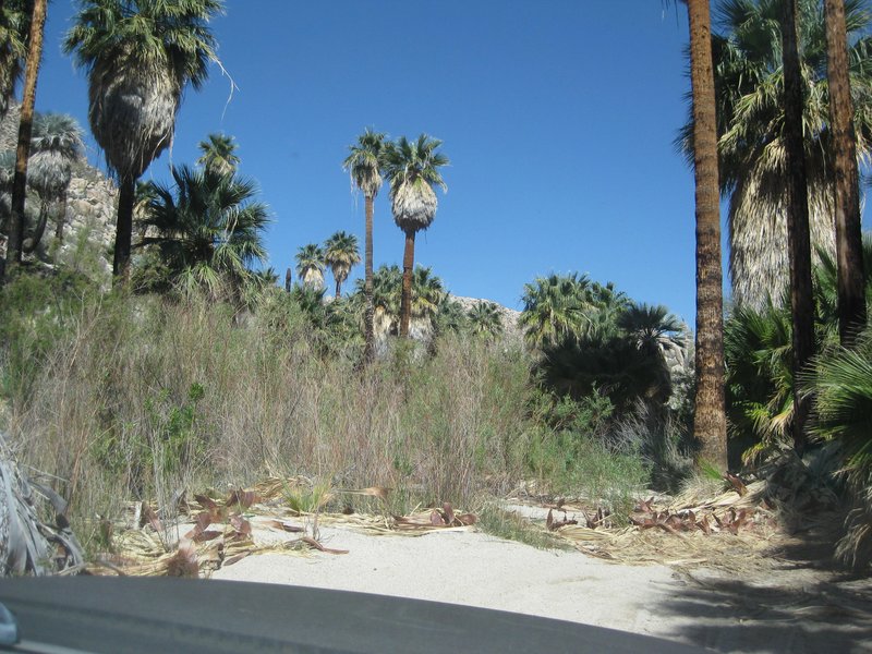
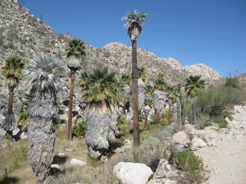
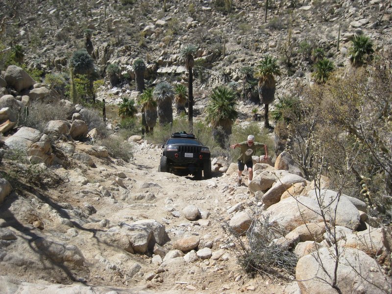
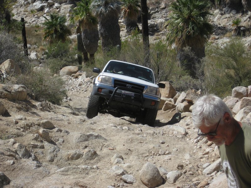
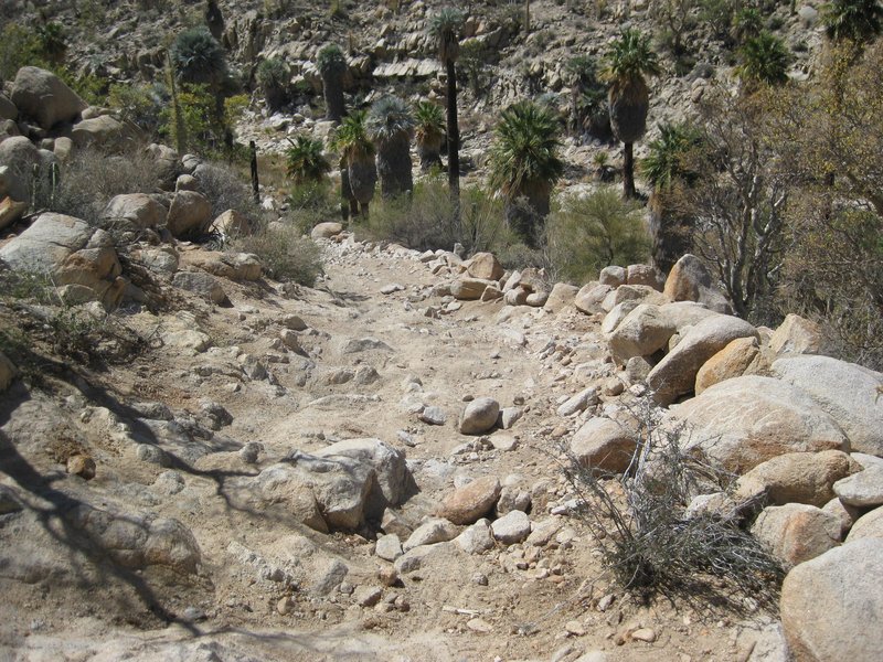
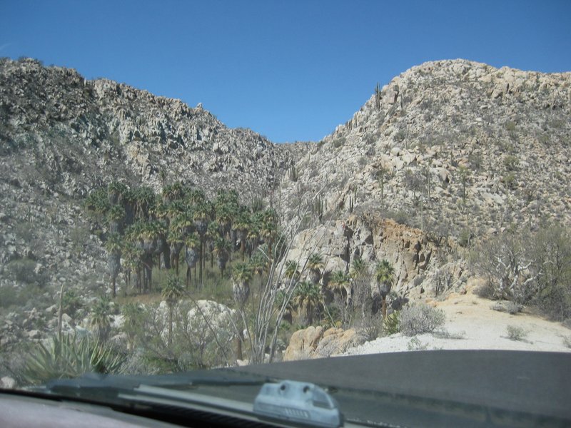
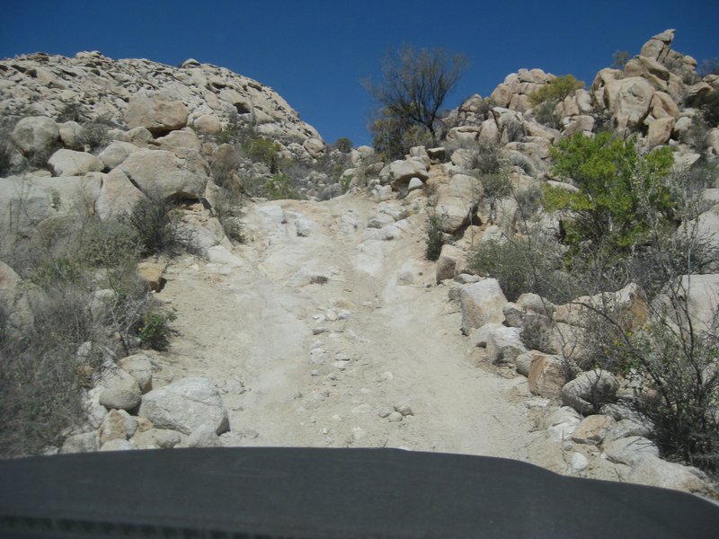
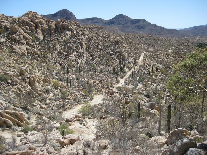
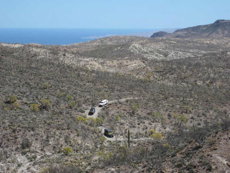
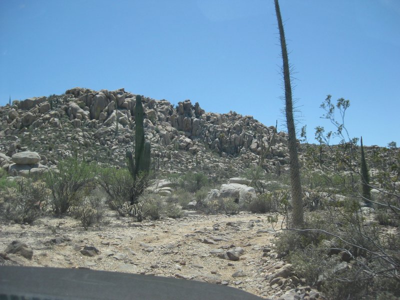
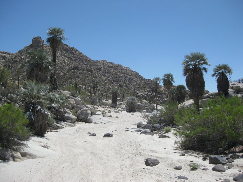
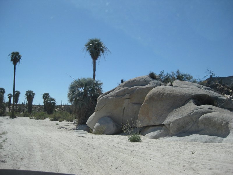
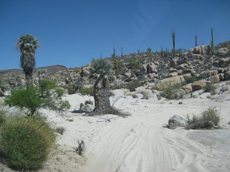
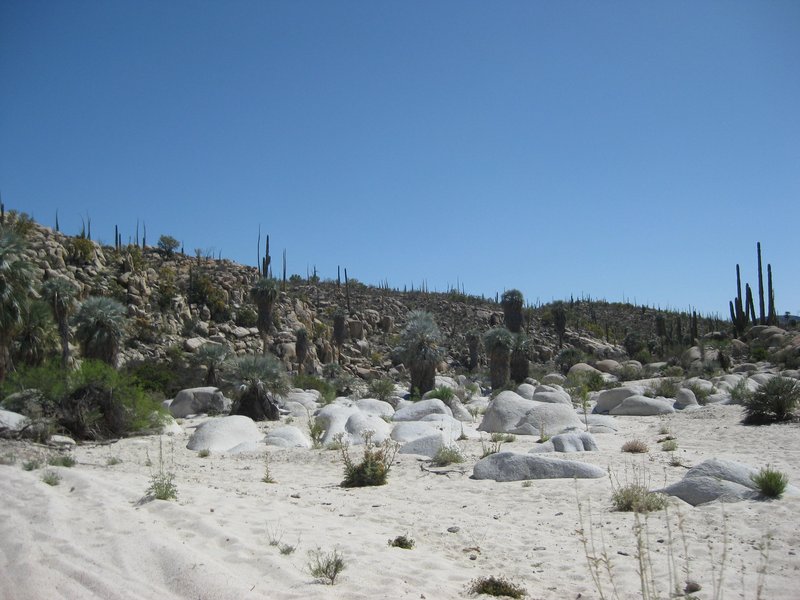
DAY 3, Part 1 Mission in the morning + canyon oasis view just east
Camp in the morning (the night was very cold), before sunrise.
I walk to the mission to get photos as the sun first lights it.
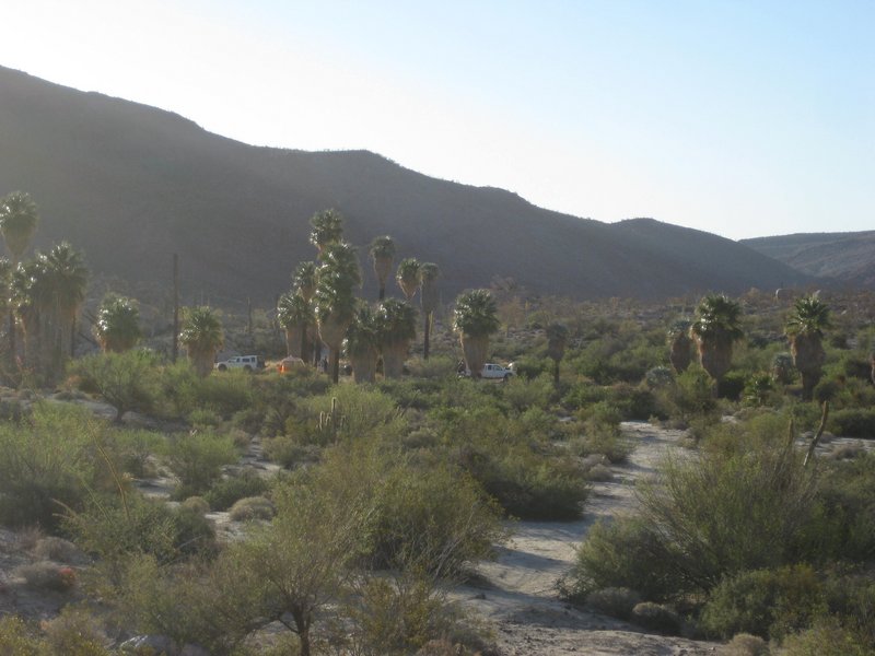
We drive to the east to have a look down at the arroyo palms where we camped with Roy, 'the squarecircle' and Blanche, back in 2007: www.vivabaja.com/msm when the bighorn came to visit us.
The steep drop off was tough to climb back up, but we managed.
Some group photos at the view and at the mission.
In the next installment, we attempt to leave... climbing up, up, up to the peninsular divide, just over 4 miles away.
Photos:
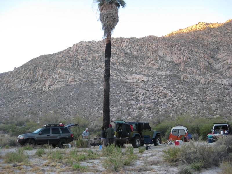
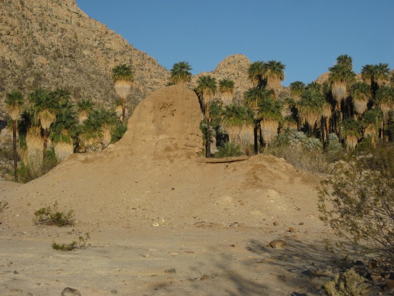
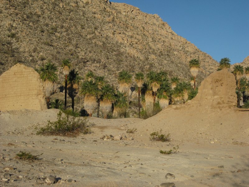
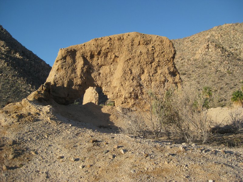
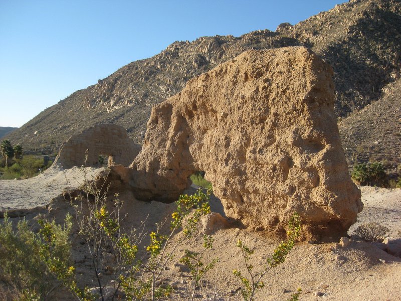
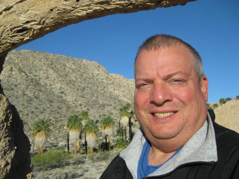
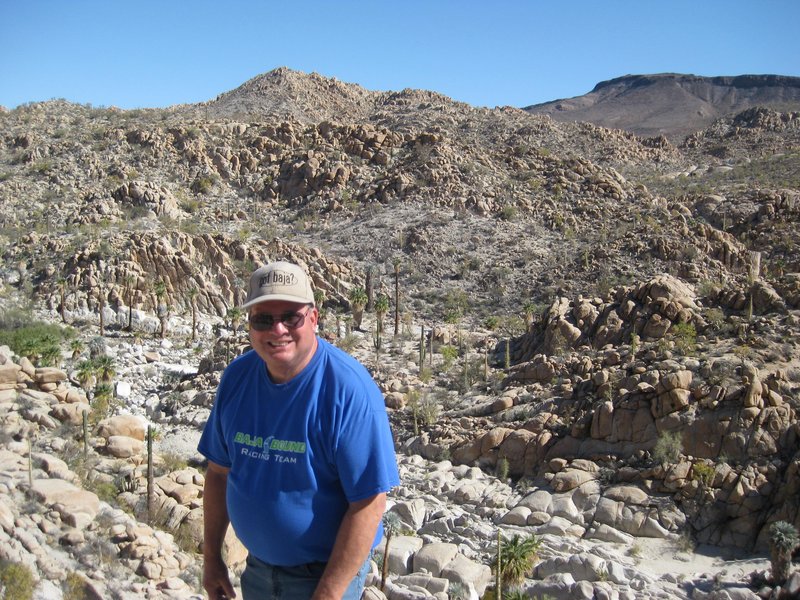
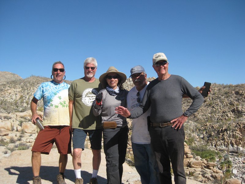
L to R: Ed, Phil, Debbie, Rudy, and Ken
|
|
|
mtgoat666
Select Nomad
Posts: 19728
Registered: 9-16-2006
Location: San Diego
Member Is Offline
Mood: Hot n spicy
|
|
Quote: Originally posted by David K  | Three zoom levels to show the original and new arroyo routes:
A short section in the arroyo, the tracker was off, on accident.
|
trip sounds like a lot of drive time with little time out of the vehicle, my legs and back hurt just thinking about it.
next time you go, skip the mission site, and stop at the northernmost point of orange track in your map above. then hike a few miles (or more)
northish into the rocky countryside. great boulder scrambling. take just a sleeping bag/pad and light meals and overnight high above in the rocks.
best in cooler seasons, and best as just a 2-day/1-nite out and back, as water is heavy to carry or plan for.
Woke!
Hands off!
“Por el bien de todos, primero los pobres.”
“...ask not what your country can do for you – ask what you can do for your country.” “My fellow citizens of the world: ask not what America
will do for you, but what together we can do for the freedom of man.”
Pronoun: the royal we
|
|
|
David K
Honored Nomad
Posts: 65245
Registered: 8-30-2002
Location: San Diego County
Member Is Offline
Mood: Have Baja Fever
|
|
The mission is my main interest, followed by the challenging road to get there. I think for most people it is the challenging road that is the main
attraction with the mission being a secondary interest.
So, it is all about the drive time... that it is hard and dangerous makes it a special attraction. I get what is interesting to you, and those white
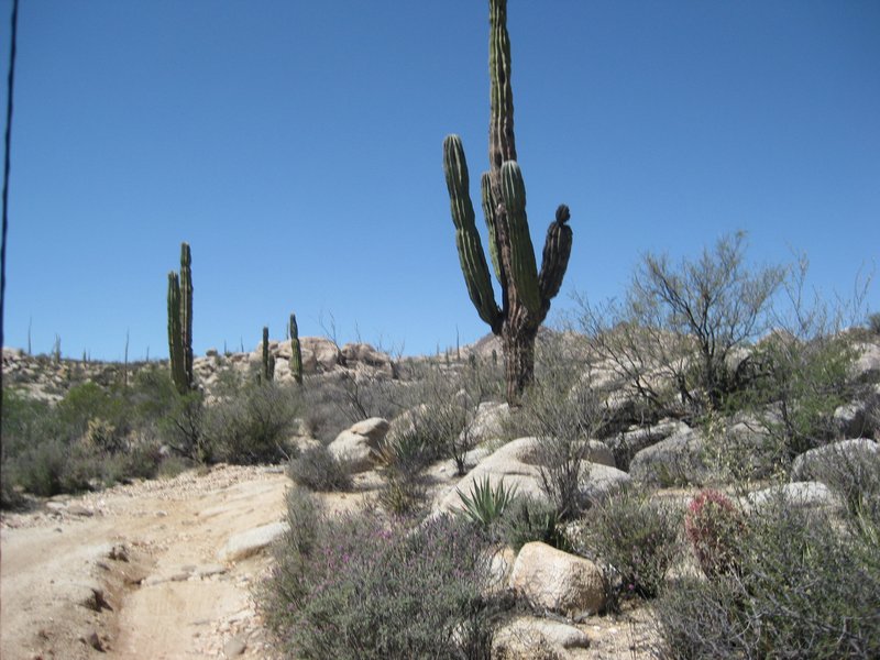
sand arroyos with palms and boulders, and boojums, are attractive to me, too.
There is a spring near where you mention, just off the Camino Real, called San Antonio.
|
|
|
Paco Facullo
Super Nomad
Posts: 1301
Registered: 1-21-2017
Location: Here now
Member Is Offline
Mood: Abiding ..........
|
|
Great trip report, David !
Hell-of-a-trip....
Outstanding photos and write-up. It's great to see you gettin' your "rocks off" doing what you love best.
Thanks for letting us join in on you-all's adventure...
Since I've given up all hope, I feel much better
|
|
|
edm1
Senior Nomad
Posts: 568
Registered: 8-23-2006
Location: Oak Hills, Ca
Member Is Offline
|
|
Congrats to all for a successful and fun trip, with just a few minor vehicle glitches.
I remember that first climb after leaving Sta Ynez when everyone in the group had no idea how my motorhome would make it to the mision, but with
everyone's help spotting/guiding, it made it. Of course, the vivid images coming up and down the Widowmaker. And finally navigating the bog, before
the Mision, which was 3-ft deep at the time. The way back to Catavina was an entirely different story.
Thanks for the photos and memories, David!!! So it looks like you're back on the saddle, as I thought you stopped going south for a while? Good for
you.
[Edited on 4-3-2022 by edm1]
|
|
|
David K
Honored Nomad
Posts: 65245
Registered: 8-30-2002
Location: San Diego County
Member Is Offline
Mood: Have Baja Fever
|
|
| Quote: Originally posted by edm1 | Congrats to all for a successful and fun trip, with just a few minor vehicle glitches.
I remember that first climb after leaving Sta Ynez when everyone in the group had no idea how my motorhome would make it to the mision, but with
everyone's help spotting/guiding, it made it. Of course, the vivid images coming up and down the Widowmaker. And finally navigating the bog, before
the Mision, which was 3-ft deep at the time. The way back to Catavina was an entirely different story.
Thanks for the photos and memories, David!!! So it looks like you're back on the saddle, as I thought you stopped going south for a while? Good for
you.
[Edited on 4-3-2022 by edm1] |
You're welcome, Art.
I will post the photos of the drive out from the mission, next.
I never got out of the saddle... but my horse just didn't go to Baja! LOL
Covid restrictions and a cancelled TV show gig are the reason no trips since 2019. How about you? When was your last Baja trip and when is the next? I
hope to bring mi esposa ('Baja Angel'/ Elizabeth) to Shell Island this summer... maybe Bahía Concepción, too?
|
|
|
David K
Honored Nomad
Posts: 65245
Registered: 8-30-2002
Location: San Diego County
Member Is Offline
Mood: Have Baja Fever
|
|
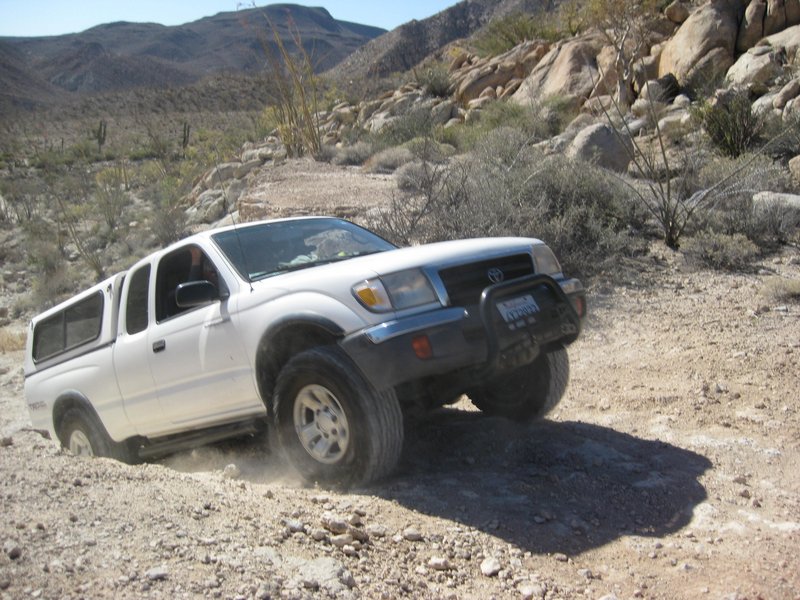
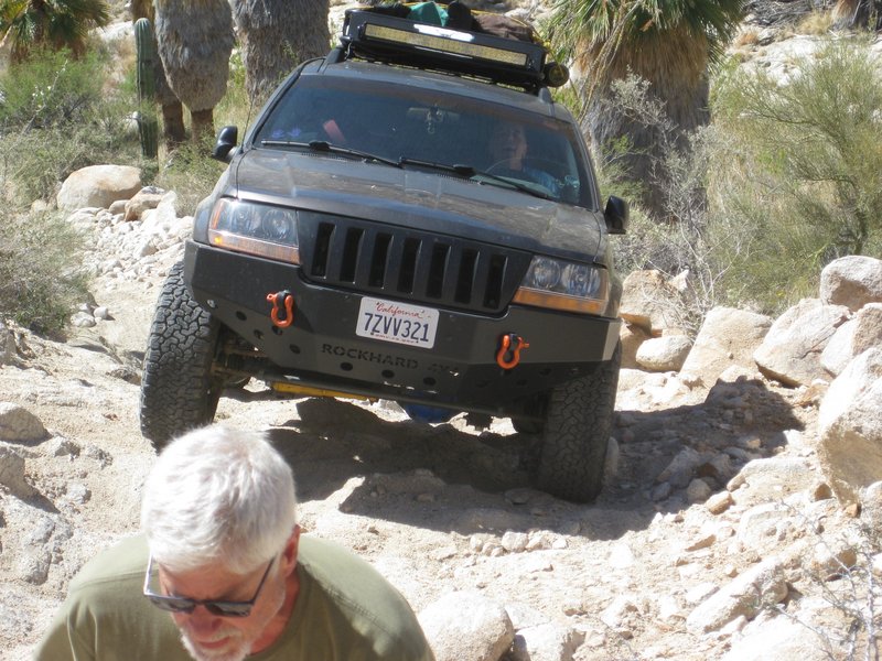
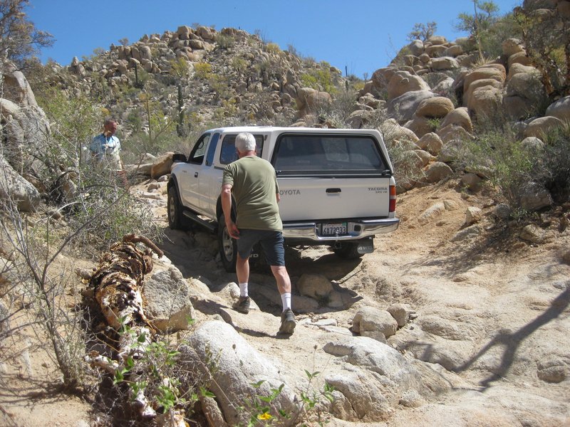
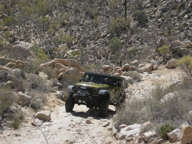
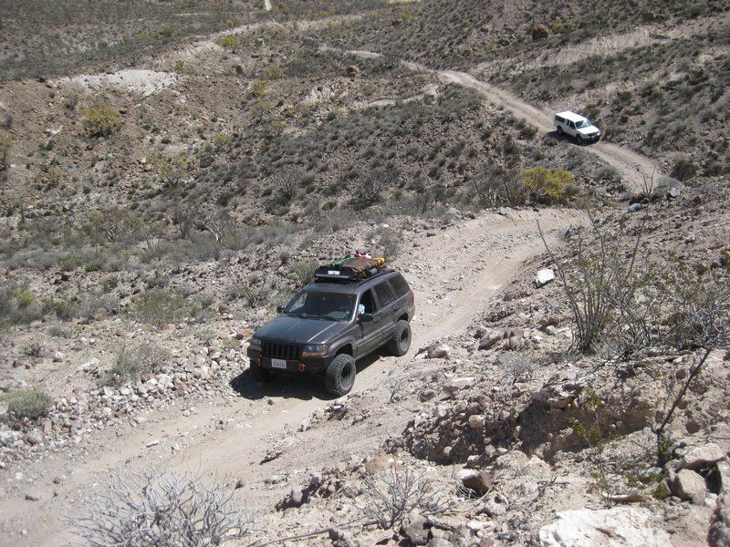
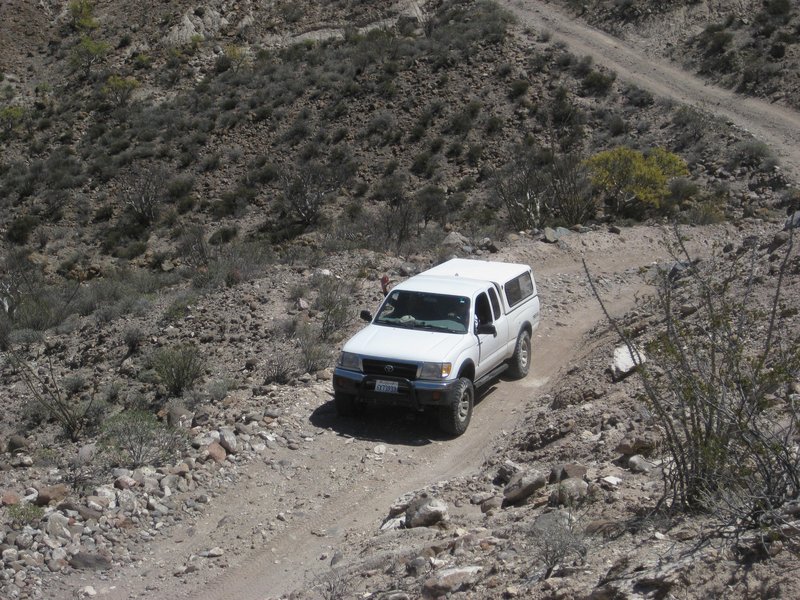
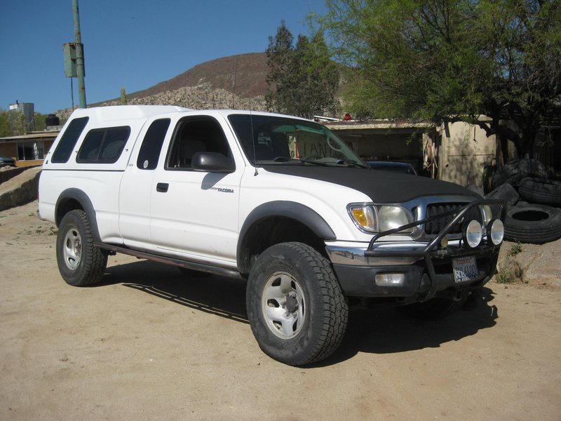
Hi Larry, it was a great trip... but I am glad I was a passenger and not taking my truck. TW was a champ and he is a dozen years older than me. I was
worn-out from getting out to spot him, and take photos. His Tacoma broke a shock mount and sliced a tire open. Driving would have also worn me out,
but good!
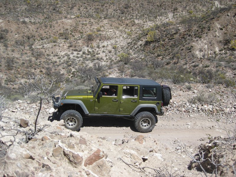
Rudy's older TRD Tacoma was stock and only had 15" wheels but he did fine. The Cherokee with open differentials had a tough time climbing out of the
mission valley.
The Rubicon had the shock mount bolt's nut come off.
To answer your question, YES. However, the bog being dry was a great plus. In 2010, it was the hardest part of the drive with 2-foot-deep water!
|
|
|
David K
Honored Nomad
Posts: 65245
Registered: 8-30-2002
Location: San Diego County
Member Is Offline
Mood: Have Baja Fever
|
|
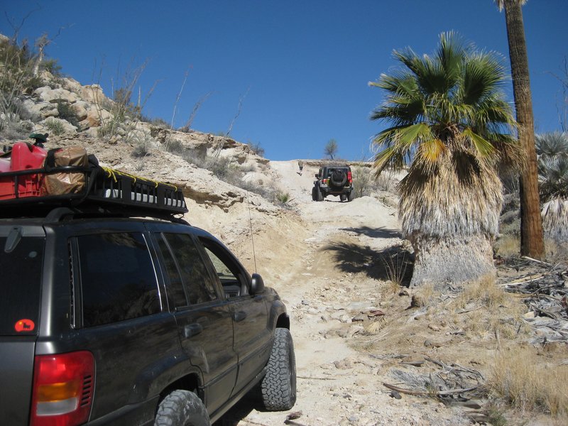
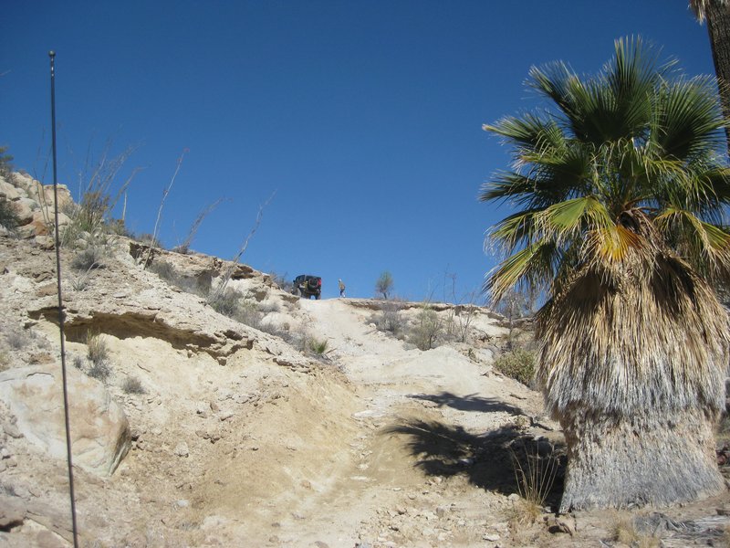
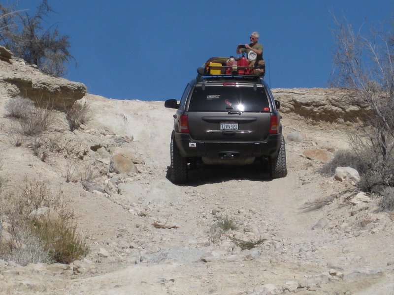
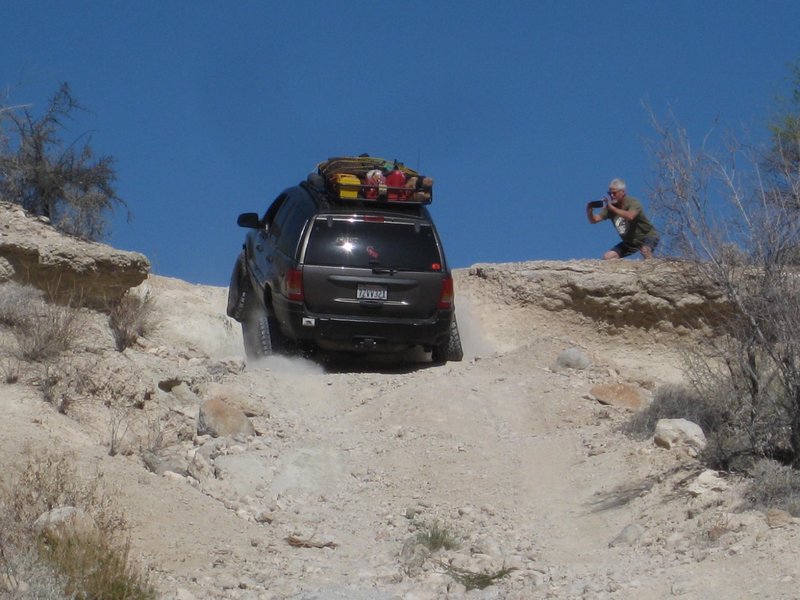
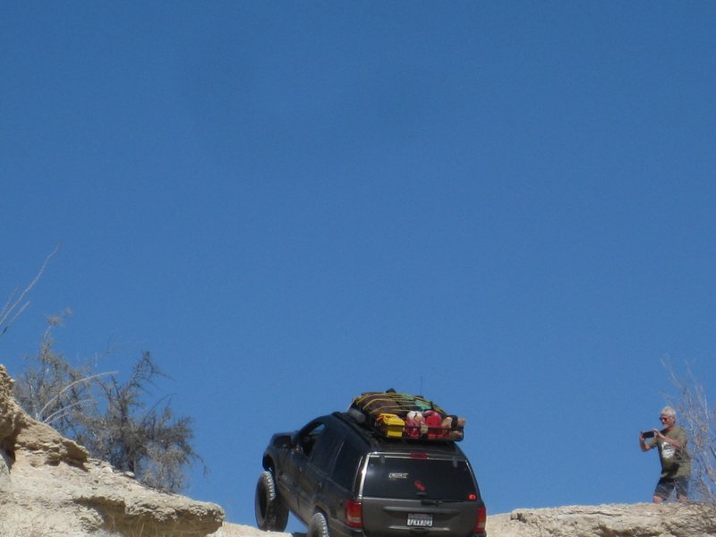
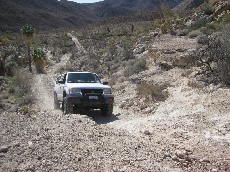
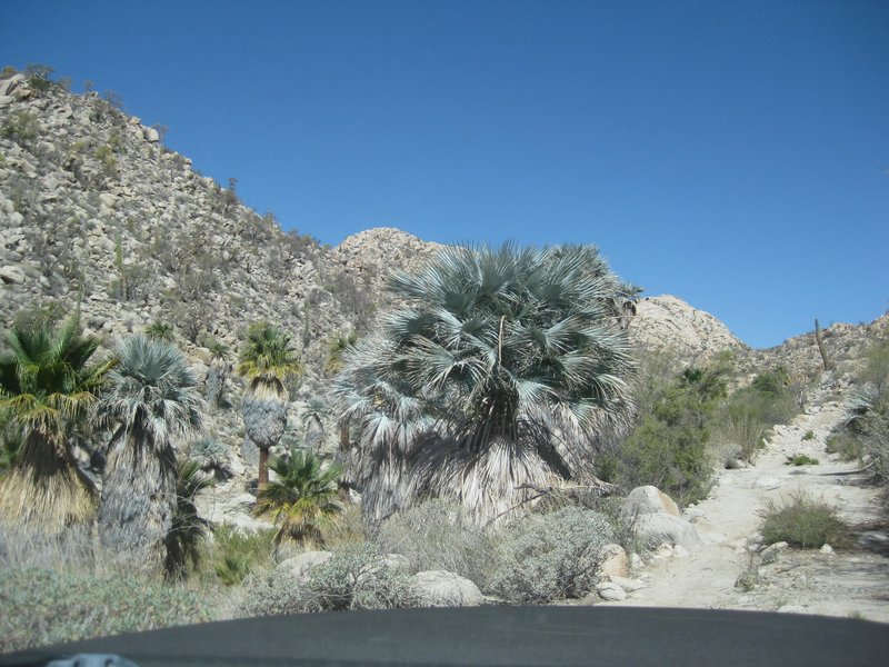
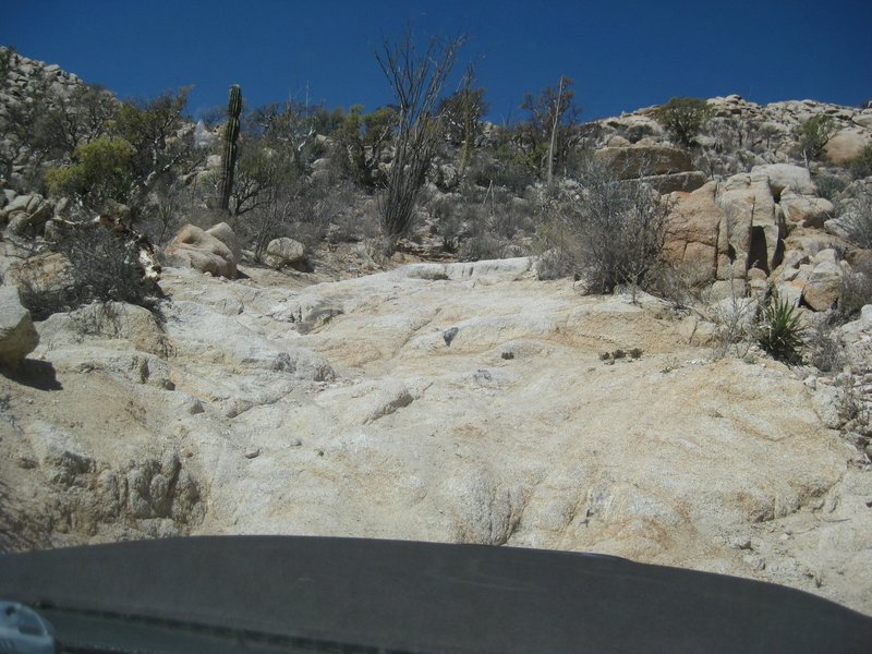
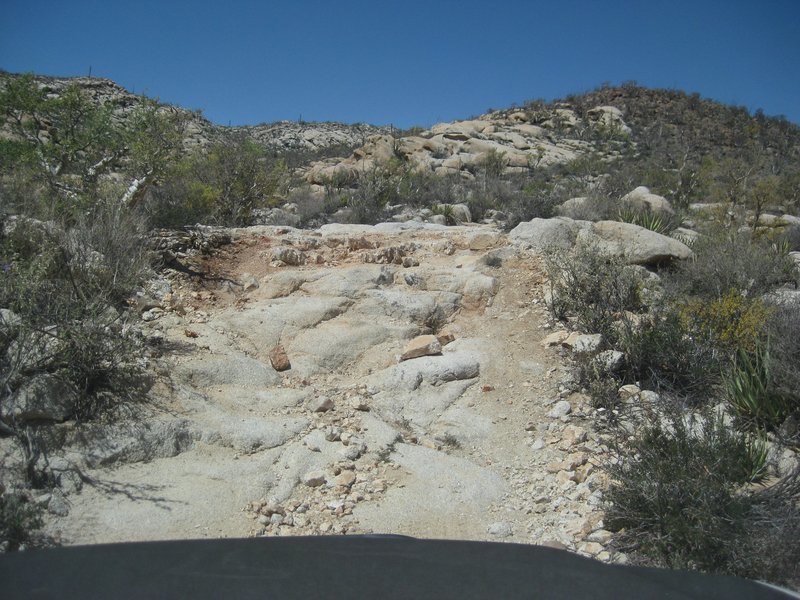
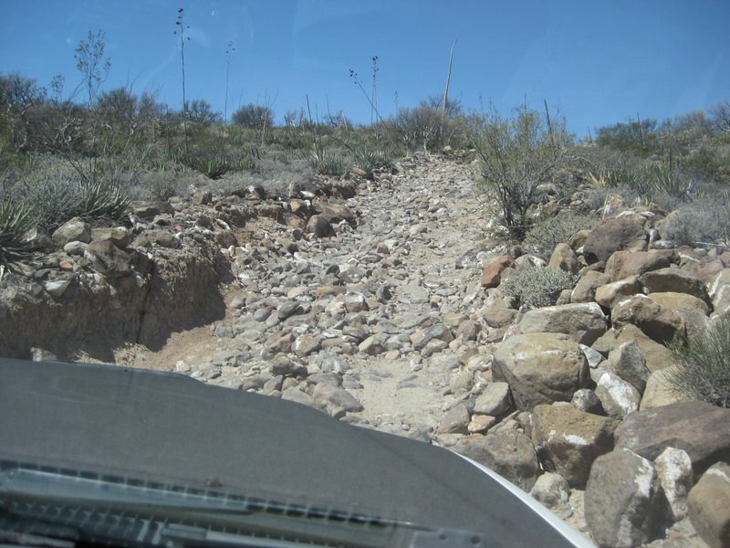
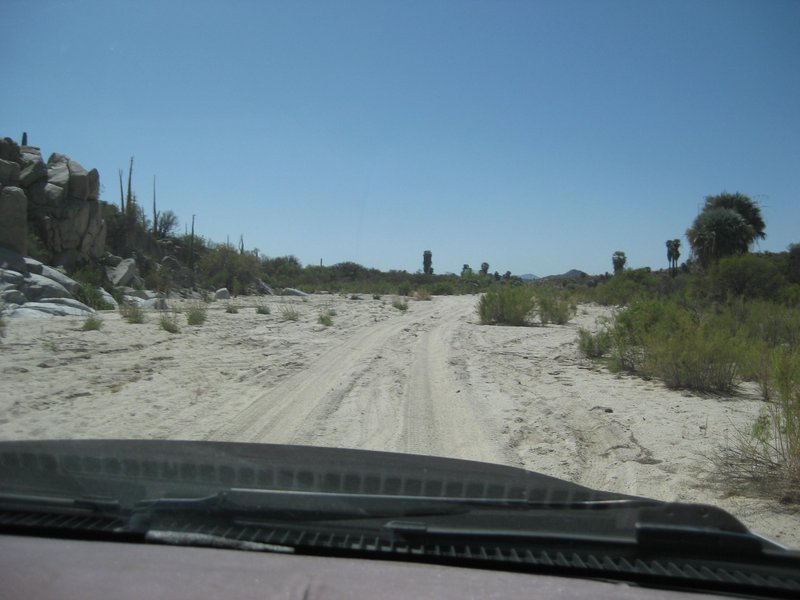
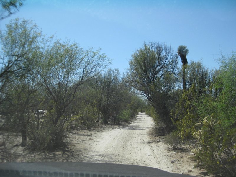
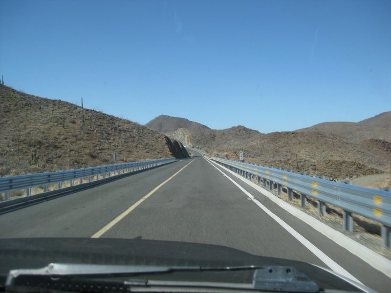
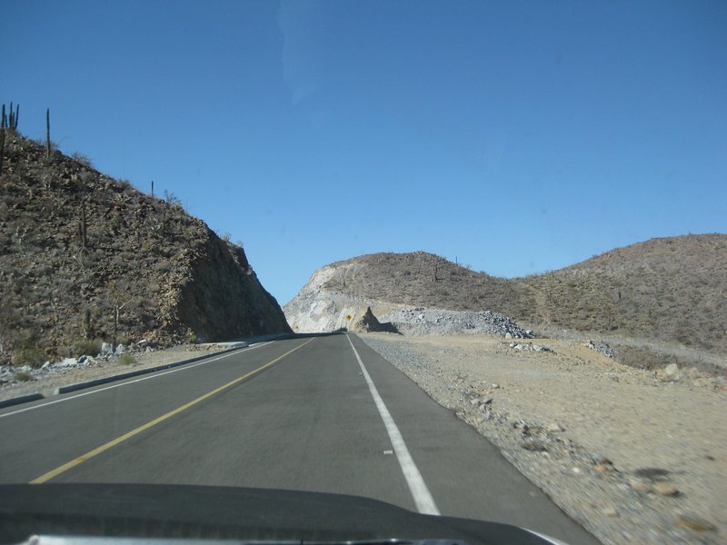
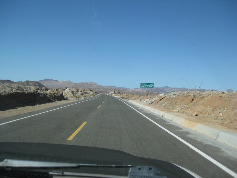
Leaving the Mission and the long climb up the mountain!
Steep dips near the mission
The bog ahead
The bog was dry!
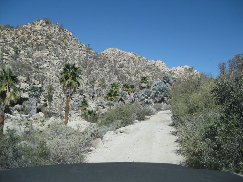
The bottom of the Widowmaker
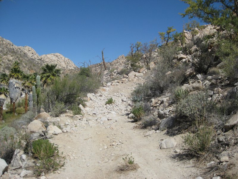
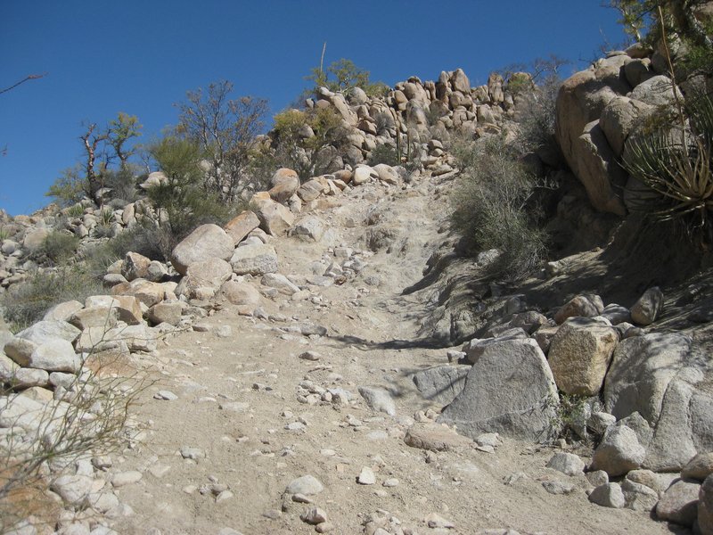
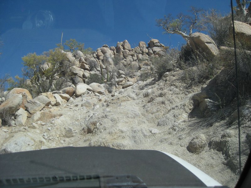
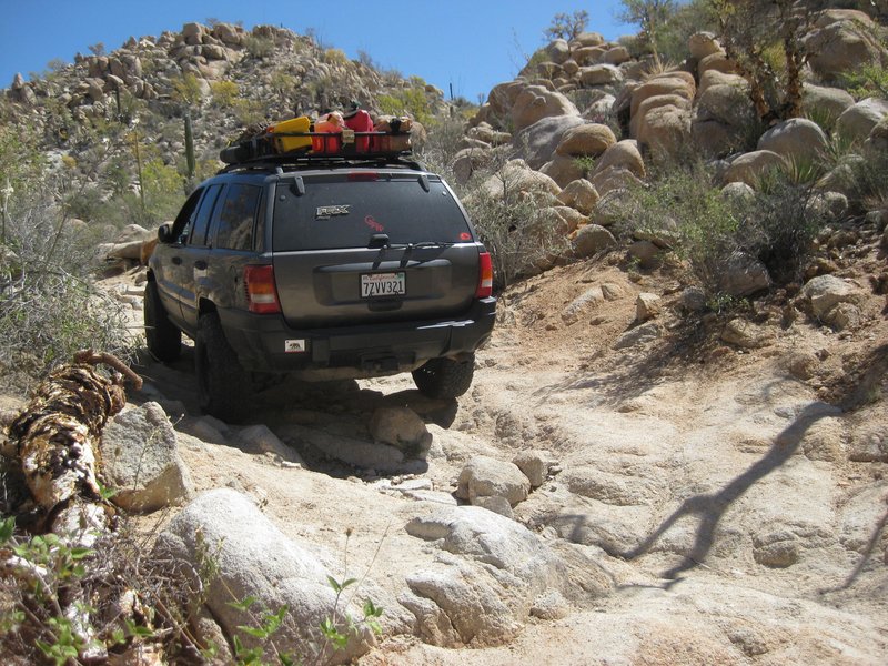
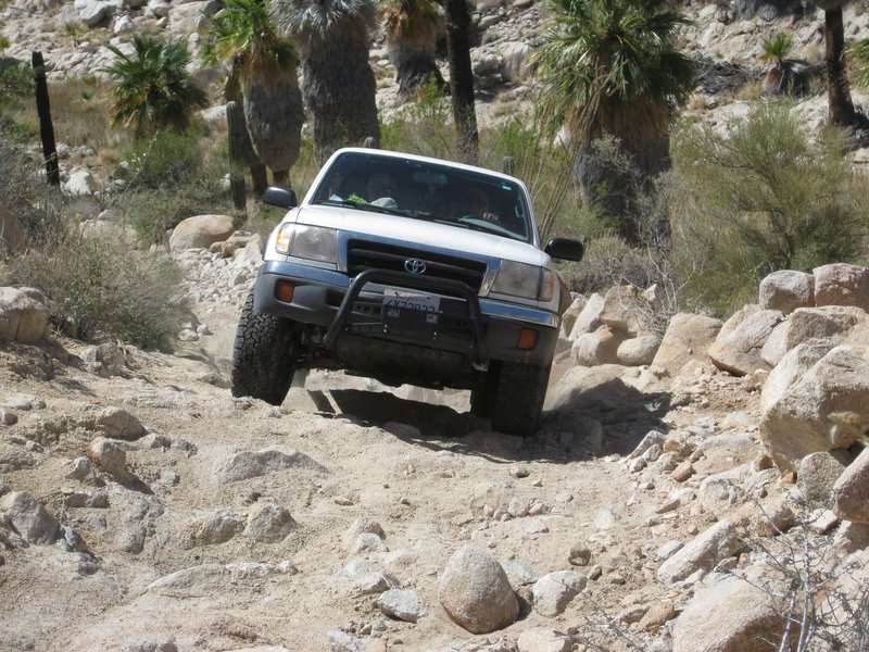
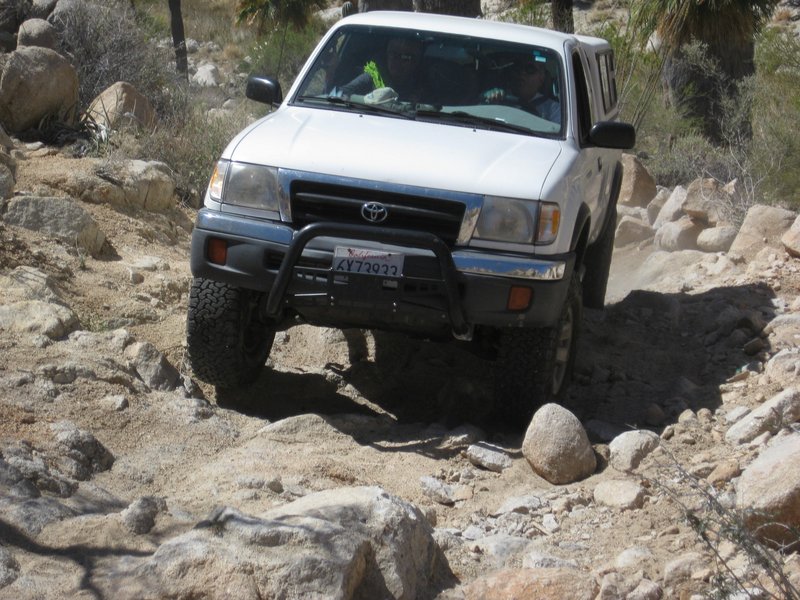
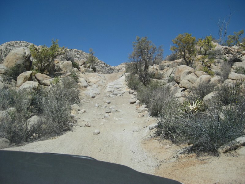
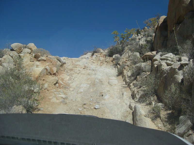
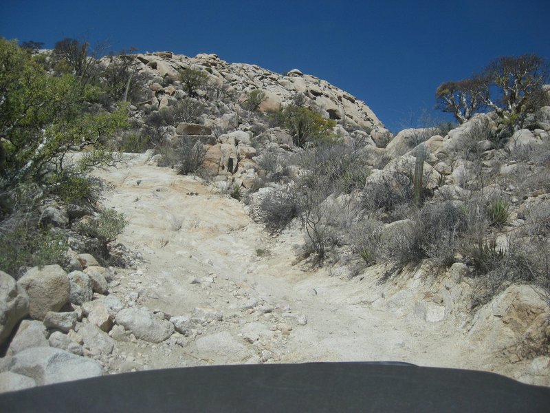
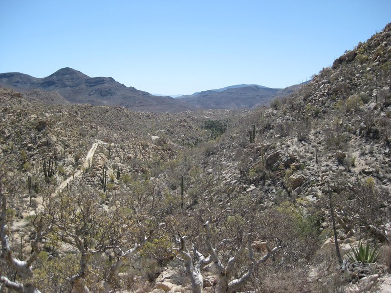

The Peninsular Divide:
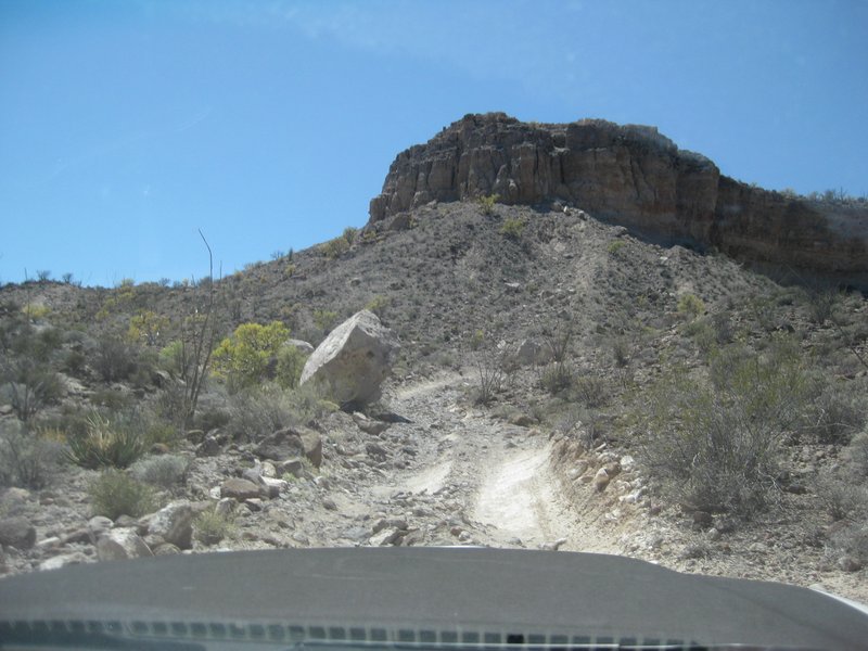
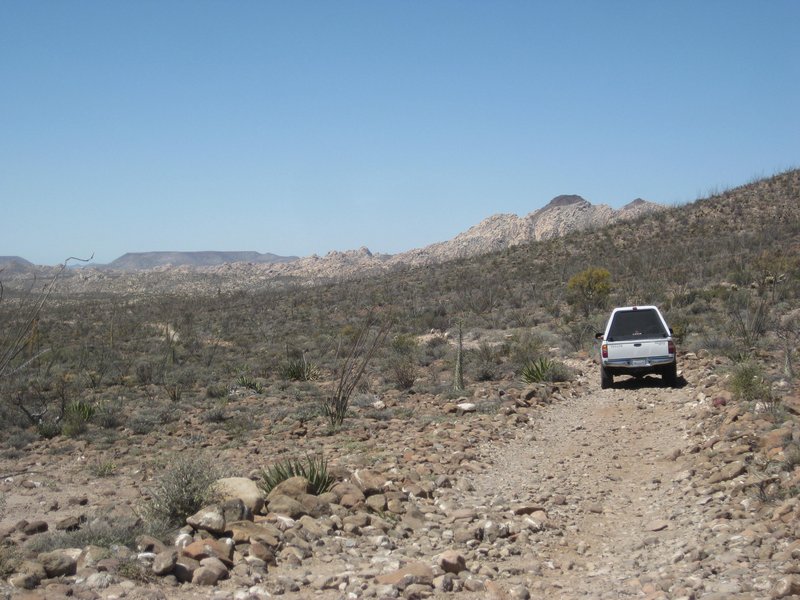


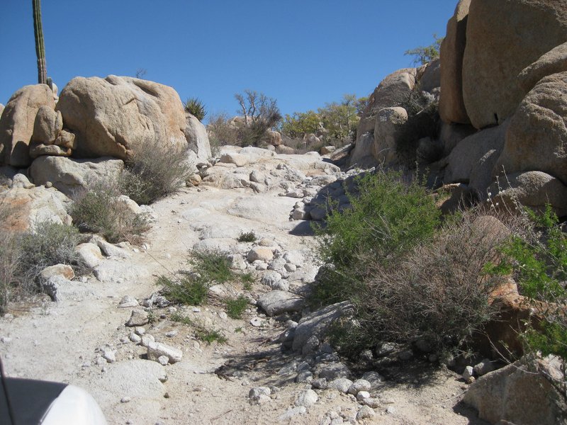
A short break here then on to Santa Ynez, 10 miles away. This time, we will use the new arroyo route for a much smoother drive the final 4-5 miles.
Stand by for more!
|
|
|
BajaNomad
Super Administrator
Posts: 5006
Registered: 8-1-2002
Location: San Diego, CA
Member Is Offline
Mood: INTP-A
|
|
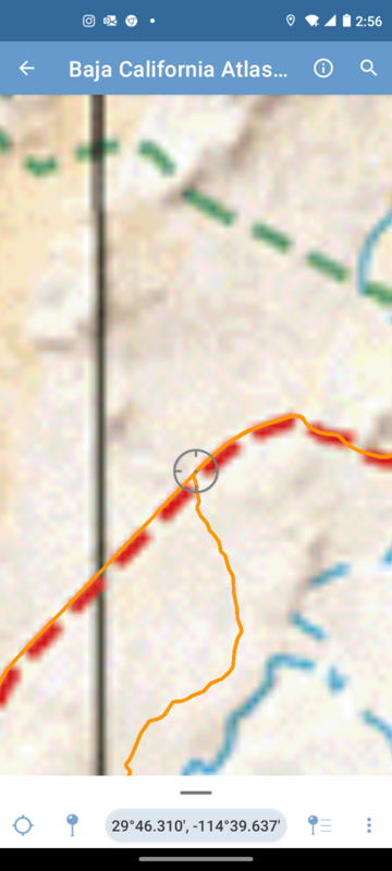
| Quote: Originally posted by David K | As I mentioned, earlier, we missed using the newer, arroyo route to the mission and ended back on the original, washed out, deep gully road.
Where the arroyo route returns to the original Fred Hampe road was easy to spot. On the return, we did not hesitate to use the newer route and it was
much better! The GPS where the new and old meet, about 4.3 miles from Santa Ynez/ 5.6 miles from the divide/ 10 miles from the mission/ or about here:
29°46.295', -114°39.648'. The newer, arroyo route is a litle bit longer drive to the mission but is well worth it to avoid the big gully and rest of
the 4+ mile rocky road. |
https://goo.gl/maps/5QJJkYLJ2TZW6wgK9
When I was young, I admired clever people. Now that I am old, I admire kind people.
– Rabbi Abraham Joshua Heschel
We know we must go back if we live, and we don`t know why.
– John Steinbeck, Log from the Sea of Cortez
https://www.regionalinternet.com
Affordable Domain Name Registration/Management & cPanel Web Hosting - since 1999 |
|
|
4x4abc
Ultra Nomad
Posts: 4430
Registered: 4-24-2009
Location: La Paz, BCS
Member Is Offline
Mood: happy - always
|
|
how many years have you been doing Baja and 4x4?
15" wheels are better than 16" or bigger
in the end tire diameter (for clearance) and volume of air count (for the ability to air down)
Harald Pietschmann
|
|
|
4x4abc
Ultra Nomad
Posts: 4430
Registered: 4-24-2009
Location: La Paz, BCS
Member Is Offline
Mood: happy - always
|
|
so sad to see a beautifully built road being driven to pieces but hordes of clueless drivers.
Just like the Rubicon Trail - started out as a great road and then was slowly hammered into a boulder festival.
And of course, the news of "challenging" attract even more clueless drivers who make it more challenging

[Edited on 4-3-2022 by 4x4abc]
Harald Pietschmann
|
|
|
David K
Honored Nomad
Posts: 65245
Registered: 8-30-2002
Location: San Diego County
Member Is Offline
Mood: Have Baja Fever
|
|
| Quote: Originally posted by 4x4abc |
how many years have you been doing Baja and 4x4?
15" wheels are better than 16" or bigger
in the end tire diameter (for clearance) and volume of air count (for the ability to air down) |
Baja since 1965.
Driven myself since 1974 (VW dune buggy).
Driven my own 4x4 since 1975 (Jeep Cherokee Chief).
My wheel size comment was because Off Road TRD Tacomas have had 16" wheels all the years I drove them (2000-2022).
|
|
|
Jack Swords
Super Nomad
Posts: 1095
Registered: 8-30-2002
Location: Nipomo, CA/La Paz, BCS
Member Is Offline
|
|
Interesting trip David. We hiked in many years ago (parked before the bog), swam in the "stream" and wandered about the area. Nights were awesome.
We did notice some areas that were cleared of rocks and had been tilled at one time. Also noticed areas of "sleeping circles'' that are still
present. Habitants must have had a challenging life.
|
|
|
4x4abc
Ultra Nomad
Posts: 4430
Registered: 4-24-2009
Location: La Paz, BCS
Member Is Offline
Mood: happy - always
|
|
| Quote: Originally posted by David K |
My wheel size comment was because Off Road TRD Tacomas have had 16" wheels all the years I drove them (2000-2022). |
meaning the older Tacomas had more suitable wheels for off road
the reason for 16" wheels (or bigger) on newer vehicles has to do with increased brakes size and, of course, looks. As long as the tire diameter
increases increases the same amount, all is good.
Harald Pietschmann
|
|
|
David K
Honored Nomad
Posts: 65245
Registered: 8-30-2002
Location: San Diego County
Member Is Offline
Mood: Have Baja Fever
|
|
I think showing how bad a road is will keep away "clueless" drivers.
How about I add a disclaimer when I make the web page for this trip... something to the effect of all motorized vehicles should avoid except the most
highly modified with skilled off-road drivers, companion vehicles, traction systems, good tires, and respect for the land and the history. 
|
|
|
David K
Honored Nomad
Posts: 65245
Registered: 8-30-2002
Location: San Diego County
Member Is Offline
Mood: Have Baja Fever
|
|
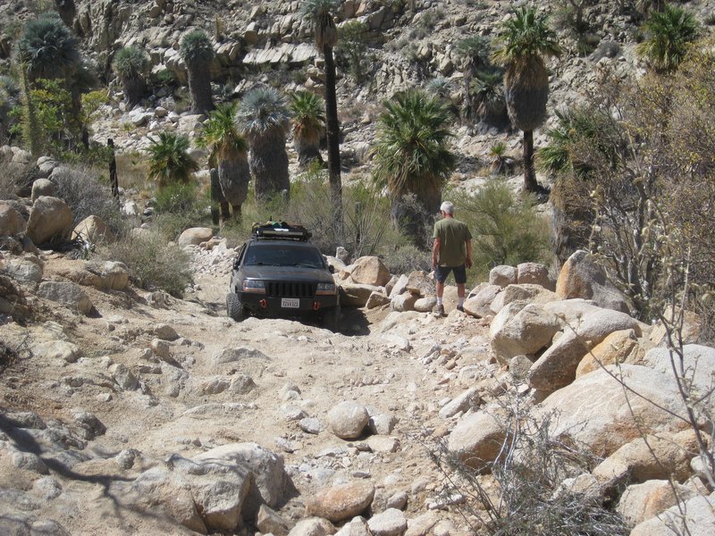
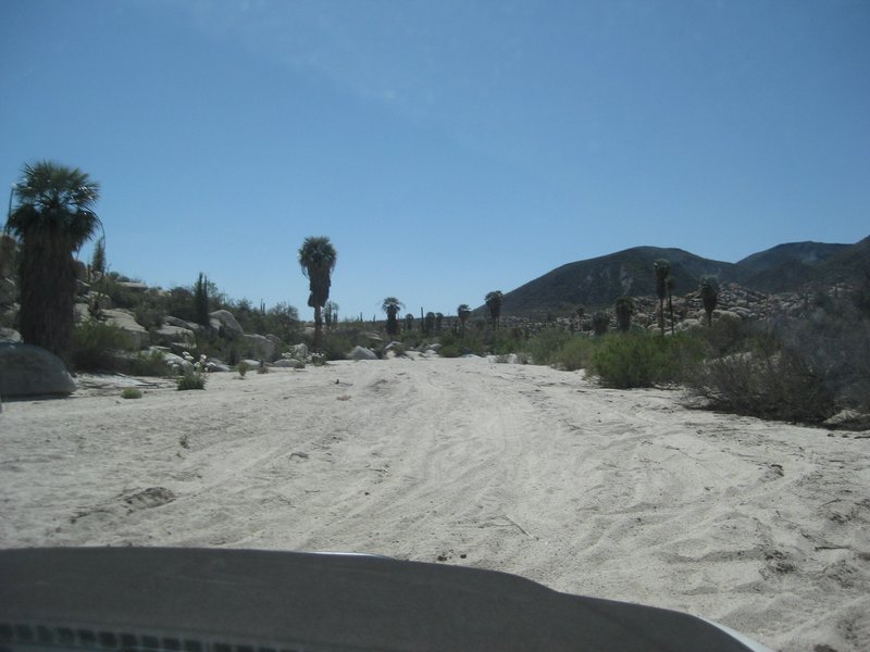
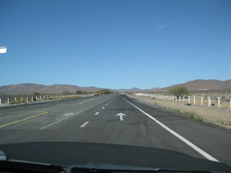
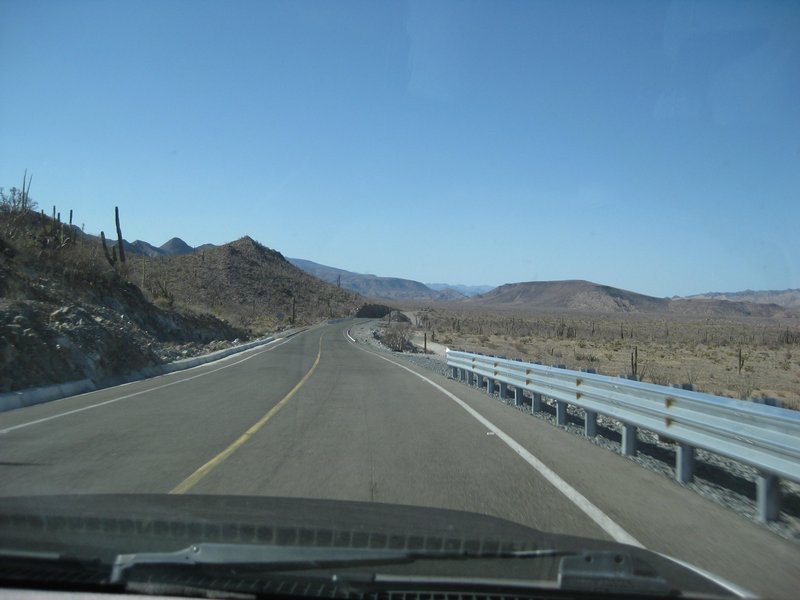
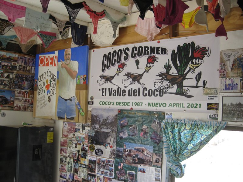
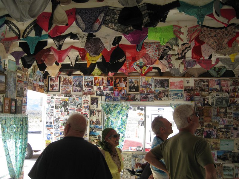
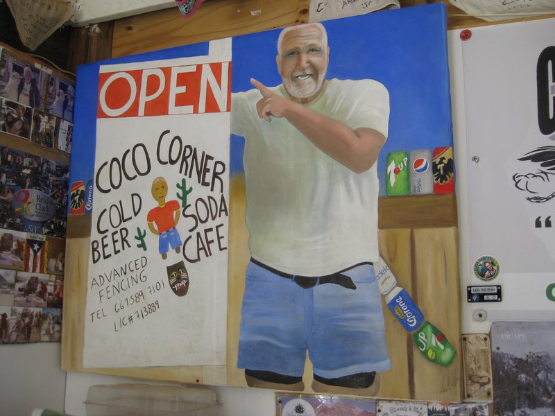
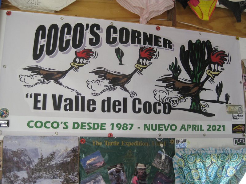
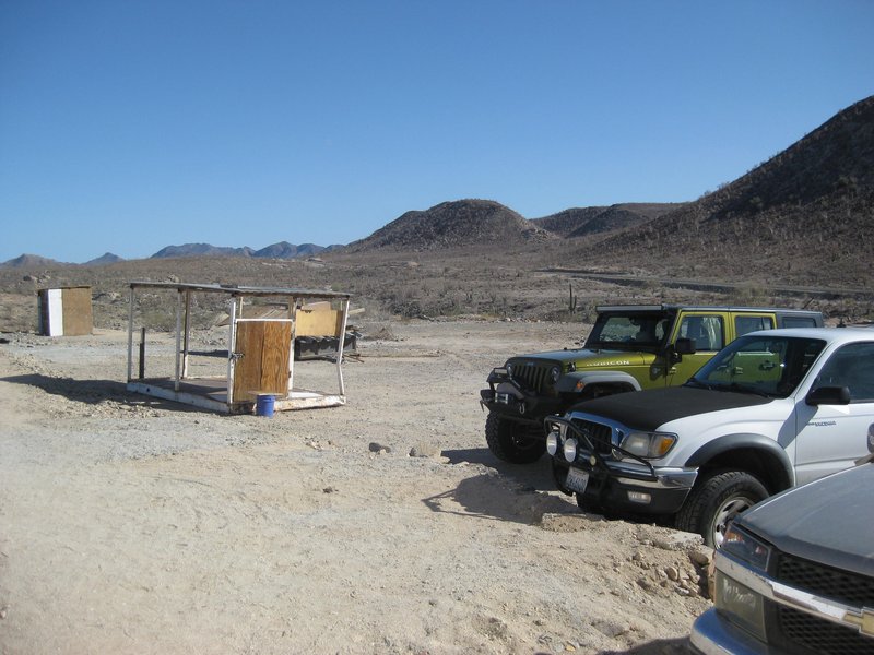
Peninsular Divide to Cataviña to (Nuevo) Coco's Corner
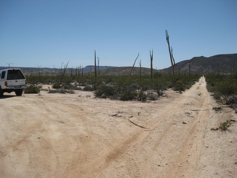
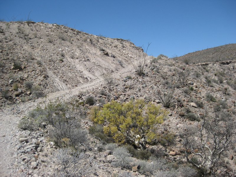
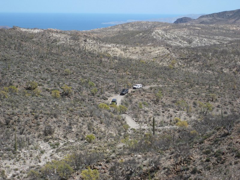
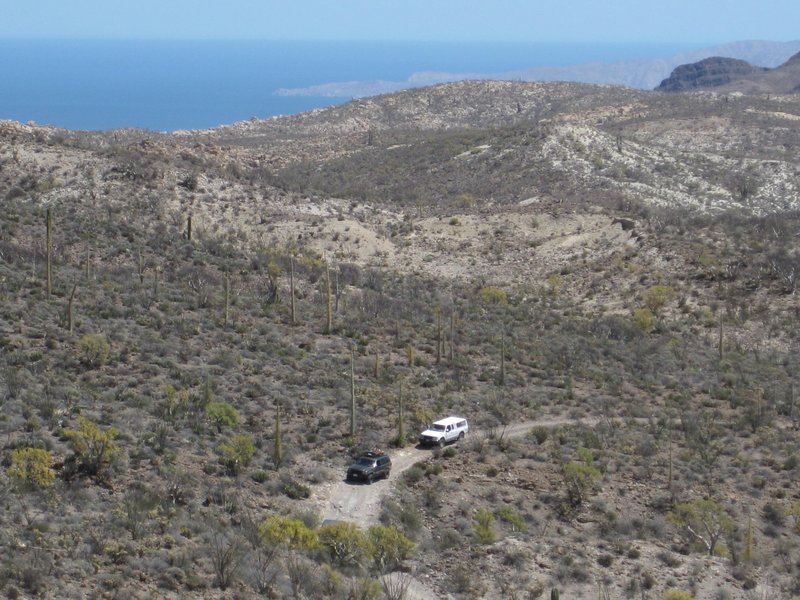
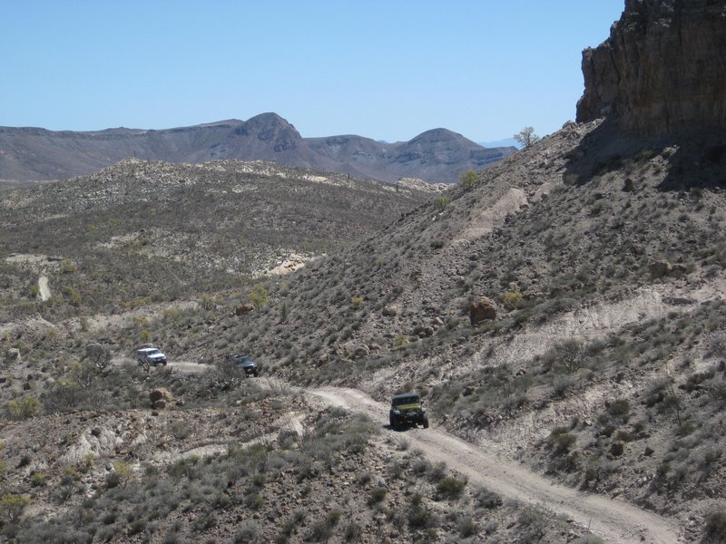
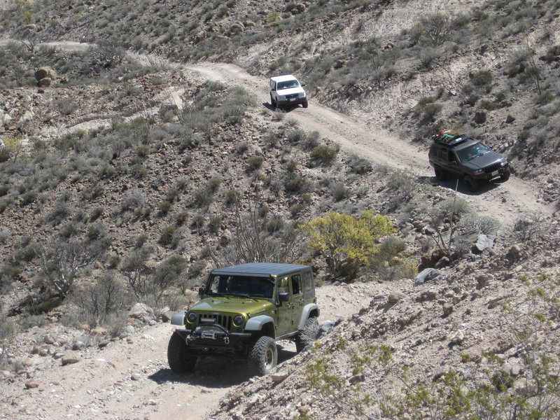
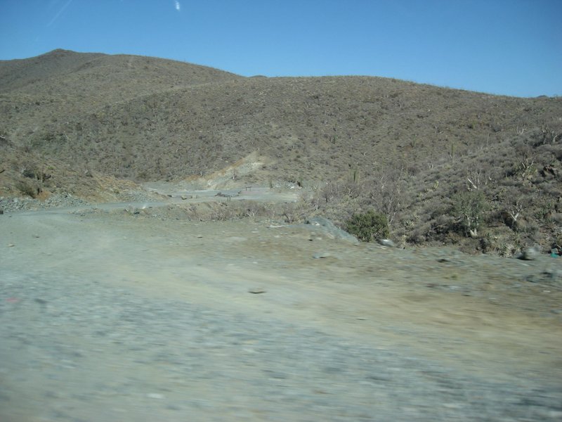
The fork to the new arroyo route.
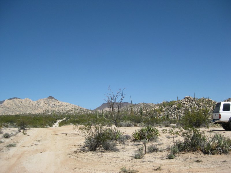
View towards the mission from the fork.
Miriam tells us a funny joke from Guayaquil, in her Ecuadorian accent.
Ken, Phil, Rudy
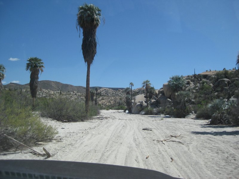
On the arroyo route.
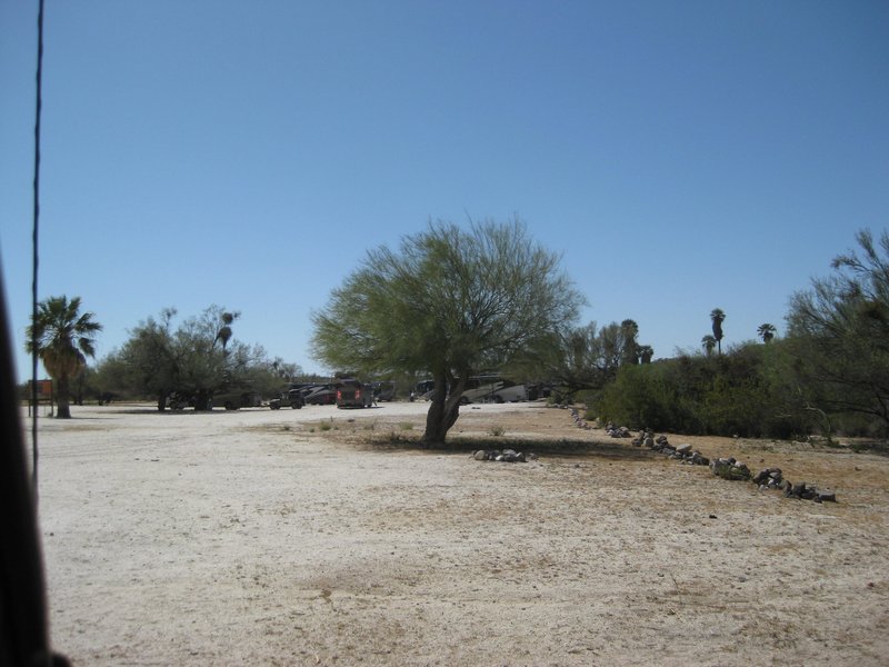
Nearing Rancho Santa Ynez/Inez/Inés
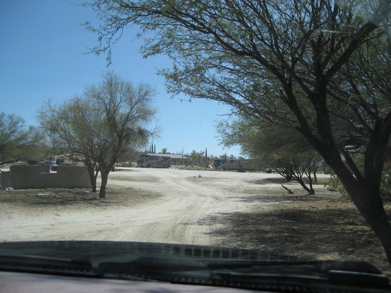
Huge caravan of BIG motorhomes is pulling into the Santa Ynez camping area.
The Santa Ynez driveway was once fully paved.
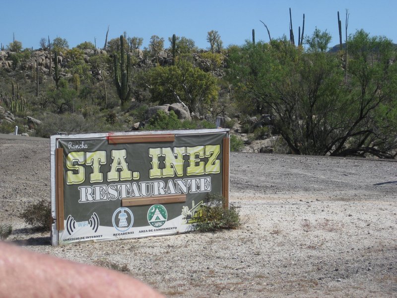
Cracks me up on the spelling choices. The ranch owner, years ago, preferred 'Ynez'. The correct Spanish spelling of the name is 'Inés'. This seems to
be a compromise?
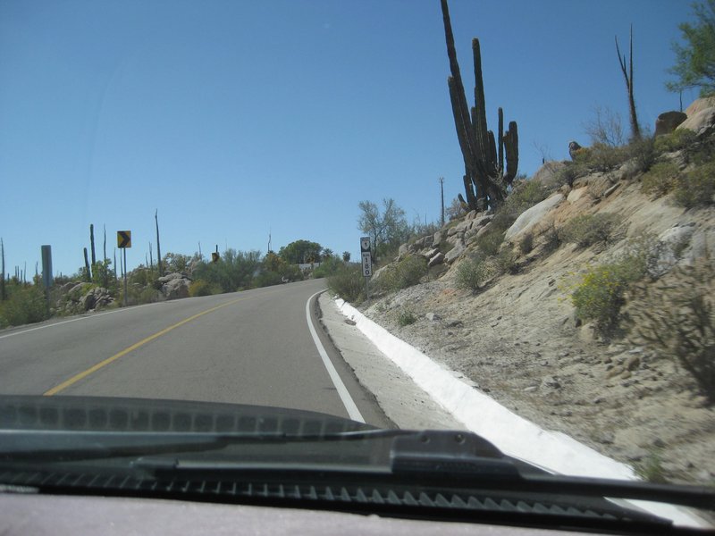
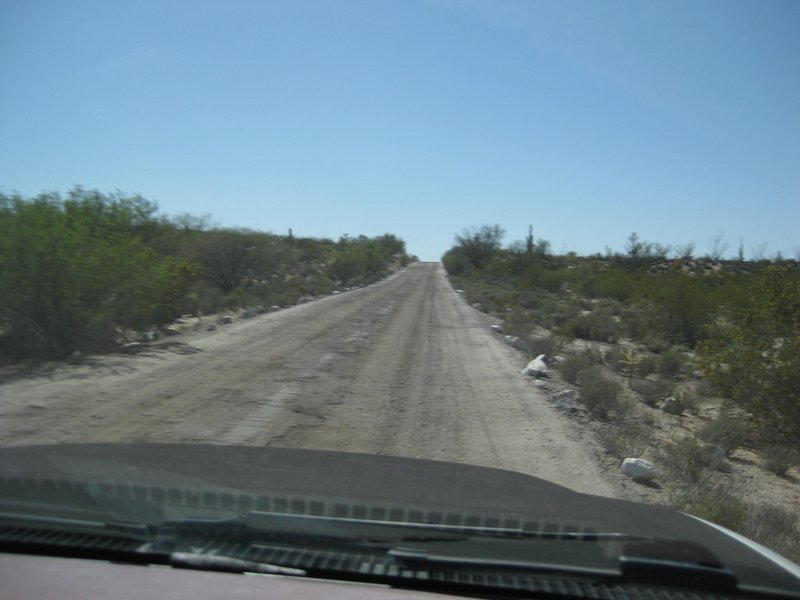
Km. 180, as we climb from the arroyo to Cataviña
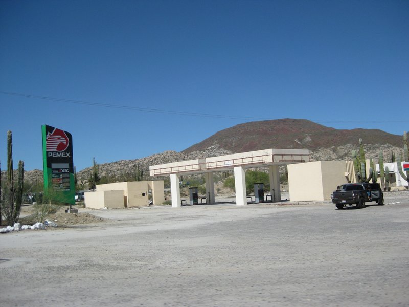
New Pemex is still not open.
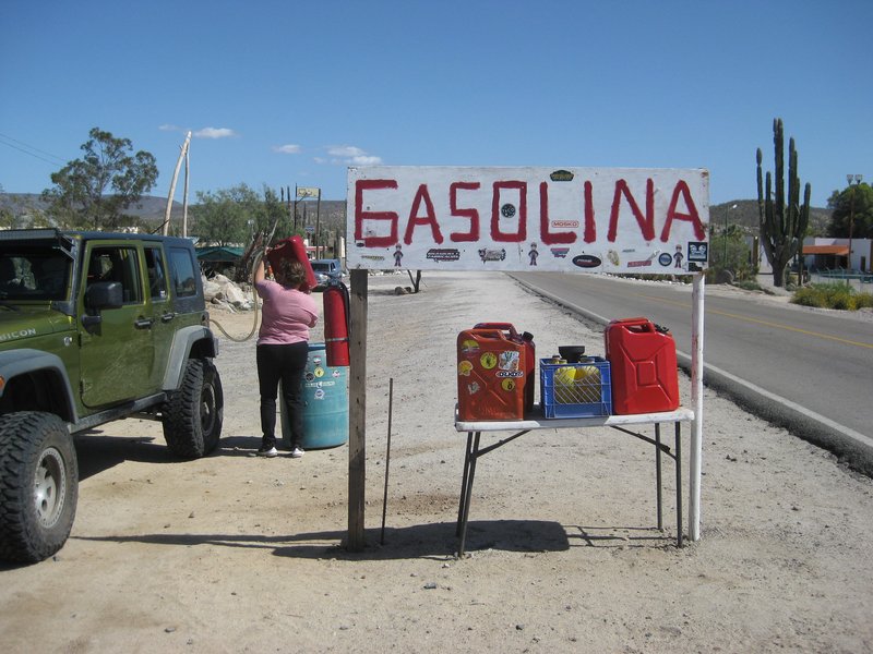
Independent dealers, like this, are all over Baja where there are no service stations. Sometimes you need to ask where to find gas in small towns, if
you need some. Punta Prieta, Santa Rosalillita, and San Miguel Comondú are such places I have bought gas from jerry cans.
Tom buys 5 gallons for 550 pesos, as I recall, and that is still cheaper than gas is in California!
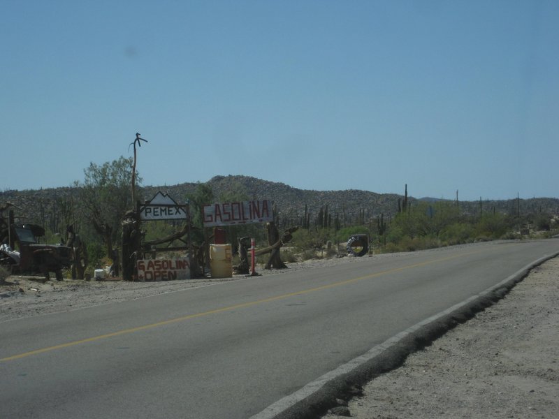
Next to the gasoline sales is a tire shop and air compressor. Tom has air added and I tip the guy $2 plus we buy 2 more gallons of gas + another
dollar tip
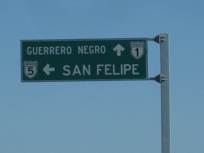
Hwy. junction at Laguna Chapala.
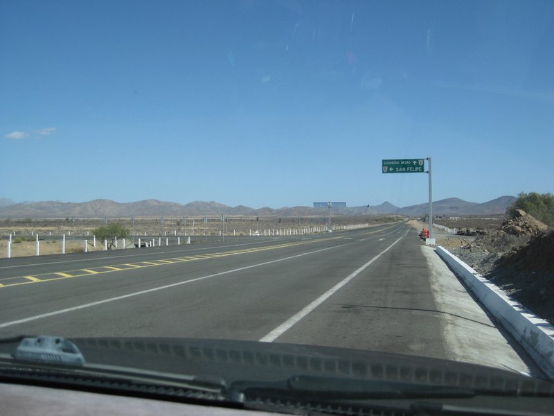
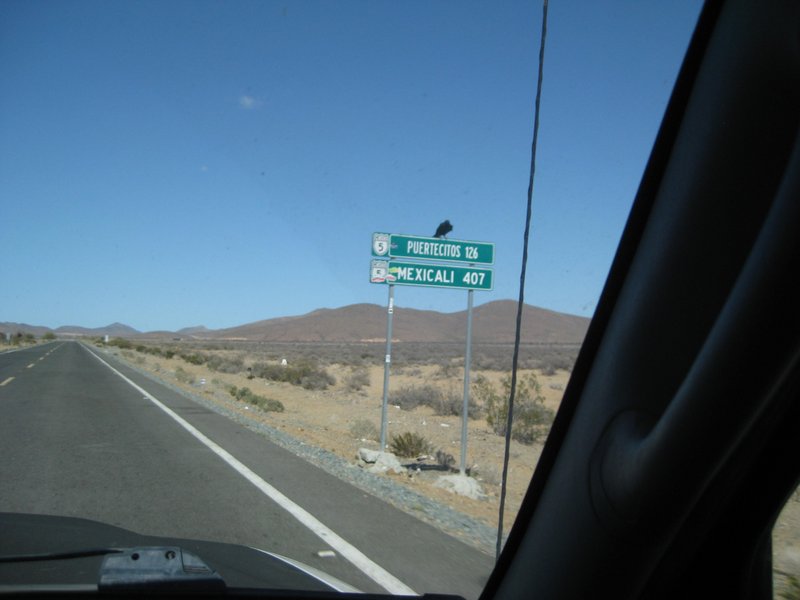
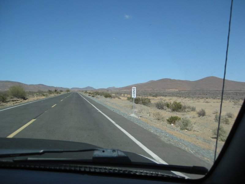
Km. 201 is about 1/2 km. from Hwy. 1 junction. This is 3 kms. over what it should read. The latest section of paving began after Km. 167 by naming the
next kilometer, 171 instead of the true 168!
Another note is that Km. 0 is 10 kms. south of San Felipe center (traffic circle). So, San Felipe traffic circle to Hwy. 1 is actually 208.5 kms.
See how weird I am with details!!!
The older road going to the original Coco's Corner, is near Km. 190.

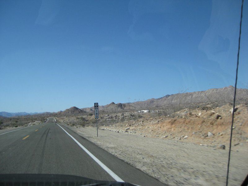
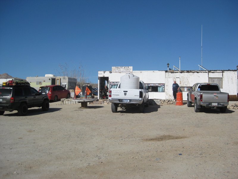
Km. 180 and we see the New Coco's Corner, just past the remains of Las Arrastras, in the arroyo to the right of the bridge.

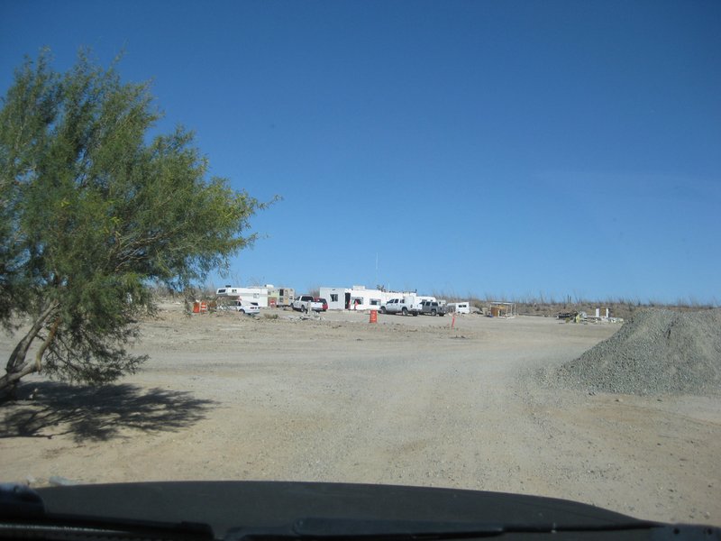
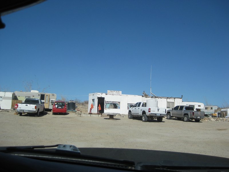
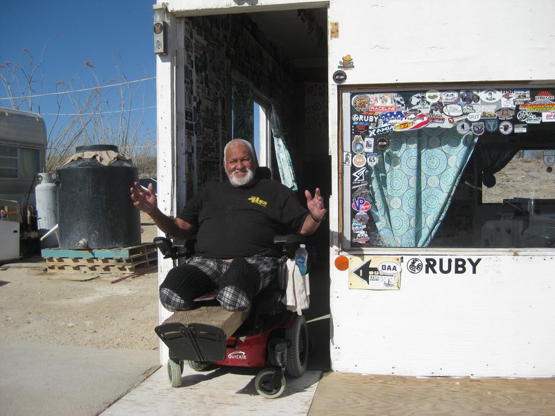
Coco welcomes us from his electric wheelchair.
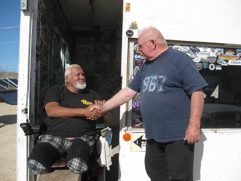
Coco and Tom (TRW on Baja Nomad)
In the next post, Gonzaga Bay, the Enchanted Islands, and Rudy's beach home...
[Edited on 4-5-2022 by David K]
|
|
|
| Pages:
1
2
3
4
5
6 |